Basics Intention - Uni Siegen
14
FOR LARGE PROJECTS IN FOR LARGE PROJECTS IN Prof Prof . Dr.- . Dr.- Ing Ing . O.K. . O.K. Postolskaya Postolskaya , Moskau , Moskau Dipl Dipl .- .- Ing Ing . A.V. Man‘ . A.V. Man‘ ko ko Prof Prof . Dr.- . Dr.- Ing Ing . Monika . Monika Jarosch Jarosch , Siegen , Siegen 25. September 2001 1. Siegener Symposium „Messtechnik im Erd- und Grundbau“ ? how ? What just try it ... ! 25. September 2001 Prof. Dr.-Ing. Jarosch 2 Basics Basics ... ... Moscow Moscow & Siegen & Siegen • Moscow State University of Civil Engineering Center of Underground and Special Engineering • University of Siegen Department of Civil Engineering Institute of Geodetic Surveying 25. September 2001 Prof. Dr.-Ing. Jarosch 3 Basics Basics ... ... Database Database data ... • sparse • unevenly distributed • uncertain 25. September 2001 Prof. Dr.-Ing. Jarosch 4 Intention • presentation of a general idea: strategy of information handling • implementation in the general solution procedure • create a first step (?) of acceptance ...
Transcript of Basics Intention - Uni Siegen
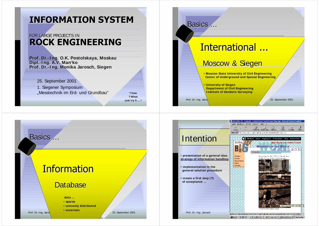
FOR LARGE PROJECTS INFOR LARGE PROJECTS IN
ProfProf. Dr.-. Dr.-IngIng. O.K.. O.K. Postolskaya Postolskaya, Moskau, MoskauDiplDipl.-.-IngIng. A.V. Man‘. A.V. Man‘kokoProfProf. Dr.-. Dr.-IngIng. Monika . Monika JaroschJarosch, Siegen, Siegen
25. September 20011. Siegener Symposium„Messtechnik im Erd- und Grundbau“ ? how
? Whatjust try it ... ! 25. September 2001Prof. Dr.-Ing. Jarosch 2
Basics Basics ......
MoscowMoscow & Siegen & Siegen• Moscow State University of Civil Engineering Center of Underground and Special Engineering
• University of Siegen Department of Civil Engineering Institute of Geodetic Surveying
25. September 2001Prof. Dr.-Ing. Jarosch 3
Basics Basics ......
Database Database data ...• sparse• unevenly distributed• uncertain
25. September 2001Prof. Dr.-Ing. Jarosch 4
Intention
• presentation of a general idea:strategy of information handling
• implementation in the general solution procedure
• create a first step (?) of acceptance ...
25. September 2001Prof. Dr.-Ing. Jarosch 5
Basics Basics ......
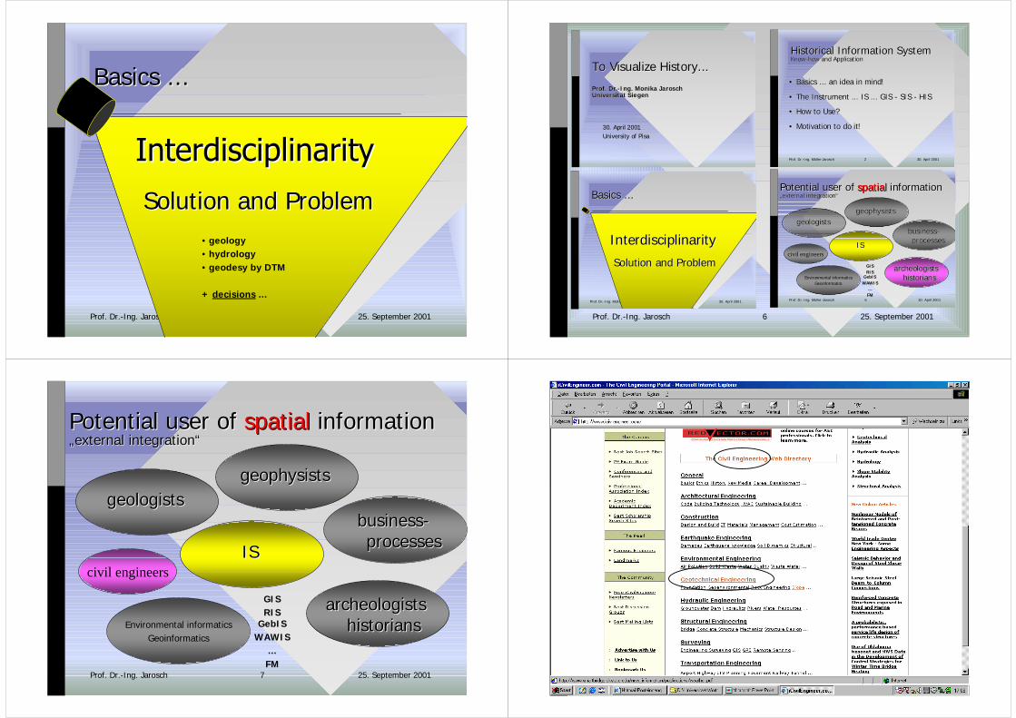
Solution and Solution and ProblemProblem• geology• hydrology• geodesy by DTM
+ decisions ...
25. September 2001Prof. Dr.-Ing. Jarosch 6
To To Visualize HistoryVisualize History......
ProfProf. Dr.-. Dr.-IngIng. Monika . Monika JaroschJaroschUniversität SiegenUniversität Siegen
30. April 2001University of Pisa
30. April 2001Prof. Dr.-Ing. Müller-Jarosch 2
Historical Historical Information SystemInformation SystemKnowKnow--howhow and Applicationand Application
•• Basics Basics ... an ... an idea idea in in mindmind!!
•• The The Instrument ... IS ... GIS - SIS - HISInstrument ... IS ... GIS - SIS - HIS
•• How How to to UseUse??
•• Motivation to Motivation to do itdo it!!
30. April 2001Prof. Dr.-Ing. Müller-Jarosch 5
Basics Basics ......
InterdisciplinarityInterdisciplinarity
Solution and Solution and ProblemProblem
30. April 2001Prof. Dr.-Ing. Müller-Jarosch 6
Environmental informaticsGeoinformatics
civil engineers
Potential Potential user ofuser of spatialspatial informationinformation„„external integrationexternal integration““
ISIS
geologistsgeologistsgeophysistsgeophysists
GISRIS
GebISWAWIS
...FM
businessbusiness-- processesprocesses
archeologistsarcheologistshistorianshistorians
25. September 2001Prof. Dr.-Ing. Jarosch 7
Environmental informaticsGeoinformatics
civil engineers
Potential Potential user ofuser of spatialspatial informationinformation„„external integrationexternal integration““
ISIS
geologistsgeologistsgeophysistsgeophysists
GISRIS
GebISWAWIS
...FM
businessbusiness-- processesprocesses
archeologistsarcheologistshistorianshistorians
25. September 2001Prof. Dr.-Ing. Jarosch 8

25. September 2001Prof. Dr.-Ing. Jarosch 9
• geological information• hydrogeological information
ThemeTheme
GeotechnicsGeotechnicssurface and underground structures ...
25. September 2001Prof. Dr.-Ing. Jarosch 10
GeotechnicsGeotechnics
Geotechnical Engineering
Geotechnical engineers evaluate and stabilize foundationsfor buildings, roads, and other structures. Earthquakes and geothermalactivity are of special interest to geotechnical engineers.
Load - weight distribution throughout a structure; loads caused by wind,earthquakes, and gravity, for example, affect how weight is distributedthroughout a structure
Stability - characteristic of a structure that is able to carry a realisticload without collapsing or deforming significantly; Stable = ability toresist collapse and deformation!
25. September 2001Prof. Dr.-Ing. Jarosch 11
• 9th ISRM Congress on Rock Mechanics, Paris, 1999• 37th U.S. Rock Mech. Symposium, Vail, Colorado, 1999• Int. Workshop on Rock Mechanics of
Nuclear Waste Repositories, Vail, Colorado, 1999• FLAC and Num.Modeling in Geomechanics, Minneapolis, 1999• Geo-Denver 2000• Int. Conference on Advances of Computer Methods
in Geotechnical and Geoenvironmental Engineering, Moscow, 2000
• MassMin 2000, Brisbane, 2000• 4th North American Rock Mechanics Symposium, Seattle, 2000
Actual meetings ...
• Tunn. & Underground Space Tech.• Int.J. Rock Mech. & Min. Sci.
Actual journals ...
... without any demand on completeness ...
25. September 2001Prof. Dr.-Ing. Jarosch 12
MSUCE
Topics for the conferenceare:• Methods, models and algorithms• Code verification• Environmental information systems• Data acquisition and filters• Graphic presentation and decision support• Risk assessment• Groundwater modeling• Underground engineering• Waste disposal and longtime prognosis• Computers & engineering education

25. September 2001Prof. Dr.-Ing. Jarosch 13
Why all that?
Earth‘s surface
Building „on“
Building „in“ rock/soil massstructure
Groundwater flow
Water „from above“
25. September 2001Prof. Dr.-Ing. Jarosch 14
Why all that?
Earth‘s surface
Building „on“
Building „in“
interaction
interaction
Groundwater flow
Factor 1
Factor n
Factor...
Factor 2Large-scale engineering projects:system of natural and engineered objects!
• Congested urban environment
• Underground facilities for radioactive waste disposal
• tunneling
Existing balance Preservation!
rock/soil massstructure
25. September 2001Prof. Dr.-Ing. Jarosch 15
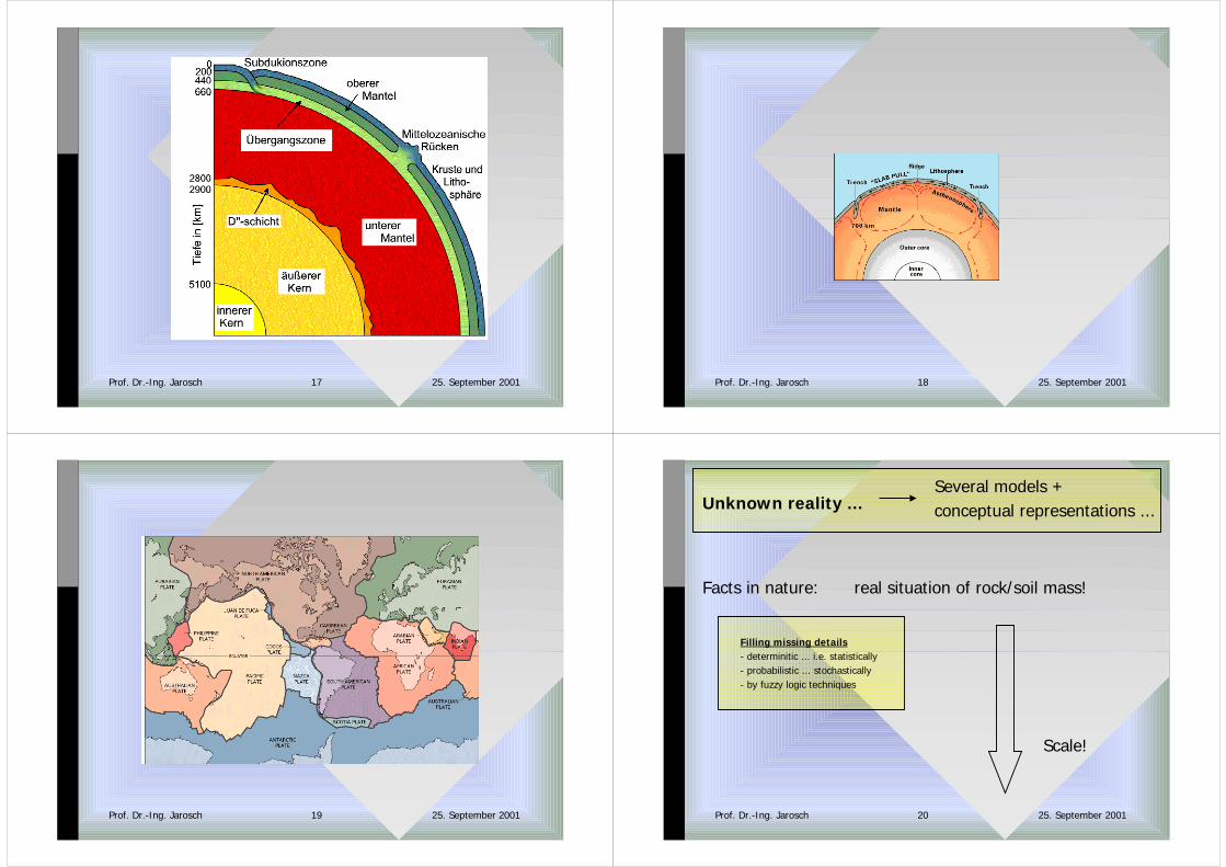
Facts in nature: real situation of rock/soil mass!
Unknown reality ...Several models +conceptual representations ...
? Description ?
25. September 2001Prof. Dr.-Ing. Jarosch 16
25. September 2001Prof. Dr.-Ing. Jarosch 17 25. September 2001Prof. Dr.-Ing. Jarosch 18
25. September 2001Prof. Dr.-Ing. Jarosch 19 25. September 2001Prof. Dr.-Ing. Jarosch 20
Facts in nature: real situation of rock/soil mass!
Several models +conceptual representations ...
Filling missing details- determinitic ... i.e. statistically- probabilistic ... stochastically- by fuzzy logic techniques
Scale!
Unknown reality ...

25. September 2001Prof. Dr.-Ing. Jarosch 21
Facts in nature: real situation of rock/soil mass!
Several models +conceptual representations ...
Engineering-geological model= Systematic description• structure• state• properties of materials
Analysis and generalization of in situ data• genesis + geological age• known mechanisms• analogous formations in similar projects• statistics and probability for unknown details
= fundamental knowledge• rock mass
Unknown reality ...
25. September 2001Prof. Dr.-Ing. Jarosch 22
Nature modelled by:real situation of rock/soil mass
Several models +conceptual representations ...
Engineering-geological model
? Interpretation of this first information ?
Unknown reality ...
25. September 2001Prof. Dr.-Ing. Jarosch 23
Nature modelled by:real situation of rock/soil mass
Several models +conceptual representations ...
Engineering-geological model
numerical models
Unknown reality ...
25. September 2001Prof. Dr.-Ing. Jarosch 24
Nature modelled by:real situation of rock/soil mass
Several models +conceptual representations ...
Engineering-geological model
= 2d/ 3d representations• principal geological features• physical properties• mechanical properties
Derivation depends on ...• Goal and techniques• special problem geomechanical model s (!)
Continued modelling ...• Different aspects ofobjects behavior
Unknown reality ...

25. September 2001Prof. Dr.-Ing. Jarosch 25
Nature modelled by:real situation of rock/soil mass
Several models +conceptual representations ...
Engineering-geological model
geomechanical model s (!)
numerical models
Special methodphysical models
Filling missing details- deterministically
Unknown reality ...
25. September 2001Prof. Dr.-Ing. Jarosch 26
25. September 2001Prof. Dr.-Ing. Jarosch 27
a-priori information from ...• Regional geological maps• air/ satellite photographs• previous investigation(mining, unrelated projects) unknown inner
known outer
• more detailed• more reliable
? rock/mass structure? rock properties
? Working procedure ?
Unknown reality ...
3d-modelling of•radionuclide transport in groundwater
• saline groundwater movementin an erosional channel crossing a salt dome
Modelling, simulation
and visualizationof general systems
in space
25. September 2001Prof. Dr.-Ing. Jarosch 28
BasicsBasics ... ...
3D 3D �� 4D 4D which problem is which problem is not not space or timespace or time
dependentdependent??

25. September 2001Prof. Dr.-Ing. Jarosch 29
data
sampling
topography
geological maps
air/ sat photographs
mining prospecting
exploration of unrelated projects
dataanalysingISGrafics+Database
datarepresentation
2d3d4d
prognosis ...
geological features ...physical properties ...mechanical properties ...... of rock/soil mass!
layers of information!
Support for our decisions! store + systemize in place and time
25. September 2001Prof. Dr.-Ing. Jarosch 30
GIS
data
storinganalyzing
Layers of information
• real• in situ• assumed• prognosticated
a-priori information from ...• Regional geological maps• air/ satellite photographs• previous investigation(mining, unrelated projects)
exploration during construction!
unknown inner
known outer
• more detailed• more reliable
• view• topography• water flows• swamps...
? rock/mass structure? rock properties
Unknown reality ...
25. September 2001Prof. Dr.-Ing. Jarosch 31
Basics Basics ......
Data and Information
•• HW+SWHW+SW
•• Geographic dataGeographic data: : vectorvector- und - und rasterorientedrasteroriented
•• MapMap + + databasedatabase
•• GIS-GIS-functionalitiesfunctionalities!!
•• CombinationCombination ofof informationinformation! ! on any topic on any topic ......
25. September 2001Prof. Dr.-Ing. Jarosch 32
25. September 2001Prof. Dr.-Ing. Jarosch 33
Basics Basics ......
2D 2D �� 3D 3D
25. September 2001Prof. Dr.-Ing. Jarosch 34
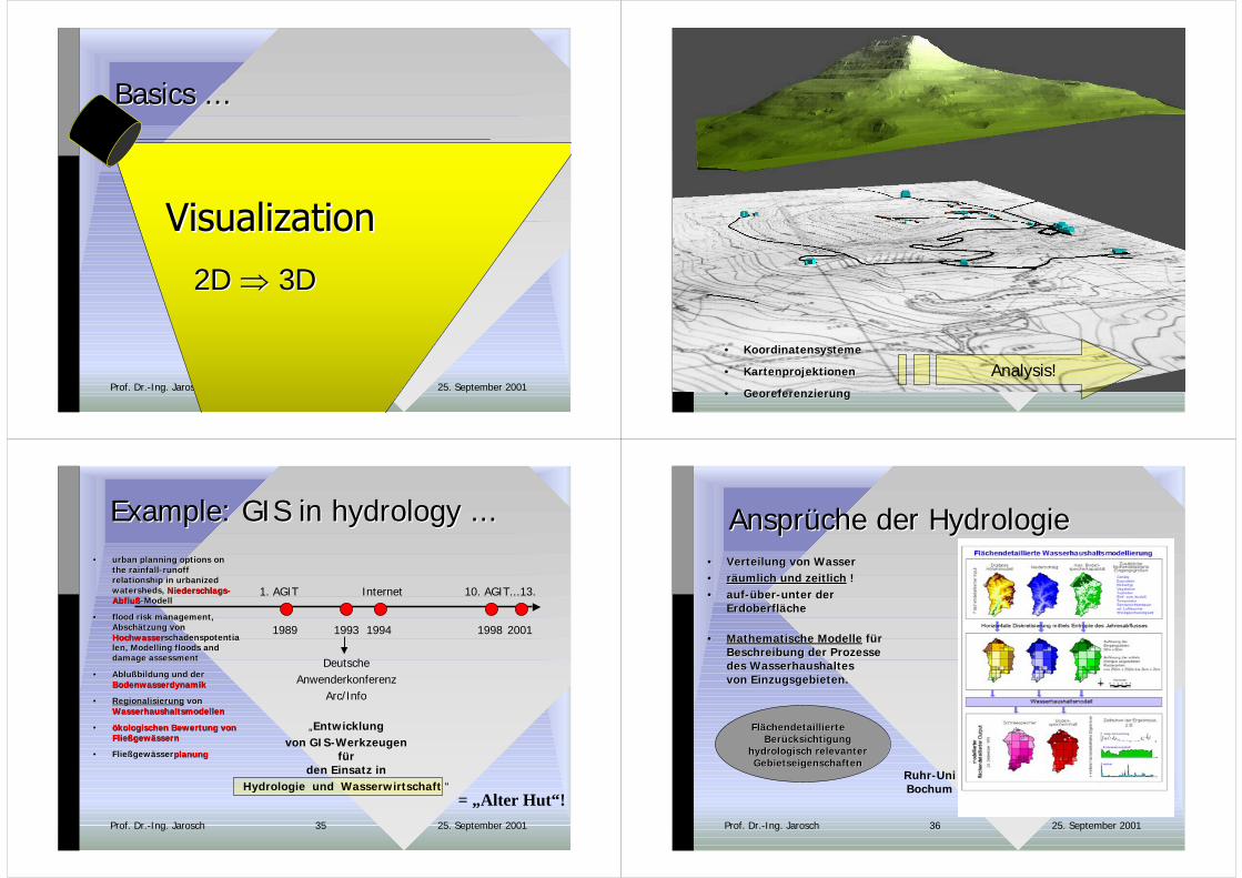
•• KoordinatensystemeKoordinatensysteme
•• KartenprojektionenKartenprojektionen
•• GeoreferenzierungGeoreferenzierung
Analysis!
25. September 2001Prof. Dr.-Ing. Jarosch 35
ExampleExample: GIS in : GIS in hydrology hydrology ......
2001
= „Alter Hut“!
1998
10. AGIT...13.
1989
1. AGIT
1993
DeutscheAnwenderkonferenz
Arc/Info
„Entwicklungvon GIS-Werkzeugen
fürden Einsatz in
Hydrologie und Wasserwirtschaft “
1994
Internet
•• urbanurban planning options on planning options onthe rainfallthe rainfall--runoffrunoffrelationshiprelationship in in urbanized urbanizedwatershedswatersheds, , Niederschlags-Niederschlags-AbflußAbfluß-Modell-Modell
•• flood risk managementflood risk management,,Abschätzung vonAbschätzung vonHochwasserHochwasserschadenspotentiaschadenspotentialenlen, , Modelling floods andModelling floods anddamage assessmentdamage assessment
•• AblußbildungAblußbildung und der und derBodenwasserdynamikBodenwasserdynamik
•• RegionalisierungRegionalisierung von vonWasserhaushaltsmodellenWasserhaushaltsmodellen
•• ökologischen Bewertung vonökologischen Bewertung vonFließgewässernFließgewässern
•• FließgewässerFließgewässerplanungplanung
25. September 2001Prof. Dr.-Ing. Jarosch 36
Ansprüche der Ansprüche der HydrologieHydrologie•• Verteilung von WasserVerteilung von Wasser•• räumlich und zeitlichräumlich und zeitlich ! !•• auf-über-unter derauf-über-unter der
ErdoberflächeErdoberfläche
•• Mathematische ModelleMathematische Modelle für fürBeschreibung der ProzesseBeschreibung der Prozessedes Wasserhaushaltesdes Wasserhaushaltesvon Einzugsgebieten.von Einzugsgebieten.
FlächendetaillierteFlächendetaillierteBerücksichtigungBerücksichtigung
hydrologisch hydrologisch relevanterrelevanterGebietseigenschaftenGebietseigenschaften
Ruhr-UniBochum

25. September 2001Prof. Dr.-Ing. Jarosch 37
Hydrologische ModellierungHydrologische Modellierung= quantitative und = quantitative und deterministische deterministische BeschreibungBeschreibungder der TeilprozesseTeilprozesse des Wasserhaushaltes des Wasserhaushaltes
VerdunstungAbfluß
Wasserspeicherungim Boden
GefälleBodenart
Landnutzung
... bestimmt durch Gebietseigenschaften ...
Energetische Verhältnisse an Landoberfläche
Hydrologie: mathematische Modelle
Prozesse desWasserhaushaltes
von Einzugsgebieten
bevavior = f { topography+attributes }
BeschreibungEntwicklung
25. September 2001Prof. Dr.-Ing. Jarosch 38
GIS-GIS-functionalitiesfunctionalities::Analysis of spatial dataAnalysis of spatial data
•• analysisanalysis ofof attributesattributesdatabasesdatabases
•• analysis accordinganalysis according to to topologic criteria topologic criteria...... distances distances - - neighbourhoodneighbourhood - - bufferbuffer
as a model of reality!
25. September 2001Prof. Dr.-Ing. Jarosch 39
Just to Just to explain explain ......
GIS =GIS =
•• methodsmethods//techniquestechniques
•• conceptsconcepts
areas of application
GIS =GIS =
integratedintegrated
component ofcomponent of
„„mainstream mainstream IT“IT“
„spatial aspect“ in
information technology.
25. September 2001Prof. Dr.-Ing. Jarosch 40
GIS - IntegrationGIS - Integration„„themeninternthemenintern““
GIS
Oberflächenhydrologie:Niederschlag-Abfluß-Prozess
Abflußmodellierung
Hochwasser-Risiko-Management
Hydrologische ModelleGIS-gestützt!
Bodenwasserhaushalt:Bodenwasserdynamik-Geländestruktur-Beziehung
Tendenz: Models and Embedded GIS
Grundwasserwirtschaft:Grundwassermodellierung� Grundwasserneubildung
Einflussfaktoren:Klima
Landnutzung(variabel in Raum und Zeit)

25. September 2001Prof. Dr.-Ing. Jarosch 41
Soil parameter?
Behavior and changes in space?
25. September 2001Prof. Dr.-Ing. Jarosch 42
Soil parameter?• Discrete volume of sample material � determination!
Behavior and changes in space?• 3D-GIS
25. September 2001Prof. Dr.-Ing. Jarosch 43
Soil parameter?• Discrete volume of sample material � determination!
Behavior and changes in space?• 3D-GIS• geostatistics
! Use of 3D-information systems in combination withgeostatistics !
Present research! � expertise+confidence ...i.e. for land recycling purposes
Update!
25. September 2001Prof. Dr.-Ing. Jarosch 44
Efficiency depends on ...
numerical modelscomputer-aided support of engineering decisions
• mechanical factor• numerical factor• human factor
• legal factor
• which SW? ... well choosen?• which sort of data - in which quality? ... suitable?• input parameters for selected model? ... suitable?• engineering task force ... experienced?• proceeding according computer model?
Yes???Compromises ...
Computer work Practical experience
designer/ contractor
Better known reality ...
25. September 2001Prof. Dr.-Ing. Jarosch 45
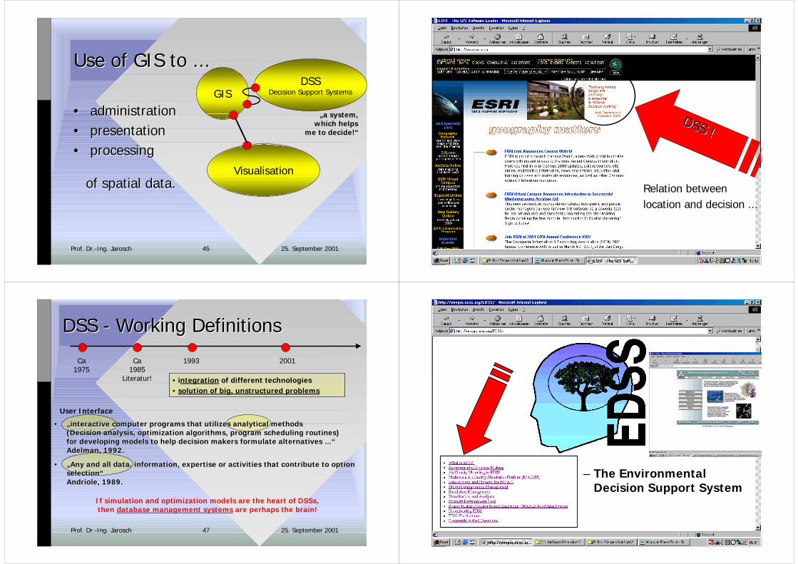
Visualisation
GISDSS
Decision Support Systems
„a system,which helps
me to decide!“
Use ofUse of GIS to ... GIS to ...
•• administrationadministration•• presentation presentation•• processing processing
ofof spatialspatial datadata..
25. September 2001Prof. Dr.-Ing. Jarosch 46
DSS !DSS !
Relation betweenlocation and decision ...
25. September 2001Prof. Dr.-Ing. Jarosch 47
DSS - DSS - Working DefinitionsWorking Definitions
•• „„interactive computer programs that utilizes analytical methodsinteractive computer programs that utilizes analytical methods((Decision analysisDecision analysis, , optimization algorithmsoptimization algorithms, , program scheduling routinesprogram scheduling routines))for developing models for developing models to to help decision makers formulate help decision makers formulate alternatives ...“alternatives ...“AdelmanAdelman, 1992., 1992.
•• „„Any and Any and all all datadata, , informationinformation, , expertise or activities that contribute expertise or activities that contribute to to optionoptionselectionselection““AndrioleAndriole, 1989., 1989.
User Interface
If simulation and optimization models are the heart of DSSs,then database management systems are perhaps the brain!
20011993Ca1975
Ca1985
Literatur! • integration of different technologies• solution of big, unstructured problems
25. September 2001Prof. Dr.-Ing. Jarosch 48
–– The EnvironmentalThe EnvironmentalDecisionDecision Support System Support System
25. September 2001Prof. Dr.-Ing. Jarosch 49 25. September 2001Prof. Dr.-Ing. Jarosch 50
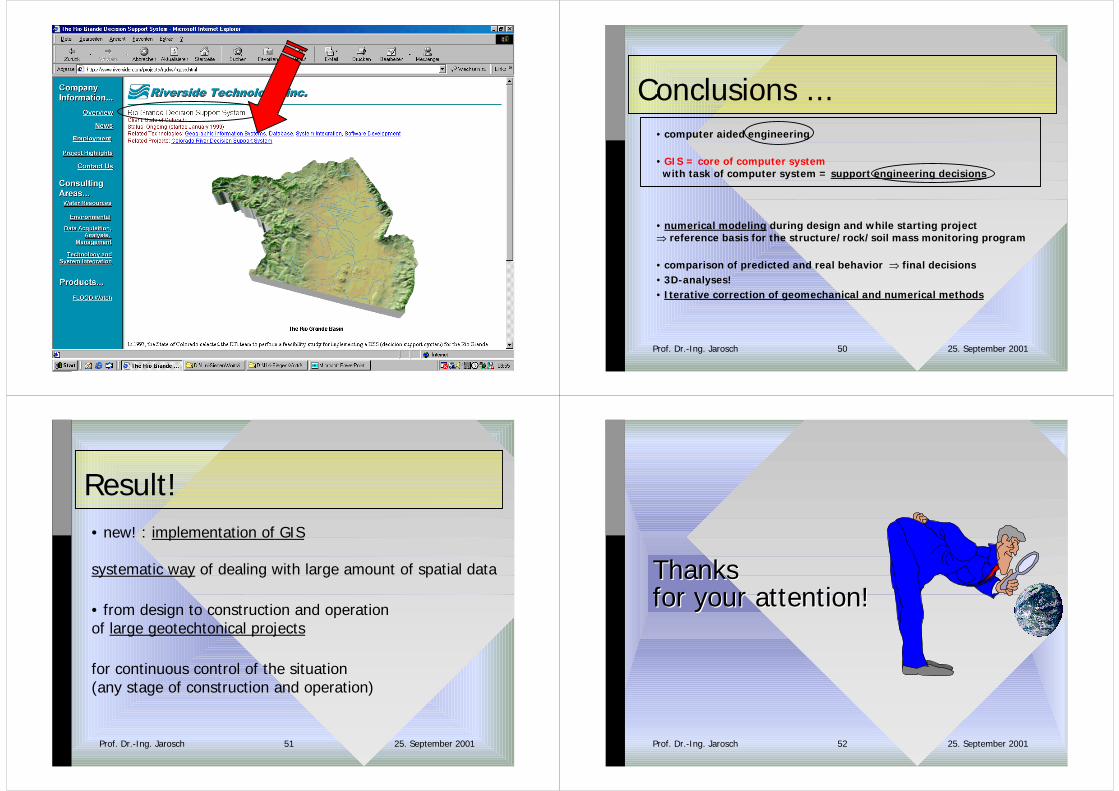
Conclusions ...• computer aided engineering
• GIS = core of computer system with task of computer system = support engineering decisions
• numerical modeling during design and while starting project� reference basis for the structure/rock/soil mass monitoring program
• comparison of predicted and real behavior � final decisions• 3D-analyses!• Iterative correction of geomechanical and numerical methods
25. September 2001Prof. Dr.-Ing. Jarosch 51
Result!• new! : implementation of GIS
systematic way of dealing with large amount of spatial data
• from design to construction and operation of large geotechtonical projects
for continuous control of the situation (any stage of construction and operation)
25. September 2001Prof. Dr.-Ing. Jarosch 52
ThanksThanksfor your attentionfor your attention!!

25. September 2001Prof. Dr.-Ing. Jarosch 53