BALLANTRAE-MUSSELMAN LAKE SERVICING REPORT · BALLANTRAE-MUSSELMAN LAKE SERVICING REPORT ... 5.2...
36
BALLANTRAE-MUSSELMAN LAKE SERVICING REPORT Submitted to: The Town of Whitchurch-Stouffville Submitted by: AMEC Environment & Infrastructure 3215 North Service Road Burlington, ON L7N 3G2 Tel: 905-335-2353 Fax: 905-335-1414 November, 2012 (Project No. 111068)
Transcript of BALLANTRAE-MUSSELMAN LAKE SERVICING REPORT · BALLANTRAE-MUSSELMAN LAKE SERVICING REPORT ... 5.2...

BALLANTRAE-MUSSELMAN LAKE
SERVICING REPORT
Submitted to:
The Town of Whitchurch-Stouffville
Submitted by:
AMEC Environment & Infrastructure
3215 North Service Road
Burlington, ON L7N 3G2
Tel: 905-335-2353
Fax: 905-335-1414
November, 2012
(Project No. 111068)

The Town of Whitchurch-Stouffville
Ballantrae-Musselman Lake
Servicing Report
November, 2012
Page i
TABLE OF CONTENTS
Page No.
1.0 INTRODUCTION .................................................................................................. 1
1.1 Purpose of the Report................................................................................ 1
2.0 STUDY AREA INFORMATION ............................................................................ 2
2.1 Study Area Location .................................................................................. 2
2.2 Planned Land Use ..................................................................................... 2
2.3 Existing Land Features .............................................................................. 2
2.4 Geology ..................................................................................................... 5
2.5 Hydrogeology ............................................................................................. 5
3.0 BACKGROUND REVIEW .................................................................................... 7
3.1 Highway 48/Aurora Sideroad Drainage Study (RV Anderson Associates Limited, March 1991) ................................................................................. 7
3.2 Ballantrae-Musselman Lake Settlement Capability Study (Gartner Lee, January 1991) ............................................................................................ 7
3.3 Ballantrae-Musselman Lake Community Secondary Plan Background Study (Macaulay Shiomi Howson Ltd. et. al., February 1992). .................. 8
3.4 Oak Ridges Moraine Conservation Plan (OMRCP) (Ontario Ministry of the Environment, 2002) ................................................................................... 9
3.5 Lake Simcoe Protection Plan (Ontario Ministry of the Environment, July 2009) ......................................................................................................... 9
3.6 East Holland River Subwatershed Plan (Lake Simcoe Region Conservation Authority, 2010) ................................................................. 10
3.7 Ballantrae Musselman Lake Water Works Project Environmental Study Report (Giffels Associates Limited, 1989) ............................................... 10
3.8 Ballantrae-Musselman Lake and Environs Secondary Plan - Section 11 (Town of Whitchurch-Stouffville, 2000) .................................................... 11
3.9 Regulatory Reporting of Municipal Drinking Water System (Town of Whitchurch Stouffville, 2007) ................................................................... 12
3.10 Regulatory Reporting of Municipal Drinking Water System (Town of Whitchurch Stouffville, 2010) ................................................................... 13
3.11 Ballantrae High Water Table Investigation (AECOM, 2009) .................... 13
3.12 Drawings and Maps ................................................................................. 14

The Town of Whitchurch-Stouffville
Ballantrae-Musselman Lake
Servicing Report
November, 2012
Page ii
3.13 Pre-Consultation with MTO ...................................................................... 14
4.0 STORMWATER AND DRAINAGE ..................................................................... 15
4.1 Storm Drainage System ........................................................................... 15
4.2 Development Constraints ........................................................................ 16
4.2.1 Hydrogeology ............................................................................ 16
4.2.2 Groundwater ............................................................................. 16
4.2.3 Phosphorous Reduction ........................................................... 16
4.2.4 Best Management Practices ..................................................... 17
4.2.5 Policy Requirements ................................................................. 17
4.2.6 Highway 48 Corridor ................................................................. 17
4.3 Summary ................................................................................................. 18
4.4 Conceptual Stormwater Servicing Strategy (Highway 48 Corridor) ......... 20
4.5 Next Steps ............................................................................................... 22
5.0 WATER AND WASTEWATER ........................................................................... 24
5.1 Existing Servicing ..................................................................................... 24
5.2 Plans of Subdivision ................................................................................ 24
5.3 Water Supply and Distribution Analysis ................................................... 24
5.4 Wastewater Collection and Treatment Analysis ...................................... 24
5.4.1 Alternative #1: Private On-Site Systems .................................. 25
5.4.2 Alternative #2: Communal Wastewater Treatment Facility ...... 26
5.4.3 Alternative #3: Ballantrae Golf & Country Club WWTP ........... 26
5.5 Conceptual Sanitary Sewer System ........................................................ 28
5.6 Preliminary Preferred Alternative ............................................................. 28
Appendix A - Sanitary Design Sheet and Drawings
The Town of Whitchurch-Stouffville
Ballantrae-Musselman Lake
Servicing Report
November, 2012
Page 1
1.0 INTRODUCTION
The Ballantrae-Musselman Lake and Environs Secondary Plan Area is a unique community
focused on the Ballantrae settlement area which includes a residential golf course community,
and the hamlet of Musselman Lake. Surrounding these areas are rural and environmental
lands, including estate lot subdivisions and residential strips. The community is located in the
Oak Ridges Moraine and includes a wide range of environmental features.
The Ballantrae-Musselman Lake and Environs Secondary Plan was adopted in 1994. It has
been amended a number of times, but has never been subject to a comprehensive review. A
number of significant emerging issues impede development in Ballantrae including the ability to
provide servicing such as stormwater and wastewater.
AMEC Environment & Infrastructure, as part of a Consulting Team, has been retained to
undertake the servicing review for the Ballantrae-Musselman Lake settlement area. This
Servicing Report has been prepared as the initial step in that regard.
The Report includes a review of previous work dating back nearly 20 years and provides the
“current situation” on groundwater issues, stormwater, wastewater and potable water for
Ballantrae. The Report also provides commentary on constraints related to servicing, focused
on the Highway 48 corridor in Ballantrae, and options related to resolving these constraints
1.1 Purpose of the Report
The purpose of this report is to present the findings from the review of the background
documents, summarize issues associated with water, wastewater, stormwater and groundwater
relative to future development in the Highway 48 corridor, and present options to provide
stormwater, water, and wastewater servicing and address groundwater concerns within the
subject lands. The report is a part of the proposed Functional Servicing Strategy (FSS) which
encompasses two main goals:
1. Determine the requirements for managing the servicing in the area, and
2. Protection of groundwater.
The information collected from this review has been used to build upon the existing servicing
information and address future water, wastewater and stormwater servicing needs relative to
the designated land use and address existing groundwater concerns.
The Town of Whitchurch-Stouffville
Ballantrae-Musselman Lake
Servicing Report
November, 2012
Page 2
2.0 STUDY AREA INFORMATION
2.1 Study Area Location
The broad scale Study Area consists of the Community of Ballantrae located at the intersection
of Highway 48 and Aurora Sideroad and a portion of Highway 48 north and south of Ballantrae.
The area is located within the Ballantae-Musselman Lake and Environs Secondary Plan as
shown on Map 1. Within the general Study Area, specific components of the servicing plan
apply to different areas; these areas are as follows:
Water Supply and Distribution – Community of Ballantrae
Wastewater Collection and Treatment – Highway 48 Corridor
Stormwater Management – Highway 48 Corridor
Groundwater – Community of Ballantrae
While the Ballantae-Musselman Lake and Environs Secondary Plan includes the area shown on
Map 1, this study is limited to the area along the Highway 48 corridor as shown on Map 2.
2.2 Planned Land Use
The Study Area includes the Community of Ballantrae. A review of Schedule E, Land Use Plan,
Ballantrae-Musselman Lake and Environs Secondary Plan (revised March 2007), indicates the
Ballantrae Community Area is centred on the intersection of Highway 48 and Aurora Road. The
southern and northwest portions of the Study Area are identified as Ballantrae Future
Residential Area. The lands to the north of the Community Area and east of Highway 48 are
shown as Mixed Use Area and Ballantrae Residential Golf Course Area.
2.3 Existing Land Features
Regionally, the Study Area is located on a topographic high that forms a surface water divide in
the Oak Ridges Morraine (ORM). The elevation of the grade in the northern limits of the Study
Area is about 340 metres above sea level (masl) with the ground surface sloping gently to the
south to about 325 masl at an average slope of 4%.
The Study Area is located within the eastern headwaters of the East Holland River
Subwatershed, part of the jurisdiction of the Lake Simcoe Region Conservation Authority. The
subject lands also lie within the Oak Ridges Moraine. Soils within the area consist of Brighton
Sandy Loam, which is classified as SCS Soil Type “A”, exhibiting high rates of infiltration and
low runoff potential. Drainage is generally conveyed from east to west across the Highway 48
corridor, and local drainage within the corridor generally flows from north to south. Surface
slopes within the study area are generally moderate to low (i.e. less than 1 %), with localized
depressions in the vicinity of the Study Area. The Ballantrae-Musselman Lake Community
Secondary Plan Background Study (Macaulay Shiomi Howson Ltd. et. al., February 1992)
indicates that the natural drainage conditions within the study area are characteristic of upland

The Town of Whitchurch-Stouffville
Ballantrae-Musselman Lake
Servicing Report
November, 2012
Page 3

The Town of Whitchurch-Stouffville
Ballantrae-Musselman Lake
Servicing Report
November, 2012
Page 4

The Town of Whitchurch-Stouffville
Ballantrae-Musselman Lake
Servicing Report
November, 2012
Page 5
areas in the Oak Ridges Moraine (i.e. sandy soils with relatively low runoff rates, kettle lakes
and other internally draining depressions, and few well developed streams).
There are intermittent streams that originate north and northwest of the Study Area and flow to
the northwest. An intermittent stream is shown in the north half of the Study Area, flowing to
the southeast and then connecting to a tributary of the east branch of the Holland River. The
Holland River East Branch is about 500 m south of the south limits of the Study Area. It flows
westerly and originates in the area of Musselman and Windsor Lakes which are located slightly
more than a kilometre to the east of the Study Area.
Major surface water bodies in the vicinity of the Study Area (i.e. Musselman Lake and wetlands)
are sustained to a large extent by discharge from the shallow groundwater system. The water
quality within the shallow groundwater system has been degraded historically. Musselman Lake
has been noted to contain elevated nutrient levels which have been attributed to high density
residential development around the Lake, recreational use and past agricultural activities.
Surface water draining to the lakes has been noted in the background information as the
apparent substantial cause of deteriorating water quality. The greatest impact has been noted
to occur along the Aurora Sideroad and Highway 48 in Ballantrae and along the north side of
Musselman Lake.
2.4 Geology
The bedrock in the area of the Study Area is described as the Whitby Shale of Blue Mountain
Formation. Regionally, there has been extensive erosion of the bedrock which has produced a
valley system known as the Laurentian Valley that extends from Georgian Bay to Lake Ontario.
This valley is located considerably west of the Study Area, however there are several
associated tributary valleys which extend to the Study Area. The overall bedrock surface in the
area, slopes from north to south from about elevation 200 metres above sea level (masl) to 150
masl, with the bedrock surface in the Study Area at about elevation 175 masl. The bedrock also
slopes gently to the west towards a locally incised spillway.
The Study Area is located on a physiographic region known as the Oak Ridges Moraine, a deep
and extensive granular deposit. Surficial geologic mapping of the area identifies the surficial soil
in the vicinity of the site as glacial river deposits and sand and gravel with Halton Till to the
south and west and moraine deposits to the north. The surficial sand and gravel of the ORM is
shown to extend to about 50 metres below ground surface (mbgs) in the Study Area. The ORM
deposits are underlain by the Newmarket Till, the Thorncliffe Formation deposits, the
Sunnybrook Drift, and then the Scarborough Formations Deposits that extend to the Whitby
shale. Quaternary sediment thickness within the Study Area is anticipated to be in the order of
175 m.
2.5 Hydrogeology
AMEC has undertaken a desk top hydrogeological appraisal of the Study Area. This appraisal
focuses on identifying the areas with a high ground water level that may create constraints to

The Town of Whitchurch-Stouffville
Ballantrae-Musselman Lake
Servicing Report
November, 2012
Page 6
both existing and proposed development. It is understood that concerns have been raised by
residents in the Aurora Road/Highway 48 area regarding wet basements and the extended use
of sump pumps. In addition, development in the Study Area is serviced by individual on-site
sewage disposal systems whose ability to function properly is understood to be constrained by
the high water table.
The desk top review includes the following:
1) East Holland River Subwatershed Plan (EHRWSP), prepared by the Lake Simcoe
Region Conservation Authority, 2010.
2) Ministry of Natural Resources topographic mapping sheet 10 17 6350 48750, air
photography 1982, published 2002.
3) Ballantrae High Water Table Investigation, prepared by Don McQuay, AECOM, dated
November 26, 2009.
The EHRSWP identified six hydrostratigraphic units within the Study Area. These aquifers
include the Oak Ridges Aquifer Complex (Upper Aquifer); the Thorncliffe Aquifer Complex
(“Intermediate Aquifer”); the Scarborough Aquifer Complex and the Weathered Bedrock (“Deep
Aquifer”). The aquitards include the Newmarket Till and the Sunnybrook Drift. These aquitards
provide a storage area for groundwater however they are generally comprised of low permeable
material and therefore do not provide a good supply of water.
The Newmarket Till acts as an aquitard which separates the Oak Ridges aquifer from the
Thorncliffe and Scarborough aquifers. Tunnel Channel Aquifers, created by the erosion of the
Newmarket Till, which can allow transfer from the shallow aquifer to deeper aquifers, were not
identified within the Study Area.
Groundwater flow in the three aquifer systems travels from the topographic highs in the ORM
towards topographic lows in the major stream channels and Lake Simcoe. This is especially
evident in the shallow aquifer and is more subdued in the Thorncliffe and Scarborough aquifers.
Observed hydraulic potentials of 310 m are shown within the Study Area. They decrease to
250 m to the north, west and south in both the Shallow and Thorncliffe Aquifers.
In general, the surficial granular nature of the ORM produces a lack of surface drainage due to
the high precipitation infiltration rates. Groundwater emerges along the northern and southern
flanks of the moraine which is a very large recharge area for the headwaters of the sub-
watersheds.
The Town of Whitchurch-Stouffville
Ballantrae-Musselman Lake
Servicing Report
November, 2012
Page 7
3.0 BACKGROUND REVIEW
Several reports have been provided as background information for use in the Study. The
following summarizes the relevant information in those reports.
3.1 Highway 48/Aurora Sideroad Drainage Study (RV Anderson Associates Limited,
March 1991)
This report was completed to address drainage issues within a low-lying area at the southwest
corner of Highway 48 and Aurora Sideroad. The report provides some information regarding
the drainage network in the vicinity of this intersection, particularly with respect to private
residences in the area. Various alternatives were provided to remediate the flooding conditions
within the low-lying area for consideration by the Ministry, however no single alternative was
advanced as a preferred alternative.
3.2 Ballantrae-Musselman Lake Settlement Capability Study (Gartner Lee, January
1991)
This report was completed in order to assess the scale and type of development which could be
accommodated in the community based upon private sewage disposal and groundwater
constraints, as well as to establish a technical foundation for detailed secondary planning
policies to be adopted by the area municipalities, including the current Study Area.
Water quality issues within the shallow groundwater system were attributed to poor planning of
separating potable water sources from septic systems, road salting activities, and past
agricultural activities. The report indicates that infilling of development within the currently built-
up areas may proceed, however it is noted that the proponent of each development proposal
should demonstrate that the densities proposed would not cause further adverse environmental
impacts on the local groundwater resources on-site or on adjoining properties. It is further
recommended that, in the absence of communal sewage treatment services, each proponent
should demonstrate that adequate space is available on each lot or development proposal for a
septic tile bed system and reserve bed area in accordance with the requirements of the local
health department. Contamination of the upper aquifer from road salting and from sewage
disposal was reported. Due to the pollution, several water supplies were considered unpotable.
The lower and intermediate aquifers were generally considered acceptable as a potable supply
for domestic purposes. However, some impairment of water quality in upper aquifer has
occurred.
Local groundwater resources are used as a source of water supply in the area. A field survey
by Gartner Lee Ltd in 1990 has found there to be sufficient quantity of groundwater in the area
The majority of Musselman Lake and Ballantrae is serviced by individual private septic systems.
A survey conducted by MOE in 1984 found 41% of the systems seriously substandard, and in
total 62% did not meet current standards. Based on field survey by Gartner Lee Ltd. most of
the sewage systems were found to be functioning properly, but a significant number of them

The Town of Whitchurch-Stouffville
Ballantrae-Musselman Lake
Servicing Report
November, 2012
Page 8
were located too close to potable water supply. Most septic systems are conventional Class 4
type with trenched in – ground till beds. Some of the larger systems exist to service local
commercial, industrial and community facilities such as the local school consist of more than
one Class 4 septic system.
Soil conditions appear to be favorable for construction and operation of Class 4 septic systems.
The soil provides high infiltration rates and little surface runoff. Shallow depth of ground water
is not considered to be a significant limitation with some exceptions, i.e. adjacent to wetlands.
Natural soils have the ability to treat septic effluent, however, operation of septic system has the
potential for adversely impacting on ground water resources. Research by University of
Waterloo has shown, the ground water impact from septic systems may extend considerable
distances within the ground water system.
Nitrate nitrogen has been identified as a critical parameter in assessing the potential ground
water impacts from septic systems. Based on the nitrate loading calculations for the area, in
future development, residential density should not exceed eight persons per hectare in order to
protect the underlying ground water sources. A minimum residential lot size of about 0.5 ha is
suggested for presently developed area.
The report concludes that infilling of development within the currently built-up areas may
proceed, however it is noted that the proponent of each development proposal should
demonstrate that the densities proposed would not cause further adverse environmental
impacts on the local groundwater resources on-site or on adjoining properties. It is further
recommended that, in the absence of communal sewage treatment services, each proponent
should demonstrate that adequate space is available on each lot or development proposal for a
septic tile bed system and reserve bed area in accordance with the requirements of the local
health department. This report further stresses the importance of maintaining groundwater
recharge at pre-development levels.
3.3 Ballantrae-Musselman Lake Community Secondary Plan Background Study
(Macaulay Shiomi Howson Ltd. et. al., February 1992).
This study included preparation of a Secondary Plan which acts to guide future development in
the Ballantrae and Musselman Lake communities, using an ecologically based planning
approach. The study provides a characterization of the drainage conditions within the areas at
the time of study. Furthermore, the study notes that promoting infiltration as part of stormwater
management is preferred in order to reduce surface runoff to the receiving systems (i.e.
Musselman Lake and other surface water bodies and wetland areas). Infiltration practices are
discouraged by the Town in areas where the primary catchment areas include roadways or
where there is no surface drainage outlet.

The Town of Whitchurch-Stouffville
Ballantrae-Musselman Lake
Servicing Report
November, 2012
Page 9
3.4 Oak Ridges Moraine Conservation Plan (OMRCP) (Ontario Ministry of the
Environment, 2002)
The ORMCP provides land use and resource management planning direction to Provincial
Ministers, Ministries, Agencies, Municipalities, Landowners and other stakeholders on how to
protect the Oak Ridges Moraine ecological and hydrological features and functions. The plan
includes specific policies and recommendations for planning and design to address various
stormwater management objectives, as well as requirements for stormwater management plans
which are to be submitted in support of major development applications.
This plan also requires that Municipal development standards incorporate planning, design, and
construction practices that will reduce the impervious surfaces on lots and sites, as well as
providing flexibility to use alternative stormwater management techniques, specifically directing
roof discharge to rear yard ponding areas and the use of grassed swales. The use of kettle
lakes for stormwater management is prohibited under this plan. The plan also specifies that
new stormwater management ponds with respect to land in key natural heritage features and
hydrologically sensitive features are prohibited.
3.5 Lake Simcoe Protection Plan (LSPP) (Ontario Ministry of the Environment, July
2009)
This plan establishes a comprehensive approach to protect and restore the ecological health of
Lake Simcoe and its watershed. The plan includes requirements and recommendations for
stormwater management practices within the Lake Simcoe watershed including requirements to
reduce contaminant loadings to Lake Simcoe and its tributaries, and to promote
environmentally sustainable land and water uses, activities, and development practices. The
Plan provides a series of policies specifically related to stormwater management, which are to
be incorporated into Official Plans of the member municipalities.
This Plan requires Municipalities to incorporate policies in their Official Plans related to reducing
stormwater runoff volume and pollutant loadings from major development (i.e. development
consisting of the creation of four or more lots, the construction of a building or buildings with a
ground floor area of 500 m2 or more, or the establishment of a major recreational use as
defined by the Oak Ridges Moraine Conservation Plan) and existing settlement areas, including
policies that:
encourage implementation of a hierarchy of source, lot-level, conveyance and end-of-
pipe controls;
encourage the implementation of innovative stormwater management measures;
allow for flexibility in development standards to incorporate alternative community design
and stormwater techniques, such as those related to site plan design, lot grading,
ditches and curbing, road widths, road and driveway surfaces, and the use of open
space as temporary detention ponds;

The Town of Whitchurch-Stouffville
Ballantrae-Musselman Lake
Servicing Report
November, 2012
Page 10
support implementation of programs to identify areas where source control or
elimination of cross connections may be necessary to reduce pathogens or
contaminants; and
support implementation of source control programs, which are targeted to existing areas
that lack adequate stormwater controls.
3.6 East Holland River Subwatershed Plan (Lake Simcoe Region Conservation
Authority, 2010)
This study was completed in order to provide the framework for the Conservation Authority, the
Municipalities, and the Subwatershed Stakeholders to mitigate the impacts from existing and
future land uses within the Subwatershed, as well as to improve upon the conditions within the
Subwatershed. The report provides a characterization of the surface drainage conditions and
water quality within the Subwatershed, as well as an evaluation of Best Management Practices
(BMP’s) to reduce nutrient loadings and address the impacts to the water budget (i.e. quantity
of surface and groundwater) within the Subwatershed.
While most recommendations are related to requirements under existing legislation,
regulations, policies and plans, some discussion of specific stormwater management practices
and technologies which may be implemented to address these requirements is provided within
the report.
3.7 Ballantrae Musselman Lake Water Works Project Environmental Study Report
(Giffels Associates Limited, 1989)
This environmental study report is the third stage in the Class Environmental Assessment
process for municipal water works projects. The report reviews the result of the previous
studies, explains the alternative water supply options considered and describes the details of
the proposed waterworks system.
Based on the study findings which confirmed salt contamination and elevated levels of bacteria
and nutrients in the upper aquifer along Highway 48, it was concluded that the water quality in
the upper and middle aquifer in Ballantrae was at risk of becoming contaminated in the future.
Because of contamination in the upper and middle aquifers, an alternative water supply
obtained from either the lower aquifer or piped in from outside of the community was
determined to be required. The lower level aquifer is acceptable; however, the test wells did
not confirm a sufficient yield to serve as municipal wells for Ballantrae.
After an evaluation of options, it was recommended that a municipal water system be
implemented and the York Regional Health unit should continue an abatement program to
investigate and upgrade defective private sewage disposal systems. A combined municipal
water system for Ballantrae and Musselman Lake with capacity for additional growth with an
interconnection to the Bloomington municipal water system to allow the sharing of the elevated
storage facility was recommended. The proposed system included two deep wells and a pump

The Town of Whitchurch-Stouffville
Ballantrae-Musselman Lake
Servicing Report
November, 2012
Page 11
house in Ballantrae, Regional supply mains, and Town distribution mains. A regional water
storage facility located in the Musselman Lake area was to be shared all three communities.
The system was designed in accordance with the MOE and York Region Guidelines and based
on a population of 1000 and 1200 persons in Ballantrae and Musselman Lake, respectively.
The future development was assumed to be primarily single detached residential on lots with a
minimum 0.4 hectare lots with 3.8 persons per lot. The water supply consists of two 400 mm
diameter wells. Each well will have capacity of 26 L/s for a total 52 L/s at a maximum
consumption rate of 800 litres per capita per day; this is sufficient to serve 5600 persons.
An elevated water storage tank was proposed for the Musselman Lake area which is higher
than the other lands and has since been constructed. The site is located south of Musselman
Lake west of the 9th Rd. The land elevation in this location is 352.5 m and the height of the
tank would be 34.5 m. This is based on a maximum static pressure of 690 kpa. The storage
tank was designed in accordance with the MOE guidelines. The storage volume is 3753 m3
and can serve a population of 6372.
3.8 Ballantrae-Musselman Lake and Environs Secondary Plan - Section 11 (Town of
Whitchurch-Stouffville, 2000)
The Ballantrae-Musselman Lake and Environs Secondary Plan consists of Section 11 and
Schedule "E" and a portion of Schedule "B" of the Official Plan of Town of Whitchurch-
Stouffville. However, where there is a conflict between the policies of the general Official Plan
and the Secondary Plan, the policies of the Secondary Plan supersede the general policies.
The following are the highlights of Section 11 of the Plan:
The Ballantrae-Musselman Lake area is located on the Oak Ridges Moraine and
because of a number of significant environmental features it contains, it is an area of
environmental sensitivity.
The Secondary Plan is based on Protection of Natural Environmental Systems and
Features Areas, which have been identified as environmentally sensitive, shall be
preserved and enhanced including all Key Natural Heritage and Hydrological Features
on Schedule “H” to the Official Plan.
New development would be permitted, subject to detailed policies to minimize impacts
on the natural systems and features, through infill or extension of the existing Ballantrae
settlement area.
New development generally will be permitted where such development will result in the
enhancement of the natural systems and features, particularly where it will result in an
improvement in sewer and water services. Development would be permitted, subject to
detailed policies to minimize impacts on the natural systems and features.
3.8.1 The Ballantrae Future Residential Area II
The Ballantrae Future Residential Area II designation recognizes future development
areas for the settlement of Ballantrae. The intent of the designation is to permit the

The Town of Whitchurch-Stouffville
Ballantrae-Musselman Lake
Servicing Report
November, 2012
Page 12
development of these lands by plan of subdivision or a maximum of three lots by
consent, subject to the stringent controls with respect to negative impacts on natural
systems and features, particularly with respect to servicing.
In addition, such development shall only be permitted, subject to the servicing policies of
Section 11.6, where it can be serviced in a manner approved by the Town, the Region of
York, the Region of York's Medical Officer of Health, the Ministry of Environment and
Energy and the Ministry of Natural Resources with
a communal water and sewer system; or,
a communal water system and individual private sewage treatment facilities.
Further, development on a communal water system and individual private sewage
treatment facilities shall have a minimum lot size of 0.5 hectares, while development on
a communal water and sewer system may have a minimum lot size of 0.2 hectares.
Limited commercial and institutional development which does not generate more than
4,500 liters of sewage per day shall be permitted as part of a proposed residential plan
of subdivision subject to the minimum lot size requirements. However, such
development shall be located at the intersection of Highway 48 and a collector or local
road and be small scale and compatible with the surrounding uses with respect to
matters such as height, setbacks and landscaping.
3.8.2 Institutional Development within the Ballantrae-Musselman Lake
Proposals for major new institutional development within the Ballantrae-Musselman
Lake and Environs Secondary Plan Area, other than those already permitted, shall
require an Official Plan amendment and shall meet the following criteria:
located on lands designated Ballantrae Community Area or Ballantrae Future
Residential Area II;
frontage on Highway 48 or the Aurora Road;
compatible with any existing or proposed adjacent residential uses with respect
to matters such as height, setbacks and landscaping, and
in accordance with the relevant provisions of the Secondary Plan including the
development review provisions of Section 11.8 and the servicing provisions of
Section 11.6 and the institutional policies of Section 9 of the Official Plan.
3.9 Regulatory Reporting of Municipal Drinking Water System (Town of Whitchurch
Stouffville, 2007)
The report provides a summary of the legislative requirements under the Safe Drinking Water
Act and information on each of the large municipal residential drinking water distribution
systems operated by the Town. The Ballantrae and Musselman Lake water distribution system
is classified as a Class 1 "Large Municipal Residential" system. This area is serviced by (2) two
groundwater production wells and a pump house located at 15341 McCowan Road. The water

The Town of Whitchurch-Stouffville
Ballantrae-Musselman Lake
Servicing Report
November, 2012
Page 13
is treated with chlorine for disinfection and sodium silicate. An elevated storage tank with a
capacity of 2,271 cubic meters is situated on the Ninth Line. The total volume of water taken
from the production wells for the reporting period January 1st to December 31st, 2007 was
440,897 cubic metres.
The MOE had allowed the Region of York to take 2,618 cubic metres per day from two wells
during the period of November 1 to April 30, and 4,580 cubic metres per day for the period of
May 1st to October 31. The total volume of water supplied to residents was less than the
maximum permitted withdrawal described above. Based on 2007 consumption rates, number 1
and 2 wells are at approximately 33% capacity.
3.10 Regulatory Reporting of Municipal Drinking Water System (Town of Whitchurch
Stouffville, 2010)
The total volume of water taken from the production wells for the reporting period January 1st,
2010 to December 31st, 2010 was 393,516 cubic metres. The Permit To Take Water (PTTW)
is 1,598,875 cubic metres. The total volume of water supplied to the system represented
approximately 24.6% of the maximum permitted withdrawal. Water consumed in 2010 from two
groundwater production wells was almost one fourth (24.6%) of the amount of water based on
the PTTW. This indicates that there is sufficient amount of water for the future development.
The volume of water taken in 2010 is less than 2007.
3.11 Ballantrae High Water Table Investigation (AECOM, 2009)
The Ballantrae High Water Table Investigation indicated that homeowners around vicinity of
Aurora Road and Highway 48 submitted complaints in 2009 of wet basements and/or frequent
operation of sump pumps. The groundwater in the area consists of three main aquifers, the
upper one underlain by low permeability soils. Higher than normal precipitation over the past
two years with no extended dry period has resulted in higher than normal retention of water in
the upper aquifer, which in turn has produced a higher water table condition. A high water table
for a community like Ballantrae with septic systems consisting of leaching beds can put the area
in high risk of water and land contamination.
AMEC has reviewed a presentation, prepared by Mr. Don McQuay of AECOM dated November
26, 2009 which included a plan entitled “Shallow Groundwater Flow”. The presentation indicated
that shallow groundwater flowed northerly and southerly from the Aurora Road area. There
was a north to south cross section along Highway 48 and an east-west cross section along the
Aurora Road.
The cross sections indicated areas of surficial sandy soil underlain by Halton Till and areas of
Halton Till extending to ground surface. A shallow aquifer was identified within the surficial
sandy soil which is confined by underlying low permeability soils. The shallow aquifer is
recharged through infiltration of rainfall and its depth changes seasonally.

The Town of Whitchurch-Stouffville
Ballantrae-Musselman Lake
Servicing Report
November, 2012
Page 14
The presentation concluded that a higher than normal precipitation in 2008 and 2009 had
resulted in higher perched water conditions in the shallow aquifer.
Based on the above, the following conclusions are made.
1. The Study Area is located on the Oak Ridges Moraine, a deep granular deposit that is a
major recharge area that provides base flow to area streams. Shallow, intermediate and
deep aquifers have been indentified within the moraine and underlying bedrock.
2. The surficial soil in the Study Area is composed of surficial sand and Halton Till. The
Halton Till underlies the surficial sand. Infiltration into the surficial sand is confined by
the Halton Till to produce a shallow groundwater table, whose surface fluctuates
seasonally. The groundwater flow divide for the shallow groundwater table is located in
the vicinity of the Aurora Road within the Study Area.
3. Higher than normal precipitation in 2008 and 2009 produced a higher than normal water
table conditions in the shallow aquifer. This resulted in wet basements and extended
usage of sump pumps.
3.12 Drawings and Maps
The following drawings and maps have been provided among the background information for
use in this study.
GIS database data of contour data within the Ballantrae-Musselman Lake Settlement
Area.
Planview Tiles of the Highway 48 Corridor provided by MTO.
Design drawings for the existing stormwater management facility at the southwest
corner of the intersection of Highway 48 and Aurora Road.
MTO Contract Drawings for Contract No. 73-93
MTO Contract Drawings for Contract No. 73-121
MTO As Constructed Drawings for Contract No. 74-19
MTO Contract Drawings for Contract No. 85-01
MTO Contract Drawings for Contract No. 97-51
3.13 Pre-Consultation with MTO
Consultation with the Ontario Ministry of Transportation was held on July 20, 2011. Based upon
discussions with Ministry staff, the following characterization of the existing drainage conditions
along Highway 48 was developed:
General drainage across the highway is from east to west.
One MTO culvert crosses Highway 48 within the limits of the current Study Area.
The Town of Whitchurch-Stouffville
Ballantrae-Musselman Lake
Servicing Report
November, 2012
Page 15
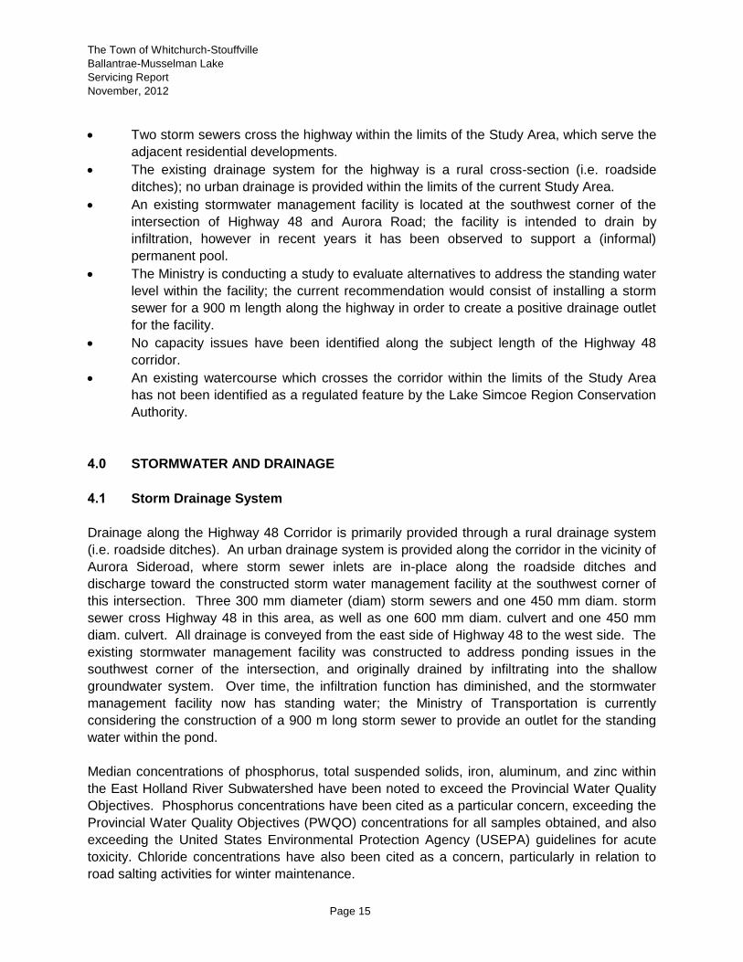
Two storm sewers cross the highway within the limits of the Study Area, which serve the
adjacent residential developments.
The existing drainage system for the highway is a rural cross-section (i.e. roadside
ditches); no urban drainage is provided within the limits of the current Study Area.
An existing stormwater management facility is located at the southwest corner of the
intersection of Highway 48 and Aurora Road; the facility is intended to drain by
infiltration, however in recent years it has been observed to support a (informal)
permanent pool.
The Ministry is conducting a study to evaluate alternatives to address the standing water
level within the facility; the current recommendation would consist of installing a storm
sewer for a 900 m length along the highway in order to create a positive drainage outlet
for the facility.
No capacity issues have been identified along the subject length of the Highway 48
corridor.
An existing watercourse which crosses the corridor within the limits of the Study Area
has not been identified as a regulated feature by the Lake Simcoe Region Conservation
Authority.
4.0 STORMWATER AND DRAINAGE
4.1 Storm Drainage System
Drainage along the Highway 48 Corridor is primarily provided through a rural drainage system
(i.e. roadside ditches). An urban drainage system is provided along the corridor in the vicinity of
Aurora Sideroad, where storm sewer inlets are in-place along the roadside ditches and
discharge toward the constructed storm water management facility at the southwest corner of
this intersection. Three 300 mm diameter (diam) storm sewers and one 450 mm diam. storm
sewer cross Highway 48 in this area, as well as one 600 mm diam. culvert and one 450 mm
diam. culvert. All drainage is conveyed from the east side of Highway 48 to the west side. The
existing stormwater management facility was constructed to address ponding issues in the
southwest corner of the intersection, and originally drained by infiltrating into the shallow
groundwater system. Over time, the infiltration function has diminished, and the stormwater
management facility now has standing water; the Ministry of Transportation is currently
considering the construction of a 900 m long storm sewer to provide an outlet for the standing
water within the pond.
Median concentrations of phosphorus, total suspended solids, iron, aluminum, and zinc within
the East Holland River Subwatershed have been noted to exceed the Provincial Water Quality
Objectives. Phosphorus concentrations have been cited as a particular concern, exceeding the
Provincial Water Quality Objectives (PWQO) concentrations for all samples obtained, and also
exceeding the United States Environmental Protection Agency (USEPA) guidelines for acute
toxicity. Chloride concentrations have also been cited as a concern, particularly in relation to
road salting activities for winter maintenance.

The Town of Whitchurch-Stouffville
Ballantrae-Musselman Lake
Servicing Report
November, 2012
Page 16
4.2 Development Constraints
The Study Area has a number of constraints to development with respect to stormwater and
drainage.
4.2.1 Hydrogeology
The Study Area is noted to be hydrogeologically sensitive, and much of the background
information reviewed has focused upon requirements to mitigate impacts of future development
on the quality and quantity (water balance) of the surface and groundwater systems. The Lake
Simcoe Protection Plan, the Oak Ridges Moraine Conservation Plan, and the East Holland
River Subwatershed Plan all require that stormwater quality management for future
development be implemented to the Enhanced Standard (formerly Level 1 80% TSS removal),
which is currently the highest stormwater quality standard required by the Province.
4.2.2 Groundwater
Potential groundwater impacts from future development have been noted in the previous
studies as a high priority for assessment and consideration for future development planning and
servicing. The Ballantrae Musselman Lake Settlement Capability Study (Gartner Lee, January
1991) recommends consideration be given to development controls with respect to providing
opportunities for the protection of groundwater resources (i.e. maintenance of maximum
development densities, zoning restrictions to provide larger lots, and site plan controls to
encourage infiltration and minimize surface runoff). The report also recommends that future
development consider the use of Site Plan controls to minimize direct discharges of surface
runoff to Musselman Lake or other surface water bodies, along with the examination of
alternative methods of winter road deicing. It is noted that seasonal conditions have created
high groundwater for the Study Area.
4.2.3 Phosphorous Reduction
Increases in phosphorus inputs are directly attributable to the decrease in the over all health of
waterways and lakes. Too much phosphorus in water causes algal blooms and excessive
aquatic plant growth. These plants, and the water quality problems that occur when they
decompose, can harm fish and other organisms. Excessive levels of phosphorus have been a
major environmental concern in Lake Simcoe and its watershed for more than 30 years.
The Lake Simcoe Protection Plan requires a reduction to phosphorus loadings to Lake Simcoe;
this may be accomplished through a variety of technologies and practices, including reducing
the runoff volume to Lake Simcoe through the promotion of infiltration practices, and the
implementation of stormwater quality retrofits within existing development areas. In order to
protect the groundwater resources, pre-treatment of storm runoff for stormwater quality control
prior to infiltration would necessarily be required.

The Town of Whitchurch-Stouffville
Ballantrae-Musselman Lake
Servicing Report
November, 2012
Page 17
The Lake Simcoe Protection Plan specifies that stormwater quality controls for future
development are required to provide Enhanced treatment as a minimum, and that pollutant
loadings from major development be reduced below existing levels. On-site stormwater
management practices alone, even designed to achieve an Enhanced standard of treatment,
are unable to reduce pollutant loadings below existing levels, hence supplemental off-site
stormwater management practices are often required in order to reduce pollutant loadings as
per the requirements of the Plan. These supplemental works are typically in the form of
retrofitting existing stormwater management facilities (i.e. dry ponds) and/or storm sewer outlets
to receiving watercourses, in order to provide stormwater quality control for areas which
currently do not receive stormwater quality control, and are implemented in addition to on-site
stormwater management practices. Opportunities for constructing stormwater quality retrofits
have been identified in the Lake Simcoe Basin Stormwater Management and Retrofit
Opportunities Report (LSRCA, 2008).
4.2.4 Best Management Practices
Best Management Practices have been advanced as opportunities to mitigate the water quality
impacts from existing development, including street sweeping, roof leader disconnection,
constructing grassed swales, and infiltration facilities within existing development areas. These
Best Management Practices are also recognized as opportunities to provide stormwater quality
control for future development areas, in addition to implementing stormwater quality control
practices currently endorsed by the Ontario Ministry of the Environment.
In addition to Best Management Practices, in order to satisfy the water quality requirements
outlined in these documents, it is recommended that the Municipality establish a stormwater
quality retrofit program, which would outline the funding and cost sharing mechanism for
constructing the retrofits, the timeline for construction, and the phasing/prioritization approach
for constructing the various facilities.
4.2.5 Policy Requirements
The Lake Simcoe Protection Plan, the Oak Ridges Moraine Conservation Plan, and the East
Holland River Subwatershed Study all provide requirements for future development to mitigate
water quality impacts from future development, and also to maintain the quantity and quality of
groundwater recharge. Consequently, any future development within the current Study Area
would be required to include additional studies, reports, and associated designs as outlined in
these documents. These documents encourage the application of a treatment train approach
toward stormwater quality management, which would consist of lot-level, conveyance, and end-
of-pipe controls. This approach is commonly referred to as a Treatment Train and is illustrated
in Drawing 1.0.
4.2.6 Highway 48 Corridor
The Ontario Ministry of Transportation has indicated a preference toward future development
reducing the contributing drainage area to the Highway 48 corridor. The existing drainage

The Town of Whitchurch-Stouffville
Ballantrae-Musselman Lake
Servicing Report
November, 2012
Page 18
infrastructure along, and within, the Highway 48 corridor is recognized as representing a
potential constraint to development. Future development along the Highway 48 Corridor would
be required to assess the capacity of the receiving conveyance system, identify the constraints
imposed by the capacity of the conveyance system to the site development, and propose
appropriate measures to mitigate any adverse impacts accordingly. Further analysis will be
required in order to determine the feasibility of integrating stormwater management for future
development with the Highway 48 stormwater management system.
4.3 Summary
The following summarizes the characterization and constraints to development within the Study
Area, as well as requirements for stormwater management:
Soils within the study area are highly permeable.
Previous studies have cited deteriorating groundwater and surface water quality as key
issues and constraints for future development.
Future development must maintain groundwater recharge.
Future development must comply with the requirements established in the Oak Ridges
Moraine Conservation Plan, the Lake Simcoe Protection Plan, and the East Holland
River Subwatershed Study.
Construction of stormwater management retrofits to provide stormwater quality control
for existing development can to address requirements for phosphorus reduction, as well
as requirements to improve the overall quality of storm runoff.
Opportunities may exist to integrate stormwater management for the future development
within the Study Area with stormwater management for the Highway 48 Corridor
however further studies will be required to confirm this opportunity
Future development along the Highway 48 Corridor would be required to assess the
capacity of the receiving conveyance system, identify the constraints imposed by the
capacity of the conveyance system to the site development, and propose appropriate
measures to mitigate any adverse impacts accordingly.
The Municipal Official Plan should encourage the application of a treatment train
approach toward stormwater management, as well as the application of alternative
stormwater management practices.
Based on the above, a conceptual stormwater management strategy has been developed which
is intended to address stormwater management requirements for the Highway 48 Corridor and
the adjacent development.

The Town of Whitchurch-Stouffville
Ballantrae-Musselman Lake
Servicing Report
November, 2012
Page 19

The Town of Whitchurch-Stouffville
Ballantrae-Musselman Lake
Servicing Report
November, 2012
Page 20
4.4 Conceptual Stormwater Servicing Strategy (Highway 48 Corridor)
Three general strategies are currently considered available for the provision of stormwater
management within the Highway 48 Corridor:
Alternative #1: Provision of individual stormwater management systems for each individual
development adjacent to Highway 48 and the right-of-way.
Alternative #2: Provision of a centralized stormwater management system to service the
Highway 48 right-of-way and adjacent developments.
Alternative #3: Combination of a centralized stormwater management system for a portion of
Highway 48 and adjacent development and individual stormwater
management systems for other portions of the right-of-way and adjacent
development.
The benefits and drawbacks of each alternative are discussed in detail below.
Alternative #1: Individual Stormwater Management Systems
Under this alternative, stormwater management systems would be designed and implemented
separately for each development adjacent to Highway 48, and the right-of-way. These
stormwater management strategies would be developed in support of the detailed design and
approval of each development area, and would be anticipated to vary among the different areas
(i.e. unique stormwater management practices would be applied for each site/development).
The advantages and disadvantages of this alternative are:
Advantages:
Functionality (i.e. stormwater management requirements would be addressed)
Ease of implementation (i.e. phasing/staging constraints associated with implementation
of a centralized stormwater management system would not apply)
Disadvantages:
Inefficiency (i.e. multiple stormwater management systems versus one centralized
system)
Long-term operation and maintenance issues (i.e. maintenance of multiple systems
versus single system)
Potential issues with respect to Municipal control over operation and maintenance
The Town of Whitchurch-Stouffville
Ballantrae-Musselman Lake
Servicing Report
November, 2012
Page 21
Alternative #2: Centralized Stormwater Management Systems
Under this alternative, a centralized stormwater management system would be designed and
implemented which would service each development adjacent to Highway 48 and the Highway
48 right-of-way. Conceptually, this system would be anticipated to consist of roadside swales
within the Highway 48 right-of-way, which would provide stormwater quality control for that
segment of Highway 48 as well as the adjacent future development areas, and would provide
sufficient capacity to convey the 100 year flow from the drainage areas. In addition, the existing
non-functioning infiltration facility at the southeast corner of Aurora Road and Highway 48 would
be retrofitted to a combined stormwater quality and quantity facility. Preliminary analyses and
discussions with the Study Team have determined that this alternative may be feasible from a
planning perspective, however more detailed analyses would be required in order to establish
the specific requirements and dimensions of the various components of this alternative (i.e.
sizing of the grassed swales and end-of-pipe stormwater management facility), as well as to
verify the overall functionality of this alternative with consideration of additional constraints and
criteria which have not been determined within the available background information. The
advantages and disadvantages of this alternative are:
Advantages:
Functionality (i.e. stormwater management requirements would be addressed)
Efficiency (i.e. single centralized system to service the Highway 48 Corridor versus
multiple individual systems)
Long-term reliability due to provision of stormwater management within public/Municipal
control
Disadvantages:
Possible staging/phasing constraints for development (i.e. centralized system required
in advance of development)
Requirement for MTO endorsement of this approach (i.e. construction of stormwater
management system within MTO right-of-way)
Conceptual Servicing Strategy requires verification as part of Functional and Detailed
Design process.
Alternative #3: Combination of Stormwater Management Systems
Under this alternative, the centralized system described under Alternative 2 would be
complemented with individual on-site stormwater management systems described under
Alternative 1 for other portions of the Corridor Area. The ultimate requirement to implement a
combined system may be due to capacity constraints within the centralized system or
functional/grading constraints within the Corridor Area, which may be determined during the
functional and detailed design stages. The advantages and disadvantages of this combined
system would depend upon the configuration of this combined system.
The Town of Whitchurch-Stouffville
Ballantrae-Musselman Lake
Servicing Report
November, 2012
Page 22
Preliminary Preferred Alternative
Alternative #2 has been advanced as the preliminary preferred alternative for the stormwater
servicing strategy. The ultimate feasibility of this alternative would necessarily require detailed
information and analysis (including modelling of hydrology and hydraulics), in order to establish
the functional elements, their dimensions/configuration and effectiveness for addressing the
stormwater management requirements of the various contributing drainage areas.
4.5 Next Steps
Following this study, the above characterization and constraints should be integrated with the
findings from the other study disciplines. The preliminary alternatives for providing stormwater
management for future development including the Preliminary Preferred Alternatives should be
evaluated in greater detail, and recommendations provided regarding stormwater management
policies to be included within the Official Plan. It is noted that the above alternatives have been
developed based on current high level information. Detailed information, including a site survey
and drainage boundary delineation, will be required to confirm and support the final
recommended alternative. Further dialogue with MTO will also be required in order to establish
the final recommended alternative; this may occur as part of the subsequent Functional Design
and Detailed Design Processes.

The Town of Whitchurch-Stouffville
Ballantrae-Musselman Lake
Servicing Report
November, 2012
Page 23

The Town of Whitchurch-Stouffville
Ballantrae-Musselman Lake
Servicing Report
November, 2012
Page 24
5.0 WATER AND WASTEWATER
5.1 Existing Servicing
The Study Area is served by private sewer and municipal water services. A municipal
communal water system, the Ballantrae/Musselman Lake Water Works project, was developed
for the Ballantrae and Musselman Lake settlement areas as a result of the contamination of a
number of wells in the area. Construction of the municipal water supply system began in March
1996 and it was operational as of January 1, 1997. All existing and proposed development
within the communities of Ballantrae and Musselman Lake are and will be connected to the
municipal water supply system.
The majority Study Area currently has no centralized or communal wastewater system and
existing developed areas are serviced by private septic systems. Outside of corridor, the
Ballantrae Golf & Country Club Residential Subdivision is serviced by a privately owned and
operated wastewater treatment facility. This facility is discussed in detail in Section 5.5
5.2 Plans of Subdivision
Currently, development within Ballantrae – Musselman Lake is serviced by:
a) a municipal communal water and septic system; or,
b) a municipal communal water system and private sewage treatment facilities.
This is the case for future development as well.
5.3 Water Supply and Distribution Analysis
Based on the review of the background documents, potable water supply and wastewater
disposal has been of concern in the Ballantrae-Musselman Lake Environs for several years.
The concern has been heightened due to development experienced in the area.
Over time, much of the potable water supply has evolved from private wells to the commercial
system. Based on 2010 data as previously discussed, the total volume of water taken from the
production wells for 2010 was 39,351 m3. The total volume of water supplied to the system
represented approximately 24.6% of the maximum permitted withdrawal (1,598,875 m3). This
indicates that there is a sufficient supply of water for the future development. It is also noted
that the volume of water taken in 2010 was less than that taken in 2007.
5.4 Wastewater Collection and Treatment Analysis
Based on the review of the wastewater systems for the Study Area, the majority of the area is
serviced by private septic systems and this will continue. Notwithstanding the current situation,

The Town of Whitchurch-Stouffville
Ballantrae-Musselman Lake
Servicing Report
November, 2012
Page 25
three (3) alternatives exist which could enable development to move forward in the Highway 48
Corridor.
5.4.1 Alternative #1: Private On-Site Systems
The Highway 48 Corridor continues to be serviced by private septic systems, sized to
accommodate residential, industrial, commercial and institutional land use. Based on our
review, Class 4 systems are predominant and the York Region Health Unit has a program for
inspection of private systems.
Constraints to development within the Study Area in terms of the use of individual on-Site
sewage disposal systems will be primarily based on the presence of suitable sandy soil into
which the distribution tile can be placed and the depth to the shallow groundwater table.
Currently, the design of on-site sewage system for one lot with daily design flows of less than
10,000 L/day must comply with criteria outlined in Part 8 of the Ontario Building Code (“OBC”)
with approvals provided by the Municipality or by a Principal Authority.
Treated sewage can be disposed of in a tile bed. Where a septic tank is used for primary
treatment, the tile bed can be set in soil with a T time or percolation rate of between 1 and 50
min/cm. This requires sandy soil and normally the Halton Till (typical in this area) has too high a
T time to allow the installation of inground leaching tile. In addition, the base of the absorption
trenches must be 900 mm above the high groundwater table, bedrock or soil with a percolation
rate above 50 min/cm.
Where primary treatment is provided by an alternative treatment unit that produces tertiary
quality effluent, effluent can be disposed of in shallow buried trenches which can be installed in
soil with a T time of up to 125 min/cm. Absorption trenches constructed as shallow buried
trenches shall have their base 900 mm above the high water table or bedrock.
Treated effluent can also be disposed of in tile beds and area beds. The stone layer used in
these disposal systems also must not be less than 900 mm above the high water table.
Where un-suitable soil or a high water table is encountered, the tile bed can be constructed with
suitable imported sandy soil. However, these systems require that a soil mantle extend 15 m
from the outermost distribution tile in any direction that effluent can flow. Thus raised systems
normally require a larger area than where tile bed can be placed in ground.
Conventional absorption trenches are to be constructed not less than 300 mm and not more
than 900 mm in depth. Thus where a high groundwater table is encountered within 1.2 m of the
ground surface, then a raised or partially raised tile bed will need to be considered.
On-Site investigative work will need to be undertaken on each lot where the construction of a
sewage disposal system is considered. This work will need to characterize the soil and

The Town of Whitchurch-Stouffville
Ballantrae-Musselman Lake
Servicing Report
November, 2012
Page 26
groundwater conditions in the proposed disposal area and provide an estimate of the T time of
the host soil. The determination of usable area for the construction of a leaching bed will need
to consider the Site grade, setbacks to structures, surface water and on and off-Site wells.
The presence of the high water table identified by AECOM also can limit the type of
development, or at least require that the design and construction of buildings consider the effect
of a seasonally high water table. As with the placement of tile beds, the effect of the high water
table will need to be considered on a property by property basis.
For both the placement of tile beds, and the design and construction of buildings, the elevation
of the water table should be considered and the possibility of higher than normal precipitation,
or a future period of higher than normal precipitation may result in further increases in the
elevation of the water table. Furthermore, if the Town of Whitchurch-Stouffville moves to a lake
based water supply and reduces its use of its municipal water supply wells, there may be some
additional increases in the elevation of the water table that will need to be considered.
The base of trenches of in tile bed used to dispose of treated sewage, can be installed in sandy
soil where the high water table is not less than 900 mm below the base of the absorption
trench. Based on available data, it is not known whether the height to the shallow water table
experienced in 2008 and 2009 came within this construction constraint.
5.4.2 Alternative #2: Communal Wastewater Treatment System
A commercial wastewater treatment system would include the construction of a wastewater
treatment facility and a piped collection system.
There has been discussion regarding the potential for construction of communal wastewater
treatment facilities, however, technical and financial considerations have ruled this out. The
geographic area, high groundwater and high cost have ruled out the construction of such
facilities.
5.4.3 Alternative #3: Ballantrae Golf & Country Club WWTP
The Ballantrae Gold and Country Club Residential Community currently own and operate a
private wastewater treatment facility located on Aurora Road. Based on information supplied by
the Town of Whitchurch-Stouffville and AWS Engineers and Planners, the rated capacity of the
system for the average daily flow of 1,045 m3/day. The plant is supplied by a sewage pumping
station with two (2) submersible pumps, each having a rated capacity of 65.6l/s at a TDH of
17.4 m.
Initial treatment is provide by a 1.65 m vortex grit removal unit having a maximum flow capacity
of 5,665 m3/day. The unit works in conjunction with screw type classifier and grit bin.
Secondary treatment is provided by two (2) 11.7 m x 8.05 m x 6.7.0 m SWD tanks constructed
to be operated as sequential batch reactors (SBR). A coagulant storage and feed system

The Town of Whitchurch-Stouffville
Ballantrae-Musselman Lake
Servicing Report
November, 2012
Page 27
provides alum injection into the SBR tanks for enhanced sedimentation and phosphorous
removal.
Tertiary treatment is provided by a SWD tertiary filter flow equalization tank, tertiary sand filters,
and continuous contact filtrations cells. Ultraviolet lights provide effluent disinfection.
Two effluent ponds have been constructed for effluent water quality assurance prior to the final
effluent being disposed of. Treated effluent is disposed of through subsurface exfiltration
and/or spray irrigation.
As per Section 2 of the Certificate of Approval, effluent parameters shall not be exceeded in the
final effluent from the sewage treatment plant as shown in Table 1.0.
Table 1.0
Final Effluent Parameter Concentration in Effluent Total Loading from Effluent
CBOD5 10.0 mg/l 10.45 kg/d
Suspended Solids 10.0 mg/l 10.45 kg/d
Ammonia + Ammonium Nitrogen
1.0 mg/l 1.05 kg/d
Nitrite + Nitrate Nitrogen 3.6 mg/l 3.76 kg/d
Total Nitrogen 5.6 mg/l 5.85 kg/d
Total Phosphorous 1.0 mg/l 1.05 kg/d
E. Coli <14 organisms per 100ml of final effluent as geometric mean density for any calendar month
As per Section 5 of the Certificate of Approval, in order to ensure continuous compliance with
the performance criteria stipulated in Section 2, the concentrations and total loadings of the
materials in the final effluent shall not exceed the parameters as shown in Table 2.0
Table 2.0
Final Effluent Parameter Concentration in Effluent
CBOD5 5.0 mg/l
Suspended Solids 5.0 mg/l
Ammonia + Ammonium Nitrogen
0.5 mg/l
Nitrite + Nitrate Nitrogen 2.0 mg/l
Total Nitrogen 3.5 mg/l
Total Phosphorous 0.5 mg/l
E. Coli <10 organisms per 100ml of final effluent as geometric mean density for any calendar month

The Town of Whitchurch-Stouffville
Ballantrae-Musselman Lake
Servicing Report
November, 2012
Page 28
Discussions with AWS Engineers and Planners indicated the maximum daily flow recorded in
the year 2011 was 380 m3/day. This equates to approximately 36% of the maximum allowable
daily flow. Discussions with the owner of the treatment facility (Schickendanz Bros.) indicate
that while the Ballantrae Golf and Country Club development as originally planned is
substantially complete, however, Schickendanz Bros. does have other potential development
interests within the immediate area and therefore will require further capacity in the treatment
plant to support these developments. It is noted that while there may be opportunities in the
future for the Highway 48 Corridor to utilize the Ballantrae G&CC treatment facility,
Schickendanz Bros. will not provide any guarantees or agreements for such usage at this time.
5.5 Conceptual Sanitary Sewer System
A conceptual sanitary sewer system has been designed for collection and conveyance of
sewage to the Ballantrae Golf and Country Club WWTP if in the future this option is realized.
The collection system would convey flow from existing and future development areas adjacent
to Highway 48. The system has been designed to convey flow from north and south of Aurora
Road to a pumping station located at the north-east corner of Aurora Road and Highway 48.
This is a conceptual location only and is subject to land acquisition and all applicable policies
and regulations.
The sewer along Highway 48 is gravity fed, and proposed to feed into a pumping station along
Aurora Road. The pumping station will pump flows via a forcemain along Aurora Road to the
existing Sewage Treatment Plant. The pumping station and forcemain are required to achieve
adequate velocities and invert elevations into the Sewage Treatment Plant. The estimated flow
from the gravity sewer into the pumping station based on the landuse proposed along Highway
48 is 38.9 L/s. The gravity sewers required to achieve a minimum velocity of 0.8 m/s are 300
mm at a slope of 0.35%. Based on this size, the downstream sewer at the pumping station will
be at 65% capacity.
Sewer design sheets and conceptual plans are included in Appendix A.
5.6 Preliminary Preferred Alternative
Based on the review undertaken, the preferred alternative would be Alternative 3 which would
utilize the existing capacity at the Ballantrae Wastewater Golf & Country Club. Logistical issues
exist with this alternative however discussions between the Town and the Owner should be
initiated to determine if an arrangement can be made. Failing this, the development of the lands
within the Study Area could proceed based on Option 1 – Private Systems.

The Town of Whitchurch-Stouffville
Ballantrae-Musselman Lake
Servicing Report
November, 2012
Appendix A
Appendix A
Sanitary Design Sheet and Drawings