Atmosphere Part III Circulation. Content Importance of Air Movement Forces control atmospheric...
67
Atmosphere Atmosphere Part III Circulation
-
Upload
clare-pearson -
Category
Documents
-
view
225 -
download
0
Transcript of Atmosphere Part III Circulation. Content Importance of Air Movement Forces control atmospheric...
AtmosphereAtmosphere
Part III
Circulation
Content Importance of Air Movement Forces control atmospheric motion Microscale Movement Mesoscale Movement Macroscale Movement Global Pressure Patterns and Planetary Wind
System Synoptic Scale Movement Climatic Classification and Climatic Regions
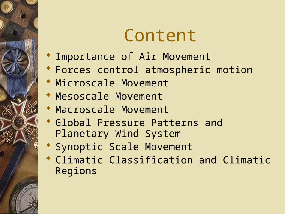
Importance of Air Movement
Air motion:– Horizontal movement (wind): air movement
parallel to the surface.– Vertical movement: sinking and rising masses
of air perpendicular to the surface and usually 100-1000 times slower than horizontal movement
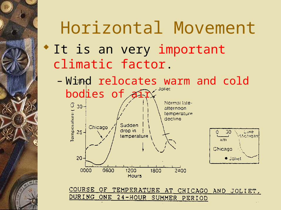
Horizontal Movement It is an very important climatic factor.
– Wind relocates warm and cold bodies of air.
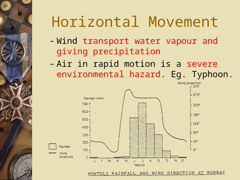
Horizontal Movement– Wind transport water vapour and giving
precipitation– Air in rapid motion is a severe environmental
hazard. Eg. Typhoon.
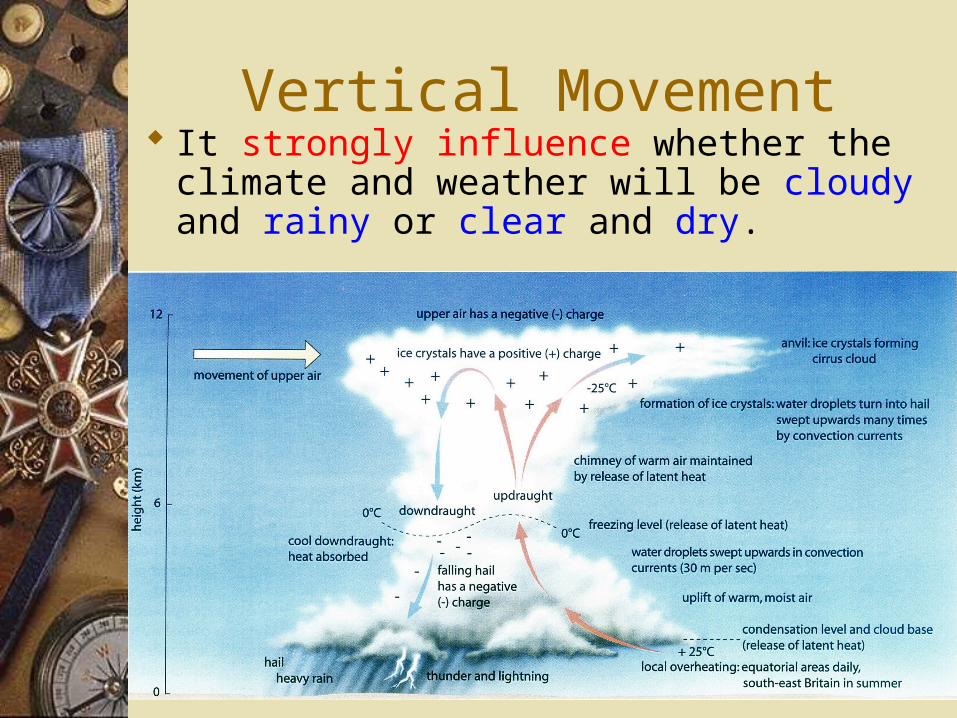
Vertical Movement It strongly influence whether the climate
and weather will be cloudy and rainy or clear and dry.
Air motion and global energy budget
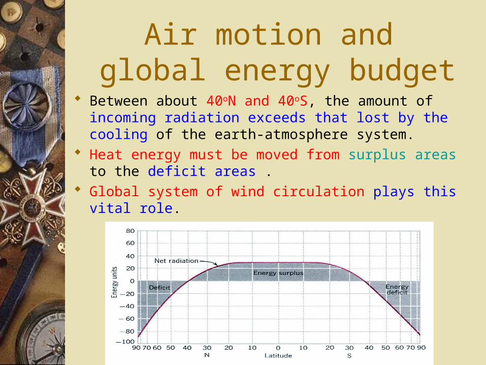
Between about 40oN and 40oS, the amount of incoming radiation exceeds that lost by the cooling of the earth-atmosphere system.
Heat energy must be moved from surplus areas to the deficit areas .
Global system of wind circulation plays this vital role.
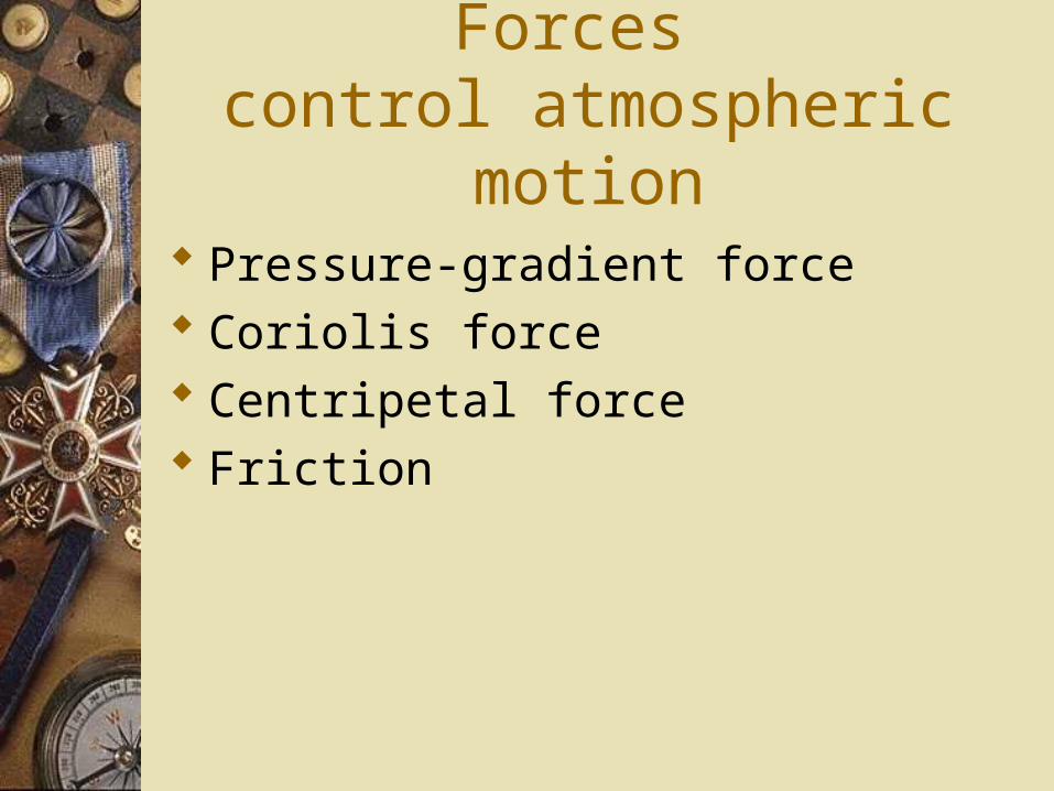
Forces control atmospheric motion
Pressure-gradient force Coriolis force Centripetal force Friction
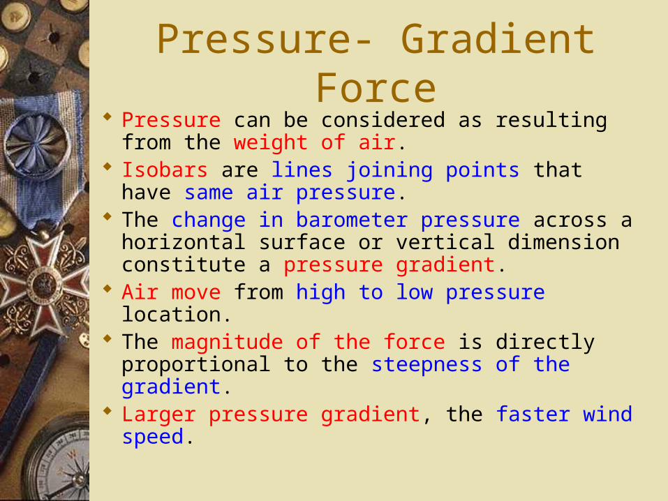
Pressure- Gradient Force Pressure can be considered as resulting from the
weight of air. Isobars are lines joining points that have same
air pressure. The change in barometer pressure across a
horizontal surface or vertical dimension constitute a pressure gradient.
Air move from high to low pressure location. The magnitude of the force is directly
proportional to the steepness of the gradient. Larger pressure gradient, the faster wind speed.
Pressure- Gradient Force
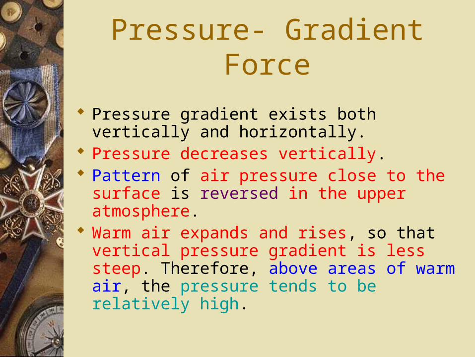
Pressure gradient exists both vertically and horizontally.
Pressure decreases vertically. Pattern of air pressure close to the surface is
reversed in the upper atmosphere. Warm air expands and rises, so that vertical
pressure gradient is less steep. Therefore, above areas of warm air, the pressure tends to be relatively high.
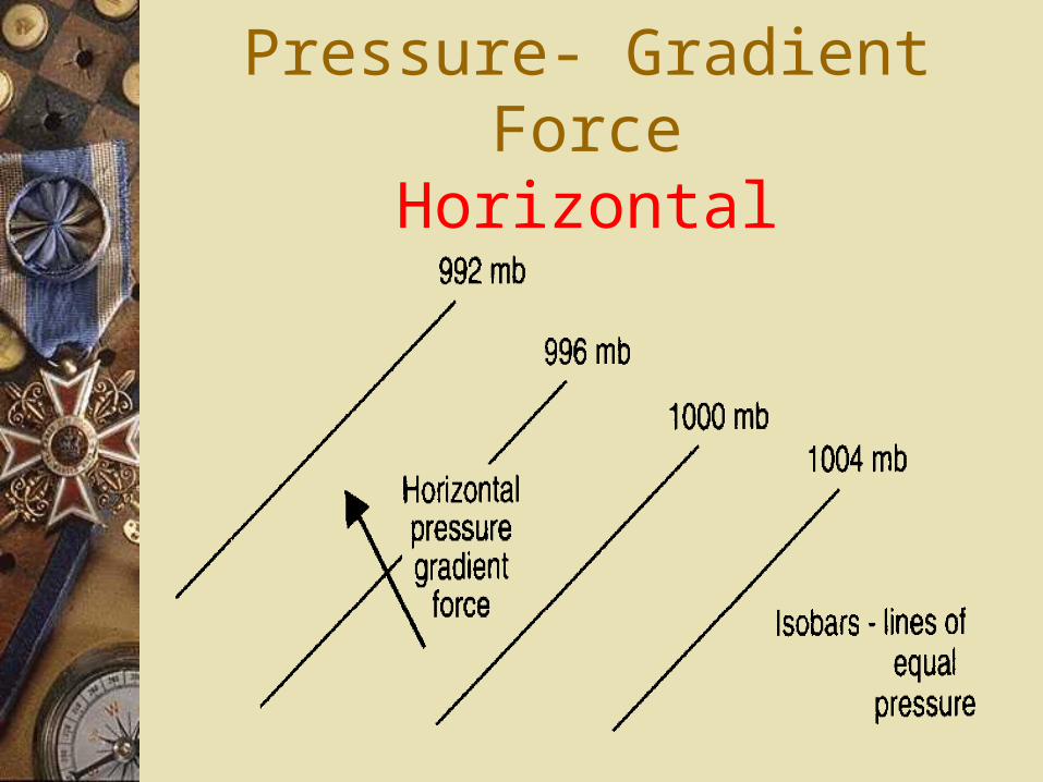
Pressure- Gradient ForceHorizontal
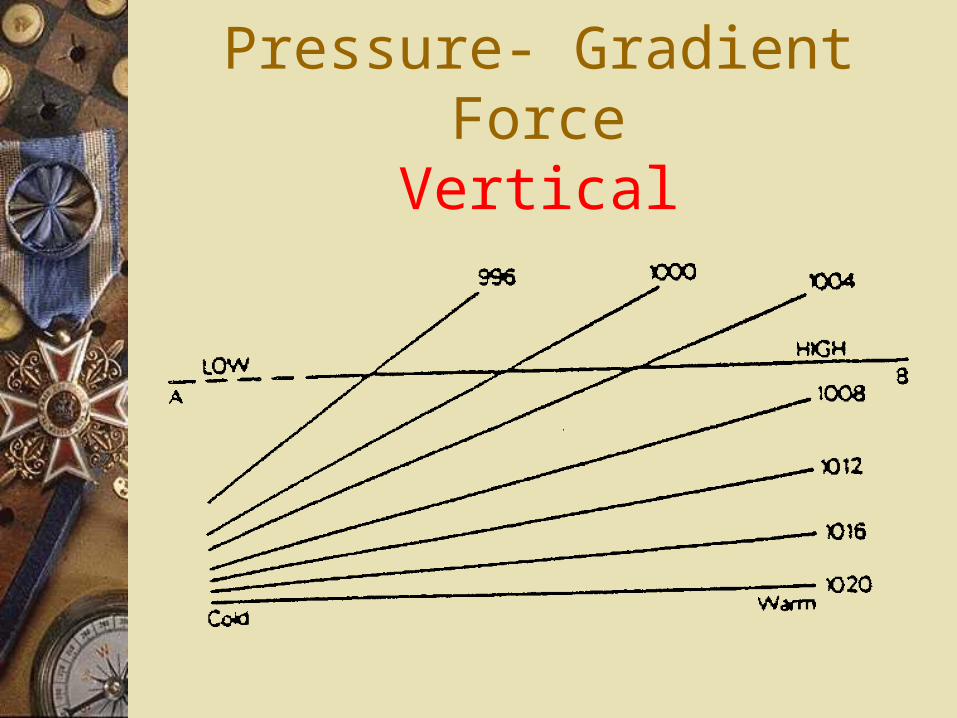
Pressure- Gradient ForceVertical
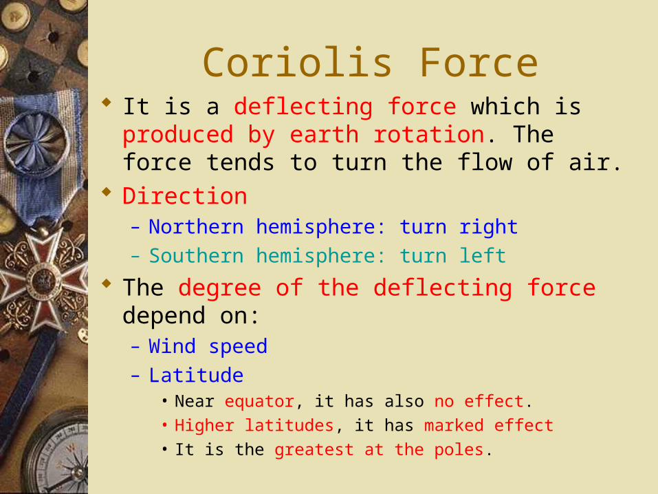
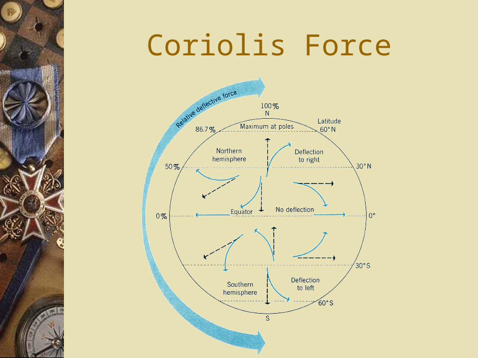
Coriolis Force It is a deflecting force which is produced by earth
rotation. The force tends to turn the flow of air. Direction
– Northern hemisphere: turn right– Southern hemisphere: turn left
The degree of the deflecting force depend on:– Wind speed– Latitude
• Near equator, it has also no effect.
• Higher latitudes, it has marked effect
• It is the greatest at the poles.
Coriolis Force
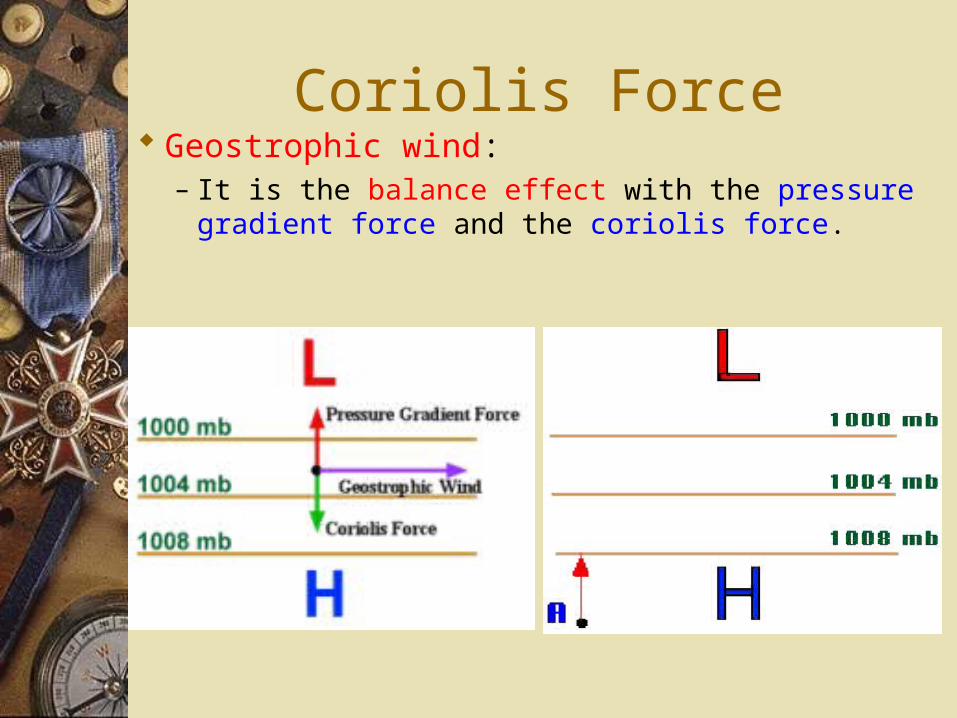
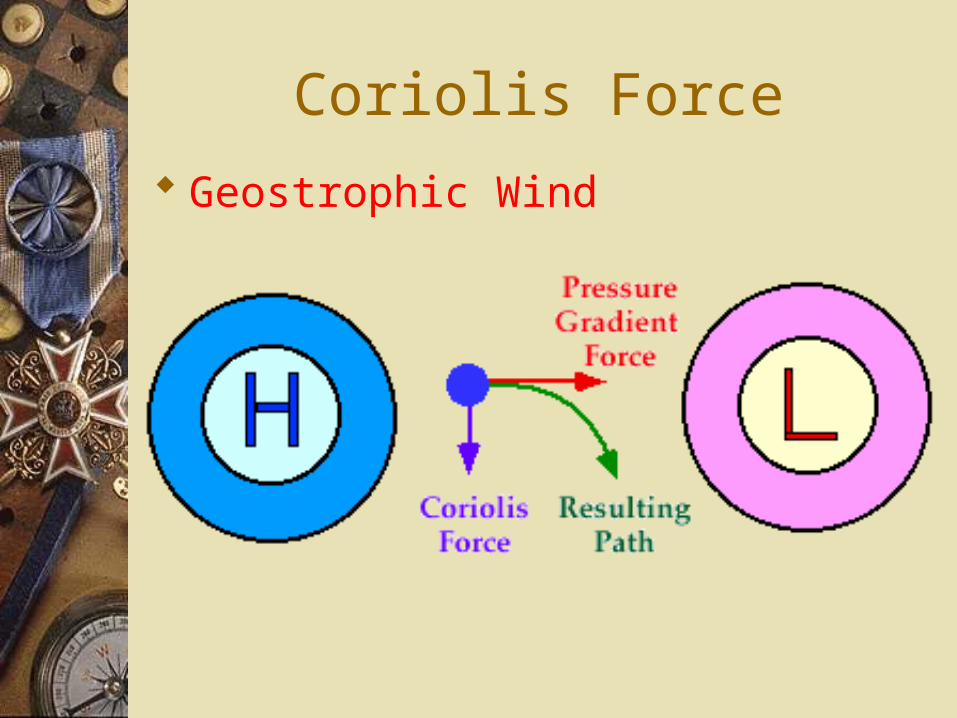
Coriolis Force Geostrophic wind:
– It is the balance effect with the pressure gradient force and the coriolis force.
Coriolis Force
Geostrophic Wind
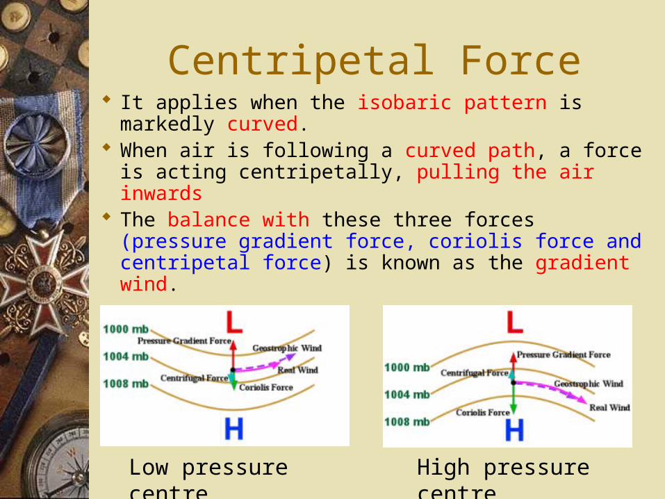
Centripetal Force It applies when the isobaric pattern is markedly
curved. When air is following a curved path, a force is
acting centripetally, pulling the air inwards The balance with these three forces (pressure
gradient force, coriolis force and centripetal force) is known as the gradient wind.
Low pressure centre High pressure centre
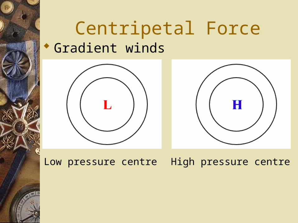
Centripetal Force Gradient winds
Low pressure centre High pressure centre
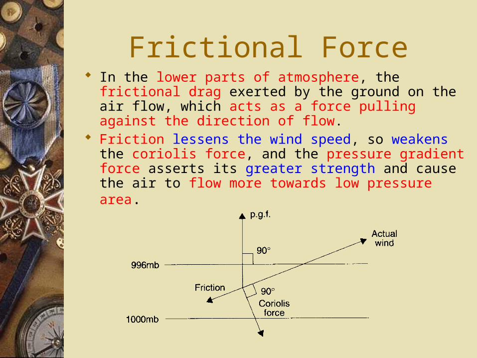
Frictional Force In the lower parts of atmosphere, the frictional drag
exerted by the ground on the air flow, which acts as a force pulling against the direction of flow.
Friction lessens the wind speed, so weakens the coriolis force, and the pressure gradient force asserts its greater strength and cause the air to flow more towards low pressure area.
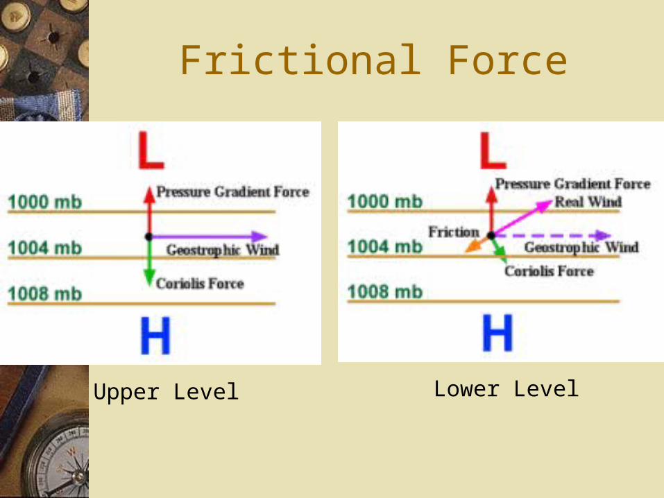
Frictional Force
Upper Level Lower Level
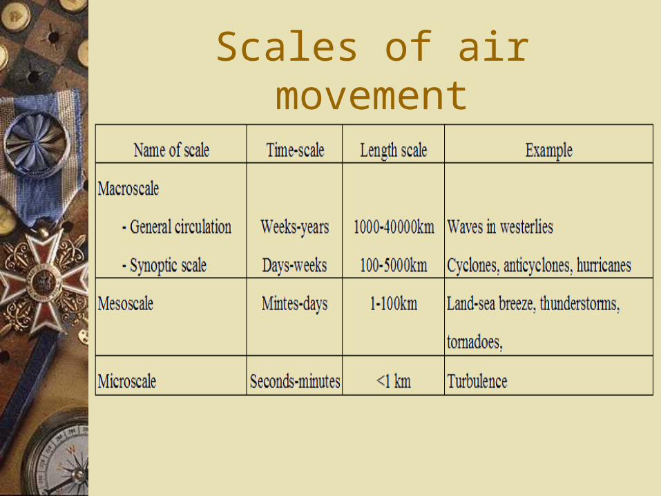
Scales of air movement
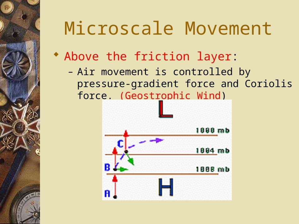
Microscale Movement Above the friction layer:
– Air movement is controlled by pressure-gradient force and Coriolis force. (Geostrophic Wind)
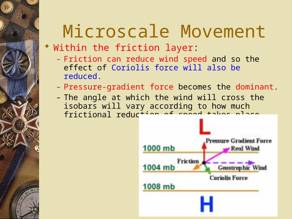
Microscale Movement Within the friction layer:
– Friction can reduce wind speed and so the effect of Coriolis force will also be reduced.
– Pressure-gradient force becomes the dominant.– The angle at which the wind will cross the isobars will
vary according to how much frictional reduction of speed takes place.
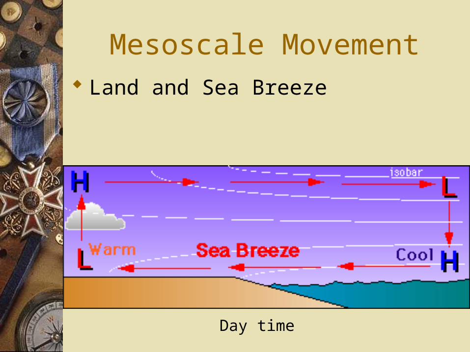
Mesoscale Movement Land and Sea Breeze
Day time
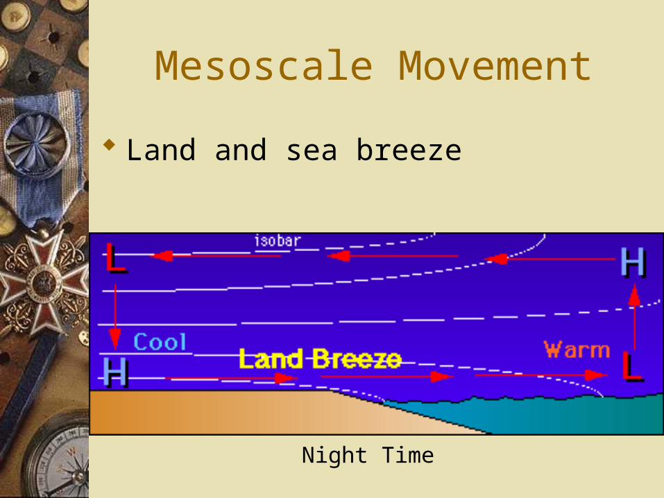
Mesoscale Movement
Land and sea breeze
Night Time
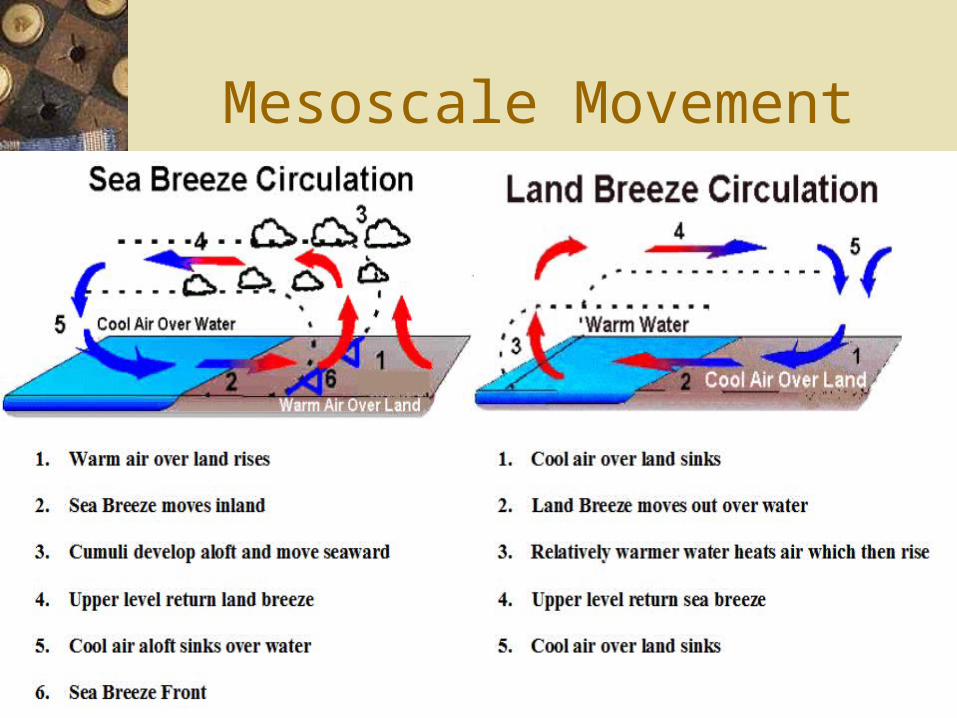
Mesoscale Movement
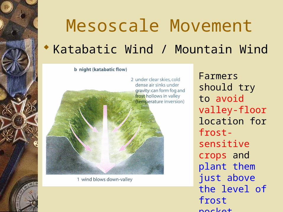
Mesoscale Movement Katabatic Wind / Mountain Wind
Farmers should try to avoid valley-floor location for frost-sensitive crops and plant them just above the level of frost pocket.
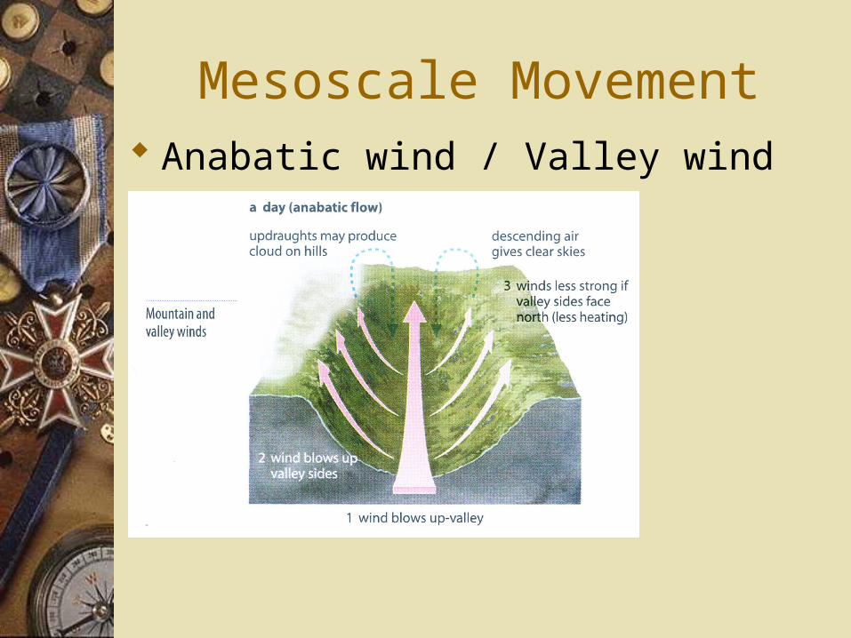
Mesoscale Movement Anabatic wind / Valley wind
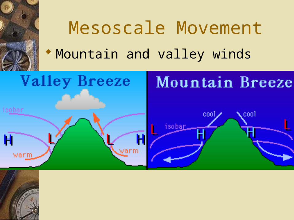
Mesoscale Movement Mountain and valley winds
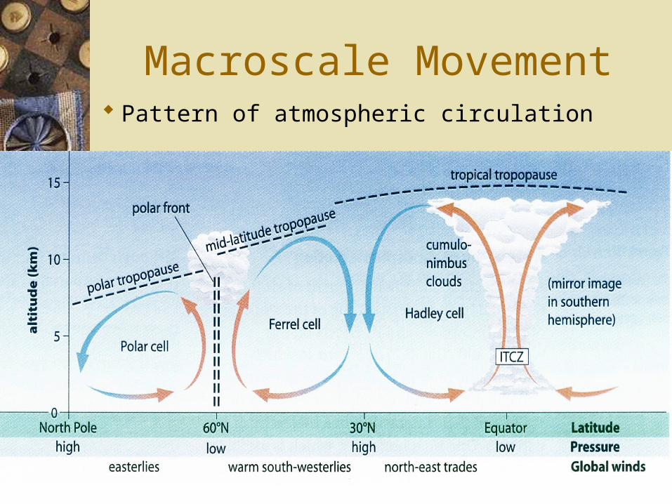
Macroscale Movement Pattern of atmospheric circulation
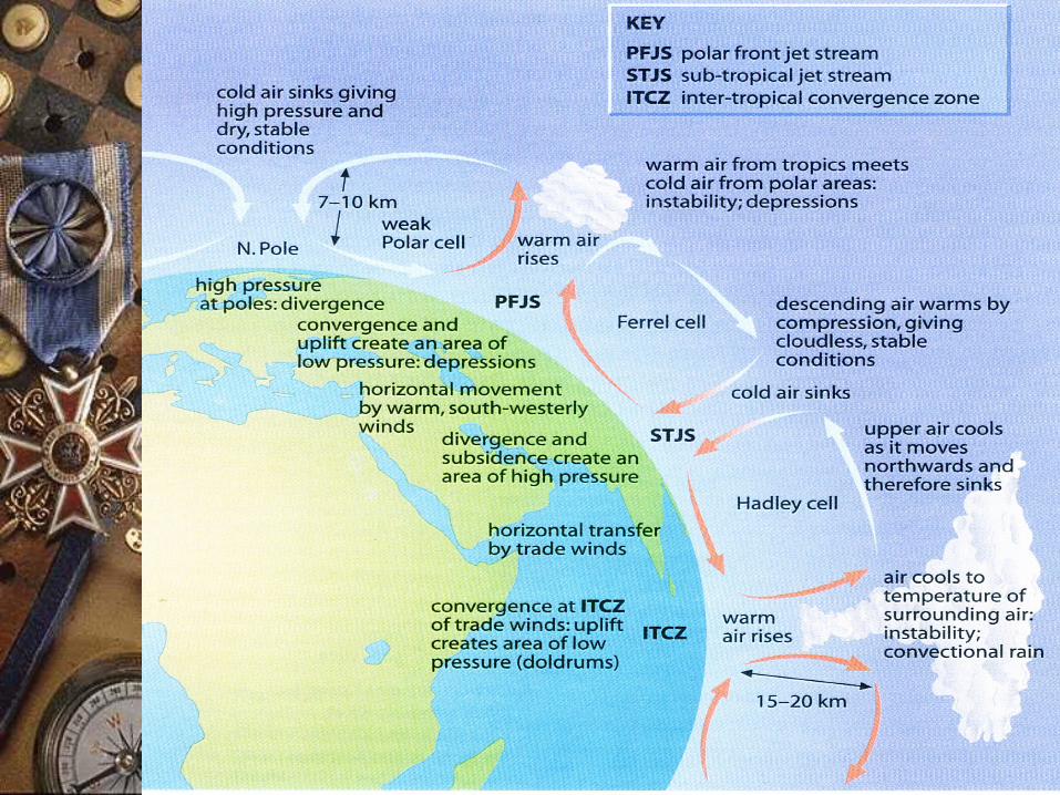
Macroscale Movement Pattern of atmospheric circulation
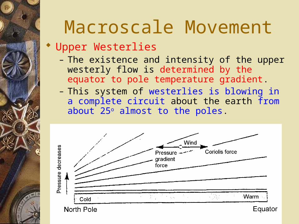
Macroscale Movement Upper Westerlies
– The existence and intensity of the upper westerly flow is determined by the equator to pole temperature gradient.
– This system of westerlies is blowing in a complete circuit about the earth from about 25o almost to the poles.
Macroscale Movement Upper air waves and the jet stream
– The uniform flow of the upper-air westerlies are frequently disturbed by the formation of large undulations, called upper air waves / Rossby waves.
– The waves develop in a zone of contact between cold, polar air and warm, tropical air.
– Jet streams are also a product of the temperature gradient between the equator and the poles.
– It concentrated into a few narrow zones where cold and warm air masses come into contact. (Polar front)
– It will be best developed during winter for the greatest equator-pole temperature gradient.
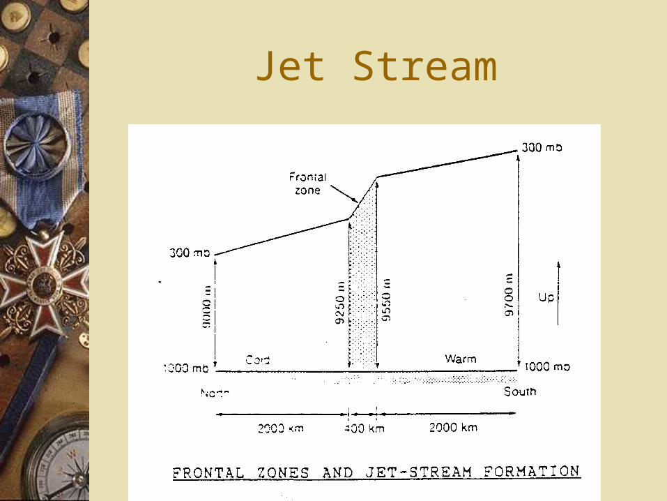
Jet Stream
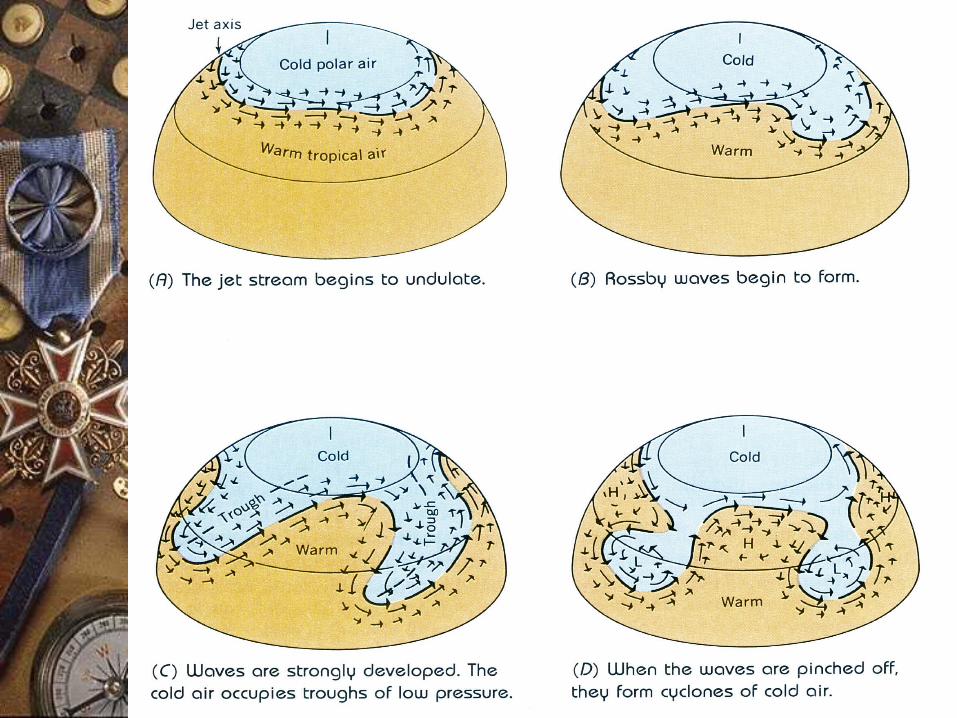
Rossby Waves
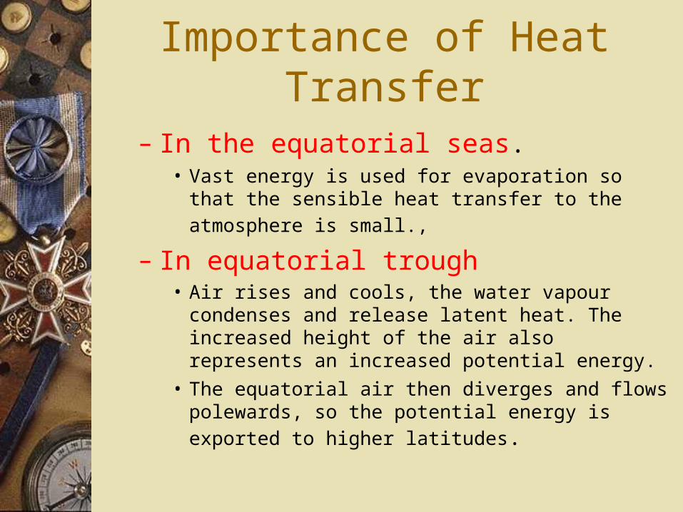
Importance of Heat Transfer
– In the equatorial seas.• Vast energy is used for evaporation so that the sensible heat
transfer to the atmosphere is small.,
– In equatorial trough• Air rises and cools, the water vapour condenses and release
latent heat. The increased height of the air also represents an increased potential energy.
• The equatorial air then diverges and flows polewards, so the
potential energy is exported to higher latitudes.
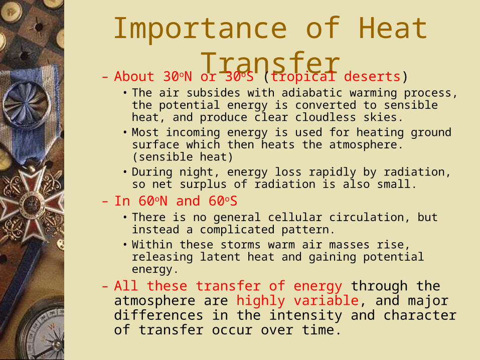
Importance of Heat Transfer– About 30oN or 30oS (tropical deserts)
• The air subsides with adiabatic warming process, the potential energy is converted to sensible heat, and produce clear cloudless skies.
• Most incoming energy is used for heating ground surface which then heats the atmosphere. (sensible heat)
• During night, energy loss rapidly by radiation, so net surplus of radiation is also small.
– In 60oN and 60oS• There is no general cellular circulation, but instead a
complicated pattern.• Within these storms warm air masses rise, releasing latent
heat and gaining potential energy.
– All these transfer of energy through the atmosphere are highly variable, and major differences in the intensity and character of transfer occur over time.

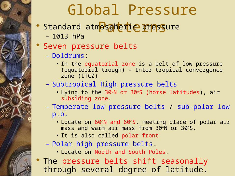
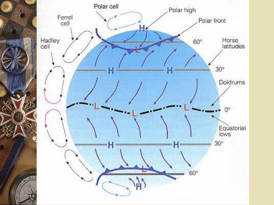
Global Pressure Patterns Standard atmospheric pressure
– 1013 hPa Seven pressure belts
– Doldrums:• In the equatorial zone is a belt of low pressure (equatorial
trough) – Inter tropical convergence zone (ITCZ)
– Subtropical High pressure belts• Lying to the 30oN or 30oS (horse latitudes), air subsiding zone.
– Temperate low pressure belts / sub-polar low p.b.• Locate on 60oN and 60oS, meeting place of polar air mass and
warm air mass from 30oN or 30oS.• It is also called polar front
– Polar high pressure belts.• Locate on North and South Poles.
The pressure belts shift seasonally through several degree of latitude.
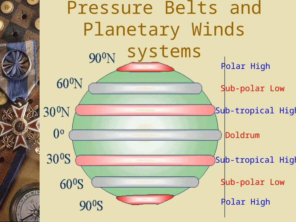
Pressure Belts and Planetary Winds systems
Sub-polar Low
Sub-polar Low
Sub-tropical High
Sub-tropical High
Doldrum
Polar High
Polar High
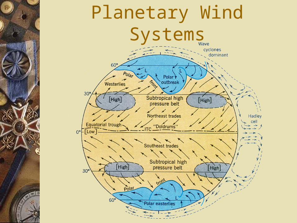
Planetary Wind Systems
Planetary Wind Systems Doldrums:
– Between 5oN and 5oS, variable winds and calms. There are no prevailing surface winds here.
Trade wind belts:– Between Doldrums and sub-tropical high pressure belts in both
hemisphere.– N. Hemisphere: North-east trade winds– S. Hemisphere: South-east trade winds
– The system of doldrums and trades shifts several degrees of latitudes seasonally north and south.
Westerlies belts– Between latitudes 35o and 60o in both hemisphere.– In southern hemisphere, it is an unbroken of ocean.– ‘the roaring forties’, ‘furious fifties’, ‘screaming sixties’
Polar easterlies– Locate on both polar zones.
Monsoon Winds in Asia Summer Monsoon
– In summer, southern Asia, warm, humid ocean air moves northward and northwestward from Pacific Ocean into Asia.
– It is accompanied by heavy rainfall in southeast Asia.
Winter monsoon– In winter, Asia is dominated by a strong centre of high
pressure, air blows southward and southeastward toward the equatorial oceans.
– It brings dry, clear and cool weather for a period of several months.
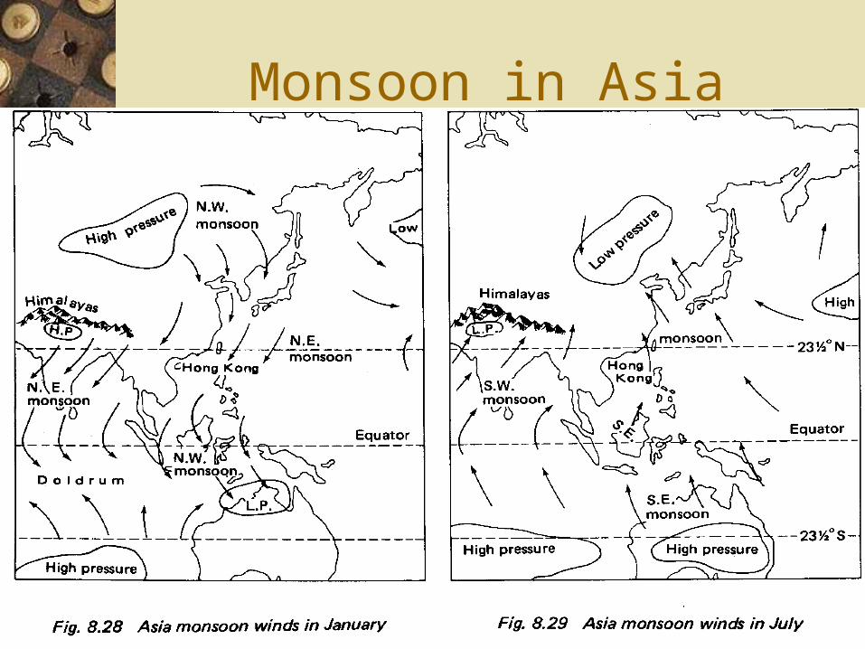
Monsoon in Asia
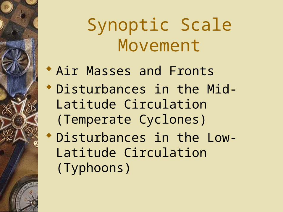
Synoptic Scale Movement
Air Masses and Fronts Disturbances in the Mid-Latitude
Circulation (Temperate Cyclones) Disturbances in the Low-Latitude
Circulation (Typhoons)
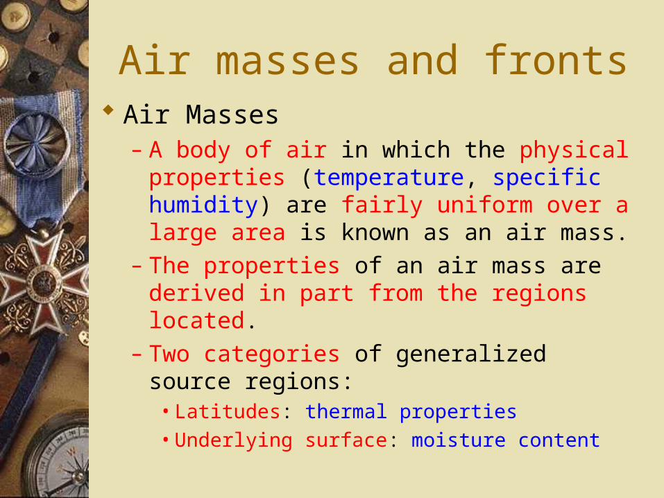
Air masses and fronts Air Masses
– A body of air in which the physical properties (temperature, specific humidity) are fairly uniform over a large area is known as an air mass.
– The properties of an air mass are derived in part from the regions located.
– Two categories of generalized source regions:• Latitudes: thermal properties
• Underlying surface: moisture content
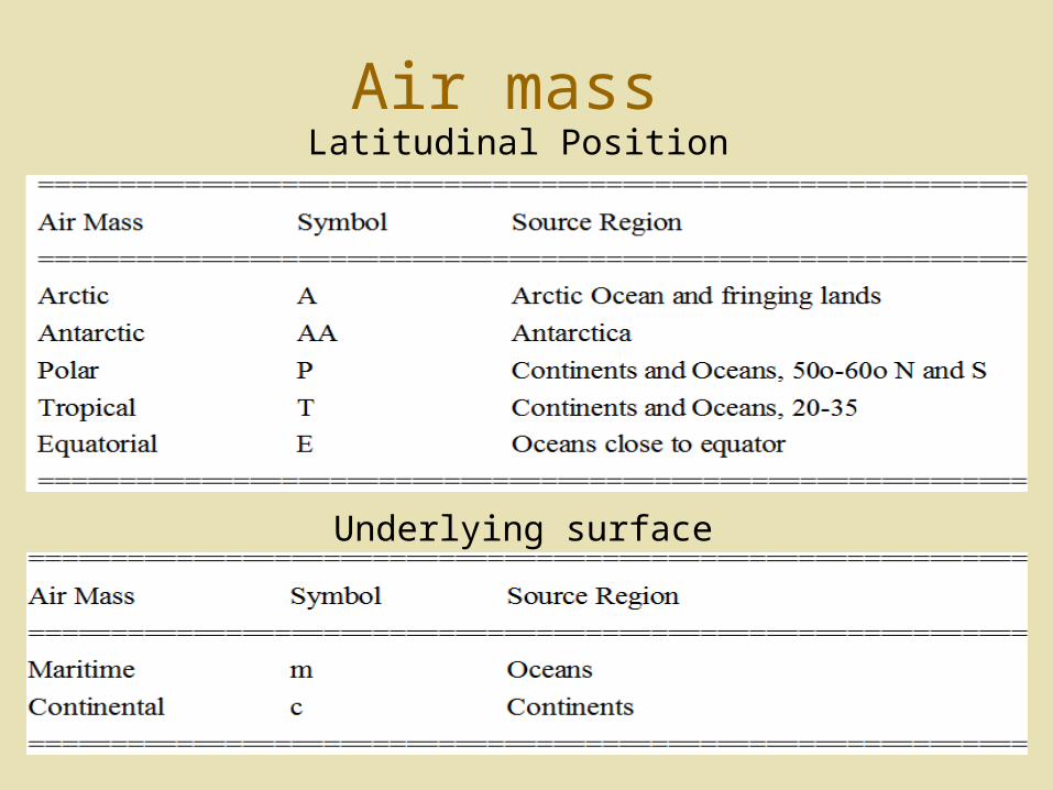
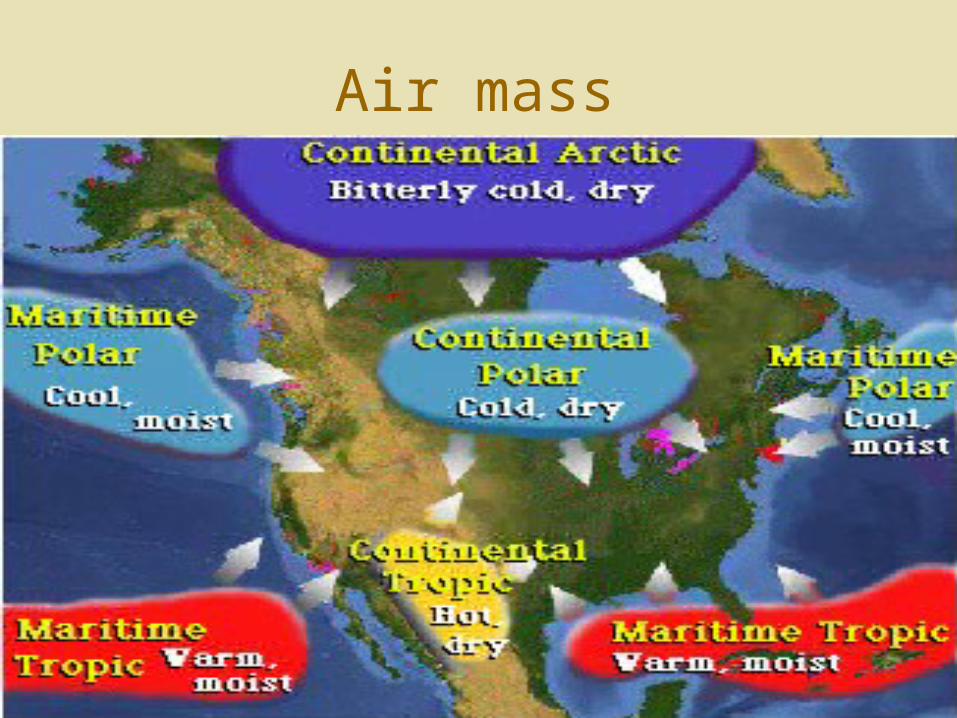
Air massLatitudinal Position
Underlying surface
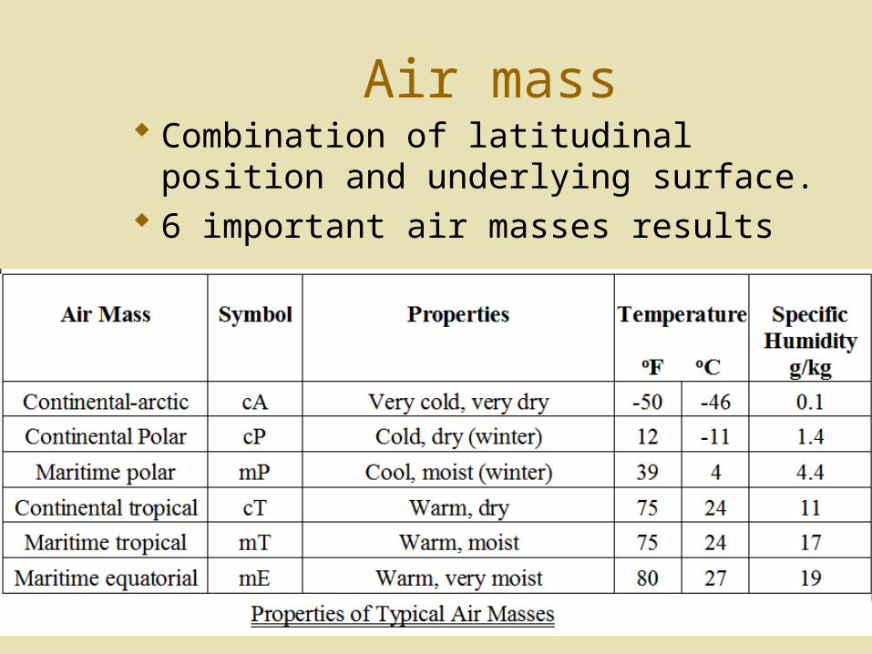
Air mass Combination of latitudinal position and
underlying surface. 6 important air masses results
Air mass
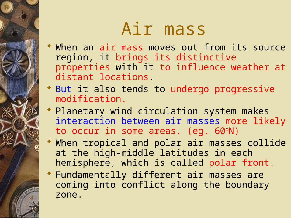
Air mass When an air mass moves out from its source
region, it brings its distinctive properties with it to influence weather at distant locations.
But it also tends to undergo progressive modification.
Planetary wind circulation system makes interaction between air masses more likely to occur in some areas. (eg. 60oN)
When tropical and polar air masses collide at the high-middle latitudes in each hemisphere, which is called polar front.
Fundamentally different air masses are coming into conflict along the boundary zone.
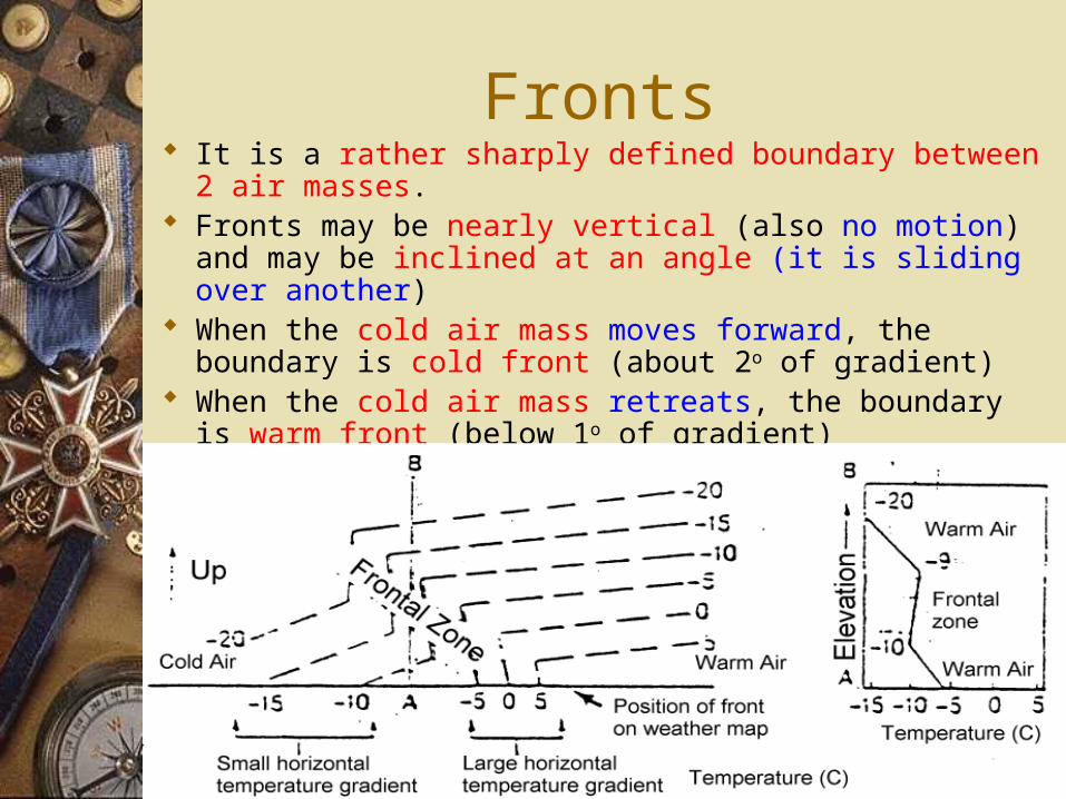
Fronts It is a rather sharply defined boundary between 2 air masses. Fronts may be nearly vertical (also no motion) and may be
inclined at an angle (it is sliding over another) When the cold air mass moves forward, the boundary is cold
front (about 2o of gradient) When the cold air mass retreats, the boundary is warm front
(below 1o of gradient)
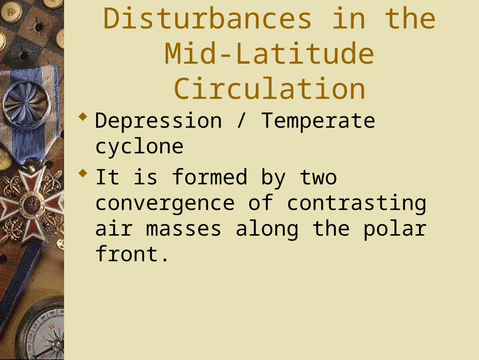
Disturbances in the Mid-Latitude Circulation
Depression / Temperate cyclone It is formed by two convergence of
contrasting air masses along the polar front.
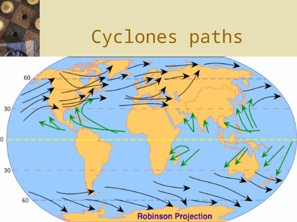
Cyclones paths
Tropical Cyclones - Typhoons
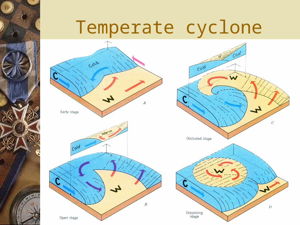
Temperate cyclone
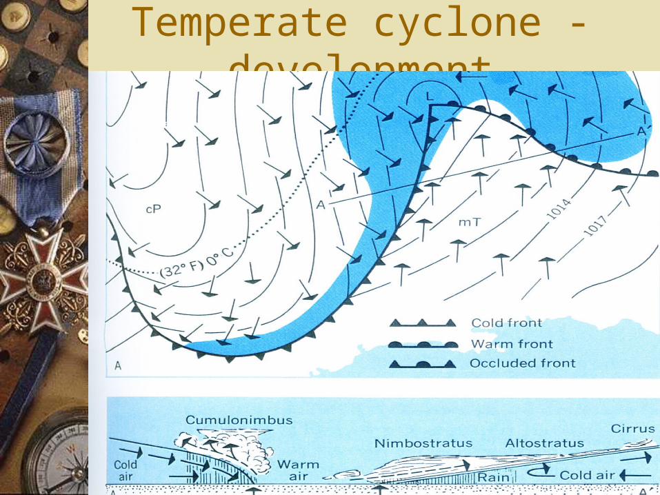
Temperate cyclone - development
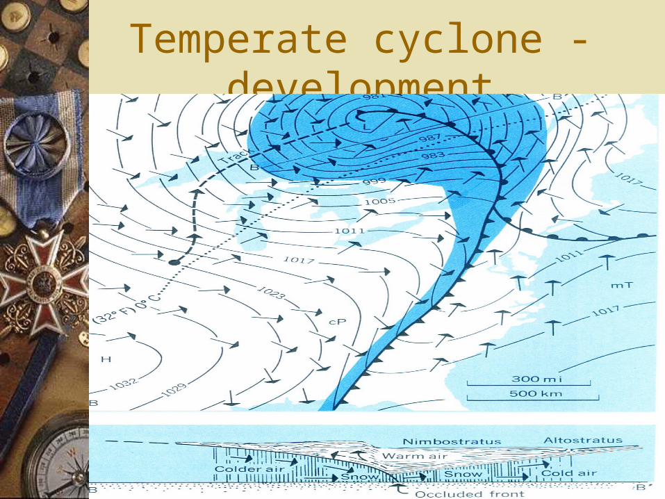
Temperate cyclone - development
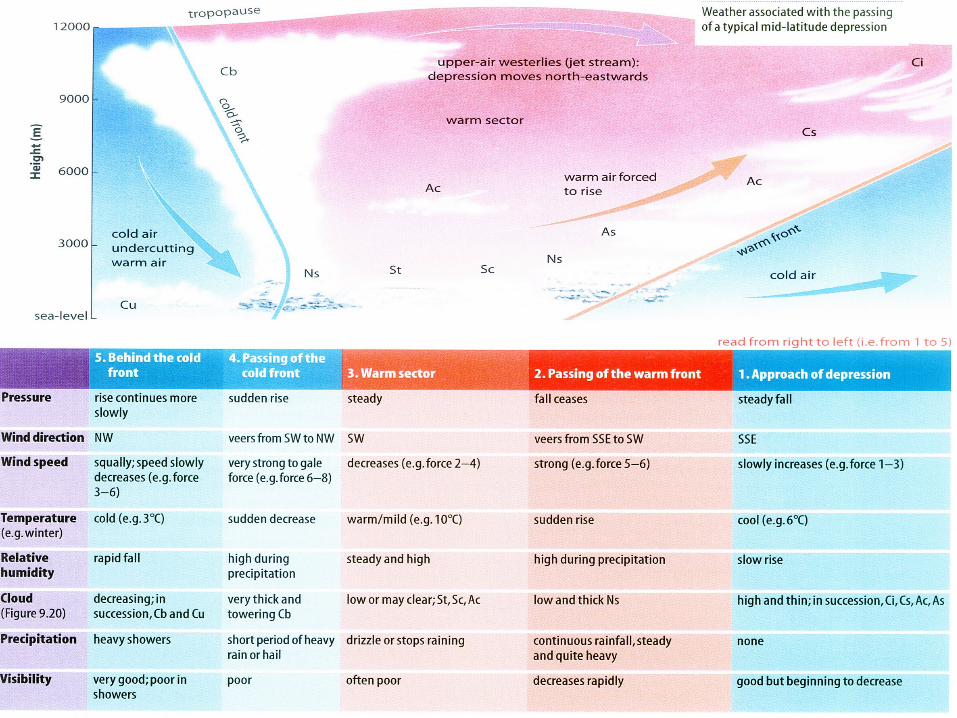
Weather changes associated with the passage of a warm and
cold front
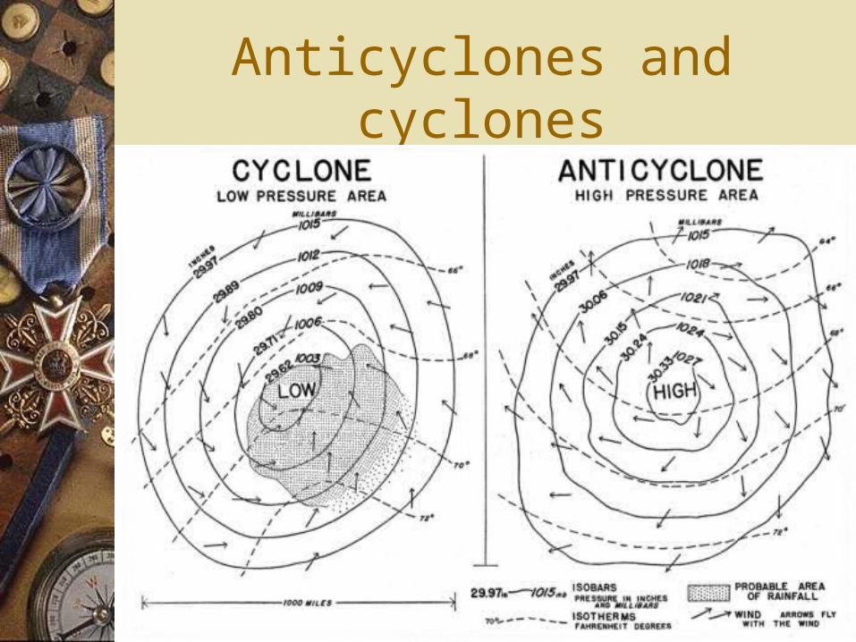
Anticyclones and cyclones
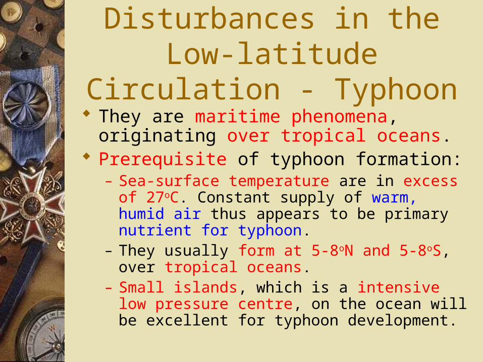
Disturbances in the Low-latitude Circulation - Typhoon
They are maritime phenomena, originating over tropical oceans.
Prerequisite of typhoon formation:– Sea-surface temperature are in excess of 27oC.
Constant supply of warm, humid air thus appears to be primary nutrient for typhoon.
– They usually form at 5-8oN and 5-8oS, over tropical oceans.
– Small islands, which is a intensive low pressure centre, on the ocean will be excellent for typhoon development.
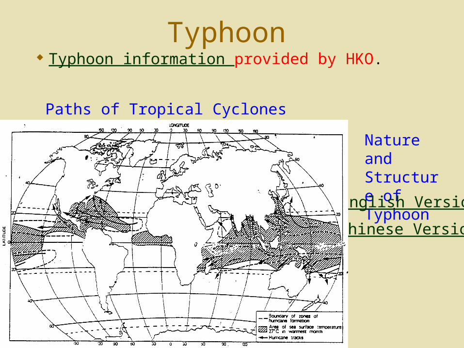
Typhoon Typhoon information provided by HKO.
Nature and Structure of Typhoon
English Version
Chinese Version
Paths of Tropical Cyclones
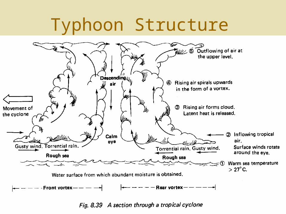
Typhoon Structure
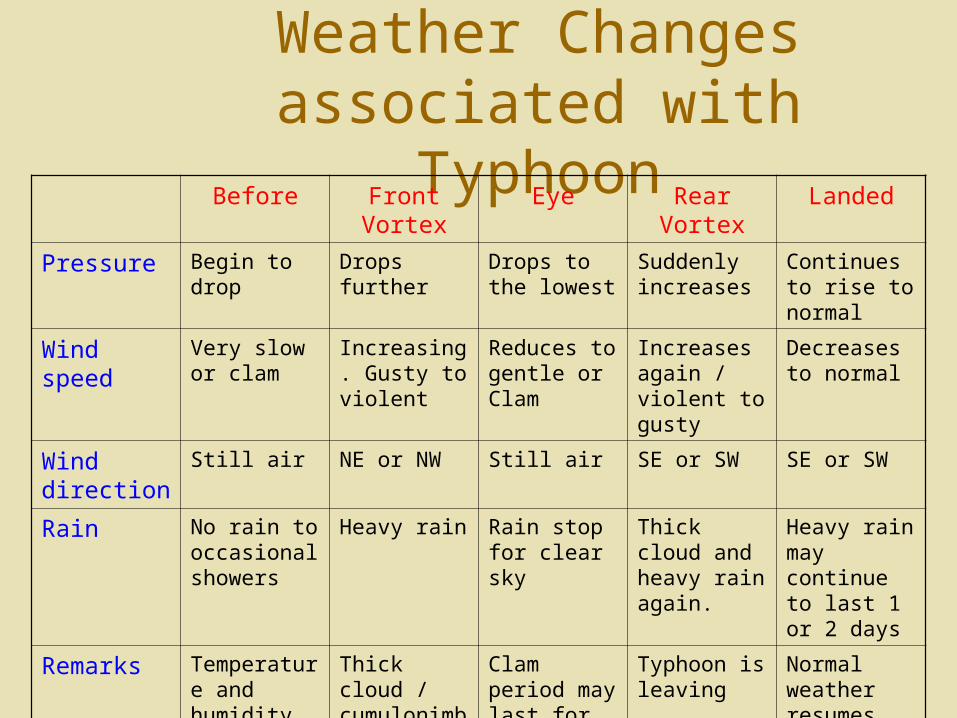
Weather Changes associated with Typhoon
Before Front Vortex Eye Rear Vortex Landed
Pressure Begin to drop Drops further Drops to the lowest
Suddenly increases
Continues to rise to normal
Wind speed Very slow or clam
Increasing. Gusty to violent
Reduces to gentle or Clam
Increases again / violent to gusty
Decreases to normal
Wind direction
Still air NE or NW Still air SE or SW SE or SW
Rain No rain to occasional showers
Heavy rain Rain stop for clear sky
Thick cloud and heavy rain again.
Heavy rain may continue to last 1 or 2 days
Remarks Temperature and humidity are high.
Thick cloud / cumulonimbus
Clam period may last for one or few hours
Typhoon is leaving
Normal weather resumes after the typhoon has completely disappear.
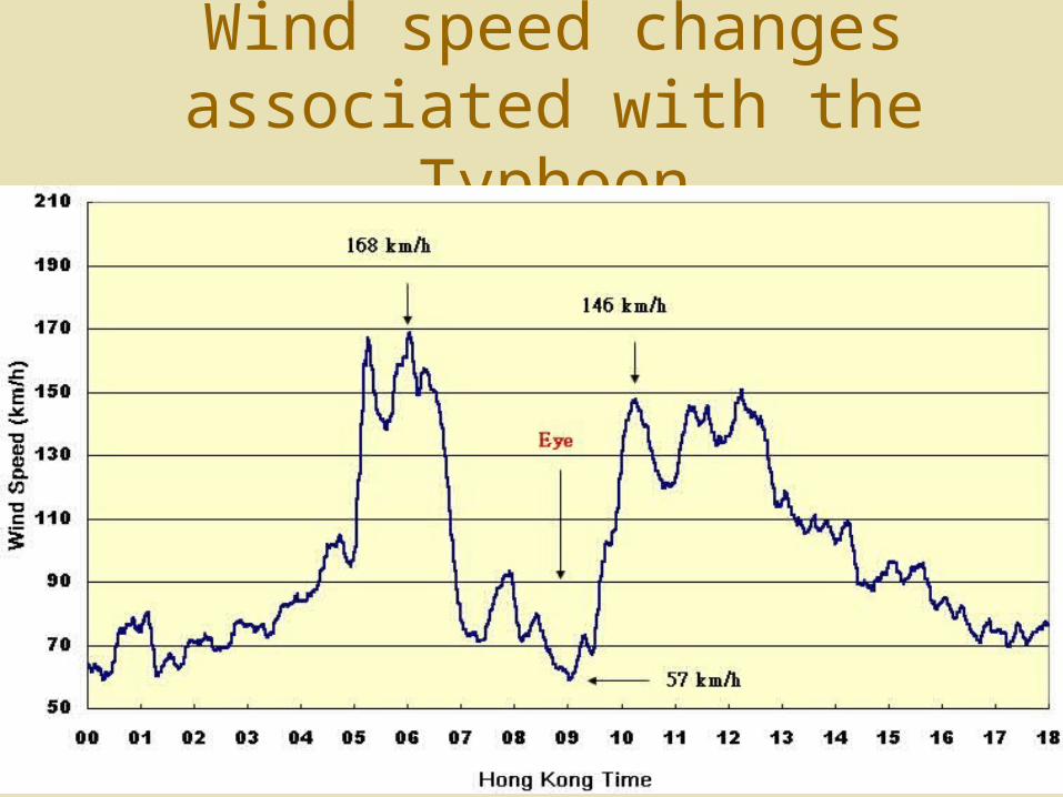
Wind speed changes associated with the Typhoon
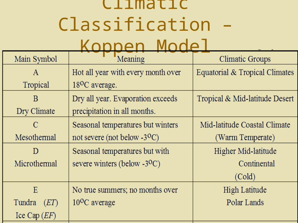
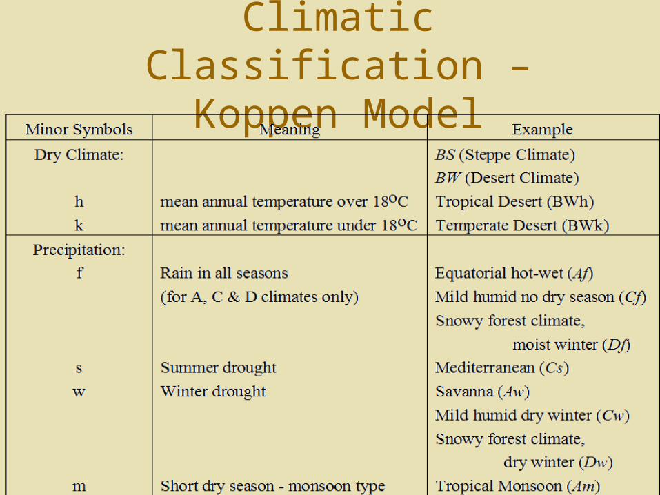
Climatic Classification – Koppen Model
Climatic Classification – Koppen Model
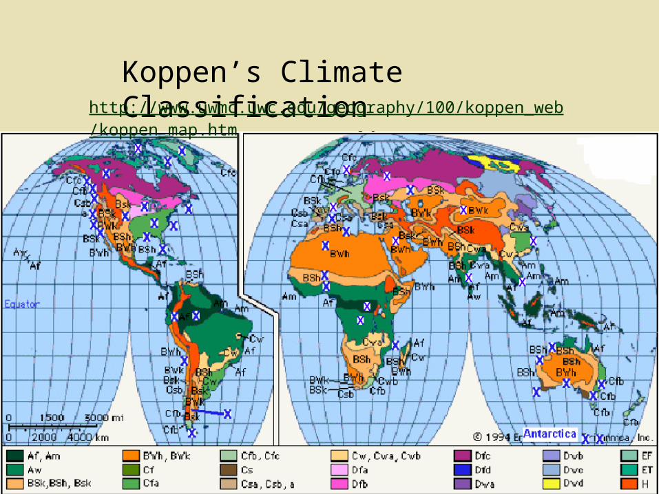
Koppen’s Climate Classificationhttp://www.uwmc.uwc.edu/geography/100/koppen_web/koppen_map.htm

![Global scale [> 20000 km] Synoptic scale [2000–20000 km] Mesoscale [2-2000 km] Microscale](https://static.fdocuments.us/doc/165x107/5681594b550346895dc68671/global-scale-20000-km-synoptic-scale-200020000-km-mesoscale-2-2000-56b0963323b5f.jpg)