Physical Accessibility of Touchscreen Smartphones+ASSETS 2013-Shari Trewin
Annals of Geographical Studies
Volume 3, Issue 3, 2020, PP 10-32
ISSN 2642-9136
Annals of Geographical Studies V3 ● 13 ● 2020 10
Assessment of the Physical Accessibility of Public Primary and
Secondary Schools in Kaduna State, Nigeria
Ezeamaka Cyril Kanayochukwu1*
, Bala Dogo2, Oluwole Olumide
1, Adewuyi Taiye Oluwafemi
1,
Ajibuah, Joel1, Aremu, JK
1 Dadan-Garba, Aliyu
1, and Daful, Mwanret Gideon
1
1Department of Geography, Nigerian Defence Academy Kaduna, Nigeria
2Department of Geography, Kaduna State University, Kaduna, Nigeria
*Corresponding Author:Ezeamaka Cyril Kanayochukwu, Department of Geography, Nigerian
Defence Academy Kaduna, Nigeria.
INTRODUCTION
Accessibility is determined by the spatial
distribution of destinations, the level of ease of
reaching each destination, the magnitude,
quality, and the character of the activities found
there, and the attractiveness of a place, which
makes people prefer it to others. Distinctions are
sometimes made between potential and realized
accessibility (Aggarwal and Thakur 2003;
Olamiju and Olujimi, 2011). Fabiyi and
Ogunyemi (2015) described accessibility as the
capacity to overcome space. According to
Nyam-Jim (2016) applied definition of
accessibility should come from the service users
rather than researchers. In other words,
accessibility concerns both the pattern of
activities and the links between the activities
(Ogunjimi, Ajibola, and Akah, 2014). A
location or point in space is defined to be
accessible if the effort it takes to get there is
acceptable to the targeted individuals; so the
concept of accessibility incorporates not only
the transport link between the origin and
destination and the ability for travelling by the
targeted people, but also the characteristics of
the destination and the objective of the trip
(Jong and Ritsema, 1999; Lu, 2004; Ogunyemi,
Muibi, Eguaroje, Fabiyi and Halilu, 2014).
Accessibility to public facility is the distance
travelled by folks to receive the service, or from
which a service is provided to the whole
community of interest in administration,
economy, education and health (Jong and
Ritsema, 1999; Lu, 2004). Public facilities such
as schools, hospitals, post office, market, court
and police/fire stations are important because
they provide both desirable services to and
impose undesirable impacts on those who do not
have access to its use in the areas. Three types
of accessibility are common; firstly,
geographical (or physical) accessibility, which
emphasizes on the relationship between the
location of centers of service provision and
those of prospective users. Secondly, socio-
economic accessibility which includes factors as
the ability to pay for the service, sufficient
ABSTRACT
This paper is aimed at evaluating the nature of physical accessibility of public primary and secondary
schools in Kaduna State. The study used Global Positioning System (Map 78) to ascertain the location of the
schools through field observation and School Accessibility Assessment Form (SAAF) for collecting
information directly from teachers and students. GIS techniques was employed to show the spatial
distribution and analysis. Multistage sampling method was adopted 3 urban Local Government Areas
(LGAs) were purposive selected while 2 LGAs were randomly selected from each senatorial zone. ArcGIS
(10.6) and Statistical Package for the Social Sciences (v25) was used for data analysis using. The study
revealed that the physical distance travelled varied from 1.13 to 1.7km in urban areas to public primary
schools and 1.3 to 2.25km in rural areas in the state. It also revealed that variation in the travelled distance
to public secondary schools varied from 2.96 to 4.32km in the rural areas and from 2.12km to 2.45km in
urban areas across the state. The study revealed that 34% of total children travelled below 2km to public
primary school and about 80% travelled more 2km to public secondary school. It concluded that the state
has not met the expected 2km walk distance to public schools; uneven distribution of public schools; most of
the public schools are concentrated in the urban areas at the expense of the rural suburbs. Government
should provide additional public schools in rural areas and allocate substantial part of its budget to the
educational sector.
Assessment of the Physical Accessibility of Public Primary and Secondary Schools in Kaduna State,
Nigeria
11 Annals of Geographical Studies V3 ● 13 ● 2020
understanding of any provision to obtain
maximum benefits from it, and the influence of
culture on determining patterns of use. Lastly,
organizational accessibility, which is associated
with the internal structure of service system and
the availability of resources (Yero, 2002; Nyam-
Jim, 2016).
Accessibility is an important issue in geography
and geographic studies. Ingram (1971) and
Alzeer (2005) pointed out that accessibility is an
inherent characteristic or advantage of a place
with respect to overcoming some form of
friction. The crucial thing about accessibility in
geography education, is that it relates to the
location of schools. These should be located
more closely to where the largest possible
number of people to be served. The
measurement of accessibility can be based on
terms of physical distance, time and monetary
and/or inconvenience costs (Alzeer, 2005). A
typical distance travelled, varies between
nations and urban or rural contexts in space
(Nyam-Jim, 2016). In Nigeria, the standard
distance for location of schools follow the
UNESCO standard of 2km walking distance to
school by any child.Travel to and from school is
a common practice for children (FGN, 2014).
Kucerová and Kucera (2012) examined the
changes in the spatial distribution of elementary
schools in rural communities in Czech and
discovered decreased in the number of
elementary schools, along with a concentration
of elementary education provisions, in larger
population centers. Aliyu, Shahidah and Aliyu
(2013) used Nearest Neighbour Analysis to
determine the distribution pattern of schools in
Yola North Local Government Area (LGA) and
found random distribution pattern. Musa and
Mohammed (2013) studied the distribution of
primary and secondary schools in Bida, Niger
State, Nigeria and found deficiency in basic
education facilities, while, quiet a number of the
inhabitant have inadequate access to education
in some part of Bida. Olamiju and Olujimi
(2011) studied the regional location of public
schools in the Akure region of Nigeria and
exposed that Akure South had more public
secondary schools than other parts of Akure.
Olamiju and Olujimi (2011) also observed that
50.06% of the students in the Akure travelled
below 2km while the remaining 49.40%
travelled above 2km to their schools. Inobeme
and Ayanwole (2009) understudied the spatial
distribution of government secondary schools
and established gross inadequacy and inequity
in the allocation of secondary schools in Zaria
Area of Kaduna State. Sule, Abdullahi and
Bungwon (2012) observed uneven distribution
of primary schools in Kaduna Metropolis,
Kaduna. Nyam Jim (2016) examined the
locational analysis of public secondary schools
in Kaduna Education Zone and observed
insufficient facilities in many schools. Thus, it
has been observed that there is little
understanding of nature of physical accessibility
to public primary and secondary schools in
Kaduna State.
The location and travel time to school is belief
to be a major factor for parents allowing their
wards attending school. The study is of the view
that the poor access to public schools in Kaduna
State is one of the reasons for the high dropout
rate in primary and secondary education in the
state. There is need for comprehensive
information to help examine the gap in
accessibility to public schools in Kaduna State.
However, the question should be if the existing
or available public schools are easily accessible
by the children in Kaduna State? Thus, this
paper will assess the nature of physical
accessibility of public primary and secondary
schools in Kaduna State.
METHODS AND MATERIAL
A multistage sampling technique was used to
obtain a representative sample of public schools
in the selected LGAs across the state. The first
stage involved the stratification of the state by
senatorial zones. The second stage was the
purposive selection of the one urban LGA from
each of the three senatorial zones. The third
stage was the randomly selection 2 LGAs from
each three senatorial zones considered semi-
urban and rural areas. The study involved the
identification and location of all public primary
and secondary schools in the 9 selected LGAs.
Three (3) LGAs from each of the three
senatorial districts. Kaduna Central Senatorial
Zone (Kaduna South, Chikun, Birnin Gwari
LGAs) Kaduna North Senatorial Zone (KNSZ)
(Zaria, Lere and Soba LGAs) and Kaduna South
Senatorial Zone (KSSZ) (Jemaa, Kagarko and
Kajuru LGAs). The choice of nine LGAs out of
the 23 LGAs in the State was enable the study to
assess of each school and covering 40% of the
LGAs. The inventory of the existing public
schools was obtained from Kaduna State
Ministry of Education, Science and Technology
(MOES&T) and administrative map from
Kaduna Sate Geographic Information Services

Assessment of the Physical Accessibility of Public Primary and Secondary Schools in Kaduna State,
Nigeria
Annals of Geographical Studies V3 ● 13 ● 2020 12
(KADGIS). Hand-held Global Positioning
System (GPS Map 78) was used to collect
coordinates of the schools. School Accessibility
Assessment Form (SAAF) was employed to
collect information directly from teachers and
students though oral interview. This study also
employed GIS techniques to show the spatial
distribution and analysis of public schools. The
spatial analysis was performed on the set of data
acquired from the GPS using descriptive (total,
mean and percentage). The study used ArcGIS
(10.6) and Statistical Package for the Social
Sciences (SPSS, version 25) for data analysis.
Study Area
Kaduna State is located at mid-central portion of
the Northern parts of Nigeria and serves as a
major gate way to important traditional, political
and commercial states of Kano, Katsina, and
Sokoto (Hena, 2014; Bako, Maiwada, Abubakar
and Akwo, 2016). The Kaduna State is located
between Latitudes 9˚ 03¹ and 11˚ 32¹ North of
the Equator and Longitudes 6˚ 05¹ and 8˚ 38¹
East of the Greenwich Meridian (Figure 1).
Figure1.Kaduna State in Nigeria
Source: KADGIS (2017)
Kaduna State has 23 LGAs and experiences a
tropical continental climate with two distinct
seasonal climates, dry and rainy seasons (Hena,
2014). The annual average rainfall in the state is
about 1323mm. The average daily minimum and
maximum temperatures are 15.1o and 35.18o
degrees Celsius (Nwude, 2006; Akpu, 2012;
Hena, 2014; Bako et al., 2016). Kaduna State
extends from the tropical grassland known as
the Guinea Savannah to Sudan Savannah
(Nwude, 2006). Kaduna State is third most
densely populated states in Nigeria. The
population of the state according to 2006
National Census stands at 6,113,503 and has
3.18% growth rate (National Population
Commission, 2009) and 2017 projected
population stands at 8,147,161 (KDSG, 2017;
NBS, 2017). The state’s population structure
shows that majority of the citizenry lives in
urban and semi urban towns like Kaduna, Zaria,
Kafanchan, Kagoro, Zonkwa, Birnin Gwari,
Makarfi and Zangon Kataf. Twenty-two percent
(22%) of the population are infants, aged
between 0-5 years while 18% are children aged
6-11 years (KDSG, 2017).
RESULTS
The result of nature of physical accessibility is
presented in three sections; at the LGA level,
then at the senatorial level and finally, the state
level.
Chikun LGA:The result reveals that 56% of the
students travel less than 2km to school in
Chikun LGA. While 24% of the children travels
more than 2km to public primary school (Table
1). Further probe reveals that more than three
out of every four students travel less than 2km
from dwelling places to schools in Chikun LGA
(Figures 2 to 5). The result also reveals less
than 76% of the students in Chikun LGA travel
more than the expected minimum walking
distance of 2 km public secondary school.

Assessment of the Physical Accessibility of Public Primary and Secondary Schools in Kaduna State,
Nigeria
13 Annals of Geographical Studies V3 ● 13 ● 2020
Table1. Percentage of Students with the Travelling Distances to Public Schools
Senatorial
Zone
LGA Primary Schools Secondary Schools
0.75km 1km 2km 4km 7km Average 0.75km 1km 2km 4km 7km Average
Central Chikun 18% 28% 30% 15% 9% 2.25 0 5% 19% 48% 28% 4.30
Birnin Gwari 30% 45% 20% 3% 2% 1.32 5% 12% 39% 25% 19% 3.25
Kaduna South 35% 32% 28% 3% 2% 1.39 15% 25% 40% 12% 8% 2.12
North Lere 25% 43% 29% 3% 0% 1.32 4% 22% 37% 21% 16% 2.96
Soba 22% 35% 38% 5% 0% 1.50 10% 19% 25% 31% 15% 3.07
Zaria 38% 45% 15% 1% 1% 1.13 9% 22% 45% 14% 10% 2.45
South Jema'a 18% 39% 26% 16% 1% 1.77 3% 7% 25% 40% 25% 3.95
Kagarko 25% 43% 28% 4% 0 1.33 7% 5% 28% 18% 42% 4.32
Kajuru 14% 38% 28% 15% 5% 2.01 5% 8% 48% 28% 11% 2.97
Source: Fieldwork (2018)
Figure2. 2Km Buffer of Primary Schools in Chikun LGA
Figure3. 2Km Buffer of Secondary Schools in Chikun LGA
Figure4. 4Km Buffer of Primary Schools in Chikun LGA

Assessment of the Physical Accessibility of Public Primary and Secondary Schools in Kaduna State,
Nigeria
Annals of Geographical Studies V3 ● 13 ● 2020 14
Figure5. 4Km Buffer of Secondary Schools in Chikun LGA
This may be attributed to urban growth pattern
of Kaduna metropolis, the capital of Kaduna
State, which is expanding very fast towards
Chikun LGA due to urbanization. This is in
agreement with the findings Maxlock and
Partners (2015).
Birnin Gwari LGA: The result reveals that
4444r4% of the students travel less than 2km to
primary schools and one out of every four pupils
travel than 2km to schools. The result also
shows that one out of every 20 pupils travel
more than 2km to the nearest public primary
school and two out of every five students agree
to travel more than 4km to public secondary
school (Figures 6 to 13). The result reveals that
less than 10% of the students in Birnin Gwari
LGA agreed to traveling over 7km to secondary
schools. The result also shows that 2km
buffering for primary schools does not covering
up to 30% of the LGA. The implication of this is
that many children must walk or travel over
4km to the nearest primary school in order to
obtain education. This might be one of the
reasons why the level of literary in Birnin Gwari
LGA is below the state average, which is in
agreement with the submission of KDSG
(2016). The buffer analysis also reveals less
than 10% of the LGA is covered by 2km
buffering for secondary schools and less than
15% of the LGA is covered by 4km buffer for
secondary schools. The result further shows that
70% and 20% coverage for primary and
secondary schools at 7km buffer. The result
reveals that secondary school buffering of 12km
and 15km cover about 57% and 72%. This
finding reveals that primary schools in Birnin
Gwari LGA does not meet the expected
minimum walking distance of 2km to school.
Figure6. 2Km Buffer of Primary Schools in Birnin Gwari LGA
Figure7. 2Km Buffer of Secondary Schools in Birnin Gwari LGA

Assessment of the Physical Accessibility of Public Primary and Secondary Schools in Kaduna State,
Nigeria
15 Annals of Geographical Studies V3 ● 13 ● 2020
Figure8. 4Km Buffer of Primary Schools in Birnin Gwari LGA
Figure9. 4Km Buffer of Secondary Schools in Birnin Gwari LGA
Source: Fieldwork (2018)
Figure10. 7Km Buffer of Primary Schools in Birnin Gwari LGA
s
Figure11. 7Km Buffer of Secondary Schools in Birnin Gwari LGA

Assessment of the Physical Accessibility of Public Primary and Secondary Schools in Kaduna State,
Nigeria
Annals of Geographical Studies V3 ● 13 ● 2020 16
Figure12. 12Km Buffer of Secondary Schools in Birnin Gwari LGA
Figure13. 15Km Buffer of Secondary Schools in Birnin Gwari LGA
Kaduna South LGA: The result reveals that
5% pupils agreed to travel more than the
expected 2km to public primary school. While
one out of every five students agreed to travel
more than 2km to secondary school. The probe
further reveals that less than 80% of the students
travels 2km or less than to school in Kaduna
South LGA. The result shows that at 0.5km
buffering for primary schools covers up to 20%
while 0.75km buffering covers 52%, 1km cover
78% and 2km covers 98.2% of Kaduna South
LGA (Figures 14 to 17). The implication of this
is that many children walk or travel less than
2km to the nearest public primary school in the
LGA. This might be one of the reasons why the
level of literary is higher in Kaduna South LGA
than the state level.
Figure14. 0.5Km Buffer of Primary Schools in Kaduna South LGA

Assessment of the Physical Accessibility of Public Primary and Secondary Schools in Kaduna State,
Nigeria
17 Annals of Geographical Studies V3 ● 13 ● 2020
Figure15. 0.75Km Buffer of Primary Schools in Kaduna South LGA
The result reveals less than 10% of the LGA is
covered by 0.5km buffer for secondary schools
and 22% of the LGA is covered by 0.75km
buffer for secondary schools (Figures 18 and
19). The result also reveals that 65% of the LGA
is covered by 1km buffer and 92% of the LGA
is covered by 2km buffer for secondary schools
(Figures 20 and 21).
Figure16. 1Km Buffer of Primary Schools in Kaduna South LGA
Figure17. 2Km Buffer of Primary Schools in Kaduna South LGA

Assessment of the Physical Accessibility of Public Primary and Secondary Schools in Kaduna State,
Nigeria
Annals of Geographical Studies V3 ● 13 ● 2020 18
Figure18. 0.5Km Buffer of Secondary Schools in Kaduna South LGA
Figure19.0.75Km Buffer of Secondary Schools in Kaduna South LGA
Figure20. 1Km Buffer of Secondary Schools in Kaduna South LGA
Figure 21: 0.5Km Buffer of Secondary Schools in Kaduna South LGA

Assessment of the Physical Accessibility of Public Primary and Secondary Schools in Kaduna State,
Nigeria
19 Annals of Geographical Studies V3 ● 13 ● 2020
Figure21. 2Km Buffer of Secondary Schools in Kaduna South LGA
Lere LGA: The result reveals that 66% of the
students travel more than the expected 2km.
While 34% of the children travel less than 2km
to the nearest public primary school within the
LGA. It also reveals that less than 30% of the
students (secondary) travel less than 2km from
home to public schools in Lere LGA. The result
similarly shows that pupils travel shorter
distances of average distance of 1.32km from
home to schools and secondary school students’
travel longer with average distance of 2.96km.
The result reveals that the locations of public
primary schools have met expected the 2km
walking distance to school. However, some
areas within Lere LGA do not meet 2 km buffer
for existing public primary schools and these are
areas are mostly farming settlements (Figures 22
to 25). The result also reveals that children from
neighbouring states of Bauchi, Kano and Plateau
attend of these public primary schools. Leading
to most public schools along the
state’sboundary are overcrowded scuh as
Tsifini, Bajima, Zankana and Kunkuru
communities of Lere LGA. It also shows that
secondary schools in Lere LGA reveals does not
meet the expected minimum walking distance of
2 km to schools. This is so because more public
secondary schools are located within the urban
settlement such as Saminaka (17 secondary and
16 primary schools), Lere town (8 secondary
and 15 primary schools), and Dan-Alhaji (three
secondary and 20 primary schools). While the
rural areas like Sheni, Gimi-Janji, Yarda and
Araba does not have public secondary schools.
However, smaller towns like Gama, Ungwan
Pa-Hauswa and Karigi do not have no public
schools and are more than 7 km away from the
nearest public schools. Thus, children within
these communities travel above 7.5 km to the
nearest public secondary school. This may be
among the reasons for the high dropout of
secondary students in Lere LGA.
Figure22. 2Km Buffer of Primary Schools in Lere LGA

Assessment of the Physical Accessibility of Public Primary and Secondary Schools in Kaduna State,
Nigeria
Annals of Geographical Studies V3 ● 13 ● 2020 20
Figure23. 2Km Buffer of Secondary Schools in Lere LGA
Figure24. 4Km Buffer of Secondary Schools in Lere LGA
Figure25. 7Km Buffer of Secondary Schools in Lere LGA
Assessment of the Physical Accessibility of Public Primary and Secondary Schools in Kaduna State,
Nigeria
21 Annals of Geographical Studies V3 ● 13 ● 2020
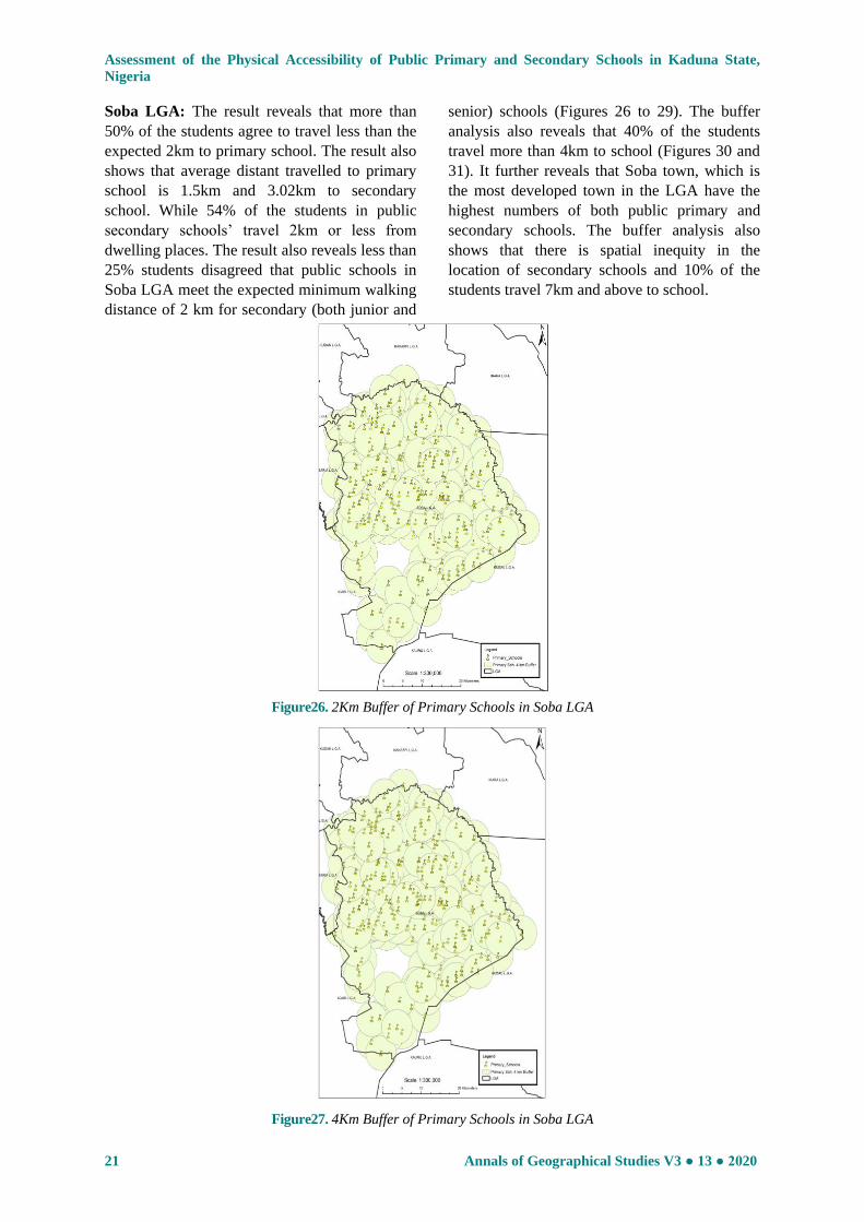
Soba LGA: The result reveals that more than
50% of the students agree to travel less than the
expected 2km to primary school. The result also
shows that average distant travelled to primary
school is 1.5km and 3.02km to secondary
school. While 54% of the students in public
secondary schools’ travel 2km or less from
dwelling places. The result also reveals less than
25% students disagreed that public schools in
Soba LGA meet the expected minimum walking
distance of 2 km for secondary (both junior and
senior) schools (Figures 26 to 29). The buffer
analysis also reveals that 40% of the students
travel more than 4km to school (Figures 30 and
31). It further reveals that Soba town, which is
the most developed town in the LGA have the
highest numbers of both public primary and
secondary schools. The buffer analysis also
shows that there is spatial inequity in the
location of secondary schools and 10% of the
students travel 7km and above to school.
Figure26. 2Km Buffer of Primary Schools in Soba LGA
Figure27. 4Km Buffer of Primary Schools in Soba LGA

Assessment of the Physical Accessibility of Public Primary and Secondary Schools in Kaduna State,
Nigeria
Annals of Geographical Studies V3 ● 13 ● 2020 22
Figure28. 2Km Buffer of Secondary Schools in Soba LGA
Figure29.4Km Buffer of Secondary Schools in Soba LGA
Figure30. 7Km Buffer of Secondary Schools in Soba LGA

Assessment of the Physical Accessibility of Public Primary and Secondary Schools in Kaduna State,
Nigeria
23 Annals of Geographical Studies V3 ● 13 ● 2020
Figure31. 9Km Buffer of Secondary Schools in Soba LGA
Zaria LGA: 83% of the pupils travel less than
2km while 76% of the students in secondary
school travel less than 2km from dwelling
places to public schools. This might be related
to the size of Zaria LGA in terms of landmass
covering 300km2.
Figure32. 1Km Buffer of Primary Schools in Zaria LGA
Figure33. 2Km Buffer of Primary Schools in Zaria LGA
Figure34. 1Km Buffer of Secondary Schools in Zaria LGA

Assessment of the Physical Accessibility of Public Primary and Secondary Schools in Kaduna State,
Nigeria
Annals of Geographical Studies V3 ● 13 ● 2020 24
Figure35. 2Km Buffer of Secondary Schools in Zaria LGA
The buffer analysis shows that 40% of the
children in primary school walk about 0.75km
to school while nine out of every 20 pupils
travel about 1km to public primary school. The
entire LGA is covered at 2km buffer while 51%
is covered by 1km bufer (Figures 32 and 33).
The result also discloses that less than 76% of
Zaria LGA meets the expected minimum
walking distance of 2km for secondary (junior
and senior) schools (Figure 34). The result also
reveals that the average distant travel to primary
school is 1.13km and 2.45km to secondary
schools. This is so because more secondary
schools are located around the Ahmadu Bello
University in Samaru and its environs (Figure
35).
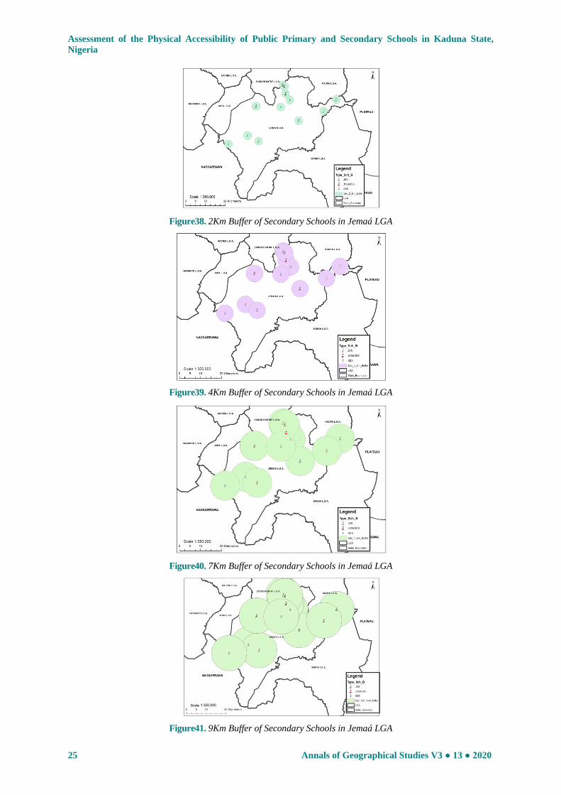
Jemaá LGA: 37.5% of the pupils travel less
than 2km to public primary school, 66.7% travel
more than 2km to secondary school and less
than 25% students travel more than 4km to
secondary schools. The buffer analysis reveals
that above 50% of the LGA are covered at 2km
buffering while above 82% are covered at 4km
buffer (Figures 36 and 37).
Figure36.2Km Buffer of Primary Schools in Jemaá LGA
Figure37. 4Km Buffer of Primary Schools in Jemaá LGA
The 2km buffer shows that less than 10%
coverage and less than 20% coverage at 4km
buffer for secondary schools (Figures 38 and
39). The result reveals that 57% and 72%
coverage of the LGA at 9 km and 12km buffer
of secondary school (Figures 40 and 41).
Assessment of the Physical Accessibility of Public Primary and Secondary Schools in Kaduna State,
Nigeria
25 Annals of Geographical Studies V3 ● 13 ● 2020
Figure38. 2Km Buffer of Secondary Schools in Jemaá LGA
Figure39. 4Km Buffer of Secondary Schools in Jemaá LGA
Figure40. 7Km Buffer of Secondary Schools in Jemaá LGA
Figure41. 9Km Buffer of Secondary Schools in Jemaá LGA

Assessment of the Physical Accessibility of Public Primary and Secondary Schools in Kaduna State,
Nigeria
Annals of Geographical Studies V3 ● 13 ● 2020 26
Kagarko LGA: The result reveals that 68% of
the pupils agreed to travel less than 2km to
school and one out every four pupils agreed to
travel about the expected 2km to public primary
school. Whileone out of every 25 children
agreed to travel more than 2km to public
primary school. It further reveals that 12%
travels less than 2km while three out of every 5
students disagreed to traveling less than 4km to
secondary school. This implies that the public
secondary schools are not sited reconsidering
the dwelling places of the children. The result
further shows that 21% of the total public
schools in the LGA are located around the
headquarter Kafanchan and its environs. The
buffer analysis of the primary schools reveals
that 50% is covered at 2km buffer while 92.1%
is covered at 4km buffer (Figures 42 and 43).
The buffer analysis of the secondary schools
reveals that less than 10% coverage at the
recommended 2km, about 20.3% at 4km, 78%
at 7km and 81.2% at 9km buffer (Figures 44 to
47).
Figure42. 2 Km Buffer of Primary Schools in Kagarko LGA
Figure43. 4Km Buffer of Secondary Schools in Kagarko LGA
This finding shows that the Kaduna State
MOES&T did not follow that Education Policy
Guideline in siting schools in Kagarko LGA.
The result also discovers that about 40% of the
schools in Kagarko LGA are sited along the
major roads as such the Abuja-Kaduna
Expressway, Bwari-Jere- and Kafanchan Road.
Figure44. 2Km Buffer of Secondary Schools in Kagarko LGA

Assessment of the Physical Accessibility of Public Primary and Secondary Schools in Kaduna State,
Nigeria
27 Annals of Geographical Studies V3 ● 13 ● 2020
Figure45. 4Km Buffer of Secondary Schools in Kagarko LGA
Figure46.7Km Buffer of Secondary Schools in Kagarko LGA
Figure47. 9Km Buffer of Secondary Schools in Kagarko LGA
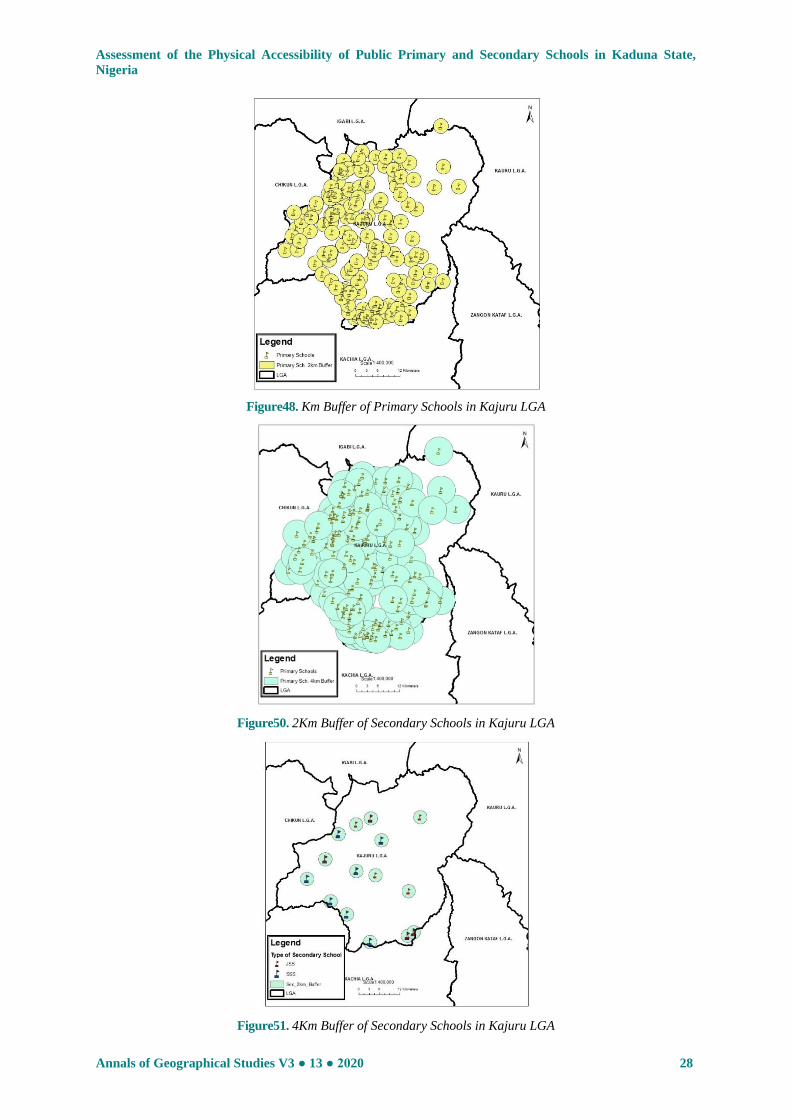
Kajuru LGA: The result shows that 14% of the
pupils walk about 0.75km to school while 70%
travel 2km or less to public primary school
(Table 1) and 5% travels 7km to public primary
school. This implies that many children spend
more than one-hour trekking to school. This
might be part of the reason why Kajuru LGA
have high level of primary school dropout on
the state. It shows that three out of every four of
the students travel less than 2km to public
secondary school. While two out of every five
students travel more than 2km to school. Further
probe reveals that less than 61% of the students
travels less than 2km to schools in the LGA.
The buffer analysis reveals that 2km buffer of
primary (72%) schools do not cover the whole
LGA and 88.2% coverage for 4km buffer
(Figures 48 and 49). The result also shows that
2km buffer for secondary schools cover less
than 10% while 4km covers 18% and 7km
buffer covers 82% of the LGA (Figures 50 to
52).
Assessment of the Physical Accessibility of Public Primary and Secondary Schools in Kaduna State,
Nigeria
Annals of Geographical Studies V3 ● 13 ● 2020 28
Figure48. Km Buffer of Primary Schools in Kajuru LGA
Figure50. 2Km Buffer of Secondary Schools in Kajuru LGA
Figure51. 4Km Buffer of Secondary Schools in Kajuru LGA
Assessment of the Physical Accessibility of Public Primary and Secondary Schools in Kaduna State,
Nigeria
29 Annals of Geographical Studies V3 ● 13 ● 2020
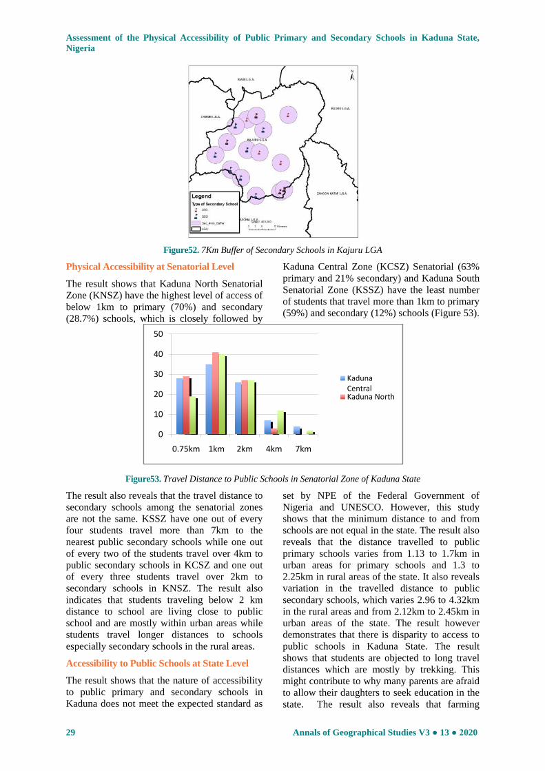
Figure52. 7Km Buffer of Secondary Schools in Kajuru LGA
Physical Accessibility at Senatorial Level
The result shows that Kaduna North Senatorial
Zone (KNSZ) have the highest level of access of
below 1km to primary (70%) and secondary
(28.7%) schools, which is closely followed by
Kaduna Central Zone (KCSZ) Senatorial (63%
primary and 21% secondary) and Kaduna South
Senatorial Zone (KSSZ) have the least number
of students that travel more than 1km to primary
(59%) and secondary (12%) schools (Figure 53).
Figure53. Travel Distance to Public Schools in Senatorial Zone of Kaduna State
The result also reveals that the travel distance to
secondary schools among the senatorial zones
are not the same. KSSZ have one out of every
four students travel more than 7km to the
nearest public secondary schools while one out
of every two of the students travel over 4km to
public secondary schools in KCSZ and one out
of every three students travel over 2km to
secondary schools in KNSZ. The result also
indicates that students traveling below 2 km
distance to school are living close to public
school and are mostly within urban areas while
students travel longer distances to schools
especially secondary schools in the rural areas.
Accessibility to Public Schools at State Level
The result shows that the nature of accessibility
to public primary and secondary schools in
Kaduna does not meet the expected standard as
set by NPE of the Federal Government of
Nigeria and UNESCO. However, this study
shows that the minimum distance to and from
schools are not equal in the state. The result also
reveals that the distance travelled to public
primary schools varies from 1.13 to 1.7km in
urban areas for primary schools and 1.3 to
2.25km in rural areas of the state. It also reveals
variation in the travelled distance to public
secondary schools, which varies 2.96 to 4.32km
in the rural areas and from 2.12km to 2.45km in
urban areas of the state. The result however
demonstrates that there is disparity to access to
public schools in Kaduna State. The result
shows that students are objected to long travel
distances which are mostly by trekking. This
might contribute to why many parents are afraid
to allow their daughters to seek education in the
state. The result also reveals that farming
0
10
20
30
40
50
0.75km 1km 2km 4km 7km
Kaduna Central Kaduna North

Assessment of the Physical Accessibility of Public Primary and Secondary Schools in Kaduna State,
Nigeria
Annals of Geographical Studies V3 ● 13 ● 2020 30
(pastoral and semi-pastoralist) is a major means
of livelihood in the state but these farming
settlements do not have schools.
Implication of Physical Accessibility to Public
Schools
The result reveals that the urban towns such as
Zaria, Kaduna, Kafanchan, Soba have more
public schools. This is in agreement Yuan,
Qingsong,Yaolin, Lingyu, Haofeng and Enxiang
(2016) that accessibility to education is relative
to economic development of the area. The result
also shows that the junior and senior secondary
school are not evenly distributed in all the LGAs
and leading to overcrowded and overstressed
public schools. The result reveals that students
trek as much as 12km to the nearest public
secondary school. It also shows that in Zaria and
Kaduna South LGAs have the minimum
distance travelled by pupils are less than 2km to
primary schools (98% and 95%) while 76%
students travel less than 2km. However, the
result reveals that in Lere, Soba, Kajuru,
Chikun, Kagarko and Birnin Gwari LGAs over
45% of the students travel more than 4km to
school. The implications of poor level of
accessibility to public schools are low
attendance and promptness by students. This is
in agreement with Jasper, Le, and Bartram
(2012) and Figueroa (2016) that better access to
public school increases school attendance. The
implication of this is that many students are late
to school while it might also lead to some
dropping out of school.
The distances travelled to school does have
effect on the student health as most rural areas
do not have good transport and where available
the cost might be high. The extra cost of
transportation might also contribute to a child
dropping out of school. Many parents are also
afraid to release their wards especially girls to
schools that far away from home due to
insecurity and leading to many children not
willing to continue secondary education or/and
dropout of school. The finding of this study
shows that Kaduna State is far from meeting
target SDG 4, which aim is that by 2030,
ensuring that all children (girls and boys)
complete free, equitable and quality primary and
secondary education leading to relevant and
effective learning outcomes (UNESCO, 2018).
The findings of this study have shown that the
distribution of public schools in Lere LGA is
uneven. However, the public primary schools
have met the expected travel distance of 2km.
While secondary schools are clustered around
the urban settlements and more than 7km travel
distance for rural students. This might be one of
the reasons why parents do not support their
wards traveling very faraway to seek education
especially with the cost, insecurity and fear.
This may account for why children in rural areas
have high dropout rate in secondary education.
Remedies to Physical Access to Public Schools
Providing public primary and secondary school
education to all school aged children with a
focus on quality education assumes greater
meaning today in our society. This stage of
education serves as means to move on to a
higher stage as well as to provide generic
competencies that cut across various domains of
knowledge as well as skills. For equity in access
to public primary and secondary school to be
achieved then the state government and
educational actors have to ensure that no child is
left behind, especially the poorest and most
vulnerable groups. The study observes that
vulnerable people including people with
disability are not considered as no school for
vulnerable person was identified in the nine
selected LGAs. Thus, there is need for building
of least two special schools in each LGA for
vulnerable persons with school bus should be
provided as well. The MOES&T should apply
the minimum travel distance to school in siting
(establishment) and re-arrangement of existing
schools especially in rural areas. This is a sure
to bring easy access to public schools, which
will reduce the travel distance to public school
and boost the quality of education.
CONCLUSION
This study has investigated the physical
accessibility in terms of travel distance to public
schools in nine selected Local Government
Areas of Kaduna State, Nigeria. This study
further carried out the evaluation of the travel
distance to public schools shown that 34% of
the students travel below 2km and while less
than 80% of secondary students travel above
2km. It has conclusively shown that the state has
not met the expected 2km walk distance to
public schools; there is lopsidedness in the
distribution of public schools; most of the public
schools are concentrated in the urban areas at
the expense of the rural suburbs. Spatial
imbalance in the nature of accessibility of the
public schools are still observed that need to be
adequately addressed to enable the state achieve
the Sustainable Development Goals on

Assessment of the Physical Accessibility of Public Primary and Secondary Schools in Kaduna State,
Nigeria
31 Annals of Geographical Studies V3 ● 13 ● 2020
education by the year 2030. The use of GIS
tools as planning and management tool has been
demonstrated by this study and can be employed
to enhance the siting of schools to ensure for
equivalent distribution. And also it will guide in
siting new public schools to favour the areas
that are deficient and also to consider the nature
of accessibility to these schools.
The study recommends for the use of
geographic data on schools especially by the
educational agencies (MOES&T) as they can be
very useful while using school mapping to
ensure efficient and equitable distribution of
public primary and secondary schools. Kaduna
State Government should provide additional
public schools at both primary and secondary to
make up the shortfalls especially in farming
settlements and rural areas. Kaduna State should
brace up to this challenge by committing
substantial part of its annual budget into
improving the educational sector and most
importantly educational facilities in the state.
REFERENCE
[1] Aggarwal, Y. P. and Thakur, R. S. (2003).
Concepts and Terms in Educational Planning A
Guidebook, National Institute of Educational
Planning and Administration, New Delhi
[2] Akpu, B. (2012). An Analysis of Spatio-
Temporal Growth of Kaduna Metropolis and Its
Environmental Consequences in Kaduna State,
Unpublished PhD Thesis, Geography
Department, Ahmadu Bello University, Zaria
[3] Aliyu, A., Shahidah, M. A. and Aliyu, R. M.
(2013). Mapping and Spatial Distribution of
Post Primary Schools in Yola North Local
Government Area of Adamawa State, Nigeria,
International Journal of Science and
Technology, 2 (5)
[4] Alzeer, N. M. (2005). Analysis of the Spatial
Distribution of Public Secondary Girls and
Boys Schools in Riyadh, Saudi Arabia,
Unpublished Thesis, University ofLeicester
[5] Bako, A. R., Maiwada, A., Abubakar, M. and
Akwo, J. S. (2016). Analysis of the Levels of
Under–Five Mortality in Kaduna State, Nigeria,
Duste Journal of Pure and Applied Sciences
(DUJOPAS), 2 (2)
[6] Fabiyi, O. O. and Ogunyemi, S. A. (2015)
Spatial Distribution and Accessibility to Post
Primary Educational Institution in Ogun State,
Southwestern Nigeria: Case Study of Yewa
South Local Government Area, Nigeria,
Journal of Scientific Research and Reports, 5
(7): 542-552
[7] Federal Republic of Nigeria (FRN) (2004).
National Policy on Education, NERDC Press,
Yaba, Lagos, Nigeria
[8] Figueroa, L. L (2016). Spatial Modelling for
Understanding the Correlation between School
Facilities and Academic Performance in
thePhilippines, Doctor of Philosophy Thesis,
School of Civil and Environmental Engineering
Faculty of Engineering, University of New
South Wales
[9] Hena, M. K. (2014). Contribution of Motor
Vehicle Emissions to Air Pollution in Kaduna,
Nigeria, Unpublished PhD Thesis, Geography
Department, Ahmadu Bello University, Zaria,
Nigeria
[10] Ingram, R. (1971). The Concept of
Accessibility, Regional Studies, 5: 101-107
[11] Inobeme, J. and Ayanwole, A. K. (2009). An
Assessment of the Spatial Distribution of
Government Secondary Schools in Zaria Area,
Kaduna State, The Information Manager, 9 (1)
[12] Jasper, C., Le, T.T. and Bartram, J. (2012).
Water and Sanitation in Schools: A Systematic
Reviewof the Health and Educational
Outcomes, International Journal of
Environmental Research and Public Health, 9:
2772–2787
[13] Jong, T. and Ritsema, J. R. (1999).
Accessibility Analysis and Spatial Competition
Effects in the Context of GIS – Supported
Service Location Planning, Compute, Environ.
and Urban System, 2 (1)
[14] Kaduna State Bureau of Statistics (KSBS)
(2018). Kaduna State Annual School Report
2017, KSBS, Kaduna
[15] Kaduna State Government (KDSG) (2016).
Kaduna State Development Plan 2016 –
2020: Delivering on Jobs, Social Justice and
Prosperity, Kaduna State Ministry of Budget
and Planning, Kaduna
[16] Kaduna State Government (KDSG) (2017).
Kaduna State Infrastructure Master Plan 2018-
2050, Providing the Infrastructure to Accelerate
Our Development, Kaduna State Ministry of
Works Housing and Transportation, Kaduna
State Press, Kawo, Kaduna
[17] Kucerová, S. and Kucera , Z. (2012). Changes
in the Spatial Distribution of Elementary
Schools and their Impact on Rural
Communities in Czechia in The Second Half of
the 20th Century, Journal of Research in Rural
Education, 27 (11): 1-17
[18] Lu, Y. (2004). Evaluation of Accessibility to
Primary Schools, Chan Printer, Pp. 26 – 31
[19] Max Lock and Partners. (1967). Kaduna
Master Plan, Kaduna State Government,
Kaduna
[20] Musa, D. H. and Mohammed, B. B. (2013). An
Analysis of Spatial Distribution of Primary and
Secondary Schools in Bida Town, Nigeria,

Assessment of the Physical Accessibility of Public Primary and Secondary Schools in Kaduna State,
Nigeria
Annals of Geographical Studies V3 ● 13 ● 2020 32
Abuja Journal of Geography and Development,
3 (2)
[21] National Bureau of Statistics (NBS) (2017).
Annual Abstract of Statistics, NBS, Abuja
[22] Nwude, M. O. (2006). A Sustainable Option for
Solid Waste Management in Kaduna State,
Unpublished MSc Dissertation, Geography
Department, Ahmadu Bello University, Zaria,
Nigeria
[23] Nyam-Jim, L. G. (2016). Location Analysis and
Creation of Geo-Database For Public
Secondary Schools in Kaduna Education Zone,
Kaduna State, Nigeria, MSc Dissertation,
Geography Department, Ahmadu Bello
University, Zaria, Nigeria
[24] Ogunjimi, L. O., Ajibola, C. A. and Akah, L. U.
(2009). Sustenance of Education Sector
Reforms in Nigeria Through Adequate
Participation by all Stakeholders, International
NGO Journal, 4 (4): 104-108
[25] Ogunyemi, S. A., Muibi, K. H., Eguaroje, O.
E., Fabiyi, O. O. and Halilu, A. S. (2014). A
Geospatial Approach to Evaluation of
Accessibility to Secondary Educational
Institution in Ogun State, Nigeria. Earth and
Environmental Science, 20: 12-45
[26] Olamiju, I. O. and Olujimi, J. (2011). Regional
Analysis of Locations of Public Educational
Facilities in Nigeria: The Akure Region
Experience, Journal of Geography and
Regional Planning, 4 (7): 428 – 442
[27] Olamiju, I. O. and Olujimi, J. (2011). Regional
Analysis of Locations of Public Educational
Facilities in Nigeria: The Akure Region
Experience, Journal of Geography and
Regional Planning, 4 (7): 428 – 442
[28] Oloko-Oba, O. M., Ogunyemi S. A., Alaga, A.
T, Olatunji, B., Sharafdeen, K. S., Isa, I.,
Sedenu A. H. and Kolawole, H. M. (2015). A
Geospatial Approach to Evaluation of
Accessibility to Government Primary Schools
in Ilorin West Local Government Area, Kwara
State, Nigeria, European International Journal
of Science and Technology
[29] Sule, J. O., Abdullahi, H. S. and Bungwon, J.
(2012). Acquisition of Geospatial Database for
Primary Schools in Kaduna Metropolis,
Research Journal of Environmental and Earth
Sciences, 4 (3): 244-247
[30] UNESCO (2017a). Education for All Global
Monitoring Report (EAGMR)
[31] UNESCO (2017b). Quick Guide to Education
Indicators for SDG 4, UNESCOInstitute for
[32] UNESCO (2018). SDG4 Data Book: Global
Education Indicators 2018, UNESCOInstitute
for Statistics, Canada
[33] Yero, J. L. (2002). The Meaning of Education,
accessed online at http://www.teachersmind.
com/pdfdirectory/Education.PDF)
[34] Yuan, G., Qingsong, H., Yaolin, L., Lingyu, Z.,
Haofeng W. and Enxiang, C. (2016).
Imbalance in Spatial Accessibility to Primary
and Secondary Schools in China: Guidance for
Education Sustainability. Sustainability,
8(12):1236; doi:10.3390/su8121236
[35] Yuan, G., Qingsong, H., Yaolin, L., Lingyu, Z.,
Haofeng W. and Enxiang, C. (2016).
Imbalance in Spatial Accessibility to Primary
and Secondary Schools in China: Guidance for
Education Sustainability. Sustainability,
8(12):1236; doi:10.3390/su8121236
Citation: Ezeamaka Cyril Kanayochukwu, “Assessment of the Physical Accessibility of Public Primary and
Secondary Schools in Kaduna State, Nigeria", Annals of Geographical Studies, 3(2), 2020, pp. 10-32.
Copyright:© 2020 Ezeamaka Cyril Kanayochukwu. This is an open-access article distributed under the
terms of the Creative Commons Attribution License, which permits unrestricted use, distribution, and
reproduction in any medium, provided the original author and source are credited.