Assessment of Groundwater Pollution using Geophysical ... · PDF fileAssessment of Groundwater...
11
© 2013. Omogunloye Olusola Gabriel & Jimoh Rafiu Atanda. This is a research/review paper, distributed under the terms of the Creative Commons Attribution-Noncommercial 3.0 Unported License http://creativecommons.org/licenses/by-nc/3.0/), permitting all non-commercial use, distribution, and reproduction in any medium, provided the original work is properly cited. Global Journal of HUMAN SOCIAL SCIENCE Geography, Geo-Sciences, Environmental Disaster Management Volume 13 Issue 8 Version 1.0 Year 2013 Type: Double Blind Peer Reviewed International Research Journal Publisher: Global Journals Inc. (USA) Online ISSN: 2249-460x & Print ISSN: 0975-587X Assessment of Groundwater Pollution using Geophysical Norms and GIS as a Tool, a Case Study of Part of Ikeja, Lagos State, Nigeria, West Africa By Omogunloye Olusola Gabriel & Jimoh Rafiu Atanda University of Lagos, Nigeria Abstract- GIS and Electrical resistivity method of geophysical methods has been combined for the assessment of groundwater potential in Ikeja Local Government of Lagos State, Nigeria. Ten (10) vertical electrical sounding was carried out using the High resolution Abem Terrameter Sas 4000 Earth resistivity Meter.Curve matching techniques and WinResist software were used to process and iterate VES data; AutoCAD 2012 version was used to draw the geoelectric section using the depth of each lithology and was then imported into the ArcGIS to perform several queries. Keywords: geophysical norms, groundwater pollution, electrical resistivity method, vertical electrical sounding, GIS. GJHSS-B Classification: FOR Code : 040499 AssessmentofGroundwaterPollutionusingGeophysicalNormsandGISasaTool,aCaseStudyofPartofIkeja,LagosState,Nigeria,WestAfrica Strictly as per the compliance and regulations of:
Transcript of Assessment of Groundwater Pollution using Geophysical ... · PDF fileAssessment of Groundwater...
© 2013. Omogunloye Olusola Gabriel & Jimoh Rafiu Atanda. This is a research/review paper, distributed under the terms of the Creative Commons Attribution-Noncommercial 3.0 Unported License http://creativecommons.org/licenses/by-nc/3.0/), permitting all non-commercial use, distribution, and reproduction in any medium, provided the original work is properly cited.
Global Journal of HUMAN SOCIAL SCIENCE Geography, Geo-Sciences, Environmental Disaster Management Volume 13 Issue 8 Version 1.0 Year 2013 Type: Double Blind Peer Reviewed International Research Journal Publisher: Global Journals Inc. (USA) Online ISSN: 2249-460x & Print ISSN: 0975-587X
Assessment of Groundwater Pollution using Geophysical Norms and GIS as a Tool, a Case Study of Part of Ikeja, Lagos State, Nigeria, West Africa
By Omogunloye Olusola Gabriel & Jimoh Rafiu Atanda University of Lagos, Nigeria
Abstract- GIS and Electrical resistivity method of geophysical methods has been combined for the assessment of groundwater potential in Ikeja Local Government of Lagos State, Nigeria. Ten (10) vertical electrical sounding was carried out using the High resolution Abem Terrameter Sas 4000 Earth resistivity Meter.Curve matching techniques and WinResist software were used to process and iterate VES data; AutoCAD 2012 version was used to draw the geoelectric section using the depth of each lithology and was then imported into the ArcGIS to perform several queries.
Keywords: geophysical norms, groundwater pollution, electrical resistivity method, vertical electrical sounding, GIS.
GJHSS-B Classification: FOR Code : 040499
Assessment of Groundwater Pollution using Geophysical Norms and GIS as a Tool, a Case Study of Part of Ikeja, Lagos State, Nigeria, West Africa
Strictly as per the compliance and regulations of:

Omogunloye Olusola Gabriel & Jimoh Rafiu Atanda ρ
Abstract- GIS and Electrical resistivity method of geophysical methods has been combined for the assessment of groundwater potential in Ikeja Local Government of Lagos State, Nigeria. Ten (10) vertical electrical sounding was carried out using the High resolution Abem Terrameter Sas 4000 Earth resistivity Meter.Curve matching techniques and WinResist software were used to process and iterate VES data; AutoCAD 2012 version was used to draw the geoelectric section using the depth of each lithology and was then imported into the ArcGIS to perform several queries.
The study area is situated in Ikeja, Lagos state and falls within the south-western Nigeria. The groundwater regime of the selected location has been delineated into Good quality fresh water, Good quality water, Intermediate quality fresh water, and Poor quality fresh water. The resistivity of the vertical electrical sounding carried out in the study area varies from 15.6Ωm to 1440Ωm. Fourteen(14) Geoelectric layers were delineated from the study area includes the Topsoil, Sand, Clayey sand, Coarse sand, Sandy clay, Clay, Clay/sand intercalation, gravelly sand, sand stone, silty clay, fine sand, clay with intercalations of thin sand layer, and coarse sand/sandstone. The pollution plume was noticed in VES1, 4, 5 and 9 and the effect was more pronounced in VES 9 because of the leachate effect from Olushosun Landfill characterized with sand having resistivity range from 27Ωm to 30Ωm.This signify that the groundwater has been polluted at the surface. Keywords: geophysical norms, groundwater pollution, electrical resistivity method, vertical electrical sounding, GIS.
I. Introduction
IS is any computerized tools that can be used for analysing, managing, editing, Manipulating, retrieving, converting, storing and output of a
Geographic data which are spatially georeferenced in the air. It has been found to be a veritable and effective tool in the management of database for groundwater pollution assessment. Surface resistivity methods have Author σ: Department of Surveying and Geoinformatics, Universityof Lagos, Akoka, Lagos State, Nigeria. Author ρ: Department of Water science and Engineering, UNESCO-IHE, Institute for Water Education, The Netherlands. e-mails: [email protected], [email protected]
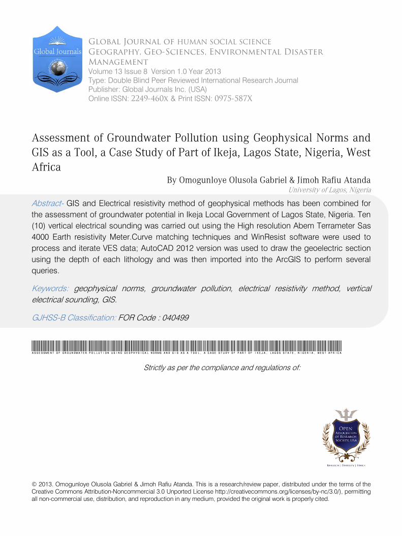
been employed successfully for detecting and mapping ground water contamination under a variety of conditions. The method is based on the fact that formation resistivity depends on the conductivity of the pore fluid as well as the properties of the porous medium. Integrating the GIS and resistivity techniques has been proved to be an efficient tool in groundwater pollution studies. Under favourable conditions, contrasts in resistivity may be attributed to mineralized ground water with a higher than normal specific conductance originating at a contamination source. Success has been reported in tracing water from landfills (Cartwright and McComas, 1968; Cartwright and Sherman, 1972; Stollar and Roux, 1975), sewage treatment effluent (Fink and Aulenbach, 1974), salt piles (Fried and Ungemach, 1971).The lithologies of the study area consist of the recent sediment, coastal plain sand, ewekoro formation, and Abeokuta formation which directly overlie the basement complex. Groundwater is a major source of water supply in Lagos state despite the provision of potable water through the state government micro water works to the people of Ikeja, the populace still depends on wells (shallow and deep) for their domestic water supply. The suitability of groundwater for drinking especially in areas close to the landfill in the study area has continued to raise a source of concern due to the possibility of contamination which pose a major environmental and health concern. Figure 1 and Figure 2 shows the Basemap and locations of the geoelectric survey points carried out for this research work respectively.
G
© 2013 Global Journals Inc. (US)
Yea
rGlob a
l Jo
urna
l o f H
uman
S ocial S
cien
ceVolum
e XIII
Issu
e VIII
Ver
sion
I
(
)B
20
13 22021
α
Assessment of Groundwater Pollution using Geophysical Norms and GIS as a Tool, a Case
Study of Part of Ikeja, Lagos State, Nigeria, West Africa
Figure 1 : Digitized Basemap of Ikeja Local Government Area showing the Streets
© 2013 Global Journals Inc. (US)
Globa
l Jo
urna
l of H
uman
Soc
ial Sc
ienc
e
Volum
e XIII Issue
VIII Ver
sion
IYea
r20
13
22022
()
B
Assessment of Groundwater Pollution using Geophysical Norms and GIS as a Tool, a Case Study of Part of Ikeja, Lagos State, Nigeria, West Africa

Figure 2 : Locations of the VES Points on the Map of Ikeja Local Government Area
II. Geology and Hydrogeology of the Study Area
Hydrogeologically, four major aquifers are recognized within the basin. The Surface aquifer is in the recent sediments, and two major aquifers are within the Coastal plain Sands. The most Prolific aquifer is within the Abeokuta formation.
© 2013 Global Journals Inc. (US)
Yea
rGlob a
l Jo
urna
l o f H
uman
S ocial S
cien
ceVolum
e XIII
Issu
e VIII
Ver
sion
I
(
)B
20
13 22023
Assessment of Groundwater Pollution using Geophysical Norms and GIS as a Tool, a Case Study of Part of Ikeja, Lagos State, Nigeria, West Africa
The study area is located within the western part of Nigeria, a zone of coastal creek and Lagoon (Elueze, et al, 2004). The area is also developed by barrier beaches associated with sand deposits (Ogbe F.G.A, 1992).The study area (Ikeja) is geologically underlain by sediments of Dahomey Basin (Geology of Nigeria).The lithologies of this study area are grouped into Recent Sediments, Coastal Plain Sands, Ilaro Formation, Ewekoro formation and Abeokuta formation, which directly overlies the basement. Geologically, the study area is within the coastal plain sand (Figure 3).

Figure 3 : The Geological Map of Lagos State showing Ikeja Local Government Area
III.
Data Collection and Processing
Data Acquisition was done using a High resolution Abem terrameter Sas 4000 earth resistivity meter spread across part of the Local Government. The Schlumberger electrode configuration with maximum electrode configuration of 200m was adapted. The acquired resistivity data were processed and interpreted with WinResist iterative software that interprets 1D
electrical resistivity sounding data and produce layered resistivity model that reveals subsurface geology. Figures (4-12) are the iterated curves with layered resistivity models of the data acquired at the VES stations. Several Spatial queries analysis were performed in ArcGIS software based on the resistivity data acquired on the field as shown in Figure(13-17).
Figure 4
: The Schlumberger Depth Sounding curve beneath the surveyed area at Dangote,Ikeja
© 2013 Global Journals Inc. (US)
Globa
l Jo
urna
l of H
uman
Soc
ial Sc
ienc
e
Volum
e XIII Issue
VIII Ver
sion
IYea
r20
13
22024
()
B
Assessment of Groundwater Pollution using Geophysical Norms and GIS as a Tool, a Case Study of Part of Ikeja, Lagos State, Nigeria, West Africa

Figure 5 : The Schlumberger Depth Sounding
curve
beneath the surveyed area at coporate Affairs, Ikeja
Figure 6 : The Schlumberger Depth Sounding curve
beneath the surveyed area at Bayo Kuku, Ikeja
Figure 7 : The Schlumberger depth sounding curve
beneath the surveyed area at Lagos Airport, Ikeja
Figure 8 : The Schlumberger depth sounding curve
beneath the surveyed area at Henry Carr crescent, Ikeja
Figure 9 : The Schlumberger depth sounding curve
beneath the surveyed area at NAHCO, Ikeja
Figure 10 : The Schlumberger depth sounding curve
beneath the surveyed area at Adebola House, Opebi, Ikeja
© 2013 Global Journals Inc. (US)
Yea
rGlob a
l Jo
urna
l o f H
uman
S ocial S
cien
ceVolum
e XIII
Issu
e VIII
Ver
sion
I
(
)B
20
13 22025
Assessment of Groundwater Pollution using Geophysical Norms and GIS as a Tool, a Case Study of Part of Ikeja, Lagos State, Nigeria, West Africa

Figure 11 : The Schlumberger depth sounding curve
beneath the surveyed area at oduduwa crescent, Ikeja
Figure 12
:
The Schlumberger depth sounding curve beneath the surveyed area at Alausa Secretariat, Ikeja
IV.
Spatial
Querry Analysis
Spatial data query were performed using the data generated in terms of resistivity, depth, Lithology in ArcGIS and the following resulted as represented from figure 13 to 17
Figure 13
:
2D Query Model showing the Layers of Geoelectric Sections containing poor quality fresh water (polluted) presented as light blue around the geoelectric layers
© 2013 Global Journals Inc. (US)
Globa
l Jo
urna
l of H
uman
Soc
ial Sc
ienc
e
Volum
e XIII Issue
VIII Ver
sion
IYea
r20
13
22026
()
B
Assessment of Groundwater Pollution using Geophysical Norms and GIS as a Tool, a Case Study of Part of Ikeja, Lagos State, Nigeria, West Africa

Figure 14 : 2D Query showing Layers of Geoelectric Section containing good quality Fresh Water presented by the
light blue colour as seen around the geoelectric layers
Figure 15 : 2D Query Model showing the distribution of VES stations and Geologic Layers
© 2013 Global Journals Inc. (US)
Yea
rGlob a
l Jo
urna
l o f H
uman
S ocial S
cien
ceVolum
e XIII
Issu
e VIII
Ver
sion
I
(
)B
20
13 22027
Assessment of Groundwater Pollution using Geophysical Norms and GIS as a Tool, a Case Study of Part of Ikeja, Lagos State, Nigeria, West Africa

Figure 16 : 2D Query Model showing Layers of Geoelectric Section containing Intermediate quality fresh water
presented as light blue around the geologic layers
Figure 17 : 2D Query showing Layers of Geoelectric section containing good quality fresh water presented by the
light blue colour around the geologic layers
V.
Discussion of Results
The results of the vertical electrical sounding carried out revealed fourteen geoeletric Layers which includes the Topsoil, Sand, Clayey Sand, Coarse Sand,
Sandy clay, Clay, Gravelly sand, Sandstone, Clay/sand intercalations, clay with intercalations of thin sand, Silty Clay, Silty Sand, Fine sand and Coarse Sand/Sandstone. From the apparent resistivity model of
© 2013 Global Journals Inc. (US)
Globa
l Jo
urna
l of H
uman
Soc
ial Sc
ienc
e
Volum
e XIII Issue
VIII Ver
sion
IYea
r20
13
22028
()
B
the curves and information from a borehole log and
Assessment of Groundwater Pollution using Geophysical Norms and GIS as a Tool, a Case Study of Part of Ikeja, Lagos State, Nigeria, West Africa

published resistivity data (Telford et al; 1990), the equivalent geologic units has been delineated. The aquifer units are Coarse Sand, Sandstone, Fine Sand and Gravelly Sand. The second layer in VES 1 represents Clay with resistivity value of 18 ohm-m and thickness of 3.2m considered as poor quality fresh water which is highly polluted and the fourth layer is characterized with sand having resistivity value of 290 ohm-m and layer thickness of 15.3m envisaged as Good quality fresh water zone. The fifth geoelectric layer is coarse sand with resistivity of 806 ohm-m considered as Good quality fresh water. The third layer in VES 4 is clay with resistivity value of 15.6 ohm-m and thickness of 4.5m considered as poor quality fresh water. This layer has been highly polluted. The fifth layer in this VES is Sand with a resistivity of 365ohm-m and a thickness of 23.0m considered as a good aquifer with Good quality fresh water. The third layer in VES 5 is clay having a low resistivity of 24 ohm-m and a thickness of
3.5 m. This
layer is a polluted region considered having poor quality fresh water. The second layer and the third layer of VES 9 delineate sand with resistivity ranging from 27.0 ohm-m to 30.0 ohm-m. These layers are highly polluted due to the leachate effect from the Olososun landfill around Oregun, Ikeja.Lagos State, Nigeria.
VI.
Conclusion and Recommendations
From the result of the electrical resistivity sounding carried out in the study area, the study has shown that Geographic Information System (GIS) and Geophysics are very useful in the assessment of the groundwater pollution. GIS Application as a database tool has also been very important and highly useful when integrated with geophysical methods. Most of the surface aquifers that are very nearer to the Oloshosun landfill have been polluted by the adjoining leachate of the Landfill thereby posing a threat to the groundwater of the area. Dwellers very nearer to the oloshosun Landfills are in a great danger because of the fact that most of their surface aquifer has been polluted by the adjoining leachate of the Landfill thereby posing a threat to the groundwater Geology of the area. This effect was noticed in VES 9 and this occurs between the depths of 2.8m to about 9.3m. Between these depths, the possibility of the shallow aquifer to be polluted is very high. The surface aquifer has also been polluted in VES 5 to the depth of about 6.0m.It is recommended hydrogeologically that in VES 2, 3,6,7,8 and 10, a deep borehole could be drilled to provide good sources of water, especially in VES 2, and also a deeper borehole can be drilled in VES 9 to a depth of 220
to 250m. A further mapping of the fresh water and salt water interface in the coastal aquifers should be carried out concurrently to further delineate possible sub-surface pollution plume to better understand the groundwater conditions of Ikeja and its environs. Other methods that
could provide solution to pollution problems of the study area include geochemical analysis of boreholes, wells, and geophysical well logging of the existing boreholes.
VII.
Acknowledgement
The author acknowledges the assistance and technical advice provided by Dr. Omogunloye Olusola, of University of Lagos, Nigeria and Mr Abideen Sanni of Row-dot Nigeria Limited.
References
Références
Referencias
1.
Cartwright, and M.R.McComas 1968.Geophysical surveys in the vicinity of sanitary landfills in northern Illinois, Groundwater .V.6.no 5, pp 23-30
2.
Cartwright K and F.B Sherman, Jr. 1972.Electrical earth resistivity surveying in Landfill investigations. Reprinted from proceedings of the 10th annual engineering and soils engineering symposium, Moscow, Idaho, pp 77-92.
3.
Elueze, A.A. and Nton, M.E., 2004. Organic geochemical appraisal of limestones and shales in part of eastern Dahomey basin, south-western Nigeria. Journal of Mining and Geology,vol. 40, 6no.1 pp 29-40
4.
Fink,W.B and D.B.Aulenbach 1974, Protracted recharge of treated sewage into sand,part 11,tracing the flow of contaminated groundwater with a resistivity survey. Groundwater .V.12.No 4, pp 219-223.
5.
Fried,J,J and P.O Ungemach.1971 ,Note: a dispersion model for a quantitative study of the groundwater pollution by salt-water research.V.5.PP.491-495
6.
Jones, H.A and Hockey, R.D., (1964). The geology of part of south western Nigeria. Geol. Survey. Nigeria, Bull. 31:1-101.
7.
Nuhu George Obaje (2009), Geology and Mineral Resources of Nigeria
8.
Ogbe, F. G. A. 1992. Stratigraphy of strata exposed in the Ewekoro quarry, Western Nigeria.
© 2013 Global Journals Inc. (US)
Yea
rGlob a
l Jo
urna
l o f H
uman
S ocial S
cien
ceVolum
e XIII
Issu
e VIII
Ver
sion
I
(
)B
20
13 22029
Assessment of Groundwater Pollution using Geophysical Norms and GIS as a Tool, a Case Study of Part of Ikeja, Lagos State, Nigeria, West Africa

This page is intentionally left blank
© 2013 Global Journals Inc. (US)
Globa
l Jo
urna
l of H
uman
Soc
ial Sc
ienc
e
Volum
e XIII Issue
VIII Ver
sion
IYea
r20
13
220210
()
B
Assessment of Groundwater Pollution using Geophysical Norms and GIS as a Tool, a Case Study of Part of Ikeja, Lagos State, Nigeria, West Africa