As we go through the PowerPoint, please do the following: Match your cards. Take notes in your...
13
Topography
-
Upload
shannon-tucker -
Category
Documents
-
view
212 -
download
0
Transcript of As we go through the PowerPoint, please do the following: Match your cards. Take notes in your...
Topography

As we go through the PowerPoint, please do the following:
Match your cards.
Take notes in your science notebook.
Label your map.
Map Notes
topography
The study…
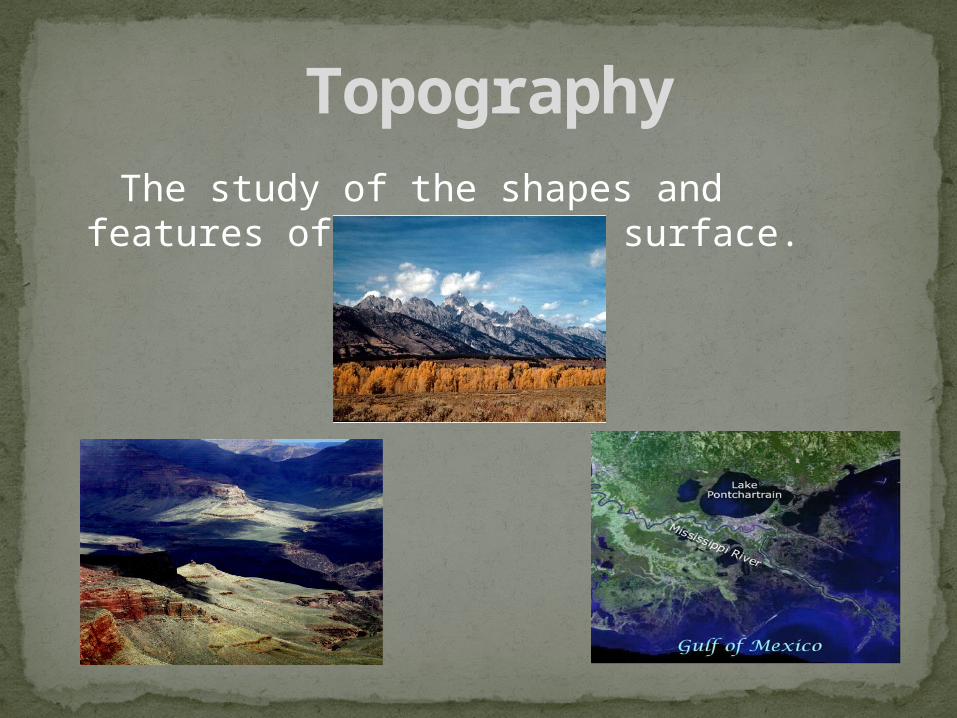
The study of the shapes and features of the Earth’s surface.
Topography

Shows the three dimensional shape and elevations of an area of land in two dimensions
Topographic Map
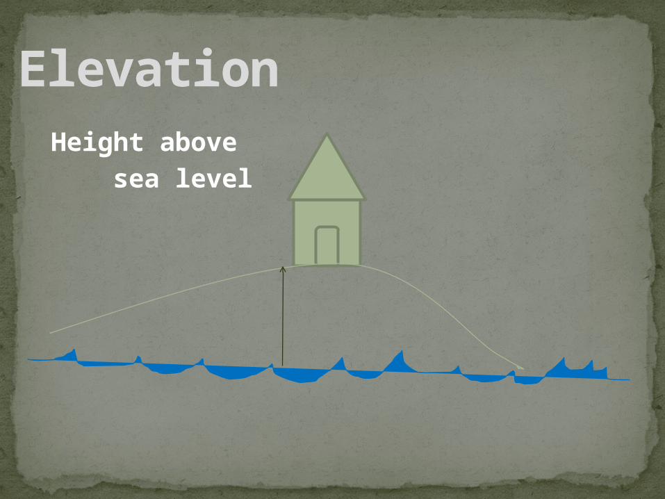
Height above sea level
Elevation

Line that connects places on a topographic map that are all at the same elevation (eventually a closed loop)
Label the contour lines on your map.
Contour Line
contour line
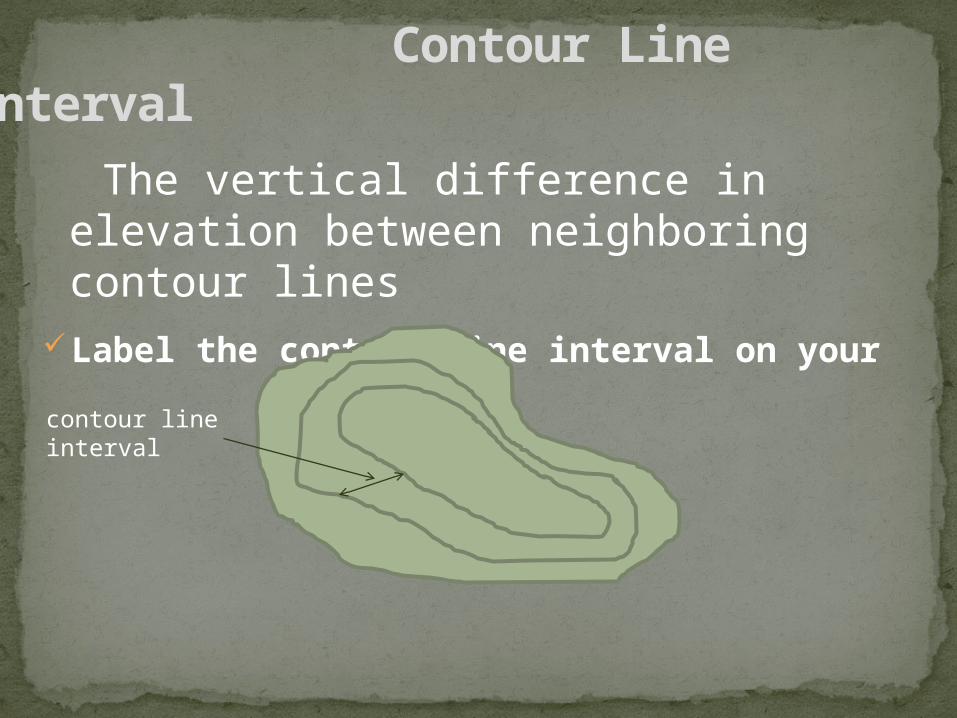
The vertical difference in elevation between neighboring contour linesLabel the contour line interval on your
map.
Contour Line Interval
contour line interval
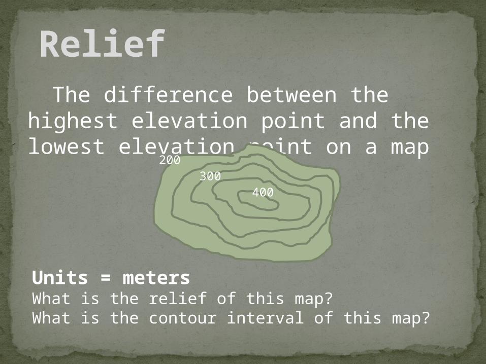
The difference between the highest elevation point and the lowest elevation point on a map
Relief
200 300
400
Units = metersWhat is the relief of this map? What is the contour interval of this map?

Contour lines are closely spaced on
steep slopes.
Contour lines are widely spaced on
gentle slopes.
Topographic Map Rules

The top of a hill or mountain forms a closed area. The top of the hill has a higher elevation than the previous contour line, but it has a lower elevation than the next contour line.
In the map above, the contour interval is 50m so the max elevation is between 400 and 450
Topographic Map Rules
200 300
400

Rivers and valleys are lower elevation areas. These lower elevation areas change the contour lines. The changes in the contour lines area shown as a “V” shape. The angle in the “V” points to the area upstream. The river and/or valley can be followed through the topographic map by following the “V” shapes.
Topographic Map Rules

Depressions without outlets are shown by closed hatched contour lines. The hatched contour lines have short lines on the inside that are pointing down slope. The bottom of the depression is lower than the lowest closed contour line.
Topographic Map Rules
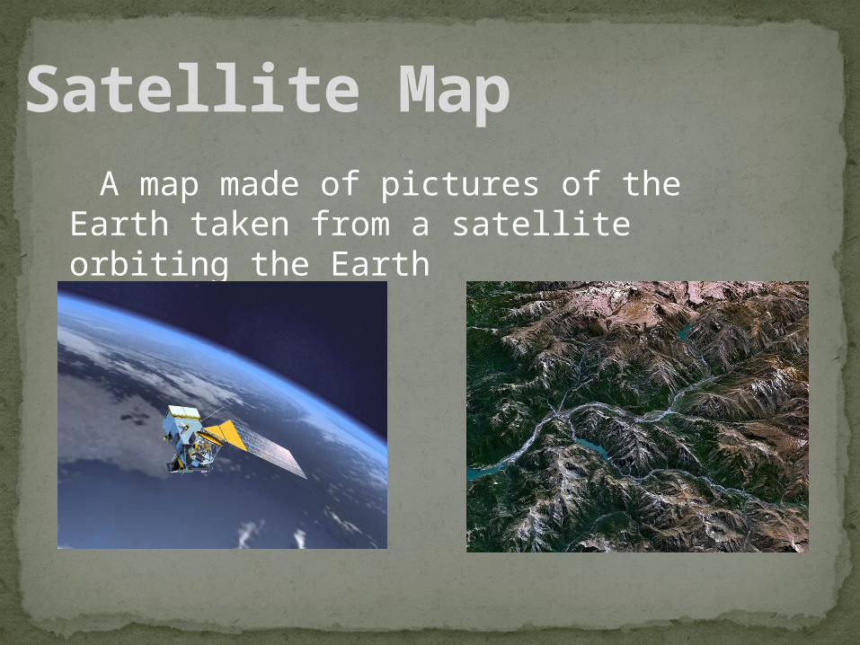
A map made of pictures of the Earth taken from a satellite orbiting the Earth
Satellite Map