ARCTIC MARITIME BOUNDARIES AND DISPUTES. Overview General overview of the physical and political...
55
ARCTIC MARITIME BOUNDARIES AND DISPUTES
-
Upload
bonnie-booker -
Category
Documents
-
view
220 -
download
0
Transcript of ARCTIC MARITIME BOUNDARIES AND DISPUTES. Overview General overview of the physical and political...
ARCTIC MARITIME BOUNDARIES AND DISPUTES
Overview
General overview of the physical and political geography of the Arctic.
Familiarity with existing maritime boundaries and how they were created.
Familiarity with maritime boundary disputes and how they might be resolved.
Particular emphasis on Beaufort Sea. Link back to South China Sea dispute.
The Maritime Arctic
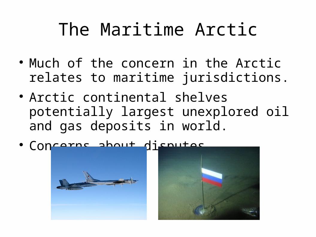
Much of the concern in the Arctic relates to maritime jurisdictions.
Arctic continental shelves potentially largest unexplored oil and gas deposits in world.
Concerns about disputes.
Hype
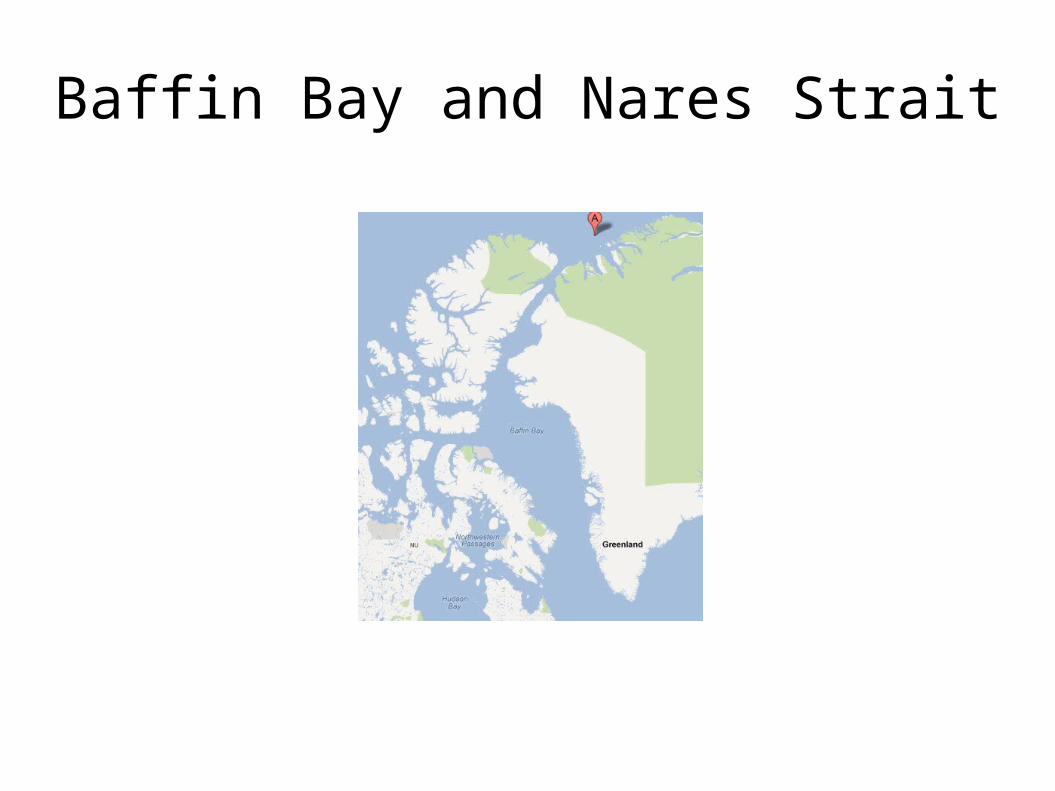
Baffin Bay and Nares Strait
Canada-Denmark Boundary
Median line between Canada's Arctic Islands and Greenland.
Simplified, uses 127 turning points. 1,450 nautical miles long. Hans Island not included in boundary. Problems of accuracy. No drilling near line without agreement.
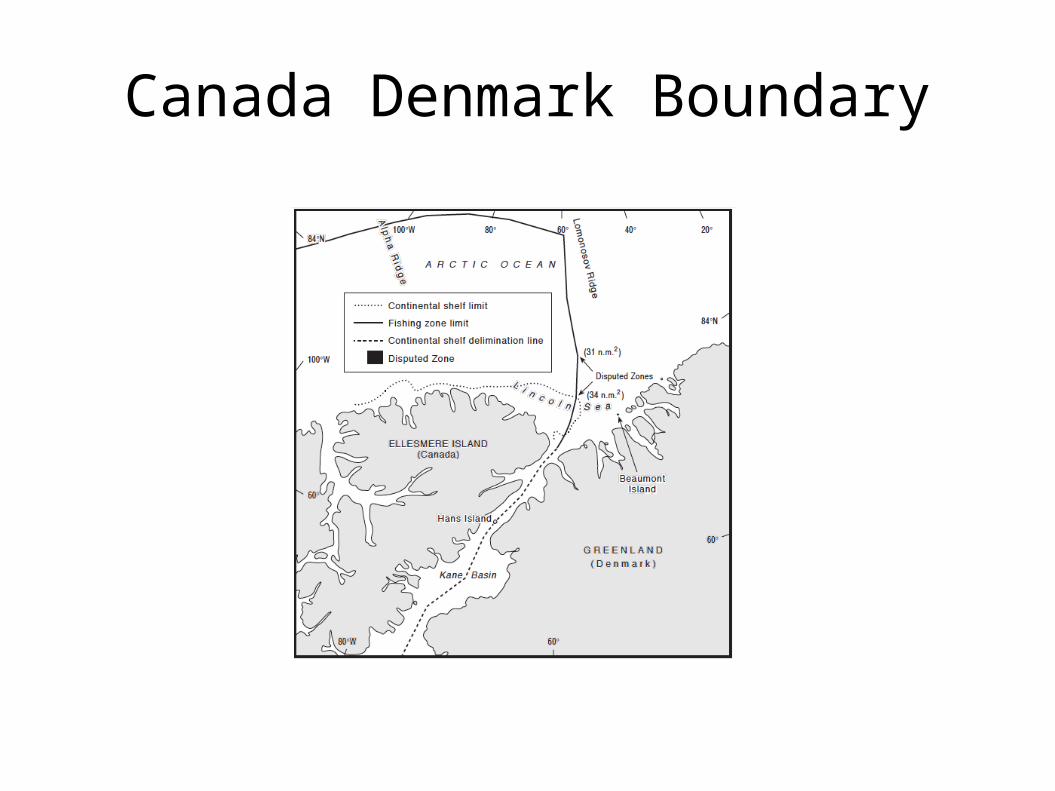
Canada Denmark Boundary
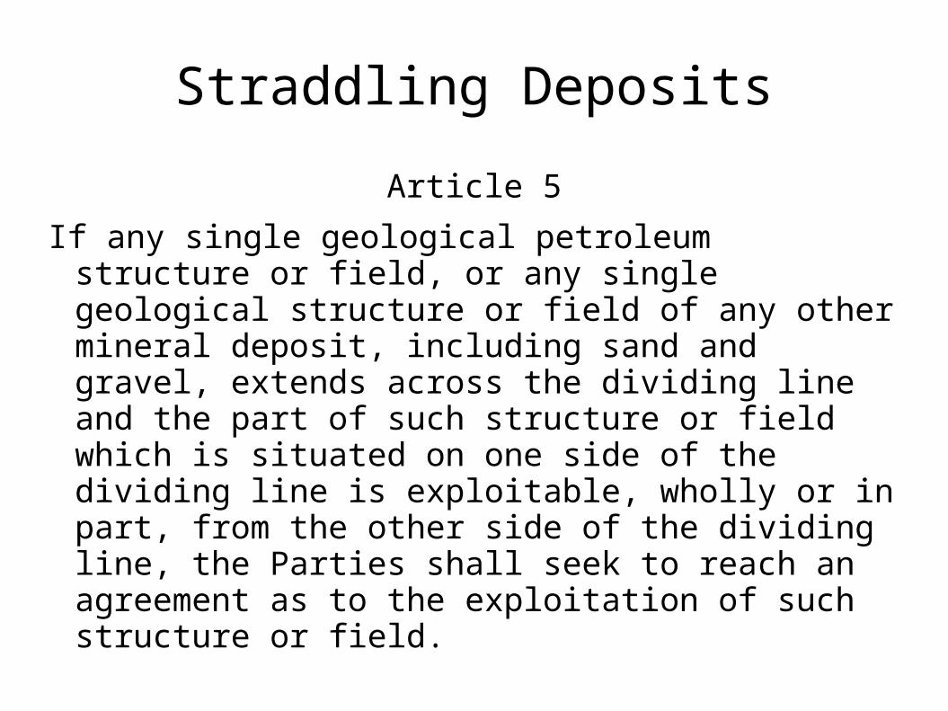
Straddling Deposits
Article 5
If any single geological petroleum structure or field, or any single geological structure or field of any other mineral deposit, including sand and gravel, extends across the dividing line and the part of such structure or field which is situated on one side of the dividing line is exploitable, wholly or in part, from the other side of the dividing line, the Parties shall seek to reach an agreement as to the exploitation of such structure or field.
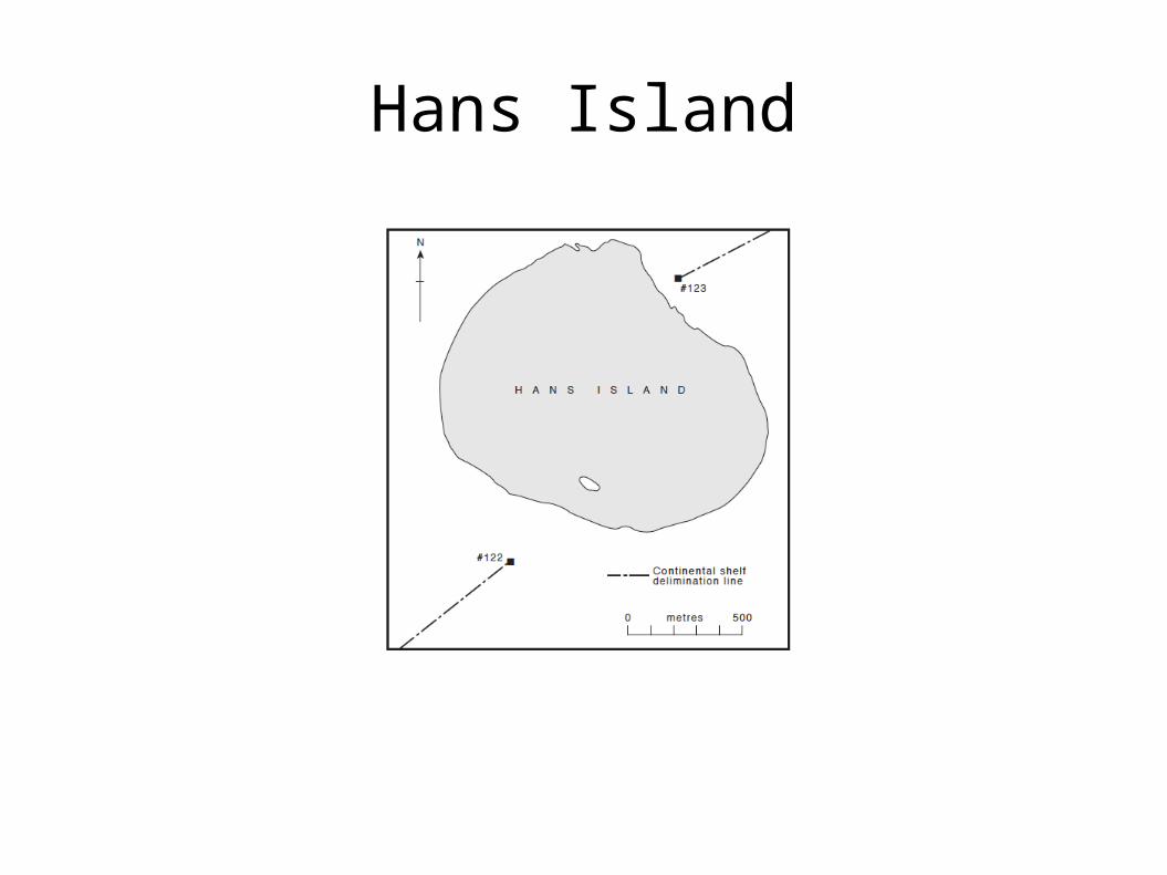
Hans Island
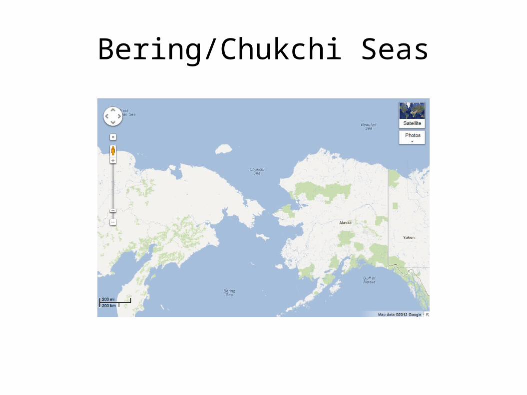
Bering/Chukchi Seas
Map Projections
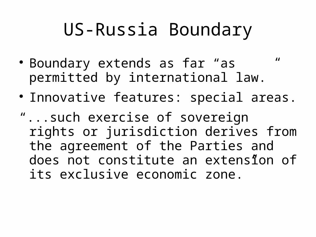
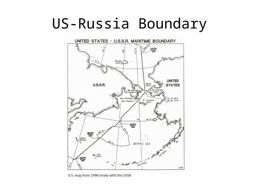
US-Russia Boundary
Based on line in 1867 Treaty that ceded Alaska to the USA.
Different methodologies for calculating the line prior to 1990.
Dispute involving 15,000 square nm of ocean. 1990 treaty divided disputed area in half. US ratified, Russia did not. Provisionally applied for 22 years.
US-Russia Boundary
Boundary extends as far “as permitted by international law.”
Innovative features: special areas.
“...such exercise of sovereign rights or jurisdiction derives from the agreement of the Parties and does not constitute an extension of its exclusive economic zone.”
US-Russia Boundary
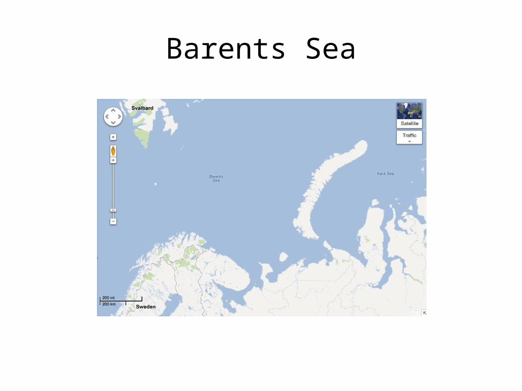
Barents Sea
Barents Sea Dispute
Gas rich area. Dispute over 51,300 sq nm until 2010. Norway: equidistance claim. Russia: special circumstances and sector claim. 1975 Fisheries Cooperation Agreement. Commission decides TAC. TAC divided equally. Loophole Agreement with Iceland.
Barents Sea Treaty
Cut the disputed area roughly in half. Drawn on basis of international law to achieve
equitable result. Equitable considerations including coastal
length. Another special area created. Agreement on straddling deposits. Fisheries cooperation continued.
Response Paper Questions
1. Do you think the unresolved maritime boundaries in the Arctic are a cause for concern? Why or why not?
2. Is the term 'Arctic Sovereignty' misleading? How has the term been used and why do you think it is used so much by politicians and the media?
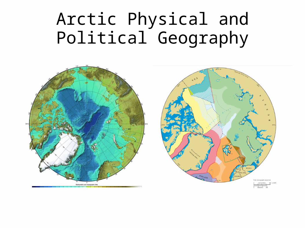
Arctic Physical and Political Geography
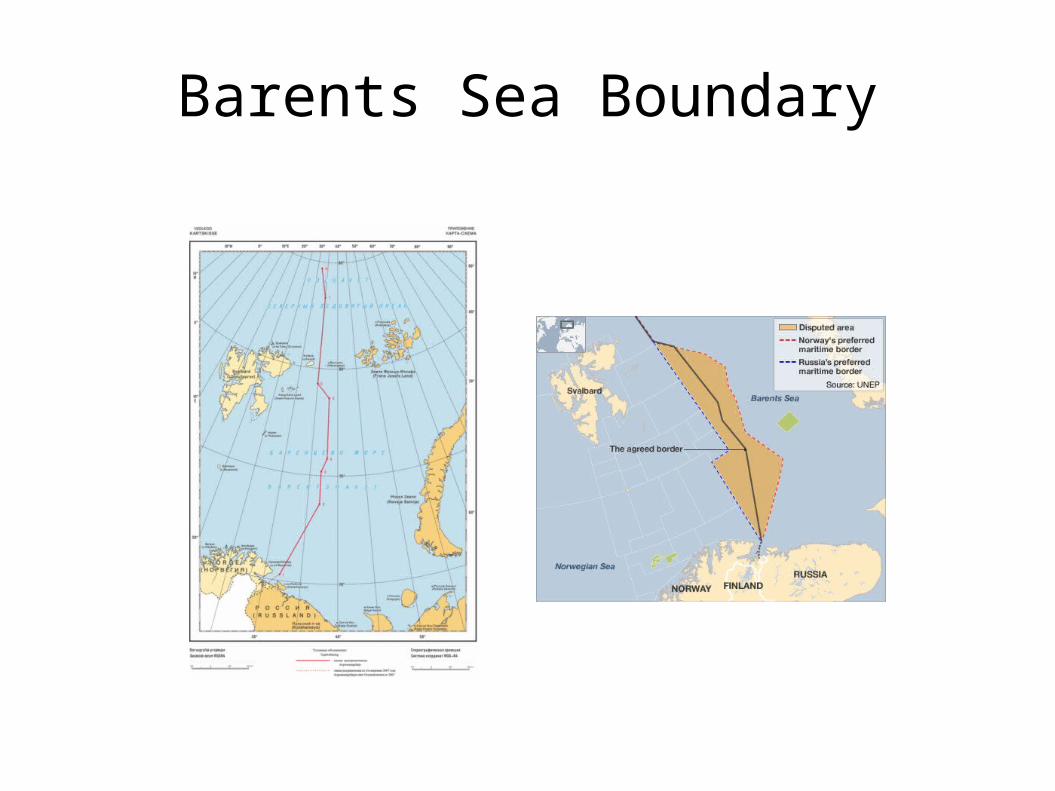
Barents Sea Boundary

Jan Mayen
Jan Mayen Boundaries
144 sq. nm. Norwegian island. Art 121? 250 nm E of Greenland, 360 nm NE of Iceland,
600 nm W of Norway. Only govt employees live there. ICJ Greenland v. Norway (Jan Mayen), coastal
length. Conciliation between Iceland and Norway. Iceland given full EEZ, with joint development.
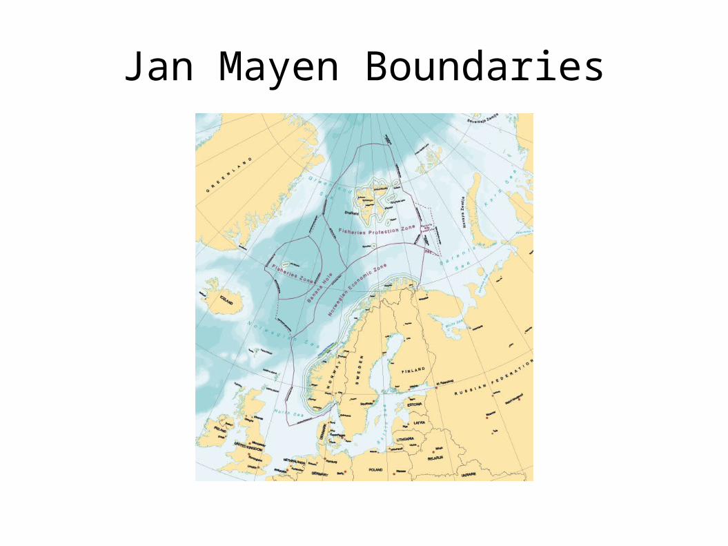
Jan Mayen Boundaries
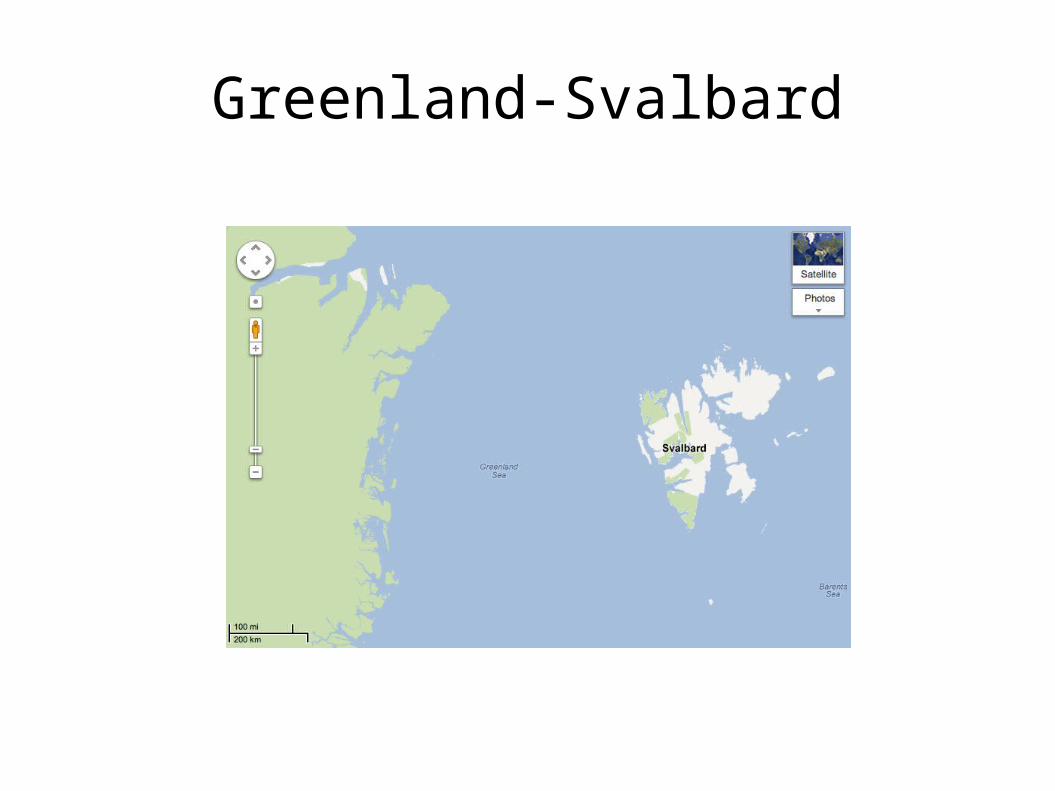
Greenland-Svalbard
Greenland-Svalbard Treaty
Slightly adjusted equidistance line. Runs 430 nautical miles. Agreement on straddling deposits.
Assessment
Several existing boundaries demonstrate good record of cooperation between neighbouring states.
Norway-Russia agreement particularly notable. Demonstration effect. Ilulissat Declaration.
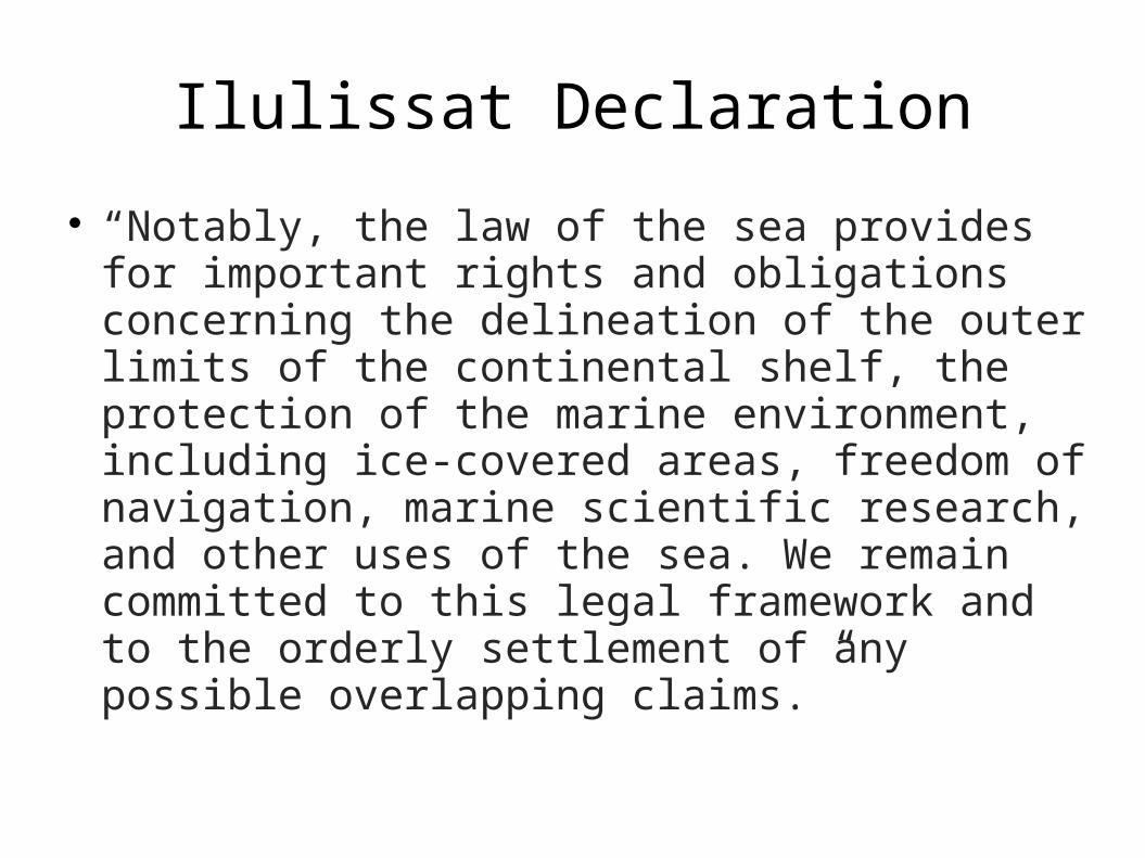
Ilulissat Declaration
“Notably, the law of the sea provides for important rights and obligations concerning the delineation of the outer limits of the continental shelf, the protection of the marine environment, including ice-covered areas, freedom of navigation, marine scientific research, and other uses of the sea. We remain committed to this legal framework and to the orderly settlement of any possible overlapping claims.”
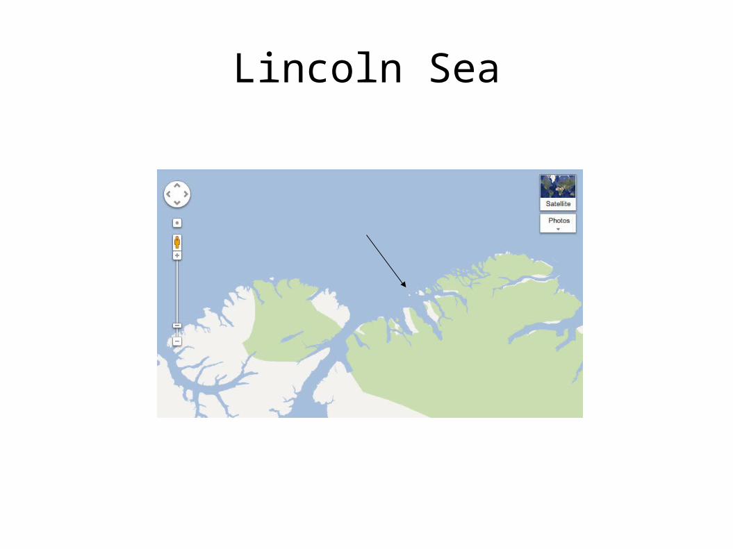
Lincoln Sea
Lincoln Sea Dispute
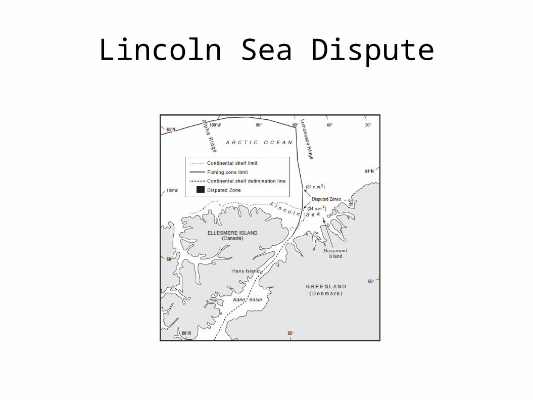
Lincoln Sea Dispute
Canada and Denmark both delineated EEZ limits, using equidistance lines.
Denmark after drawing straight baselines. Canada protested baselines: Beaumont Island. Two small disputed areas created – total area
65 sq nm.
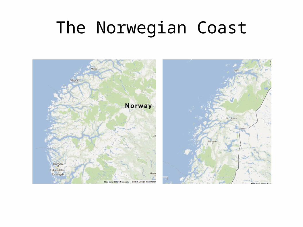
The Norwegian Coast
Straight Baselines
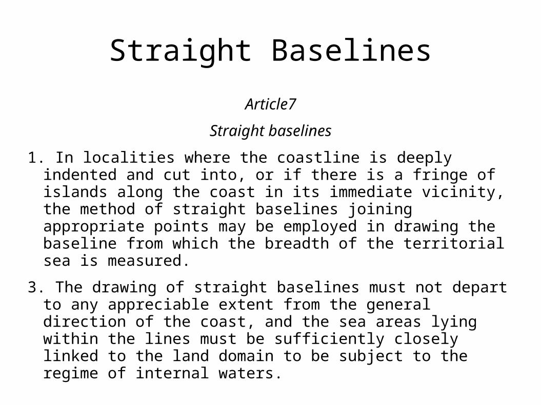
Article7
Straight baselines
1. In localities where the coastline is deeply indented and cut into, or if there is a fringe of islands along the coast in its immediate vicinity, the method of straight baselines joining appropriate points may be employed in drawing the baseline from which the breadth of the territorial sea is measured.
3. The drawing of straight baselines must not depart to any appreciable extent from the general direction of the coast, and the sea areas lying within the lines must be sufficiently closely linked to the land domain to be subject to the regime of internal waters.
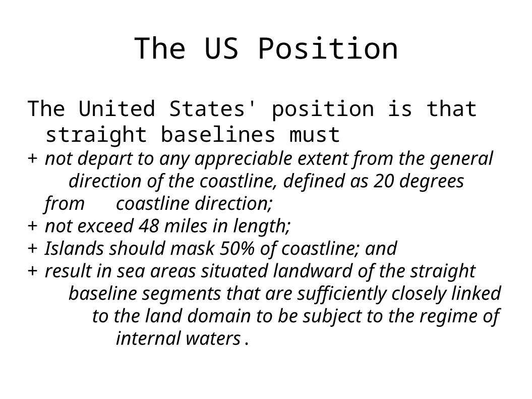
The US Position
The United States' position is that straight baselines must
+ not depart to any appreciable extent from the general direction of the coastline, defined as 20 degrees from coastline direction;
+ not exceed 48 miles in length; + Islands should mask 50% of coastline; and+ result in sea areas situated landward of the straight
baseline segments that are sufficiently closely linked to the land domain to be subject to the regime of
internal waters.
Lincoln Sea Dispute
Beaumont Island an island or rock? Coastal length? Canada's own straight baselines. Lack of protest by Canada of 2004 baselines.
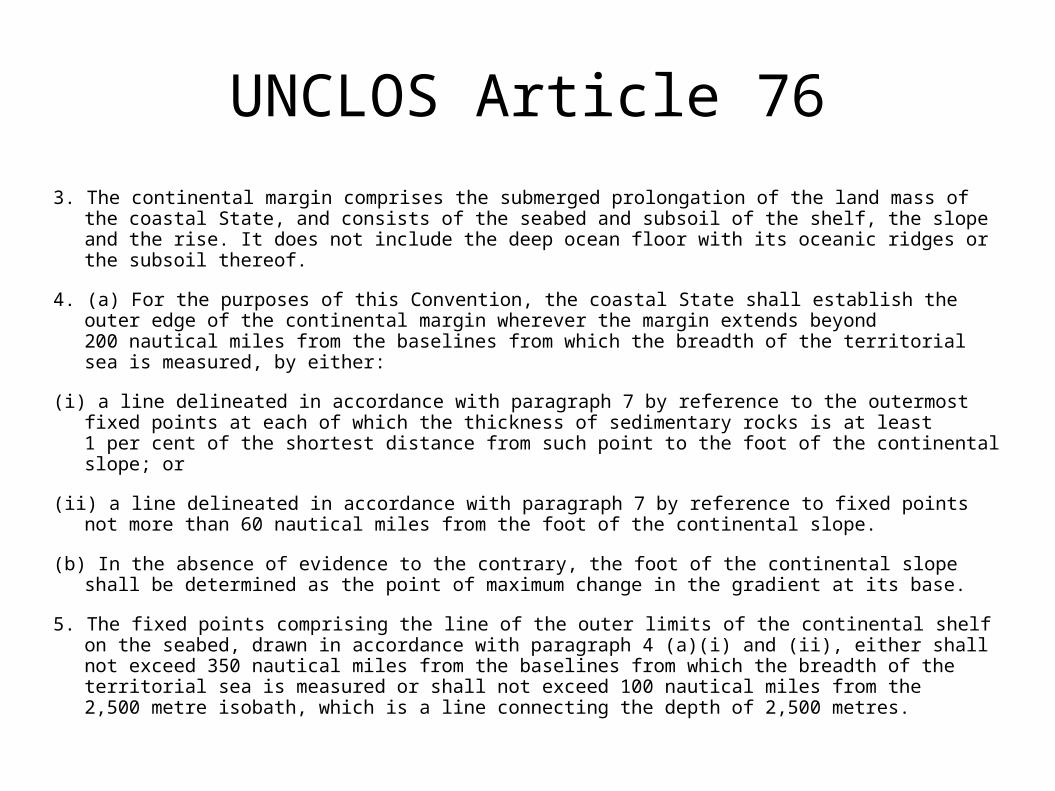
UNCLOS Article 76
3. The continental margin comprises the submerged prolongation of the land mass of the coastal State, and consists of the seabed and subsoil of the shelf, the slope and the rise. It does not include the deep ocean floor with its oceanic ridges or the subsoil thereof.
4. (a) For the purposes of this Convention, the coastal State shall establish the outer edge of the continental margin wherever the margin extends beyond 200 nautical miles from the baselines from which the breadth of the territorial sea is measured, by either:
(i) a line delineated in accordance with paragraph 7 by reference to the outermost fixed points at each of which the thickness of sedimentary rocks is at least 1 per cent of the shortest distance from such point to the foot of the continental slope; or
(ii) a line delineated in accordance with paragraph 7 by reference to fixed points not more than 60 nautical miles from the foot of the continental slope.
(b) In the absence of evidence to the contrary, the foot of the continental slope shall be determined as the point of maximum change in the gradient at its base.
5. The fixed points comprising the line of the outer limits of the continental shelf on the seabed, drawn in accordance with paragraph 4 (a)(i) and (ii), either shall not exceed 350 nautical miles from the baselines from which the breadth of the territorial sea is measured or shall not exceed 100 nautical miles from the 2,500 metre isobath, which is a line connecting the depth of 2,500 metres.
Beaufort Sea Dispute
Most significant of the remaining disputes. Traditional understanding has changed. Oil in the area is probable. Early efforts at resolution unsuccessful. Special interests of indigenous peoples.
Fishery. Joint mapping of ECS. Case study: ideas for resolving the dispute.
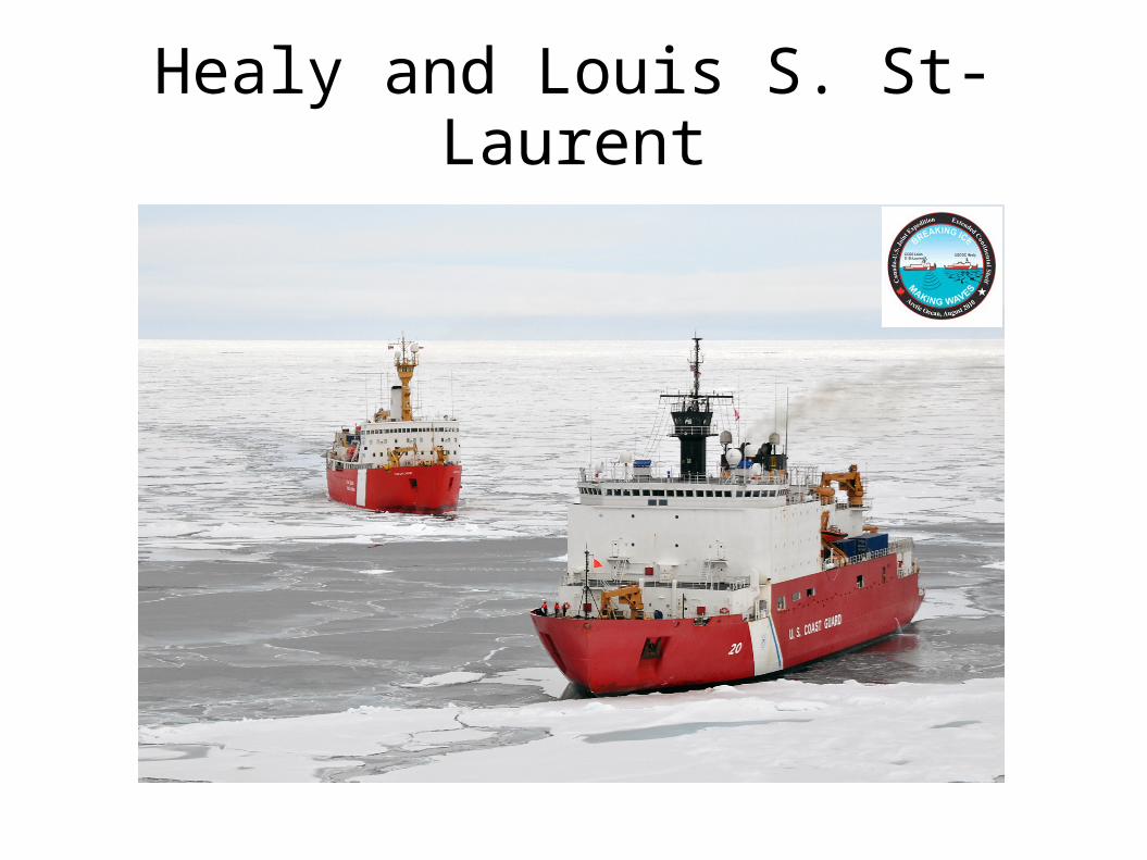
Healy and Louis S. St-Laurent
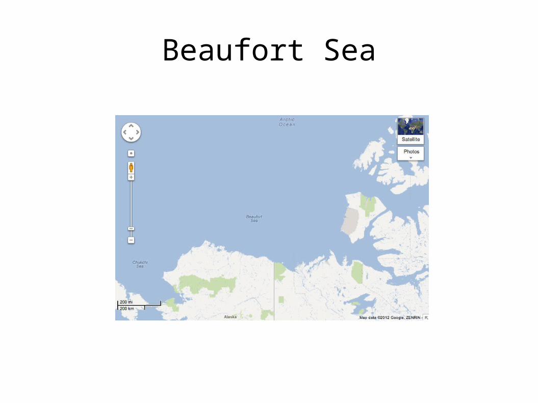
Beaufort Sea
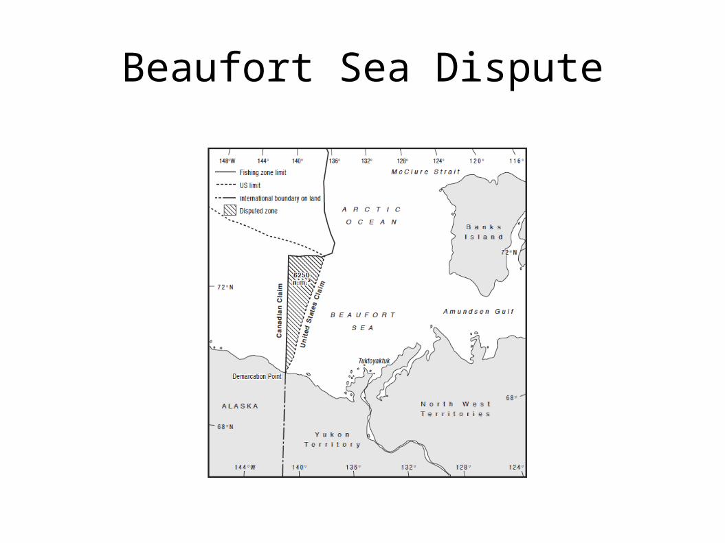
Beaufort Sea Dispute
Canada's Claim
Meridian line (141° W). 1825 Treaty between UK and Russia. “As far as the frozen ocean”. Object and purpose – Czar's claim. US acquiescence? US use of 1867 Treaty in 1990 USSR-USA
boundary. Sector theory abandoned.
United States' Claim
Equidistance line. Equitable claim in line with requirements of
international law. No factors that require adjustment. 1825 treaty construction: “As far as...” Historically, waters did not extend far. Different language of 1867 treaty: “into...”
Extended Continental Shelves
Changes: climate change, oil price, CLCS and mapping.
Canada's CLCS deadline: 2013. Mapping conducted collaboratively. ECS reaches further than first thought. Possibility of both countries being able to
extend rights. Canada invited US to negotiate in 2010.
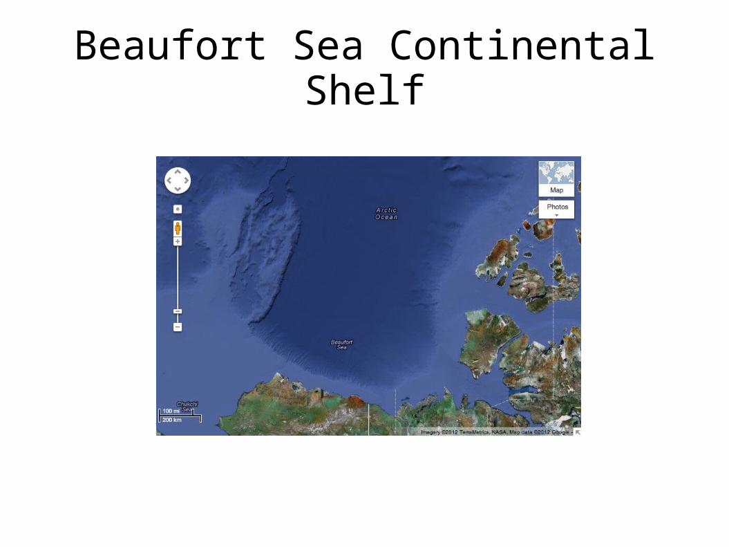
Beaufort Sea Continental Shelf
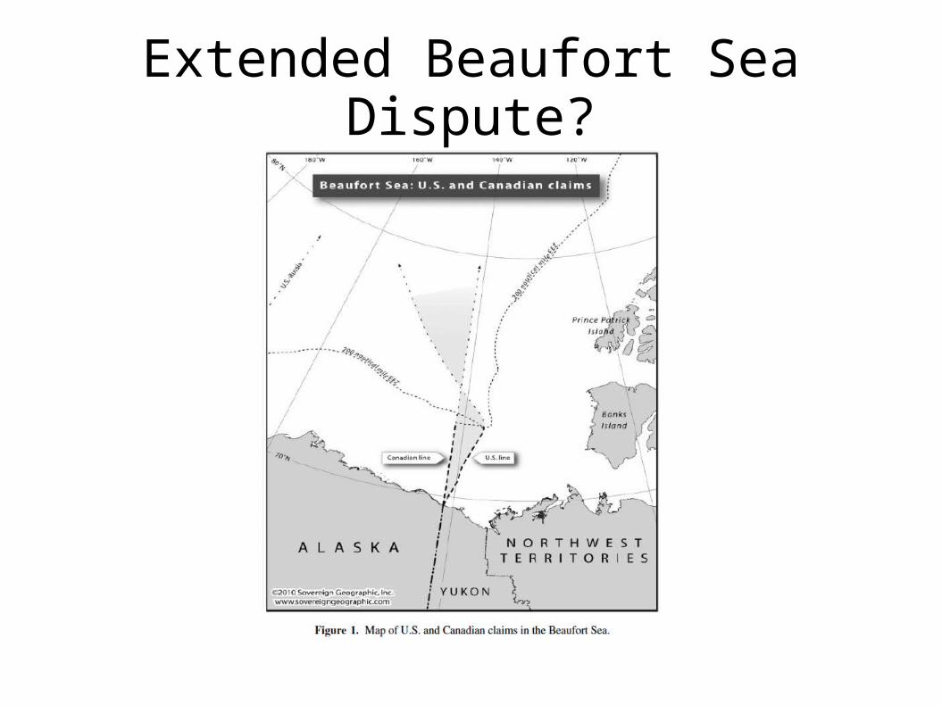
Extended Beaufort Sea Dispute?
Considerations
Canadian position would seem to benefit the US in the northern area and vice versa.
Disputed northern area may be larger. Disputed northern area may have fewer
resources. Disputed northern area deeper, further from
shore, more ice.

What Should The Parties Do?
One party recognizes the position of the other? Retain same position beyond 200 nm to that
within it? Divide the are in half? Retain part of this position? Abandon their positions altogether?
Recap of Relevant Law
Three-step test. Coastal length. Coastal configuration. Islands. Seabed configuration.
Domestic Constraints
Inuvialuit Settlement Region uses 1825 line. Constitutionally protected document. Duty to consult and compensate. Involve the Inuit in negotiations? Incentive to compromise as little as possible. Ammunition for shifting equidistance? Possible creative solutions?
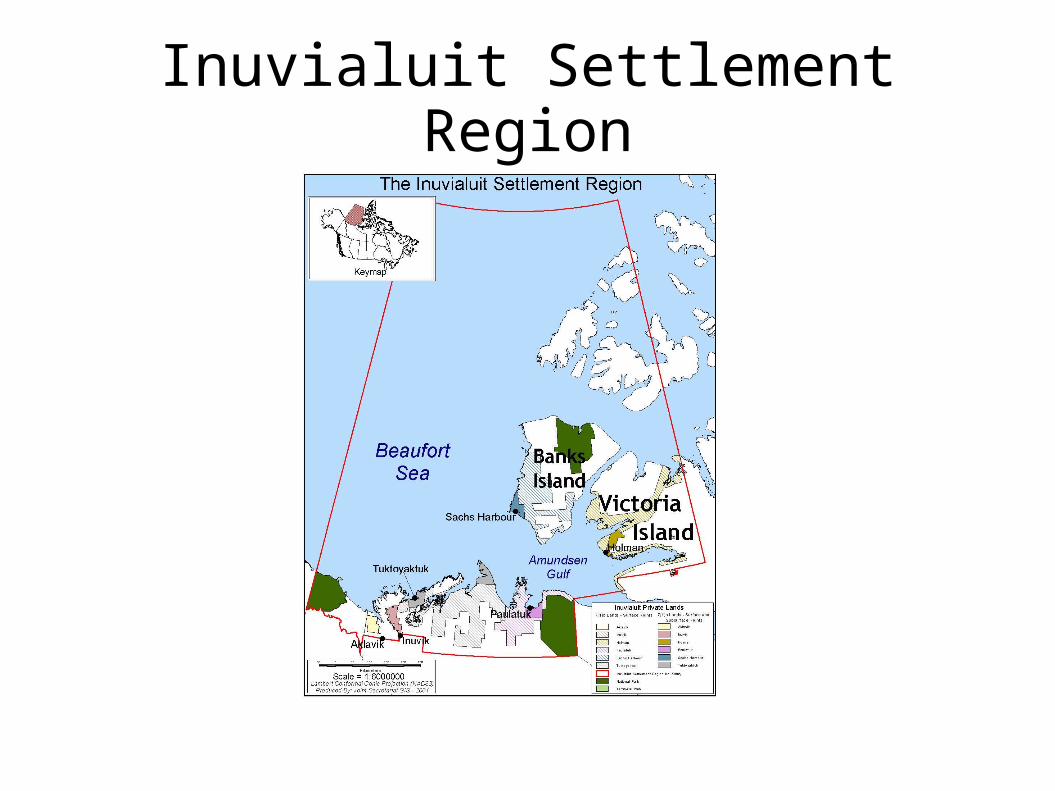
Inuvialuit Settlement Region
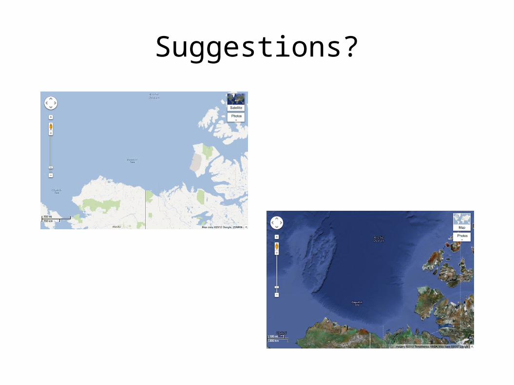
Suggestions?
New Canadian Position?
Difficult to change method beyond 200 nm. Equidistance preferable? Reasons to adjust equidistance? Coastal configuration? Costal length? Which coasts? Islands? Adjusted equidistance and then equidistance? Natural prolongation irrelevant – shared ECS.
New US Position?
Chukchi Plateau a natural prolongation of US shelf?
Richardson at UNCLOS negotiations. Equidistance within 200 as per Libya-Malta? Natural prolongation beyond? Cannot cut off
Chukchi Plateau. Effect of Bay of Bengal Case?
Other Options
Litigation/arbitration. Options for the CLCS process Reduce size of dispute. Multifunctional delimitation (e.g. Torres Strait). Economic access rights. Joint development. Which model? Where?
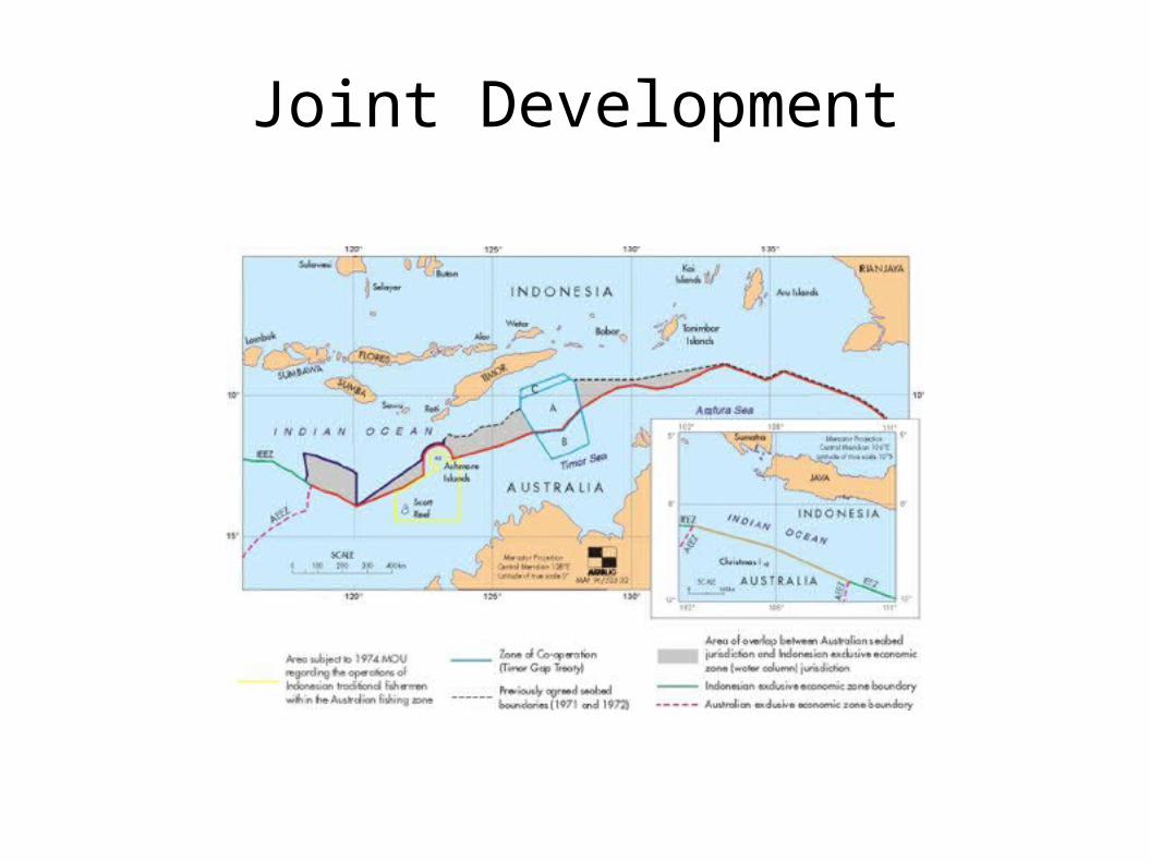
Joint Development
Assessment
Most remaining disputes are small. Beaufort Sea is largest active dispute but being
negotiated. Russia-Canada boundary? Not nearly as complex as SCS. Central Arctic Ocean may prove more complex.