APPENDIX L. PRELIMINARY RECONNAISSANCE: ARCHITECTURAL ... · Plaistow Commuter Rail Extension Study...
14
Plaistow Commuter Rail Extension Study Alternaves Analysis Report – March 2015 APPENDIX L. PRELIMINARY RECONNAISSANCE: ARCHITECTURAL- HISTORICAL DATA
Transcript of APPENDIX L. PRELIMINARY RECONNAISSANCE: ARCHITECTURAL ... · Plaistow Commuter Rail Extension Study...

Plaistow Commuter Rail Extension Study
Alternatives Analysis Report – March 2015
APPENDIX L. PRELIMINARY RECONNAISSANCE: ARCHITECTURAL-HISTORICAL DATA

Page 1 of 12
PRELIMINARY RECONNAISSANCE: ARCHITECTURAL-HISTORICAL DATA
PLAISTOW, NEW HAMPSHIRE, COMMUTER RAIL EXTENSION STUDY
Philip E. Pendleton
Senior Architectural Historian Historic Documentation Company, Inc.
ABSTRACT: The preliminary reconnaissance finds that construction of the commuter rail extension apparently will not affect historic architectural resources in Plaistow and the adjacent portion of Haverhill, Massachusetts. Five potential rail facility sites were researched and surveyed in the field. Some of the site locations would require demolition of existing buildings according to current design plans. Of these potentially directly impacted properties, all either are not of historic age, or do not appear to possess historic significance. Nor does there appear to be potential for construction at any of the site locations to affect historic resources located in close proximity.
I. Introduction
The goal of the Plaistow Commuter Rail Extension Study is to evaluate the extension of the Massachusetts Bay Transportation Authority (MBTA) Haverhill Line commuter rail service from Haverhill, Massachusetts to Plaistow, New Hampshire. The objective of the study is to develop information and analysis that can form the basis of an informed decision-making process regarding whether or not to advance the project. The specific purpose of this architectural reconnaissance is to gather preliminary archival and field data concerning the presence of historic architectural resources on the potential site properties (layover facilities and commuter rail stations) and in their immediate environment.
II. Methodology
Historic Documentation Company, Inc. (HDC) conducted research and survey for the reconnaissance during July 30-August 2, 2014. The research comprised a review of historic resource inventory files for the Town of Plaistow archived at the New Hampshire Division of Historic Resources (NHDHR) in Concord, and online inspection of Plaistow tax parcel data. The field survey consisted of pedestrian inspection and photography at the five potential sites, undertaken to identify potential historic resources located on the site properties and to make a preliminary assessment of the visual relationship between the sites and possible historic resources situated in the immediate vicinity of each site. For this purpose, a historic architectural resource is defined as a building, structure, or object of 50 or more years of age, the standard age criterion for eligibility for the National Register of Historic Places (NRHP). I.e., assuming the year 2017 as potential date for completion of construction on a proposed

Page 2 of 12
commuter rail extension, the goal of this reconnaissance was to identify resources dating to 1967 or earlier. For each of the potential rail extension sites, in addition to individual historic resources, the reconnaissance considered the potential for an eligible historic district to be located so as to include the rail extension site or situated adjacent to it. Photographs of the potential site environments and photo key maps showing their location appear below (Figure 1).
III. Architectural Resources in the Town of Plaistow
The information available at NHDHR on the town’s historic architectural resources consists chiefly of a town-wide area form compiled in 2003 by the Preservation Company. Only one architectural resource in Plaistow has been placed on the National Register, the Plaistow Carhouse, listed in 1980, and it is no longer standing. There are no properties in Plaistow that are listed on the State Register of Historic Places, a separate listing of significant historic resources from that of the National Register. There is no listed historic district located within the town. The town-wide area form study of 2003 compiled a comprehensive description of the town’s historic architecture as well as a detailed historic context interpreting the town’s development from the onset of English settlement in 1642 up to the present era. The area-wide survey mapped the hundreds of properties in the town constructed up to 1953 (although omitting to state prominently in the text the overall number of properties of historic age), and presented photographs of more than 300 of these resources in the report in order to illustrate the architectural-historical character of the town. The mapping provides a ready and valuable resource for future surveys of specific locations or areas within the town. Two detail maps extracted from the overall survey map are presented below, to facilitate identification of pre-1954 resources that are present in proximity to the potential rail extension sites and may require update architectural survey treatment as project planning proceeds (Figures 2 and 3). Note that it appears that some of the pre-1954 properties mapped in 2003 are no longer standing as of 2014. The 2003 town-wide study asserted that, although no Plaistow properties were listed on the National Register, the town “contains many individual properties potentially eligible for the National Register.”1 The study assessed the town center village, extending along Main and Elm streets and located a short distance to the east of the Layover 2-Station B and Layover 9-Station G rail extension sites, as being “potentially eligible as a historic district.” (The present preliminary reconnaissance, however, made a tentative finding that there is no potential for effects on the potential historic district from rail extension construction at these sites, due to distance and tree cover.) The town-wide study of 2003 found that there was no potential for a historic district in Westville, the town’s only other village area located along Route 125, due to its lack of integrity to its historic appearance.
1 Kari Ann Laprey and Elaine Stiles, Plaistow Townwide Area Form (2003), 33.

Page 3 of 12
IV. The Potential Commuter Rail Extension Sites
The preliminary reconnaissance made field inspections at the five potential rail extension sites, which were identified by the project team as those under consideration as of July 30, 2014.
A. Layover 2 – Station B
The site location lies on the northwest side of the existing rail line, situated between Main Street on the northeast and Plaistow Road (Route 125) on the southwest. If built according to current design, the rail extension facilities at this site would be located so as to be set back from Main Street by approximately 1,000 feet and from Plaistow Road by about 1500 feet. Construction at this site would directly impact the multi-tenant light industrial facility currently occupying the location at 144-146 Main Street, which is presently used by four tenants. One major multi-section building is located on this parcel, accompanied by two smaller auxiliary buildings. Based on architectural character (form, shape, materials, etc.), these buildings appear to date to approximately the 1980s (Photo 1). Rail facility construction would require demolition of the major building and the auxiliary building to the southwest; however, due to the post-1967 date of the buildings, such action would not constitute an effect on historic resources. The nearest architectural resources of historic age (i.e., built by 1967) are the buildings in the town center village along Main Street, which were recommended in the 2003 town-wide study as composing a potential historic district. However, the closest of these buildings are located more than 800 feet away from this rail extension site, generally considered an interval to provide a buffer against visual effects, and there is also a dense screen of mature trees blocking most of the sight lines between the two locations (Photos 2 and 3). In addition, it is anticipated that the rail facility design would follow the prevailing modern design standards for public rail transportation properties and that the scale of any buildings, the site landscaping, and the facility lighting would be designed to minimize any impact on the surrounding environment. Hence the preliminary reconnaissance finds that construction at this site would be unlikely to affect any historic architectural resources.
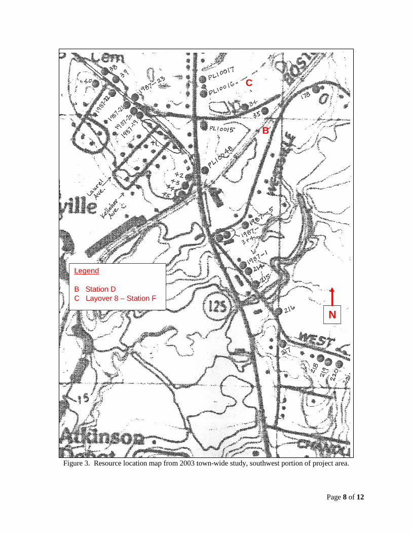
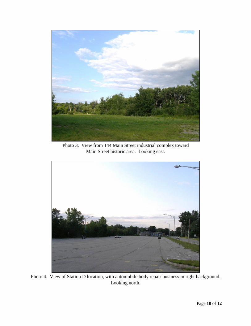
B. Station D
The site location lies on the southeast side of the existing rail line, situated between Westville Road to the northeast, east, and south, and Plaistow Road (Route 125) to the southwest. The station facility at this site would be located so as to adjoin Westville Road directly and to be set back from Plaistow Road by about 400 feet, with a light-industrial facility occupying the interval between the station and Plaistow Road. The preliminary plan shows the facility as being directly adjacent to an automobile body repair business, and construction of the station facility could possibly require demolition of this business property (Photo 4). The property consists of a building evidently built in two stages that took place within about the past 30 years, based on architectural character (form, shape, materials, etc.). Due to the post-1967 date of the buildings, demolition would not constitute an effect on historic resources.
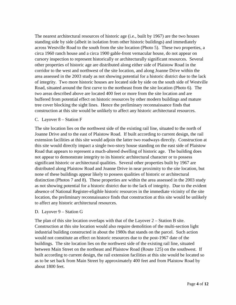
Page 4 of 12
The nearest architectural resources of historic age (i.e., built by 1967) are the two houses standing side by side (albeit in isolation from other historic buildings) and immediately across Westville Road to the south from the site location (Photo 5). These two properties, a circa 1960 ranch house and a circa 1900 gable-front vernacular house, do not appear on cursory inspection to represent historically or architecturally significant resources. Several other properties of historic age are distributed along either side of Plaistow Road in the corridor to the west and northwest of the site location, and along Joanne Drive within the area assessed in the 2003 study as not showing potential for a historic district due to the lack of integrity. Two more historic houses are located side by side on the south side of Westville Road, situated around the first curve to the northeast from the site location (Photo 6). The two areas described above are located 400 feet or more from the site location and are buffered from potential effect on historic resources by other modern buildings and mature tree cover blocking the sight lines. Hence the preliminary reconnaissance finds that construction at this site would be unlikely to affect any historic architectural resources.
C. Layover 8 – Station F
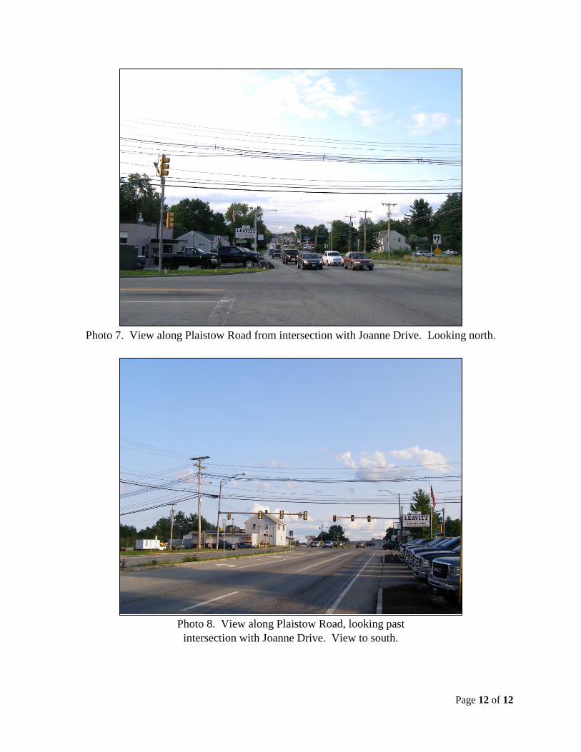
The site location lies on the northwest side of the existing rail line, situated to the north of Joanne Drive and to the east of Plaistow Road. If built according to current design, the rail extension facilities at this site would adjoin the latter two roadways directly. Construction at this site would directly impact a single two-story house standing on the east side of Plaistow Road that appears to represent a much-altered dwelling of historic age. The building does not appear to demonstrate integrity to its historic architectural character or to possess significant historic or architectural qualities. Several other properties built by 1967 are distributed along Plaistow Road and Joanne Drive in near proximity to the site location, but none of these buildings appear likely to possess qualities of historic or architectural distinction (Photos 7 and 8). These properties are within the area assessed in the 2003 study as not showing potential for a historic district due to the lack of integrity. Due to the evident absence of National Register-eligible historic resources in the immediate vicinity of the site location, the preliminary reconnaissance finds that construction at this site would be unlikely to affect any historic architectural resources.
D. Layover 9 – Station G
The plan of this site location overlaps with that of the Layover 2 – Station B site. Construction at this site location would also require demolition of the multi-section light industrial building constructed in about the 1980s that stands on the parcel. Such action would not constitute an effect on historic resources due to the post-1967 date of the buildings. The site location lies on the northwest side of the existing rail line, situated between Main Street on the northeast and Plaistow Road (Route 125) on the southwest. If built according to current design, the rail extension facilities at this site would be located so as to be set back from Main Street by approximately 400 feet and from Plaistow Road by about 1800 feet.
Page 5 of 12
The nearest architectural resources of historic age (i.e., built by 1967) are the buildings in the town center village along Main Street, which were recommended in the 2003 town-wide study as composing a potential historic district. The closest of these buildings are located about 350 feet away from this rail extension site. There is also a fairly dense screen of mature trees blocking much of the sight lines between the two locations. It is anticipated that the rail facility design would follow the prevailing modern design standards for public rail transportation properties and that the scale of any buildings, the site landscaping, and the facility lighting would be designed to minimize any impact on the surrounding environment. For these reasons, i.e., distance, tree cover, and facility design, the preliminary reconnaissance finds that construction at this site would be unlikely to affect historic architectural resources. However, it should be noted, due to the relative proximity of this site location to the concentration of historic properties along Main Street, that of the five site locations inspected in the preliminary reconnaissance, this one shows somewhat more likelihood to result in an effect on historic architectural resources than does any of the other four.
E. Layover 6
This site location is situated to an extent of 90% or more within the Town of Haverhill, Massachusetts, on the boundary with New Hampshire. The site location lies on the east side of the existing rail line, situated to the south of Atkinson Depot Road (NH Route 121), southwest of Main Street (MA Route 121), northwest of Merrill Avenue, and north of Rosemont Street. The site location is screened densely around most of the perimeter by dense mature tree cover. The exception to the woodlots are areas occupied by modern (i.e., post-1967) industrial and commercial properties. There do not appear to be any architectural resources of historic age in close proximity to the site location. Hence the preliminary reconnaissance finds that construction at this site would be unlikely to affect any historic architectural resources.

Page 6 of 12
Figure 1. Photo locations.
N
1
2
3
4
5
6
7 8

Page 7 of 12
Figure 2. Resource location map from 2003 town-wide study, northeast portion of project area.
A
N
B C
D
Legend A Layover 2 – Station B B Station D C Layover 8 – Station F D Layover 9 – Station G
Page 8 of 12
Figure 3. Resource location map from 2003 town-wide study, southwest portion of project area.
N
B
C
Legend B Station D C Layover 8 – Station F

Page 9 of 12
Photo 1. Industrial property at 144 Main Street, Plaistow. View to southwest.
Photo 2. View along driveway of 144 Main Street, between industrial
complex and Main Street. Looking southwest.
Page 10 of 12
Photo 3. View from 144 Main Street industrial complex toward
Main Street historic area. Looking east.
Photo 4. View of Station D location, with automobile body repair business in right background.
Looking north.

Page 11 of 12
Photo 5. Houses of historic age to south of Station D location,
on east side of Westville Road. View to south.
Photo 6. Houses of historic age to northeast of Station D location,
on south side of Westville Road. View to south.
Page 12 of 12
Photo 7. View along Plaistow Road from intersection with Joanne Drive. Looking north.
Photo 8. View along Plaistow Road, looking past
intersection with Joanne Drive. View to south.

This page intentionally blank.