Appendix E Permitting Inventory - Department of Energy E Permitting Inventory April 27, 2016 E.i...
18
Newberry Geothermal Energy Establishment of the Frontier Observatory for Research in Geothermal Energy (FORGE) at Newberry Volcano, Oregon Appendix E Permitting Inventory April 27, 2016
-
Upload
vuongnguyet -
Category
Documents
-
view
213 -
download
0
Transcript of Appendix E Permitting Inventory - Department of Energy E Permitting Inventory April 27, 2016 E.i...

Newberry Geothermal Energy Establishment of the Frontier Observatory for Research in Geothermal Energy (FORGE) at Newberry Volcano, Oregon
Appendix E Permitting Inventory
April 27, 2016

E.i
Contents
Acronyms and Abbreviations .................................................................................................................. E.iii E.1 Summary .......................................................................................................................................... E.1 E.2 Updates to the Permitting Inventory ................................................................................................ E.1
E.2.1 Surface Ownership............................................................................................................. E.1 E.2.2 Environmental and Cultural Conditions ............................................................................ E.1
E.3 Permitting Status .............................................................................................................................. E.5 E.4 Project Relationship to Laws, Regulations, Policies, and NEPA Documents .................................. E.5
E.4.1 2011 EA and Decision Record for the Newberry Volcano Enhanced Geothermal System Demonstration Project .......................................................................................... E.5
E.4.2 2010 EA and Decision Record for Drilling, Testing, and Monitoring of up to 12 Temperature Gradient/Passive Seismic Geothermal Exploratory Wells ........................... E.5
E.4.3 Programmatic Environmental Impact Statement for Geothermal Leasing in the Western United States, December 2008 ............................................................................ E.5
E.4.4 2007 Newberry Geothermal Exploration Project EA and Decision Record ...................... E.5 E.4.5 Energy Policy Act of 2005 ................................................................................................ E.6 E.4.6 National Energy Policy and Executive Order 13212 – Actions to Expedite Energy
– Related Projects .............................................................................................................. E.6 E.4.7 Newberry National Volcanic Monument Comprehensive Management Plan,
August 1994 ....................................................................................................................... E.6 E.4.8 1994 Newberry Geothermal Pilot Project Final EIS and Record of Decision ................... E.6 E.4.9 The National Forest Management Act of 1976, as Amended, 1990 .................................. E.6 E.4.10 Newberry National Volcanic Monument Act, November 1990 ........................................ E.7 E.4.11 The Federal Land Policy and Management Act of 1976 as Amended .............................. E.7 E.4.12 Geothermal Steam Act of 1970 ......................................................................................... E.7 E.4.13 National Environmental Policy Act of 1969, Council of Environmental Quality
Regulations, and the Federal Land Policy and Management Act of 1976 ......................... E.7 E.5 Mineral Rights .................................................................................................................................. E.7 E.6 Lease Status ...................................................................................................................................... E.8 E.7 Water Availability ............................................................................................................................ E.8
E.7.1 Onsite Water Availability .................................................................................................. E.8 E.7.2 Water Rights ...................................................................................................................... E.8
E.8 State and Local Regulations ............................................................................................................. E.9 E.9 Transmission Accessibility .............................................................................................................. E.9 E.10 Year-Round Accessibility ................................................................................................................ E.9 E.11 Existing Permits ............................................................................................................................... E.9 E.12 Unit Agreement Approval Letter and Unit Map ............................................................................ E.11

E.ii
Figures
E.1 NEWGEN FORGE site. .................................................................................................................... E.1 E.2 NEWGEN FORGE site pads. ............................................................................................................ E.4
Tables
E.1 Environmental impact statement activities completed at the NEWGEN FORGE site. ..................... E.2 E.2 Environmental assessments completed at the NEWGEN FORGE site. ............................................ E.2 E.3 Existing BLM permits. .................................................................................................................... E.10 E.4 Existing Forest Service permits. ...................................................................................................... E.10 E.5 Oregon Department of Geology and Mineral Industries permits. ................................................... E.10 E.6 Oregon Department of Environmental Quality permits. .................................................................. E.11 E.7 Oregon Water Resources Department permits................................................................................. E.11

E.iii
Acronyms and Abbreviations
AltaRock AltaRock Energy, Inc. BE biological evaluation BLM Bureau of Land Management BPA Bonneville Power Administration cfs cubic feet per second CMP Comprehensive Management Plan DNH Davenport Newberry Holdings LLC DOE U.S. Department of Energy EA environmental assessment EGS enhanced geothermal system(s) EIS environmental impact statement FLPMA Federal Land Policy and Management Act of 1976, as amended FONSI Finding of No Significant Impact FORGE Frontier Observatory for Research in Geothermal Energy gpm gallons per minute hp horse power Monument Act Act establishing the Newberry National Volcanic Monument NEGSD Newberry EGS Demonstration NEPA National Environmental Policy Act of 1969, as amended NEWGEN Newberry Geothermal Energy NNVM Newberry National Volcanic Monument PA Participating Area PEIS programmatic EIS ROD Record of Decision TES threatened, endangered, or sensitive

E.1
Appendix E
Permitting Inventory
E.1 Summary
In this Appendix, Newberry Geothermal Energy (NEWGEN) presents a robust Updated Permitting Inventory to support the establishment and management of the Frontier Observatory for Research in Geothermal Energy (FORGE) at Newberry Volcano in Oregon. A full set of permits, which exists for previous geothermal exploration and an enhanced geothermal system (EGS) demonstration project at the site, is being updated for NEWGEN. The NEWGEN Permitting Inventory supports the FORGE goal to “accelerate breakthroughs” in EGS. The permitting inventory for NEWGEN will be updated by populating all existing data realized during Phase 1 that support the Environmental Information Synopsis and the ability to meet National Environmental Policy Act of 1969, as amended (NEPA). Other permitting/regulatory compliance requirements by the end of Phase 2B will be reflected in this Updated Permitting Inventory Appendix.
E.2 Updates to the Permitting Inventory
As part of the FORGE proposal submitted in November 2014, a permitting inventory was included as Appendix C. This inventory has been updated with the changes below to reflect changes to existing permits since 2014.
E.2.1 Surface Ownership • Ownership: Surface rights for the proposed project area are owned and held by the U.S. Forest
Service.
• Total acreage of proposed site:
– Permitted Geothermal Unit Area: 19,120.15 acres (the 9400-acre NEWGEN FORGE activities area will be within the Geothermal Unit Area).
– Primary Surface Activity Area: 15 acres (three 5-acre existing well pads).
E.2.2 Environmental and Cultural Conditions
E.2.2.1 Existing Environmental Activities
NEWGEN will leverage the Consortium’s previous working experience at Newberry Volcano and their proven track record successfully executing environmental activities. To date, four environmental assessments (EAs), two environmental impact statements (EISs), and one programmatic EIS (PEIS) have been executed by operators of the Newberry geothermal leases (Table E.1 and Table E.2).
Figure E.1. NEWGEN FORGE site.

E.2
Table E.1. Environmental impact statement activities completed at the NEWGEN FORGE site.
1994 Newberry Geothermal Pilot Project Final EIS and Record of Decision In 1994, the Deschutes National Forest, Prineville District Bureau of Land Management (BLM), and Bonneville Power Administration (BPA) analyzed potential effects of a proposed federal pilot project for geothermal exploration, development, and production of electrical energy on federal leases at Newberry Volcano, near the NEWGEN FORGE site. The pilot project was approved by the Forest Service (as lead agency with the BLM and BPA as cooperating agencies) and several exploration wells were drilled, but the results were inconclusive and the project was suspended in 1996. An extensive and detailed environmental analysis was conducted for that project, and some of the data may be relevant to the analysis of future proposed geothermal projects in the area. This (NEPA) document may be cited where appropriate, and referenced in future NEPA analyses.
Programmatic Environmental Impact Statement for Geothermal Leasing in the Western United States, December 2008. One of the goals of the PEIS is to facilitate geothermal leasing decisions in the western United States. The PEIS was jointly prepared by the BLM and Forest Service in cooperation with the U.S. Department of Energy (DOE), and includes a comprehensive list of stipulations, Best Management Practices, and procedures to provide consistent guidance for geothermal exploration and development. The effects analyzed and addressed in the PEIS and Record of Decision (ROD) can be incorporated by reference in any subsequent NEPA documents.
2012 Ogden Vegetation Management Project EIS and Record of Decision This EIS and subsequent ROD by the Bend/Ft. Rock Ranger District of the Deschutes National Forest, analyzed the environmental effects of a vegetation management project authorizing forest thinning of the ponderosa pine-dominated forest with the goal of increasing growth and vigor of trees, and increasing their resilience to insects, disease, and wildfire. The Ogden project area consists of 26,521 acres and includes a sizeable portion of the NEWGEN FORGE site. This detailed environmental analysis of the forest area is relatively recent and will be relevant to future environmental analyses in the area.
Table E.2. Environmental assessments completed at the NEWGEN FORGE site.
2007 Newberry Geothermal Exploration Project EA and Decision Record (OR-050-075) This 2007 EA analyzed a Davenport Newberry exploration project that involved drilling up to nine deep geothermal exploration wells (10,000 feet deep or more) on three well pads each approximately 5 acres in size. All well pads were constructed, and two wells have been drilled and continue to be monitored and evaluated. One well pad and well from this project (NWG 55-29) was used for the Newberry Volcano EGS Demonstration Project, 2011 through 2015.
2010 EA and Decision Record for Drilling, Testing, and Monitoring of up to 12 Temperature Gradient/Passive Seismic Geothermal Exploratory Wells (DOI-BLM-OR-P000-2010-003-EA) (Davenport TG Program) This EA and the subsequent Decision Record issued by the BLM and the Finding of No Significant Impact (FONSI) issued by DOE analyzed 12 sites for shallow small-diameter wells on one-quarter–acre well pad sites, to be used to collect geologic and seismic data to provide new information about the geology and potential geothermal resource in the area. Seven pads have been prepared since 2010, and seven wells have been drilled.
2011 EA and Decision Record for the Newberry Volcano Enhanced Geothermal System (EGS) Demonstration Project (DOI-BLM-OR-P000-2011-0003-EA, DOE/EA-1897) This EA and subsequent Decision Record and FONSI issued by the BLM and DOE analyzed the environmental effects of developing and testing a geothermal reservoir created by using EGS technologies, as proposed by Davenport Newberry Holdings LLC (DNH) and AltaRock Energy, Inc. (AltaRock). The analysis covered all aspects of the EGS demonstration project, including water quality and induced seismicity.
2014 EA and Decision Notice for the Newberry Geothermal Consent to Lease Project This EA and subsequent Decision Notice and FONSI issued by the Bend/Ft. Rock Ranger District of the Deschutes National Forest, analyzed the environmental effects of granting consent to lease additional parcels of land for geothermal exploration and development within and surrounding the NEWGEN FORGE site. The decision gives Forest Service consent to the BLM to advertise and award leases of 11 nominated parcels of Deschutes National Forest Land. This includes three parcels within the Davenport Newberry Unit Area totaling approximately 1820 acres. BLM has not yet announced when these leases will be advertised and awarded.

E.3
E.2.2.2 Environmental Studies Performed in Area
Nearby Population Center Density and Distance
The nearest population center to the NEWGEN FORGE site is La Pine, Oregon, approximately 10 miles southwest of the project site. According to 2010 US Census data, the population was 1653, with a population density of 236.8 inhabitants per square mile.
The nearest larger city is Bend, Oregon, approximately 22 miles north of the project site. According to 2010 U.S. Census data, the population was 76,639, with a population density of 2,321.7 inhabitants per square mile.
Nearby Wildlife Habitats (Endangered Species/Habitat)
The Forest Service conducted wildlife studies and biological evaluations (BEs) for each of the recent EAs in the project area (2007, 2010, and 2011) and produced the 2012 Ogden Vegetation Management Project EIS to address the potential effects of the proposed activities on federally threatened, endangered, candidate, or proposed species. The BEs concluded that there is no suitable habitat for any federally threatened, endangered, candidate, or proposed species. Potential habitat was identified in the area for some Management Indicator Species, including osprey and northern goshawk. The BE stipulated a mitigation measure regarding the timing of drilling activities. If a nesting site of certain raptors is occupied during the breeding season, then a wildlife biologist must make a determination about whether a timing restriction on drilling is necessary. Subsequent field surveys by wildlife biologists have not identified any nesting raptors in the project area, and therefore no timing restrictions have been needed.
A recent review of the project area for Threatened, Endangered, and Sensitive Plants concluded:
There are no known threatened, endangered, or sensitive (TES) plant sites within the project area. The closest known site is the pumice moonwort (Botrychium pumicola), about 3.5 direct miles away, within Newberry Crater. There is no high-probability habitat for this or other TES plant species within the project area. (Ogden FEIS, P.414)
Nearby Scenic Vistas
A scenic resource analysis was completed as part of the 2011 EA for the Newberry EGS Demonstration (NEGSD). Six viewpoints of concern were selected as the most representative viewpoints in the project for travelers and recreationists. Paulina Peak was the only viewpoint higher in elevation than the project area, and it represents the closest scenic vista. It is located approximately 4 miles southeast of Well NWG 55-29. A steam plume resulting from circulation testing or venting of geothermal wells on clear cold days was identified as the most likely visual impact. It was noted that an Amendment of the Forest Plan adopted in 1994, allows for a long-term constant steam plume from an operating geothermal power plant as proposed in the 1994 Newberry Geothermal Pilot Project.
Nearby Areas of Critical Environmental Concern or Wilderness Areas
There are no congressionally designated wilderness areas in or near the project area.
Nearby Wetlands or Scenic Waterways
A portion of Paulina Creek is identified as being eligible for designation as a wild and scenic river, but it is not currently designated as wild and scenic. Paulina Creek cuts through the Newberry Unit, but is located south of the NEWGEN FORGE site.

E.4
Nearby Native American Tribes
Prineville BLM and Deschutes National Forest are engaged in ongoing consultation with the Confederated Tribes of the Warm Springs Reservation, the Klamath Tribes, and the Burns Paiute Tribes on projects and issues involving uses of public or National Forest lands in central Oregon, including the proposed NEWGEN FORGE site and other geothermal activities. No comments were submitted by any of the tribes during scoping of the recent NEGSD EA (2011).
Potential for Landslides, or Excessive Subsidence as a Result of Induced Seismic Activity
As part of the 2011 NEGSD EA, potential impacts from induced seismic on nearby structures as well as the potential for landslides to occur were analyzed in detail. The EA found only a few buildings near the project site that could be affected by moderate ground shaking. An Induced Seismicity Mitigation Plan was designed to protect these structures and signs were placed on the road to Paulina Peak to warn road users of potential rock fall. No impacts were observed during the NEGSD.
Review of Any Potential Issues Associated with the National Historic Preservation Act
No historic structures, historic districts, or traditional cultural properties were identified during the records search, nor were any cultural resources identified during an intensive pedestrian survey of sites with potential surface disturbance conducted as part of the 2011 NEGSD EA. Surveys for cultural resources are conducted for each project that occurs on the Forest Service lands; therefore, any future site disturbance will require additional cultural surveys.
Indication of Whether Public Opposition Is Likely
The NEWGEN FORGE site has a rich foundation of strong stakeholder support owing to the decades of EGS characterization and exploration conducted at the site, and more recently, due to the NEGSD project funded by the U.S. Department of Energy (DOE) and led by AltaRock. For example, the local communities were key participants in the previous EGS stimulation at the Newberry Volcano; therefore, the NEWGEN FORGE site already enjoys strong support for geothermal development and EGS. The NEWGEN team has maintained a strong stakeholder outreach effort during Phase 1 (see Appendix H), and as a result, the FORGE project has achieved an unprecedented level of support for implementing FORGE at Newberry Volcano, as documented via the extensive set of letters of support from local, state, and national stakeholders provided within the Project Management Plan.
Figure E.2. NEWGEN FORGE site pads.

E.5
E.3 Permitting Status
The status of existing exploration permits, approved well permits and permits pending approval is as follows:
• Existing Exploration Permits: Not applicable
• Approved Well Permits
– Drilled and Not Commercial: Wells NWG 55-29 and NWG 46-16 have been drilled and are not commercial at this time.
– Not Drilled: Well NWG 23-17 has not been drilled, but the pad and sump have been constructed.
• Permits Pending Approval: None at this time.
E.4 Project Relationship to Laws, Regulations, Policies, and NEPA Documents
E.4.1 2011 EA and Decision Record for the Newberry Volcano Enhanced Geothermal System (EGS) Demonstration Project (DOI-BLM-OR-P000-2011-0003-EA, DOE/EA-1897)
This EA and subsequent Decision Record and FONSI issued by the BLM and DOE analyzed the environmental effects of developing and testing a geothermal reservoir created by using EGS technologies, as proposed by DNH and AltaRock. The analysis covered all aspects of NEGSD including water quality and induced seismicity. This EA may also be cited and incorporated by reference in any future NEPA documents.
E.4.2 2010 EA and Decision Record for Drilling, Testing, and Monitoring of up to 12 Temperature Gradient/Passive Seismic Geothermal Exploratory Wells (DOI‐BLM‐OR‐P000‐2010‐003‐EA) (Davenport TG Program)
This EA and subsequent Decision Record issued by BLM and the FONSI issued by the DOE analyzed 12 sites for shallow small-diameter wells on one-quarter–acre well pad sites to be used to collect geologic and seismic data to provide new information about the geology and potential geothermal resource in the area. Seven pads have been prepared since 2010 and seven wells have been drilled; the project will continue in 2012. These NEPA documents may be cited and also incorporated by reference.
E.4.3 Programmatic Environmental Impact Statement for Geothermal Leasing in the Western United States, December 2008
One of the goals of the PEIS is to facilitate geothermal leasing decisions in the western United States. The PEIS was jointly prepared by the BLM and the Forest Service in cooperation with the DOE, and includes a comprehensive list of stipulations, Best Management Practices, and procedures to provide consistent guidance for geothermal exploration and development.
E.4.4 2007 Newberry Geothermal Exploration Project EA and Decision Record (OR‐050‐075)
The 2007 EA and Decision Record issued by BLM analyzed a Davenport Newberry exploration project that involves drilling deep geothermal exploration wells (10,000 feet deep or more) on three well pads, each approximately 5 acres in size. All well pads were constructed, and two wells have been drilled and continue to be monitored and evaluated. The well pads (16, 17, and 29) and wells (NWG 55‐29 and NWG 46-16) from the geothermal exploration project are part of the proposed NEWGEN FORGE site.

E.6
E.4.5 Energy Policy Act of 2005
This Act also applies to the BLM and the Forest Service, and directs the agencies to promote leasing and development of geothermal resources where appropriate on public lands.
E.4.6 National Energy Policy (May 2001) and Executive Order 13212 – Actions to Expedite Energy – Related Projects
This Policy and Executive Order apply to energy‐related projects and direct the federal agencies “to expedite projects that will increase the production, transmission, or conservation of energy,” and “expedite their review of permits or take other action as necessary to accelerate the completion of such projects.”
E.4.7 Newberry National Volcanic Monument Comprehensive Management Plan, August 1994
As mandated in the Monument Act, the Forest Service prepared a Comprehensive Management Plan (CMP) for the Newberry National Volcanic Monument (NNVM) establishing programmatic management direction for National Forest lands within the newly created Monument, and for the four specially designated management areas (Special Management Area, Transferal Area Adjacent, Transferal Area, and Transferal Corridor) within the Monument boundary that may be used for geothermal exploration and development under certain circumstances.
Consistent with the Monument Act, the CMP acknowledges there are valid geothermal leases within the Special Areas identified within the Monument Act. The CMP includes a goal
“to manage the surface of the Special Management Area and of the Transferal Area Adjacent as part of the Monument, while allowing subsurface exploration for and development of geothermal resources” (CMP, page 7).
E.4.8 1994 Newberry Geothermal Pilot Project Final EIS and Record of Decision
In 1994 the Deschutes National Forest, Prineville District BLM, and Bonneville Power Administration (BPA) analyzed potential effects of a proposed federal pilot project for geothermal exploration, development, and production of electrical energy on federal leases at Newberry Volcano, near the NEWGEN FORGE site. The pilot project was approved by the Forest Service (as lead agency with the BLM and BPA as cooperating agencies) and several exploration wells were drilled, but the results were inconclusive and the project was suspended in 1996. An extensive and detailed environmental analysis was conducted for that project and some of the data may be relevant to the analysis of the proposed NEWGEN FORGE site; therefore, this NEPA document, and the two listed below, may be cited in the future.
E.4.9 The National Forest Management Act of 1976 (NFMA), as Amended, 1990
The NFMA requires that all National Forests develop Land and Resource Management Plans to guide allowable uses and activities on National Forest System Lands, and that all activities be consistent with those plans.

E.7
E.4.10 Newberry National Volcanic Monument Act, November 1990
In 1990, Congress designated over 50,000 acres to become the Newberry National Volcanic Monument (NNVM) through the Newberry National Volcanic Monument Act (Monument Act). The Act creating the Monument restricts geothermal development within the NNVM, and also provides specific guidance related to activities outside the Monument boundaries.
Nothing in this Act shall be construed as authorizing or directing the establishment of protective perimeters or buffer zones around the Monument or Special Management Area for the purpose of precluding activities outside the Monument and Special Management Area boundary which would otherwise be permitted under applicable law….The fact that activities or uses outside the Monument and Special Management Area can be seen, heard, measured, or otherwise perceived from within the Monument and Special Management Area shall not, of themselves, limit, restrict, or preclude such activities or uses up to the boundary of the Monument and the Special Management Area (Public Law 101‐522, Section 8(a)).
In addition, the Act includes the following provision:
“The Secretary, in cooperation with the Secretary of Interior, shall maintain a research and monitoring program for geothermal resources for the purpose of identifying and assessing the impact that present and proposed geothermal development in the vicinity of the Monument and Special Management Area may have on the values for which such Monument and Special Management Area were established” (Sec. 6(b)(7)).
E.4.11 The Federal Land Policy and Management Act of 1976 as Amended (FLPMA)
Among other things, FLPMA establishes public land policy, establishes guidelines for its administration, and provides for the management, protection, development, and enhancement of the public lands. FLPMA also establishes the BLM’s multiple‐use mandate to serve present and future generations, and directs that on BLM leases, the management plan in place be used for guidance.
E.4.12 Geothermal Steam Act of 1970
Under the terms of the Geothermal Steam Act and implementing regulations, the BLM is required to respond to proposed geothermal plans, applications, and programs submitted by a lessee or the lessee’s designated operator.
E.4.13 National Environmental Policy Act of 1969, Council of Environmental Quality Regulations, and the Federal Land Policy and Management Act of 1976
Future EAs would be prepared in accordance with NEPA, the Council of Environmental Quality regulations (Title 40 of the Code of Federal Regulations Parts 1500–1508) implementing NEPA, and the FLPMA of 1976. Furthermore, future EAs would be prepared in accordance with the BLM NEPA Handbook H‐1790‐1, January 2008.
E.5 Mineral Rights
The BLM owns the geothermal resource rights at the proposed NEWGEN FORGE site in accordance with the federal Mineral Leasing Act of 1920.

E.8
E.6 Lease Status
A total of 19,120.15 acres of active BLM geothermal lease areas have been unitized into one lease, which is operated by DNH. AltaRock is the majority owner of DNH and manages the geothermal leases through a subsidiary, AltaRock Operations.
• Lease Status: Active
• Type: Geothermal resource lease
• Unit Area: 19,120.15 acres
• Utilization Sites: The Davenport Newberry Unit Lease Area; a copy of the Unit Agreement Approval letter with a map is provided in section E.13 in this appendix.
• Participating Areas (PAs): All of the areas identified in the attached Unit Lease Agreement are potential PAs.
• Effective Date of Unit Agreement: February 2014
• Term of Unit Agreement (§18.1): Five years unless: (a) Such date of expiration is extended by the authorized officer; (b) Unitized Substances are produced or utilized in commercial quantities in which event this
Agreement shall continue for so long as Unitized Substances are produced or utilized in commercial quantities.
E.7 Water Availability
E.7.1 Onsite Water Availability
An 845 ft deep water well is located on Pad 16. It has an electric pump capable of withdrawing 800 gallons per minute (gpm) or 1.78 cubic feet per second (cfs). Pumping tests of this and other wells in the shallow aquifer have measured transmissivities between 131 and 338 square centimeters per second, a very productive aquifer.
A 583 ft deep water well is also located on Pad 29; it has a 100 hp submersible electric pump capable of withdrawing 700 gpm or 1.56 cfs.
Finally, a third water 793 ft deep water well (Well 2) is located approximately equidistant between Pad 16 and Pad 29 in Section 21. The well is currently not equipped with a pump and serves as an observation well monitored by Oregon Water Resources Department. The well could potentially be used for additional supply if needed.
E.7.2 Water Rights
Water rights and demands include the following:
• Water rights included/secured with a land/lease deal: DNH has two water permits (G-17031 and G-17316) that permit groundwater use of 0.89 and 3.56 cfs, respectively, from up to eight wells within the project area. The three wells listed above are part of this water right, allowing up to five more water wells to be drilled under the water right. These permits were recently amended to move a point of diversion and place of use to match NEGSD activities at Pad 29. The permits, which had been scheduled to expire in October 2015, were recently successfully extended to October 2030. These permits are referenced in Table E.7.

E.9
• Easily purchased water rights: If the groundwater permits cannot be renewed in 2030, limited use licenses are available provided mitigating groundwater is purchased. To date, there has been no shortage of mitigation credits in the area.
• Other local water demands for agricultural or other purpose: domestic consumption.
E.8 State and Local Regulations
Regulations include the following:
• Solid waste disposal standards: Mandated by the Deschutes County solid waste disposal regulations.
• Access and limitations on waste disposal: Wilderness Garbage and Recycling Services serviced the NEGSD. Hazardous waste is not currently accepted, but could be if permitted.
• Air-quality standards: State of Oregon Department of Environmental Quality Air Quality Program regulates air quality. The project is in an Attainment area, meaning air quality meets the National Ambient Air Quality Standards as set by the U.S. Environmental Protection Agency.
• Drinking water and aquatic life protection: There is a prolific regional unconfined aquifer (unnamed) with wide areal extent approximately 350 to 1500 feet below the NEWGEN FORGE site. Locally, this aquifer is a primary water source. The aquifer eventually connects to the wider Deschutes River watershed system.
• Compatible land use: Logging
• Acceptable local effects of heat rejection: None identified
E.9 Transmission Accessibility
There currently is no electricity transmission to or from the NEWGEN FORGE site. The closest electrical substation is located approximately 8 miles to the southwest (La Pine Substation operated by BPA).
E.10 Year-Round Accessibility
The site is served by Forest Service roads. While not paved, the roads are large enough, and in good enough condition, to allow easy access to the site by large vehicles and equipment, including flat-bed trucks and drill rigs. The roads are not regularly plowed during the winter but are plowed on an as-needed basis to provide winter access. The nearest all-season paved road is Highway 97, approximately 6.5 miles west of the NEWGEN FORGE site.
E.11 Existing Permits
NEWGEN has established the required drilling permits needed to execute FORGE drilling at multiple pads at the Newberry site (Table E.3).

E.10
Table E.3. Existing BLM permits.
PERMITS DESCRIPTION
GDP-050-08-01 Well NWG 55-29 Geothermal Drilling Permit for the NWG 55-29 geothermal well and pad.
GDP-050-08-02 Well NWG 46-16 Geothermal Drilling Permit for the NWG 46-16 geothermal well and pad.
GSN-050-08-03 Pad 17 Geothermal Sundry Notice for the geothermal well Pad S-17, sump and conduit.
GSN to GDP-050-08-01 dated September 6, 2012 to Stimulate NWG 55-29
Sundry Notice permitting stimulation of the NWG 55-29 well for NEGSD.
NEWGEN has secured the appropriate access and use permits to enable the execution of FORGE at Newberry Volcano (Table E.4).
Table E.4. Existing Forest Service permits.
PERMITS DESCRIPTION
Road Use Permit dated May 28, 2014 Permit grants use of roads accessing the project area on Deschutes National Forest Lands.
Temporary Special-Use Permit BEN1114 for MSA and SMS
Forest Service Special-Use Permit allowing installation and operation of micro-seismic array (MSA) and a strong motion sensor (SMS) on Deschutes National Forest Lands.
Special-Use Permit BEN895 for Geophysical Exploration
Forest Service Special-Use Permit allowing geophysical surveys in the project area including Gravity, MT, CSE, and InSAR.
NEWGEN currently holds the required permits in place to execute the required drilling activities under FORGE (Table E.5).
Table E.5. Oregon Department of Geology and Mineral Industries permits.
PERMITS DESCRIPTION
Permit to Drill Geothermal Well API No. 36-017-90042 for NWG 55-29 Permit to drill NWG 55-29
Permit to Drill Geothermal Well API No. 36-017-90043 for NWG 46-16 Permit to drill NWG 46-16
Permit to Drill Geothermal Prospect Wells API No. 36-017-P0108
Permit to drill 5 temperature gradient wells in the project area (TG5S, TG7S, TG16S, TG19N, TG32S)
Permit to Drill Geothermal Prospect Wells API No. 36-017-P0109
Permit to drill 2 temperature gradient wells in the project area (TG17N, TG19S)
Modification Permit to Stimulate NWG 55-29 Modification Permit permitting stimulation of the NWG 55-29 well for the NEGSD.

E.11
NEWGEN has already proven its ability to establish several infrastructure permits that will be required to execute the FORGE project, and will leverage this previous expertise to further develop the needs of NEWGEN (Table E.6).
Table E.6. Oregon Department of Environmental Quality permits.
PERMITS DESCRIPTION
Simple Air Contaminant Discharge Permit No. 37-0678-SI-01
Air permit for the operation of non-mobile diesel generator sets at the project site. The permit is currently in temporary closure status but can be reactivated as necessary.
General Permit Water Pollution Control Facility Class V Injection Permit File No. 122447
Permit to inject water and geothermal fluids during well testing for geothermal wells in the project area.
Underground Injection Control Permit Authorization by Rule ID No. 14729
DEQ decision confirming the Newberry EGS Project stimulation of NWG 55-29 is rule authorized to inject tracers and diverters.
NEWGEN has the required water rights need to execute an EGS system (Table E.7).
Table E.7. Oregon Water Resources Department permits.
PERMITS DESCRIPTION
Permit to Appropriate the Public Waters G-17031 Permit authorizing use of 0.89 cfs of groundwater from two wells in the project area.
Permit to Appropriate the Public Waters G-17316 Permit authorizing the use of 3.56 cfs of groundwater from six wells in the project area.
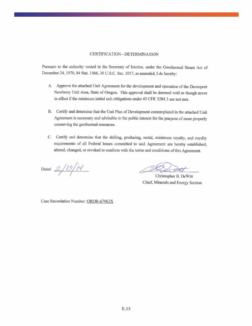
E.12 Unit Agreement Approval Letter and Unit Map
Below is a copy of the Agreement dated February 19, 2014, which specifies the geothermal leases that are now under the unified control of DNH.

E.12
E.13

E.14
![Inventory of Shellfish Restoration Permitting & …masglp.olemiss.edu › projects › files › tnc-report.pdf! 8!! • LeasingforRestoration:!Alabamadoesnothavespecificprovisionsforleasingstate]](https://static.fdocuments.us/doc/165x107/5f0b9f067e708231d431682b/inventory-of-shellfish-restoration-permitting-a-projects-a-files-a-tnc-reportpdf.jpg)