
Appendix B: Existing Plans and Policies Review B
16
B Appendix B: Existing Plans and Policies Review
Transcript of Appendix B: Existing Plans and Policies Review B

BAppendix B: Existing Plans and Policies Review
Appendix B: Existing Plans and Policy Review 67
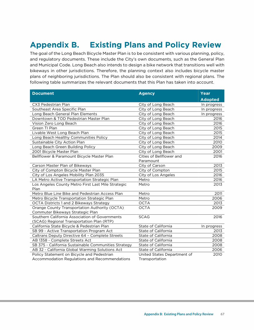
Appendix B. Existing Plans and Policy Review The goal of the Long Beach Bicycle Master Plan is to be consistent with various planning, policy, and regulatory documents. These include the City’s own documents, such as the General Plan and Municipal Code. Long Beach also intends to design a bike network that transitions well with bikeways in other jurisdictions. Therefore, the planning context also includes bicycle master plans of neighboring jurisdictions. The Plan should also be consistent with regional plans. The following table summarizes the relevant documents that this Plan has taken into account.
Document Agency Year Adopted
CX3 Pedestrian Plan City of Long Beach In progress Southeast Area Specific Plan City of Long Beach In progress Long Beach General Plan Elements City of Long Beach In progress Downtown & TOD Pedestrian Master Plan City of Long Beach 2016 Vision Zero Long Beach City of Long Beach 2016 Green TI Plan City of Long Beach 2015 Livable West Long Beach Plan City of Long Beach 2015 Long Beach Healthy Communities Policy City of Long Beach 2014 Sustainable City Action Plan City of Long Beach 2010 Long Beach Green Building Policy City of Long Beach 2009 2001 Bicycle Master Plan City of Long Beach 2001 Bellflower & Paramount Bicycle Master Plan Cities of Bellflower and
Paramount 2016
Carson Master Plan of Bikeways City of Carson 2013 City of Compton Bicycle Master Plan City of Compton 2015 City of Los Angeles Mobility Plan 2035 City of Los Angeles 2016 LA Metro Active Transportation Strategic Plan Metro 2016 Los Angeles County Metro First Last Mile Strategic Plan
Metro 2013
Metro Blue Line Bike and Pedestrian Access Plan Metro 2011 Metro Bicycle Transportation Strategic Plan Metro 2006 OCTA Districts 1 and 2 Bikeways Strategy OCTA 2013 Orange County Transportation Authority (OCTA) Commuter Bikeways Strategic Plan
OCTA 2009
Southern California Association of Governments (SCAG) Regional Transportation Plan (RTP)
SCAG 2016
California State Bicycle & Pedestrian Plan State of California In progress SB 99 - Active Transportation Program Act State of California 2013 Caltrans Deputy Directive 64 – Complete Streets State of California 2008 AB 1358 - Complete Streets Act State of California 2008 SB 375 - California Sustainable Communities Strategy State of California 2008 AB 32 - California Global Warming Solutions Act State of California 2006 Policy Statement on Bicycle and Pedestrian Accommodation Regulations and Recommendations
United States Department of Transportation
2010
68 Long Beach Bicycle Master Plan | City of Long Beach
City Documents
CX3 Pedestrian Plan (In progress) The City of Long Beach Department of Health and Human Services Healthy Active Long Beach Program, in collaboration with the City’s Planning Bureau, Public Works Department, and City Fabrick developed the Communities of Excellence in Nutrition, Physical Activity, and Obesity Prevention (CX3) Pedestrian Plan. Eight neighborhoods were assessed in the Central and Downtown area. One key finding from the assessments was the lack of connectivity within the pedestrian environment as it relates to the design and conditions of public infrastructure. This plan provides the tools for improving active transportation accessibility in the eight neighborhoods, promoting healthier lifestyles.
Southeast Area Specific Plan (In Progress) In 2014, Long Beach began the process to develop a specific plan for the Southeast Area. The Southeast Area covers about 1,500 acres and the specific plan takes a fresh look at this area while acknowledging work conducted through previous efforts. The plan maintains valuable natural resources, customizes land uses and development standards, and identifies locations for future development and expanded transportation choices.
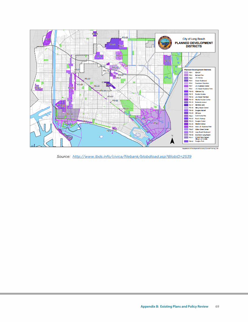
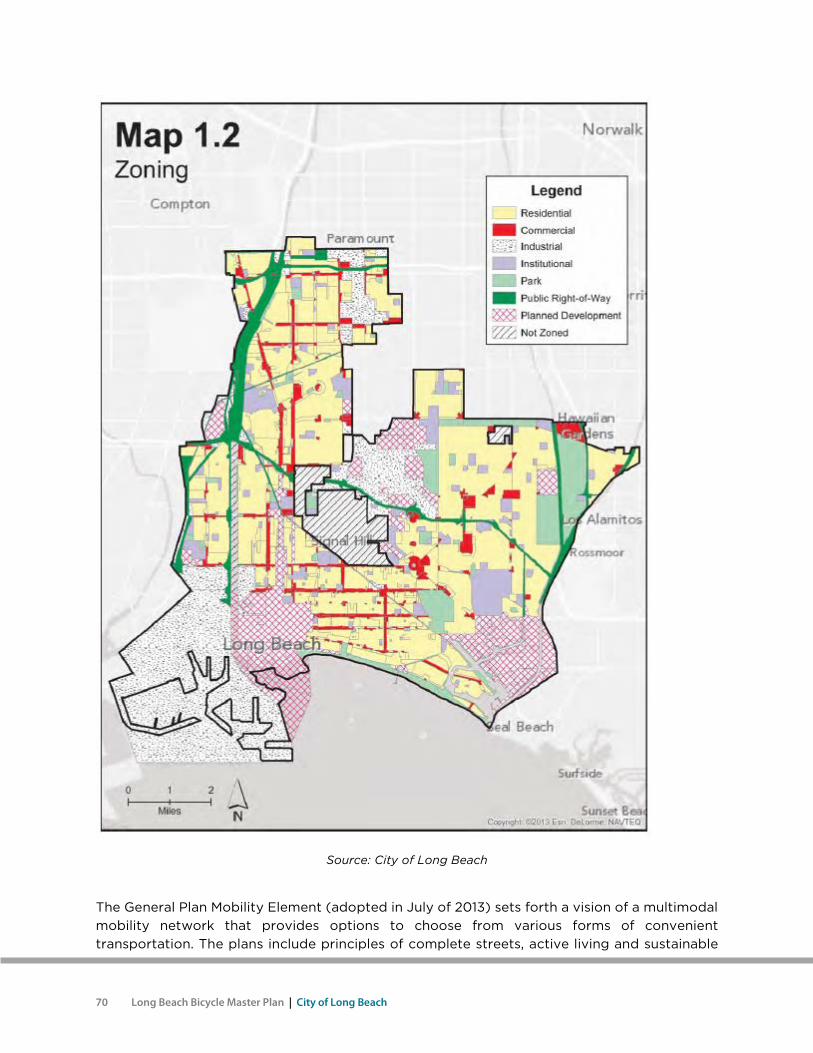
General Plan (In progress) The City’s General Plan Land Use Element calls for functional transportation that will maintain or improve the current ability to move people and goods to and from development centers while preserving and protecting residential neighborhoods. Much of the expected new development will be directed to the following areas:
• Downtown • Downtown Shoreline • Willmore City • Long Beach Boulevard • The Marina • Areas surrounding the Long Beach Airport • Long Beach Business Center • West Long Beach Business Park • Rancho Estates • California State University, Long Beach Tech Center • Atlantic Avenue
This Bicycle Master Plan delineates a network of bikeways that will provide high-priority bikeways to development centers. The following maps illustrate the city’s zoning and where new development will concentrate.
Appendix B: Existing Plans and Policy Review 69
Source: http://www.lbds.info/civica/filebank/blobdload.asp?BlobID=2539
70 Long Beach Bicycle Master Plan | City of Long Beach
Source: City of Long Beach
The General Plan Mobility Element (adopted in July of 2013) sets forth a vision of a multimodal mobility network that provides options to choose from various forms of convenient transportation. The plans include principles of complete streets, active living and sustainable
Appendix B: Existing Plans and Policy Review 71
community design. The Mobility Element contains provisions for better bicycle access and secure bicycle storage. One section of the Mobility Element specifies various means of planning for active transportation and living. Another reiterates the City’s desire to become the most bicycle-friendly city in the United States. A map in the Mobility Element shows the proposed bicycle-priority network. Lastly, it stresses the value of the “5E” (engineering, education, encouragement, enforcement and evaluation) approach to making Long Beach more bicycle-friendly. This Bicycle Master Plan creates the opportunities for reaching the vision and goals in the Mobility Element. Chapter 5 meets the needs for 5E programs. The bikeway system in this Plan contains the bicycle corridors in the Mobility Element.
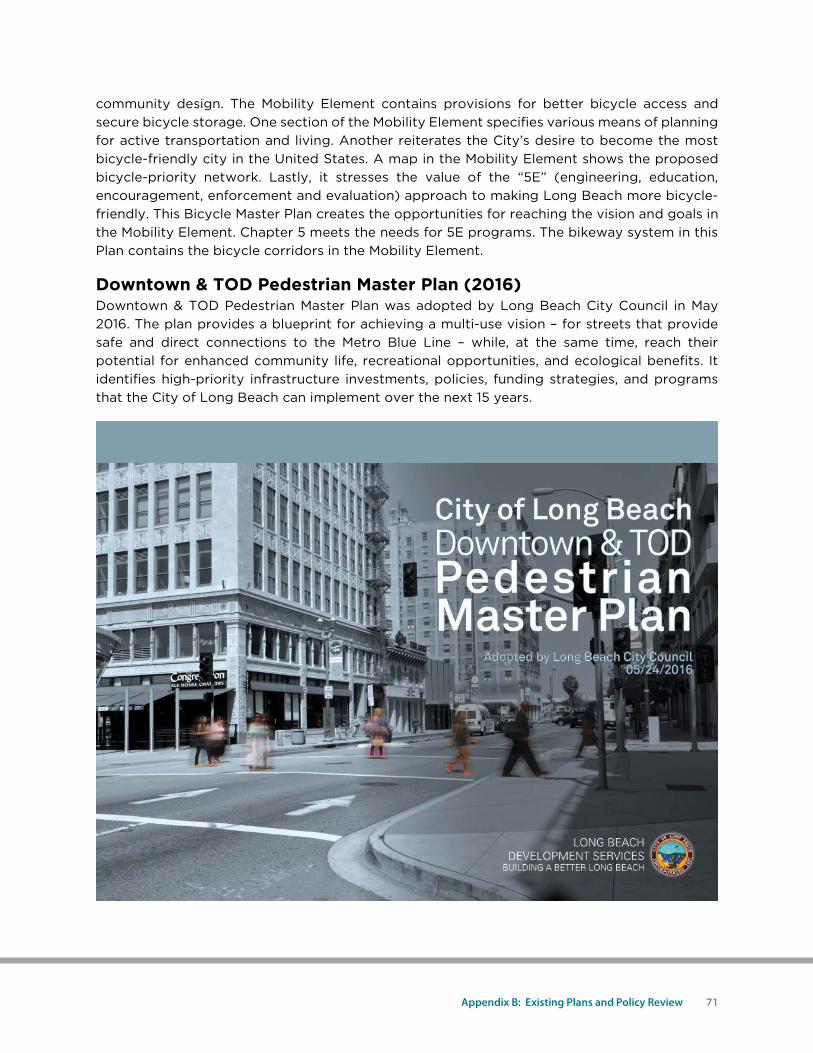
Downtown & TOD Pedestrian Master Plan (2016) Downtown & TOD Pedestrian Master Plan was adopted by Long Beach City Council in May 2016. The plan provides a blueprint for achieving a multi-use vision – for streets that provide safe and direct connections to the Metro Blue Line – while, at the same time, reach their potential for enhanced community life, recreational opportunities, and ecological benefits. It identifies high-priority infrastructure investments, policies, funding strategies, and programs that the City of Long Beach can implement over the next 15 years.
72 Long Beach Bicycle Master Plan | City of Long Beach
Vision Zero Long Beach (2016) On May 24, 2016, Long Beach City Council approved a staff recommendation to become a Vision Zero city with the goal to eliminate traffic fatalities and serious injuries among all road users by 2026. Vision Zero uses a combination of engineering to slow down vehicles and programs to educate all roadway users in order to achieve this goal.
Green TI Plan (2015) The Green Terminal Island (TI) Transition Plan was completed at the end of 2015. The plan looks at the first/last mile of the Terminal Island Freeway, and includes the community vision, preliminary feasibility study, and design concept aimed at transforming the segment of State Route 103 to a local-serving road, while increasing open space and buffering the West Long Beach neighborhood from air, noise, light, and visual pollution.
Livable West Long Beach Plan (2015) The Livable West Long Beach Plan presents a comprehensive plan for achieving the community vision for healthy, vibrant, attractive, and safe neighborhoods. The plan synthesized the various City planning efforts proposed in the previous years and presented them to the community for their input. Based on feedback, the plan prioritizes the projects then identifies funding mechanisms for implementation.
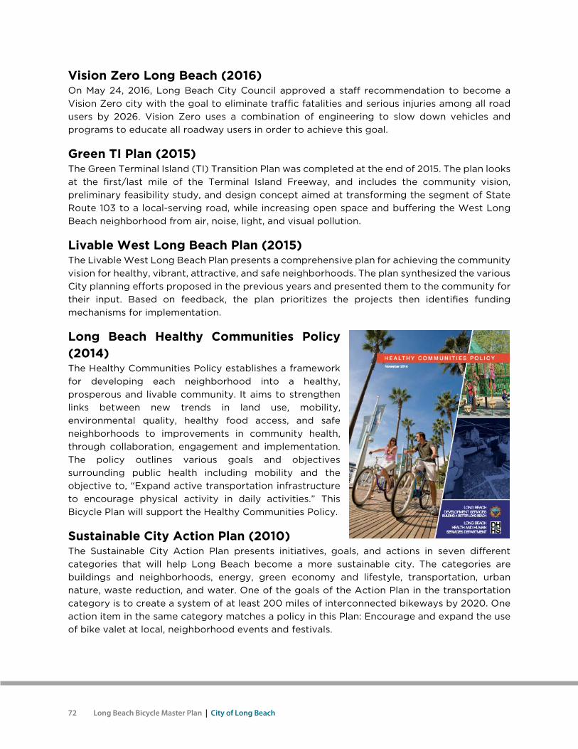
Long Beach Healthy Communities Policy (2014) The Healthy Communities Policy establishes a framework for developing each neighborhood into a healthy, prosperous and livable community. It aims to strengthen links between new trends in land use, mobility, environmental quality, healthy food access, and safe neighborhoods to improvements in community health, through collaboration, engagement and implementation. The policy outlines various goals and objectives surrounding public health including mobility and the objective to, “Expand active transportation infrastructure to encourage physical activity in daily activities.” This Bicycle Plan will support the Healthy Communities Policy.
Sustainable City Action Plan (2010) The Sustainable City Action Plan presents initiatives, goals, and actions in seven different categories that will help Long Beach become a more sustainable city. The categories are buildings and neighborhoods, energy, green economy and lifestyle, transportation, urban nature, waste reduction, and water. One of the goals of the Action Plan in the transportation category is to create a system of at least 200 miles of interconnected bikeways by 2020. One action item in the same category matches a policy in this Plan: Encourage and expand the use of bike valet at local, neighborhood events and festivals.
Appendix B: Existing Plans and Policy Review 73
Long Beach Green Building Policy (2009) By focusing on municipal buildings, the Green Building Policy demonstrates the city’s commitment to environmental, economic, and social stewardship, to cost savings for taxpayers through reduced operating costs, to a healthy work environment for staff and visitors, and to the city’s goals of protecting, conserving, and enhancing the region’s environmental resources. Through the implementation of Green Building Guidelines, new construction, remodel, and tenant improvement projects will help to set a community standard and model of sustainable building.
2001 Bicycle Master Plan (2001) This Plan builds upon the 2001 Bicycle Master Plan with additional bikeways, enhanced bikeways and updates to facility and programmatic recommendations.
Bicycle Plans of Neighboring Cities
Cities of Bellflower & Paramount (2015) The cities of Bellflower and Paramount developed a joint Bike and Trail Master Plan. The Plan proposed bikeways that lead into Long Beach on:
• 70th Street • Ramona Street • Vermont Avenue
This Plan includes bikeways that already link or will link with all of these specific bikeways proposed in Bellflower and Paramount.
City of Carson (2013) The City of Carson Master Plan of Bikeways proposes bikeways that lead into Long Beach on:
• Del Amo Boulevard • Wardlow Road • Compton Creek
This Plan includes bikeways that will link with all of these specific bikeways proposed in Carson.
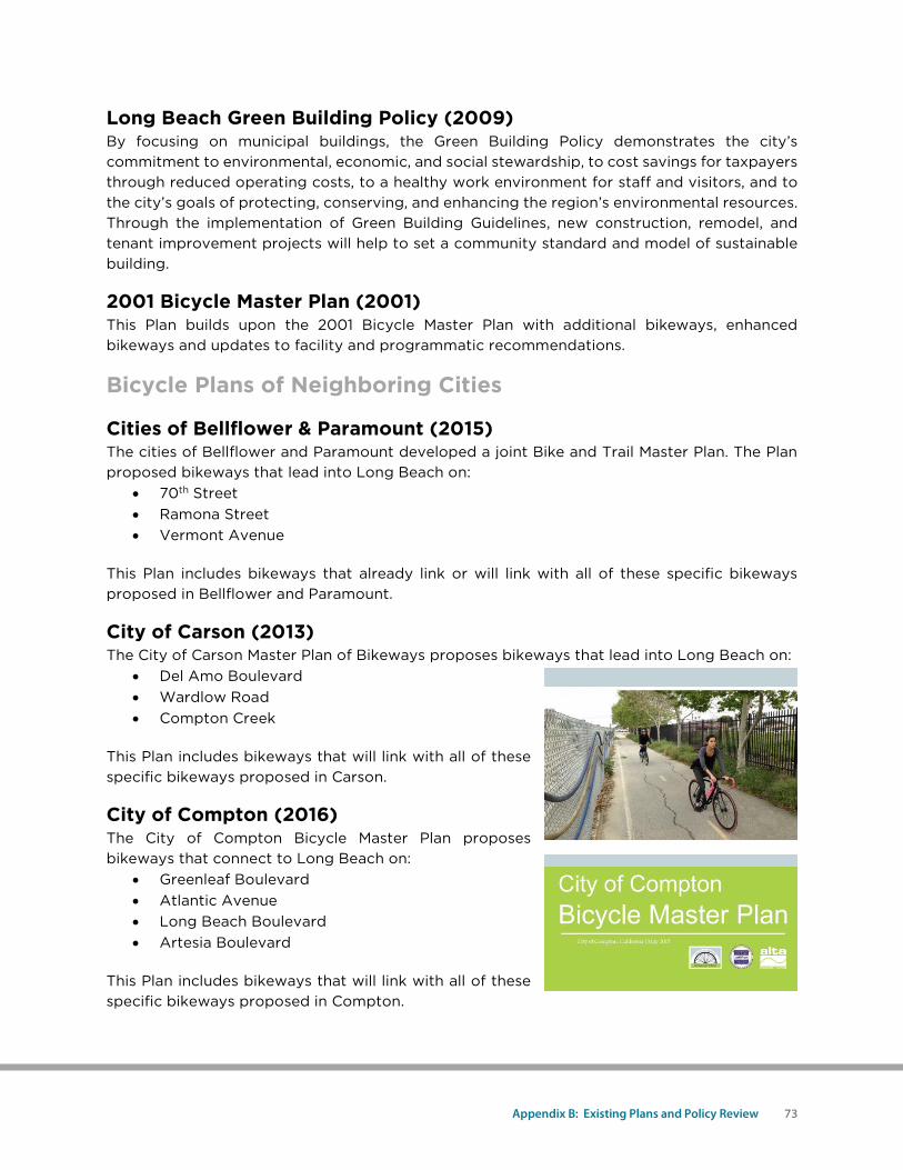
City of Compton (2016) The City of Compton Bicycle Master Plan proposes bikeways that connect to Long Beach on:
• Greenleaf Boulevard • Atlantic Avenue • Long Beach Boulevard • Artesia Boulevard
This Plan includes bikeways that will link with all of these specific bikeways proposed in Compton.
74 Long Beach Bicycle Master Plan | City of Long Beach
City of Los Angeles (2016) The City of Los Angeles Mobility Plan 2035 proposes bikeways that lead into Long Beach on:
• Pacific Coast Highway • Anaheim Street • Vincent Thomas Bridge
This Plan contains bikeways that will link with all of these specific bikeways proposed in Los Angeles.
Regional Plans
Los Angeles Metro Active Transportation Strategic Plan (2016) The Active Transportation Strategic Plan is Metro's county-wide effort to identify strategies to increase walking, bicycling and transit use in Los Angeles County. The Plan focuses on improving first and last mile access to transit and propose a regional network of active transportation facilities, including shared-use paths and on-street bikeways.
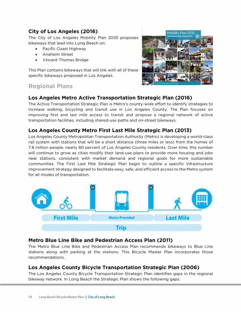
Los Angeles County Metro First Last Mile Strategic Plan (2013) Los Angeles County Metropolitan Transportation Authority (Metro) is developing a world-class rail system with stations that will be a short distance (three miles or less) from the homes of 7.8 million people, nearly 80 percent of Los Angeles County residents. Over time, this number will continue to grow as cities modify their land-use plans to provide more housing and jobs near stations, consistent with market demand and regional goals for more sustainable communities. The First Last Mile Strategic Plan begin to outline a specific infrastructure improvement strategy designed to facilitate easy, safe, and efficient access to the Metro system for all modes of transportation.
Metro Blue Line Bike and Pedestrian Access Plan (2011) The Metro Blue Line Bike and Pedestrian Access Plan recommends bikeways to Blue Line stations along with parking at the stations. This Bicycle Master Plan incorporates those recommendations.
Los Angeles County Bicycle Transportation Strategic Plan (2006) The Los Angeles County Bicycle Transportation Strategic Plan identifies gaps in the regional bikeway network. In Long Beach the Strategic Plan shows the following gaps:
Appendix B: Existing Plans and Policy Review 75
• Connection between the Carson Street Bike Path and Los Angeles River Bike Path • Connection between the beach bike path and Orange County and the San Gabriel River • Connection along Willow Street between the Los Angeles River and the San Gabriel
River • Along Ocean Boulevard between the Harbor bike lanes and the terminus of the Los
Angeles River This Bicycle Master Plan proposes to close all of these gaps.
OCTA Districts 1 and 2 Bikeways Strategy (2013) The Districts 1 and 2 Bikeways Strategy report summarizes the results of a collaborative effort focused on the identification of potential regional bikeways within Orange County’s Supervisorial Districts 1 and 2. The Strategy proposes 11 regional bikeway corridors to the east of Long Beach which connect to existing facilities that lead into Long Beach such as Westminster-Hazard and the Pacific Coast Highway.
Orange County Transportation Authority (OCTA) Commuter Bikeways Strategic Plan (2009) The OCTA Commuter Bikeways Strategic Plan shows two existing or planned bikeways that link with Long Beach bikeways:
• The City of Los Alamitos plans a bikeway along Cerritos Avenue that will connect with a future bike route on Spring Street in Long Beach.
• The City of Seal Beach has bike lanes on Westminster Boulevard that link to the 2nd Street bike lanes in Long Beach.
Southern California Association of Governments (SCAG) Regional Transportation Plan (2016) The SCAG Regional Transportation Plan includes a commitment to reduce transportation-related emissions to comply with California Senate Bill 375. This Plan will help Long Beach contribute to this goal.
State Plans and Policies
California State Bicycle & Pedestrian Plan (In Progress) The California State Bicycle and Pedestrian Plan will be a visionary and comprehensive policy plan to promote a multi-modal transportation system that supports active modes of transportation and creates a framework to increase safe bicycling and walking. The plan will contain:
• The vision, goals, and objectives to guide Caltrans active transportation efforts. • The most promising strategies to achieve the goals and objectives. • Performance measures and data needs to evaluate success. • Recommendations for improved
Caltrans processes. • Safety statistics and a safety
awareness brochure. • Investment strategies.
76 Long Beach Bicycle Master Plan | City of Long Beach
This plan will help Long Beach to work with the local Caltrans office to implement projects on Caltrans right-of-ways.
Senate Bill 99 – Active Transportation Program Act (2013) SB 99 establishes the Active Transportation Program for the state, in accordance with the federal Moving Ahead for Progress in the 21st Century (MAP-21) legislation, to encourage increased use of active modes of transportation and create a mechanism for distributing federal funds to local and regional efforts. The bill includes the following goals for the Active Transportation Program:
• Increase the proportion of trips accomplished by biking and walking. • Increase safety and mobility for nonmotorized users. • Advance the active transportation efforts of regional agencies to achieve greenhouse
gas reduction. • Enhance public health, including reduction of childhood obesity through the use of
programs including, but not limited to, projects eligible for Safe Routes to School Program funding.
• Ensure that disadvantaged communities fully share in the benefits of the program. • Provide a broad spectrum of projects to benefit many types of active transportation
users.
Caltrans Deputy Directive 64 – Complete Streets (2008) In 2001, the California Department of Transportation (Caltrans) adopted Deputy Directive 64, “Accommodating Non-Motorized Travel,” which contained a routine accommodation policy. The directive was updated in 2008 as “Complete Streets – Integrating the Transportation System.” The new policy includes the following language:
The Department views all transportation improvements as opportunities to improve safety, access, and mobility for all travelers in California and recognizes bicycle, pedestrian, and transit modes as integral elements of the transportation system.
The Department develops integrated multimodal projects in balance with community goals, plans, and values. Addressing the safety and mobility needs of bicyclists, pedestrians, and transit users in all projects, regardless of funding, is implicit in these objectives. Bicycle, pedestrian and transit travel is facilitated by creating “complete streets” beginning early in system planning and continuing through project delivery and maintenance operations.
The directive establishes Caltrans’ own responsibilities under this policy. The responsibilities Caltrans assigns to various staff positions under the policy include the following:
• Ensure bicycle, pedestrian, and transit interests are appropriately represented on interdisciplinary planning and project delivery development teams.
• Ensure bicycle, pedestrian, and transit user needs are addressed and deficiencies identifies during system and corridor planning, project initiation, scoping, and programming.
• Ensure incorporation of bicycle, pedestrian, and transit travel elements in all Department transportation plans and studies.
• Promote land uses that encourage bicycle, pedestrian, and transit travel. • Research, develop, and implement multimodal performance measures.
Appendix B: Existing Plans and Policy Review 77
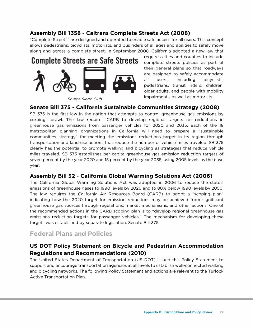
Assembly Bill 1358 - Caltrans Complete Streets Act (2008) “Complete Streets” are designed and operated to enable safe access for all users. This concept allows pedestrians, bicyclists, motorists, and bus riders of all ages and abilities to safely move along and across a complete street. In September 2008, California adopted a new law that
requires cities and counties to include complete streets policies as part of their general plans so that roadways are designed to safely accommodate all users, including bicyclists, pedestrians, transit riders, children, older adults, and people with mobility impairments, as well as motorists.
Senate Bill 375 - California Sustainable Communities Strategy (2008) SB 375 is the first law in the nation that attempts to control greenhouse gas emissions by curbing sprawl. The law requires CARB to develop regional targets for reductions in greenhouse gas emissions from passenger vehicles for 2020 and 2035. Each of the 18 metropolitan planning organizations in California will need to prepare a “sustainable communities strategy” for meeting the emissions reductions target in its region through transportation and land use actions that reduce the number of vehicle miles traveled. SB 375 clearly has the potential to promote walking and bicycling as strategies that reduce vehicle miles traveled. SB 375 establishes per-capita greenhouse gas emission reduction targets of seven percent by the year 2020 and 15 percent by the year 2035, using 2005 levels as the base year.
Assembly Bill 32 - California Global Warming Solutions Act (2006) The California Global Warming Solutions Act was adopted in 2006 to reduce the state’s emissions of greenhouse gases to 1990 levels by 2020 and to 80% below 1990 levels by 2050. The law requires the California Air Resources Board (CARB) to adopt a “scoping plan” indicating how the 2020 target for emission reductions may be achieved from significant greenhouse gas sources through regulations, market mechanisms, and other actions. One of the recommended actions in the CARB scoping plan is to “develop regional greenhouse gas emissions reduction targets for passenger vehicles.” The mechanism for developing these targets was established by separate legislation, Senate Bill 375.
Federal Plans and Policies
US DOT Policy Statement on Bicycle and Pedestrian Accommodation Regulations and Recommendations (2010) The United States Department of Transportation (US DOT) issued this Policy Statement to support and encourage transportation agencies at all levels to establish well-connected walking and bicycling networks. The following Policy Statement and actions are relevant to the Turlock Active Transportation Plan.
Source Sierra Club
78 Long Beach Bicycle Master Plan | City of Long Beach
Policy Statement The DOT policy is to incorporate safe and convenient walking and bicycling facilities into transportation projects. Every transportation agency, including DOT, has the responsibility to improve conditions and opportunities for walking and bicycling and to integrate walking and bicycling into their transportation systems. Because of the numerous individual and community benefits that walking and bicycling provide – including health, safety, environmental, transportation, and quality of life – transportation agencies are encouraged to go beyond minimum standards to provide safe and convenient facilities for these modes.
Recommended Actions The DOT encourages States, local governments, professional associations, community organizations, public transportation agencies, and other government agencies, to adopt similar policy statements on bicycle and pedestrian accommodation as an indication of their commitment to accommodating bicyclists and pedestrians as an integral element of the transportation system. In support of this commitment, transportation agencies and local communities should go beyond minimum design standards and requirements to create safe, attractive, sustainable, accessible, and convenient bicycling and walking networks. Such actions should include:
• Considering walking and bicycling as equals with other transportation modes: The primary goal of a transportation system is to safely and efficiently move people and goods. Walking and bicycling are efficient transportation modes for most short trips and, where convenient intermodal systems exist, these nonmotorized trips can easily be linked with transit to significantly increase trip distance. Because of the benefits they provide, transportation agencies should give the same priority to walking and bicycling as is given to other transportation modes. Walking and bicycling should not be an afterthought in roadway design.
• Ensuring that there are transportation choices for people of all ages and abilities, especially children: Pedestrian and bicycle facilities should meet accessibility requirements and provide safe, convenient, and interconnected transportation networks. For example, children should have safe and convenient options for walking or bicycling to school and parks. People who cannot or prefer not to drive should have safe and efficient transportation choices.
• Going beyond minimum design standards: Transportation agencies are encouraged, when possible, to avoid designing walking and bicycling facilities to the minimum standards. For example, shared-use paths that have been designed to minimum width requirements will need retrofits as more people use them. It is more effective to plan for increased usage than to retrofit an older facility. Planning projects for the long-term should anticipate likely future demand for bicycling and walking facilities and not preclude the provision of future improvements.
• Integrating bicycle and pedestrian accommodation on new, rehabilitated, and limited-access bridges: DOT encourages bicycle and pedestrian accommodation on bridge projects including facilities on limited-access bridges with connections to streets or paths.
• Collecting data on walking and biking trips: The best way to improve transportation networks for any mode is to collect and analyze trip data to optimize investments. Walking and bicycling trip data for many communities are lacking. This data gap can be overcome by establishing routine collection of nonmotorized trip information.
Appendix B: Existing Plans and Policy Review 79
Communities that routinely collect walking and bicycling data are able to track trends and prioritize investments to ensure the success of new facilities. These data are also valuable in linking walking and bicycling with transit.
• Setting mode share targets for walking and bicycling and tracking them over time: A byproduct of improved data collection is that communities can establish targets for increasing the percentage of trips made by walking and bicycling.
Improving nonmotorized facilities during maintenance projects: Many transportation agencies spend most of their transportation funding on maintenance rather than on constructing new facilities. Transportation agencies should find ways to make facility improvements for pedestrians and bicyclists during resurfacing and other maintenance projects.
Corridor Investment Projects
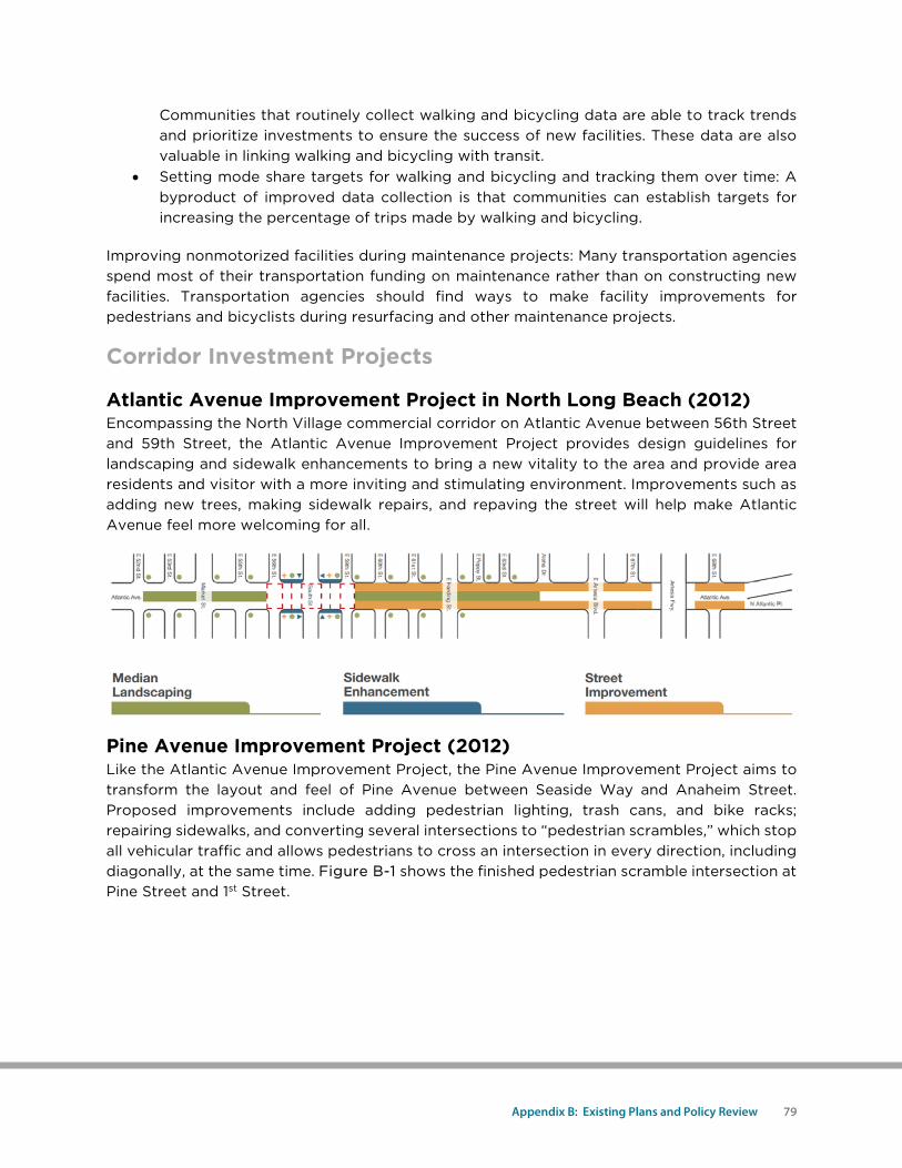
Atlantic Avenue Improvement Project in North Long Beach (2012) Encompassing the North Village commercial corridor on Atlantic Avenue between 56th Street and 59th Street, the Atlantic Avenue Improvement Project provides design guidelines for landscaping and sidewalk enhancements to bring a new vitality to the area and provide area residents and visitor with a more inviting and stimulating environment. Improvements such as adding new trees, making sidewalk repairs, and repaving the street will help make Atlantic Avenue feel more welcoming for all.
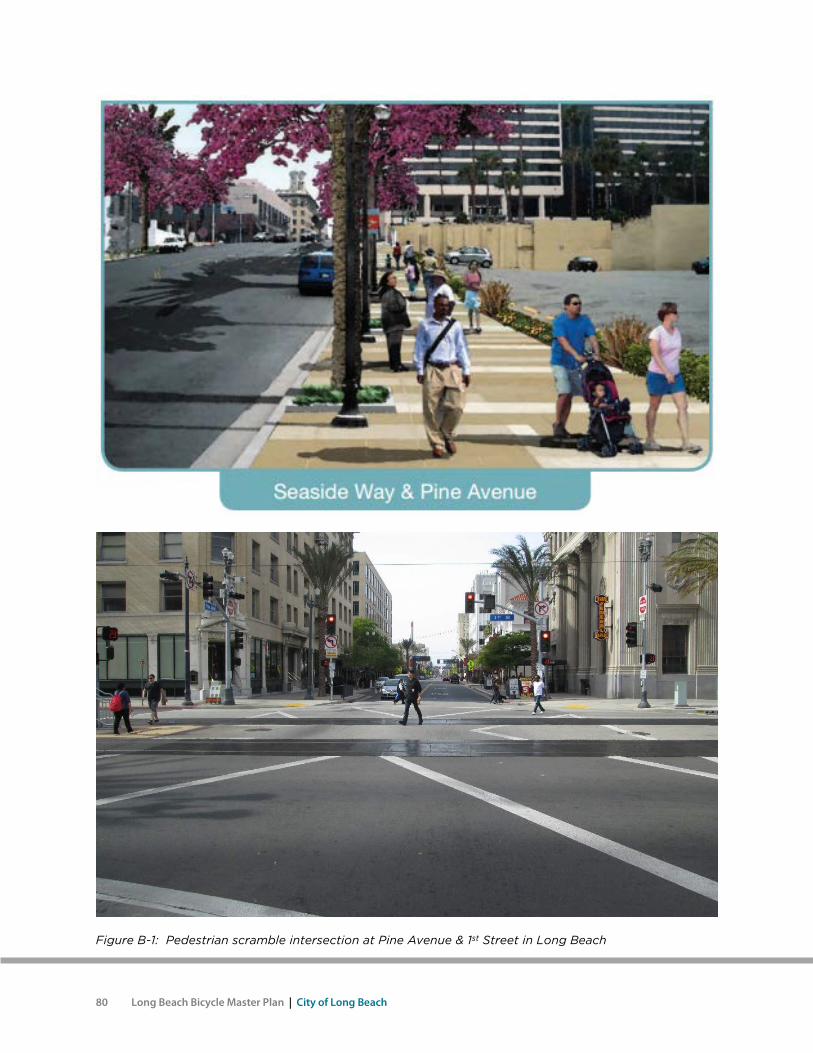
Pine Avenue Improvement Project (2012) Like the Atlantic Avenue Improvement Project, the Pine Avenue Improvement Project aims to transform the layout and feel of Pine Avenue between Seaside Way and Anaheim Street. Proposed improvements include adding pedestrian lighting, trash cans, and bike racks; repairing sidewalks, and converting several intersections to “pedestrian scrambles,” which stop all vehicular traffic and allows pedestrians to cross an intersection in every direction, including diagonally, at the same time. Figure B-1 shows the finished pedestrian scramble intersection at Pine Street and 1st Street.
80 Long Beach Bicycle Master Plan | City of Long Beach
Figure B-1: Pedestrian scramble intersection at Pine Avenue & 1st Street in Long Beach
Appendix B: Existing Plans and Policy Review 81
This page intentionally left blank.


