APPENDIX ‘A’ GEOTECHNICAL REPORT - Winnipeg€¦ · APPENDIX ‘A’ - GEOTECHNICAL REPORT ......
13
The City of Winnipeg Bid Opportunity No. 439-2011 Template Version: C420110107 - RW APPENDIX ‘A’ GEOTECHNICAL REPORT
Transcript of APPENDIX ‘A’ GEOTECHNICAL REPORT - Winnipeg€¦ · APPENDIX ‘A’ - GEOTECHNICAL REPORT ......

The City of Winnipeg Bid Opportunity No. 439-2011 Template Version: C420110107 - RW
APPENDIX ‘A’
GEOTECHNICAL REPORT

The City of Winnipeg Appendix ‘A’ Bid Opportunity No. 439-2011 Page 1 of 1 Template Version: C420110107 - RW
APPENDIX ‘A’ - GEOTECHNICAL REPORT GEOTECHNICAL REPORT FOR: i) Furby Place
The geotechnical report is provided to aid in the Contractor’s evaluation of the existing pavement structure and/or soil conditions. The information presented is considered accurate at the locations shown on the Drawings and at the time of drilling. However, variations in pavement structure and/or soil conditions may exist between test holes and fluctuations in groundwater levels can be expected seasonally and may occur as a result of construction activities. The nature and extent of variations may not become evident until construction commences.

GEOTECHNICAL INVESTIGATION FURBY PLACE RECONSTRUCTION
WINNIPEG, MANITOBA
Submitted to:
City of Winnipeg Engineering Technology Services
106 – 1155 Pacific Avenue Winnipeg, Manitoba
R3E 3P1
Attention: Mr. Brent Kellett
Submitted by:
AMEC Earth & Environmental A Division of AMEC Americas Limited
440 Dovercourt Drive Winnipeg, Manitoba
R3Y 1N4
16 March 2009
AMEC File No. WX10364.5001

Geotechnical Investigation Proposed COW Street Reconstruction Furby Place Winnipeg, Manitoba
P:\Jobs\10300's\10360x's\10364 COW Street Coring\10364.5001 Furby Place\10364.5001-Report revised.doc Page i
TABLE OF CONTENTS
PAGE
1.0 INTRODUCTION.............................................................................................................1
2.0 SITE CONDITIONS.........................................................................................................1
3.0 FIELD INVESTIGATON ..................................................................................................1
4.0 LABORATORY TESTING ...............................................................................................2
5.0 SUBSURFACE CONDITIONS ........................................................................................2
6.0 CLOSURE.......................................................................................................................3
LIST OF TABLES Table 1: Pavement and Soil Thickness (mm)..............................................................................3 Table 2: Lab Test Results ...........................................................................................................3
LIST OF FIGURES Figures 1 Test Hole Location Plan Figures 2 to 4 Test Hole Logs
LIST OF APPENDICES Appendix A Test Hole Location Plans and Test Hole Logs

Geotechnical Investigation Proposed COW Street Reconstruction Furby Place Winnipeg, Manitoba
P:\Jobs\10300's\10360x's\10364 COW Street Coring\10364.5001 Furby Place\10364.5001-Report revised.doc Page 1
1.0 INTRODUCTION
AMEC Earth and Environmental, a division of AMEC Americas Limited (AMEC), were retained by the City of Winnipeg (COW) to conduct a geotechnical investigation for a proposed street upgrading project in Winnipeg, Manitoba. The location of the project is Furby Place, approximately between Furby Street and Langside Street. The purpose of the investigation was to determine the soil profile at locations along Furby Place.
2.0 SITE CONDITIONS
The roadway consisted of asphalt pavement overlying a base structure. At the time of the investigation, the roadway was snow and ice covered and therefore a detailed review of the pavement condition was not possible. Typical of roads in the Winnipeg area, the road was generally flat lying and level, with local slopes between catch basins to facilitate drainage.
3.0 FIELD INVESTIGATON
The COW requested a total of 3 test holes. Initially the 3 test hole locations were determined by COW however due to the location of utilities AMEC revised their location accordingly. On 12 February 2009, following utility clearances, all test holes were drilled on the roadway, using a truck mounted Mobile B40LX drill rig operated by Maple Leaf Drilling Ltd. of Winnipeg, and equipped with 125 mm continuous flight solid stem augers. Typically the asphalt encountered would have been cored prior to test hole drilling however the COW informed AMEC that the street was gravel surfaced. Therefore in order to avoid costs associated with drill rig mobilization and standby charges, drilling proceeded without coring. The test hole locations are shown on Figure 1 in Appendix A. Test hole logging, subcontractor supervision and temporary traffic control was provided on a full time basis by Mr. Blair Power of AMEC. All soils observed during test hole drilling were visually classified on site according to the Modified Unified Soil Classification System (MUSCS) and in accordance with the City of Winnipeg geotechnical guidelines. Groundwater and drilling conditions, as well as any pertinent subsurface observations, were also recorded at the time of the investigation. Disturbed soil samples were taken at regular intervals from the auger flights in each test hole. All soil samples obtained during the field investigation were labelled, sealed in plastic bags to limit moisture loss and transported to AMEC's Soils Laboratory in Winnipeg for further examination and testing. The test hole logs are presented in Appendix A, Figures 2 to 4 and show the soil profile, results of the field and laboratory testing, and comments relative to groundwater and sloughing conditions encountered.
Geotechnical Investigation Proposed COW Street Reconstruction Furby Place Winnipeg, Manitoba
P:\Jobs\10300's\10360x's\10364 COW Street Coring\10364.5001 Furby Place\10364.5001-Report revised.doc Page 2
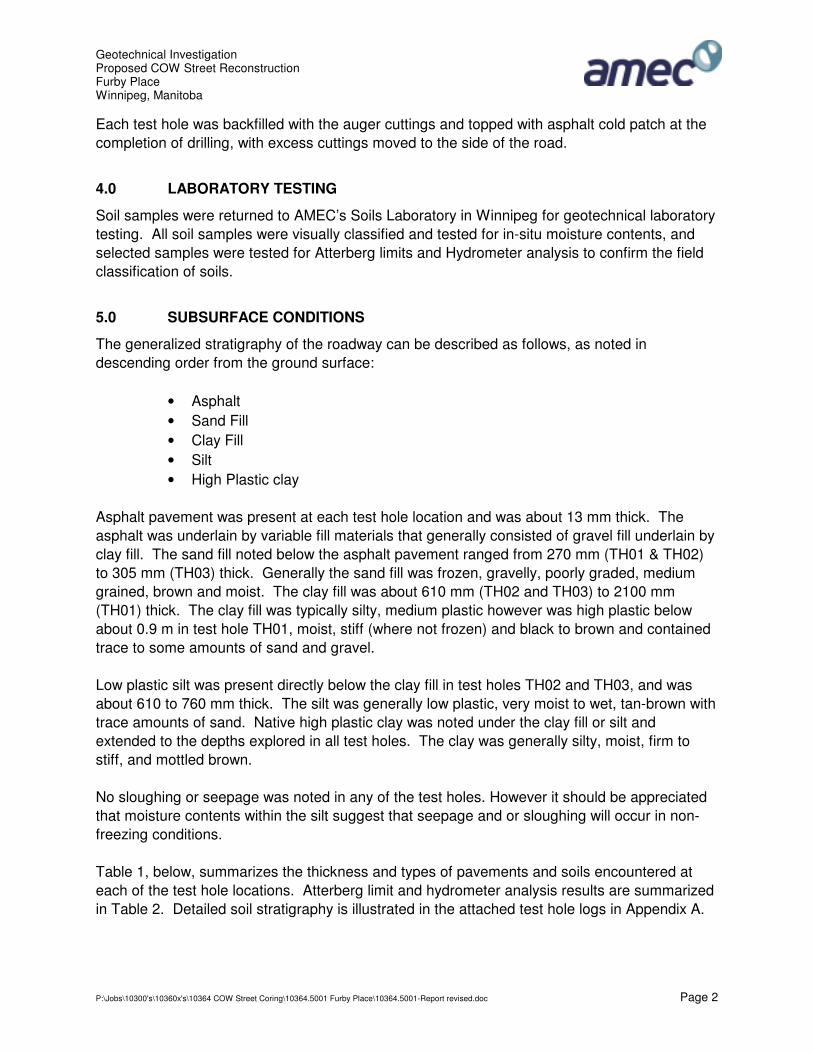
Each test hole was backfilled with the auger cuttings and topped with asphalt cold patch at the completion of drilling, with excess cuttings moved to the side of the road.
4.0 LABORATORY TESTING
Soil samples were returned to AMEC’s Soils Laboratory in Winnipeg for geotechnical laboratory testing. All soil samples were visually classified and tested for in-situ moisture contents, and selected samples were tested for Atterberg limits and Hydrometer analysis to confirm the field classification of soils.
5.0 SUBSURFACE CONDITIONS
The generalized stratigraphy of the roadway can be described as follows, as noted in descending order from the ground surface:
• Asphalt • Sand Fill • Clay Fill • Silt • High Plastic clay
Asphalt pavement was present at each test hole location and was about 13 mm thick. The asphalt was underlain by variable fill materials that generally consisted of gravel fill underlain by clay fill. The sand fill noted below the asphalt pavement ranged from 270 mm (TH01 & TH02) to 305 mm (TH03) thick. Generally the sand fill was frozen, gravelly, poorly graded, medium grained, brown and moist. The clay fill was about 610 mm (TH02 and TH03) to 2100 mm (TH01) thick. The clay fill was typically silty, medium plastic however was high plastic below about 0.9 m in test hole TH01, moist, stiff (where not frozen) and black to brown and contained trace to some amounts of sand and gravel. Low plastic silt was present directly below the clay fill in test holes TH02 and TH03, and was about 610 to 760 mm thick. The silt was generally low plastic, very moist to wet, tan-brown with trace amounts of sand. Native high plastic clay was noted under the clay fill or silt and extended to the depths explored in all test holes. The clay was generally silty, moist, firm to stiff, and mottled brown. No sloughing or seepage was noted in any of the test holes. However it should be appreciated that moisture contents within the silt suggest that seepage and or sloughing will occur in non-freezing conditions. Table 1, below, summarizes the thickness and types of pavements and soils encountered at each of the test hole locations. Atterberg limit and hydrometer analysis results are summarized in Table 2. Detailed soil stratigraphy is illustrated in the attached test hole logs in Appendix A.

Geotechnical Investigation Proposed COW Street Reconstruction Furby Place Winnipeg, Manitoba
P:\Jobs\10300's\10360x's\10364 COW Street Coring\10364.5001 Furby Place\10364.5001-Report revised.doc Page 3
Table 1: Pavement and Soil Thickness (mm)
Test Hole No. TH01 TH02 TH03
Asphalt 13 13 13
Fill – Sand 280 280 305
Fill – Clay 2160 635 610
Silt N/A 760 610
Clay 610 1370 1520
Table 2: Lab Test Results
Atterberg Limits Hydrometer Analysis Test Hole No.
Sample Depth
(m)
Moisture Content
(%) Liquid Limit
Plastic Limit
Plasticity Index
MUSCS Classification
Gravel
(%)
Sand
(%)
Silt
(%)
Clay
(%)
TH01 1.1 43 82 25 57 CH (Clay) 0 3 24 73
TH02 1.1 26 27 15 12 CL (Silt) 0 9 70 21
TH03 1.8 37 70 21 49 CH (Clay) 0 4 31 65
6.0 CLOSURE
The findings of this report were based on the results of field and laboratory investigations at test hole locations as selected by AMEC. The site investigation was conducted for the sole purpose of providing subsurface conditions. Although no environmental issues were identified during the fieldwork, this does not indicate that no such issues exist. If the owner or other parties have any concern regarding the presence of environmental issues, then an appropriate level environmental assessment should be conducted. Soil conditions, by their nature, can be highly variable across a site. The placement of fill and prior construction activities on a site can contribute to the variability especially near surface soil conditions. A contingency should always be included in any construction budget to allow for the possibility of variation in soil conditions, which may result in modification of any potential design and construction procedures which may arise from this factual investigative report.

Geotechnical Investigation Proposed COW Street Reconstruction Furby Place Winnipeg, Manitoba
P:\Jobs\10300's\10360x's\10364 COW Street Coring\10364.5001 Furby Place\10364.5001-Report revised.doc Page 4
This report was prepared exclusively for the City of Winnipeg, and their agents for the proposed development as described in the report. The data provided herein are presented in a factual manner only with no engineering interpretation provided, and should not be used for any other purpose, or by any other parties, without review and advice from a qualified geotechnical engineer. No other warranty, expressed or implied, is given. Yours truly, AMEC Earth & Environmental Reviewed By: _____________________ _____________________ Blair Power, CET Trevor Gluck, P. Eng. Geotechnical Technologist Staff Geotechnical Engineer

Geotechnical Investigation Proposed COW Street Reconstruction Furby Place Winnipeg, Manitoba
P:\Jobs\10300's\10360x's\10364 COW Street Coring\10364.5001 Furby Place\10364.5001-Report revised.doc
APPENDIX A
TEST HOLE LOCATION PLANS AND TEST HOLE LOGS


ASPHALT (13mm thick)SAND (FILL) - gravel1y, poorly graded, medium grained, frozen, moist,brown, some silt, trace clay
CLAY (FILL) - silty, medium plastic, moist, frozen, blackish brown,some sand and gravel to 0.6m
- black, some cinders from 0.6m to 0.9m
CLAY (FILL) - silty, high plastic, moist, brown, occasional silt inclusionsand wood pieces
- frozen to 1.4m- stiff below 1.4m
CLAY - silty, high plastic, moist, firm, mottled brown
TEST HOLE TERMINANTED AT 3.1m BELOW EXISTING GROUNDSURFACENOTES:No sloughing or seepage encountered during drilling. Test holeremained open to 3.1m below grade after completion of drilling. Testhole backfilled auger cuttings.
Hydrometer Analysis ResultsSample #4 (1.1m)Gravel = 0%Sand = 3%Silt = 24%Clay = 73%
SP
CI
CH
CH
1
2
3
4
5
6
7
8
9
4
SOIL
SYMB
OL
COMMENTS
Core
LOGGED BY: BPREVIEWED BY: TGFigure No.
Depth
(m)
200
Shelby Tube
80
SOILDESCRIPTION
Drill Cuttings Grout
POCKET PENETROMETER (kPa)
Depth
(m)
SAMPLE TYPE
60
Page 1 of 1
SandBACKFILL TYPESPT (N)
UNCONFINED COMPRESSION (kPa) 100 200 300 400
PLASTIC M.C. LIQUID
SloughNo Recovery
Bentonite
40
Grab Sample
Pea Gravel
Split-Pen
100 200 300 400
1
2
3
1
2
3
COMPLETION DEPTH: 3.1 mCOMPLETION DATE: February 12, 2009
PROJECT: Furby PlaceCLIENT: City Of WinnipegLOCATION: Winnipeg, MB
DRILLED BY: Maple Leaf EnterprisesDRILL TYPE: B-40DRILL METHOD: 125mm
BORE HOLE NO: TH01PROJECT NO: WX10364.5001ELEVATION:
1036
4 FU
RB
Y P
LAC
E.G
PJ
09/
03/1
6 03
:00
PM
(G
EO
TEC
HN
ICA
L)
AMEC Earth and EnvironmentalWinnipeg, Manitoba
MUSC
S
SAMP
LE T
YPE
SPT
(N)
SAMP
LE N
O

ASPHALT (13mm thick)SAND (FILL) - gravelly, poorly graded, medium grained, frozen, moist,brown, some silt
CLAY (FILL) - silty, medium plastic, moist, frozen, black, trace to somesand and gravel
SILT - clayey, low plastic, very moist to wet, frozen, tan-brown, tracesand
CLAY - silty, high plastic, moist, mottled brown
- frozen to 1.8m- stiff below 1.8m
- firm below 2.6m- silt lens at 2.6m
TEST HOLE TERMINANTED AT 3.1m BELOW EXISTING GROUNDSURFACENOTES:No sloughing or seepage encountered during drilling. Test holeremained open to 3.1m below grade after completion of drilling. Testhole backfilled auger cuttings.
Hydrometer Analysis ResultsSample #4 (1.1m)Gravel = 0%Sand = 9%Silt = 70%Clay = 21%
SP
CI
CL
CH
1
2
3
4
5
6
7
8
9
4
SOIL
SYMB
OL
COMMENTS
Core
LOGGED BY: BPREVIEWED BY: TGFigure No.
Depth
(m)
200
Shelby Tube
80
SOILDESCRIPTION
Drill Cuttings Grout
POCKET PENETROMETER (kPa)
Depth
(m)
SAMPLE TYPE
60
Page 1 of 1
SandBACKFILL TYPESPT (N)
UNCONFINED COMPRESSION (kPa) 100 200 300 400
PLASTIC M.C. LIQUID
SloughNo Recovery
Bentonite
40
Grab Sample
Pea Gravel
Split-Pen
100 200 300 400
1
2
3
1
2
3
COMPLETION DEPTH: 3.1 mCOMPLETION DATE: February 12, 2009
PROJECT: Furby PlaceCLIENT: City Of WinnipegLOCATION: Winnipeg, MB
DRILLED BY: Maple Leaf EnterprisesDRILL TYPE: B-40DRILL METHOD: 125mm
BORE HOLE NO: TH02PROJECT NO: WX10364.5001ELEVATION:
1036
4 FU
RB
Y P
LAC
E.G
PJ
09/
03/1
6 03
:00
PM
(G
EO
TEC
HN
ICA
L)
AMEC Earth and EnvironmentalWinnipeg, Manitoba
MUSC
S
SAMP
LE T
YPE
SPT
(N)
SAMP
LE N
O

ASPHALT (13mm thick)SAND (FILL) - gravelly, poorly graded, medium grained, frozen, moist,brown
CLAY (FILL) - silty, medium plastic, moist, frozen, black, trace to somesand
SILT - low plastic, very moist, frozen, tan-brown, trace sand
CLAY - silty, high plastic, moist, mottled brown
- frozen to 2.1m- stiff below 2.1m
TEST HOLE TERMINANTED AT 3.1m BELOW EXISTING GROUNDSURFACENOTES:No sloughing or seepage encountered during drilling. Test holeremained open to 3.1m below grade after completion of drilling. Testhole backfilled auger cuttings.
Hydrometer Analysis ResultsSample #6 (1.8m)Gravel = 0%Sand = 4%Silt = 31%Clay = 65%
SP
CI
ML
CH
1
2
3
4
5
6
7
8
9
4
SOIL
SYMB
OL
COMMENTS
Core
LOGGED BY: BPREVIEWED BY: TGFigure No.
Depth
(m)
200
Shelby Tube
80
SOILDESCRIPTION
Drill Cuttings Grout
POCKET PENETROMETER (kPa)
Depth
(m)
SAMPLE TYPE
60
Page 1 of 1
SandBACKFILL TYPESPT (N)
UNCONFINED COMPRESSION (kPa) 100 200 300 400
PLASTIC M.C. LIQUID
SloughNo Recovery
Bentonite
40
Grab Sample
Pea Gravel
Split-Pen
100 200 300 400
1
2
3
1
2
3
COMPLETION DEPTH: 3.1 mCOMPLETION DATE: February 12, 2009
PROJECT: Furby PlaceCLIENT: City Of WinnipegLOCATION: Winnipeg, MB
DRILLED BY: Maple Leaf EnterprisesDRILL TYPE: B-40DRILL METHOD: 125mm
BORE HOLE NO: TH03PROJECT NO: WX10364.5001ELEVATION:
1036
4 FU
RB
Y P
LAC
E.G
PJ
09/
03/1
6 03
:00
PM
(G
EO
TEC
HN
ICA
L)
AMEC Earth and EnvironmentalWinnipeg, Manitoba
MUSC
S
SAMP
LE T
YPE
SPT
(N)
SAMP
LE N
O