Appendix 4. Biological Resources · Appendix 4. Biological Resources ... 4.2.1 Habitat Evaluation...
96
Appendix 4. Biological Resources 4.1 Biological Resources Technical Report 4.2 Jurisdictional Delineation Report
Transcript of Appendix 4. Biological Resources · Appendix 4. Biological Resources ... 4.2.1 Habitat Evaluation...
Appendix 4. Biological Resources
4.1 Biological Resources Technical Report 4.2 Jurisdictional Delineation Report
Appendix 4.1 Biological Resources Technical Report

Biological Resources Technical Report for the Southern California Edison
El Casco System Project Riverside County, California
Prepared for:
Southern California Edison Corporate Environment, Health and Safety Division
2244 Walnut Grove Avenue, #3A Rosemead, CA 91770
Contact: Maija Benjamins 626/302-3936
Prepared by:
Jones & Stokes 42145 Lyndie Lane, Suite 200
Temecula, CA 92591 Contact: Tricia A. Campbell
951/506-4038
October 2007

Contents
Executive Summary ........................................................................................................ i 1.0 Introduction ........................................................................................................ 1
1.1 Project Description ....................................................................................... 1 1.2 Project Location............................................................................................ 3 1.3 Western Riverside County Multiple Species Habitat Conservation Plan ................................................................................................. 3
1.3.1 Background ...................................................................................... 3 1.3.2 Project Understanding ...................................................................... 4
2.0 Existing Conditions ............................................................................................ 7 2.1 Physical Conditions ...................................................................................... 7 2.2 Vegetation and Natural Communities........................................................... 8 2.3 Wildlife .......................................................................................................... 9
3.0 Riparian-Riverine and Vernal Pool Resources/Jurisdictional Waters ............................................................................................................... 11 3.1 Riparian-Riverine (Jurisdictional Water Features)...................................... 11 3.2 Vernal Pools ............................................................................................... 16
3.2.1 Methods.......................................................................................... 16 3.2.2 Results............................................................................................ 17
3.3 Fairy Shrimp ............................................................................................... 17 3.3.1 Results............................................................................................ 17
4.0 Rare Plant Studies............................................................................................. 19 4.1 Background ................................................................................................ 19
4.1.1 Yucaipa Onion ................................................................................ 20 4.1.2 Many-stemmed Dudleya................................................................. 20 4.1.3 Round-leaved Filaree ..................................................................... 21
4.2 Methods...................................................................................................... 21 4.2.1 Habitat Evaluation .......................................................................... 21 4.2.2 Focused Survey.............................................................................. 22
4.3 Results ........................................................................................................ 23 5.0 Los Angeles Pocket Mouse Focused Studies ................................................ 25
5.1 Background ................................................................................................ 25 5.2 Methods...................................................................................................... 26
5.2.1 Habitat Assessment........................................................................ 26 5.2.2 Focused Trapping........................................................................... 26
5.3 Results ....................................................................................................... 28 6.0 San Bernardino Kangaroo Rat Focused Study .............................................. 31
6.1 Background ................................................................................................ 31 6.2 Methods...................................................................................................... 32 6.3 Results ....................................................................................................... 33

Biological Resources Technical Report for the El Casco System Project
ii
October 2007
J&S 00446.07
7.0 Burrowing Owl Focused Studies ..................................................................... 35 7.1 Background ................................................................................................ 35 7.2 Methods...................................................................................................... 36
7.2.1 Habitat Evaluation .......................................................................... 36 7.2.2 Focused Survey.............................................................................. 36
7.3 Results ....................................................................................................... 38 8.0 Least Bell’s Vireo Focused Studies................................................................. 39
8.1 Background ................................................................................................ 39 8.2 Methods...................................................................................................... 41
8.2.1 Habitat Evaluation .......................................................................... 41 8.2.2 Focused Survey.............................................................................. 41
8.3 Results ....................................................................................................... 42 9.0 Southwestern Willow Flycatcher Focused Studies........................................ 43
9.1 Background ................................................................................................ 43 9.2 Methods...................................................................................................... 45 9.2.1 Habitat Evaluation .......................................................................... 45 9.2.2 Focused Survey.............................................................................. 45 9.3 Results........................................................................................................ 46
10.0 WesternYellow-billed Cuckoo Focused Studies ............................................ 47 10.1 Background ................................................................................................ 47 10.2 Methods...................................................................................................... 48 10.2.1 Habitat Evaluation ........................................................................ 48 10.2.2 Focused Survey............................................................................ 49 10.3 Results........................................................................................................ 49
11.0 Impacts Analysis ............................................................................................... 51 11.1 Construction Impacts............................................................... to be provided 11.2 Operational Impacts ................................................................ to be provided
12.0 Recommendations ....................................................................... to be provided 13.0 Certification ........................................................................................................... 14.0 Literature Cited............................................................................. to be provided Appendix A: Study Area Photographs Appendix B: Floral and Faunal List Appendix C: Floral and Faunal Lists Appendix D: Jurisdictional Delineation for the El Casco System Project Appendix E: Burrowing Owl Survey Details Appendix F: Least Bell’s Vireo, Southwestern Willow Flycatcher, and
Yellow-billed Cuckoo Focused Survey Conditions Appendix G: Determination of Biologically Significant or Superior
Preservation (DBESP)
Biological Resources Technical Report for the El Casco System Project
iii
October 2007
J&S 00446.07
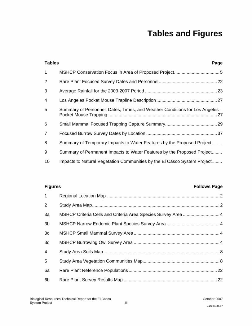
Tables and Figures
Tables Page
1 MSHCP Conservation Focus in Area of Proposed Project.................................... 5
2 Rare Plant Focused Survey Dates and Personnel .............................................. 22
3 Average Rainfall for the 2003-2007 Period ......................................................... 23
4 Los Angeles Pocket Mouse Trapline Description................................................ 27
5 Summary of Personnel, Dates, Times, and Weather Conditions for Los Angeles Pocket Mouse Trapping ...................................................................................... 27
6 Small Mammal Focused Trapping Capture Summary......................................... 29
7 Focused Burrow Survey Dates by Location ........................................................ 37
8 Summary of Temporary Impacts to Water Features by the Proposed Project ........
9 Summary of Permanent Impacts to Water Features by the Proposed Project........
10 Impacts to Natural Vegetation Communities by the El Casco System Project........
Figures Follows Page
1 Regional Location Map ......................................................................................... 2
2 Study Area Map..................................................................................................... 2
3a MSHCP Criteria Cells and Criteria Area Species Survey Area ............................. 4
3b MSHCP Narrow Endemic Plant Species Survey Area ......................................... 4
3c MSHCP Small Mammal Survey Area .................................................................... 4
3d MSHCP Burrowing Owl Survey Area .................................................................... 4
4 Study Area Soils Map............................................................................................ 8
5 Study Area Vegetation Communities Map............................................................. 8
6a Rare Plant Reference Populations ...................................................................... 22
6b Rare Plant Survey Results Map .......................................................................... 22

Biological Resources Technical Report for the El Casco System Project
iv
October 2007
J&S 00446.07
7 San Bernardino Kangaroo Rat & Los Angeles Pocket Mouse Survey Results Map
............................................................................................................................ 28
8 Burrowing Owl Survey Results Map.................................................................... 38
9 Listed Riparian Birds Results Map ...................................................................... 42

Biological Resources Technical Report for the El Casco System Project
i
October 2007
J&S 00446.07
Executive Summary
To be provided.

Biological Resources Technical Report for the El Casco System Project
ii
October 2007
J&S 00446.07

Biological Resources Technical Report for the El Casco System Project
1
October 2007
J&S 00446.07
1.0 Introduction
Southern California Edison (SCE) is proposing the El Casco System Project to increase its supply of electricity to customers in the Beaumont, Banning, and northwestern Riverside County area (Figure 1). This area of northwest Riverside County’s electrical needs are currently served by an electrical system of interconnected substations and transmission lines. SCE has determined based on its evaluation of planned and approved residential, commercial, and industrial development projects that these electric facilities will be unable to reliably serve customer needs in this area during periods of high demand. To meet the electrical needs of the area, SCE is proposing to construct the El Casco System Project to be phased into operation from mid-2009 to mid-2010. The project will also improve reliability to the City of Banning’s electric utility customers by providing additional lines into Banning Substation.
This biological resources technical report provides an analysis of the Proposed Project under the Western Riverside County Multiple Species Habitat Conservation Plan (MSHCP, the Plan). It incorporates the findings presented in the El Casco Substation System Project BioTechnical Report by URS (2007) as appropriate, and provides the results of additional focused studies required by the MSHCP that were performed in 2007. Also included in this report is an analysis of proposed impacts to biological resources resulting from the Project as needed under the MSHCP, and a Determination of Biologically Equivalent or Superior Preservation (DBESP).
SCE will be acquiring coverage under the MSHCP by participating as a developer and obtaining the required permits from the County of Riverside and the cities of Banning and Beaumont. As required by the MSHCP, a Habitat Evaluation and Acquisition Negotiation Strategy (HANS) applicatioin will be required for those portions of the Project that occur within MSHCP Criteria Cells. This report provides the necessary information required for HANS processing.
1.1 Project Description The proposed El Casco System Project includes the following components:
• Construct a new substation (Site 33 - El Casco Substation) on approximately 28 acres of land located within the Norton Younglove County Reserve adjacent to San Timoteo Canyon Road and approximately 5 miles east of Live Oak Canyon Road.

1.0 Introduction
Biological Resources Technical Report for the SCE El Casco System Project
2
October 2007
J&S 00446.07
The proposed site is currently accessible via a dirt access road off San Timoteo Canyon Road. SCE also proposes to pave the access road with asphalt and replace a single existing culvert during the surface improvements.
• A 20-foot wide duct bank will also be constructed under San Timoteo Creek joining the proposed substation. This duct will house eight 5-inch ducts (2 telecommunication lines and six 12kV lines).
• Connect an existing SCE 220 kilovolt (kV) transmission line into the proposed substation.
• Replace approximately 13 miles of existing single-circuit 115 kV subtransmission lines with new, higher capacity doublecircuit 115 kV subtransmission lines and replace support structures within existing SCE rights-of-way in the Cities of Banning, Beaumont, and unincorporated areas of Riverside County.
• Replace approximately 1.9 miles of existing single-circuit 115 kV subtransmission lines with new, higher capacity singlecircuit 115 kV subtransmission lines and replace support structures within existing SCE rights-of-way in the City of Beaumont.
• Replace approximately 0.5 miles of existing single-circuit 115 kV subtransmission lines with new, higher capacity single-circuit 115 kV subtransmission lines within existing SCE rights-of-way in the City of Beaumont.
• Modify equipment within two existing substations (Maraschino and Banning) in the Cities of Banning and Beaumont.
• Install telecommunications equipment at the proposed Site 33 (El Casco Substation).
Refer to Figure 2 for a illustration of the project components.
Project Assumptions For the proposed 115 kV Line, a 50-foot by 50-foot temporary work zone, and a 10-foot by 10-foot permanent impact area around each pole are planned. Access to each pole would occur on the maintained existing SCE easement roads.
Impacts at proposed Site 33 is expected to be permanent and would include the entire footprint. As described in URS (2007), in addition to the Site 33 substation footprint, two duct banks spaced 6 feet apart would enter separate 26-inch (internal dimension) bore casings near the northeast substation corner. These duct banks would be installed underground for about 300 feet, under both the San Timoteo Creek and the adjacent railroad tracks. The boring would then terminate in separate vaults on the south side of San

1.0 Introduction
Biological Resources Technical Report for the SCE El Casco System Project
3
October 2007
J&S 00446.07
Timoteo Canyon Road. The installation of the bore casings would be accomplished using horizontal directional drilling (HDD) techniques that would adhere to the following requirements:
• The directional bore would be at least eight feet below the channel to avoid impacts to the base flow of the stream.
• All impacts to riparian vegetation would be avoided by placing bore pit outside of riparian habitat.
• No resulting spoils or sediment would enter the waterway.
• HDD would occur outside of the Least Bell’s Vireo and Southwestern Willow Flycatcher breeding season.
The proposed improvement to the existing dirt access road leading to Site 33, would occur within the existing roadbed with the exception of the replacement of a culvert at the west end and possibly bank stabilization at a localized area of San Timoteo Creek on the east side of the access road at Site 33.
All proposed work at the existing Maraschino and Banning substations would occur on existing developed land within the boundaries of each substation.
1.2 Project Location The Proposed El Casco System Project spans developed and undeveloped lands within the cities of Beaumont and Banning and unincorporated Riverside County (Figure 2). In summary, the Project begins at the existing Banning Substation located on East Lincoln Street in Banning, follows the existing 115kV Line south and west through agricultural lands, rural residential, high density residential as well as natural open space and ends within the Norton Younglove County Reserve just southeast of the the proposed Site 33. The existing Maraschino substation is located at the corner of Veile Avenue and West Fourth Street.
1.3 Western Riverside County Multiple Species Habitat Conservation Plan
This provides the context of the Project to the Western Riverside County Multiple Species Conservation Plan.
1.3.1 Background The Proposed Project lays within the boundaries of the MSHCP. The MSHCP is a comprehensive, multi-jurisdictional Habitat Conservation Plan (HCP) focusing on conservation of species and their associated habitats in

1.0 Introduction
Biological Resources Technical Report for the SCE El Casco System Project
4
October 2007
J&S 00446.07
western Riverside County. The MSHCP allows for the County of Riverside and cities within the Plan area to manage local land-use decisions and maintain a strong economic climate while addressing the requirements of the state and federal Endangered Species Acts. This Plan is one of several large, multi-jurisdictional habitat-planning efforts in southern California with the overall goal of maintaining biological and ecological diversity within a rapidly urbanizing region.
The importance of this Plan to the Proposed Project and other projects within its boundaries is that it streamlines the environmental review and permitting processes for projects that affect biological resources. This is accomplished by having established survey and analysis requirements that directly support the identified conservation goals of the Plan and that lead to development of a comprehensive biological resources reserve system that provides conservation of biological resources in perpetuity. The overall benefit to a project proponent is the streamlined forms of mitigation and Endangered Species Act (ESA; state and federal) take authorizations.
1.3.2 Project Understanding The Project lies within the Pass Plan Area of the MSHCP and has portions that lie inside and outside Criteria Areas. Criteria Areas are areas within the MSHCP that have been identified as having potential conservation value for specific resources, and preservation of a portion of the Criterial Area is intended to occur under the Plan. It is the carefully planned conservation of portions of each Criteria Area that will eventually lead to a comprehensive reserve design for all covered species. A Covered Species is a species that will be conserved in perpetuity by the MSHCP. To aid in the evaluation and analysis of conservation potential within criteria areas, the areas have been divided into Criteria Cells that allow evaluation of resources at a finer scale.
In addition to Criteria Cells, some of the Covered Species have mapped survey areas whereby a project present within a survey area must conduct a habitat evaluation at a minimum followed by a survey when potential habitat is present. The Figure 3 series illustrates the Criteria Cells and the MSHCP survey areas for Narrow Endemic Species (Area 8), Criteria Area Species (Area 6), Small Mammals, and Burrowing Owl within the study area. The Proposed Project lies within Criteria Cells 569, 572, 662, 753, 936, 1032, and 1024. Focused evaluations/surveys are required for the following sensitive biological resources/species: Yucaipa Onion, Many-stemmed Dudleya, Nevin’s Barberry, Round-leaved Filaree, Smooth Tarplant, Riverside Fairy Shrimp, Vernal Pool Fairy Shrimp, San Bernardino Kangaroo Rat, Los Angeles Pocket Mouse, Burrowing Owl, Least Bell’s Vireo, Southwestern Willow Flycatcher, California Yellow-Billed Cuckoo, riparian-riverine resources, and vernal pools if the required habitat is present.
The only portion of the proposed Project to occur on Public/Quasi Public Conserved Lands (specifically the Norton Younglove County Reserve) is at the west end of the 115kV Line and at Site 33 and the associated access road.

1.0 Introduction
Biological Resources Technical Report for the SCE El Casco System Project
5
October 2007
J&S 00446.07
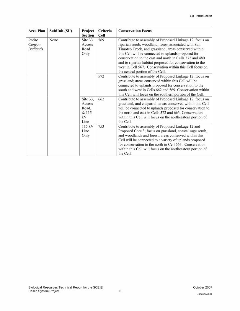
Table 1 below provides a summary of the conservation focus of the MSHCP in the area of the Proposed Project.
Table 1. MSHCP Conservation Focus in Area of Proposed Project
Area Plan SubUnit (SU) Project Section
Criteria Cell
Conservation Focus
936 Contribute to assembly of Proposed Core 3; focus on grassland, chaparral, and coastal sage scrub; areas conserved will be connected to uplands proposed for conservation in Cells 933 and 1030 to the west and south. Conservation will focus on the southwestern portion of the Cell.
1024 Contribute to assembly of Proposed Core 3 and Proposed Constrained Linkage 22; focus on coastal sage scrub, chaparral, grassland, and Riversidian alluvial fan sage scrub; areas conserved within this Cell Group will be connected to uplands proposed for conservation in Cells 937 and 934 to the north and northeast. Conservation will focus on the western portion of Cell Group C.
SU1 - Potrero/Badlands
115 kV Line Only
1032 Contribute to assembly of Proposed Core 3; focus on chaparral, coastal sage scrub, and grassland; areas conserved within Cell will be connected to uplands proposed for conservation in Cells 1030 and 1125 to the west and southeast, and to chaparral and coastal sage scrub habitat proposed for conservation in Cell Group A in the Reche Canyon/Badlands Area Plan to the south. Conservation within this Cell will focus on the southwestern portion of the Cell.
The Pass
Proposed Linkage 12
Site 33, Access Road, & 115 kV Line
Proposed Linkage 12 is comprised of riparian habitats associated with San Timoteo Creek. Planning Species are San Bernardino Kangaroo Rat, Stephens' Kangaroo Rat, Los Angeles Pocket Mouse, Bobcat, Cooper's Hawk, White-tailed Kite, Loggerhead Shrike, Southwestern Willow Flycatcher, Least Bell's Vireo, Yellow Warbler, Yellow-breasted Chat, and Bell's Sage Sparrow. This Linkage likely provides for movement of common mammals such as Bobcat connecting to San Bernardino County and Core Areas in the Badlands. Maintenance of habitat quality and wetland functions and values of San Timoteo Creek are important for these species.
Proposed Constrained Linkage 22
115 kV Line Only
Comprised of the portion of San Timoteo Creek extending west from I-10 to De Anza Cycle Park. Provides habitat for riparian-associated species and a connection to Core Area in the Badlands. This Linkage is constrained by I-10 to the east, San Timoteo Canyon Road, and railroad tracks to the north, SR-60 to the south, and by existing agricultural land uses within the City of Beaumont. Planning Species for this Linkage include Least Bell's Vireo, Los Angeles Pocket Mouse, and Bobcat. In addition to maintenance of habitat quality, maintenance of floodplain processes along the San Timoteo Creek is important for this species. This Linkage likely provides for movement of common mammals such as Bobcat.
1.0 Introduction
Biological Resources Technical Report for the SCE El Casco System Project
6
October 2007
J&S 00446.07
Area Plan SubUnit (SU) Project Section
Criteria Cell
Conservation Focus
569 Contribute to assembly of Proposed Linkage 12; focus on riparian scrub, woodland, forest associated with San Timoteo Creek, and grassland; areas conserved within this Cell will be connected to uplands proposed for conservation to the east and north in Cells 572 and 480 and to riparian habitat proposed for conservation to the west in Cell 567. Conservation within this Cell focus on the central portion of the Cell.
Site 33 Access Road Only
572 Contribute to assembly of Proposed Linkage 12; focus on grassland; areas conserved within this Cell will be connected to uplands proposed for conservation to the south and west in Cells 662 and 569. Conservation within this Cell will focus on the southern portion of the Cell.
Site 33, Access Road, & 115 kV Line
662 Contribute to assembly of Proposed Linkage 12; focus on grassland, and chaparral; areas conserved within this Cell will be connected to uplands proposed for conservation to the north and east in Cells 572 and 663. Conservation within this Cell will focus on the northeastern portion of the Cell.
Reche Canyon Badlands
None
115 kV Line Only
753 Contribute to assembly of Proposed Linkage 12 and Proposed Core 3; focus on grassland, coastal sage scrub, and woodlands and forest; areas conserved within this Cell will be connected to a variety of uplands proposed for conservation to the north in Cell 663. Conservation within this Cell will focus on the northeastern portion of the Cell.

Biological Resources Technical Report for the El Casco System Project
7
October 2007
J&S 00446.07
2.0 Existing Conditions
2.1 Physical Conditions The project site is generally located in San Timoteo Canyon and the Gorgonio Pass, north of the San Jacinto Mountains and south of the San Bernardino National Forest, west of the San Gorgonio River and east of The Badlands.
A mosaic of land uses exist within the proposed project site including portions of the Riverside County Norton Younglove Reserve, Southern Pacific Railroad, I-10 and the 60 Freeway, open space, rural development, urban development, and agriculture (grazing).
The western portion of the project site, including the proposed El Casco Substation is located in the Riverside County Norton Younglove Reserve. This area is also referred to as San Timoteo Canyon. The proposed transmission line parallels San Timoteo Canyon Road, the Southern Pacific Railroad, and San Timoteo Creek to the south side of these landmarks. The transmission line crosses over San Timeoteo Creek at the SR 60 road bridge over San Timoteo Creek. This area consists mostly of open space with scattered rural development. San Timoteo Creek is a perennial stream dominated by riparian vegetation (predominantly willow trees). Adjacent to San Timoteo Creek, on the proposed substation site are relatively flat plains characterized as grassland dominated by ruderal herbaceous plant species. Along the 60 Freeway and I-10, the landscape flattens with rolling hills and sloping mesas. Continuing to the easternmost portion of the project, the topography transitions to flat to rolling hills predominantly used for grazing. Several ephemeral washes traverse this area. Within the Cities of Beaumont and Banning, the proposed project is spans over residential, commercial, industrial, and agricultural lands (i.e grazing activities).
Major waterways that cross the project site include San Timoteo Creek, Potrero Creek, Smith Creek, Montgomery Creek, and various unnamed blue line streams and ephemeral drainages.
Soils withn the Project study area are composed of a mix of soils series and include Badland, Chino, Greenfield, Hanford, Metz, Placentia, Ramona, Riverwash, San Emigdio, San Timoteo, Terrace Escarpments, Tujunga. Soil types are loams and sands ranging from coarse sandy loam to silt loam; gravelly loamy fine sand to loamy fine sand; and riverwash. Figure 4 illustrates the soils within the study area.
2.0 Existing Conditions
Biological Resources Technical Report for the SCE El Casco System Project
8
October 2007
J&S 00446.07
Photographs of the study area are located in Appendix A.
2.2 Vegetation and Natural Communities The proposed project traverses through many natural vegetation communities as shown in Figure 5. There are nine broadly categorized natural vegetation communities occurring in the study area are: Southern Mixed Chaparral, Chamise Chaparral, Scrub Oak Chaparral, Nonnative Grassland, Riversidian Sage Scrub, Riversidian Alluvial Fan Sage Scrub, Southern Riparian Forest, and Southern Willow Scrub. All other areas are either disturbed/ruderal and do not comprise a natural vegetation community or are currently under development.
Three chaparral communities occur in the study area. Chaparral communities are shrub-dominated and composed largely of evergreen species that range from 1 to 4 m in height (Keeley 2000). The Chamise Chaparral community in the study area is dominated by Chamise (Adenostoma fasciculatum) with Black Sage (Salvia mellifera) and California Buckwheat (Eriogonum fasciculatum) scattered throughout. Scrub Oak Chaparral within the study area is dominated by Scrub Oak (Quercus berberidifolia), Holly-leaved Redberry (Rhamnus ilicicolia), and Spiny Redberry (Rhamnus crocea). The Southern Mixed Chaparral community in the study area is composed of a mixture of Chamise, Holly-leaved Redberry and California Buckwheat.
Nonnative Grasslands in the study area are dominated by several species of annual grasses. These species are Ripgut Brome (Bromus diandrus), Red Brome (Bromus madritensis), oat (Avena sp.), Rat-tail Fescue (Vulpia myuros), Glaucous Foxtail Barley (Hordeum murinum), Mediterranean Schismus (Schismus barbatus), and Soft Chess Brome (Bromus hordeaceus).
Riversidian Sage Scrub is dominated by low-statured, aromatic, drought-deciduous shrubs and subshrub species. The dominant Riversidian Sage Scrub species in the study area are California Buckwheat, Black Sage, goldenbush (Ericameria sp.), and Mexican Elderberry (Sambucus mexicana).
Riversidian Alluvial Fan Sage Scrub is a Mediterranean shrubland type that occurs in washes and on gently sloping alluvial fans. The species occurring in this community in the study area are scattered California Buckwheat and Scale-broom (Lepidospartum squamatum), with sparse amounts of Tarragon (Artemisia dracunculus) and Mulefat (Baccharis salicifolia).
The Southern Riparian Forest within the study area has a canopy composed of Western Cottonwood (Platanus racemosa), Goodding’s Black Willow (Salix gooddingii), Red Willow (Salix laevigata), Arroyo Willow (Salix lasiolepis), White Alder (Alnus rhombifolia), California Walnut (Juglans californica), and California Box-elder (Acer negundo). The dominant species in the understory are Mulefat, Giant Creek Nettle (Urtica dioica), Wild Grape (Vitis girdiana), Western Poison-oak (Toxicodendron diversilobum) and California Mugwort (Artemisia douglasiana).

2.0 Existing Conditions
Biological Resources Technical Report for the SCE El Casco System Project
9
October 2007
J&S 00446.07
The Southern Willow Scrub within the Project study area has a similar species composition to the Southern Riparian Forest community discussed above with the difference being canopy structure. Southern Willow Scrub is dominated by shrub structure rather than a mature tree canopy. The willows in willow scrub are young in age (roughly one to 10 years old) and create a middle layer within the riparian drainages that is difficult to walk through and are highly diverse in structure.
Disurbed/Ruderal areas in the study area consist of disced and/or bare fields that appear to be due to heavy grazing activities, routine discing, or horse corrals. The species dominating these areas are Short-pod Mustard (Hirschfeldia incana), Prickly Russian-thistle (Salsola tragus), Tocalote (Centaurea melitensis), Yellow Star-thistle (Centaurea solstitialis), Telegraph Weed (Heterotheca grandiflora), and Prickly Lettuce (Lactuca serriola). Soils within these areas were heavily compacted.
A list of the plant species observed during the focused work can be found in Appendix B.
2.3 Wildlife Over 110 species of animals were detected over the course of the current studies. Some of the species are characteristic of human landscapes while others are characteristic of natural land ecosystems within interior cismontane California. Outside of the riparian drainages, overall species richness was low which may be a sign of the severe drought and/or past and/or ongoing disturbances. Appendix B provides a complete list of animals observed during the focused survey.
The common butterflies observed were Western Tiger Swallowtail (Papilio rutulus), Red Admiral (Vanessa atalanta), Lorquin’s Admiral (Limenitis lorquini), Orange Sulphur (Cloia eurytheme) and Cabbage White (Pieris rapae). Several species of dragonfly were observed including Vivid Dancer (Argia vivida) and Flame Skimmer (Libellula saturata).
Commonly observed herpetofauna included Pacific Chorus Frog (Pseudacris regilla), Western Fence Lizard (Sceloporus occidentalis), Side-blotched Lizard (Uta stansburiana), and Southern Alligator Lizard (Elgaria multicarinata).
Bird species richness was highest for birds. The raptors that were commonly observed were White-tailed Kite (Elanus leucurus), Red-tailed Hawk (Buteo jamaicensis), and American Kestrel (Falco sparverius). Other birds commonly observed included Mourning Dove (Zenaida macroura), Rock Pigeon (Columba livia), Anna’s Hummingbird (Calypte anna), Black-chinned Hummingbird (Archilochus alexandri), Nuttall’s Woodpecker (Picoides nuttallii), Black Phoebe (Sayornis nigricans), Western Kingbird (Tyrannus verticalis), Cassin’s Kingbird (Tyrannus vociferans), American Crow (Corvus brachyrhynchos), Common Raven (Corvus corax), Horned Lark (Eremophila alpestris), Northern Rough-winged Swallow

2.0 Existing Conditions
Biological Resources Technical Report for the SCE El Casco System Project
10
October 2007
J&S 00446.07
(Stelgidopteryx serripennis), Cliff Swallow (Petrochelidon pyrrhonota), Bushtit (Psaltriparus minimus), House Wren (Troglodytes aedon), Bewick’s Wren (Thryomanes bewickii), Wrentit (Chamaea fasciata), European Starling (Sturnus vulgaris), Phainopepla (Phainopepla nitens), Western Yellow Warbler (Dendroica petechia brewsteri), Common Yellowthroat (Geothlypis trichas), California Towhee (Pipilo crissalis), Spotted Towhee (Pipilo maculatus), Song Sparrow (Melospiza melodia), Black-headed Grosbeak (Pheucticus melanocephalus), Blue Grosbeak (Passerina caerulea), Bullock’s Oriole (Icterus bullockii), House Finch (Carpodacus mexicanus), Lesser Goldfinch (Carduelis psaltria), American Goldfinch (Carduelis tristis), and House Sparrow (Passer domesticus).
The mammals commonly detected included Desert Cottontail (Sylvilagus audobonii), Botta’s Pocket Gopher (Thomomys bottae), Domestic Dog (Canis familiaris), Coyote (Canis latrans), Northern Raccoon (Procyon lotor), and Bobcat (Lynx rufus), Mule Deer (Odocoileus hemionus), and Domestic Cattle (Bos taurus).
Special-Status Animals The special-status species observed in the study area during the course of the current work were White-tailed Kite, Cooper’s Hawk (Accipiter cooperii), Peregrine Falcon (Falco peregrinus), Golden Eagle (Aquila chrysaetos), Yellow-billed Cuckoo (Coccyzus americanus), Loggerhead Shrike (Lanius ludovicianus), Southwestern Willow Flycatcher (Empidonax traillii extimus), Least Bell’s Vireo (Vireo bellii pusillus), Western Yellow Warbler, Yellow-breasted Chat (Icteria virens), and San Diego black-tailed jackrabbit (Lepus californicus bennettii).

Biological Resources Technical Report for the El Casco System Project
11
October 2007
J&S 00446.07
3.0 Riparian-Riverine and Vernal Pool Resources/Jurisdictional Waters
This section presents the results of focused field studies to assess the potential for riparian-riverine and vernal pool resources within the Project study area as well as to provide a summary of the delineation of jurisdictional waters, wetlands, and streambeds performed in support of the Proposed Project.
3.1 Riparian-Riverine/Jurisdictional Water Features The complete jurisdictional delineation is provided in Appendix C. The following section summarizes the jurisdictional delineation report, including findings related to vegetation communities, topography and soils, hydrology, and wetlands within the study area. The areas described below correspond to jurisdictional waters and wetlands located within 50 feet of the proposed El Casco Substation footprint and within 50 feet of any 115 kv Line poles (Appendix C Figure 3).
Impact Area 1: Access Road Culvert Replacement The access road culvert is located in the western most portion of the project site at the existing dirt access road to the proposed El Casco Substation location (Appendix C Figure 4).
Impact Area 1 encompasses a north-flowing ephemeral drainage ditch, which crosses under the existing dirt access road through a 36-inch corrugated metal pipe (CMP) into San Timoteo Creek. The ephemeral ditch appears to have been constructed or modified by human activity, especially in the area nearest the access road and culvert. The drainage is approximately 9 feet wide and three feet deep with an OHWM 3.5 feet wide. San Timoteo Creek does not appear significantly altered or disturbed in this area. The banks of San Timoteo Creek at the culvert crossing are vertically aligned at an approximate depth of 6 feet. The creek bed is broad and generally flat (refer to Appendix C Figure 4).

3.0 Riparian-Riverine and Vernal Pool Resources/Jurisdictional Waters
Biological Resources Technical Report for the SCE El Casco System Project
12
October 2007
J&S 00446.07
Vegetation within the ephemeral drainage ditch is dominated by ruderal upland species. Conversely, San Timoteo Creek is dominated by hyrdophyric vegetation.
The ephemeral drainage ditch did not contain evidence of wetland hydrology; however, San Timoteo Creek is a perennial water body and contained several hydrologic indicators of wetland hydrology. No soil pit was dug within San Timoteo Creek at this location because the creekbed was inaccessible; however, based on the mapped soil type and the strong evidence of wetland vegetation and hydrology, hydric soils are also concluded to be present.
In summary, the presence of hydrophytic vegetation, wetland hydrology, and hydric soils within the Ordinary High Water Mark (OHWM) of San Timoteo Creek indicate that this area is an USACE jurisdictional wetland. The Regional Water Quality Control Board (RWQCB) jurisdictional boundary is the same as the United States Army Corps of Engineers (USACE). California Department of Fish and Game (CDFG) and MSHCP jurisdiction associated with San Timoteo Creek extends to the edge of the riparian canopy (refer to Appendix C Figure 4).
The ephemeral drainage ditch is a tributary to San Timoteo Creek. USACE and RWQCB jurisdiction extend to the OHWM (approximately 3.5 feet wide). CDFG and MSHCP jurisdiction extend from bank to bank (approximately 9 feet wide) (refer to Appendix C Figure 4).
Impact Area 2: Duct Bank Installation Duck bank installation, Impact Area 2, is located at the northeastern corner of the proposed El Casco Substation site (Appendic C Figure 5).
The vegetation community associated with San Timoteo Creek within Impact Area 2 is southern riparian forest. Additionally, within the impact area, a portion of the existing dirt access road adjacent to the creek has eroded and slumped into the creek bed. Ruderal upland herbaceous species from the roadway including ripgut brome, mustard (Brassica sp.), and California sagebrush seedings occur on the slumped bank.
San Timoteo Creek contained several hydrologic indicators of wetland hydrology and wetland hydrology is present within the OHWM. Although no indicators of hydric soils were observed in the pits, the pits were dug in a dynamic stream adjacent to an eroded road cut. Therefore, hydric soil indicators may not have had enough time to form. Based on the mapped soil type and the strong evidence of wetland vegetation and hydrology, hydric soils are also concluded to be present.
In summary, the presence of hydrophytic vegetation, wetland hydrology, and hydric soils within the OHWM of San Timoteo Creek indicate that this area is an USACE jurisdictional wetland. The RWQCB jurisdictional boundary is the same as the USACE. CDFG and MSHCP jurisdiction associated with

3.0 Riparian-Riverine and Vernal Pool Resources/Jurisdictional Waters
Biological Resources Technical Report for the SCE El Casco System Project
13
October 2007
J&S 00446.07
San Timoteo Creek extends to the edge of the riparian canopy (refer to Appendix C Figure 5).
Impact Area 3: Pole Upgrade #1 The pole upgrade, Impact Area 3, portion of the project is located on the south side of the 60 Freeway road bridge over San Timoteo Creek (Appendix C Figure 6).
The vegetation community associated with San Timoteo Creek within Impact Area 3 is southern riparian forest with a sparce understory component near the road bridge that is characteristic of a freshwater marsh. Wetland hydrology is present within the OHWM and based on this indicator of hydric soils, the mapped soil type, and the strong evidence of wetland vegetation and hydrology, hydric soils are also concluded to be present.
In summary, the presence of hydrophytic vegetation, wetland hydrology, and hydric soils within the OHWM of San Timoteo Creek indicate that this area is an USACE jurisdictional wetland. The RWQCB jurisdictional boundary is the same as the USACE. CDFG and MSHCP jurisdiction associated with San Timoteo Creek extends to the edge of the riparian canopy (refer to Appendix C Figure 6).
Impact Area 4: Pole Upgrade #2 Impact Area 4, additional pole upgrade #2 work, is located at San Timoteo Creek approximately 300 feet upstream from a poultry farm and adjacent to an unimproved roadway. Access to the site is gained beyond the terminus of 4th Street in the City of Banning and via a private roadway through the poultry farm (Appendix C Figure 7).
The vegetation community associated with San Timoteo Creek within Impact Area 3 is southern riparian forest with a sparse understory component near the road bridge that is characteristic of a freshwater marsh. Wetland hydrology is present within the OHWM and based on the mapped soil type and the strong evidence of wetland vegetation and hydrology, hydric soils are also concluded to be present.
In summary, the presence of hydrophytic vegetation, wetland hydrology, and hydric soils within the OHWM of San Timoteo Creek indicate that this area is an USACE jurisdictional wetland. The RWQCB jurisdictional boundary is the same as the USACE. CDFG and MSHCP jurisdiction associated with San Timoteo Creek extends to the edge of the riparian canopy (refer to Appendix C Figure 7).
Impact Area 5: Pole Upgrade #3 Impact Area 5, additional pole uprade #3 work, is located at San Timoteo Creek approximately 600 feet upstream from upstream from Impact Area 4 and adjacent to an unimproved roadway. Access to the site is gained beyond

3.0 Riparian-Riverine and Vernal Pool Resources/Jurisdictional Waters
Biological Resources Technical Report for the SCE El Casco System Project
14
October 2007
J&S 00446.07
the terminus of 4th Street in the City of Banning and via a private roadway through the poultry farm (Appendix C Figure 7).
The vegetation community within Impact Area 5 is classified as non-native grassland and southern riparian forest. The existing pole is located entirely within non-native grassland adjacent to San Timoteo Creek. Wetland hydrology is not present within the 50 feet of the impact area and no hydric soils or associated indicators were present within the impact area.
In summary, Impact Area 5 is located outside the OHWM and near the edge of the riparian canopy associated with San Timoteo Creek. The lack of wetland hydrology and hydric soils within the impact area indicate that an USACE jurisdictional wetland is not present. The RWQCB jurisdictional boundary is the same as the USACE. CDFG and MSHCP jurisdiction associated with San Timoteo Creek extends to the edge of the riparian canopy (refer to Appendix C Figure 7).
Impact Area 6: Pole Upgrade #4 Impact Area 6, additional pole upgrade #4 work, is located at a concrete V-ditch located north of 4th Street in the City of Beaumont (refer to Appendix C Figure 8). The V-ditch is approximately 4 feet wide with an OHWM of 2 feet wide. The V-ditch passes under several asphalt driveways via a 24-inch concrete metal pipe (CMP). The concrete V-ditch appears to have been constructed in an upland to contain roadside storm water runoff and likely connects to the City of Beaumont’s storm drain system.
The V-ditch contains less than 5 percent vegetation cover and is therefore considered unvegetated. Evidence of wetland hydrology is limited to one secondary indicator and thus, does not have wetland hydrology. No hydric soils or associated indicators are present within the impact area; the V-ditch is concrete.
In summary, the lack of hydrophytic vegetation, wetland hydrology, and hydric soils within the OHWM of the V-ditch indicate that this area is not an USACE jurisdictional wetland.
The USACE has traditionally taken jurisdiction over features that have connectivity to storm drains as these drains typically lead to a navigable water, particularly near the coastal areas. However, under the new Rapanos guidelines, this feature may be exempt from USACE jurisdiction as a roadside ditch (refer to Appendix C for further details.
The RWQCB may require a permit for impacts to this feature, however, due to the lack of beneficial uses associated with the V-ditch, mitigation would generally not be required.
The CDFG may take jurisdiction over this feature based on the presence of a bed and bank. However, the CDFG may not require a permit of mitigation for impacts to this feature based on a lack of habitat.

3.0 Riparian-Riverine and Vernal Pool Resources/Jurisdictional Waters
Biological Resources Technical Report for the SCE El Casco System Project
15
October 2007
J&S 00446.07
This feature is non-jurisdictional under the MSHCP because it is an artificially created structure for purposes unrelated to the providing wetland habitat or alterations of a natural stream.
Impact Area 7: Pole Upgrade #5 Impact Area 7, additional pole upgrade #5 work, is located at an unnamed ephemeral stream located approximately 400 feet east of the intersection of Bobcat Road and Turtle Dove Lane in unincorporated Riverside County south of the City of Banning (Appendix C Figure 9).
The vegetation community within Impact Area 7 is classified as Riversidian alluvial fan sage scrub. No vegetation occurs within the OHWM due to scouring, however, a majority of the wash contains California buckwheat with a small component of scale-broom (Lepidospartum squamatum) and saltcedar (Tamarix sp.). The dominant California buckwheat is not characterized as hydrophytic vegetation.
Impact Area 7 appears to be an ephemeral wash and does not contain evidence of wetland hydrology and no hydric soil or associated indicators were present within the impact area.
In summary, the existing pole is located outside the OHWM but within the banks of an unnamed ephemeral drainage. The lack of hydrophytic vegetation, wetland hydrology, and hydric soils within the impact area indicate that an USACE jurisdictional wetland is not present. The RWQCB jurisdictional boundary is the same as the USACE. CDFG and MSHCP jurisdiction associated with the unnamed ephemeral drainage extends to the top of each bank (refer to Appendix C Figure 9).
Impact Area 8: Pole Upgrade #6 Impact Area 7, additional pole upgrade #6 work, is located at Montgomery Creek 0.68 miles southeast of the intersection of San Gorgonio Avenue (243) and Westward Avenue in the City of Banning. Access to the site is available via a dirt access road (Water Canal) located immediately west of Banning High School (Appendix C Figure 10).
The vegetation communities within Impact Area 8 are Riversidean Alluvial Fan sage scrub and Riversidean sage scrub. The dominant vegetation within the impact area is not hydrophytic. Impact Area 8 appears to be an ephemeral wash and does not contain evidence of wetland hydrology and no hydric soil or associated indicators were present within the impact area.
In summary, the existing pole is located outside the OHWM but within the banks of Montgomery Creek. The lack of hydrophytic vegetation, wetland hydrology, and hydric soils within the impact area indicate that an USACE jurisdictional wetland is not present. The RWQCB jurisdictional boundary is the same as the USACE. CDFG and MSHCP jurisdiction associated with the unnamed ephemeral drainage extends to the top of each bank (refer to Appendix C Figure 10).
3.0 Riparian-Riverine and Vernal Pool Resources/Jurisdictional Waters
Biological Resources Technical Report for the SCE El Casco System Project
16
October 2007
J&S 00446.07
3.2 Vernal Pools As defined under the MSHCP, “vernal pools are seasonal wetlands that occur in depression areas that have wetlands indicators of all three parameters (soils, vegetation and hydrology) during the wetter portion of the growing season but normally lack wetlands indicators of hydrology and/or vegetation during the drier portion of the growing season. Obligate hydrophytes and facultative wetlands plant species are normally dominant during the wetter portion of the growing season, while upland species (annuals) may be dominant during the drier portion of the growing season.”
The determination that an area exhibits vernal pool characteristics and meets the definition of the watershed supporting vernal pool hydrology must be made carefully. Such determinations should consider the length of the time the area exhibits upland and wetland characteristics and the manner in which the area fits into the overall ecological system as a wetland. Evidence concerning the persistence of an area's wetness can be obtained from its history, vegetation, soils, drainage characteristics, uses to which it has been subjected, weather, and hydrologic records.
Protection of vernal pools is important to the conservation of many of the MSHCP Covered Species including fairy shrimp and vernal pool obligate plants.
3.2.1 Methods To ascertain potential presence of vernal pools within the Project study area, a review of soil mapping by the Soil Survey Geographic Data Base (SSURGO 2007) within 100 feet of the 115kV Line and within the limits of disturbance proposed at Site 33 and the associated access road was performed to determine presence of clay soils or soils that characteristically are able to retain water (e.g., silt). Based on NRCS mapping, no clay soils are present within the Project area (Figure 4). However, NRCS mapping is at a relatively coarse level and it is possible that localized clay lenses are present. To ensure that all potential vernal pool areas were identified, the entire project footprint was evaluated for shallow depressions that indicated water retension for at least a portion of the rainy season during the course of the current studies. Particular emphasis was given to areas mapped in the Ramona series, which are soils that can have clay-like properties primarily in the subsoil horizons.
The current studies commenced in May and ended in August under severe drought conditions. Indirect indicators were used to further determine the potential for vernal poles including, but not limited to, the presence of siltation, soil cracking, and hydrophytic plant species that can be associated seasonally wet conditions. The absence of dead hydrophytic plants as an indicator of vernal pools was used cautiously since limited annual vegetation growth was supported this winter/spring severe regional drought.

3.0 Riparian-Riverine and Vernal Pool Resources/Jurisdictional Waters
Biological Resources Technical Report for the SCE El Casco System Project
17
October 2007
J&S 00446.07
3.2.2 Results No depressions judged to potentially hold water seasonally were found. Perennial wetlands are present with the drainages, but no vernal pool hydrology was found.
3.3 Fairy Shrimp There are two species of fairy shrimp that could conceivably occur within the Project study area based on geographic distribution. The two species are Riverside fairy shrimp (Streptocephalus woottoni) and vernal pool fairy shrimp (Branchinecta lynchi). Based on available distribution information including the California Department of Fish and Game (CDFG) California Natural Diversity Data Base (CNDDB), neither species of fairy shrimp have been collected within the Beaumont and Banning areas.
Both of these species are federally listed and are covered species under the MSHCP but require surveys when potentially suitable habitat is present. As discussed in Section 3.2, coarse soil mapping of the study area indicates that clay soils or other “heavy” soils are absent. In addition, during further evaluation for potential vernal pools, seasonal hydrology in the form of shallow depressions as indicated by siltation, soil cracking, and/or dead hydrophytic plants were also not found within the study area.
3.3.1 Results Potential habitat for fairy shrimp, including Riverside Fairy Shrimp and Vernal Pool Fairy Shrimp, is absent from the Project study area.

3.0 Riparian-Riverine and Vernal Pool Resources/Jurisdictional Waters
Biological Resources Technical Report for the SCE El Casco System Project
18
October 2007
J&S 00446.07

Biological Resources Technical Report for the El Casco System Project
19
October 2007
J&S 00446.07
4.0 Rare Plant Studies
In 2005, focused surveys for rare plants were performed by URS (2007). Based on the table of special-status plants listed in the URS (2007) report, the work did not include surveys for Many-stemmed Dudleya (Dudleya multicaulus) or Round-leaved Filaree (Erodium macrophyllum), two species the MSHCP require be addressed for the Proposed Project.
The 2005 work did, however, include the following rare plants: Nevin's Barberry (Berberis nevinii), Slender-horned Spineflower (Dodecahema leptoceras), Santa Ana River Woollystar (Eriastrum densifolium ssp. sanctorum), Munz's Onion (Allium munzii), Plummer's Mariposa Lily (Calochortus plummerae), Smooth Tarplant (Centromadia pungens ssp. laevis), California Bedstraw (Galium californicum ssp. primum), Parry's Spineflower (Chorizanthe parryi var. parryi), Chaparral Sand-verbena (Abronia villosa var. aurita), California Muhly (Muhlenbergia californica), Yucaipa Onion (Allium marvinii), Jaeger's Milk-vetch (Astragalus pachypus var. jaegerii), Mesa Horkelia (Horkelia cuneata ssp. puberula), San Bernardino Aster (Symphyotrichum defoliatum), Brand's Phacelia (Phacelia stellaris), Salt Spring Checkerbloom (Sidalcea neomexicana), Mud Nama (Nama stenocarpum), Wright's Trichocoronis (Trichocoronis wrightii var wrightii), and Cleveland's Bush Monkeyflower (Mimulus clevelandii).
Three of the nineteen plants surveyed were found, including Plummer’s Mariposa Lily, Smooth Tarplant, and Cleveland’s Bush Monkeyflower. None of these three species was found within Site 33 or along the 115kV Line study area.
The following subsections provide an understanding of the Project requirements for rare plants under the MSHCP, species background information, focused survey methods for the 2007 work, and results.
4.1 Background The Proposed Project lays within the MSHCP Narrow Endemic Plant Species Survey Area (NEPSSA) 8 and the MSHCP Criteria Species Survey Area (CASSA) 6. Figure 3a and 3b in Section 1.3.2 provise an illustration of the MSHCP survey areas within the Proposed Project. For lands within NEPSSA 8 and CASSA 6, the MSHCP requires that focused habitat evaluations be performed for Yucaipa Onion, Many-stemmed Dudleya, Nevin’s Barberry, Smooth Tarplant, and Round-leaved Filaree. No other focused work is required for any other NEPSSA or CASSA species.

4.0 Rare Plant Studies
Biological Resources Technical Report for the SCE El Casco System Project
20
October 2007
J&S 00446.07
Under the MSHCP, if potential habitat is found present for any of these five species, a focused survey is needed to determine each species’ status within the Project area. It was determined during the 2005 focused survey work (URS 2007) that potential habitat for Nevin’s Barberry, Smooth Tarplant, and Yucaipa Onion was present and that all three species were found absent within the Project study area.
No focused survey work was performed for Many-stemmed Dudleya or Round-leaved Filaree in 2005. Sections 4.2 and 4.3 provide the methods and results of the 2007 focused study performed for Many-stemmed Dudleya and Round-leaved Filaree. Yucaipa Onion habitat is very similar to the potential habitat required for Many-stemmed Dudleya and, therefore, was also included in the current survey work.
There are several species of special-status plants that are covered under the MSHCP, but for which full coverage is not provided under the Plan until specific measures are met for the species. The plants that fall within this category and have potential for occurrence within the Project Area are Plummer’s Mariposa Lily and Parry’s Spineflower. The focused survey work in 2005 performed by URS (2007) determined that both of these species are absent from the Proposed Project study area. No further evaluation of these species is required under the MSHCP.
4.1.1 Yucaipa Onion There is little literature available regarding this species. Yucaipa onion was originally described by J. Marvin in 1921 and little to no information has been published on it since. No species-specific studies and little data are available regarding life history (reproductive biology, pollinators or dispersal mechanisms) for Yucaipa onion. It is a bulbiferous herb that blooms typically in April and May depending on rainfall patterns.
This species has been previously associated within clay openings in chaparral habitat at elevations between 760 and 1065 m (CNPS 2001). Currently the species is known from only two occurrences in the Yucaipa and Beaumont region of the southern San Bernardino Mountains in San Bernardino County and western Riverside County at elevations ranging from 2490 to 3490 feet (CNPS 2007).
4.1.2 Many-stemmed Dudleya A number of populations exist within western Riverside County; however, these are concentrated within the Santa Ana Mountains Bioregion and western portion of the Riverside Lowlands Bioregion. A majority of the populations are known from the Temescal Canyon, Gavilan Hills, and Alberhill areas and the Santa Ana Mountains, including the San Mateo Wilderness Area of the Cleveland National Forest.

4.0 Rare Plant Studies
Biological Resources Technical Report for the SCE El Casco System Project
21
October 2007
J&S 00446.07
Many-stemmed dudleya is associated with openings in chaparral, coastal sage scrub, and grasslands underlain by clay and cobbly clay soils of the following series: Altamont, Auld, Bosanko, Claypit, and Porterville. Proposed conservation of this species within the MSHCP Plan area is directly associated with only these five soil series. The majority of populations are associated with coastal sage scrub or open coastal sage scrub (Dodero 1995). In Riverside County, Many-stemmed Dudleya has been associated with Palmer’s Grappling hook (Harpagonella palmeri), Munz’s Onion, Chocolate Lily (Fritillaria biflora), Douglas’ Lupine (Lupinus bicolor), Purple Needlegrass (Nassella pulchra), Foothill Needlegrass (N. lepida), California Buckwheat, California Sagebrush, and California Juniper (Juniperus californica) (CNDDB 2001).
The species is a perennial herb that blooms typically in April through July depending on rainfall patterns.
4.1.3 Round-leaved Filaree This species is restricted to open cismontane woodland and valley and foothill grassland habitats on very friable clay soils between 50 and 6550 feet in elevation (CNPS 2001). It is an annual herb that blooms between March and May depending on rainfall levels and patterns. Within the MSHCP Plan, two of the mapped localities occur on Bosanko clay soils and the species tends to be associated primarily with wild oats (CNDDB 2000).
This species is known primarily from five records in the Gavilan Hills, one record at Lake Mathews, one at Diamond Valley Lake, one along Temescal Wash near Lee Lake, one in French Valley, and one in the foothills of the Agua Tibia Mountains. No core areas have been identified for this species.
4.2 Methods The focused studies performed for Many-stemmed Dudleya, Yucaipa Onion, and Round-leaved Filaree occurred within all proposed limits of disturbance plus a 100-foot buffer.
4.2.1 Habitat Evaluation Soils along with vegetation mapping were reviewed prior to visiting the Project study area to determine at a coarse-scale, potentially suitable habitat conditions for the three species with all three requiring clay or clay-like soils. Of the soils mapped within the Project study area, those from the Ramona series were of focus. These soils have clay-like properties primarily in the subsoil horizons. However, none of these soils was present within the MSHCP survey area for Round-leaved Filaree.

4.0 Rare Plant Studies
Biological Resources Technical Report for the SCE El Casco System Project
22
October 2007
J&S 00446.07
Altamont, Auld, Bosanko, Claypit, and Porterville soil series are absent from the Project study area. Many-stemmed Dudleya is known to be strongly associated with these five soils series.
On May 24 through May 26, 2007, the Project study area (rare plant “study area”) was carefully evaluated to demarcate potentially suitable habitat for both Yucaipa Onion and Many-stemmed Dudleya. The focused survey for these two species is described below.
4.2.2 Focused Survey The focused surveys were conducted by Korey Klutz and Brant Primrose, Jones & Stokes botanists familiar with the identification and habitat requirements for Many-stemmed Dudleya and Yucaipa Onion. Surveys were conducted on four separate days by walking meandering transects within potentially suitable habitat to ensure 100% coverage. Careful and systematic examination of all vascular plant species was performed. All observed plant species were identified and recorded during the site visits; thus, the work was floristic in nature. Surveys occurred during the blooming period for both species to allow identification if present.
Because this work was performed during one of the most severe droughts of Southern California, reference populations were reviewed to determine whether rainfall conditions were suitable for either species to emerge. Figures 6a and 6b illustrate the geographic location of the reference populations checked and the location of the potentially suitable habitat mapped for the target species. Table 2 below provides the dates and personnel for each site visit.
Table 2. Rare Plant Focused Survey Dates and Personnel
Date Personnel Purpose 05/24/07 Korey Klutz Rare Plant Focused Survey 05/25/07 Korey Klutz Rare Plant Focused Survey 05/26/07 Korey Klutz Rare Plant Focused Survey 06/1/07 Korey Klutz Rare Plant Focused Survey 06/22/07 Brant Primrose Reference Populations 1 & 2 06/27/07 Korey Klutz Reference Population 3 Reference population 1 and 3= Many-stemmed Dudleya Reference population 2= Yucaipa Onion
Table 3 shows the total rainfall for the last 5 years at the University of California, Riverside campus weather station, approximately 15 miles west of the study area. Because the 2006-2007 rainfall year was extremely dry, negative results for focused plant surveys conducted this year are potentially less reliable than in years of average or greater rainfall.
4.0 Rare Plant Studies
Biological Resources Technical Report for the SCE El Casco System Project
23
October 2007
J&S 00446.07
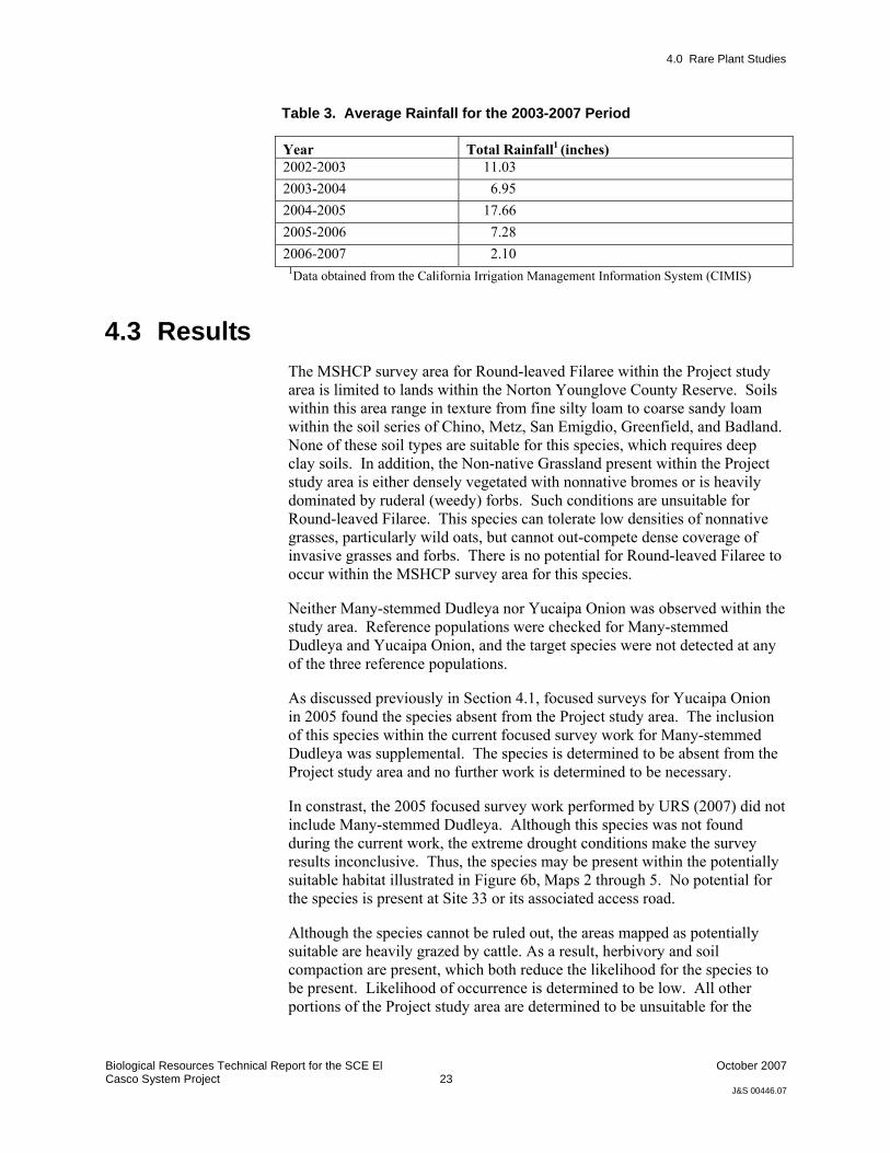
Table 3. Average Rainfall for the 2003-2007 Period
Year Total Rainfall1 (inches) 2002-2003 11.03 2003-2004 6.95 2004-2005 17.66 2005-2006 7.28 2006-2007 2.10
1Data obtained from the California Irrigation Management Information System (CIMIS)
4.3 Results The MSHCP survey area for Round-leaved Filaree within the Project study area is limited to lands within the Norton Younglove County Reserve. Soils within this area range in texture from fine silty loam to coarse sandy loam within the soil series of Chino, Metz, San Emigdio, Greenfield, and Badland. None of these soil types are suitable for this species, which requires deep clay soils. In addition, the Non-native Grassland present within the Project study area is either densely vegetated with nonnative bromes or is heavily dominated by ruderal (weedy) forbs. Such conditions are unsuitable for Round-leaved Filaree. This species can tolerate low densities of nonnative grasses, particularly wild oats, but cannot out-compete dense coverage of invasive grasses and forbs. There is no potential for Round-leaved Filaree to occur within the MSHCP survey area for this species.
Neither Many-stemmed Dudleya nor Yucaipa Onion was observed within the study area. Reference populations were checked for Many-stemmed Dudleya and Yucaipa Onion, and the target species were not detected at any of the three reference populations.
As discussed previously in Section 4.1, focused surveys for Yucaipa Onion in 2005 found the species absent from the Project study area. The inclusion of this species within the current focused survey work for Many-stemmed Dudleya was supplemental. The species is determined to be absent from the Project study area and no further work is determined to be necessary.
In constrast, the 2005 focused survey work performed by URS (2007) did not include Many-stemmed Dudleya. Although this species was not found during the current work, the extreme drought conditions make the survey results inconclusive. Thus, the species may be present within the potentially suitable habitat illustrated in Figure 6b, Maps 2 through 5. No potential for the species is present at Site 33 or its associated access road.
Although the species cannot be ruled out, the areas mapped as potentially suitable are heavily grazed by cattle. As a result, herbivory and soil compaction are present, which both reduce the likelihood for the species to be present. Likelihood of occurrence is determined to be low. All other portions of the Project study area are determined to be unsuitable for the

4.0 Rare Plant Studies
Biological Resources Technical Report for the SCE El Casco System Project
24
October 2007
J&S 00446.07
species. Recommendations to address Many-stemmed Dudleya are provided in Section 12.0.
As discussed at the beginning of Section 4.0, potentially suitable habitat for Nevin’s Barberry was determined to be present by URS in 2005 (URS 2007). A focused survey was performed and the species was found to be absent.
Although a focused survey for Smooth Tarplant was performed in 2005 by URS (2007), several populations were found during the 2007 focused surveys. The survey work performed in 2007 did not focus on Smooth Tarplant, as this species was surveyed in 2005 and found absent. However, populations were found during other survey work. Two of the 10 populations found in 2007 are within or directly adjacent to the Proposed Project. One population of roughly 50 individuals was adjacent to the proposed Site 33 access road and another population of 3 individuals was on the edge of the Site 33 substation footprint (Figure 6B Map 1). The other populations were either within 100 feet of Site 33 or well away from the Proposed Project. All populations found are illustrated on Figure 6b Map 1. Given the severity of the drought, it is likely that the extent of the land occupied by Smooth Tarplant and the number of individuals occupying a particular area is greater than that found in 2007. Refer to Section 12.0 for recommendations to address this project constraint.

Biological Resources Technical Report for the El Casco System Project
25
October 2007
J&S 00446.07
5.0 Los Angeles Pocket Mouse Focused Studies
The following sections present the background, methods, and results of the focused study conducted to determine the presence or absence of Los Angeles Pocket Mouse in the study area.
5.1 Background The Los Angeles Pocket Mouse (Perognathus longimembris brevinasis) is one of 16 subspecies of Little Pocket Mouse. This species is a golden-brown heteromyid (family of rodents including pocket mice, kangaroo rats, and kangaroo mice) that weighs between 6 to 11 grams. The historic range of the Los Angeles pocket mouse is estimated to be from Burbank and San Fernando in Los Angeles County east to the City of San Bernardino, San Bernardino County (the type locality) (Hall 1981). Its range extends eastward to the vicinity of the San Gorgonio Pass in Riverside County, and southeast to Hemet and Aguanga, and possibly to Oak Grove, in north-central San Diego County.
The Los Angeles Pocket Mouse prefers fine, sandy soils, particularly associated with washes within sparsely vegetated habitats. Vegetation communities known to support this species include non-native grassland, Riversidian sage scrub, Riversidian alluvial fan sage scrub, chaparral, and redshank chaparral. Dense grass cover is believed to preclude Los Angeles pocket mouse because of difficulty locomoting and finding seeds. Like other heteromyids, the little pocket mice primarily are granivores (seed eaters) and possess external, fur-lined cheek pouches that promote collecting and caching of seeds.
As a species, the Little Pocket Mouse is primarily nocturnal, with an initial bout of surface activity within two to four hours after sunset and then declining activity throughout the night. In spring and summer, there may be a smaller bout of surface activity before sunrise.
This species exhibits a distinct seasonal pattern in surface activity. During the colder months, the Little Pocket Mouse may enter into torpor and not engage in surface activity. In general, surface activity begins in April and peaks around June and July. By August, surface activity declines and almost absent in October.
As with other heteromyids, the Little Pocket Mouse is not a prolific breeder - producing one or two litters per year with typical litter sizes of 3-4 pups.

5.0 Los Angeles Pocket Mouse Focused Studies
Biological Resources Technical Report for the SCE El Casco System Project
26
October 2007
J&S 00446.07
The Los Angeles Pocket Mouse is a California Species of Special Concern and a MSHCP Covered Species that is Adequately Conserved. The Los Angeles Pocket Mouse generally is widely distributed in the eastern two-thirds of the MSHCP Plan, but recent known localities are sparsely scattered throughout this area.
The current status of populations in the MSHCP Plan Area is unknown, but some biologists believe that the Los Angeles Pocket Mouse is in serious decline in the region because it is seldom trapped and much of its suitable habitat has been lost to agriculture and urban development. Conservation of sage scrub and grassland habitats on sandy soils, population monitoring and adaptive management will be important for the long term survival of this species.
Portions of the MSHCP survey area for Los Angeles Pocket Mouse occur at three locations within the Project Project study area (refer to Figure 3c in Section 1.3.2).
5.2 Methods The following describes the methods used during the habitat assessment and focused trapping for the Los Angeles Pocket Mouse.
5.2.1 Habitat Assessment The Proposed Project bisects three MSHCP survey areas that require a habitat assessment for Los Angeles Pocket Mouse. The presence of potentially suitable habitat was assessed along the portions of the proposed 115kV Line (plus a 100-foot buffer) that transected the three survey areas. Neither Site 33 nor the associated access road occur within the survey area for this species. The criterion used for assessing potentially suitable Los Angeles Pocket Mouse habitat was predicated on the presence of sandy soils and open vegetation, the preferred conditions for this subspecies. The assessment included review of aerial photographs and soil survey maps and a field inspection.
Field inspection involved driving and/or walking all portions of the 115kV Line within the three MSHCP survey areas for Los Angeles Pocket Mouse. Existing conditions, such a vegetation communities, percent cover of vegetation, and basic surface soil types (e.g., loam, sand, clay), were noted on aerial photographs depicting the 115kV alignment plus a 100-foot buffer. Representative photographs were taken and are provided in Appendix A.
5.2.2 Focused Trapping Small mammal trapping for Los Angeles Pocket Mouse consisted of three traplines totaling 290-trap nights. Traplines 1, consisting of 25 traps, was set under the 115kV Line within a sandy wash known as Smith Creek. Trapline 2, consisting of 40 traps, was set under the 115kV Line in an unnamed sandy

5.0 Los Angeles Pocket Mouse Focused Studies
Biological Resources Technical Report for the SCE El Casco System Project
27
October 2007
J&S 00446.07
wash. Both trapline 1 and 2 were set for 5 nights for a total of 225 trap nights. Traplines 1 and 2 were initially set and baited on June 4, 2007. Traps were processed from June 5, 2007 through June 9, 2007. Trapline 3a, consisting of 25 traps, was set under the 115kV alignment within a sandy wash known as Montgomery Creek. Trapline 3a was initially set and baited on June 4, 2007. After capturing several Los Angeles Pocket Mice during the midnight trap check, trapping within the Wash ceased to minimize potential take of the subspecies. Trapline 3a represented 25 trapnights. To determine the potential occupation of Los Angeles Pocket Mouse in upland habitat adjacent to Montgomery Creek, trapline 3b, consisting of 10 traps, was set and baited on June 5, 2007. Traps were processed from June 6, 2007 through June 9, 2007. Table 4 describes the landscape and vegetation communities present at each trapline.
Table 4: Los Angeles Pocket Mouse Trapline Description
Trapline Trap Nights
No. of Traps
Trap Sequence Physical Description Vegetative
Community
1 5 25 1-25
Smith Creek- Sandy and fine sandy soils within wash with a minor loamy component. Emerging Tarragon and Mulefat within the channel. Soils in the upland area are nonnative grasses, mustard, and goldenbush.
Riversidian Alluvial Fan Sage Scrub and ruderal/disturbed upland
2 5 20 26-45
Unnamed creek - Soils are a pure sand w/in the wash and upper terraces are a sandy loam with some scattered cobble and loose sands. Heavy cattle disturbance and grazing. Dominated by buckwheat scrub with occasional Scale-broom. Also scattered Tamarisk in broad channel.
Riversidian Alluvial Fan Sage Scrub
3a 1 25 46-70 Montgomery Creek- Soils are loamy sand with small cobbles. Scattered buckwheat scrub present.
Riversidian Alluvial Fan Sage Scrub and Riversidian Sage Scrub
3b 4 10 46-55 Upland of Montgomery Creek- Large amount of bare grazed lands and scattered buckwheat scrub.
Scattered Riversidian Sage Scrub and ruderal/disturbed upland
A summary of trapping personnel, dates, times, and weather conditions are provided in Table 5.
Table 5: Summary of Personnel, Dates, Times, and Weather Conditions for Los Angeles Pocket Mouse Trapping
Temperature Ranges
Date Time Personnel Weather Conditions Air At Breast Height
Soil @ a depth of 6″
06/05/07 2323-0214 0437-0638
Phillip Richards Marisa Flores
clear, wind 2-7 mph, no precipitation 59°-66°F 77°-85°F
06/06/07 0024-0224 Phillip Richards cloudy, wind 2-13 50°-55°F 76°-72°F

5.0 Los Angeles Pocket Mouse Focused Studies
Biological Resources Technical Report for the SCE El Casco System Project
28
October 2007
J&S 00446.07
Temperature Ranges
Date Time Personnel Weather Conditions Air At Breast Height
Soil @ a depth of 6″
0527-0725 Marisa Flores mph, no precipitation 06/07/07 0025-0238
0525-0730 Phillip Richards Marisa Flores
clear, wind 1-15 mph, no precipitation 41°-54°F 67°-°72°F
06/08/07 0025-0220 0525-0705
Phillip Richards Marisa Flores
clear, wind 2-7 mph, no precipitation 49°-58°F 69°-69°F
06/09/07 0018-0250 0540-0727
Phillip Richards Marisa Flores
clear, wind 2-11 mph, no precipitation 52°-58°F 71°-75°F
Sequentially numbered 9-inch Sherman live traps were set at dusk, approximately 5-15 meters apart. Traps were sign set and placed where potential small rodent captures were judged to be most probable. Where rodent sign was not apparent, traps were placed near the base of shrubs. The location of each trap was recorded using a Garmin hand held GPS unit. Mixed birdseed was used as bait, and a few seeds were trailed out from the mouth of the trap, usually toward a game trail, burrow, or open area. All 9-inch Sherman live traps were modified by the addition of a binder clip to the lip of the trap body, to prevent the doors from closing on the tails of animals. All traps were checked twice, once at midnight and then at dawn, where they were then closed.
When animals were captured, each animal was transferred from the trap into a cloth bag. The animals were removed by their napes and identified to species. The sex and reproductive condition of each animal was recorded (i.e., testes scrotal, not scrotal, vagina perforate, not perforate). Any mites, ticks, or other parasites were noted. Digital photos were taken of some specimens. Once the data were recorded onto data sheets, each animal was released where it had been captured. This whole process took several minutes. The released animals were observed until they moved to the safety of a burrow or clump of vegetation.
5.3 Results Of the three MSHCP Designated Small Mammal Survey Areas, only one area exhibited conditions judged suitable for Los Angeles Pocket Mouse within the 115kV alignment plus a 100-foot buffer. However, within this single MSHCP Survey Area, three locations exhibited conditions judged potentially suitable for Los Angeles Pocket Mouse. These three locations are associated with three sandy washes – Smith Creek, an unnamed wash, and Montgomery Creek (Figure 7, Maps 4 and 5).
No potentially suitable habitat for Los Angeles Pocket Mouse is present at Site 33 or along the associated access road.
During the focused survey, six Los Angeles Pocket Mice were captured. Four individuals (two males and two females) were captured within Montgomery Creek (Figure 7, Map 5) the first night of trapping. As
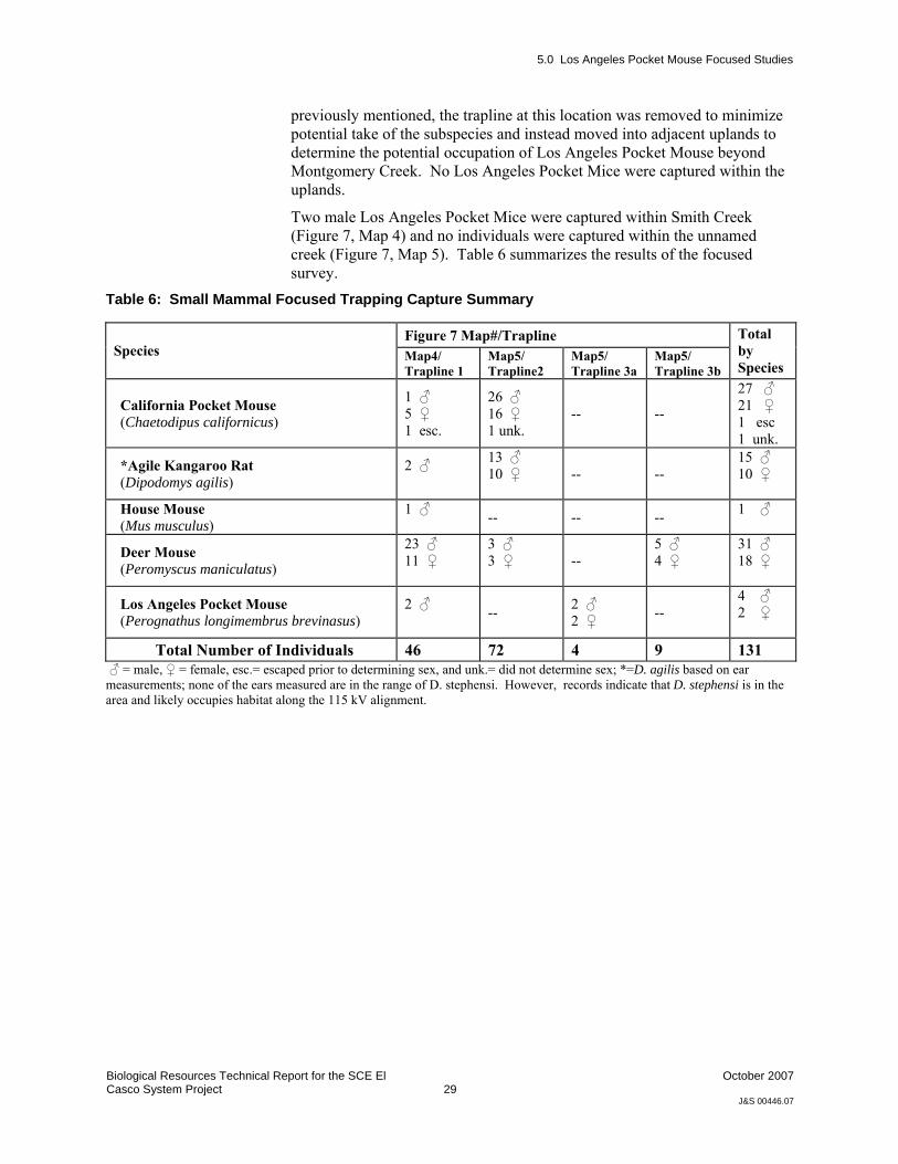
5.0 Los Angeles Pocket Mouse Focused Studies
Biological Resources Technical Report for the SCE El Casco System Project
29
October 2007
J&S 00446.07
previously mentioned, the trapline at this location was removed to minimize potential take of the subspecies and instead moved into adjacent uplands to determine the potential occupation of Los Angeles Pocket Mouse beyond Montgomery Creek. No Los Angeles Pocket Mice were captured within the uplands.
Two male Los Angeles Pocket Mice were captured within Smith Creek (Figure 7, Map 4) and no individuals were captured within the unnamed creek (Figure 7, Map 5). Table 6 summarizes the results of the focused survey.
Table 6: Small Mammal Focused Trapping Capture Summary
Figure 7 Map#/Trapline Species Map4/
Trapline 1 Map5/ Trapline2
Map5/ Trapline 3a
Map5/ Trapline 3b
Total by Species
California Pocket Mouse (Chaetodipus californicus)
1 ♂ 5 ♀ 1 esc.
26 ♂ 16 ♀ 1 unk.
-- --
27 ♂ 21 ♀ 1 esc 1 unk.
*Agile Kangaroo Rat (Dipodomys agilis)
2 ♂
13 ♂ 10 ♀
-- -- 15 ♂ 10 ♀
House Mouse (Mus musculus)
1 ♂ -- -- -- 1 ♂
Deer Mouse (Peromyscus maniculatus)
23 ♂ 11 ♀
3 ♂ 3 ♀
-- 5 ♂ 4 ♀
31 ♂ 18 ♀
Los Angeles Pocket Mouse (Perognathus longimembrus brevinasus)
2 ♂ -- 2 ♂
2 ♀ -- 4 ♂ 2 ♀
Total Number of Individuals 46 72 4 9 131 ♂ = male, ♀ = female, esc.= escaped prior to determining sex, and unk.= did not determine sex; *=D. agilis based on ear measurements; none of the ears measured are in the range of D. stephensi. However, records indicate that D. stephensi is in the area and likely occupies habitat along the 115 kV alignment.

5.0 Los Angeles Pocket Mouse Focused Studies
Biological Resources Technical Report for the SCE El Casco System Project
30
October 2007
J&S 00446.07

Biological Resources Technical Report for the El Casco System Project
31
October 2007
J&S 00446.07
6.0 San Bernardino Kangaroo Rat Focused Study
The following sections present the background, methods, and results of the focused survey conducted to determine the presence or absence of San Bernardino kangaroo rat in the study area.
6.1 Background The San Bernardino Kangaroo Rat (Dipodomys merriami parvus), a subspecies of the Merriam’s Kangaroo Rat, is typically found in Riversidian alluvial fan sage scrub within sandy loam soils, alluvial fans and flood plains, and along washes with nearby sage scrub (McKernan 1997). Soil texture is a primary factor in this subspecies’ occurrence because sandy loam substrates allow for the digging of simple, shallow burrows (McKernan 1997). Known high quality habitat for this subspecies supports California buckwheat (Eriogonum fasciculatum), California croton (Croton californicus), scale-broom (Lepidospartum squamatum), and deerweed (Lotus scoparius) as dominant species, and scattered chaparral yucca (Yucca whipplei), cacti (Opuntia spp.) and a variety of native annual forbs such as phacelia (Phacelia sp.), lupine (Lupinus sp.), cryptantha (Cryptantha sp.), and popcorn flower (Plagiobothrys sp.). Such areas can support mustard species (e.g., Hirschfeldia incana and Brassica nigra), brome grasses (Bromus spp.), and other non-native grasses and herbs, such as slender wild oat (Avena barbata) and tocalote (Centaurea melitensis) in low densities.
The historic range of the subspecies D. m. parvus lies west of the desert divide of the San Jacinto and San Bernardino mountains and extends from the San Bernardino Valley in San Bernardino County to the Menifee Valley in Riverside County (Hall 1981). The subspecies currently occupies approximately 1,299 ha (3,247 acres) of suitable habitat in about seven general locations (USFWS 1998), including the Santa Ana River, Cajon Creek Wash, Lytle Creek Wash, City Creek, and upper Etiwanda Wash in San Bernardino County, and sites in western Riverside County described below.
The species D. merriami are primarily granivores (seed eaters), but they ingest herbaceous material and insects when available. They collect seeds from the substrate into fur-lined cheek pouches for transport and then store them in scattered surface caches in vicinity of their home burrows for later retrieval and consumption. Unlike some larger kangaroo rat species (e.g., D.

6.0 San Bernardino Kangaroo Rat Focused Study
Biological Resources Technical Report for the SCE El Casco System Project
32
October 2007
J&S 00446.07
spectabilis), D. merriami do not hoard seeds to a central location (i.e., larder hoarding).
The species D. merriami, and all other kangaroo rats, are primarily nocturnal animals, but they also exhibit crepuscular behavior around dusk and dawn. They emerge from their day burrows around dusk to engage in foraging and other activities. Animals may be active any hour of the night, but the heaviest concentration of activity tends to occur in the three- to four-hour time span just after dusk. They usually return permanently to their day burrows before dawn.
The species D. merriami, and heteromyids in general, have relatively low reproductive output for rodents. D. merriami and other kangaroo rat species typically breed one or two times per year, with the peak breeding being mid-winter through spring, although they may breed more frequently in good years.
The primary populations within the MSHCP Planning Area are the San Jacinto River and Bautista Creek in vicinity of San Jacinto, Hemet, and Valle Vista. The USFWS (1998) estimated the size of the San Jacinto River population at approximately 350 acres. Smaller populations are historically known from Reche Canyon and the Bloomington area. There also are historic records for the Homeland, Perris, March Air Reserve Base, San Jacinto Wildlife/Lake Perris, and Moreno Valley areas. The key populations of the San Bernardino Kangaroo Rat within the MSHCP Planning Area are primarily located along the San Jacinto River and possibly in Bautista Creek in the San Jacinto, Hemet, and Valle Vista areas.
The San Bernardino Kangaroo Rat is a federally endangered species, California Species of Special Concern, and a MSHCP Covered Species that is Adequately Conserved. The MSHCP has designated survey areas for this species of kangaroo rat within the Plan. The survey areas demarcate lands by which proposed project must evaluate the presence of potentially suitable habitat for the species and if potential habitat is present, a focused survey must be performed to ascertain the species status. The Proposed Project lies within one such survey area at the western end within private lands and the Norton Younglove County Reserve (refer to Section 1.3.2, Figure 3c).
6.2 Methods The following describes the methods used during the habitat assessment for the San Bernardino Kangaroo Rat.
The portion of the Proposed Project within the MSHCP survey area for San Bernardino Kangaroo Rat was assessed to determine whether potentially suitable habitat for San Bernardino Kangaroo Rat was present within the project footprint and a 100-foot buffer. The criterion used for assessing potentially suitable San Bernardino Kangaroo Rat habitat was based on the presence of sandy soils within Riversidian alluvial fan sage. This assessment

6.0 San Bernardino Kangaroo Rat Focused Study
Biological Resources Technical Report for the SCE El Casco System Project
33
October 2007
J&S 00446.07
included review of aerial photographs, soil survey maps, and a field inspection.
Field inspection involved driving and/or walking all portions of the Proposed Project within the MSHCP survey area for the species. Existing conditions, such a vegetation communities, percent cover of vegetation, and basic surface soil types (e.g., loam, sand, clay), were noted on aerial field maps. Representative photographs were taken and are provided in Appendix A.
6.3 Results No potentially suitable habitat for San Bernardino Kangaroo Rat is supported within the portion of the Proposed Project that lies within the MSHCP survey area for this species.

Biological Resources Technical Report for the El Casco System Project
34
October 2007
J&S 00446.07
7.0 Burrowing Owl Focused Studies
The following sections present the background, methods, and results of the focused survey conducted to determine the presence or absence of burrowing owl in the study area.
7.1 Background The Burrowing Owl, which is a distinctive, small owl, is a state Species of Special Concern. Burrowing Owls are also protected from direct “take” (in this case killing, injuring, or causing failure of an active nesting effort) by both the federal Migratory Bird Treaty Act and the California Department of Fish and Game (CDFG) Code (Section 3503.5 and other sections).
The Burrowing Owl is generally most active near dawn and dusk when it hunts its prey of small mammals (Zarn 1974). In the current survey protocols, the breeding season is defined as February 1 through August 31 (CDFG 1995, California Burrowing Owl Consortium [CBOC] 1997). Fledglings appear to reach independence in August and September (Martin 1973), although this may be a more gradual process in non-migratory populations. In non-migratory Burrowing Owls, pair bonds often continue year-round; pairs produce only a single brood per year, but will re-nest in response to early nest failures (Haug et al. 1993).
Burrowing Owls in the western United States are only rarely known to construct their own burrows (Haug et al. 1993). Many researchers and observers have noted a strong association between Burrowing Owls and burrowing mammals, especially ground squirrels (Spermophilus spp.). Soils suitable for burrows may limit distribution in natural areas; however, the species will also occupy human-made niches such as banks and ditches, piles of broken concrete, and even abandoned structures (Haug et al. 1993).
Grinnell and Miller (1944) describe habitat in California as, “[o]pen, dry, nearly or quite level, grassland; prairie; desert floor.” Another source notes that shrubland should be considered potential habitat if the shrub cover is below 30 percent (CBOC 1997). In coastal Southern California, a substantial fraction of Burrowing Owls are found in microhabitats highly altered by humans, including flood control and irrigation basins, dikes, banks, abandoned fields surrounded by agriculture, and road cuts and margins. Several factors in combination probably explain the species’ distribution on local scales: vegetation density, availability of suitable prey, availability of
7.0 Burrowing Owl Focused Studies
Biological Resources Technical Report for the SCE El Casco System Project
35
October 2007
J&S 00446.07
burrows or suitable soil, and disturbance (primarily from humans). In a few areas, the threat of predators may be an important limiting factor.
Threats include deaths caused directly by humans (including vehicle collisions), excessive disturbance by humans and pets, pesticide use (resulting in death, loss of prey populations, and loss of burrow-constructing animals), habitat degradation and loss, and predatory behavior by nonnative animals, especially pets. Burrowing Owls are greatly reduced in numbers in coastal southern California, as compared to historical populations (Garrett and Dunn 1981; Unitt 1984), with the species now nearly extirpated from many areas (Hamilton and Willick 1996).
The Burrowing Owl is narrowly distributed at relatively few locations within the MSHCP Area in suitable habitat. Although the preferred habitat, grassland and some forms of agriculture land, is well distributed, the recent locations of the Burrowing Owl are clumped in only a few locations. The Burrowing Owl requires specific soil and micro-habitat conditions, occurs in few locations within a broad habitat category, requires a relatively large home range to support its life history requirements, occurs in relatively low numbers, and is semi-colonial. As a result of the specific habitat of the Burrowing Owl, site-specific considerations and management conditions are included in the MSHCP.
7.2 Methods 7.2.1 Habitat Evaluation
For those portions of the Proposed Project that lie within the MSHCP Burrowing Owl Survey Area, at a minimum, the Plan requires that a habitat evaluation be performed.
A habitat evaluation was performed on June 29, 2007 by Tricia Campbell, a Jones & Stokes biologist experienced in identifying suitable habitat for Burrowing Owl within the Proposed Project footprint and a buffer of 500 feet. Open lands, regardless of whether there were burrows, were evaluated for habitat suitability for Burrowing Owls. Nonnative Grassland, Riversidian Sage Scrub, and Riversidian Alluvial Fan Sage Scrub vegetation communities were assessed on whether potential habitat for Burrowing Owl could occur. Disturbed/ruderal lands were also evaluated.
7.2.2 Focused Survey Under the MSHCP (County of Riverside 2006), the focused survey protocol has two parts; (A) Focused Burrow Survey; and (B) Focused Burrowing Owl Survey. The current work for the proposed project was conducted during the breeding season as defined under the MSHCP (March 1 – August 31).
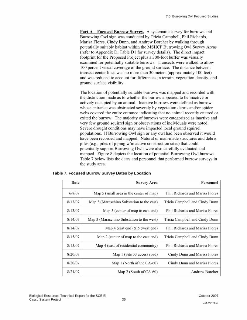
7.0 Burrowing Owl Focused Studies
Biological Resources Technical Report for the SCE El Casco System Project
36
October 2007
J&S 00446.07
Part A – Focused Burrow Survey. A systematic survey for burrows and Burrowing Owl sign was conducted by Tricia Campbell, Phil Richards, Marisa Flores, Cindy Dunn, and Andrew Borcher by walking through potentially suitable habitat within the MSHCP Burrowing Owl Survey Areas (refer to Appendix D, Table D1 for survey details). The direct impact footprint for the Proposed Project plus a 300-foot buffer was visually examined for potentially suitable burrows. Transects were walked to allow 100 percent visual coverage of the ground surface. The distance between transect center lines was no more than 30 meters (approximately 100 feet) and was reduced to account for differences in terrain, vegetation density, and ground surface visibility.
The location of potentially suitable burrows was mapped and recorded with the distinction made as to whether the burrow appeared to be inactive or actively occupied by an animal. Inactive burrows were defined as burrows whose entrance was obstructed severely by vegetation debris and/or spider webs covered the entire entrance indicating that no animal recently entered or exited the burrow. The majority of burrows were categorized as inactive and very few ground squirrel sign or observations of individuals were noted. Severe drought conditions may have impacted local ground squirrel populations. If Burrowing Owl sign or any owl had been observed it would have been recorded and mapped. Natural or man-made structures and debris piles (e.g., piles of piping w/in active construction sites) that could potentially support Burrowing Owls were also carefully evaluated and mapped. Figure 8 depicts the location of potential Burrowing Owl burrows. Table 7 below lists the dates and personnel that performed burrow surveys in the study area.
Table 7. Focused Burrow Survey Dates by Location
Date Survey Area Personnel
6/8/07 Map 5 (small area in the center of map) Phil Richards and Marisa Flores
8/13/07 Map 3 (Maraschino Substation to the east) Tricia Campbell and Cindy Dunn
8/13/07 Map 5 (center of map to east end) Phil Richards and Marisa Flores
8/14/07 Map 3 (Maraschino Substation to the west) Tricia Campbell and Cindy Dunn
8/14/07 Map 4 (east end) & 5 (west end) Phil Richards and Marisa Flores
8/15/07 Map 2 (center of map to the east end) Tricia Campbell and Cindy Dunn
8/15/07 Map 4 (east of residential community) Phil Richards and Marisa Flores
8/20/07 Map 1 (Site 33 access road) Cindy Dunn and Marisa Flores
8/20/07 Map 1 (North of the CA-60) Cindy Dunn and Marisa Flores
8/21/07 Map 2 (South of CA-60) Andrew Borcher

7.0 Burrowing Owl Focused Studies
Biological Resources Technical Report for the SCE El Casco System Project
37
October 2007
J&S 00446.07
Part B – Focused Burrowing Owl Surveys. The focused survey consisted of survey visits on four separate days for all areas within the MSHCP Burrowing Owl Survey Area, having potentially suitable habiat at a coarse scale, having active burrows as defined in Part A above. Figure 8 illustrates the locations of burrows and areas that the focused surveys were performed. The first visit was conducted concurrently with Part A with the caveat that all survey visits were conducted in the morning between one hour before sunrise to two hours after sunrise and two hours before sunset to one hour after sunset. The first course of action during the focused survey visits were to scan mapped burrows and potential perch locations using binoculars. Once this had been accomplished, a search for owls and owl sign was conducted by walking through the suitable habitat areas and visually assessing all areas within the Proposed Project footprint and a 300-foot buffer. This work followed transects spaced to allow 100 percent visual coverage of the ground surface and spaced no more than 30 meters (approximately 100 feet). For potentially suitable habitat between 300 and 500 feet of the Project footprint, binoculars were used to determine if owls were present. Appendix D summarizes the site visit data for the Burrowing Owl focused surveys. Every attempt was made to ensure that all survey work was conducted during weather that is conducive to observing owls outside their burrows and detecting Burrowing Owl sign. No survey visits were conducted during dense fog, rain, or within 5 days following rain. Almost all visits were performed when temperatures were 90 degrees Fahrenheit. During the first week of surveys in August, temperatures often exceeded 90 degrees Fahrenheit in the afternoons prior to sunset, and did not cool to below 90 degrees until just before sunset. Therefore, some of the afternoon surveys began while temperatures were above 90 degrees and ended after it had cooled down. For those sections surveyed on a visit above 90 degrees that same area was surveyed on the following visit during cooler conditions (i.e., 90 degrees or less). Temperatures were also closely monitored to determine when temperatures dropped below 90 degrees.
Similarly, during the morning survey on August 14, heavy winds (with gusts up to 40 mph) occurred during the entire survey window. Winds were closely documented throughout this survey visit to see when and if winds fell below 20 mph.
7.3 Results No Burrowing Owls or Burrowing Owl sign (i.e. scat, feathers, tracks) was detected within any portion of the study area for Burrowing Owl. Figure 8, Maps 1 through 5, illustrates the Burrowing Owl focused survey areas and potentially suitable burrow locations that were carefully surveyed. The species is judged absent.

Biological Resources Technical Report for the El Casco System Project
38
October 2007
J&S 00446.07
8.0 Least Bell’s Vireo Focused Studies
The following sections present the background, methods, and results of the focused survey for Least Bell’s Vireo (Vireo bellii pusillus) on the study area.
Protocol focused surveys for this species was performed in 2006 by URS (2007) for Site 33 and associated lands. Non-protocol surveys were conducted in potentially suitable habitat along the 115kV Line. The results of this work indicated that three territorial male Least Bell’s Vireos were detected in the riparian habitat in vicinity of Site 33. One of the three males appeared to be paired with a female, but no confirmed nesting was obtained.
Along the 115kV Line, a total of at least four Least Bell’s Vireo territories and a transient individual were detected in vicinity of the alignment in 2005.
Because portions of the previous work were not performed at the protocol-level, United States Fish and Wildlife Service (USFWS) requested that the surveys be updated.
8.1 Background This westernmost subspecies of the Bell’s vireo was first given protection as an endangered species by the state of California on October 2, 1980, and then by the federal government on May 2, 1986.
Least Bell’s Vireo is a small, migratory insect gleaner that normally selects dense vegetation low in riparian zones for nesting. The breeding season for Least Bell’s Vireo is typically mid-March to September (USFWS 1986). During this period Least Bell’s Vireo are known to breed almost exclusively within riparian habitats (USFWS 1998). Nesting sites are typically selected within structurally heterogeneous woodlands, forests and scrubs that support dense vegetation near the ground, and dense horizontally separated vegetation higher up in the canopy (Goldwasser 1981; Gray and Greaves 1984; Salata 1983; RECON 1989). Nests are typically suspended in forked branches of many different riparian species with no clear preference for any particular species (Nolan 1960; Barlow 1962; Goldwasser 1981). Because willows (Salix spp.) and Mule Fat are typically the most abundant species in vireo habitat, these species are most commonly selected for nesting (Goldwasser 1981; Franzreb 1989). Least Bell’s Vireo nests are usually placed between 0.9 and 1.5 meters from the ground with a range between 0.2 to 3.6 meters (Goldwasser 1981; Salata 1984; RECON 1988). Females
8.0 Least Bell’s Vireo Focused Studies
Biological Resources Technical Report for the SCE El Casco System Project
39
October 2007
J&S 00446.07
probably select the nesting sites but both genders participate in nest construction (Barlow 1962). Nests appear to only be used once with new ones constructed for failed or successive broods (Greaves 1987).
The clutch size of the Least Bell’s Vireo is between 2 to 5 (typically 3 or 4) eggs, which are laid shortly after nest construction (Salata 1984; Kus 1994; USFWS 1998). A typical clutch is incubated by both parents for about 14 days with the young remaining in the nest for another 10-12 days (Pitelka and Koestner 1942; Nolan 1960; Barlow 1962). Fledglings linger in established breeding territories, remaining under parental care for several more weeks (USFWS 1998). Least Bell’s Vireo produce typically only one brood, but additional broods up to four or five have also been reported (Franzreb 1989; USFWS 1998).
Predation is common in Least Bell’s Vireo owing in part to the close proximity between nest and ground (Franzreb 1989; Kus 1994). Nest predation among Least Bell’s Vireo has been reported as high as 45 percent in the San Luis Rey river to as low as 8 percent on the San Diego river (Salata 1983). Additionally, nest parasitism by the Brown-headed Cowbird (Molothrus ater) is one of the primary threats to successful reproduction in Least Bell’s Vireo (USFWS 1998).
Least Bell’s Vireo has a breeding distribution that extends northwest to Santa Barbara County (rarely Monterey County and formerly the northern Sacramento Valley), northeast to Inyo County, south into northern Baja California, Mexico, and east to the western edges of the deserts at a few points such as at the Mohave River (USFWS 1998). The subspecies winters in Baja California (Howell and Webb 1995).
Given the ongoing recovery of the species and the large concentration of birds in the western portion of the MSHCP Plan Area, the Least Bell’s Vireo may be found in suitable habitats nearly throughout the Plan Area. The Least Bell’s Vireo population in the Prado Basin and contiguous (upstream and downstream) reaches of the Santa Ana River is the second largest population of this endangered species within its range. Other key population areas of the Least Bell’s Vireo, in addition to the Prado Basin and Santa Ana River, include: Temescal Wash (including Alberhill Creek), Mockingbird Canyon, Murrieta Creek, Temecula Creek, Lake Skinner (including Rawson Canyon), Vail Lake, Wilson Creek, San Timoteo Canyon, Lake Elsinore, March Air Reserve Base, Meadowbrook, Canyon Lake, De Luz Creek, Potrero Creek, Bautista Creek, and Reche Canyon.
According to the MSCHP, approximately 2,780 acres of potential habitat for the Least Bell’s Vireo is located outside the MSHCP Criteria Area and Public/Quasi-Public designations, or about 23 percent of the total potential habitat within the MSHCP Plan Area. Although Least Bell’s Vireo is a MSHCP Covered Species that is Adequately Conserved under the Plan, potential Least Bell’s Vireo habitat is associated with wetland habitats, which are subject to the MSHCP Riparian/Riverine Areas and Vernal Pools policy (Volume I, Section 6.1.2 of the Plan). This policy provides protection of

8.0 Least Bell’s Vireo Focused Studies
Biological Resources Technical Report for the SCE El Casco System Project
40
October 2007
J&S 00446.07
riparian/riverine areas and vernal pools and a variety of species that occupies these habitats, including Least Bell’s Vireo.
8.2 Methods The following describes the methods used during the habitat assessment and focused survey for the Least Bell’s Vireo. The study area for Least Bell’s Vireo included the entire Project limits plus a 500-foot buffer (Section 1.2, Figure 2).
8.2.1 Habitat Evaluation The Project survey area was evaluated for potentially suitable habitat for Least Bell’s Vireo on May 4, 2007 by Tricia A. Campbell, a Jones & Stokes biologist familiar with the habitat needs of the species. This assessment included a careful review of aerial photographs prior to the site visit and a field inspection. The field inspection was a windshield survey that spanned the entire Project footprint. Potentially suitable habitat was mapped onto aerial photographs. Figure 9 presents the potential habitat for the species within the Project study area. Potential habitat was limited to the western half of the Project study area. Riparian vegetation that had a shrub understory was judged potentially suitable.
8.2.2 Focused Survey From May 14 through July 31, 2007, focused surveys for Least Bell’s Vireo were conducted in all riparian areas within the project survey area judged as potentially suitable habitat (Figure 9). Methods for the focused surveys followed currently recommended guidelines for presence/absence surveys (USFWS 2001). Appendix E Table E1 provides a summary of the dates, times, and weather conditions during the focused survey visits.
Under the methodology used, visits consisted of careful, thorough coverage of potential habitat on each survey visit. No tape recording of vocalizations was used during any of the survey visits. During each visit, the locations of detected Least Bell’s Vireo were mapped on an aerial photograph. All wildlife species detected during each visit were recorded. In addition, the locations and estimated age and sex of detected Brown-headed Cowbirds were recorded (Appendix E Table E2). All visits were performed during morning hours until 1100, when Least Bell’s Vireos are most active, and the rate of coverage was well within recommendations for such surveys. Three biologist days were needed to survey all potential habitat once. It took a single biologist to cover each of the three potential habitat polygons shown on Figure 9.
At this time, no special permits are required to perform focused surveys for Least Bell’s Vireo in accordance with the recommended guidelines. The biologists that conducted the surveys are experienced with the species and its habitat requirements.

8.0 Least Bell’s Vireo Focused Studies
Biological Resources Technical Report for the SCE El Casco System Project
41
October 2007
J&S 00446.07
8.3 Results Results of the habitat evaluation indicated potentially suitable habitat for Least Bell’s Vireo at three locations within the Project study area. These three riparian areas are depicted on Figure 9.
Based on professional experience, available literature, and Least Bell’s Vireo detections over the course of the focused survey, an estimated 15 to 18 pairs of Least Bell’s Vireo are present within the study area (refer to Figure 9). Occupation by the species is in vicinity of Site 33 and its associated access road as well as along portions of the 115kV Line.
It is important to understand that the survey protocol used is to determine presence or absence of the species is 95 percent reliable. It is not adequate to ascertain territories. Figure 9 illustrates use areas of the species that was gathered across the course of the focused survey work. The use areas were established by collecting points where individuals or pairs were observed and/or detected across survey visits. Consequently, it is likely that the depicted use areas represent only a portion of an individual’s and/or pair’s territory across a season. A range of pair numbers is provided because positions of birds appeared to change across survey visits and without the marking of individuals (e.g., leg bands) it is not possible to know with certainty whether an individual observed on one visit is the same individual that is later detected in a different location.
Refer to Section 12.0 for recommendations to address this project constraint.

Biological Resources Technical Report for the El Casco System Project
42
October 2007
J&S 00446.07
9.0 Southwestern Willow Flycatcher Focused Studies
The following sections present the background, methods, and results of the focused studies conducted to determine the presence or absence of Southwestern Willow Flycatcher (Empidonax traillii extimus) in the Project study area.
Protocol surveys for this species were performed by URS (2007) in 2006 in vicinity of Site 33. One Willow Flycatcher was detected during the first two survey visits and was judged a northern migrant of a different subspecies (i.e., E. t. brewsteri). No survey work was performed in vicinity of the 115 kV Line.
9.1 Background The species as a whole was given protection by the state of California as an Endangered species on December 3, 1990, and the Southwestern subspecies (E.t. extimus) was federally listed as an Endangered species effective March 29, 1995.
This subspecies (or race) of the Willow Flycatcher normally arrives on breeding grounds in southern California beginning in early May and continuing through at least late July. Timing of departure of local birds is obscured by secretive behavior at that time along with more abundant migrants of other subspecies passing through the area. Migrants of subspecies other than E.t. extimus are very widespread, and uncommon to fairly common as they pass through southern California. This occurs mainly from late May through mid-June, and again from late July through September. The period in which migrants of other subspecies are absent from southern California is approximately June 14 through July 17 (Unitt 1987).
As noted in the Federal Register final rule listing the species as endangered (USFWS 1995), the Southwestern Willow Flycatcher, “occurs in riparian habitats along rivers, streams, or other wetlands, where dense growths of willows (Salix spp.), Baccharis spp., arrowweed (Pluchea spp.), buttonbush (Cephalanthus spp.), tamarisk (Tamarix spp.), Russian olive (Eleagnus spp.) or other plants are present, often with a scattered overstory of cottonwood (Populus spp.) . . . Throughout the range of E.t. extimus, these riparian habitats tend to be rare, widely separated, small and/or linear locales,
9.0 Southwestern Willow Flycatcher Focused Studies
Biological Resources Technical Report for the SCE El Casco System Project
43
October 2007
J&S 00446.07
separated by vast expanses of arid lands. The Southwestern Willow Flycatcher has experienced extensive loss and modification of this habitat and is also endangered by other factors including brood parasitism by the Brown-headed Cowbird.”
In describing breeding habitat, the Final Rule (USFWS 1995) also noted that the subspecies, “nests in thickets of trees and shrubs approximately 4 - 7 meters (13 - 23 feet) or more in height, with dense foliage from approximately 0 - 4 meters (13 feet) above ground, and often a high canopy cover percentage. The diversity of nest site plant species may be low (e.g., willows) or comparatively high . . . Nest site vegetation may be even- or uneven-aged, but is usually dense and structurally homogenous . . . Following modern changes in riparian plant communities, E.t. extimus still nests in native vegetation where available, but has been known to nest in thickets dominated by tamarisk and Russian olive . . . Nesting Willow Flycatchers of all subspecies generally prefer areas with surface water nearby . . . but E.t. extimus virtually always nests near surface water or saturated soil (Phillips et al. 1964, Muiznieks et al. 1994). At some nest sites surface water may be present early in the breeding season but only damp soil is present by late June or early July.”
The general breeding range of the Southwestern Willow Flycatcher includes: southern California, Arizona, New Mexico, extreme southern portions of Nevada and Utah, far western Texas, southwestern Colorado, and extreme northwestern Mexico (USFWS 1993). The specific breeding range for this subspecies includes: Owens Valley, south fork of the Kern River, the Los Angeles Basin (Unitt 1987; Zeiner, et al. 1990), the Santa Ynez River near Buellton, the Prado Basin riparian forest in Riverside County, the Santa Margarita and San Luis Rey Rivers in San Diego County, Middle Peak in the Cuyamaca Mountains, and near Imperial Beach (Small 1974). Breeding populations also exist in southern Nevada, Arizona, and New Mexico (Garrett and Dunn 1981). Additionally, this taxon overwinters in Mexico (USFWS 1995). Important stopovers along the Rio Grande provide important refueling sites for flycatchers as they migrate between their breeding and wintering grounds (Yong and Finch 1997).
Within the MSHCP Plan area, the Southwestern Willow Flycatcher is sparsely located from the Prado Basin and Santa Ana River southeast to the Vail Lake region. It has been recorded as a single location or very few locations currently or historically within Temescal Wash/Alberhill Creek, Canyon Lake, Temecula Creek, Box Springs Mountains, Bautista Creek, Vail Lake, Hemet Lake (old record), Santa Rosa Plateau Nature Reserve, Lake Mathews, Lake Skinner, Lake Perris, and Potrero Creek. The locations that have been recorded since 1990 within the Plan Area are: Prado Basin (3-5 territories; seven territories in 2001), Santa Ana River (3-5 territories), Box Springs Mountain, Alberhill Creek, Canyon Lake, Santa Rosa Plateau Nature Reserve, Temecula Creek (approximately 3 locations), Vail Lake (2-4 locations), Lake Skinner, Bautista Creek, and Potrero Creek. The MSHCP Core Areas for the Southwestern Willow Flycatcher are considered to be Prado Basin/Santa Ana River, Temescal Wash, Temecula Creek, Murrieta Creek, Vail Lake, and San Timoteo Creek.

9.0 Southwestern Willow Flycatcher Focused Studies
Biological Resources Technical Report for the SCE El Casco System Project
44
October 2007
J&S 00446.07
According to the MSCHP, approximately 3,220 acres (about 23 percent) of suitable Southwestern Willow Flycatcher Habitat will be outside the Criteria Area and Public/Quasi-Public Lands and individuals within these areas may be subject to Incidental Take. However, implementation of the Protection of Species Associated with Riparian/Riverine Areas and Vernal Pools and adjacency policies, avoidance of clearing of suitable habitat in the breeding season and protection and management of 90 percent of the area with conservation value of any site where the species is found will minimize Take of the species.
9.2 Methods The following describes the methods used during the habitat assessment and focused survey for Southwestern Willow Flycatcher. The study area for this species was the Project limits of disturbance and a 500-foot buffer.
9.2.1 Habitat Evaluation The survey area was evaluated for potentially suitable habitat for the Southwestern Willow Flycatcher. This assessment included a careful review of aerial photographs and a field inspection. The habitat assessment was performed concurrently with the habitat evaluation for Least Bell’s Vireo on May 4, 2007 and was conducted by Tricia A. Campbell, a Jones & Stokes biologist familiar with the species and its habitat requirements. The field inspection was principally done by vehicle with the caveat that riparian vegetation judged potentially suitable by structure was checked for hydrology criteria of either perennial surface water or indicators of the presence subsurface water. Unlike Least Bell’s Vireo, this species tree canopy sturcure in conjunction with an understory shrub layer as well as either surface water or a broad subsurface hydrology base for which potential prey is supported through the dry cismontane southern California summer.
Figure 9 illustrates the potentially suitable habitat for Southwestern Willow Flycacher present within the Project study area. Only the western half of the Project study area supported potential habitat and all potential habitat for this species was the same areas as that present for Least Bell’s vireo. Perennial hydrology was present in all potential habitat for both species.
9.2.2 Focused Survey From May 24, 2007 through July 17, 2007, a focused survey was conducted for Southwestern Willow Flycatcher in all potentially suitable habitat within the Project study area (Figure 9). The survey protocol to determine presence or absence of Southwestern Willow Flycatcher requires a federal 10(A)1(a) permit. This survey was conducted by Tricia A. Campbell (federal permit # TE-789266-9, expires July 12, 2008) and Kurt F. Campbell (federal permit # TE781485-6, expires July 12, 2008). Appendix E Table E1 provides a summary of dates, times and weather conditions during the focused survey visits for Southwestern Willow Flycatcher.

9.0 Southwestern Willow Flycatcher Focused Studies
Biological Resources Technical Report for the SCE El Casco System Project
45
October 2007
J&S 00446.07
The focused survey for Southwestern Willow Flycatcher followed the published survey methodology (Sogge et al.1997, USFWS 2000) and consisted of five visits to all potential habitat. Visits consisted of one each within the first two windows (May 15-31; June 1-21), and three within the window between June 22- July17. On each of the survey visits, all potential habitat was carefully checked for this species. This included slow walking with frequent stops to look, listen, and play taped willow flycatcher vocalizations. Tapes were played every several minutes, or at distance intervals of approximately 75-100 feet (23-30 meters). Tapes were played only while stationary and only after first looking and listening for any potential willow flycatchers.
Three biologist days were needed to survey all potential habitat once. It took a single biologist to cover each of the three potential habitat polygons shown on Figure 9.
During each visit, the locations of detected Southwestern Willow Flycatcher were mapped on an aerial photograph. All wildlife species detected during each visit were recorded. In addition, per permit conditions the locations and estimated age and sex of detected Brown-headed Cowbirds were recorded and can be found in Appendix E Table E2.
9.3 Results Based on the habitat evaluation, three riparian areas were found to be potentially suitable for Southwestern Willow Flycatcher (Figure 9). the same as that identified for Least Bell’s Vireo. The potential habitat present has perennial hydrology and both shrub and canopy vegetation structure.
An estimated five pairs of Southwestern Willow Flycatcher occur within the Project study area and their use areas are shown on Figure 9. Occupied areas occur in vicinity of Site 33 and its associated access road and the 115 kV Line. Similar to Least Bell’s Vireo, the survey work performed is used to determine presence or absence rather than extent of territory. In addition to the estimated five pairs, a single willow flycatcher was sighted (Figure 9 Map 3) during the first survey set in May. Because this individual was not found during any of the later visits, it is judged a migrant of the northern subspecies E. t. brewsteri, not the southwestern subspecies, E. t. extimus.
As discussed in Section 9.1, SouthwesternWillow Flycatcher is a rare breeder in western Riverside County and the presence of this subspecies is judged biologically important. Refer to Section 12.0 for recommendations to address this constraint to the project.

Biological Resources Technical Report for the El Casco System Project
46
October 2007
J&S 00446.07
10.0 WesternYellow-billed Cuckoo Focused Studies
The following sections present the background, methods, and results of the focused survey conducted to determine the presence or absence of Western Yellow-billed Cuckoo (Coccyzus americanus occidentalis) in the study area.
10.1 Background The Western Yellow-billed Cuckoo was given protections by the state of California as an Endangered Species on March 28, 1988 and is currently a candidate for listing under the Endangered Species Act. This species has declined from a fairly common, local breeder in much of California sixty years ago, to virtual extirpation, with only a handful of tiny populations remaining in all of California today. In California, this cuckoo once numbered more than 15,000 pairs, but the population has been reduced to about 30 pairs in less than 100 years due to the destruction of preferred riparian habitat and to pesticide use (Hughes 1999).
In California nesting activities usually occur from late June to late July, however, breeding may also occur as early as late May and as late as the end of August. Cuckoos have been observed in California into mid-September. The species begins migrating in late August to the northwestern portion of South America.
Western Yellow-billed Cuckoo in California requires dense, wide riparian woodland with a well-developed understory for breeding (Garrett and Dunn 1981). It occurs in densely foliaged, deciduous trees and shrubs, especially willows, which are required for roost and nest sites. It is restricted when breeding to river bottoms and other mesic habitats where humidity is high and where the dense understory abuts slow-moving watercourses, backwaters or seeps (Zeiner, et al. 1990). Willow is almost always a dominant component of the vegetation.
Up to seven cuckoo territories, three pairs during the 2001 breeding season, have been documented in the western Riverside County area in recent years; all of these were located in or adjacent to Prado Basin, Riverside County along the Santa Ana River (Pike et al. 2001). The Prado Basin birds may represent the only remaining summering location in southern California away from the Colorado River. Breeding of Yellow-billed Cuckoos has been confirmed only once in the Prado Basin during 14 years of observations there

10.0 Western Yellow-billed Cuckoo Focused Studies
Biological Resources Technical Report for the SCE El Casco System Project
47
October 2007
J&S 00446.07
(USFWS 1999 unpublished data). Geographic locations recorded within the U.C. Riverside database include: Santa Ana River, Prado Park, North Peak Conservation Bank, Poorman Reservoir, and Temecula Creek. These last three records are either old, low precision records, or were not confirmed for breeding activity (MSHCP 2003).
10.2 Method This section provides the methods used for the habitat evaluation and focused survey.
10.2.1 Habitat Evaluation During the last half of May 2007, the entire study area was evaluated for the presence of potentially suitable habitat for Western Yellow-billed Cuckoo within 500 feet of the proposed project. Habitat was defined as areas of riparian vegetation with a tall, dense tree layer with a largely closed canopy at least 100 feet wide, willows included as at least part of the dominant plant species, and an understory at least moderately vegetated in shrub and herb layers. Based on these criteria, we concluded that no potentially suitable habitat was present.
However, during the last visit for the Least Bell’s Vireo survey, on 31 July 2007, one Yellow-billed Cuckoo was seen and heard in the project study area (see Figure 9 Map 1 for location). For a combination of several reasons it appears very likely that the bird was not nesting locally. Instead it most likely was passing through the project area as a non-breeder or after a failed nesting attempt elsewhere and thus not dependent on suitable breeding habitat. The evidence supporting this is: (1) the fact that cuckoos were undetected in 11 prior visits for Willow Flycatcher and Bell’s Vireos from 14 May through 30 July by biologists familiar with identification of cuckoos by sight and sound (2) the timing of the observation, approximately eight weeks after spring migrants normally arrive on territory and initiate nesting, (3) this year’s drought conditions which probably resulted in poor breeding conditions, (4) the bird’s behavior, consisting of slow but fairly steady movement along the riparian corridor, covering at least 300 feet in less than 4 minutes and disappearing upstream, (5) the apparent unsuitability of the riparian portions of the study area as cuckoo breeding habitat, and (6) the lack of any evidence in recent decades of cuckoos nesting along San Timoteo Creek, including potentially more suitable areas of the creek elsewhere beyond the Project study area. Results of the focused survey, presented below, also support this interpretation.
Out of caution, it was decided to conduct a focused survey for this species in accordance with the most widely accepted survey protocol.
10.0 Western Yellow-billed Cuckoo Focused Studies
Biological Resources Technical Report for the SCE El Casco System Project
48
October 2007
J&S 00446.07
10.2.2 Focused Survey A focused survey was conducted between August 7, 2007 and August 31, 2007 for Western Yellow-billed Cuckoo within those areas approaching potentially suitable habitat in the study area. Focused surveys were performed by Kurt Campbell, a Jones & Stokes biologist experienced and knowledgeable in the identification, habitat requirements and vocalizations of this species. See Appendix E Table E1 for dates, times and conditions.
The protocol used for the focused survey work follows methodology developed by the Arizona Game and Fish Department and the United States Geological Survey Colorado Plateau Field Station (Halterman 2002). Survey visits occurred three times and were 12 days apart. The survey window for Yellow-billed Cuckoo is mid-June through August at times when temperatures are below 100°F or before 12:00 pm, whichever comes first. Survey visits also occurred within conditions conducive for auditory detection of Western Yellow-billed Cuckoo (i.e., winds below 8 mph and no heavy rain).
Tape playbacks with the cuckoos’ contact call (the “kowlp” call) were made approximately every 328 feet (100 meters) at the edge of or within surveyed habitat. Tapes were played while stationary and only after first looking and listening for Western Yellow-billed Cuckoo. Five “kowlp” calls, at approximately one-minute intervals, were played at each survey point. At this time, no special permits are required to perform focused surveys for Yellow-billed Cuckoo in accordance with the recommended guidelines.
10.3 Results Although a single, apparently non-breeding cuckoo was detected on 31 July 2007, no Yellow-billed Cuckoos were detected during the focused survey conducted in August 2007. This result supports and reinforces the conclusion that the species did not nest in the Project study area. However, detection of the species just prior to the survey indicates a remote possibility that the species breeds, or has bred in recent years, in the study area during non-drought years. It was absent as a breeding species in the Project study area in 2007. However, based on all available information, we conclude the species should be considered present at this time.

Biological Resources Technical Report for the El Casco System Project
49
October 2007
J&S 00446.07
11.0 Impacts Analysis
This section provides an analysis of impacts to biological resources expected to occur from the construction of Site 33 Substation (El Casco Substation), the Site 33 Substation access road, replacement of the existing 115 kV subtransmission lines (including support structures), and modification of equipment at the existing Maraschino and Banning Substations (Section 11.1).
Analysis of impacts to biological resources due to the operation of the Project is also presented (Section 11.2).
Both direct and indirect impacts are anticipated. Direct impacts are those effects that can be expected from direct removal and grading of lands. Examples of direct impacts include mortality of individuals and permanent loss of habitat. Indirect impacts are those effects that give rise to delayed, secondary effects. Examples of indirect impacts include fragmentation, pollination interruption, increased environmental toxins, plant and wildlife dispersal interruption, increase risk of fire, and increased invasion by nonnative animals and plants that out-compete natives. Indirect impacts can safely be assumed to increase mortality, reduce productivity, and/or reduce the value and functions of natural open space for the native species that inhabit it.
Recommendations to address impacts identified below are provided in Section 12.0.
11.1 Construction Impacts No impacts to biological resources are expected to occur from the construction activities at the Maraschino and Banning Substations. The following sections provides an analysis potential impact to biological resources by the proposed construction of Site 33, Site 33 access road, and the 115 kV line upgrades.
11.1.1 Riparian-Riverine and Vernal Pool Resources/Jurisdictional Waters
Impact Area 1 will be temporarily impacted during replacement of a culvert under an existing access road (Appendix C). Impact Area 2 will be temporarily and permanently impacted as a result of the installation of a

11.0 Impacts Analysis
Biological Resources Technical Report for the SCE El Casco System Project
50
October 2007
J&S 00446.07
telecommunications duct bank. Impact Areas 3 through 8 will be temporarily impacted by utility pole replacement/upgrade activities. At the pole replacement and upgrade locations, temporary impacts are calculated using an assumption of disturbance in a 50-foot buffer around the existing poles that will be replaced. Permanent impacts are calculated using an assumption of loss of existing resources in a 10-foot buffer around the existing poles. Table 8 summarizes all temporary impacts to water features and Table 9 summarizes all permanent impacts to water features. There is no overlap in area between temporary and permanent impacts.
Table 8. Summary of Temporary Impacts to Water Features by the Proposed Project
USACE
Feature Non-Wetland
Waters Wetlands DFG RWQCB MSHCP Impact Area 1 Site 33 Access Rd.
212 sq ft (0.005 acre)
60 linear feet
0.03 acres 75 linear feet
0.07 acre 150 linear feet
0.04 acres 135 linear feet
0.07 acre 150 linear feet
Impact Area 2 Site 33 Duct Bank
0.0 acre 0 linear feet
0.0 acre 0 linear feet
0.00 acre 0 linear feet
0.0 acres 0 linear feet
0.00 acre 0 linear feet
Impact Area 3 115kV Line
0.0 acre 0 linear feet
0.01 acre 50 linear feet
0.15 acre 200 linear feet
0.01 acre 50 linear feet
0.15 acre 200 linear feet
Impact Area 4 115kV Line
0.0 acre 0 linear feet
0.0 acre 0 linear feet
0.13 acre 100 linear feet
0.0 acres 0 linear feet
0.13 acre 100 linear feet
Impact Area 5 115kV Line
0.0 acre 0 linear feet
0.0 acre 0 linear feet
0.03 acre 25 linear feet
0.0 acres 0 linear feet
0.03 acre 25 linear feet
Impact Area 6 115kV Line
178 sq ft (0.004 acre)
100 linear feet
0.0 acre 0 linear feet
356 sq ft (0.008 acre)
100 linear feet
178 sq ft (0.004 acres)
100 linear feet
356 sq ft (0.008 acre)
100 linear feet
Impact Area 7 115kV Line
0.06 acre 100 linear feet
0.0 acre 0 linear feet
0.18 acres 100 linear feet
0.06 acres 100 linear feet
0.18 acres 100 linear feet
Impact Area 8 115kV Line
0.01 acre 80 linear feet
0.0 acre 0 linear feet
0.18 acres 100 linear feet
0.0 acres 0 linear feet
0.18 acres 100 linear feet
Total Jurisdiction
0.08 acre 340 linear feet
0.04 acre 125 linear feet
0.75 acres 775 linear feet
0.11 acres 385 linear feet
0.75 acres 775 linear feet

11.0 Impacts Analysis
Biological Resources Technical Report for the SCE El Casco System Project
51
October 2007
J&S 00446.07
Table 9. Summary of Permanent Impacts to Water Features by the Proposed Project
USACE
Feature Non-Wetland
Waters Wetlands DFG RWQCB MSHCP Impact Area 1 Access Rd.
0.0 acre 0 linear feet
0.0 acre 0 linear feet
0.0 acre 0 linear feet
0.0 acre 0 linear feet
0.0 acre 0 linear feet
Impact Area 2 Site 33 Duct Bank
0.0 acre 0 linear feet
0.0 acre 0 linear feet
0.02 acre 20 linear feet
0.02 acre 20 linear feet
0.0 acre 0 linear feet
Impact Area 3 115kV Line
0.0 acre 0 linear feet
0.0 acre 0 linear feet
90 sq ft (0.002 acre)
20 linear feet
0.0 acre 0 linear feet
90 sq ft (0.002 acre)
20 linear feet
Impact Area 4 115kV Line
0.0 acre 0 linear feet
0.0 acre 0 linear feet
314 sq ft (0.007 acre)
20 linear feet
0.0 acre 0 linear feet
314 sq ft (0.007 acre)
20 linear feet
Impact Area 5 115kV Line
0.0 acre 0 linear feet
0.0 acre 0 linear feet
0.0 acre 0 linear feet
0.0 acre 0 linear feet
0.0 acre 0 linear feet
Impact Area 6 115kV Line
0.0 acre 0 linear feet
0.0 acre 0 linear feet
0.0 acre 0 linear feet
0.0 acre 0 linear feet
0.0 acre 0 linear feet
Impact Area 7 115kV Line
79 sq ft (0.001 acre) 20 linear feet
0.0 acre 0 linear feet
314 sq ft (0.007 acre) 20 linear feet
79 sq ft (0.001 acre) 20 linear feet
314 sq ft (0.007 acre) 20 linear feet
Impact Area 8 115kV Line
0.0 acre 0 linear feet
0.0 acre 0 linear feet
314 sq ft (0.007 acre) 20 linear feet
0.0 acre 0 linear feet
314 sq ft (0.007 acre) 20 linear feet
Total Jurisdiction
79 sq ft (0.001 acre) 20 linear feet
0.0 acre 0 linear feet
0.043 acres 100 linear feet
0.02 acre 40 linear feet
0.043 acres 100 linear feet
As shown in Tables 8 and 9, temporary impacts to riparian-riverine features under the MSHCP total 0.75 acres and permanent impacts to those features total 0.043 acres. In both cases, the substantial majority of the area is within DFG jurisdiction but outside USACE jurisdiction. That majority area is dominated by riparian vegetation (especially willows) but is outside both active channels and adjacent wetlands. Recommendations for addressing these impacts are provided in Section 12.0.
No vernal pools or fairy shrimp are present within the Proposed Project study area and thus impacts to these resources are not expected.
11.0 Impacts Analysis
Biological Resources Technical Report for the SCE El Casco System Project
52
October 2007
J&S 00446.07
11.1.2 Natural Vegetation Communities The Proposed Project would permanently and temporarily remove natural vegetation communities during construction. Table 10 below provides proposed impacts to natural vegetation communities by MSHCP vegetation categories. Mitigation is not required for impacts to natural vegetation communities that are covered under the MSHCP except for riparian-riverine associated vegetation (i.e., Riparian Scrub, Woodland, Forest).
Recommendations to address proposed impacts to riparian-riverine resources can be found in Section 12.0.
Table 10. Impacts to Natural Vegetation Communities by the El Casco System Project.
Vegetation Type1 Project Element Site 33 (El Casco Substation)
Site 33 Access Road
115 kV Line
Permanently Impacted Acres
0.00 0.00 0.00 Woodland and Forests
Temporarily Impacted Acres
0.00 0.00 0.00
Permanently Impacted Acres
0.00 0.00 0.04 Coastal Sage Scrub
Temporarily Impacted Acres
0.00 0.00 1.01
Permanently Impacted Acres
0.00 0.00 0.01 Riversidian Alluvial Fan Sage Scrub
Temporarily Impacted Acres
0.00 0.00 0.17
Permanently Impacted Acres
3.53 0.00 0.07 Chaparral
Temporarily Impacted Acres
0.00 0.00 1.65
Permanently Impacted Acres
0.99 0.00 0.19 Grassland
Temporarily Impacted Acres
0.00 0.00 4.82
Permanently Impacted Acres
0.00 0.00 0.01 Riparian Scrub, Woodland, Forest
Temporarily Impacted Acres
0.00 0.06 0.30
Permanently Impacted Acres
8.90 0.25 0.96 Developed/Disturbed Land
Temporarily Impacted Acres
0.00 1.30 23.63
1 = MSHCP vegetation categories
11.1.3 Rare Plants Based on information provided in URS (2007) and the results of the 2007 focused surveys, the Proposed Project has the potential to impact two

11.0 Impacts Analysis
Biological Resources Technical Report for the SCE El Casco System Project
53
October 2007
J&S 00446.07
special-status non-listed plants, Smooth Tarplant and Many-stemmed Dudleya. Smooth Tarplant is an MSHCP Criteria Area Species and Many-stemmed Dudleya is a Narrow Endemic species.
Smooth Tarplant Smooth Tarplant was not found during the 2005 focused survey work, but was found in 2007. Smooth Tarplant is located directly adjacent to the proposed Site 33 access road (roughly 50 individual plants) and within the proposed footprint of Site 33 (3 individuals). Another population of about 100 individuals is located within 100 feet of the Site 33 footprint. Figure 6b in Section 4.3 provides an illustration of the population locations relative to the Project footprint.
Construction of Site 33 would directly and permanently impact at least 3 Smooth Tarplants. There is potential for temporary indirect impacts to the two populations totaling roughly 150 individuals during construction. The number of individuals occupying all three areas would likely be more numerous during an average rainfall year.
Section 12.0 presents recommendations to address constraints to the project posed by Smooth Tarplant.
Many-stemmed Dudleya Potentially suitable habitat for Many-stemmed Dudleya is present within the 115kV Line. Likelihood of occurrence for the species is judged as low. An estimated 0.14 acres of potentially suitable habitat would be directly and permanently impacted and another 3.52 acres directly and temporarily impacted during construction. However, if the species was present in either the area proposed for direct permanent or direct temporary disturbance, impacts to the species would be permanent. This species of plant would be unlikely to passively reoccupy lands temporarily disturbed during construction. Because the focused survey results are inconclusive due to drought conditions, neither the species’ presence/absence status within the potential habitat is known nor how many individuals would be impacted if present. Potential habitat present within the 115kV Line and 100-foot buffer is determined to be low in quality due to intense grazing and soil compaction. It is likely that if the species was present the number of individuals affected would be limited. Recommendations to address potential impacts to this species by the Proposed Project are presented in Section 12.0.
The Proposed Project would result in impacts no other special-status plants covered under the Western Riverside MSHCP.
11.1.4 Los Angeles Pocket Mouse and San Bernardino Kangaroo Rat
Los Angeles Pocket Mouse occupies two distinct areas in the eastern portion of the 115kV Line footprint. Figure 7 Maps 4 and 5 present the locations of

11.0 Impacts Analysis
Biological Resources Technical Report for the SCE El Casco System Project
54
October 2007
J&S 00446.07
the occupied habitat for this species. Only one of the occupied areas would be directly impacted (permanently and temporarily) by the replacement of the existing pole in Montgomery Creek. Permanent direct impacts are expected to occur to less than 0.005 acres of occupied habitat. Another 0.06 acres of occupied habitat would be temporarily impacted. Direct mortality of Los Angeles Pocket Mouse is expected. The quality of habitat that would be impacted is determined to be moderate. The habitat and lands in the vicinity have been cattle grazed for many years and continue to be grazed. The other area with Los Angeles Pocket Mouse occupation is in Smith Creek (Figure 7 Map 4). The 115 kV Line traverses the wash and no encroachment into occupied habitat is planned. Recommendations to address proposed impacts to Los Angeles Pocket Mouse by the Proposed Project are addressed in Section 12.0.
Based on the habitat evaluation for San Bernardino Kangaroo Rat within the overlap area of the Project study area and the MSHCP survey area for this species, potentially suitable habitat is absent from the Proposed Project footprint and within 100 feet of the Project footprint. No impacts to this species are expected.
11.1.5 Burrowing Owl The focused survey for Burrowing Owl was completed in accordance with the applicable survey protocol. The species is absent from the Project study area at this time. No impacts to this species are expected. Although this species was found absent from the Project study area, Burrowing Owl is a species that is known for its ability to move into and out of areas across seasons and years. A recommendation to ensure that impacts to this species do not occur is presented in Section 12.0.
11.1.6 Listed Riparian Birds Least Bell’s Vireo Least Bell’s Vireo occupies the riparian vegetation within 500 feet of the Proposed Project footprint with an estimated 15 to 18 pairs present. Figure 9 Maps 1 through 3 illustrate the use areas observed during the 2007 focused surveys.
One direct impact is anticipated. The culvert replacement would temporarily remove 0.06 acres of occupied Least Bell’s Vireo habitat. Based on the location of Least Bell’s Vireo use areas and the amount of habitat proposed for impact, it is expected that two to three pairs would be affected (Figure 9 Map 1). No other direct impacts to the species are expected to occur from the Proposed Project.
One indirect impact is anticipated. Occupied Least Bell’s Vireo habitat also occurs within 500 feet of the Proposed Project footprint and could be indirectly impacted during construction if scheduled between March 15 and September 15. An additional estimated 12 to 16 pairs of Least Bell’s Vireo

11.0 Impacts Analysis
Biological Resources Technical Report for the SCE El Casco System Project
55
October 2007
J&S 00446.07
occur within 500 feet of the proposed limits of disturbance, including the Site 33 access road, Site 33, and several 115 kV Line poles. Depending on the timing of construction, indirect impacts could occur in the form of construction noise and human presence. Refer to Figure 9 Maps 1 thru 3 for the locations of the species relative to the Project footprints.
However, existing levels of noise and human disturbance are already very high in the occupied riparian adjacent to the Site 33 access road, Site 33, and along the 115 kV Line. Existing noise and human disturbance are caused from trains frequently passing by and routine off-road vehicle use.
Section 12.0 provides recommendations for addressing the proposed direct and indirect impacts to Least Bell’s Vireo by the Project.
Southwestern Willow Flycatcher The Proposed Project is expected to directly impact occupied habitat. Figure 9 Maps 1 through 3 illustrate the locations of Southwestern Willow Flycatcher occupied habitat relative to the Proposed Project footprints. The culvert replacement for the Site 33 access road would temporarily remove 0.06 acres of occupied Southwestern Willow Flycatcher habitat (one pair). Additionally, pole replacement at several 115 kV Line poles would permanently remove 0.02 acres of occupied habitat and temporarily remove an additional 0.50 acres of occupied habitat for an estimated two pairs.
Depending on construction timing (i.e., if occurring in the period from April 15 through September 15), indirect effects could occur to the above-mentioned three pairs as well as to an additional two pairs that occur beyond the impact footprint but within 500 feet. Indirect effects could occur due to construction noise and human presence. However, all of the locations of occupied habitat occur within areas with existing high levels of noise caused by humans (trains and/or off-road motorcyclists).
Recommendations to address impacts to Southwestern Willow Flycatcher are provided in Section 12.0.
Western Yellow-billed Cuckoo The Proposed Project may temporarily and indirectly impact Western Yellow-billed Cuckoo. An individual of this species was seen once during the current fieldwork (July 31, 2007). The individual is judged not to have been a breeder and there is a very low likelihood that the species occupies the Project study area as a breeder in non-drought years. However, as illustrated on Figure 9 Map 1, a cuckoo was observed within 500 feet of a 115 kV Line pole within San Timoteo Creek near SR60. If construction activities were to occur during the period of May 15 through September 15, indirect effects are possible.
The species was not observed in the vicinity of Site 33 or the access road.

11.0 Impacts Analysis
Biological Resources Technical Report for the SCE El Casco System Project
56
October 2007
J&S 00446.07
Recommendations to address potential impacts to Western Yellow-billed Cuckoo can be found in Section 12.0.
11.1.7 Federally and/or State Listed MSHCP Fully Covered Animals
This section identifies anticipated impacts to species listed as endangered or threatened but for which full coverage under the MSHCP is provided.
Quino Checkerspot Potentially suitable habitat is present for Quino Checkerspot (Euphydryas editha quino) within the Project study area. This is a fully covered species under the MSHCP with no survey requirements. Take of the species is tracked by the MSHCP through removal of potential habitat. The Proposed Project is expected to permanently remove a total of 13.73 acres (0.31 acres from 115 kV Line + 13.42 acres from Site 33) of potentially suitable habitat and temporarily impact an additional 17.88 acres (16.58 acres from 115 kV Line + 1.30 acres from the Site 33 access road). Potential for indirect effects to the species could occur but would be fully covered by the MSHCP.
Stephens’ Kangaroo Rat Stephens’ Kangaroo Rat (Dipodomys stephensi) has the potential to be present and impacted by the Proposed Project. The species is known to occur within the local vicinity. This species of kangaroo rat is fully covered under the MSHCP and focused surveys are not required. The Proposed Project is expected to permanently remove a total of 13.73 acres (0.31 acres from 115 kV Line + 13.42 acres from Site 33) of potentially suitable habitat and temporarily impact an additional 17.88 acres (16.58 acres from 115 kV Line + 1.30 acres from the Site 33 access road). Potential for indirect effects to the species could occur but would be fully covered by the MSHCP.
Coastal California Gnatcatcher Potentially suitable habitat for Coastal California Gnatcatcher (Polioptila californica californica) is present within the Proposed Project study area. This is a fully covered species under the MSHCP with no focused survey requirements. The MSHCP tracks impacts to this species through habitat removal. As listed above in Table 9, the Proposed Project would permanently remove 0.04 acres of potential habitat for Coastal California Gnatcatcher during the 115 kV Line pole replacement and temporarily impact an additional 1.01 acres, again during pole replacement. Coastal Sage Scrub is absent from the Site 33 and Site 33 access road footprints. Potential for indirect effects to the species could occur but would be fully covered by the MSHCP.

11.0 Impacts Analysis
Biological Resources Technical Report for the SCE El Casco System Project
57
October 2007
J&S 00446.07
11.1.8 Non-Listed MSHCP Fully Covered Animals A wide array of non-listed, MSHCP special-status animals have potential or are known to occur within the Project study area. During the current survey work, the following species were identified: White-tailed Kite (Elanus leucurus), Cooper’s Hawk (Accipiter cooperii), Golden Eagle (Aquila chrysaetos), Loggerhead Shrike (Lanius ludovicianus), Western Yellow Warbler (Dendroica petechia), Yellow-breasted Chat (Icteria virens), and San Diego Black-tailed Jackrabbit (Lepus californicus bennettii).
Other MSHCP Fully Covered species known to occur within the Project vicinity, based on the URS (2007) studies, include Western Spadefoot (Scaphiopus hammondii), Belding’s Orange-throated Whiptail (Aspidoscelis hyperythrus beldingi), San Diego Coast Horned Lizard (Phrynosoma coronatum blainvillei), Northern Red Diamond Rattlesnake (Crotalus ruber ruber), Northern Harrier (Circus cyaneus), Sharp-shinned Hawk (Accipiter striatus), Ferruginous Hawk (Buteo regalis), Merlin (Falco columbarius), Prairie Falcon (F. mexicanus), Bell’s Sage Sparrow (Amphispiza belli belli), and Tricolored Blackbird (Agelaius tricolor).
The Proposed Project may directly and/or indirectly impact these fully covered MSHCP species. All impacts would be fully covered by the MSHCP with the exception of direct impacts to birds. The MSHCP does not provide mitigation for direct impacts to non-listed birds that are protected under the federal Migratory Bird Treaty Act and similar provisions under CDFG code. Section 12.0 provides recommendations to address potential impacts to native non-listed birds by the Proposed Project.
Of the species listed above that are known to occur within the Project vicinity, Western Spadefoot does not have potential to occur within the Project study area itself. The study area for the URS (2007) work included an additional proposed substation (Site 38) and a northern transmission alignment that supports a broader array of vegetation communities and microhabitats than does the Proposed Project.
11.1.9 Proposed Linkage 12 and Proposed Constrained Linkage 22
As discussed in Section 1.3.2 Table 1, Proposed Linkage 12 and Proposed Constrained Linkage 22 occur within the Project study area and specifically within the Norton Younglove County Reserve. The linkages are associated with San Timoteo Creek and provide important habitat for species inhabiting the creek as well as animals moving through the area to other open space lands.

11.0 Impacts Analysis
Biological Resources Technical Report for the SCE El Casco System Project
58
October 2007
J&S 00446.07
The Proposed Project could temporarily and indirectly impact animals within San Timoteo Creek during construction due to increased human presence and construction noise. On an important note, the existing ambient noise levels within the creek are very high as a result of the frequent train passage. Trains pass routinely throughout the day, seven days a week. For example, during the focused surveys for riparian listed birds, the surveyor often had to halt work and wait several minutes for the trains to pass. It was not unusual for trains to pass by every 15 minutes. Direct human presence is very low with the exception of the off-road motorcycles that are routine within the creek in the area of SR60, primarily on the weekends.
Given the existing disturbances, the Proposed Project is not judged to cause appreciable additional disturbance to the functions of either linkage during construction. No direct impacts to the linkages are expected.
11.2 Operational Impacts Project improvements proposed at the Maraschino and Banning substations would not impact biological resources. Both substations are present within a developed landscape and are currently being operated.
There are no anticipated changes to existing operation of the 115 kV Line that would affect biological resources.
Potential effects to biological resources from the operation of the Site 33 (El Casco) substation would be related to artificial lighting and human presence. Site 33 is adjacent to San Timoteo Creek and is occupied by two endangered species, Least Bell’s Vireo and Southwestern Willow Flycatcher, as well as, other special-status riparian-associated species (Western Yellow Warbler, Yellow-breasted Chat). Night lighting can indirectly impact species through increased depredation and cause habitat avoidance (nesting habitat and habitat associated with linkage/corridor). Human presence at the substation is expected to be limited and would be confined within the walls/fencing surrounding the substation footprint. Recommendations to address indirect operational impacts caused by the Proposed Site 33 substation are provided in Section 12.0.
Vehicle use of the access road to Site 33 would be marginally greater than vehicular use of the existing dirt road. The Norton Younglove County Reserve is not open to public vehicle use, but off-road motorcylists commonly use the existing dirt road with a high volume of dust redistributed with each use. Potential impacts to biological resources from the use of the proposed access road are not expected to appreciably differ from existing conditions.

Biological Resources Technical Report for the El Casco System Project
59
October 2007
J&S 00446.07
12.0 Recommendations
To be provided.

12.0 Conclusions
Biological Resources Technical Report for the SCE El Casco System Project
60
October 2007
J&S 00446.07

Biological Resources Technical Report for the El Casco System Project
61
October 2007
J&S 00446.07
13.0 Certification
I hereby certify that the statements furnished above and in the attached exhibits present data and information required for this biological evaluation, and that the facts, statements, and information presented are true and correct to the best of my knowledge and belief.
___________________ October 9, 2007 Phillip Richards Date Staff Biologist
October 9, 2007 Tricia Campbell Date Senior Biologist

13.0 Certification
Biological Resources Technical Report for the SCE El Casco System Project
62
October 2007
J&S 00446.07

13.0 Literature Cited
Biological Resources Technical Report for the El Casco System Project
63
October 2007
J&S 00446.07
14.0 Literature Cited
Barlow, J. C. 1962. Natural history of the Bell Vireo, Vireo bellii Audubon. University of Kansas Publications in Natural History 12(5): 241-296.
[CBOC] California Burrowing Owl Consortium. 1997. Burrowing Owl Survey Protocol and Mitigation Guidelines. Journal of Raptor Research Report 9:171-177.
[CDFG] California Department of Fish and Game. 1995. Staff report on Burrowing Owl mitigation. Sacramento, CA: California Dept. of Fish and Game. Dated September 1995.
[CIMIS] Department of Water Resources. 2007. California Irrigation Management Information System. Available: http://wwwcimis.water.ca.gov/cimis/welcome.jsp
[CNDDB] California Department of Fish and Game. 2007. California Natural Diversity Data Base (CNDDB). Sacramento, CA: Wildlife and Habitat Data Analysis Branch, California Dept. of Fish and Game. Element report for the El Casco, California and Banning, California and immediately surrounding USGS 7.5-minute quadrangle maps. Data date: 17 April 2007.
[CNPS] California Native Plant Society. 2007. Inventory of Rare and Endangered Plants (online edition, v7-07c). Sacramento, CA: California Native Plant Society. Accessed 17 April 2007 from http://www.cnps.org/inventory.
[CNPS] California Native Plant Society. 2001. California Native Plant Society’s Inventory of Rare and Endangered Plants of California. Sacramento, CA: California Native Plant Society.
Dodero, M. 1995. Phylogenetic analysis of Dudleya subgenus Hasseanthus (Crassulaceae) using morphological and allozyme data. Masters Thesis, San Diego State University.
[Dudek] Dudek & Associates. 2004. Western Riverside County Multiple Species Habitat Conservation Plan. Volumes 2 - The MSHCP Reference Document.

13.0 Certification
Biological Resources Technical Report for the SCE El Casco System Project
64
October 2007
J&S 00446.07
[Dudek] Dudek & Associates. 2003. Western Riverside County Multiple Species Habitat Conservation Plan. Volumes 1 – 5. Prepared for the Transportation and Land Management Agency, County of Riverside, California as part of the Riverside County Integrated Project. Adopted June 2003, currently available at http://www.rcip.org/conservation.htm.
Franzreb, K. E. 1989. Ecology and conservation of the endangered Least Bell's Vireo. U.S. Fish and Wildl, Service Biological Report 89(1).
Goldwasser, S. 1981. Habitat requirements of the Least Bell's Vireo. California Dept. Fish and Game, Nongame Wildlife Investigations Report 81.09, Project E-W-4, Job IV-38.1. Nongame Bird and Mammal Section Report 81.09.
Garrett, K., and J. Dunn. 1981. Birds of Southern California: Status and Distribution. Los Angeles, CA: Los Angeles Audubon Society.
Gray, M. V., and J. Greaves. 1984. Riparian forest as habitat for the Least Bell's Vireo. Pp. 605-611 in R. Warner and K. Hendrix, editors. California Riparian Systems: Ecology, Conservation and Productive Management. University of California Press, Davis.
Grinnell, J., and A. H. Miller. 1944. The Distribution of the Birds of California. Pacific Coast Avifauna 27.
Hall, E. R. 1981. The Mammals of North America. 2nd ed. New York: John Wiley and Sons.
Halterman, M., T. Corman, and M. Johnson. 2002. Draft Western Yellow-billed Cuckoo Natural History Summary and Survey Methodology. Weldon, CA; Southern Sierra Research Station.
Hamilton, R. A., and D. R. Willick. 1996. The Birds of Orange County: Status and Distribution. Irvine, CA: Sea and Sage Press.
Hancock, J., and J. Kushlan. 1984. The Herons Handbook. New York: Harper and Row, Publishers.
Haug, E. A., B. A. Millsap, and M. S. Martell. 1993. Burrowing Owl (Speotyto cunicularia). In The Birds of North America, No. 61 (A. Poole and F. Gill, editors). Philadelphia: The Academy of Natural Sciences; Washington, D.C: The American Ornithologists' Union.
Howell, S. N. G., and S. Webb. 1995. A Guide to the Birds of Mexico and Northern Central America. Oxford: Oxford University Press.
Hughes, J. M. 1999. Yellow-billed cuckoo (Coccyzus americanus) In The Birds of North America, No. 418 (A. Poole and F. Gill eds.) The Academy of Natural Sciences, Philadelphia, PA and The American Ornithologists’ Union, Washington, D.C.

13.0 Certification
Biological Resources Technical Report for the SCE El Casco System Project
65
October 2007
J&S 00446.07
Keeley, J.E. 2000. Chaparral, pp. 203-253. In M.G. Barbour and W.D. Billings (ed), North American Terrestrial Vegetation. 2nd Edition. Cambridge University Press, N.Y.
Kus, B. E., and Miner, K. L. 1989. Use of non-riparian habitats by Least Bell’s Vireos. Pages 299-303 in D. L. Abell, technical coordinator, Proceedings of the California Riparian Systems Conference: Protection, management, and restoration for the 1990's. USDA Forest Service, Pacific Southwest Forest and Range Experiment Station, General Technical Report PSW-110.
Martin, D. J. 1973. Selected aspects of Burrowing Owl ecology and behavior. Condor 75:446-456.
McKernan, R.L. 1997. The status and known distribution of the San Bernardino kangaroo rat (Dipodomys merriami parvus): Field surveys conducted between 1987 and 1996. Unpublished report on file at the U.S. Fish and Wildlife Service, Carlsbad, CA.
Muiznieks, B. D., T. E. Corman, S. J. Sferra, M. K. Sogge, and T. J. Tibbitts. 1994. Arizona Partners in Flight Southwestern Willow Flycatcher Survey 1993. Phoenix, AZ: Arizona Game and Fish Dept. Technical Report 52.
Nolan, V. 1960. Breeding Behavior of the Bell Vireo in southern Indiana. Condor 62:225-244.
Phillips, A. R., J. Marshall, and G. Monson. 1964. The Birds of Arizona. Tucson: University Ariz. Press.
Pike, J. D., D. Pellegrini, L. Hays, and R. Zembal. 2001. Least Bell’s Vireo’s and Southwestern Willow Flycatchers in Prado Basin of the Santa Ana River Watershed, CA. Unpublished report prepared for the Orange County Water District and U.S. Fish and Wildlife Service.
Pitelka, F., and Koestner. 1942, Breeding Behavior of Bell’s Vireo in Illinois. Wilson Bulletin 54:97-106.
Regional Environmental Consultants. 1989. Draft Least Bell’s Vireo Study Program: interim report for Eastside Reservoir Siting Project. Prepared for the Metropolitan Water District. 1988.
[RECON] Regional Environmental Consultants. 1988. Draft Comprehensive Species Management Plan for the Least Bell’s Vireo. Prepared for the San Diego Association of Governments.
Salata, L. 1984. Status of the least Bell’s vireo on Camp Pendleton, California: report on research done in 1984. Unpubl. Rept., U.S. USFWS, Laguna Niguel, California.

13.0 Certification
Biological Resources Technical Report for the SCE El Casco System Project
66
October 2007
J&S 00446.07
Salata, L. 1983. Status of the Least Bell's Vireo on Camp Pendleton, California. Laguna Niguel, CA: U.S. Fish and Wildlife Service. Unpublished Report.
Small, A. 1974. The Birds of California, Winchester Press, New York, NY.
[SSURGO] Soil Survey Staff, Natural Resources Conservation Service, United States Department of Agriculture. Soil Survey Geographic (SSURGO) Database for Riverside, California. www.ncgc.nrcs.usda.gov, accessed April 15, 2007.
Unitt, P. 1984. The Birds of San Diego County. Memoir 13, San Diego, CA: San Diego Society of Natural History.
URS. 2007. El Casco Substation System Project Biotechnical Report. Prepared for Southern California Edison, Rosemead, California.
[USFWS] United States Fish and Wildlife Service. 1998a. Endangered and threatened wildlife and plants; emergency rule to list the San Bernardino kangaroo rat as endangered. 50 CFR Part 17. Department of the Interior.
[USFWS] U.S. Fish and Wildlife Service. 1998b. Draft Recovery Plan for the Least Bell’s Vireo (Vireo bellii pusillus). Portland, OR.
[USFWS] U.S. Fish and Wildlife Service. 1995. Endangered and Threatened Wildlife and Plants; Final Rule Determining Endangered Status for the Southwestern Willow Flycatcher. Federal Register 60:10694-10715.
[USFWS] U.S. Fish and Wildlife Service. 1992. Least Bell's Vireo Survey Guidelines. Unpublished report from the Carlsbad, CA: U.S. Fish and Wildlife Service. Dated February, 1992.
USFWS] U.S. Fish and Wildlife Service. 1986. Endangered and threatened wildlife and plants: Determination of endangered status for the Least Bell’s Vireo. Final Rule. Federal Register 51:16474-16482.
Yong, W., and D. M. Finch. 1997. Migration of the willow flycatcher along the Middle Rio Grande. Wilson Bulletin 109:252-268.
Zarn, M. 1974. Burrowing Owl. Report No. 11. Habitat Management Series for Unique or Endangered Species. Denver, CO: U.S. Dept. Int., Bur. Land Management Technical Note T-N 250.
Zeiner, D. C., W., F. Laudenslayer, Jr., K. E. Mayer, M. White. Editors. 1990. California’s Wildlife. Volume 2. Birds. State of California, Department of Fish and Game. Sacramento, California.

Appendix A Wetland Delineation Data Sheets (see Appendix 4.2 of this EIR)

Photographs start here

Appendix B Floral and Faunal List
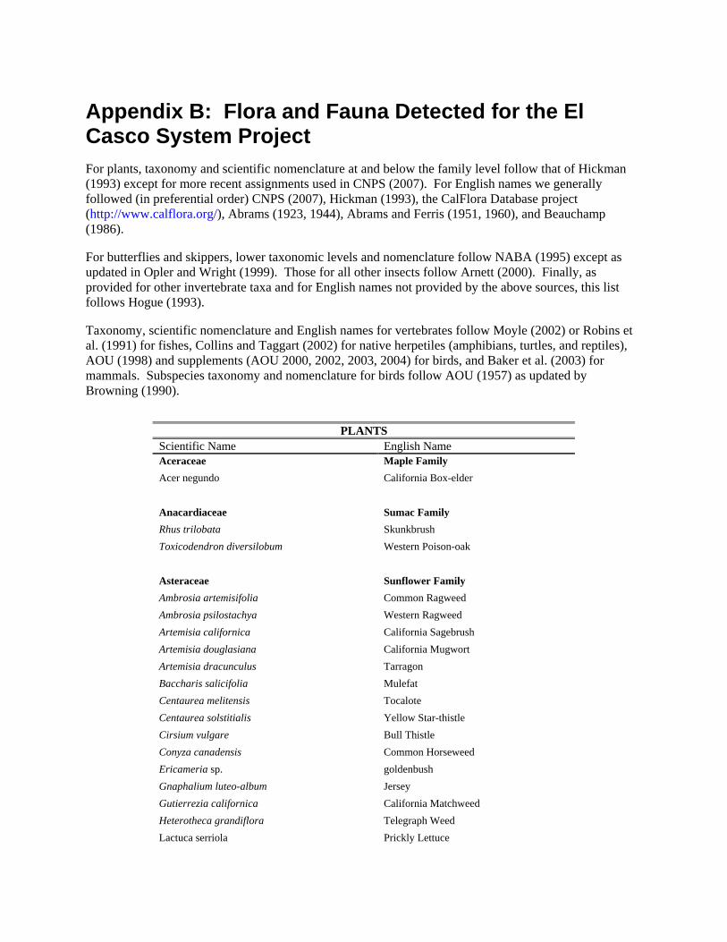
Appendix B: Flora and Fauna Detected for the El Casco System Project For plants, taxonomy and scientific nomenclature at and below the family level follow that of Hickman (1993) except for more recent assignments used in CNPS (2007). For English names we generally followed (in preferential order) CNPS (2007), Hickman (1993), the CalFlora Database project (http://www.calflora.org/), Abrams (1923, 1944), Abrams and Ferris (1951, 1960), and Beauchamp (1986).
For butterflies and skippers, lower taxonomic levels and nomenclature follow NABA (1995) except as updated in Opler and Wright (1999). Those for all other insects follow Arnett (2000). Finally, as provided for other invertebrate taxa and for English names not provided by the above sources, this list follows Hogue (1993).
Taxonomy, scientific nomenclature and English names for vertebrates follow Moyle (2002) or Robins et al. (1991) for fishes, Collins and Taggart (2002) for native herpetiles (amphibians, turtles, and reptiles), AOU (1998) and supplements (AOU 2000, 2002, 2003, 2004) for birds, and Baker et al. (2003) for mammals. Subspecies taxonomy and nomenclature for birds follow AOU (1957) as updated by Browning (1990).
PLANTS
Scientific Name English Name Aceraceae Maple Family Acer negundo California Box-elder Anacardiaceae Sumac Family Rhus trilobata Skunkbrush Toxicodendron diversilobum Western Poison-oak Asteraceae Sunflower Family Ambrosia artemisifolia Common Ragweed Ambrosia psilostachya Western Ragweed Artemisia californica California Sagebrush Artemisia douglasiana California Mugwort Artemisia dracunculus Tarragon Baccharis salicifolia Mulefat Centaurea melitensis Tocalote Centaurea solstitialis Yellow Star-thistle Cirsium vulgare Bull Thistle Conyza canadensis Common Horseweed Ericameria sp. goldenbush Gnaphalium luteo-album Jersey Gutierrezia californica California Matchweed Heterotheca grandiflora Telegraph Weed Lactuca serriola Prickly Lettuce

Lepidospartum squamatum Scale-broom Sonchus oleraceus Common Sow Thistle Xanthium strumarium Rough Cocklebur Betulaceae Birch Family Alnus rhombifolia White Alder Boraginaceae Borage Family Amsinckia menziesii Rancher’s Fiddleneck Heliotropium curassavicum Salt Heliotrope Brassicaceae Mustard Family Hirschfeldia incana Short-pod Mustard Lepidium latifolium Perennial Pepperweed Rorippa nasturtium-aquaticum True Water Cress Sisymbrium sp. mustard Caprifoliaceae Honeysuckle Family Sambucus mexicana Mexican Elderberry Chenopodiaceae Goosefoot Family Chenopodium album Lamb's-quarters Chenopodium ambrosioides Mexican-tea Salsola tragus Prickly Russian-thistle Convolvulaceae Morning-glory Family Calystegia sp. morning glory Cucurbitaceae Gourd Family Cucurbita palmata Coyote Melon Euphorbiaceae Spurge Family Chamaesyce sp. spurge Eremocarpus setigerus Turkey Mullein Fabaceae Pea Family Astragalus pomonensis Pomona Milk-vetch Lupinus sp. lupine Melilotus sp. clover Prosopis glandulosa Honey Mesquite Vicia sp. vetch Fagaceae Beech Family Quercus berberidifolia Interior Scrub Oak

Geraniaceae Geranium Family Erodium cicutarium Red-stemmed Filaree Hydrophyllaceae Waterleaf Family Phacelia distans Wild Heliotrope Juglandaceae Walnut Family Juglans californica California Black Walnut Juglans regia English Walnut Lamiaceae Mint Family Marrubium vulgare White Horehound Salvia mellifera Black Sage Stachys sp. hedge-nettle Malvaceae Mallow Family Malva sp. mallow Gaura sp. gaura Moraceae Mulberry Family Ficus carica Common Fig Onagraceae Evening-primrose Family Epilobium canum California Fuchsia Epilobium ciliatum California Cottonplant Oenothera elata Hooker's Evening-primrose Polygonaceae Buckwheat Family Eriogonum fasciculatum California Buckwheat Polygonum amphibium Water Smartweed Rumex crispus Curly Dock Rumex salicifolius Willow Dock Rhamnaceae Buckthorn Family Rhamnus crocea Spiny Redberry Rhamnus ilicifolia Holly-leaved Redberry Rosaceae Rose Family Adenostoma fasciculatum Chamise Rubus sp. blackberry Salicaceae Willow Family Populus fremontii Western Cottonwood Salix exigua Narrow-leaved Willow Salix gooddingii Goodding's Black Willow

Salix laevigata Red Willow Salix lasiolepis Arroyo Willow Salix lucida Shining Willow Saururaceae Lizard's-tail Family Anemopsis californica Yerba Mansa Scrophulariaceae Figwort Family Mimulus cardinalis Scarlet Monkeyflower Mimulus guttatus Seep Monkeyflower Verbascum sp. mullein Verbascum thapsus Woolly Mullein Veronica sp. speedwell Simaroubaceae Quassia Family Ailanthus altissima Tree-of-heaven Solanaceae Nightshade Family Datura stramonium Annual Jimsonweed Nicotiana glauca Tree tobacco Tamaricaceae Tamarisk Family Tamarix ramosissima Mediterranean Tamarisk Ulmaceae Elm Family Ulmus sp. elm Urticaceae Nettle Family Urtica dioica Giant Creek Nettle Vitaceae Grape Family Parthenocissus vitacea Woodbine Vitis girdiana Wild Grape Cyperaceae Sedge Family Cyperus sp. flatsedge Juncus xiphioides Iris-leaved Rush Poaceae Grass Family Avena sp. oat Bromus diandrus Ripgut Brome Bromus hordeaceus Soft Chess Bromus madritensis Red Brome Hordeum murinum Glaucous Foxtail Barley Leymus triticoides Beardless Wild Rye

Polypogon monspeliensis Annual Beard Grass Schismus barbatus Mediterranean Schismus Vulpia myuros Rat-tail Fescue
ANIMALS Scientific Name English Name
INVERTEBRATES
Shrimps and Allies Cambaridae Crayfish Family Procambarus clarkii Red Swamp Crayfish
Dragonflies and Damselflies Coenagrionidae Pond Damsel Family
Argia vivida Vivid Dancer Libellulidae Skimmer and Emerald Family Brechmorhoga mendax Pale-faced Clubskimmer Libellula saturata Flame Skimmer
Butterflies, Moths, and Skippers Papilionidae Swallowtail Family Papilio rutulus Western Tiger Swallowtail Pieridae White and Sulphur Family Pieris rapae Cabbage White Colias eurytheme Orange Sulphur Nymphalidae Brush-footed Butterfly Family Nymphalis antiopa Mourning Cloak Vanessa atalanta Red Admiral Limenitis lorquini Lorquin’s Admiral Hesperiidae Skipper Family Pyrgus albescens White Checkered-Skipper
AMPHIBIANS
Hylidae Treefrog Family Pseudacris regilla Pacific Chorus Frog
REPTILES Anguidae Alligator Lizard Family Elgaria multicarinata Southern Alligator Lizard Phrynosomatidae Spiny Lizard Family Sceloporus occidentalis Western Fence Lizard

Sceloporus orcutti Granite Spiny Lizard Uta stansburiana Side-blotched Lizard Teiidae Whiptail Lizard Family Cnemidophorus tigris Western Whiptail Colubridae Colubrid Snake Family Lampropeltis getula Common Kingsnake Viperidae Viper and Pitviper Family Crotalus sp. rattlesnake
BIRDS Anatidae Swan, Goose, and Duck Family Anas platyrhynchos Mallard Phasianidae Partridge and Turkey Family Gallus gallus Domestic Chicken Odontophoridae New World Quail Family Callipepla californica California Quail Ardeidae Heron Family Egretta thula Snowy Egret Butorides virescens Green Heron Nycticorax nycticorax Black-crowned Night-Heron Accipitridae Hawk Family Elanus leucurus White-tailed Kite Accipiter cooperii Cooper's Hawk Buteo lineatus Red-shouldered Hawk Buteo jamaicensis Red-tailed Hawk Aquila chrysaetos Golden Eagle Falconidae Falcon Family Falco sparverius American Kestrel Falco peregrinus Peregrine Falcon Charadriidae Plover Family Charadrius vociferus Killdeer Columbidae Pigeon and Dove Family Columba livia Rock Pigeon Streptopelia decaocto Eurasian Collared-Dove Zenaida macroura Mourning Dove

Cuculidae Cuckoo and Roadrunner Family Coccyzus americanus Yellow-billed Cuckoo Geococcyx californianus Greater Roadrunner Tytonidae Barn Owl Family Tyto alba Barn Owl Caprimulgidae Nightjar Family Chordeiles acutipennis Lesser Nighthawk Trochilidae Hummingbird Family Archilochus alexandri Black-chinned Hummingbird Calypte anna Anna's Hummingbird Calypte costae Costa's Hummingbird Selasphorus sp. Rufous/Allen’s Hummingbird Picidae Woodpecker Family Melanerpes formicivorus Acorn Woodpecker Picoides nuttallii Nuttall's Woodpecker Picoides pubescens Downy Woodpecker Tyrannidae Tyrant Flycatcher Family Contopus sordidulus Western Wood-Pewee Empidonax traillii extimus Southwestern Willow Flycatcher Empidonax difficilis Pacific-slope Flycatcher Sayornis nigricans Black Phoebe Sayornis saya Say's Phoebe Myiarchus cinerascens Ash-throated Flycatcher Tyrannus verticalis Western Kingbird Tyrannus vociferans Cassin’s Kingbird Laniidae Shrike Family Lanius ludovicianus Loggerhead Shrike Vireonidae Vireo Family Vireo bellii pusillus Least Bell's Vireo Vireo flavifrons Yellow-throated Vireo Vireo gilvus Warbling Vireo Corvidae Jay and Crow Family Aphelocoma californica Western Scrub-Jay Corvus brachyrhynchos American Crow Corvus corax Common Raven
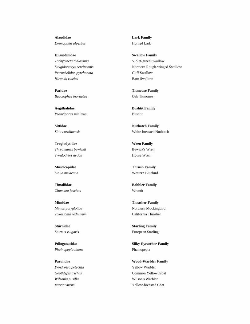
Alaudidae Lark Family Eremophila alpestris Horned Lark Hirundinidae Swallow Family Tachycineta thalassina Violet-green Swallow Stelgidopteryx serripennis Northern Rough-winged Swallow Petrochelidon pyrrhonota Cliff Swallow Hirundo rustica Barn Swallow Paridae Titmouse Family Baeolophus inornatus Oak Titmouse Aegithalidae Bushtit Family Psaltriparus minimus Bushtit Sittidae Nuthatch Family Sitta carolinensis White-breasted Nuthatch Troglodytidae Wren Family Thryomanes bewickii Bewick's Wren Troglodytes aedon House Wren Muscicapidae Thrush Family Sialia mexicana Western Bluebird Timaliidae Babbler Family Chamaea fasciata Wrentit Mimidae Thrasher Family Mimus polyglottos Northern Mockingbird Toxostoma redivivum California Thrasher Sturnidae Starling Family Sturnus vulgaris European Starling Ptilogonatidae Silky-flycatcher Family Phainopepla nitens Phainopepla Parulidae Wood-Warbler Family Dendroica petechia Yellow Warbler Geothlypis trichas Common Yellowthroat Wilsonia pusilla Wilson's Warbler Icteria virens Yellow-breasted Chat

Thraupidae Tanager Family Piranga ludoviciana Western Tanager Emberizidae Sparrow Family Pipilo maculatus Spotted Towhee Pipilo crissalis California Towhee Aimophila ruficeps Rufous-crowned Sparrow Spizella passerina Chipping Sparrow Spizella atrogularis Black-chinned Sparrow Chondestes grammacus Lark Sparrow Melospiza melodia Song Sparrow Zonotrichia leucophrys gambelii Gambel’s White-crowned Sparrow Cardinalidae Grosbeak and Bunting Family Pheucticus melanocephalus Black-headed Grosbeak Passerina caerulea Blue Grosbeak Passerina amoena Lazuli Bunting Icteridae Blackbird, Cowbird and Oriole Family Agelaius phoeniceus Red-winged Blackbird Sturnella neglecta Western Meadowlark Euphagus cyanocephalus Brewer's Blackbird Quiscalus mexicanus Great-tailed Grackle Molothrus ater Brown-headed Cowbird Icterus cucullatus Hooded Oriole Icterus bullockii Bullock’s Oriole Fringillidae Finch Family Carpodacus mexicanus House Finch Carduelis psaltria Lesser Goldfinch Carduelis lawrencei Lawrence's Goldfinch Carduelis tristis American Goldfinch Passeridae Old World Sparrow Family Passer domesticus House Sparrow
MAMMALS Talpidae Mole Family Scapanus latimanus Broad-footed Mole Leporidae Hare and Rabbit Family Sylvilagus audubonii Desert Cottontail Lepus californicus bennettii San Diego Black-tailed Jackrabbit

Sciuridae Squirrel Family Spermophilus beecheyi California Ground Squirrel Geomyidae Pocket Gopher Family Thomomys bottae Botta's Pocket Gopher Heteromyidae Heteromyid Family Perognathus longimembris brevinasus Los Angeles Pocket Mouse Chaetodipus californicus California Pocket Mouse Dipodomys simulans Dulzura Kangaroo Rat Muridae Mouse, Rat, and Vole Family Peromyscus maniculatus Deer Mouse Neotoma fuscipes Dusky-footed Woodrat Neotoma macrotis Large-eared Woodrat Microtus californicus California Vole Mus musculus House Mouse Canidae Canid Family Canis familiaris Domestic Dog Canis latrans Coyote Urocyon cinereoargenteus Common Gray Fox Procyonidae Procyonid Family Procyon lotor Northern Raccoon Felidae Cat Family Lynx rufus Bobcat Equidae Equid Family Equus asinus Domestic Burro Equus caballus Domestic Horse Cervidae Cervid Family Odocoileus hemionus Mule Deer Bovidae Bovid Family Bos taurus Domestic Cattle Ovis aries Domestic Sheep Capra hircus Domestic Goat

Appendix C Jurisdictional Delineation for the El Casco System
Project (see Appendix 4.2 of this EIR)
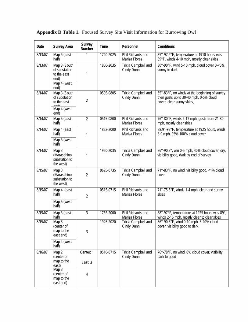
Appendix D Table 1. Focused Survey Site Visit Information for Burrowing Owl
Date Survey Area Survey Number Time Personnel Conditions
8/13/07 Map 5 (east half)
1 1740-2025 Phil Richards and Marisa Flores
85°-97.2°F, temperature at 1910 hours was 89°F, winds 4-10 mph, mostly clear skies
Map 3 (South of substation to the east end)
8/13/07
Map 4 (west end)
1
1850-2035 Tricia Campbell and Cindy Dunn
80°-90°F, wind 5-10 mph, cloud cover 0-<5%, sunny to dark
Map 3 (South of substation to the east end)
8/14/07
Map 4 (west end)
2
0505-0805 Tricia Campbell and Cindy Dunn
65°-83°F, no winds at the beginning of survey then gusts up to 30-40 mph, 0-5% cloud cover, clear sunny skies,
8/14/07 Map 5 (east half)
2 0515-0800 Phil Richards and Marisa Flores
76°-80°F, winds 6-17 mph, gusts from 21-30 mph, mostly clear skies
Map 4 (east half)
8/14/07
Map 5 (west half)
1 1822-2000 Phil Richards and
Marisa Flores 88.9°-93°F, temperature at 1925 hours, winds 3-9 mph, 95%-100% cloud cover
8/14/07 Map 3 (Maraschino substation to the west)
1 1920-2035 Tricia Campbell and
Cindy Dunn 86°-90.3°, win 0-5 mph, 40% cloud cover, dry, visibility good, dark by end of survey
8/15/07 Map 3 (Maraschino substation to the west)
2 0625-0735 Tricia Campbell and
Cindy Dunn 71°-83°F, no wind, visibility good, <1% cloud cover
Map 4 (east half)
8/15/07
Map 5 (west half)
2 0515-0715 Phil Richards and
Marisa Flores 71°-75.6°F, winds 1-4 mph, clear and sunny skies
8/15/07 Map 5 (east half)
3 1755-2000 Phil Richards and Marisa Flores
88°-97°F, temperature at 1925 hours was 89°, winds 2-16 mph, mostly clear to clear skies
Map 3 (center of map to the east end)
8/15/07
Map 4 (west half)
3
1925-2020 Tricia Campbell and Cindy Dunn
86°-90.3°F, wind 0-10 mph, 5-20% cloud cover, visibility good to dark
Map 2 (center of map to the east)
Center: 1
East: 3
8/16/07
Map 3 (center of map to the east end)
4
0510-0715 Tricia Campbell and Cindy Dunn
76°-78°F, no wind, 0% cloud cover, visibility dark to good

Date Survey Area Survey Number Time Personnel Conditions
Map 4 (west half)
4
8/16/07 Map 5 (east half)
4 0535-0740 Phil Richards and Marisa Flores
73°-81.5°F, wind 1-6 mph, clear skies
Map 4 (east half)
8/16/07
Map 5 (west half)
3 1820-1955 Phil Richards and
Marisa Flores 88°-93°F, temperature at 1930 hours was 89°, wind 3-8 mph, clear and sunny skies
8/16/07 Map 3 (Maraschino substation area to the west end)
3
1900-2015 Tricia Campbell and Cindy Dunn
84°-90°F, wind 0-10 mph, 0-15% cloud cover, visibility good
Map 4 (east half)
8/17/07
Map 5 (west half)
4 0520-0735 Phil Richards and
Marisa Flores 72°-82°F, winds 2-4 mph, clear skies
Map 2 (center of map to the east)
2
Map 3 (Maraschino substation area to the west end)
4
8/17/07
Map 4 (west half)
4
0510-0710 Tricia Campbell and Cindy Dunn
70°-74°F, wind 0-3 mph, <1% cloud cover
Map 1 (Site 33 access road)
8/20/07
Map 4 (east of dense residential)
1
1820-2010 Marisa Flores and Cindy Dunn
82°-93°F, temperature at 1910 hours was 90°F, wind 0-6 mph, clear skies
Map 1 (Site 33 access road)
8/21/07
Map 4 (east of dense residential)
2
0540-0755 Marisa Flores and Cindy Dunn
68°-70°F, winds 0-5 mph, clear skies, visibility good
Map 1 (eastern half)
8/21/07
Map 2 (area north of CA-60)
1
1820-1945 Marisa Flores and Cindy Dunn
85°-90.5°F, winds 1-7 mph, clear skies

Date Survey Area Survey Number Time Personnel Conditions
8/21/07 Map 2 (Area south of CA-60)
1 0530-0820 Andrew Borcher 64°-81°F, no wind, clear skies
8/22/07 Map 2 (Area south of CA-60 almost to the east end)
East end: 3
South of CA-60: 2
0515-0810 Andrew Borcher 63°-71°F, no wind, clear
Map 1 (Site33 access road & east half)
Access Rd: 3
East half: 2
8/22/07
Map 2 (area north of CA-60)
2
0620-820 Marisa Flores and Cindy Dunn
63.8-78° F, winds calm, mostly clear skies
8/22/07 Map 4 (east of dense residential)
3 1800-1945 Marisa Flores and Cindy Dunn
81°-89°, wind 5-13 mph, clear skies, visibility good
8/23/07 Map 2 (Area south of CA-60 almost to the east end)
East end: 4
South of CA-60: 3
0520-0815 Andrew Borcher 60°-64°F, no wind, clear skies
8/23/07 Map 4 (east of dense residential)
4 0610-0755 Marisa Flores and Cindy Dunn
65°-72°, wind 1-5 mph, clear skies overhead, offsite there is 100% cloud cover and fog along the foothills
Map 1 (Site33 access road & east half)
Access Rd: 4
East half: 3
8/23/07
Map 2 (area north of CA-60)
3
1755-1930 Marisa Flores and Cindy Dunn
81°-87°F, winds 1-5 mph, clear skies
Map 1 (east half)
8/25/07
Map 2 (area north of CA-60)
4
0600-0700 Marisa Flores and Cindy Dunn
60°-70°F, winds calm, clear skies
8/28/07 Map 2 (Area south of CA-60)
4 0520-0820 Andrew Borcher 69°-82°F, no wind, clear skies

Appendix E Least Bell’s Vireo, Southwestern Willow
Flycatcher, and Yellow-billed Cuckoo Focused Survey Conditions

Appendix E: Least Bell’s Vireo, Southwestern Willow Flycatcher, and Yellow-billed Cuckoo Site Visit Information Appendix Table E1. Survey Visit Details for the Listed Riparian Birds Focused Surveys. Date Survey
Area Species Surveyed
Time Personnel Conditions
05/14/07 Map 2 (east end) and Map 3 (west end)
LBVI 1 0530-0900 Kurt Campbell & Phil Richards
55°-71°, winds 1-3 mph, visibility good, 10% cloud cover
05/14/04 Map 1 (east end) and Map 2 (west end)
LBVI 1 0950-1115 Kurt Campbell 69°-79°F, winds 1-4 mph, 28-38% rel. humidity, 10% cloud cover, visibility good, water temp at 1030 hours was 67.5°F
05/14/07 Map 1 (west end)
LBVI 1 0950-1100 Phil Richards 67°-79°F, winds 2-7 mph, sunny
05/23/07 Map 2 (east end)
LBV 2 & SWFL 1
0545-0900 Kurt Campbell 61°- 66°F, 0-3 mph, 43-65% rel. humidity, 100% cloud cover, visibility good
05/23/07 Map 2 (west end) and Map 3 (west end)
LBVI 2 & SWIFL 1
0610-1045 Tricia Campbell & Kylie Fischer
55°-75°F, winds 0-2 mph, 0%-50% cloud cover
05/23/07 Map 1 (west end)
LBVI 2 & SWFL 1
0915-1130 Kurt Campbell Started at 66°F and ended in conditions that meet protocol, 2-5 mph (w/in canopy), 43% rel. humidity, clear skies
06/03/07 Map 1, 2, and 3
LBVI 3 0530-1145 Tricia Campbell
57°-82°F, wind 0-2 mph, 0-60% cloud cover, dry
06/13/07 Map 2 (east end) and Map 3 (west end)
LBVI 4 & WIFL 2
0535-1000 Kurt Campbell 59°-86°F, wind 1-4 mph, 22-55% rel. humidity, visibility good, clear skies
06/14/07 Map 1 (east end) and Map 2 (west end
LBVI 4 & WIFL 2
0525-1025 Kurt Campbell 61°-87°F, wind 1-5 mph, mostly clear skies, 20%-46% rel. humidity, visibility good
06/19/07 Map 1 (west end)
LBVI 4 & WIFL 2
0600-1000 Tricia Campbell
53°-90°F, winds 0-2 mph, clear skies, dry
06/24/07 Map 2 (east end) and Map 3 (west end)
LBVI 5 & SWFL 3
0535-1000 Kurt Campbell 51°-76°F, winds calm and then 4-8 mph, 34%-74% rel. humidity, 10%-20% cloud cover, visibility good.
06/24/07 Map 1 (east end) and Map 2 (west end
LBVI 5 & SWFL 3
0930-1100 Tricia Campbell
79°-92°F, winds 1-2 mph, clear skies
06/24/07 Map 1 (west end)
LBVI 5 & SWFL 3
0600-0930 Tricia Campbell
53°-79°F, winds 1-2 mph, 0%-10% cloud cover
07/06/07 Map 1 (east end) and Map 2 (west end)
LBVI 6 & SWFL 4
0530-0740 Tricia Campbell
68°-72°F, wind 0-5 mph, 20% cloud cover
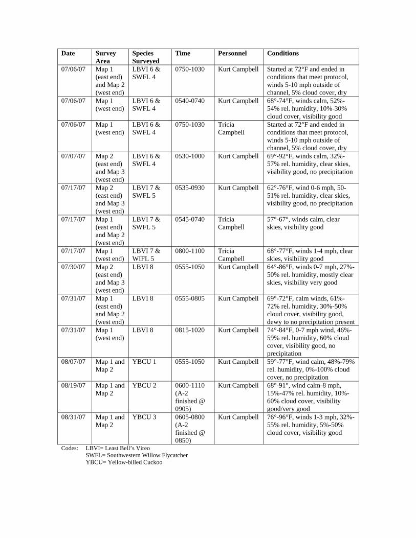
Date Survey Area
Species Surveyed
Time Personnel Conditions
07/06/07 Map 1 (east end) and Map 2 (west end)
LBVI 6 & SWFL 4
0750-1030 Kurt Campbell Started at 72°F and ended in conditions that meet protocol, winds 5-10 mph outside of channel, 5% cloud cover, dry
07/06/07 Map 1 (west end)
LBVI 6 & SWFL 4
0540-0740 Kurt Campbell 68°-74°F, winds calm, 52%-54% rel. humidity, 10%-30% cloud cover, visibility good
07/06/07 Map 1 (west end)
LBVI 6 & SWFL 4
0750-1030 Tricia Campbell
Started at 72°F and ended in conditions that meet protocol, winds 5-10 mph outside of channel, 5% cloud cover, dry
07/07/07 Map 2 (east end) and Map 3 (west end)
LBVI 6 & SWFL 4
0530-1000 Kurt Campbell 69°-92°F, winds calm, 32%-57% rel. humidity, clear skies, visibility good, no precipitation
07/17/07 Map 2 (east end) and Map 3 (west end)
LBVI 7 & SWFL 5
0535-0930 Kurt Campbell 62°-76°F, wind 0-6 mph, 50-51% rel. humidity, clear skies, visibility good, no precipitation
07/17/07 Map 1 (east end) and Map 2 (west end)
LBVI 7 & SWFL 5
0545-0740 Tricia Campbell
57°-67°, winds calm, clear skies, visibility good
07/17/07 Map 1 (west end)
LBVI 7 & WIFL 5
0800-1100 Tricia Campbell
68°-77°F, winds 1-4 mph, clear skies, visibility good
07/30/07 Map 2 (east end) and Map 3 (west end)
LBVI 8 0555-1050 Kurt Campbell 64°-86°F, winds 0-7 mph, 27%-50% rel. humidity, mostly clear skies, visibility very good
07/31/07 Map 1 (east end) and Map 2 (west end)
LBVI 8
0555-0805 Kurt Campbell 69°-72°F, calm winds, 61%-72% rel. humidity, 30%-50% cloud cover, visibility good, dewy to no precipitation present
07/31/07 Map 1 (west end)
LBVI 8 0815-1020 Kurt Campbell 74°-84°F, 0-7 mph wind, 46%-59% rel. humidity, 60% cloud cover, visibility good, no precipitation
08/07/07 Map 1 and Map 2
YBCU 1 0555-1050 Kurt Campbell 59°-77°F, wind calm, 48%-79% rel. humidity, 0%-100% cloud cover, no precipitation
08/19/07 Map 1 and Map 2
YBCU 2 0600-1110 (A-2 finished @ 0905)
Kurt Campbell 68°-91°, wind calm-8 mph, 15%-47% rel. humidity, 10%-60% cloud cover, visibility good/very good
08/31/07 Map 1 and Map 2
YBCU 3 0605-0800 (A-2 finished @ 0850)
Kurt Campbell 76°-96°F, winds 1-3 mph, 32%-55% rel. humidity, 5%-50% cloud cover, visibility good
Codes: LBVI= Least Bell’s Vireo SWFL= Southwestern Willow Flycatcher YBCU= Yellow-billed Cuckoo

Appendix E Table 2: Detected Brown-headed Cowbirds for Least Bell’s Vireo and Southwestern Willow Flycatcher Focused Surveys Date Survey Area Brown-headed Cowbirds Detected Total 05/14/07 Figure 8, Maps 1 thru 3 Males=9, Females=2, Female/juvenile=1 12 05/23/07 Figure 8, Maps 2 & 3 Males=2, Females=3, Unknown sex=3 8 06/03/07 Figure 8, Map 1 Males=1, Females=1 2 06/13/07 Figure 8, Map 3 Males=1, Females=1 2 06/19/07 Figure 8, Map 1 Females=1 1 06/24/07 Figure 8, Map 1 & 3 Males=4, Females=5 9 07/06/07 Figure 8, Maps 1 & 2 Males=3, Females=1 4 07/07/07 Figure 8, Map 3 Males=5, Females=1 6 07/17/07 Figure 8, Maps 2 & 3 Males=3, Females=5 8 07/30/07 Figure 8, Map 3 Males=1 1