AIRBORNE MAG EM-VLF RAD RPT · OperawJns Reportjor STARFlRE MINERALS I/I/e High Resolution...
39
• • • · 389 38 ae9 ('f"",/l1I ,; 7\ I<<!f'(l rl fflr ." .;] 'IRI-I RI- . ' 1\(' fll\!.h 1<(, ,\1)11111 111/ .J <!r(} m u,'.!,nl '//<, ,\ n .... I LJ " ', \! (\ R",I'''II'''/I', SlIn'"l , ,\ /. 'IL ·) ,\ ,\11,1:.' "1< 'I ud, 1' !" IJI , 'd ,\ ' ''' IIJ I/lr",,! Un ()nlur/(J • Operations Report for ST MINERA .LS INC. Hi gh Re so lu tion Tr i-Sensor Magnetic, XDS V LF -EM & Radiometr ic A irborne S rvey SLATER & SU GA N AQ lJ EB PROJECTS M ontreal River, Ontario RECElVED AUG 2 1 2008 qJ) GEOSGIEr cc lc h ruan , Report #: 13-195 RCljucsk J [1: • '\; tln 1 I-IliOl ST AR FI RF VlIN ERAL S 1;\;('. Pre pared [1: • C hark:-. Isarric . Part ne r Ter raquest LId. Terr quest Ltd , Ai rbo rne Geo phYSi cal Contract B 19<; 2007 /02( 28 1
-
Upload
dangkhuong -
Category
Documents
-
view
218 -
download
0
Transcript of AIRBORNE MAG EM-VLF RAD RPT · OperawJns Reportjor STARFlRE MINERALS I/I/e High Resolution...
•
•
•
· 389 38 ae9
('f"",/l1I ,;7\ I<<!f'(lr l fflr ." .;] 'IRI-I RI-. ,\. fI\I-, I<~1 ' 1\(' fll\!.h 1<(,,\1)11111 111/ .J <!r(}m u,'.!,nl'//<, ,\ n .... I LJ " ', \! (\ R",I'''II'''/I', SlIn'"l , ,\ /. 'IL ·) , \ ,\11,1:.'"1< 'Iud, 1' !"IJI ,'d,\ '''' IIJ I/lr",,!
Un ~ . ,. ()nlur/(J
•
Operations Report for ST A]~FIRE MINERA.LS INC.
High Resolution Tri-Sensor Magnetic, XDS V LF- EM & Radiometric A irborne S rvey
SLATER & SUGA NAQ lJ EB PROJECTS M ontreal River, Ontario
RECElVED
AUG 2 1 2008 qJ) GEOSGIEr cc ~\S~;ESSr/'ENT
Ot:ti ~E
lchruan, ~k, ~()07
Report #: 13-195
RCljucsk J [1: •
'\; tln 1 I-IliOl ST AR FI RF VlIN ERALS 1;\;('.
Prepa red [1: •
C hark:-. Isarric . \1Lma~i n~ Part ne r
Terraquest LId.
Terr quest Ltd , Ai rborne GeophYSical Surv~Y5 Contract B 19<;
2007/02(28 1

•
•
•
Operations Report Ji>r STARFIRE MI'vERAL<"" /'v( '.
High Resolution Aeromugnelic, XD.'> i IF-EM & Radiometric Survey, SImer & Sugunaqueb Proiects, Montreal River, Ontario
1. 1.1. 1.2.
2. 2.1. 2.2. ') , -' ._"1.
2.4. 2.5.
2. 3. --I. 5. 6,
2.6.
3. 3. I. , ) :l._.
3.3. I. ~
J. 4, 5 6,
8 I),
4. 4.1. 4,2.
Table of Contents
INTRODUCTION .......................................................................................................................................... 4
[XlCI'TIVl SUMMARy ................ .. ................. , ................................ 4 UK AllOr-.. .................................... .. .. .................................. :5
SURVEY SPECIFICATIONS ....................................................................................................................... 6
LlNES AND DATA ........ , .................................................................................... 6 SURVEY K[LOMETRAGE .......... , ....... '.......... .., .. , ................................ , .................. " ... , ............ 6 NA VIGATION SPECIFIC ATIONS . fLIGHT PLAN ......................... .. TOLERANCES - REFLIGHT ... . Traverse Line Intervul , Terrain Clearance Diurnal Variation: GPS Datu. Radio TransmIssion: Sumple Density: . NAVIGATION ......... , ......... , ...
., ... ,........... . ............ , ... , .......................... 6 .. ....................................... , ......... , ... , ..... , ....................... 8
.. ...................................................................................... 10 ......... , ..... /0
..".'. 10 ... , I ()
' ...... I () ..,. f () ... , I ()
.. ................. 10
AIRBORNE GEOPHYSICAL EQUIPMENT ........................................................................................... 12
EQUIPMENT SUMMARY. ..................................................................... 12 SURVEY AIRCRAFT ............................... . ....................................................... " ............ 13 SURVEY EQUIPMENT AND SPECIFICATIONS: ............. . . .................................... 13 High Sensitivity MagnelOm<?ters .. Tn-Axial Fluxgate Magnetic Sensor" ' Radiometrics System ... Radar Altimeter .. Barometric Altimeler ........... . Data AcquisilioniNavigallon 81'slem . A1agneIOmeler Processor .... UPS Differential Receiver. f"erraquesl XDS V/,F-EM Syslem .
/3 ...... J.J
..... 14 1-1
..... /5 . ... 15
. . 15 16
8ASE: STATION EQUiPMENT .................................................................................................................. 17
BASE STATION MAGNETOMETER ................. ·.··· ...................................................... 17 BASE STATION GPS RECEIVER ............................................................. 17
Terraquest Ltd., Airborne GeophySical Surveys Contract 8-195
2007/02/28 2

•
•
•
OperawJns Reportjor STARFlRE MINERALS I/I/e High Resolution Aeromagnelic. XDS VLF-EM & RudlUmetric Survey. Simer & Suganaqueh Projects. Montreal River. On/uno
5. TESTS AND CALIBRATIONS ................................................................................................................... 18
'i.1. MAGNETIC FIGURE OF MERIT ......................... . ........................................................... 18 5.2. RADAR ALTIMETER CALIBRATION ............. . . .................................................................. 18
5 . .3. RADIOMETRIC SAMPLE CHECKS ............... .. . ........................................................... 18 5.4. RADIOMETRIC SENSITIVITY FACTORS ........ . .. ....................................................................... 18 5.5. RADIOMETRIC ALTITUDE ATTENUATION ..... . .. ........................................... 18 5.6. RADIOMETRIC COMPTON COEFFiCiENTS ................... . . ................................................... 18
6. LOC ISTICS .................................................................................................................................................. 19
6.1. PERSONNEL ....................... . ................................................................................ 19
6.2. FLIGHT REPORTING ...... . .. ........................................................ 19 6.3. BASE OF OPERATIONS ... . .. .............................................. 19
7. DATA PROCESSING .................................................................................................................................. 20
7.1. DATA QUALITY CONTROL................................................ . ......................................... 20 7.2. FI~AL MAGNETIC DATA PROCESSING .......................... .................................... 20 7.3. FINAL ELECTROMAGNETC DATA PROCESSINC; ............. » •••••••••• " ••••••••• - ................. " .............. 23 7.4. FINAL RADIOMETRIC DATA PROCESSING....... ........ . ................................................. 25 7.5. LIST OF FINAL PRODUCTS ............................. ................................... 28
8. SUMMARY ................................................................................................................................................... 29
9. APPENDiCES ............................................................................................................................................... 30
9.1. APPENDIX I - CERTIFICATE Of QUALIfiCATION ............................................................... 30 9.2. APPENDIX II DAILY LOG ................................................................................................ 31 9..3. APPENDIX III FIGURE OF MERIT .................................................................................... 34 9.4. APPENDIX IV RADAR ALTIMETER CALIBRATION ......................................................... 35 9.5. APPENDIX V - COMPTON COEFFICiENTS ................................................................................. 36 9.6. APPENDIX VI . ALTITUDE ATTENTUATION ........................... ............. 37 97 APPENDIX VII - SENSITIVITY FACTORS .................................................... 39
Terraquest ltd., Airborne GeophYSical Surveys Contract B·195
2007/02/28 3

• Operations Reporl/or STARFIR£ MINERALS /.1I/C High Resoiution Aeromagnetic:. XDS VLF-EM & RadionJl!lric SurVl!Y. Slater & .','uganaqueh Projects. Montreal Ri\·er. ()ntarw
1. Introduction
1.1. Executive Summary
This report describes the specitications and parameters of an airborne geophysical survey carried out for:
ST ARFIRE MINERALS INC. 520-355 Burrard Street Vancouver. BC V6C 2G8
Attention: Norm Elliot Phone: 604-669-5642 Fax: 604-687-6714
• The survt:y was performed by:
•
TERRAQUEST LTD., 2-2800 John Street. Markham ON. Canada L3R OE2
Phone: 905-477-2800 ext. 22 Email: [email protected].
The purpose of the survey of this type is to collect geophysical data that can bt: used to prospect directly t~Dr anomalous magnetic. conductive and radiometric areas in the earth's crust which may be caused by or related to economic minerals. Secondly, the geophysical patterns can be used indirectly for exploration by mapping the geology in detaiL including faults shear zones, folding. alteration zones and other structures.
To obtain this data. the area was systematically traversed by aircraft carrying geophysical equipment along parallel flight lines spaced at even intervals and oriented so as to intersect the geology and structure in a way as to provide optimum contour patterns of the geophysical data.
Terraquest ltd., Alrbome GeophYSical Surveys Contract B-195
2007/02/28 4

•
•
•
( ' f,erc/IIIJ/I., {(ef)url /111' ST4Rf-fRI: H/\t.R ·H.S 1\ ('
I llgh R"\ullllll m ./ el'onwgnellc . \ D."" I I.F-f. ""I ~ Ru,l" ,mdn< ,\111'1' , '\ , .\/ 1110'1' , ( ·11.\!.Clt1(/LIIl c'h PI'IJ/l'''',', \ Ifl ilI I'''o ! R,,,,',- ()//I(/I'I O
1.2. Location
I e s Ll rvc'~ is located in north central Ontario east of I.ake Superior. It is comprised or two sur\c') hlocks referred to as Slater and Suganaquen Blocks. ['he Slater Block is located rrimari1~ in Slater. Smilsk y. Kincaid and 'iwkt 1'0\\ Ilships approxim~llcl :- 70 kilometres north of Sault Ste Marie . The survey shape i~ rectangula r: the dimensions arc 16 kilometres east-west and 14 kilometres north-south. ('he centre of the area is approx imately 47 degrees 12 min utes north and X4 degrees 34 minutes v.-est. rhc Suganaqueh Bloc!.. is located pri maril y in Suganaqucn I'o wnship approximately .,5 ' i\ometres southeast or Wav.-a. The survey ' hape is rectangular: the di mensions are 6,4 kilometres east -west and X,4 kilometres north-south. The cenlre o f the area is approximately -+7 degrees 4 1 minutC's north and R4 degrees 26 mi n utes wesl.
LOCATION MAP
Terraquest ltd" Alrbome GeophYSIcal Surveys Contract B 1 9 ~
2007102/28 5

•
•
•
()p<'rUlion.~ Report/or STARFIRE i .. frVERALS liVC Hi;:;h ResolutIOn Aeroma~netic. XDS VLF-Elvl & RI1Jioml!fric Survey. SJutl;!r & Su~anaqueb PrOle<:/s. Montreal RtVl!r. ()ntarlO
2. SURVEY SPECIFICATIONS
2.1. LINES AND DATA
Parameter Specification Instrument Precision
2.2. SURVEY KILOMETRAGE
, Lines Tie Total
Sug~~queL __ , km km
---~-,------+-~-----
, 561 km
2.3. NAVIGATION SPECIFICATIONS
The following files are the navigation parameter files. which include the survey comer coordinates in WGS84 projection zone 16, line spacing. line direction. master line and other navigational parameters.
Terraquest Ltd., Airborne GeophYSical Surveys Contract 6-195
2007/02/28 6

•
•
•
Operutwns Reporljor STARFIRE MiNERALS f'v(' High ResolutIOn Aeromagneflc, XDS VLF-EM (( Radiometric Survey, Sialer &- Sugunaqueb Proiecls. Montreal River. Ontarw
Slater Block
La. .:-, r ;
, f ~... • ~-.
" ; o
'1 ,; ~;
; r
~::g 'IL .,,):.-~~21
4918 ; I) ~i49"7E';
')L lIn:;
Suganqueb Block
6
c. ,< . r', ;
, .'-' y . !
TerraQuest ltd., Alrbome GeophYSical Surveys Contract 8- 195
If "-I It
2007/02/28 7

•
•
•
( )/ )er ' IIIINI\ He/)Uri IlJr SI ~RJ-IRI:. \fI\tR~/ .\ /\l
/"gll Ht',nllllilill -/crfJ/twgnl'lll · . . \[).\ ! I . /-·L 1/ «( R,IJ'"IIIl' l rt( .\{lI"I't'1. SILlier c( SII.l!.tln"'IIICh I'r"le II. I/omr.:al R,I','/ ()/1I,II'/ /I
, ;
; .l
.. t " " ,
2.4 . FLIGHT PLAN
Terraquesr Ltd ., Airborne Geophysical Surveys Contr"rt B 1 <}')
.,
2007/02/ 28 8

•
•
•
('po'rulIfJ fl.\ Rc!jlorl lur . ...,.7.-1 R I- / R 1-, \,,,,, t.R.-1 L.'> / \ ( Hlf!.h Rl!su/llfwn Aeromagnetic . \DS I/J -I-. \/ (\ Rudll!flll'lrh '>I/IT"-:I .\/U{<'I" ,\ . . \ 'U,I!.<l I /l /(/lIen j'rfJ!L'l'I.\ . . V/IJnl rL'U/
1<1\'l' ) ()I1{(/I''''
... +
Terraquest td ., Airborne Geophysical Surveys Contract 6 19~
2007/02/28
. 14RdH:., MlN!"AL.~ I¥(. .", ."",_#0_, -...
9

•
•
•
Operatum:> Reportj(Jr STARFIRE MINERALS lXC High R.;.w/ution Aeroma[!,nelic. XDS VLF-£lI .. 1 & Rudwmelric Survey. Slater &: Suganaqueh Projects. Montreal River. (Jnlariu
2.5. TOLERANCES - REf LIGHT
1. Traverse Line Interval
Re-flights would take place if the flight line separation of the final differentially corrected flight path is greater than 1.25 of the line spacing from the intended flight path over a distance greater than I kilometres.
2. Terrain Clearance:
The aircraft mean terrain clearance was to be smoothly maintained at 70 metres MTC in a drape mode. Re-f1ights were done if the tinal differentially corrected altitude deviated from the specified flight altitude by +1-10m over a distance of 3 kilometres or more it: in the pilot's opinion, it was sate to do so.
3. Diurnal Variation:
Diurnal activity during the survey was limited to 20 nT deviation from a 5-minute chord.
4. GPS Data:
GPS data included at least four satellites for accurate navigation and flight path recovery. There were no significant gaps in any of the digital data including GPS and magnetic data.
S. Radio Transmission:
The aircraft pilot makes no radio transmission that interteres with the magnetic response.
6. Sample Density: A reflight is required if the sample density along one or more of the survey lines exceeds 10 metres over a cumulative total of 1000 metres for the magnetic survey. and 100 metres over a cumulati ve total of 1000 metres for the radiometric survey.
2.6. NAVIGATION
The satellite navigation system was used to ferry to the survey sites and to survey along each line. The survey coordinates were supplied by the client and were used to establish the survey boundaries and the flight lines.
Terraquest Ltd., Airborne Geophysical Surveys Contract B- 195
2007/02/28 10

• Upt!ra{/(m.~ Reporljbr STARFIRE MINERALS INC
High Resolution AeromagnetIc. XDS VLF,EM & Radiometric Survey. Slater & Suganaqueh Projects. Montreal RH't!f. Ontario
The flight path guidance accuracy is variable depending upon the number and condition (health) of the satellites employed. The selective availability normally imposed by the military was at a minimum during this period and consequently the accuracy was for the most part better than 10 metres. Real-time GPS correction using the Trimble receiver and Omnistar broadcast services tor North America improves the navigational accuracy to about 3 metres or Jess in the horizontaJ pJane and 4-5 metres in the vertical direction.
Terraque5t ltd., Alrbome GeophYSical Surveys Contract 6-195
2007/02/28 11

•
•
•
Operulwns Reporlji)r ST4RFIRE MI'VERALS /,VC High Resu/ulion Aeroma~neli<.·. XDS I LF-EA4 & Radiometnc Survev. SIGler & 5;u~anuqueh Projects. MOnlreul River. ()ntar/o
3. AIRBORNE GEOPHYSICAL EQUIPMENT
The primary airborne geophysical equipment includes three high senSltlVlty cesium vapour magnetometers, an XDS VLF -EM system and a gamma ray spectrometer system. Ancillary suppon equipment includes a tri-axial fluxgate magnetometer. recorder, radar altimeter, barometric altimeter, GPS receiver with a real-time correction service, and a navigation system. The navigation system comprises a left/right indicator for the pilot and a screen showing the survey area, planned flight lines, and the real time flight path. All data were collected and stored by the data acquisition system. The following provides a summary listing and detailed equipment specifications:
3.1. EQUIPMENT SUMMARY
.-~----, '-'
ircr ... ft A E
.- -Piper Navajo PA 31-325 CR .
quipment: Ma~netometers CS-3 Cesiwn Vapour 3-axis Ma~netometer Billingsiei'TFMIOO-LJ\: Gamma Ray St!ectrometer AGfS / IRIS 256 channel
Gamma Ray Detector Packs 2048 in' (33.6 I ~) Downward 512 in.l (8.4 litres) Lpward
,-~,-~-.---.
VLF-EM Terraquest Ltd: XDS system .-~. '-UPS Receiver Trimble AgGPS 132
'---
Radar Altimeter King KRi\ lOA ,,-
Barometric Altimeter ! Sensym ' --
Navi~ation & Data Acquisition_ AGIS by PicoEnvirotec Inc. --Tracking Camera Dev-Tech (Colour) digital
agnetic S~ecifications: ~~-~~-
Lateral Sensor separation ! t4.6 metres '-[,ongitudinal Sensor separation 9.2 metres
. -
M
~ Output Sample Rate r 4th difference noise envelope ~---------~~--~~------~-----
0.10 from tail~ti..cng"")t:_'r ____ ' ' __ I <1.5 nT L- FOM index (fail)
L Sensor Sensitivity
10Hz ==1 --, -J-t-. -O.OO1-n-T-- ,-~- I
Terraquest ltd., Airborne GeophYSical Surveys Contract B- 195
2007/02/28 12

• O/l!'r ' ''IIJm I<et/url!()!' S'/ -INf-INJ-. \f/\t..R.·II .. \ 1.\('
IIlgh Rt!\(,1 UII{)rI A erom(Jf.!,nt'fic. . \ D .... · t If .£J/ t<: RlliI/(JIllc'/I'/( .\/1"" (:' \ . '1 • .\ l ifer «- Sligall{l(tlieh Pro/ec/.\'. t./{)nl'·" c/ /
/?It't' !' (111ft/rio . ,
3.2. SURVEY AIRCRAFT
l:he S~lrVCy Aircrati f?r this proje~: was a . avajo PAJ 1-325 CR. owned h: I erraquest Ltd. The alrcr~1t has heen specifically modi tied with long-range fuel cells and an array of sensors to carry out ulrhornl' geophys ical surveys .
3.3. S URVEY EQUIPMENT AND SPECIFICATIONS:
1. High Sensitivity Magnetometers:
I hrt:e high-n:slliution cesium vapour magnetometers_ manufactured hy Scintrex are included. two in wing-tip sensors and one in a tail stinga. :\ tluxgate tri-axial magnetometer. model rFM 1 ()O-I.~ h: Billingsley Magnetics Ltd .. is mounted in front of the tail stinger to mon ito r aircraft manoeuvre and magnetic interference . l'he magnetic data i - post-Ilight compensated for aircraft manoeuvre nois(;.
•
Tvpe of Ma~netometer Sensor \IIodel Manufacturer Resolution Sensitiyih Dvnamic Range Fourth Difference Recorded Sample Rate
I Noise Envelope
TerraQuest Ltd., Alrbome GeophySical Surveys Contract B· 95
Cesium Vapour CS-3 Scintrex Ltd . (l.OOI n r Cl)UIHin!2. at 0.1 per ~econd
- - (l .OOS n I
1:) .000 tn 100.000 n I (J.t)' n ['
n.1 -.;econds 0.IOn1 t1ail \t1ag)
2007102 /28 1 3

•
--
•
0pt'rations Report/or STARFIRE M1:\ERALS INC Hi~h Resolution Aeroma~nelic, XDS VLF-£A1 & Radiometric Survey, .'-.. tafer & Suganaqueh ProjeCls, Montreal Ril't:r, Ontario
2. Tri-Axial Fluxgate Magnetic Sensor
Tri-Axial Fluxgate I (for compensation, mounted in mid-section of tail Magnetic Sensor stinger) Model TFMIOO-LN Manufacturer Billingsley Magnetics Description Low noise miniature triaxial tluxgate magnetometer Axial Alignment > Orthogonality +1- 0.5 degree
LAccurac~ 1< "/- 0.75% offull scale (0.5% typical) I Field Measurement I Linearity
-1- 100,000 nanotesla < TI- 0.0035% of full scale
Sensitivity 100 microvoltinanotesla Noise < J 4 picotesla RMSI Hz /q~ J Hz
3. Radiometries System
Radiometries Type Gamma Ray Spectrometer Model GRS410 Manufacturer \ Pico Envirotec Inc,
i---8 X 256 cubic inches down Downwards Volume
Upwards Volume 1 X 256 cubic inches up Software Real Time Data Collection Energy Detection Range 50KeY to 3 MeV Count Rate Up to 1000.000 pps communication Collected Spectrum 256 Channels Spectra Tracking Individual detectors with recorded stat~s of tuning Time to Stabilization Automatic on natural radionuclci ~~tra Stabilization Automatic after system calibration
Windows {ROIs) Additional to full srectra up to 22 srecial windows ~- . ') I- VIn nal J? bit s. nal Sam hn _0 M Iz b. ter A to D for each detector
Peak Detector [~ital time resol ution 50 nsec. ~~~~~---------~---~
Dead Time 1\Ie 71igible for u to 60000 pulses/secidetector Pulse Rate per Detector > 60000 pulses/sec. with negli )ible dead time
LI -=C-=h.:..::a.:..::n:..::n.::...e~I_C.::...a.::...PLa_c_i~ty"--___ .1...I_Serial among all units (detector. concentrator. host)
4. Radar Altimeter
I Altimeter ! Mode_I _____ ~_~ ! Manufacturer
Terraquest Ltd., Airborne Geophysical Surveys Contract B~ 195
Radar KRA-10A King
2007/02/28
I
I
I
14

•
--
•
Operations Reporlj()r S'7ARFIRE ,\41lvERALS /.\(. High Resolutiun Aeromagnetic. XDS VLF-EM If Radiometrtc Survey, S'/ata & Suganaqueh Pro/eels, MOnlreal Ril'<:'r. Ontario
Serial Number 071- \ 114-00 ~~==~~~~---------+--
1;-, .:-A:.:c:..:c:..:u:.:.r:=a:=cy"--_______ -+ __ 5_ol_o_'~uLP~t,0 2.500 teet Calibrate Accuracy I 1%---- - .
Output I Analog f(x pil~)~~~onver:!ed to digital tor data acquisition
5. Barometric Altimeter
Altimeter Model Manufacturer
L Source to aircraH barometric
6. Data Acquisition/Navigation System
I Data Acquisition and , Navi2ation System
Combined ~~--
Model AGIS 100 Manufacturer Pico Envirotec Inc.
Operating System MSDOS -
Microprocessor CPU Pentium based
I Ports I ~CMCIA tor data storage/retrieval. COM ports ior data
'-,
mput
J!taphi.c Display LCF TFT color disElay, Sun readable screen controls ., .-;'~. ,"" --
PIlot Dl:::;spa::.:l:.::a.r..y ___ _ posItIOn. Icft/rIght. navIgatIOnal mto '
Recording Media
Sampling
In uts
7. Magnetometer Processor
standard ha~~dri":.e, removable memory cards ---1 Selectable sampling t()r each input type: 10. 0.5. 0.25. 0.2.0, 1,0.05 seconds (magnetometers at 0.05 seconds) 12 differential with 16 bit resolution
!Magnetometer Processor I Stand alone mod.u~l~e __ _ MMS4 ~odel =1
J i ,
Manufacturer Pico Envirotec Inc.
Input Range 20.000·· JOOOOO nT
Sampling --J,.:OOO per second Bandwidth Selectable 0.7. J.O or 2.0 Hz
-Resolution
.~-
_~).OOI nT up to 100 s~mple Eer second ~,
I
Terraquest Ltd., Airborne Geophysical Surveys Contract 8-19S
-
--
2007/02/28 15
•
•
Operations Repurt/or STARFlR£ .lo,;fl.'vERALS /.\C fI('.!,h Resolu/ion Aeroma~netic. XDS VLF-£M & Radiome/ric Survey. Slater & Sugana4ueh Pro/ecls. Montreal RII'er, OnlllrilJ
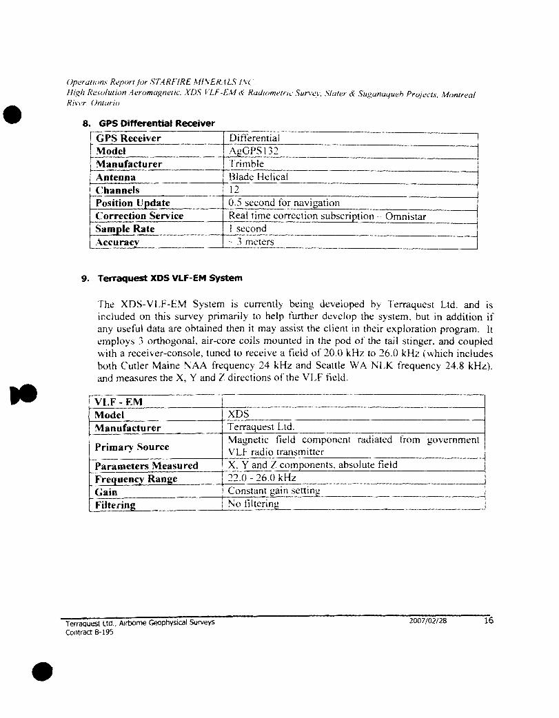
8. GPS Differential Receiver
r GPS Receiver DitrerentiaJ Model AgGPS132 Manufacturer Trimble Antenna Blade Hdical Channels 12 Position Update 0.5 second for navi~ation Correction Service Real time correction subscription - Omnistar
I Sam~le Rate I second ~ccurac~ 3 meters
9. l"erraquest XDS VLF-EM System
I
The XDS-V LF -EM System is currently being developed by Tcrraquest Ltd. and is included on this survey primarily to help further develop the system. but in addition if any useful data are obtained then it may assist the client in their exploration program. It employs :3 orthogonal. air-core coils mounted in the pod of the tail stinger. and coupled with a receiver-console, tuned to receive a field of 20.0 kHz to 26.0 kHz (which includes both Cutler Maine NAA frequency 24 kHz and Seattle W A NLK frequency 24.8 kHz). and measures the X, Y and Z directions of the VLF field.
I VLF-EM Model Manufacturer
I Primary Source -.---
Parameters Measured Frequency Range Gain Filtering
Terraquest Ltd., AlrbOme Geophysical Surveys Contract B,195
! XDS Terraquest Ltd. Magnetic field component radiated from government V LF radio transmitter X. Y and Z comeonents. absolute field 22.0 - 26.0 kHz Constant gain setting No tilterinl!
2007/02/28 16

•
•
OperaTions Repurt/orST,4RFIRE MlNERALS rve High Resulution Aeromagnetic, XDS VLF-EM & RadiometTic Survey, Slater & Suganu(IUeh Proje(:ts, Montreal River, Ontario
4. Base Station Equipment
4.1. BASE STATION MAGNETOMETER High sensitivity magnetic base station data was provided by a cesium vapour magnetometer logging onto a computer and with time synchronization from the GPS base station receiver.
The magnetometer was the same as used in the aircraft, a CS-2 magnetometer manufactured by Scintrex. The magnetometer processor was a KMAG manufactured by Kroum VS Instruments and the data logger was an iP AQ PDA by Hewlett Packard. The counter was powered by a IOVAC 50/60hz to 30VDC 3.0 amp power supply with an internal 12VDC fan. The logging software SDAS-I was written by Kroum VS Instrument Ltd. specifically for the pocket pc hardware. 1t supports real time graphics with selectable windows (uses two liser selectable scales. coarse and fine). Time recorded was taken from the base GPS receiver. Magnetic data was logged at 2Hz. Data collection was by RS232 recording ASCII string and stored on flash card.
Ground Magnetometer I Cesium Vapo~ Model CS 2 Manufacturer Scintrex
Sensitivity 0.0] oT 0.05 nT Noise Envelo2e ~amPltng Interval ~inimum Range
! 1 second ------------.---1
• > •
150 ~3_.5_00_ft _______ ~
4.2. BASE STATION GPS RECEIVER
Model \l2 channel GPS-~--~-~-Manufacturer I Deluo . .-----~. Tlpe I Ll,C/Acode ~---~------
\---=A..>l.n·.l:t:.:e:.....n-n-a~--------.....,..I-:B::-U-;i--;-lt-:i:-n~p-a-t.ch ---" , .------------/
rLogging Rate ! 1 per secon~d ____ _ Power I 5 VCO ta}(~!1~ fh~I'l1 iPAQ power:.supply ~.-~.~~----------~-------
Terraquest Lt(t, Airborne GeophYSical Surveys Contract 6-195
2007/02/28 17

•
•
(}peralwns Reporljilr STARFIRE MI,VERALS /iv('
Hi~h Resolution AeromuRnelic, )(DS VLF-E,'v1 (\ Radiometric Surver, Slater (\ .<')u~anaqueh ProP!c/s, Montreal RH'er, ()warin
5. TESTS AND CALIBRATIONS
5.1. MAGNETIC FIGURE OF MERIT
Compensation calibration tests were performed to determine the magnetic influence of aircraft maneuvers and the effectiveness of the aircraft compensation method. The aircraft tlew a square pattern in the four survey directions at a high altitude over a magnetically quiet area and perform pitches (± 5°). rolls (± 10°) and yaws (±
5°). The sum of the maximum peak-to-peak residual noise amplitudes in the total compensated signal resulting from the twelve maneuvers is refen-ed to as the Figure of Merit (FOM) index.
5.2. RADAR ALTIMETER CALIBRATION A radar altimeter calibration was performed over the runway.
5.3. RADIOMETRIC SAMPLE CHECKS The performance and consistency of gamma ray system was checked before and after each flight day using sample pucks of uranium, thorium and cesium to ensure that there was no change in the system during the survey.
5.4. RADIOMETRIC SENSITIVITY FACTORS The radiometric system sensitivity was determined from measurements acquired over the Breckenridge calibration test site monitored by the Geological Survey of Canada.
5.5. RADIOMETRIC ALTITUDE ATTENUATION The altitude attenuation was determined from the results of flying over the runway.
5.6. RADIOMETRIC COMPTON COEFFICIENTS A pad calibration was performed over the GSC pads in Ottawa.
TerraQuest Ltd., Airborne Geophysical Surveys Contract 6-195
2007/02/28 18

•
•

•
•
•
Operations Report jor STARFfRE ,~1li\'ERALS fN(' High Resolulion Aeromagnetic. XDS ViI-EM & Radiometric Surve.'v, Slater & Suganaqueh Project.\', Montreal RH'l'Y. Ontarm
7. Data Processing
7.1. DATA QUALITY CONTROL
The field data were couriered back to the office to inspect the data for quality control and tolerances on all channels, This included any corrections to the tlight path, making flight path plots. importing the base station data, creating a database on a flight-by-flight basis. and posting the data. All data were checked for continuity and integrity, Any errors or omission or data beyond tolerances were flagged for re-flight and the crew was notified ready for their flight in the morning,
7.2. FINAL MAGNETIC DATA PROCESSING Raw magnetic data was initially compensated for aircraft motion effects in advance of calculating measured longitudinal and lateral magnetic gradients, The lateral magnetic gradient was calculated by subtracting the left wing sensor reading from the right wing sensor reading and dividing the resulting value by the tip-to-tip separation. yielding the measurement expressed as nT/m, The longitudinal gradient was similarly calculated by subtracting the tail sensor measurement from the average of the wing-tip values normalized by the wing-centre to tail sensor separation. Both gradients were "DC shifted" by subtracting the median value on a lineby-line basis and converted from aircraft-centric to survey grid orientation by selectively inverting (mUltiplying by -1) in the south and westbound directions, The gradient data was subsequently verified by generating a Reconstructed Total Field (RTF) grid using the Lateral and Longitudinal data grids as input.
In the final correction process the compensated tail sensor magnetic data were initially corrected with standard tie-line intersection leveling, Tie line leveled Total Field Magnetic data from the Left Wing. Right Wing and Tail Sensors were subsequently subjected to an enhanced microleveling procedure. operating on the regional magnetic component (isolated by removal of the reconstructed Total Field), Leveling in this manner minimizes "damage" to higher frequency geologic anomalies and improves upon residual errors left by traditional tie-line leveling. The vertical magnetic gradient was subsequently calculated from the final processed total magnetic tield data grid (originating from the Tail Sensor). The finalized datasets were gridded with minimum curvature procedure with a cell size of 20 metres.
Terraquest Ltd., Airborne GeophYSical Surveys Contract 6-195
2007/02/28 20

•
•
•
(Jpc'rtillum R,,/ l()r/ /or .'-.'7 .·1RFIRE \//:\I:.R·IU; /\(. HIgh Re.HJ/u/wlI · kr"f)w,~n<!/lc. \'f)S I I.f-I:. \I ,0: RllJilJlI/('II'IL '\·IIFl'<'1 .<.,'/ul<.'/" c'( . ' lIg,JlILI</IIL'f> 1' /""leL·h. \/,,11/1'1'01
H I I(,/" ()II/tlrIlJ
Terraquest Ltd., AIrborne GeophysIcal Surveys Contract B' 19~
2007 /02/28
"7A"FfRf MI""r"lI, .. /",-............... -.: ";.!""~ _'f"
21

•
•
•
()/ )('rUlllim R<!f}(ln lor.\7 ARf IRI:. Hf.'\tR ... U..\' / \( . fin.!. 1 [«('I'tI/lllum -1erot/llIgnl.'ll( .\U,<.; I/.f-I: \1,( R"JIIIII/{'II'I< \ ' /ltTe l ·I,,'e,. ,\ .\II.l:u/I(/(/lIeh /)ru/eClI . Htlnl ,.eu/
R,, ',' / ()/lI",.",
Terraquest Ltd., Airborne Geophysical Surveys Contract B 195
2007/02/28
LOCA T ION MA P
\ TARFIRE II'NER~ .. :)·"" ,,, .. ~ ,. -, ~ . ...::"2:. -- ... _
22

•
•
•
( ){ I<' r 1I1 (J17\ Hepor! llir S { 4 R f {R f: .\f/ '\ I:.HA/ .. ) f\ ( .
1111:17 !?('\O/II! 1lJ1/ ·lcr(J/t/ ugnellc. .\D,c., I L I--/: \1 ('(. R<I.// I I/I/t'/rl t .\111'1'''1 .'>'/uk l ,( . '1I;':'<II/<1<llIl:'h l'rfJlec/.\ \-IlJntr~(//
R/ I' l'r ( )/1/ar/ l ,
7.3 . FINAL ELECTROMAGNETC DATA PROCESSING
I'he rerraq uest I)S s. stem produced rdat i\ely consistent resuhs in all channels . T h I erraquest XD." -VI.F _ yst~m i currentl)- in the developmental stage and av such only basic processing has h~en p~rrormcd on th is data. I he :\. ;. and / c()mpon~nts of th\..' XD.' -VI.F-EV1 data in the range of 22 .0 to 26 .0 kHI (which include Cutl er and Seattle transmitter si gna ls). were rescaled (where requ ired). lov. pass filter -d. DC sh ift corrected and levelled . rhe data were griddcd v.ith 20 metre grid cell SiLl..' and pres\..'nted as contour p ints of the a) Line Fie ld (Vex) coil. h) Ortho held (Vcp) coil and c) Vertical Field (Ilep) coil.
erraquest Ltd ., Airborne GeophYSI al Surveys Contract 8- 195
2007/02/ 28 23

•
•
•
(JPI!r<l/t()11.\ R<!por1 lor S'/ ARf/RF 14/ "I:.R~/. ,)' / \ ( HI,\!.h R<!\(Ihl{[IJII Il1ru l1/ugl1l'IIC .\ DS I/J-f. \,f & Rudl()mt'lrtt \111'1'£.' 1 , .\/"I~r (~ .\/1 ' uII(/(/l/I.lI, P r o/eel,\, 1,, /(lnlr<!u /
RII' I!J' ()nlll"' ''
Terraquesr Ltd " Airborne Geophysical Surveys Contract B 195
7007/02/28
,·\.T~RFfRE M/kER .. t.. INC , ........, .. ., .... ' , -..... " ... . .... . -. ~.-. ~ .
24
•
•
•
Operaf/on\ Repurt/i}r STARFIRE MJlI/ERAL5; /.ve . fllRh Re.'iu/ulion .4eromaRnelic, :>;:DS VLF'-EM & Radiumetric Survev, Slater & Suganaqueb Projects, Montreal Rlvl!r, Ontario
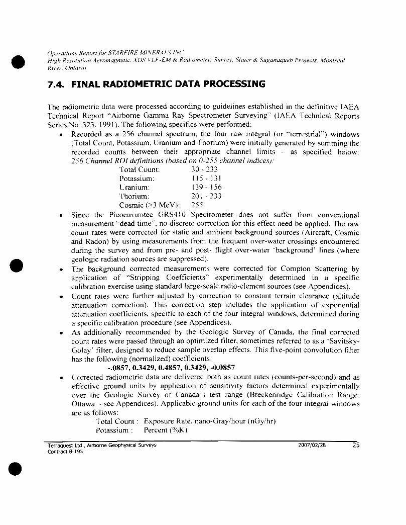
7.4. FINAL RADIOMETRIC DATA PROCESSING
The radiometric data were processed according to guidelines established in the definitive lAEA Technical Report "Airborne Gamma Ray Spectrometer Surveying" (lAEA Technical Reports Series No, 323, 1991). The following specifics were performed:
• Recorded as a 256 channel spectrum, the four raw integral (or "terrestrial") windows (Total Count, Potassium, Uranium and Thorium) were initially generated by summing the recorded counts between their appropriate channel limits - as specified below: 256 Channel ROI definitions (based on 0-255 channel indices)'
Total Count: 30 - 233 Potassium: 115 - 131 Uranium: 139 - 156 Thorium: 20 t - 233 Cosmic (>3 MeV): 255
• Since the Picoenvirotec GRS410 Spectrometer does not suffer from conventional measurement "dead time", no discrete correction fDr this effect need be applied. The raw count rates were corrected fDr static and ambient background sources (Aircraft, Cosmic and Radon) by using measurements tt'om the frequent over-water crossings encountered during the survey and from pre- and post- flight over-water 'background' lines (where geologic radiation sources are suppressed) .
• The background corrected measurements were corrected tor Compton Scattering by application of "Stripping Coefficients" experimentally determined in a specific calibration exercise using standard large-scale radio-element sources (see Appendices).
• Count rates were further adjusted by correction to constant terrain clearance (altitude attenuation correction). This correction step includes the application of exponential attenuation coefficients, specific to each of the tDur integral windows, determined during a specific calibration procedure (see Appendices).
• As additionally recommended by the Geologic Survey of Canada, the final corrected count rates were passed through an optimized filter, sometimes referred to as a 'SavitskyGolay' filter, designed to reduce sample overlap effects. This five-point convolution filter has the following (normalized) coefficients:
-.0857,0.3429,0.4857,0.3429, -0.0857 • Corrected radiometric data are delivered both as count rates (counts-per-second) and as
efTective ground units by application of sensitivity factors determined experimentally over the Geologic Survey of Canada's test range (Breckenridge Calibration Range, Ottawa - see Appendices). Applicable ground units fDr each of the fDur integral windows arc as tollows:
Total Count: Exposure Rate, nano-Gray/hour (nGy/hr) Potassium: Percent (%K)
TerraQuest Ltd" Ani:)(:>me Geophysical Surveys Contract 9-195
2007/02./28 25

•
•
•
(){)t'YtlllI'i/.' RI!PfJYI/nr S7ARrlRL 1I'\L-:R.·nS /,\( ' II /gil He.,ullil/nll 4erllf//lIgl7l'l/c \D\' ~Lf-l: \I ,(- RUc/IIl1nelrJ C ,\1111"1'('\ SluI1'1" n' ..... ·ugtlnUl/ud, Prule(/., !.-Iutll reu/
I<lIl'/ ( )n!(/1'I1>
[ jra ni llm : Parts pe r Mil lion equ ivaknt [ ran ium (ppm I)
Ihorium : Parts p-.: r Million equi\aknt I hori um (rpm ~ I'h )
I ht: radiomet ric d a ta we re g ridded hy min imum cunalUre method \\-ith a ce ll S i 7~ of 20 m et res and COI1l01lfCd .
- A IoI FI"it ""N~ "'iJ. ~.,> "u
Terraquest Ltd ., Alrtxlrne GeophYSical Surveys Comract B 195
2007/02/28
I~ . , f...... .. ..
26

e"
e
( ){ll'rllli(ll/\ Nq){) /"I /or S /' -l RflRl:. 1//\ f .RAI.\ 1\(
fit. ,17 R.!,,,J/IlfIOJl ,,1errif)wgm-"/L', .\'f).'; t '1.1- -ft1 tt· RwllllnJ l" r" \/II'1 't'I , .... ·Iu{e/" tt )'/Igutll/(/uen Pr,,/ed .\ ,\llIlII r<'al R /I '('/" ()t/1 {[/'/o
Terraquest LW., Airborne Geophysical Surveys Contract B 195
1
2007/02/28
., r ~Rf:,ftf WINt'R.:. U. l folf ~~-. .... , ......
"!:. RRAouES· rO
27
•
•
•
Operations RepOrlforSTARFJRE MINERALS INC High Resolution Aeromagnetic, XDS VLF-EM & Radiometric Survev, Slater & Sugana'lueb Pro;ecls, Montreal River, Ontariu
8. SUMMARY
An airborne high sensitivity magnetic, XOS VLF-EM and gamma ray spectrometer survey was performed over the Slater & Suganaqueb Projects Ontario, located respectively approximately 70 kilometres north of Sault Ste Marie and 35 kilometres southeast of Wawa, with 70 metre mean terrain clearance, 100 metre line intervals, 2,000 metre tie line interval, and with data sample points at 6-8 metres along the flight lines. The base of operations was at Sault Ste Marie, Ontario. A high sensitivity magnetic and a GPS base station located at the airport recorded the diurnal magnetic activity and reference GPS time during the survey for adherence to survey tolerances.
The data were subjected to tinal processing to produce two sets of the following colour maps at J :20,000 scale for Slater Block and 1: 1 0,000 scale for Suganaqueb Block:
a) Magnetics: total magnetic intensity of tail sensor. measured lateral gradient. measured longitudinal gradient and first vertical derivative
b) XDS VLF-EM: x, y and z fields c) Radiometries: total count. potassium. uranium. thorium. ternary d) Flight Path e) Digital Terrain Model
All data have been archived as Geosoft database (GOB); all MAP and GRID tiles used to make the maps and this report are included in the archive.
Vice President T erraquesl Ltd.
TerraQuest Ltd., Airborne Geophysical Surveys Contract 8-195
2007/02/28 29

•
•
•
Operations Reportfor STARFIRE MINERALS INC. High Resolution Aeromagnetic, XDS VLF-EM & Radiometric Survey, Slater & Suganaqueb Projects, Montreal River, Ontario
9. APPENDICES
9.1. APPENDIX I - CERTIFICATE OF QUALIFICATION
I, Charles Barrie, certify that I:
1) am registered as a Fellow with the Geological Association of Canada and work professionally as a geologist,
2) hold an Honours degree in Geology from McMaster University, Canada, obtained in 1977,
3) 4) 5) 6) 7)
8)
hold an M.Sc. in Geology from Dalhousie University, Canada, obtained in 1980, am a member of the Prospectors and Developers Association of Canada, am a member of the Canadian Institute of Mining, Metallurgy and Petroleum, have worked as a geologist for over twenty five years, am employed by and am an owner of Terraquest Ltd., specializing in high sensitivity airborne geophysical surveys, and have prepared this operations and specifications report pertaining to airborne data collected by T erraquest Ltd ..
Markham, Ontario, Canada
Terraquest Ud., Airborne Geophysical Surveys Contract 8-195
YU(:u'1"'S • Barrie, M.Sc. Ice President, T erraquest Ltd.
2007/02/28 30

•
•
Operaillms Report/i)r STARFIRE MINERALS INC High Resolution AeromagnetIC. XDS VLF-EM & RadIOmetric Survev. Slater & Suganaqueb PrOjects. Montreal Rh·!.:r. Ontario
9.2. APPENDIX II - DAILY LOG
October 2, 2006 Weather: good Flight: Comments: van arrive, set up base station, parking, fuel. office;
camera not work on this survey. permission to proceed from client
October 3, 2006 Weather: fog in morning, wind Flight: 228 in afternoon Comments: FOM
October 4, 2006 Weather: clear, 15+ visibility, wind 15-20 kts Flight: 229. 230 Comments: 229: only 2 lines. abort due to turbulence
October 5, 2006 Weather: clear, wind light and variable Flight: 231 Comments: 20 lines
October 6, 2006 Weather: wind 10 kts N-W Flight: 232 Comments: isolate capacitor to alternator case. on left engine
October 7, 2006 Weather: Flight: Comments: crew off
October 8,2006 W cather: clear Flight: Comments: crew off
October 9,2006 W cather: clear
TerraQuest ltd., AIrborne Geophysical Surveys Contract 8-195
200?/02/28 31

•
•
•
01'<'ratiol1.1 Repurthr 5,'TARFIR£ MINE.l?ALS INC
lIiKh Resol",ion Aeromagnetic. XDS "UCEM .. Radiome"" Sarvey. Siafer" Snganaqaeh hOjecls. Momreal River, ()l1/ario
Flight:
('omments: operator otT. testing & repairs on aircraft October 10, 2006
Weather: clear, wind 7 kts Flight: 234
Comments: 3 Jines, noise problem
October 11,2006
Weather: vis I mile. 200ft ceiling, rain Flight:
('ommenzs: standby
October 12, 2006
Weather: rain and strong winds Fljght:
Comments:
October 13, 2006
Weather: rain, strong wind. Poor vis Flight: ('ornments:
October 14, 2006 . .
Weather: rain, strong wmd, poor VIS Flight:
Comments: crew off
October 15, 2006 . _
Weather: clear, moderste turbulence, VIS 1)+
Flight: 235,236 nt"'· 85 Imes Comme v.
October 16, 2006, . m clear pm Wcatht.:r: tog 111 a , Flight: 237 "
t " 41 Imes Commen s.
(
O~C:t:O:b:e~rl~7~'~~'~OO:.6~~r;c;a;st~;ra~in;;a~11~d:a~Y~-----------------------------"200m7,7J~022;/"28'-----:32 Weather. ove
Geophysical Surveys est Ltd. Airborne Terraqu , Contract 8·195

•
•
•
Operu!uJnI Reportf()r STARFIRE .111lvERALS INC High Resolution Aeromagneti(.·, ,\'DS I IF-EM ({ Rud/()mt'lric Survey. Simer ({ Suganaqueh Projeels. Montreal River, ()n/arJ{J
Flight: Comments: no flight
October 18, 2006 Weather: poor Flight: Comments: no flight
October 19,2006 Weather: Flight: 238 Comments: 38 lines
October 20, 2006 Weather: Flight: 239-240 Comments: 71 lines
October' 21, 2006 Weather: wind, turbulent Flight: Comments: no night
October 22, 2006 Weather: poor Flight: Comments: no flight
October 23. 2006 Weather: rain, wind. turbulent Flight: Comments: no flight
October 24. 2006 W cather: poor Flight: 241 Comments: 7 lines. 5 tie
Terraquest Ltd., Alrbome Geophysical Surveys Contract 6-195
2007/02/28 33

•
i Jl lt'rulio /IS Rei )"'" / 01' S7.-lRfIRE II/'V/-,R .IL\ 1\('
II/~h Rnu//( //I) /I l<!r()nlUgn<'/Ic. In.\" I "l.1--f. II & RodlfJ/II <!/I"/ ( SI//"\ '<'l. .... 111/('1' (\: SIl.~{II1L1(lltt:'h I'rflWt1.1 \' /" I/rr (:'u/ Nil",'!" ( )l"/IuJ"t"
9 .3 . APPENDIX III - FIGURE OF MERIT
FOM INDEX : C-GXKS - FLIGHT XKS243 31 OCT 2006 (B197) I BASE:CHAPLEAU. N.ONTARIO FOM TEST #1 - SET "S"
MAG 1 OIR TRAV LINE PITCH ROLL YAW P R Y FLG MAX MIN MAX MIN MAX MIN 9050 001 -0 03 000 ·002 001 -004 004 002 005
~-r ' 9060 0 05 003 000 ·003 007 ·002 008 003 009
E
003 '006 003 003 000 003 004 002 C 06
S 9070
012 003 01 5 007 -005 00' -002 007 008
W 9080
SUM 03 o 11 035 I , +--- -+-f--- ---r I I -
FOM 0.76 I
~ FOM TRAVERSE ONLY 0.26 (x2 : 0.52 )
MAG 2
Y YAW P R DIR TRAV LINE PITCH ROLL
MAX MIN MAX MIN MAX MIN FLG
01 6 004 006 002 ·0 02 001 -005 008 ·0 08
0"
N 9050
007 0 04 004 004 9060 002 002 000 004 E S 9070 001 -0 04 000 -0 05 008 002 005 005 010
008 005 015 008 a O~ Y.Q!lQ.- 0 05 003 002 033 02 1 020 052
W --,.-SUM
FOM 0.93 FOM TRAVERSE ONLY 0.46 (x2 0.92
MAG)
DIR TRAV I LINE PITCH ROLL I YAW P R Y MIN I MAX MIN MIN MAX
001 002 001 FLG r MAX
001 --0 0 1 000 ·0 02 . 000 -- 003 002 005 N ! 9050 000
0001 004 001 00 1 002 I 9060 003 000 002 - 002 000 002
003
E 002
001 9070 000 -0 02 ·001
002 001 001 o 11
S I 000 ·0 01
0 07 006 9080 I 001 000 SUM
W I I
0.24 I I I 1" FOM
0.09 (x2 0 .18 ) FOM TRAVERSE ONLY
I I t
•
SUM
011 020 01 5 030 076
SUM
026 019 020 028 093
SUM
004 010 005 005 024

•
•
•
Url'rtlIWII.' RI'{IIWI/or ,\F.JRI-IRt. 'v1/\/. R4V·; /.\( . High R I'SU / IIl1l1ll A er(Jf}/{/gnellC .\{)c,,- I Lf- -I-. v! cl: H uc /i U tli t' Ir/ ( '\II/"\ 'I'l . . \ /"ll'r (~ . .'wg CI/l{/(/III' j, {'rul ed., . \luntre,,/
1<" .,'" ( )nl l ll"lI'
9 .4 . APPENDIX IV - RADAR ALTIMETER CALIBRATION
LINE Ground Ref 5100210 5200210 5300 210 5400210 S500210 5600210 5800.210 $1000210
3!>0 0
300
~ ~50 a "C
'" cr
'" .. "ii 200 a :e "iii u (jj 0.. l!) 150 0 -0 .. ;:; ... :: 0 u 'OC C
'>00
U 0
C-GXKS RADAR CALI BRA TION DATA SUMMARY
-calibration oeriormed 20 AUG 2006 / Chapleau, Northern Ontario
RAW RADAR GPS ALT CORRECTED GPS AL T RAW RADAR 4505 00
1436 0 4798 293 14360 27240 508 0 57 5 27240 4269 0 542 .5 92 0 4269 0 5615.0 5720 121 5 561 5 0 74760 6127 1622 74760 8775.0 6408 1903 87750 10756 0 683.3 2328 10756 0 14 1070 7571 306 6 141 070
Radar Altimeter Calibration C-GXKS:Flight XKS210 (Chapleau, N Ont) - 20-AUG-06
INTERCEPTl -1.641 4 SLOPE 1 0.021856
CALIBRATED RADAR
297 579 91 7 121 1 161 8 1901 233 4 306.7
au 2000 a 4000 0 6000" BOOO 0 '0000 0 1;>000 0 ' 4000 a 16000 a
Terraquest ltd., Airborne Geophysical Surveys Contraa B 19~)
Raw Radar
2007/02/ 28 35
t:KKUK
04 04 ·04 ·05 -04 ·02 06 00
•
•
•
(JI 'L'r ,/lI())/., He'llIlr/lor S/..JRfIRf, \/I\I,R n.\ /\(. High R<!Il!/II/lun ..Jcr(}nwgllL'li( \ n ,<., ILI- · t.. He( Rod/()/J/du,' '\"r\"('I . . \Iu/er (\ . SugulI'''ILIeh {'ru/l'c", Hun /reul
R/I 'L' /' ( )I1I£I/'/(I
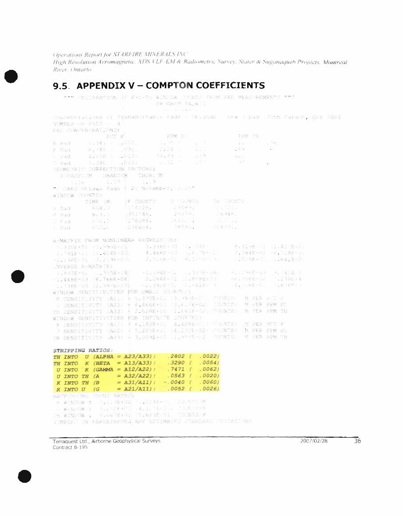
9.5 . APPENDIX V COMPTON COEFFICIENTS ,", "
1. t· . "
'v'
• I'.
. ' .
". V.J-, ~,:
~ 4 t.
( .
t , I, 'L
" l"
I .. " 0 .'t
k
. ~ ~ ..
. r.
r (.
~
,.,
..
" )~
·1
- ,j'J
. ... .t~: '" T ,
, --:!
. 1
~
" ,I I , t'!,,· .. ~!""
" j ...f .
. \ • F ;. . 'Mt ",
~ F· . £
.... I.
STRIPPING RATIOS : TH INTO U {ALPHA A23/A33) :
TH INTO K {BETA A13/A33) : U INTO K {GAMMA A12/A22) :
U INTO TH {A A32/A22) :
K INTO TH (B A31/All) :
K INTO U (G A21/All) :
"-. !. t . , .. t,
~\ . . , r I . , ~" L-
. ~
Terraquest Ltd., AlftJorne GeophYSical Surveys Contra t B 1 ~
I ~
" ,
.2802
. 3290 , 7471
, 0563 - , 0040
.0052
f 'l; ... .
.. '\ -
\;
" . ~
( . 0022 ) ( , 0054 ) ( . 0062 ) ( ,0020) ( .0060) ( . 0026)
..
v
v
t'"
2007/02/28 36

•
•
•
( )f l('rUIIU n.\ 1?L'p()rt Ilir .\'7 ~H./-fRI-_ \//\I:"f?.J L \ 1 '1;(
High Re.,ulilfum ·krnfll llgnt' flc. .\ OS 11.1- -I:.. tI & RuLiI()ntL'fn, ' \ '1//'1'1'1 '> fU I L'r ( . \/IguliuLfll t'n Pro/ed.\' . \.fun/r eal
Ri \'(',. ()III(II'/"
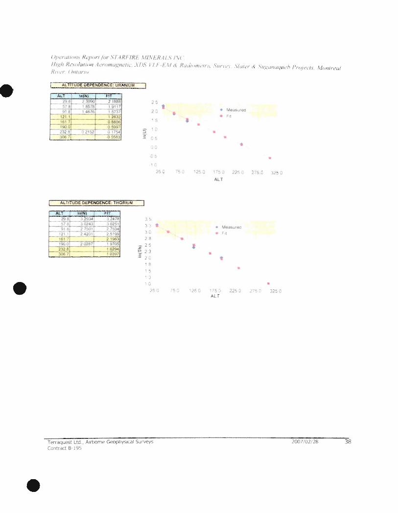
9.6. APPENDIX VI - ALTITUDE ATTENTUATION
r-
_. - TERRAQUEST C·GXKS N. vojol PEl AI~h. S~tra -RADIOMETRIC AL TJTUDE ATIENUATION CALIBRATION
"-Performed ' 20 AU{JIJs, 2006 1 Chapleau. N Onr.
LINE Average Clearance TC I I K II u,J TH tmetres) (cor. CPS) (co,. CPS) (cor. CPS (cor CPS)
100 :?!o8 Ii;415 • 1.a. 0 10 ' 26 9 <00 578 ·1 ~~ - "1:" J
.~-.~
~- ~1B - as? r,2f -;; 'Sb - -;-ili' 660 .: ; - To"7 ~~ ' >2 t--~OO 161 7 ~95 0 '):J- :: 1 5 4 600 1900 40S J 4G. J 1 -6
1~ ~32 8 298 ~r 309 - 2 -j) 1000 )06 7 1168" - -lbJ " 02+ -h
ALTITUDE ATIENUATION COEFFICIENTS
Ca/cuIM/ed "II LSQ h"o .- In(N) • AL T'" + In(N . J ffllilllon
TC ~c - 0007527 In(N.hc = 4S07
K ~ ... .; i. -0 0084'",' , In(N, ). - ! ; 3,:\4
- U ~" " o ~221 In(N.h. = .' 4049 Th ).It,, ; r o OC"'791'~ I nfN~h" = <.~
ALTITUDE DEPENDENCE: TOTAL COU NT
AU InIN) FIT
298 7 '2734 72<61 5i 8 70266 ; 0159 -;1 0' 484 6 7!1~
'21 1
~"~5¥0 t :'39 '
- 16"! -;;23:i6 190 6v'~5 '"""60205 2J~ B : 70CP 56986 306 ' ~ '-~dq 51 420
ALTITUDE DEPENDENCE: POTASSIUM
ALT In(N) FIT
~6 ~ 1!£8 ~} 101 4
~j, .~ :;--88~1 -< 8655 .1 il • 5506 4 ':J717
1211 42!.4!l • J J05 I 3 ~J4 • !;Sf? ..:.6.:...1.
19001 3/48!>
.:'Ji d 336/3 306 7 "~84r 1 7628
75 73 . 10
b~
_ ~ 5 U ... b J
E 60
S8
53
50 ~5 1
• S
35
30
25
250
•
-, G
•
•
.::l, (
•
• • •
, .1 r 0 l~~ (
All
• MedSllf PQ
hI
•
. -5 Q
AU
•
Terraquest Ltd., Alrbome Geophy leal Surveys Contract 8 ·1 95
• 1.7'. J.!~ v
• 275 G 325 C
2007/02/28 37
•
•
•
( )/'erllflOI/I R<'/)()rt lor "IIR!-IR! "",\I:R '/I.\ 1\ ( '
I It l!, h R L' I'u l u fltll/ krlltna.<":I'It'flt',.\!>. j I f -f . t / (\ R (/, / III III, ' II It ,"111 ' \ t'\ ,'J " " ) , (/ /<'r (\ 1I.!.!, Wh1ll ll t' h I 'r(j/ t 'C /.I , HlJn/rl'u/ Rlll'r { )IIIt/rllI
AL TlTUDE DEPENDENCE: URANIUM
ALT InIN) FIT 298 2 3090 21888 25 578 1 8578 -~ q18 1 4676 15737 2 ~
121 1 1 2832 1617 08806
, 5
190 0 05997 232 8 " 2152 o 17'>4 306 7T 05583
2 ' -L
E
c =>
1 C
2
AL TlTUDE DEPENDENCE: THORIUM
ALT I lo(N ) FIT
298 3 2934 32478 3~ 57 ~ 30243 10251 9181 27501 27534
:1 • '21 I 2 4201 25199 '3G
161 :' 2 1963 28 190 0 20287 19705 2328 16294 306 7 10397
~ 25
~ :1 3 E 2u
, 8 , 5
3 .. G
:;'5 C
Terraquest Ltd" Airborne Geophysical Surveys Contr dct B· 195
t .. ,
C -:, \.I 12~ J
•
');)
• M£:odS l.rea
FIt
• ..
17:' J 22 a ALT
Measurea
1'"
•
17
ALT
•
.. 275 G 3.!S Q
• 2 ., 0 325 G
2007/02/ 28 38

•
•
()r)~'! ,11/1111\ Hl'fi" rl {or, 'I ~ RI-I H f: 1." \ f R I L .... 1\(
fltif" Helli/Llftlll! 4<.'r(}m,lt;n"'/( ,\/),\ I r I--F. ~I (\ R""LIJnH'ir" \1/n.' ,'1 \'f...J/('r <t< \Ul!,tl tlU'/ llen Pro/l'c/I. t /(Jnlr l.'Ld Rt\L" ()nlt trtlJ
9 .7. APPENDIX VII - SENSITIVITY FACTORS
Measured Ground Values : C-GXKS > Onawa.8reCkendrldge CalibratIon 19 AUGUST 2004 Exp ITC) nGylhr 51 49
%K 193 ppm U 0 86 ppm Ttl 800
Clearance TC K U Th STC SK SU Line (metres) (cps) (cps) (cps) (cps) (cpslunit) (cps/unit) (cps/unit)
10300 91 0 148848 13585 11 61 3549 2891 7027 13 53 10400 121 2 120850 10508 885 2944 2347 54 35 10 32 10500 173 6 85650 67 28 71 5 19 94 1664 34 80 833 10600 1955 73861 56 74 601 1797 1435 2935 7 00 10700 221 2 626 14 4628 508 15 77 12 16 2394 592
10800 254 4 511 49 3704 434 1262 993 1916 507
"m" "b'
I ExponentIal Fit Parameters: TC 09935 52 1028
K 09920 1436203
U 0994 1 223156
TH 09937 78104
r Calculated Sensitivities
I CLEARANCE: 70
TC 32_92
K 81.80
U 14,78 TH 5.02
STH (cpslunit)
444 368 2 49 225 197 1 58

OperUlh,n.1 Report/or ,'l'T4RFlRE MltV£I?AL,)' ltV( ~
HiKh Resolution Aeromagnetic. XDS VLF-EM & Radiometric ,'iurvey, S/uler & SUKunuL/ueh ProjeCls, MOnlr<'al
River, On/ario
8000
7000 •
6000
0:: 5000 0 I-()
< IL.
>- 4000 I-
~ iii z w :10 00 til
2000
10.00
000 a '" 0 '" 0 '" 0 ;? co g a
'!2 ~ <0 <0 ;? ;:'! ;:: ;!
t Ltd Airborne GeophYSical Surveys Terraques " Contract 8-195
SensitiVity Factors
'" 0 '" g 0 0 0 '" 0 '<t en
"- ';!. C1> N N <")
N '" '" '" '" CLEARANCE
'" '" '" '" (,Q I'- '" <» N N N N
2007/02/28
a 0
""
• TC
• K
U TH
-Expon (K)
-Expon (TC)
Expon (U)
Expon (TH)
40