AGCO’s Precision Technology Solutions
12
AGCO’s Precision Technology Solutions • Open architecture • Solutions that fit your operation • Technologies built for the future
Transcript of AGCO’s Precision Technology Solutions

AGCO’s Precision Technology Solutions
• Openarchitecture• Solutionsthatfityouroperation• Technologiesbuiltforthefuture

The Total SolutionAdvanced Technology Answers For Today’s Needs

The gains in productivity and efficiency available through Precision Farming can put more money in your pocket. Advanced Technology Solutions (ATS) from AGCO provides precise data and control to get the maximum yield out of your operation.
Equally important, AGCO’s precision farming equipment adheres to the ISO11783 standard for “plug and play” capabilities. ISOBUS (International Standards Organization Binary Unit System) allows tractors with an ISOBUS virtual terminal to operate any ISOBUS compliant implement without the need for a separate terminal.
MACHINE MANAGEMENT
• Telematics• Fleet/asset tracking• Mobile communications• Onboard service tools
PRECISION FARMING
• Console data logging• Crop yield monitoring• Variable-rate controllers• Real-time sensors• Data management/record keeping• Traceability reporting
Precision Agriculture: Unlock your farm’s potential
The technology now exists to carry out a whole range of operational
functions automatically. Three distinct areas of farm operations can now
be controlled and managed by systems specifically developed to ease
the workload and provide valuable management information.
SYSTEM 150 SYSTEM 350ISOBUS
MA
CH
INE
MA
NAGEMENT
PRECISION
FAR
MIN
G
MACHINE CONTROL
MACHINE CONTROL
• Satellite-assisted steering• Headland management• Harvester settings• Pre-planned and saved
machine settings

AGCO’s AGCOMMAND system is a leading edge telemetry-based data recording tool that helps users optimize fleet performance, monitor operating costs and generate reports.
Machine Management

The AGCOMMAND system plots the collected data on a map. Each colored square indicates a machine’s status:
Working
Stopped
TransportExample of a performance report.
Stopped / Idle
Working
Headland Turning
Transport
Total
Percentage Absolute
9.8%
83.0%
2.9%
4.1%
0.2
2.0
0.0
0.1
2.59.8%
4.1%
2.9%
83.0%
EFFICIENCY-TIME: CH660C
FROM: 08/04/2010 12:00:00 AMTO: 08/04/2010 11:59:59 PM
AGCOMMANDAGCO’s AGCOMMAND system is a leading edge data recording tool that helps users optimize fleet performance, monitor operating costs and generate reports. AGCOMMAND is available in two optional data packages; Standard Plus or Advanced. AGCOMMAND will meet the needs of all farmers who are serious about utilizing telemetry to manage their operation.
HOW AGCOMMAND WORKS
The AGCOMMAND system collects GNSS (Global Navigation Satellite System) satellite location and machine performance data every 60 seconds in the Standard Plus package and every 10 seconds in the Advanced package. Allowing users to see where machines are, where they have been and the data collected at each interval.
DATA COLLECTION
Machine performance data is collected from the CAN (Control Area Network) or other machine sensors — up to 4 CAN messages in the Standard Plus package and up to 25 CAN messages in Advanced package. Data is then transferred via GPRS, cell phone, network and is accessed through an easy-to-use website. Transmission rates are every 15 minutes in the Standard Plus package and every 10 minutes in the Advanced package.
BENEFITS OF AGCOMMAND
Utilizing this information will help users manage uptime efficiency, maximize productivity and increase profitability. The full mobility of the system allows AGCOMMAND to be fitted to any piece of machinery in a fleet, regardless of brand or type of vehicle.
OPTIMUM PERFORMANCEAGCOMMAND is set up to organize information and develop reports. In Standard Plus these reports can show information such as engine hours, machine summary, service, efficiency and field. With Advanced, the reporting capabilities expand to information such as fuel comsumption, field trends, comparisons and costs. By collecting and summarizing this information, the system promotes accountability to help optimize performance and maximize capacity per hour.
MAINTENANCE
AGCOMMAND makes maintenance easier to plan and track. Service alerts can be set to signal maintenance intervals. Alerts can also be set to notify your dealer for faster service response time.
GEO-FENCING AND LOGISTICS
Geo-fences, or virtual GNSS boundaries, can be created to track when machines enter or exit designated areas. Track up to 3 Geo-Fences in the Standard Plus package and up to 40 Geo-Fences in the Advanced package at one time. Tracking logistics enables the user to anticipate routine tasks like refueling machines and refilling spreaders and spray tanks. To help reduce downtime, the system plots a machine’s exact position on the map so it can be quickly located.
INTERNAL MEMORY
If a machine leaves a GPRS coverage area, the onboard module will record its location and performance data for up to 50 hours and transfer the information once the machine reenters a coverage area.
EFFICIENCYManagers using AGCOMMAND to operate a fleet of sprayers and fertilizer spreaders have reported a significant increase in revenues by utilizing logistics to minimize road time, refueling and refilling downtime as well as geo-fences to reduce spraying errors.

MULTIPLE VIEWING OPTIONSThe screen can be set up to optimize the operator’s comfort. See the field as Bird’s Eye, North Up, and Horizon views on the moving map display.
VISUAL INDICATORSEasily identify area applied, speed, row number and satellites.
AUTOMATIC COVERAGE MAPPINGEasy to read maps for tracking areas covered or missed. Boundary mapping is useful for planning application and coverage.
CONVENIENT USB PORTQuick and simple way to transfer field data and reports.
SatelliteAssisted Guidance The strongest partnership in the industry
System
150AGCO has teamed up with specialized technology providers to offer the most state of the art technology products in precision agriculture. These relationships were formed out of the mutual commitment to providing the most sophisticated technology on the market today.AGCO’s satellite assisted guidance systems are a result of such relationships.
The System 150 is a complete AutoSteering System featuring flexible accuracy options and is an industry leader in performance.

DIRECT INTERFACE STEERING
• Automated calibration of steering system
• Designed for a wide range of “guidance ready” equipment
DECIMETER READY
Every System 150 from AGCO comes standard
with sub-meter and decimeter accuracy. All that’s
needed is a call to OmniSTAR to subscribe to one
of their correction signals (VBS. XP or HP) and
start driving. Or, you can use the WAAS signal for a
no annual fee sub-meter steering system.
RTK CENTIMETER SNAP-IN MODULE
Easily upgrade from sub-meter/decimeter to centimeter accuracy by installing
the System 150 Snap-In Module. The Snap-In module enables the connection
to a mobile base station or to the internet for an internet correction source
such as C.O.R.S. networks.
The AGI-3 is a complete steering solution that can be upgraded to Omnistar
or RTK performance with 900 mHz, Digital UHF or GSM options. The AGI-3
is also compatible with HiPerAg base stations, GSM and CORS networks.
The AGI-3’s unique Paradigm G3 Triple Constellation Technology is capable of
receiving GPS, GLONASS and Galileo (when available) and features state-of-the-
art inertial sensors and steering control with superior line acquisition and
holding capabilities.
DIRECT INTERFACE STEERING
• Fast, accurate steering response
• Up to 0.8 in./2 cm performance accuracy
• Full terrain compensation
• Reverse operation
• Convenient, simple installation
• Easy installation and easily transferable
The AES-25, working in conjunction with the System 150, is an advanced vehicle
integration solution for all platforms, from basic steering
to those striving for high-accuracy results. With a quiet, high-torque,
direct drive motor, the AES-25 provides silent operation and the most
accurate electric steering in the world. The AES-25 does not intrude into
the operator’s working area with external components that could
interfere with normal day-to-day operation.
AGI-3Complete Steering Solution
AES-25Accurate Electric SteeringThe convenience of electric, with hydraulic performance.
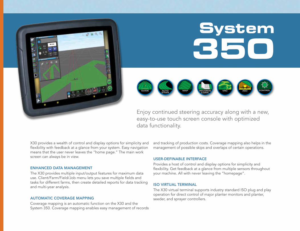
Enjoy continued steering accuracy along with a new, easy-to-use touch screen console with optimized data functionality.
System
350
X30 provides a wealth of control and display options for simplicity and flexibility with feedback at a glance from your system. Easy navigation means that the user never leaves the “home page.” The main work screen can always be in view.
ENHANCED DATA MANAGEMENTThe X30 provides multiple input/output features for maximum data use. Client/Farm/Field/Job menu lets you save multiple fields and tasks for different farms, then create detailed reports for data tracking and multi-year analysis.
AUTOMATIC COVERAGE MAPPINGCoverage mapping is an automatic function on the X30 and the System 350. Coverage mapping enables easy management of records
and tracking of production costs. Coverage mapping also helps in the management of possible skips and overlaps of certain operations.
USER-DEFINABLE INTERFACEProvides a host of control and display options for simplicity and flexibility. Get feedback at a glance from multiple sensors throughout your machine. All with never leaving the “homepage”.
ISO VIRTUAL TERMINALThe X30 virtual terminal supports industry standard ISO plug and play operation for direct control of major planter monitors and planter, seeder, and sprayer controllers.

Complete Steering Solutions For Today’s FarmerAGCO offers a wide range of steering solutions that lets you select the option that’s just right for your operation.
AES-25 An electric steering solution with the functionality and the accuracy of a hydraulics system.
AGI-3 This state-of-the-art technology features inertial sensors and steering controls allowing for superior line acquisition and line holding capabilities and the flexibility to access all forms of GNSS correction sources.
SYSTEM 150 The System 150 uses the AES-25 electric steering wheel as well as a direct hydraulic interface. With the System 150’s simplicity and functionality, nothing can surpass this steering system.
SYSTEM 350 WITH X30 (TOUCHSCREEN)We’ve taken the premier steering system and made it better. The System 350 features a next-generation interface for ease of use and increased data management capability.
The Power of Information
AGCO’s preferred Farm Management Information System (FMIS) is SGIS Desktop Software. SGIS was developed to manage and analyze data that will help you make reliable crop production decisions. SGIS provides management tools such as: •BusinessManagement •SoilSampleReports •HarvestSummaryReports •AsAppliedSummaryReports •ApplicationSummaryReports •WorkloadEfficiencies •MarketingToolforProductivity SGIS is not the only software package that can be used with AGCO branded equipment. Any FMIS product that works with shape files (*.shp) and ISO*.xml files can be used.
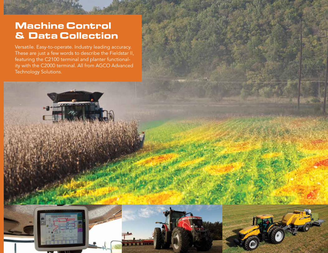
Machine Control & Data CollectionVersatile. Easy-to-operate. Industry leading accuracy. These are just a few words to describe the Fieldstar II, featuring the C2100 terminal and planter functional-ity with the C2000 terminal. All from AGCO Advanced Technology Solutions.

C2000
The C2000 provides the necessary power to control variable-rate application
plans for customers who want to vary planting rates based on field evaluation
analysis. C2000 also incorporates the ability to provide true as applied maps
of the rate applied. Map based variable-rate planting automatically changes
planting/seeding rates using a satellite signal to match a geo-referenced,
predetermined plan. Task controller is also incorporated into the C2000. This
feature enables operators to set up specific farms, fields, and jobs. Operators
can build comprehensive records to track their operation and transfer data
to their personal computers.
C2100/FieldStar II
As standard equipment on all current Challenger, Gleaner and Massey Ferguson
combines, Fieldstar II uses the C2100 terminal; advanced global positioning
components, and AE50 award-winning AGCO Yield Sensor II unit to track yield,
moisture and performance data across any terrain.
Compatible with most software packages in the industry, Fieldstar II will
produce maps of yield data, moisture level, fuel consumption, wheel slippage
and other recorded data.The system produces reliable harvest data for tracing
production by precise location and enable better management and more
economic production of high and low producing areas. Thus helping operations
comply with documentation requirements and reveal areas of crop stress. When
combined with the capabilities of desktop software for analysis, this information
can be used to vary seed, fertilizer, chemical or other inputs across acreage.
The C2100, with its enhanced user interface, operates in the ISO 11783 environment. This highly versatile, highly functional 12.9 inch terminal with 18 Input/Output ports and video input provides controlling, monitoring and recording operations that put the operator in unprecedented control.
The C2000 also operates in the ISO 11783 environment. This easy to use, 10.4 inch terminal with SD media and video input provides your operation with the flexibility of the user interface and transferability among ISO 11783 compliant operations.

The AGCO ATS Family of Products TheCompleteSolution
AES-25 Electric Steering Wheel Vehicle System
Vehicle integration system used in conjunction with the System 150.
Hands-free steering for accuracy up to 0.8 in/2 cm, coverage map
System 150 GNSS satellite signal Hands-free steering for accuracy up to 0.8 in/2 cm, coverage maps
System 350 GNSS satellite signal and enhanced user interface using the X30 terminal.
Hands-free steering for accuracy up to 0.8 in/2 cm, coverage maps
AGCOMMANDTelemetry-based data recording tool to optimize fleet performance
GNSS satellite location and machine performance data
Machine location, where they have been and the information collected
Fieldstar II®
on the C2100Yield and combine perfor-mance data tied to real time GNSS positioning data for creating accurate, reliable, decision making information.
Single terminal in cab combine control coupled with logging of crop data and machine performance
C2000 ISOBUS TerminalThe complete, single unit solution for controlling ISOBUS compatible and compliant equipment
Application plan using GNSS data
In-cab system control for map based variable rate applications
Application data from machine operations
As-applied record keeping for compliance
SOLUTION INPUTS OUTPUTS
© 2011 AGCO Corporation. AGCO®, Fieldstar® and Falcon® are registered trademarks of AGCO Corporation. All rights reserved. AGCO Corporation, 4205 River Green Parkway, Duluth, GA 30096. AT11B001DS
AGCOtechnologies.com
At AGCO, customer care isn’t just a department. It’s a commitment. Contact us with your questions. We’ll do our best to answer them promptly or put you in touch with someone who can.