Aerial Photography, Geoinformation & Air Intelligence · Aerial Photography, Geoinformation & Air...
12
Aerial Photography, Geoinformation & Air Intelligence One of the world’s largest collections of historical aerial photography.
Transcript of Aerial Photography, Geoinformation & Air Intelligence · Aerial Photography, Geoinformation & Air...
Aerial Photography, Geoinformation & Air Intelligence
One of the world’s largest collections of historical aerial photography.
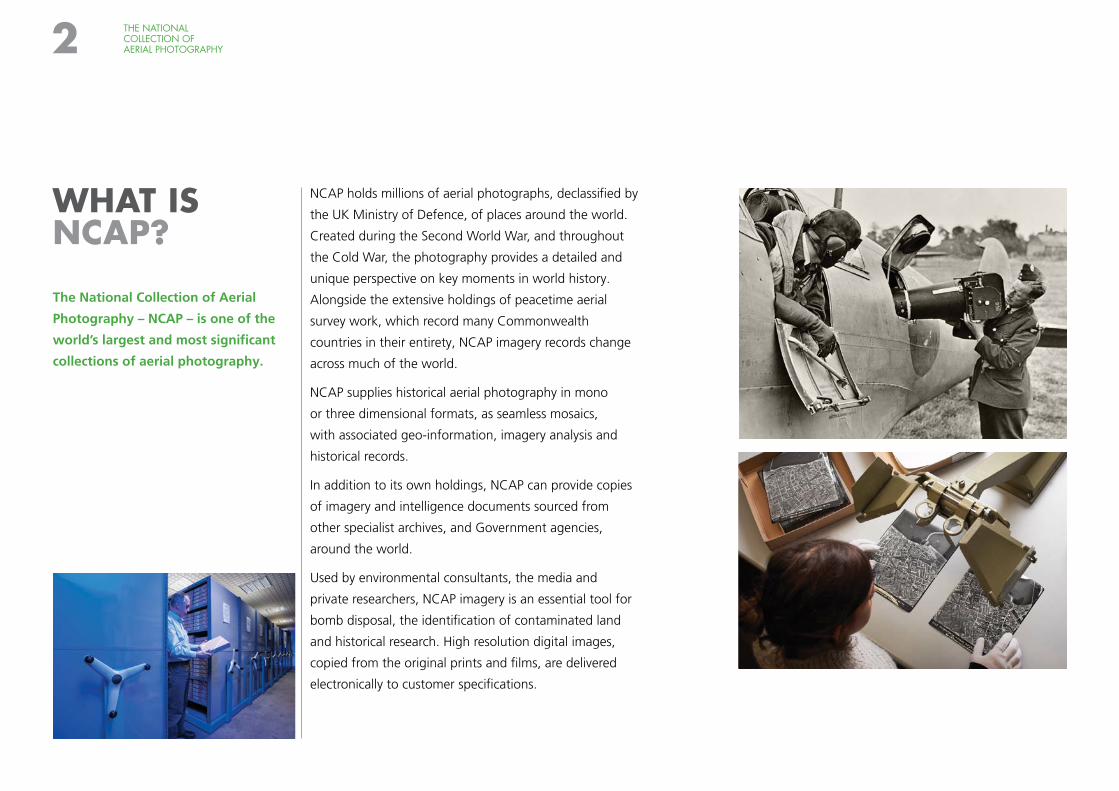
NCAP holds millions of aerial photographs, declassified by
the UK Ministry of Defence, of places around the world.
Created during the Second World War, and throughout
the Cold War, the photography provides a detailed and
unique perspective on key moments in world history.
Alongside the extensive holdings of peacetime aerial
survey work, which record many Commonwealth
countries in their entirety, NCAP imagery records change
across much of the world.
NCAP supplies historical aerial photography in mono
or three dimensional formats, as seamless mosaics,
with associated geo-information, imagery analysis and
historical records.
In addition to its own holdings, NCAP can provide copies
of imagery and intelligence documents sourced from
other specialist archives, and Government agencies,
around the world.
Used by environmental consultants, the media and
private researchers, NCAP imagery is an essential tool for
bomb disposal, the identification of contaminated land
and historical research. High resolution digital images,
copied from the original prints and films, are delivered
electronically to customer specifications.
WHAT IS NCAP?
The National Collection of Aerial
Photography – NCAP – is one of the
world’s largest and most significant
collections of aerial photography.
THE NATIONAL COLLECTION OF AERIAL PHOTOGRAPHY2
THE NATIONAL COLLECTION OF AERIAL PHOTOGRAPHY 3
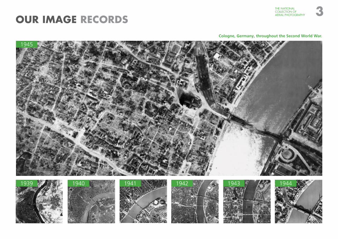
OUR IMAGE RECORDSCologne, Germany, throughout the Second World War.
1945
1939 1940 1941 1942 1943 1944
PRODUCTS & SERVICES
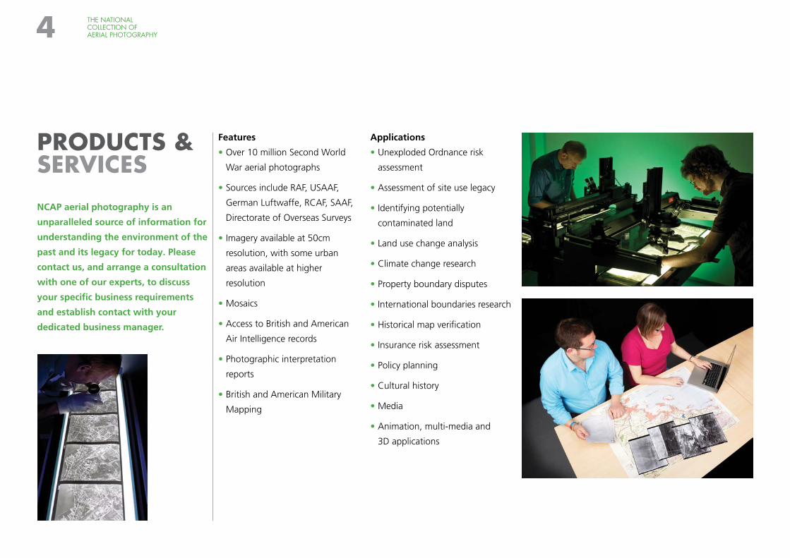
NCAP aerial photography is an
unparalleled source of information for
understanding the environment of the
past and its legacy for today. Please
contact us, and arrange a consultation
with one of our experts, to discuss
your specific business requirements
and establish contact with your
dedicated business manager.
Features
• Over 10 million Second World
War aerial photographs
• Sources include RAF, USAAF,
German Luftwaffe, RCAF, SAAF,
Directorate of Overseas Surveys
• Imagery available at 50cm
resolution, with some urban
areas available at higher
resolution
• Mosaics
• Access to British and American
Air Intelligence records
• Photographic interpretation
reports
• British and American Military
Mapping
Applications
• Unexploded Ordnance risk
assessment
• Assessment of site use legacy
• Identifying potentially
contaminated land
• Land use change analysis
• Climate change research
• Property boundary disputes
• International boundaries research
• Historical map verification
• Insurance risk assessment
• Policy planning
• Cultural history
• Media
• Animation, multi-media and
3D applications
THE NATIONAL COLLECTION OF AERIAL PHOTOGRAPHY4
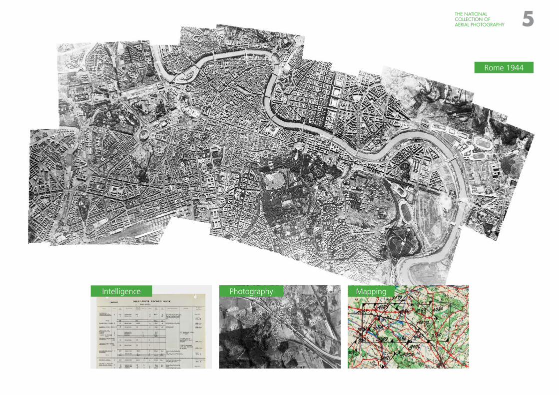
Rome 1944
MappingPhotographyIntelligence
THE NATIONAL COLLECTION OF AERIAL PHOTOGRAPHY 5
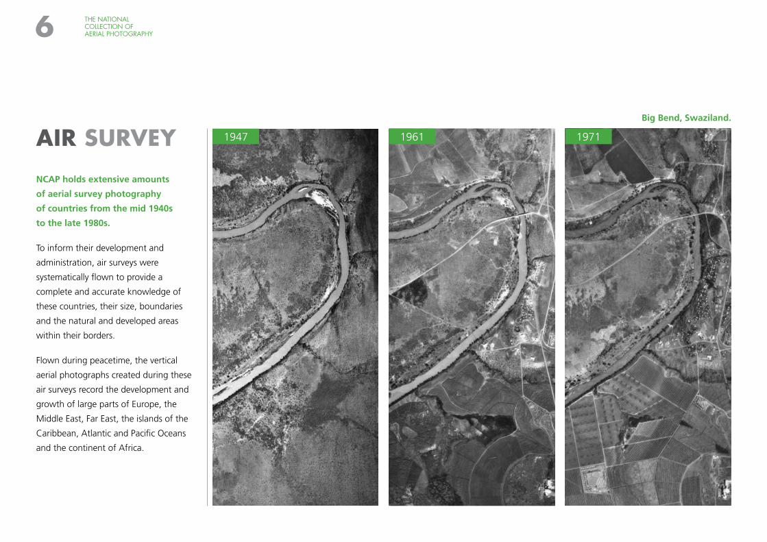
AIR SURVEY
NCAP holds extensive amounts
of aerial survey photography
of countries from the mid 1940s
to the late 1980s.
To inform their development and
administration, air surveys were
systematically flown to provide a
complete and accurate knowledge of
these countries, their size, boundaries
and the natural and developed areas
within their borders.
Flown during peacetime, the vertical
aerial photographs created during these
air surveys record the development and
growth of large parts of Europe, the
Middle East, Far East, the islands of the
Caribbean, Atlantic and Pacific Oceans
and the continent of Africa.
1961 1971
THE NATIONAL COLLECTION OF AERIAL PHOTOGRAPHY6
Big Bend, Swaziland.
1947
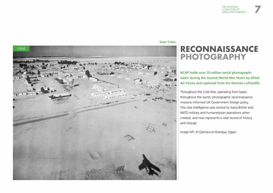
RECONNAISSANCE PHOTOGRAPHY
NCAP holds over 10 million aerial photographs
taken during the Second World War flown by Allied
Air Forces and captured from the German Luftwaffe.
Throughout the Cold War, operating from bases
throughout the world, photographic reconnaissance
missions informed UK Government foreign policy.
This vital intelligence was central to many British and
NATO military and humanetarian operations when
created, and now represents a vital record of history
and change.
Image left: El-Qantara el-Sharqiya, Egypt.
1956
THE NATIONAL COLLECTION OF AERIAL PHOTOGRAPHY 7
Suez Crisis.
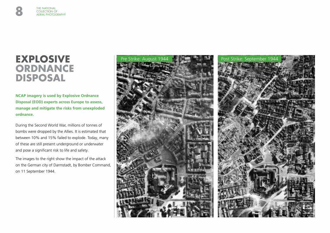
EXPLOSIVE ORDNANCE DISPOSAL
NCAP imagery is used by Explosive Ordnance
Disposal (EOD) experts across Europe to assess,
manage and mitigate the risks from unexploded
ordnance.
During the Second World War, millions of tonnes of
bombs were dropped by the Allies. It is estimated that
between 10% and 15% failed to explode. Today, many
of these are still present underground or underwater
and pose a significant risk to life and safety.
The images to the right show the impact of the attack
on the German city of Darmstadt, by Bomber Command,
on 11 September 1944.
THE NATIONAL COLLECTION OF AERIAL PHOTOGRAPHY8
Pre Strike: August 1944 Post Strike: September 1944
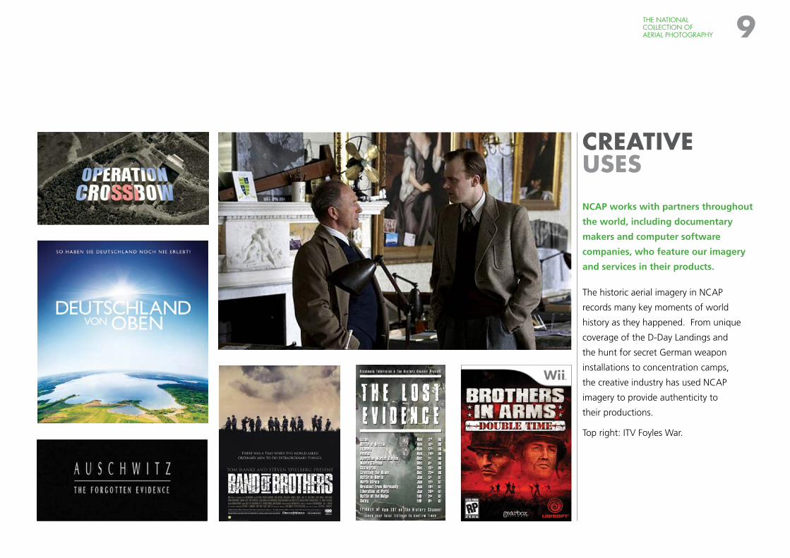
CREATIVE USES
NCAP works with partners throughout
the world, including documentary
makers and computer software
companies, who feature our imagery
and services in their products.
The historic aerial imagery in NCAP
records many key moments of world
history as they happened. From unique
coverage of the D-Day Landings and
the hunt for secret German weapon
installations to concentration camps,
the creative industry has used NCAP
imagery to provide authenticity to
their productions.
Top right: ITV Foyles War.
THE NATIONAL COLLECTION OF AERIAL PHOTOGRAPHY 9
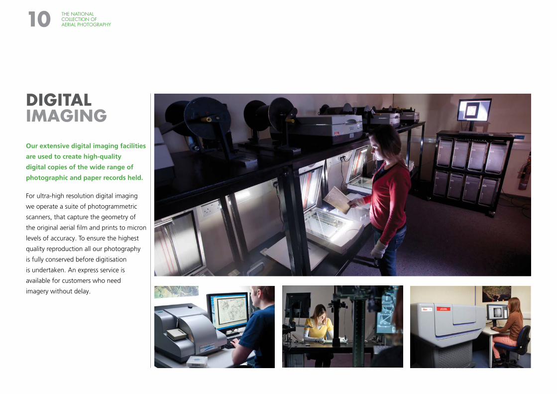
DIGITAL IMAGING
Our extensive digital imaging facilities
are used to create high-quality
digital copies of the wide range of
photographic and paper records held.
For ultra-high resolution digital imaging
we operate a suite of photogrammetric
scanners, that capture the geometry of
the original aerial film and prints to micron
levels of accuracy. To ensure the highest
quality reproduction all our photography
is fully conserved before digitisation
is undertaken. An express service is
available for customers who need
imagery without delay.
THE NATIONAL COLLECTION OF AERIAL PHOTOGRAPHY10
THE NATIONAL COLLECTION OF AERIAL PHOTOGRAPHY 11
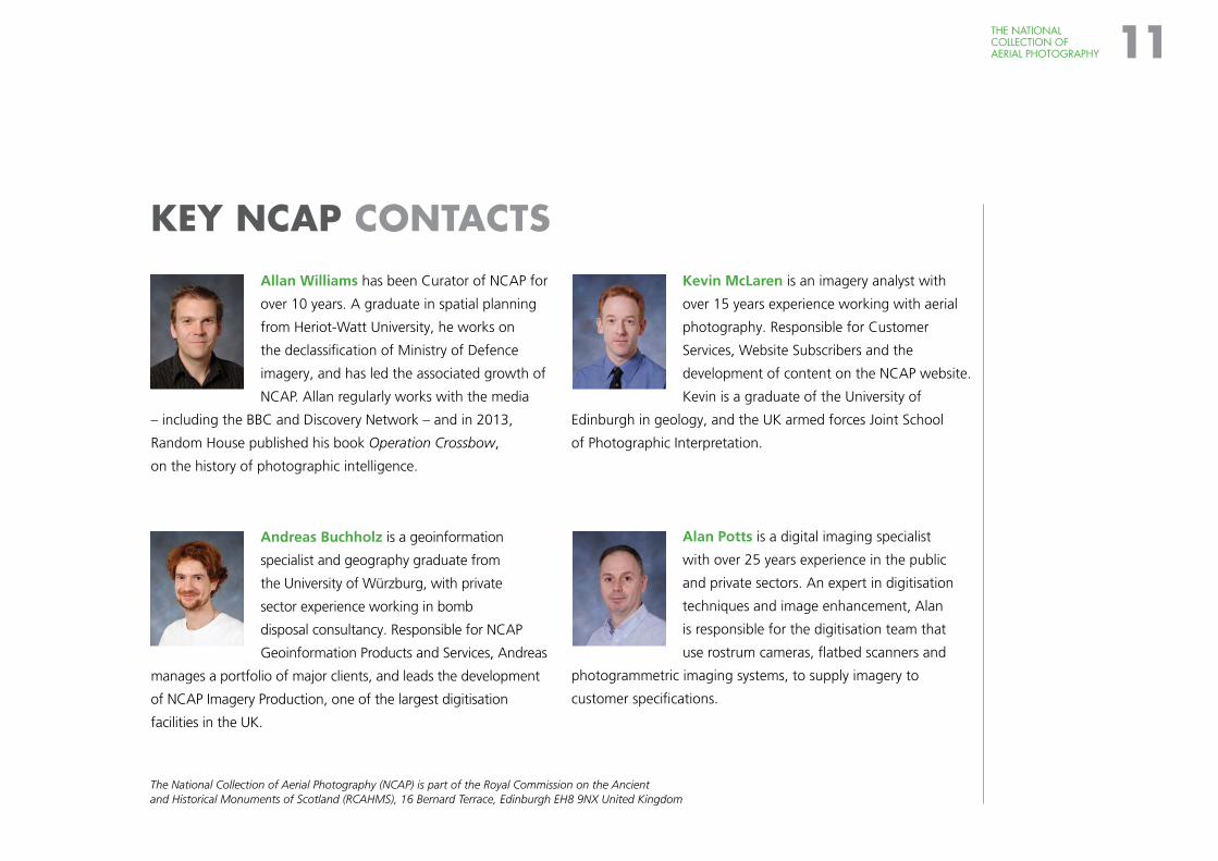
KEY NCAP CONTACTSAllan Williams has been Curator of NCAP for
over 10 years. A graduate in spatial planning
from Heriot-Watt University, he works on
the declassification of Ministry of Defence
imagery, and has led the associated growth of
NCAP. Allan regularly works with the media
– including the BBC and Discovery Network – and in 2013,
Random House published his book Operation Crossbow,
on the history of photographic intelligence.
Andreas Buchholz is a geoinformation
specialist and geography graduate from
the University of Würzburg, with private
sector experience working in bomb
disposal consultancy. Responsible for NCAP
Geoinformation Products and Services, Andreas
manages a portfolio of major clients, and leads the development
of NCAP Imagery Production, one of the largest digitisation
facilities in the UK.
Kevin McLaren is an imagery analyst with
over 15 years experience working with aerial
photography. Responsible for Customer
Services, Website Subscribers and the
development of content on the NCAP website.
Kevin is a graduate of the University of
Edinburgh in geology, and the UK armed forces Joint School
of Photographic Interpretation.
Alan Potts is a digital imaging specialist
with over 25 years experience in the public
and private sectors. An expert in digitisation
techniques and image enhancement, Alan
is responsible for the digitisation team that
use rostrum cameras, flatbed scanners and
photogrammetric imaging systems, to supply imagery to
customer specifications.
The National Collection of Aerial Photography (NCAP) is part of the Royal Commission on the Ancient and Historical Monuments of Scotland (RCAHMS), 16 Bernard Terrace, Edinburgh EH8 9NX United Kingdom
The National Collection of Aerial PhotographyRCAHMSJohn Sinclair House16 Bernard TerraceEdinburghEH8 9NXUnited Kingdom
+44 (0)131 651 [email protected]
NCAP IS A SERVICE OF RCAHMS
3D A
nag
lyp
h: E
din
bu
rgh
Cas
tle,
196
1
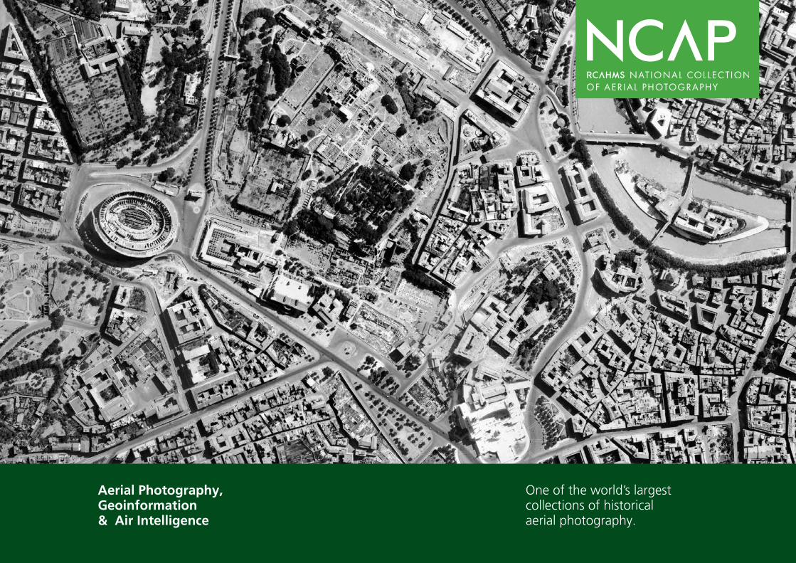
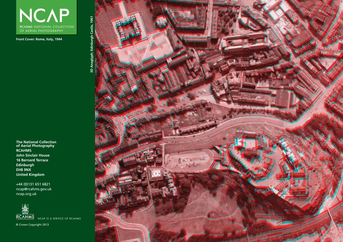
Front Cover: Rome, Italy, 1944
© Crown Copyright 2013