Advanced World Geography Chapter 01 – Exploring Geography · Advanced World Geography Chapter 01...
12
Copyrighted by New Learning Resources, Inc. Advanced World Geography Chapter 01 – Exploring Geography Lesson 1 – Study of Geography In this lesson you will learn how to: tell what geography is and what geographic tools are used. tell what the various geographic themes are and what they entail. describe places that may have absolute and relative locations, as well as human and physical characteristics. describe the interaction that occurs between people and their environments, and how these interactions can have positive and negative consequences. Exploring Geography What comes to mind when you think of your world? Some may see their world as their home, school, state, and other places that connect them. Others may see it as places they have been, read about, or seen on television. Some, however, see it as the entire planet. No matter how you view the world, the study of geography will help you to see your world from various angles. Through the study of geography, you will learn about the earth, those who inhabit it, and the different relationships between them. Study of Geography. People have always been and still are curious about the world around them. Because of this, we know a great deal of information about our surroundings. In a small way, people have always had some desire to be geographers and explore the things around them. What then is geography? Geography is the study of where people, places, and things are located and how they interact and relate to one another. Ultimately, geography allows man to discover and organize information about the many facets of the world. Geography looks at the earth’s surface and the different courses of action that shape it. Also, it observes the people who inhabit the earth, and examines their diverse cultures and economies. Geography explores the intricate relationships that develop between people and their environments.
Transcript of Advanced World Geography Chapter 01 – Exploring Geography · Advanced World Geography Chapter 01...

Copyrighted by New Learning Resources, Inc.
Advanced World Geography Chapter 01 – Exploring Geography
Lesson 1 – Study of Geography
In this lesson you will learn how to: tell what geography is and what geographic tools are used. tell what the various geographic themes are and what they entail. describe places that may have absolute and relative locations, as well as human and physical characteristics. describe the interaction that occurs between people and their environments, and how these interactions canhave positive and negative consequences.
Exploring GeographyWhat comes to mind when you think of your world? Some may see their world as their home, school, state, and other places that connect them. Others may see it as places they have been, read about, or seen on television. Some, however, see it as the entire planet. No matter how you view the world, the study of geography will help you to see your world from various angles. Through the study of geography, you will learn about the earth, those who inhabit it, and the different relationships between them.
Study of Geography. People have always been and still are curious about the world around them. Because of this, we know a great deal of information about our surroundings. In a small way, people have always had some desire to be geographers and explore the things around them. What then is geography? Geography is the study of where people, places, and things are located and how they interact and relate to one another. Ultimately, geography allows man to discover and organize information about the many facets of the world. Geography looks at the earth’s surface and the different courses of action that shape it. Also, it observes the people who inhabit the earth, and examines their diverse cultures and economies. Geography explores the intricate relationships that develop between people and their environments.

Copyrighted by New Learning Resources, Inc.
Geographic Tools
Technology. Scientific approaches are used in geography to examine and understand where things are located. A sonar is one of the tools that has been used for decades. The word sonar stands for “SOund, NAvigation, and Ranging.” Sonar analyze sound to verify distance and direction. It was developed in 1906 to find icebergs, soon becoming an important tool used by the military during World War I to identify and avoid submarines. In geography, however, sonar is used for looking at the ocean floor.
Remote-sensing technology like satellites are also used by geographers. The United States has relied on the Landsat Program for information since 1972. By 1999, Landsat 7 was launched. It recorded images of the surface of the earth and downloaded them to a computer. With that information, scientists are able to compare old and new images and identify changes in the land, vegetation, and urban growth.
New ventures for studying the earth are always being presented by technological advances. In recent years, geographers have come to depend on the global positioning system (GPS). The GPS system depends on a group of 24 satellites that are always orbiting the earth. The satellites give extremely accurate time measurements by using atomic clocks. On earth, GPS units then provide information about location by analyzing these time signals.
The geographic information systems (GIS) are another innovation that is growing in importance. The GIS uses computer technology to gather, influence, examine, and present data about the surface of the earth to solve geographic problems. This system may combine information collected from satellite photos, census results, or tax assessors. Then, the information is ‘layered’ by computers to show the relationships among the information gathered. The GIS system can be used to study a variety of things ranging from public health to retail market size.
An example of GIS data layers.
Source: csc.noaa.gov

Copyrighted by New Learning Resources, Inc.
Many people only think of geography when finding a place to live or somewhere to travel to. One may be surprised to find thatwell developed geographic skills can enable a person to be more successful in their career. Maybe someone will protected a wildlife habitat or develop a new source of energy. Geography is an important element to everyone’s life when they better understand what it is.
Geographic Concepts. While people who are geographically informed generally use tools like maps, charts, and graphs, they can also use a tool known as geographic concepts. People use ideas as tools to help organize the way one thinks about geography. Some of the geographic concepts are: physical characteristics, patterns of settlement, science and technology, and economic activities (see chart on next slide).
Each concept helps us identify and comprehend geographic patterns and methods that we can relate to in real life situations around us. For instance, physical processes like volcanoes, earthquakes, and erosion have always and still do shape the world around us.
As you study geography, you will use these and other concepts to study how people, environments, and places are connected. You will learn how to use geography to figure out the past and present. You will be more able to make good decisions that will shape your future by identifying and understanding geographic patterns.
GPS units are used to for navigating both short and long distances.

Copyrighted by New Learning Resources, Inc.
Copyrighted by New Learning Resources, Inc.
Five Themes of Geography
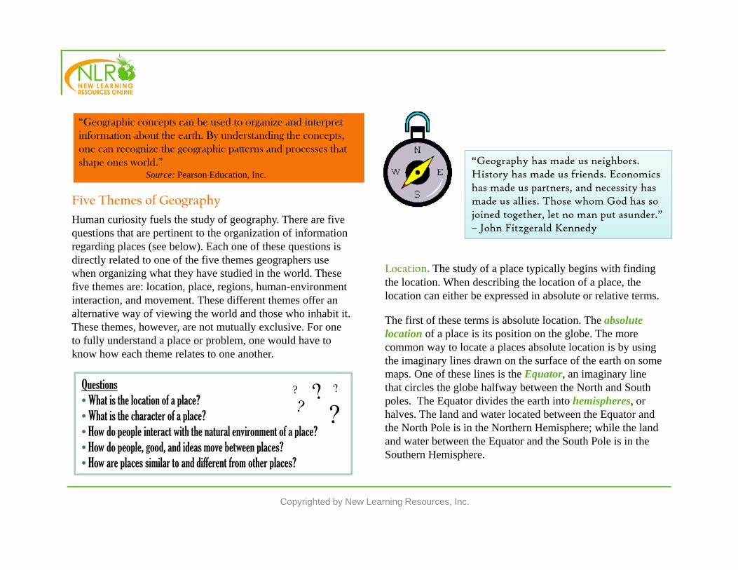
Human curiosity fuels the study of geography. There are five questions that are pertinent to the organization of information regarding places (see below). Each one of these questions is directly related to one of the five themes geographers use when organizing what they have studied in the world. These five themes are: location, place, regions, human-environment interaction, and movement. These different themes offer an alternative way of viewing the world and those who inhabit it. These themes, however, are not mutually exclusive. For one to fully understand a place or problem, one would have to know how each theme relates to one another.
Location. The study of a place typically begins with finding the location. When describing the location of a place, the location can either be expressed in absolute or relative terms.
The first of these terms is absolute location. The absolute location of a place is its position on the globe. The more common way to locate a places absolute location is by using the imaginary lines drawn on the surface of the earth on some maps. One of these lines is the Equator, an imaginary line that circles the globe halfway between the North and South poles. The Equator divides the earth into hemispheres, or halves. The land and water located between the Equator and the North Pole is in the Northern Hemisphere; while the land and water between the Equator and the South Pole is in the Southern Hemisphere.
“Geographic concepts can be used to organize and interpret information about the earth. By understanding the concepts, one can recognize the geographic patterns and processes that shape ones world.”
Source: Pearson Education, Inc.
Questions• What is the location of a place?• What is the character of a place?• How do people interact with the natural environment of a place?• How do people, good, and ideas move between places?• How are places similar to and different from other places?
?
“Geography has made us neighbors. History has made us friends. Economics has made us partners, and necessity has made us allies. Those whom God has so joined together, let no man put asunder.” – John Fitzgerald Kennedy

Copyrighted by New Learning Resources, Inc.
Another set of imaginary lines runs parallel to the Equator, called lines of latitude, or parallels. These lines measure the distance north and south of the Equator. The Equator is located at 0 , while the North and South poles are located at 90 . The boundaries of the places on earth that receive the most direct sunlight and the most heat energy from the sun are marked by the Tropic of Cancer at 23½ N and the Tropic of Capricorn at 23½ S. These two areas receive the most sun because the earth is tilted 23½ as it revolves around the sun.
Lines of longitude, or meridians, are another set of imaginary lines. These lines run north and south between the two poles. At 0 , the Prime Meridian runs through the Royal Observatory in Greenwich, England. The other meridians are calculated in degrees from 0 to 180 east or west of Greenwich. Meridians are not parallel to one another. The distance between meridians is greatest at the Equator, but decrease as you get closer to the poles. While using the grid made by the lines of longitude and latitude, one can find the absolute location of anywhere on earth. For example, New Orleans is located at 90 W longitude and 30 N latitude, while Cairo, Egypt is located at 30 E longitude and 30 N latitude.
Relative location is defined as a point or place in relation to another point or place. For example, Birmingham, Alabama can be described as being southwest of Ashville, North Carolina. While each location only has one absolute location, they have many different relative locations which can change as time goes on. For instance, New York City, New York was once seen as days and days of travel away from San Diego, California. Now, one can board an airplane and be there in no time, making them only hours away.
Arctic Circle
Tropic ofCancer
Tropic ofCapricorn
Latitude and LongitudeYouTube
Copyrighted by New Learning Resources, Inc.

Copyrighted by New Learning Resources, Inc.
PlaceEach place on this planet has different features that make it stand out from other places. One of the biggest challenges faced in geography is to figure out how places are similar to and different from one another.
Physical Characteristics. Every place has physical characteristics that make it stand out from the rest such as land forms, plant life, and climate. Physical characteristics of a place vary depending on their location in the world. Some land might be flat, mountainous, or anywhere in between the two. Plant life, or vegetation, can range anywhere from plush rain forests, to a tundrawith little moss coverage. A place’s climate goes beyond the weather patterns of an area, to the natural disasters that occur like tornadoes, hurricanes, earth quakes, droughts, and floods.
Human Characteristics. A place can also be described by the use of its human characteristics. How many people are living, visiting, and working in a place? What do they believe and what languages do they speak? What does their economy and government look like? Geographers study human activities to better answer these types of questions.
With unique combinations of physical and human characteristics, each place on Earth is matchless. Those who return home after traveling do not tell about a place’s longitude and latitude. Instead, they speak about the people, environment, and traditions that made their trip unforgettable. At the same time, they may have spoken the same language, used the same type of money, and watched the same movies at home. The complex mix of distinctive and ordinary features is what a geographer means when they speak about a place. A dancer in the traditional attire of a
Hawaiian luau.

Copyrighted by New Learning Resources, Inc.
RegionsAnother geographic theme deals with regions. A region can be defined as a group of places that contain at least one common characteristic. At times, a region is determined by a person’s perception. Perception is a point of view that is influenced by one’s culture and experiences. The world is divided into many different regions by geographers. Formal regions are defined as areas with a specific characteristic that is seen throughout those areas. For instance, states, countries, and cities are all categorized as political regions. People in these formal regions are subject to the same laws and ruled by the same government. Other characteristics can also be used to define formal regions. New York City is home to Little Italy, a section of the city containing many Italian-American people, stores, and restaurants. The Cotton Belt is a section of the United States where cotton is produced in abundance.
Functional regions are comprised of one central place and the surrounding places that are affected by it. Functional regions can be defined using different types of criteria. For instance, the Amazon drainage basin in South America is the region that is drained by the Amazon River. In Los Angeles, California, the metropolitan region is comprised of the city of Los Angeles and the suburbs that surround it.
Another type of region is a perceptual region. They are defined by a person’s feelings and attitudes about an area. Regions like Dixie, the upper Midwest, and the Middle States do not have exact borders. For instance, if you ask someone in Orlando if Florida is in the deep south and part of Dixie, you would get a mixture of answers, depending on the person’s individual perception.
Since different criteria can be used to define a region, the same place may be categorized in several regions. For example, Mexico is a part of the continent of North America. Culturally, it is linked to the Spanish-speaking nations of Central and South America.
“Little Italy” in New York City. Source: rutgers.edu
Copyrighted by New Learning Resources, Inc.
Human/Environment RelationsThe next geographical theme looks at how people use their environment. Questions may arise like: Have they altered the environment? What consequences come with the alterations made? How have the people in the environment responded to the changes made?
People have made enormous changes to their environments, whether intentional or accidental. Some of the changes made are destructive, while others are constructive. For example, the Southwestern portion of the United States has taken on big changes. Originally, this hot, dry region of the country had little to no population. With the inventions of the air-conditioner, swimming pool, substantial irrigation, and the car, this area has become one of the fastest growing regions in the United States. People from all over flock to the area in hopes of finding a comfortable place for retirement. The natural environment of the area has been heavily altered by the construction of big buildings and roadways. The already inadequate supply of water is being exhausted by the rapid population growth. Changes like this one may cause huge problem down the road.
Once a hot, desert land, Phoenix, Arizona has been transformed into a thriving city.
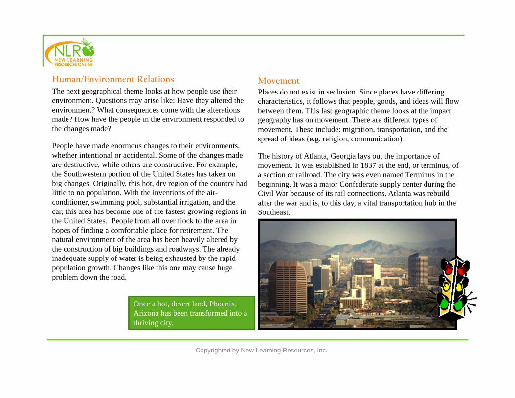
MovementPlaces do not exist in seclusion. Since places have differing characteristics, it follows that people, goods, and ideas will flow between them. This last geographic theme looks at the impact geography has on movement. There are different types of movement. These include: migration, transportation, and the spread of ideas (e.g. religion, communication).
The history of Atlanta, Georgia lays out the importance of movement. It was established in 1837 at the end, or terminus, of a section or railroad. The city was even named Terminus in the beginning. It was a major Confederate supply center during the Civil War because of its rail connections. Atlanta was rebuild after the war and is, to this day, a vital transportation hub in the Southeast.

Copyrighted by New Learning Resources, Inc.
Vocabulary:Absolute location – a place’s location on a globe.
Equator - an imaginary line that circles the globe halfway between the North and South poles.
Formal region – an area with a specific characteristic that is seen through out that area.
Functional region - one central place and the surrounding places that are affected by it.
Geography - the study of where people, places, and things are located and how they interact and relate to one another.
GIS - Geographic Information Systems use computer technology to gather, influence, examine, and present data about the surface of the earth to solve geographic problems.
GPS – Global Positioning System rely on satellite images to communicate location and direction.
Hemisphere – the northern or southern portion of the globe as divided by the equator.
Today, Atlanta is still heavily depends on movement. The links of transportation in the city have attracted many companies that rely on distribution and manufacturing. In response to the new companies, jobs have been made and the city has grown. Also, the airport, Atlanta’s Hartfield International Airport, is one of the biggest and busiest in the nation.
Atlanta's city area is a huge transportation hub.

Latitude - imaginary lines that measure the distance north and south of the Equator.
Longitude – imaginary lines that run north and south between the two poles.
Perception - a point of view that is influenced by one’s culture and experiences.
Perceptual Region – region defined by a person’s feelings and attitudes about that area.
Prime Meridian – the line of longitude that runs at 0˚.
Relative location - a point or place in relation to another point or place.
SONAR – stands for Sound Navigation, and Ranging, and is a form of technology that analyzes sound to verify direction and location.
Copyrighted by New Learning Resources, Inc.
After reviewing the material in this lesson, please complete the Advanced World Geography, Chapter 01, Lesson 1 Learning Check and Quiz.