
AD-A179 385 A/ UNCLASSIFIED F/G 13/2 ML - dtic.mil · wetland, and old field habitats in the...
168
AD-A179 385 A/ UNCLASSIFIED F/G 13/2 ML
-
Upload
nguyennhan -
Category
Documents
-
view
213 -
download
0
Transcript of AD-A179 385 A/ UNCLASSIFIED F/G 13/2 ML - dtic.mil · wetland, and old field habitats in the...

AD-A179 385 A/
UNCLASSIFIED F/G 13/2 ML

.0IMICROCOPY RESOLUTIONd TEST CHART
MftYONM. RUJRE.MJ OF ST4NOiDS-1963-A
&
__:
MLLIVA IL__ _-

Los Coches CreekSan Diego County, California
US Army Corpsof EngineersLos Amples District
Li)
~'FINALO Detailed Project Report
and Environmental Assessment DTICZLECTE
< D
Main Report and
F--
i Environmental Appendix
! August 1984 ,, . ;.,0]8.
1 R ' i i in I m - U 1 1

REPOR DOCMENTAION AGE EAD INSTRUCTIONSREPORT DCUMENTATON PAGEBEFORE COMPLEilOFRIREPORT NUMeRf 1. GOVT ACCESSION NO. 3. RECIPIEMT'S CAAO UMMER
4. TITLE (M4v SUbhgel) S. TYPE Or REPORT a PERIOD COVEREDFinalDetailed Project, Report and Environmental Assess. Final
6. PERFORMING ORto. REPORT NUMBER-ain Report and Env. Appendis Tech. Appendixes ______________
1*.-~!ft . eMTRACT OR GRANT NMBfR.)
Los Angeles DistrictU.S. Army Corps of Engineers
9. P691FORMING ORGANIZATION NAME AND ADDRESS 10. PROGRAM ELEMT. PROJECT, TASK
Los Angeles District. Corps of Engineers AE OEAEI JR
P.O. Box 2711, Los Angeles, CA 90053
11, CONTROLLING OFFICE NAME ANO ADDRESS 12. REPORT DATE
Los Angeles District, Corps of Engineers Auut 19814P.O. Box 2711, Los-Angeles, CA 90053 IS MMEOF ;AGE'
14.- MONITOR9NG AGENCY MAME & AOORESSQC dll-ft.k. C~nIgeIIiall Officeo) IS. SECURITY CLASS. (.1 f al mpof)
unclassified
j i o S O E C L .A S S I F I C: A Tfi o N I OO W M G A o i M Gc
IS. DISTRIBUTION STATEMNT (of ahlo R.poI)
Approved for public realease: distribution unlimited
M DIWSTRIBUTION STATEMENT (of ab. .b.t..ct onloed In Block 20. it difle'"t fro R@PN)
IS. SUPPLEMENTARY MOTES*1 Copies are obtainable from the National Technical Informsation ServiceSpringfield, VA 22151
Io. Key WORDS (Coo"",, on ~* ,.ads it Ift emor. md IdenMil, by Wok oA
Flood CnrlPlanIdentify water reasources needs of study area
20' ABSRACT (CAiI~oO Mu,.... old. N niw00 and Idooll? 6, blockmmS.
Studies performed for this report were intended to identify water resourceneeds of the study area, to develop alternative solutions to the problems andneeds identified, and to select a flood control plan that maximizes benefitsto the surroundings community within the guidelines established by federallaws and policies.
WO I p&147W3 EVlIlion or I Nov s Bis oUssLaTE
SECURIT CLASSIFICATIONI oF rtf PAGE (Whm Dom. "toreo
LOS COCHUS CREEK
SAN DIEGO COUNTY, CALIFORNIA
FINAL
DETAILED PROJECT REPORT FOR FLOOD CONTROL
AND
ENVIRONMENTAL ASSESSMENT
Acceslon For
DTIC TAB 1"
Unannounced IAugust 1984 Justification
DlstributionI
Availablity Codes-. Avail amd I or
Dis

SYLLABUS
This study on Los Coches Creek is authorized under the continuingauthority of Section 205 of' the Flood Control Act of' 1948, as amended,following a request by the County of' San Diego. Los Coohes Creek, a tributaryof the San Diego River, originates at an elevation of' 2,200 feet just belowthe El Capitan Reservoir in San Diego County and flows through the communityof Lakeside before joining the San Diego River. The Los Coches Creek drainagebasin is approximately nine miles long and two miles wide, draining an area ofsixteen square miles.
Flooding is the major water resource related problem in the study area.During three consecutive years, 1978-1980, damaging floodflows occurred alongthe creek, causing substantial coimunity disruption and trauma. The largestof these floods, in 1980, caused about $6 million in damages. The existingchannel has, in the reach through downtown Lakeside, been substantiallyaltered by existing development. The non-damaging flood has a discharge of300 cubic feet per second (cf's), and a return interval of three years.
The main objectives of' this study are to develop and recommend a planwhich would provide a high degree of flood protection to the residents ofLakeside and protect the nation's environment. Alternative plans consideredin this study included a reservoir plan, removal of obstructing bridges, aflood-warning system, floodproof'ing, relocation, no action, and channelizationof the creek. Of this array, only three alternatives, all concrete channelplans, were considered feasible enough to study in detail. The recommendedplan is a rectangular concrete channel, with a total length of 2.1 Milesincluding inlet and outlet structures. This channel, designed to convey a100-year flood, would solve the local flooding problem. Potentialenvironmental impacts associated with this plan include loss of riparian,wetland, and old field habitats in the project area, loss of wildlife accessto water in the creek, loss of groundwater recharge, loss of aesthetic values,impacts to archeologic or historic sites, changes in land use, and impacts tolocal air and water quality. Of' these potential impacts, prior toconsideration of mitigation, only the loss of habitat and wildlife access towater were judged significant and adverse. However, the local sponsor'splanned dedication of about 30 acres of riparian and wetland habitat forprotection of' wildlife resource values and provision of a wildlife watersource (guzzler) would mitigate for this unavoidable loss. Therefore, the
* project is expected to result in no significant adverse impact to the humanenvironment.
In selecting a plan of improvement, economic justification, degree andcompleteness of protection, public input, and implementability wereconsidered. The recommended plan has net economic benefits, provides 100-yearflood protection, has minimal impacts on the environment, and has the supportof the local sponsor and coimmunity. Recreation development was considered informulating the plans, and may be justified, but the local sponsor does notwish to provide recreation facilities as project features at this time.
The Corps recommends that, subject to certain conditions of non-Federalcooperation as outlined in this report, the proposal for flood control beapproved for construction. The total financial cost of the recommended plan
i

||A
is estimated at $6,197,000. The Federal share of the estimated cost would belimited to $4,000,000 in accordance with Section 205 of the 1948 Flood ControlAct (PL 80-858) and its amendments, and the non-Federal share would be$2,197,000 of which $2,002,000 is for construction and $195,000 is for lands,easments and rights-of-way. The local sponsor of the project is the Countyof San Diego.
Annual charges for the recomended plan are estimated at $509,200. Annualbenefits are estimated at $601,000, and the benefit-to-cost ratio is 1.2.Following construction, non-Federal interests would be required to operate andmaintain all project features. Included in the annual charges are annualoperation and maintenance costs, currently estimated at $15,000.
ii
bi

TABLE OF CONTENTS
page
SYLLABUS .................................................................. i
INTRODUCTION ...............................................................
Study Authority ....................................................... 1Study Purpose and Scope ............................................... 1Prior Studies and Reports ............................................. 2
PLAN FORMULATION .......................................................... 2
Assessment of' Problems and Opportunities .............................. 2Flood History ...................................................... 3Existing Conditions .............................................
4Future Conditions .................................................. 7Discussion of' Problems and Opportunities .............................. 8Planning Objectives ................................................... 9Planning Constraints .................................................. 9Alternative Plans ..................................................... 10Trade-Off' Analysis .................................................... 14Selection of the Recommended Plan ..................................... 15
DESCRIPTION OF THE RECOMMENDED PLAN ....................................... 19
Plan Components ....................................................... 19Design and Construction Considerations ................................ 20Operation and Maintenance Considerations .............................. 20Plan Accomplishments .................................................. 20Summary of' Effects .................................................... 21
PLAN IMPLEMENTATION ....................................................... 24
Institutional Requiirements ............................................ 24Division of' Responsibilities ....................................... 2Report Processing and Approval ........................................ 25Views of' Local Interests .............................................. 25Views of Fish and Wildlife Agencies ................................... 25
SUMMARY OF COORDINATION, PUBLIC VIEWS, AND COMMENTS ....................... 26
RECOMMENDATION ............................................................ 27
FINAL ENVIRONMENTAL ASSESSMENT
Finding of No Significant Impact .................................... EA -i
Summary .............................................................EA -1Alternatives ........................................................EA -2Affected Environment ................................................EA -5Environmental Effects/Proposed Mitigation .......................... A1Compliance with Environmental Requirements ..........................EA-20References ..........................................................EA-24List of Preparers ...................................................EA-24Attachme'.t A. Section 404 (b)(1) Water Quality Evaluation ..........EA-AlAttachment B. Letter CommentR and Responses ........................EA-BI
iii

TABLE OF CONTENTS (Cont'd)
Page
Tables
1. Discharge-Frequency Relationship ................................... 82. Evaluation of Plans ............................................... 153. Project Investments/Costs for Alternative Plans.....................1is4. Suimmary of Annualized Benefits and Costs of Alternative Plans ......... 185. Recommended Plan Economics......................................... 216. Cost Apportionment...... .......................................... 26
EA-1. Comparison and Summnary of Alternative Plans .................... EA -4J
EA-2. Habitat Quality Values of Existing Habitat ..................... EA-10
EA-3. Average Channel Widths of Alternative Plans .................... EA-14t
Figures
1. Design and Construction Schedule.................................... 29
EA-1. Project Location Map ......................................... EA- 6
EA-2. General Habitat Map .......................................... EA- 8
EA-3. Mitigation Lands Map ......................................... EA-20
Plates
1. Drainage Area2. Overflow Area3. Recommended Plan Design Concept
Photographs
A collection of 15 photographs showing flood damage in the study area.
Draft Agreement
Appendixes
1. Environmental2. Hydrology3. Engineering, Design, and Cost4. Geotechnical5. Concrete Materials6. Economics
*Appendixes 2 through 6 published under separate cover.
iv

INTRODUCTION
The community of Lakeside is located in the western foothills of theCuyamaca Mountains, adjacent to the San Diego River, about 21 miles northwestof the City of San Diego. For many years, Lakeside has remained a small ruralcommunity. It is known for its horses, chicken ranches, hay and dairy farmingalong the river bottom lands, and tree crops such as olives, citrus fruits,avocados, peaches, and apricots in the nearby uplands. Despite tremendouspressures toward urbanization, the community of Lakeside retains a rusticcharacter while accommodating a population of 24,O00 (1980).
Within this setting flows Los Coches Creek, which originates at anelevation of 2,200 feet just below the El Capitan Reservoir. From there itflows through the community of Lakeside before joining the San Diego River.The Los Coches Creek drainage basin is approximately 9 miles long and 2 mileswide, draining an area of 16 square miles (see Plate 1). The upstream reachof Los Coches Creek is well-defined as it flows through a steep, rockycanyon. However, downstream reaches have been drastically altered to make wayfor residential, commercial and highway development.
Prior to 1978, Los Coches Creek was not considered to pose a major threatto the community of Lakeside. However, floods in 1978, 1979, 1980, and eachyear since have caused substantial flood damages and trauma to people livingadjacent to the creek. These recent flood damages and the concern expressedby the local sponsor and the community prompted this report.
This report presents alternative solutionj to the flood problem, andrecommends a plan that is believed to be the best solution for the area. Therecommended plan meets the planning objectives expressed by the Lakesidecommunity, the local sponsor and the Federal and non-Federal agenciesinvolved. The report discusses the plan formulation process, impacts,benefits and costs of the preferred plan, and also describes the necessarycoordination and responsibilities to be fulfilled before design andconstruction of the project may be completed.
STUDY AUTHORITY
In an effort to expedite improvements along Los Coches Creek through theCommunity of Lakeside, the San Diego County Board of Supervisors requested inDecember, 1981, that the Los Coches Creek study be separated from the SanDiego County Streams Survey Study program and accomplished as a small projectunder the continuing authority of Section 205 of the 1948 Flood Control Act(PL 60-858), as amended. Under the small project authority, Federal funds ofup to $4 million may be allocated for a flood control project if authorized bythe Chief of Engineers.
STUDY PURPOSE AND SCOPE
The purpose of this study is to determine the flood damage reduction needsalong Los Coches Creek, in the Lakeside community, and to recommend animplementable plan for meeting those needs. The principal study area islocated along a 2-mile reach of Los Coches Creek, through the community of

Lakeside, from Los Coohes and Ha-Hana Roads to the creek' s mouth at the SanDiego River. Areas adjacent to the creek are included in populationprojections, economic data, and water resource forecasts.
Studies performed for this report were intended to identify water resouceneeds of the study area, to develop alternative solutions to the problems andneeds identified, and to select a flood control plan that maximizes benefitsto the surrounding community within the guidelines established by Federal lawsand policies. Economic, engineering, social, and environmental studies wereconducted in sufficient detail to determine the functionality, economicjustification, environmental and social acceptability of the variousalternatives.
Prior Studies and Reports
Several streams in San Diego County, including Los Coches Creek, have beenstudied under the authority of Section 14 of the Flood Control Act of August18, 1941. Previous reports prepared by the Corps of Engineers on thesestreams include:
"Environmental Working Paper, San Diego County Streams, Jan. 1976" and "SanDiego County Streams Reconnaissance Study, Sept. 1978".
These preliminary studies indicated a lack of economic justification forchannel improvement in the Community of Lakeside.
After a series of floods in 1978, 1979, and 1980, a reconnaissance studyof Los Coches Creeks was undertaken and a report completed in December 1980.This new evaluation of the flooding problem along Los Coches Creek indicatedthat Federal participation in providing flood control measures could beeconomically justified.
PLAN FORMULATION
ASSESSMENT OF PROBLEMS~ AND OPPORTUNITIES
The main purpose of this study has been to assess existing and projectedwater and related land resource management problems and opportunities in orderto develop and recommend a solution to the flooding problems associated withLos Coches Creek which is satisfactory to all concerned. Public participationhas been an important and integral aspect of this study in identifyingopportunities and problems, establishing planning objectives, formulating andselecting plans; first as part of the general investigation of the San DiegoCounty Streams Study, and then under the Small Project Authority (Section 205of the 1948 Flood Control Act). Input was received in: 1) the data collectionphase, from a coordinated flood damage survey involving the Los Coches CreekFlood Victims Association; 2) the plan formulation phase, during a series ofcommnunity meetings workshops, in the summer and autumn of 1979; and 3) theplan refinement and selection phase - since the project has been pursued underthe Small Project Authority in February 1982 - through a series of meetings inthe spring and stummer of 1982, and regular correspondence with the flood
2

victims association. The following discussions of the study area's floodhistory, existing, and future conditions identify the problems andopportunities as a basis for formulating objectives and plans.
Flood History
The mean annual precipitation for the Los Coches Creek watershed rangesfrom about 14 inches, near the confluence with the San Diego River, to about17 inches in the higher elevations. Most of the rainfall occurs from Novemberthrough April, with the greatest frequency and intensity normally in theperiod from December through March. Typically, these storms which originateover the Pacific Ocean and move eastward over the watershed, last for severaldays and result in widespread precipitation.
General summer storms have occurred during the summer and autumn months,usually in the form of tropical storms which originate off the western coastof Mexico and move northward and eastward into Southern California. Localstorms, which cause most of the major flooding in the Los Coches Creek basin,can occur at any time of the year, either during general storms or as isolatedphenomena. These storms concentrate over the watershed and result in highintensity precipitation for durations of six hours or less.
Little historical information is available regarding floods in San DiegoCounty along the smaller streams of the county before the mid-1900's.Moderate to heavy rainfall affected the area during the intense storms ofMarch 3-6, 194I3 and March 8, 1968. During the period of February 27 throughMarch 5, 1978, a series of low-latitude Pacific storms moved into SouthernCalifornia from the subtropics. Intermittent rain fell throughout the period,with several heavy cloudbursts. The total precipitation for the week rangedfrom about 2.5 inches in the city of San Diego to over 15 inches at MountPalomar. On Los Coches Creek, at Julian Avenue, a peak discharge of anestimated 1000 cfs (10-year frequency storm) occurred on March 5 and thecommunity of Lakeside suffered substantial flood damage.
Near the end of January 1979, a cold upper-level, low pressure centermoved into the area, dropping moderately heavy rain and snow. On the morningof January 31, high intensity precipitation fell in the region, with about 3inches at the coast and 6 inches in the foothills and mountains. Runoff fromthe storm was locally quite high, with a measurement along Los Coches Creek of1500 cfs near Old Highway 80, while at Los Coches Road the estimated peak flowwas about 2000 cfs (15-year frequency).
The storm of mid-February 1980 was one of the worst storms in history tohit San Diego County. Like the preceding storms of late January 1979, theFebruary 1980 event developed as massive surges of tropical Pacific moisturemoved into the region from the southwest. A total of six storm impulsescrossed the County during the period--some producing very high intensityrainfall for short and intermediate durations. The total 9-day precipitationin San Diego County ranged from just over 2 inches along the coast aroundChula Vista to more than 214 inches in the Cuyamaca Mountains. Late on thenight of 20 February, 2.05 inches fell within a 3-hour period at nearby FlinnSprings. This was recorded on a county rain gauge located in the Los CoohesCreek watershed.
3

Just after midnight, on 21 February, an estimated peak discharge of 5,000-6,000 cfs (nearly 100-year frequency) occured on Los Coches Creek.Resultantly, Lakeside sustained damages in excess of $6 million to residentialand commercial property as well as road damages. Flooding has occurred insubsequent years, though to a lesser degree.
EXISTING CONDITIONS
Topography and Drainage
Los Coches Creek, a tributary of the San Diego River, originates in SanDiego County near El Capitan Reservoir. It flows in a westward directionalong Interstate 8, then turns north through the community of Lakeside whereit joins with the San Diego River. The 16 square mile drainage basin is about9 miles long, with an average width of about 2 miles (see Plate 1).Elevations range from about 400 feet at the mouth of the creek to over 2,200feet on the higher peaks. The average elevation in the headwaters is about1,600 feet. The periphery of the watershed is generally quite steep androcky. The Lo.3 Coches Creek main stem ranges in gradient from about 50 to 150
feet per mile (0.95% - 2.8%).
Existing Channel Conditions
The existing Los Coches Creek channel is inadequate to contain even minorfloodflows. In the upstream reach, through the low density residential area,the channel is well-defined. However, in the downstream reach, the existingchannel has been drastically obstructed by highway and commercial development.Box culverts or uLp crossings have been conotructed so that streets may crossthe creek. Further downstream, 2 shopping centers are situated directly inthe path of the channel. Low flows occur in a swale within the parking areaof one of these shopping centers. The nondamaving flood is estimated to havea discharge of about 300 cfS (a 3-year flood), In other words, flows over300 cfs would be expected to cause damages.
Geology and Soils
The Los Coches Creek bed consists of alluvial soils of Holocene age
overlying quartz diorite, granodiorite, and granite rock of cretaceous age.The San Diego River bed consists of an alluvial deposit of silt, sand, andgravel approximately 200 feet thick. The bedrock underlying the alluvialdeposit is granitc.
Groundwater
The water table varies with the season, tho duration and amount ofstreamflow and the depth to bedrock in the stream channel, upstream of Del SolRoad, (sta. 76+59), continuous streamflw in an area of shallow bedrock, hassaturated the stream sediments. Downstream of Del Sol Road, the streamchannel becomes wider and the depth to bedrock increases. The depth to waterincreases from 6 feet below ground surface near Del Sol Road, to about 20 feetbelow ground surface near the confluence with the San Diego River.
4a

Biological hesources
Much of Los Coches Creek, from Ha-Bana and Los Coches Roads to Highway 67,
contains a variety of riparian and upland species. The environment appears
most natural at the upstream (south) end of the project area with development
increasing in magnitude moving downstream. Habitat on the east side of the
creek is limited due to low density residential development along the upper
reach. Upland vegetation consists of scattered coastal sage scrub speciessuch as California buckwheat (Eriogonum fasciculatum), elderberry (Sambucus
p.), bror.r bacoharis (Baccharis sarathroides), and coast live oak (Quercus
agrifolia). Native and introduced grasses and various weedy annuals are found
in disturbed areas. Willow (Salix sp.) is the dominant riparian species, with
occasional stands of giant reed in and adjacent to the stream channel.
Raptors and passerines have been obeserved in the area.
The U.S. Fish and Wildlife Service (FWS) reports that there are no known
listed threatened or endangered species located in the project area considered
by the Corps. For additional detailed biological information, the attached
Environmental Assessment (EA) and Appendix 1 should be consulted.
Cultural Resources
Cultural resources studies within the Los Coches Creek Study area have
revealed five archeological sites. Two are prehistoric, one is historic and
the other two incorporate components from both these periods. The prehistoricsites and components all consist of bedrock milling surfaces but differsubstantially in size with the smallest site consisting of a single milling
surface while the largest exhibits at least twenty-nine. Although no
archeological artifacts were noted on the surface of the ground at these
sites, minimal subsurface testing at one site indicated that the ground around
these boulder outcrops may contain further evidence of prehistoric
activities. The ages represented by these sites may vary from 7,500 years to
only several hundred years. The historic sites and components consist ofseveral structures and a small dam across Los Coches Creek that were built in
the early 1900's.
Health and Safety
A serious flood threat exists along Los Coches Creek through the community
of Lakeside. Residential and commercial developments, highways and roads, aswell as utilities located in the floodplain are subject to flooding, erosion,
and deposition with little notice.
During a one-hour period on the night of 20 February, 1980, Los Coches
Creek became 60-feet wide and 10-feet deep. At the peak period, over 1,500acres in Lakeside were covered with up to 8 feet of water. On several
occasions the sewer line running along the creek has broken as a result of
flooding, causing a serious health hazard to the community.
Several storms since 1978 have demonstrated that there is a severe
continuing threat to the inhabitanti: of the flood prone area from the direct
impact of floodwaters and from the threat that transportation, communication,
and utilities of the area could be damaged when they are most needed.
5

Aesthetics
The project area can be divided into three reaches to describe aestheticquality. The upstream reach, fram the Los Caches Road bridge to Castle CourtDrive is a fairly natural riparian area. In this area the creek bed and theriparian vegetation are visible and visually attractive. Development adjacentto the creek is low density residential/single family homes. The appearanceof the middle reach has been altered by limited flood control construction andcommercial development. The downstream reach, located between the commercial
0 area and the San Diego River has been altered by Highway 67 and sand andgravel mining operations.
Human Resources
The community at Lakeside has undergone extremely rapid growth in the pastdecade, largely from combined immigration and suburbanization. The populationaf Lakeside roughly doubled from 11,991 in 1970 to 23,921 in 1980. Up to50,000 people are expected to reside in Lakeside and in surrounding areas by1995.
Economic Resources
The rural-residential open space character sought by Lakeside's residentsis made evident by the fact that Lakeside is predominatly residential.Lakeside's business community includes 62 outlets within the flood prone area.The major sources of income in the community are tram retail and servicebusinesses and tram the extractive industry, principally sand and graveloperations along the San Diego River. Lakeside is largely a "bedroomcommunity" though, with most at the labor force working in the City of SanDiego or in the La Mesa-El Cajon areas.
Land Use
The general character at Lakeside is low density residential, with about70 percent at the total 8572 housing units being owner-occupied, single-familydwellings. Large residential lots support home gardens, equestrian facilitiesand other rural amenities. The region has experienced accelerated populationgrowth and urban development in the past 15 years, modifying Lakeside's pastrural character. The goals of the city, as stated in the Lakeside CommunityPlan, are the protection of Lakeside's unique environment and preservation ofrural way of life and cultural heritage.
Goals tar flood plain development are to reduce flood hazard, and topromote limited housing and business development, agriculture, recreation, andopen space as the highest and best use. Development which does occur shouldminimize environmental degradation and flood hazard. Preservation of'specialized flora and fauna habitats, historic sites, and natural landscapesis also of prime importance. Zoning far the provision of flood control worksto adequately protect existing urban development is made in the LakesideCommunity Plan. Equestrian trials, bike paths and hiking trails connected toappropriate recreation facilities, parks, and open space via flood plains,drainage channels, and other public rtghts-of-way are provided for in theCommuity Plan.
6

FUTURE ODNDIT IONS
Lakeside is determined to retain its rustic residential character as apart of future development plans. Despite tremendous pressure towardurbanization, and as a result of periodic flooding, the citizens of Lakesidehave limited development to date in an effort to combat uncontrolled urbansprawl. However, the overriding community consensus and sentiment is tomanage future urban growth in Lakeside in a manner that will allow for greaterresidential, recreation, commercial, and industrial development whilepreserving a rustic community character and sense of spaciousness. County andcommunity planners believe that these goals can be accomplished whileaccommodating a population of about 50,000 people by 1995.
Current plans call for revitalizing and enhancing business in the TownCenter, particularly along Maine and Woodside Avenues; improving andconstructing new recreation facilities, including parks, trail networks(pedestrian, equestrian, and bicycle paths), and a community center;rehabilitating and developing new housing, including single and multifamilydwellings, condominiums, and garden apartments; and generally improving theaesthetic appearance of the built and natural environment.
Future Flooding
Los Coches Creek has recently and frequently been affected by floods whichhave resulted in millions of dollars of damage and trauma to the localresidents of Lakeside. If no flood protection action is taken, the communitycan expect continued flooding, damages, and hazard to life, health, andsafety. Future flooding would definitely impair Lakeside's development plansand economy.
To predict the future flood threat from Los Coches Creek, a regionaldischarge-frequency analysis has been performed. Relationships between themagnitude of future floods and their probability of occurrence have beendetermined. In addition, the standard project flood has been developed. Thestandard project flood is the flood that would result from the most severecombination of meteorological and hydrological conditions consideredreasonably characteristic of the region. It is normally larger than any pastrecorded flood and can be expected to be exceeded in magnitude only on rareoccasions. The SPF thus constitutes a standard for design that will provide ahigh degree of flood protection. The following table presents the discharge-frequency relationships for selected future floods (with and without aproject).
7

Table 1
Discharge-Frequency Relationship
Los Coches Creek at the Mouth
DRAINAGE PEAK DISCHARGE
AREA (Cfs)(sq. mi.)
SPF 500-YR 100-YR 50-YR 25-YR 10-YRFLOOD FLOOD FLOOD FLOOD FLOOD
WITHOUT PROJECT 16.0 9,500 11,200 5,500 21,000 2,700 1,500WITH PROJECT 16.0 10,400 12,200 6,200 4,500 3,000 1,700
(100-YR DESIGN)
The current value of development subject to inundation from the SPF,100-year, and 50-year floods is estimated as $26.8 million, $25.5 million,
and $25.0 million, respectively (not including roads :ind utilities). Underpresent conditions of development, a SPF is estimated to cause damageamounting to about $8.3 million; a 100-year flood would cause damages of about$6.4 million; and a 50-year flood would cause damages of about $5.6 million.
DISCUSSION OF PROBLEMS AND OPPORTUNITIES
The preceding description of existing and projected resource conditionsprovides a basis from which forecasts and evaluations can he made regardingthe effects of alternative plans. An important factor in the formulation ofthe plans for Los Coches Creek is the urgency in providing flood protection toan area that was severely flooded in 1978, 1979 and 1980 and receivedadditional flood damage each year since. If no flood protection is providedthen the continued threat of destruction by floods will remain as the capacityof the existing channel is about a 3-year flood.
The flooding problem in the study area has led the San Diego County Boardof Supervisors to impose a moratorium on development in the Los Co hes Creekwatershed. Permit processing of subdivision maps is allowed, but constructionis prohibited until implementation of flood control improvements on Los CochesCreek are assured by either the Corps of Engineers or some other entity(County of San Diego, California-Board of Supervisors Policy 1-87). Theprovision of flood control facilities on the creek would allow: 1) thebuilding moratorium to be lifted; 2) the resumption of planned development
activities consistent with the currently accepted Lakeside Community Plan; 3)a higher sense of social and economic well-being for residents of the area; 4)
a measurable contribution to the total plan of national economic development;5) significantly improved health and safety conditions; and 6) opportunitiesfor enhancing leisure, recreation, and cultural activities (at local expense).
- - ' ,d • n8

PLANNING OBJECTIVES
The principal planning objective addressed by the Corps of Engineers was aprogram that would provide the community of Lakeside with a high degree offlood protection along the presently developed area beside Los Coches Creek,downstream from Los Coches Road to the confluence with the San Diego River,consistent with the objectives of' the local sponsor and community goals asexpressed in the community plan, and within the confines of the Section 205authority. In developing the program additional consideration was given to(1) meeting recreational needs through joint use of flood control facilities;
p (2) groundwater resources; (3) maintenance and preservation of natural,cultural, and aesthetic resources and ecological systems; (4i) contribution tothe national economic development.
National Economic Development (NED)
The national economic development objective is identified by severalgeneral guidelines. Contributions to national economic development areincreases in the net value of the national output of' goods and services,expressed in monetary units. Contributions to NED are the direct benefitsand costs that accrue in the planning area and the rest of the nation.Contributions to NED include increases in the net value of those goods andservices that are marketed, and also those that may not be marketed.Contributions to NED by a flood control project include the value of thedamages to goods which would have suffered flooding, as well as the increasedproductivity of land which is flood free.
PLANNING CONSTRAINTS
The safe, efficient and economical conveyance of floodflows to alleviateinjury and damage currently expected from major storms is the primarymotivation for this study. The seriousness of the flood problem along LosCoches Creek dictates that only those alternative plans which provide a highdegree of protection be seriously considered. It is both the policy of thelocal sponsor and the desire, along with the local community, to provide aminimum of 100-year flood protection along Los Coches Creek in the study area.In the interest of expediting the implementation of flood control forLakeside, local interests have requested developing a project under the SmallProject Authority of' the 194e8 Flood Control Act, as amended. This authorityallows the development and construction of small flood control works withoutspecific authorization of Congress. However, the project is subject to thelimitations of being complete in itself and not committing the FederalGovernment to more than $4 million. San Diego County has agreed to be thelocal sponsor for the project, and has indicated the willingness and abilityto assume all related costs above $4 million. Among the chief concerns andconstraints are engineering, environmental and economic factors.
9

Engineeringx
Engineering design constraints require that any solution developed becomplete and acceptable. The development of' a solution is constrained by(1) limited rights-at-way in view of' existing building and road encroachments,(2) design considerations of' the channel's slope, projected sediment, debrisloads, and high velocity flows, and (3) construction considerations.
Environmental
Construction of a f'lood control channel would unavoidably alter wildlife,habitat, and aesthetic values in and along the creek, especially in theupst 'ream reach. However, it would be possible to mitigate f'or adverse impactsthrough the acquisition of' suitable habitat outside the project area andprovision of a wildlife water source/guzzler adjacent to the recommendedchannel. Lands for mitigation purposes would need to be acquired outside theproject area because land adjacent to the channel is not available.
In order to achieve the primary goal of' flood protection the local sponsorand coimmunity have indicated their willingness to provide any compatiblerecreation facilities and beautification ef'forts sometime af'ter projectconstruction, at no cost to the Corps of' Engineers/Federal Government.
Economic
A project for flood control involving Federal funds must satisfy basicbenefit-cost criteria. That is, the dollar value of' benefits provided by aproject must exceed the project cost. The test of' this condition is expressedby a ratio of' benefits to costs. Generally, this ratio should be greater thanone to justify Federal participation in a project proposal.
ALTERNATIVE PLANS
A broad variety of prlans were formulated and evaluated for reducing flooddamages along Los Coches Creek, through Lakeside, consistent with the planningobjectives expressed by the Corps, the local sponsor, and the local community.In the plan formulation process consideration was given to: a) nonstructuralmeasures, including flood plain management, floodproofing and relocation ofstructures; b) structural measures, including improvements to increase thecarrying capacity of the existing stream through modification or constructionof a new channel; c) a combination of' various structural and nonstructuralmeasures and; d) taking no action, in recognition of' the existing Federalflood insurance program and local land use plans. No reservoir site wasapparent or appropriate. A flood warning system has recently been institutedin the study area as part of' a county-wide flood warning network.
The views, needs, and concerns of the local sponsor and community weresolicited and integrated throughout the plan formulation and selectionprocess, through a series of meetings and workshops. In addition to the Corpsinterdisciplinary planning and design team, the principal participants informulating plans of' improvement were the County of' San Diego, the Los CachesFlood Victims Association, the Lakeside Planning Group, the Lakeside
10

Resident's Coalition (and other concerned individuals and interest groups in
Lakeside), the U.S. Fish and Wildlife Service, and the State of CaliforniaDepartment of Fish and Game. In compliance with the Water Resource Council'sPrinciples and Guidelines for Water and Related Resources Planning, attentionwas given to environmental quality, cultural and aesthetic values, socialwell-being, regional development, and identifying a plan which would producethe greatest contribution to national economic development. The following
twelve plans were initially formulated in response to the identified planningopportunities and constraints. During the latest stage of the reiterative
formulation/refinement process Plans 2, 4, and 9 were considered in greaterdetail than the others for technical and economic reasons, as discussed in theSelection Process section of this report.
Plan 1. This plan would consist of a rectangular concrete channel, inlet andoutlet structures, and provide 100-year flood protection through the communityof Lakeside. The entire project length is 2.1 miles, from just downstream ofthe Los Coches Creek bridge, at Los Coches Road and Ha-Hana Road, to the SanDiego River. The upstream channel reach of about 1.4 miles (upstream from apoint near Woodside Avenue) would be approximately 32 feet wide and 10 feet
deep, while the downstream 0.5 mile of channel would be 60 feet wide and 8feet deep. The channel would control the 100-year peak discharge of 6200cubic feet per second (cfs) through Lakeside.
An inlet structure would be constructed immediately downstream of the
bridge at Los Coches Road. It would consist of a compacted earth embankmentand a rectangular spillway chute extending 1200 feet, designed to convey thestandard project flood peak discharge of 10,400 cfs.
An outlet structure would be located at the confluence with the San DiegoRiver. It would consist of a 600-foot long by 90-foot wide trapezoidal
sediment basin, with side slopes protected by grouted riprap.
Plan 2 (NED Plan). This plan would consist of a rectangular concrete channel,inlet and outlet structures, and provide 50-year flood protection through thecommunity of Lakeside. The entire project length is 2.1 miles, from justdownstream of the Los Coches Creek bridge, at Los Coches Road and Ha-HanaRoad, to the San Diego River. The rectangular concrete channel would be about1.8 miles long, with base widths ranging from 23 to 34 feet, and with a depthof 9.5 feet. The channel would control the 50-year peak discharge of 4500 cfsand include a 1300-foot long covered section and five closed box culverts atroad crossings.
An inlet structure would be constructed immediately downstream of the
bridge at Los Coches Road to guide floodflows into the channel. The inletwould convey the standard project flood peak discharge and consist of: agraded compacted earth embankment; a trapezoidal grouted stone apron and; aconcrete trapezoidal transition channel with a combined length of about 603feet, which would collect and convey floodflows into the rectangular channel.
An outlet structure would be located adjacent to the existing river bankat the confluence with the San Diego River. It would consist of a trapezoidalsediment basin, 63 feet by 600 feet.
11

Plan 3. This plan would consist of a rectangular concrete channel, inlet andoutlet structures, and provide 100-year flood protection from Castle CourtDrive to the San Diego River. The total project length is about 1.0 mile andwould protect the downstream half of the study area. The upper reach ofchannel would be about 0.5 miles long, 32 feet wide, and 9 feet deep, whilethe lower reach would be 0.5 miles long, 60 feet wide, and 7.5 feet deep.Structures located in the flood plain, upstream of the proposed channel andinlet structure, would remain subject to inundation and channel erosion andfailure.
An inlet structure similar to the one described for Plan 1 would beconstructed immediately upstream of Castle Court Drive and convey the standardproject flood.
The outlet would also be similar to the structure described in Plan 1.
Plan 4 (Recommended Plan). This plan would consist of a rectangular concretechannel, inlet and outlet structures, and provide 100-year flood protectionthrough Lakeside. The entire project length is 2.1 miles, from justdownstream of the Los Coches Creek bridge, at Los Coches and Ha-Hana Roads, tothe San Diego River. The main rectangular concrete channel would be about 1.8miles long, with base widths ranging from 25 to 36 feet, and with wall heightsvarying from 12 to 13.5 feet. The channel would control the 100-year peakdischarge of 6200 cfs and include a 1300-foot long covered section and fiveclosed box culverts at road crossings (see Plate 3).
An inlet structure would be constructed immediately downstream of thebridge at Los Cocnes Road to guide floodflows into the channel. The designwould convey the standard project flood peak discharge and consist of: agraded compacted earth embankment; a trapezoidal grouted stone apron and; aconcrete trapezoiial transition channel with a combined length of about600 feet.
An outlet structure, of grouted stone, would be constructed adjacent tothe existing river bank at the confluence with San Diego River.
Plan 5. This plan would consist of a rectangular concrete channel, inlet andoutlet structures, and provide SPF (standard project flood) protection. Thetotal project length is 2.1 miles, from just downstream of the Los CochesCreek bridge, at Los Coches and Ha-Hana Roads, to the San Diego River. Therectangular concrete fhannel would be about 1.8 miles long. The upstream1.3 miles of channel would be 32 feet wide and 12 feet deep; the downstream0.5 mile of channel would be 60 feet wide and 9 feet deep. The channel wouldcontrol the SPF peak discharge of 10,400 cfs, and include a 1300-foot longcovered section and five closed box culverts at road crossings.
An inlet structure, identical to that described in Plan 4, would beconstructed to convey SPF flows into the rectangular concrete channel.
An outlet structure would be constructed at the confluence of Los CochesCreek and the San Diego River which would consist of a 90 feet by 900 feettrapezoidal sediment basin.
12

Plan 6. This plan would consist of a rectangular concrete channel, about1.0 mile long, inlet and outlet structures, and provide SPF protection fromCastle Court Drive to the San Diego River. The channel widths are the same asthose described in Plan 3, but the upstream depth would be 11.5 feet and thedownstream depth would be 9.0 feet.
The inlet and outlet structures would also be similar to those describedfor Plan 3 and convey the SPF peak flows.
Plan 7. This plan is a nonstructural plan. Floodproofing methods would beimplemented to protect development throughout Lakeside, from the Los CochesCreek bridge to the San Diego River. These methods would include constructionof floodwalls for residential, commercial, and industrial structures, and/orearthen dikes around commercial, industrial, and public structures. Due tothe spatial development pattern of the Los Coches flood plain, it would bemore practical to floodproof individual structures than to provide floodwallsfor groups of structures. For the plan to function properly, the Corps wouldadvise that development in the floodway be prohibited, and that all newconstruction in the flood fringe be built above the 100-year flood plain.
Plan 8. This plan combines floodproofing measures as described in Plan 7 forthe upper rea'h with the channel plan as described in Plan 3 for the lowerreach. Future development in the floodway would be prohibited and all newconstruction in the flood fringe would be built above the 100-year floodplain.
Plan 9. This plan would consist of a trapezoidal concrete channel along theupper 1.0 mile reach and a rectangular concrete channel along the lower reach(similar to Plan 4), inlet and outlet structures, and provide 100-year floodprotection. As in Plans 2, 4, and 5, the total project length is 2.1 miles,from the Los Coches Creek bridge to the San Diego River. The upstream 1.0mile of concrete channel would be trapezoidal, with a base width of 32 feet, atop width of 60 feet, and a depth of 10 feet. The lower 0.8 mile reach wouldbegin at the box culvert at Julian Avenue and conform to the design describedfor Plan 4, with a rectangular concrete channel, 12 feet deep, and base widthsranging from 29 feet to 34 feet. The 100-year peak discharge of 6200 crswould be controlled and the channel design would include a 1300-foot longcovered section, four closed box culverts and two bridges at road crossings.
An inlet structure would be constructed as described for Plan 4, except
that the transition section would tie-in to the proposed trapezoidal concretechannel instead of the rectangular channel described for Plan 4. As in Plans2, 4, and 5, the inlet would convey SPF flows into the channel.
An outlet structure would be constructed exactly as described for Plan 4.
Plan 10. This plan would consist of a trapezoidal soft-bottomed channel,inlet and outlet structures, and provide 100-year flood protection throughLakeside. As in Plans 2, 4, 5 and 9, the entire project length would be2.1 miles, from the Los Coches Creek bridge to the San Diego River. Theupstream reach of the channel would be 32 feet wide at the base, 90 feet wideat the top, and 14.5 feet deep; while the downstream reach would be 60 feet
13

wide at the sase, 116 feet it the top, and 14 feet deep. Precise inlet and
outlet designs were not fully developed as preliminary investigationsindicated that this plan would be economically unjustifiable.
Plan 11. This plan is a relocation plan which would involve removing existingstructures from the floodway and relocating the structures outside of the 100-year flood plain. A preliminary analysis of the flood plain indicated thatrelocation would prove to be infeasible in view of the number and value of
structures involved.
Plan 12. This plan is a no-action plan. It was developed to allow acomparison of the effectiveness of all plans. The no-action plan considers no
additional Federal action in reducing or eliminating the flood problem. Underthis plan the flood problem would likely continue unabated and reliance would
be placed on local flood plain management measures and flood insurancecompensati,,n. Flood plain management practices under the National Flood
Insurance Program require that no development take place in the floodway areaand that any nabi'_ation in the floodway fringe area be floodproofed to the
100-year fld plain level.
Other Act Ion: %)nsuered
Among other plans considered were a flood warning system, a program forremoving o.::tructing bridges, and mitigation for lost habitat. A flood
warning syste.m was to be an integral part of all nonstructural plans, but isnow rn oary as a system has been installed by the County of San Diego. In1982 the r loal sponsor) instituted a county-wide flood warning network
which includes monitoring Los Coches Creek. An electronic stream gauge andradio traormitter relay information to the County's Flood Control DistrictComputer and Emergency Center.
Preliminary investigations revealed that removing obstructing bridgesalong tne ex i'ing channel would not significantly modify overflow conditionsin the flood piain. On that basis, there is no justification inreconstruct ng the bridges except as a feature in an overall plan for channelimprovemen t.
A variety of plans were developed to mitigate for losses of habitat
associated with the previously described plans of improvement, in compliancewith Federal liws ind regulations. The proposed mitigation plan for the
recommended plan is presented in the description of the Recommended Plan
section of th~s report and in the Final Environmental Assessment.
Trade-off Analysis
The relationships of the impacts of alternative plans to the planning
objectives were determined through evaluation and trade-off analysis. Therecommended plan kPian 4) was resolved to best satisfy the stated planning
objectives, in addition to national economic development objectives, and isconsistent with regional development objectives of non-Federal agencies (seeTable 2 and the following plan selection discussion).
14

SELECTION OF RECOMMENDED P',AN
Plan Selection Rationale
Selection of the plan recommended for implementation is based on:(1) completeness, the extent to which a plan accounts for all necessaryinvestments; (2) effectiveness, the extent to which a plan solves problems;(3) efficiency, the extent to which a plan is cost effective; and(4) acceptability, the compatibility of the plan with existing laws,regulations, public policies, and public opinion. Plans were evaluated fortheir engineering, economic, social and environmental merits, in light of theplanning problems, constraints and objectives. Consideration was given toselecting a plan that produces the greatest contribution to national economicdevelopment while fulfilling the local sponsor's and community's primary goalof' providing flood protection. In addition to national economic values,environmental quality was taken into account, as well as social well-being andregional development goals, in formulating, comparing, and evaluatingalternative plans.
Table 2, below, presents a summary evaluation of' plans in accordance withthe selection criteria of completeness, ef'fectiveness, efficiency, andacceptability. Following Table 2 is a discussion of plan selection rationaleregarding all twelve alternative plans. During the most recent phase of theplan formulation/refinement process it was determined that plans 2, 4, and 9warranted consideration in greater detail than the others for technical,economic, and environmental reasons. Therefore, plans 2, 4, and 9 areemphasized in project costs and benefits evaluations (see Tables 3 and 4following discussion of plan selection rationale and Appendix 6) and in theattached Environmental Assessment (EA). An evaluation and comparison of theenvironmental impacts/effects of the alternative plans may be found inchapters 2, 3 and 4, and Table EA-1 of the EA.
Table 2
EVALUATTON OF PLANS IN ACCORDANCE WITH SELECTION CRITERIA*
(B/C Ratio 1)
Completeness Effectiveness Efficiency AcceptabilityPlan 1 + +--
Plan 2* + + +Plan 3 -+--
Plan 466 + + + +
Plan 5 + + -+
Plan 6 +
Plan 7 -+--
Plan 8 + +--Plan 960 + +--
Plan 10 + +--
Planl11 + +-Plan 12 N/A N/A N/A N/A
*The ()symbol indicates that the criterion has been satisfied and the -symbol indicates that the criterion has not been satisfied.
**Plan was considered in higher level of detail.
15

A review of Table 2 reveals that only Plan 4 satisfies all of theselection criteria, as further supported by the following discussion.
Plan 5 is economically and technically unjustified. While Plans 1, 9, and10 would provide a high level of protection, their costs were found to beprohibitive due to excessive rights-of-way widths and related relocationproblems. Under plans 3, 6 and 8 the structures within the flood plain,upstream of the proposed channel and inlet structure, would remain vulnerableto high flood waters and channel erosion and failure. Also, the inletstructure would only capture floodflows conveyed by the existing channel andnot flows which occur across the flood plain or which may breakout of thechannel. Thus, these plans are infeasible and unacceptable.
Plan 7, the floodproofing plan, is both infeasible and unacceptable.Along the upstream reach of the flood plain residential spacing is such that asystem of individual floodwalls for each unit would be required. Earthendikes and floodwalls would be required continguous to the downstream reachAart~ng from Castle Court Drive. High maintenance required to removesediment deposited from high water along flood protection devices accompaniedwith an undesirable B/C ratio, result in the decision to discontinue furtherconsideration.
Plan 11 examined the idea of structure relocation along Los Coches Creek.It was found that relocation of the residential structures was noteconomically justified due to the number and value of the structures,especially in view of the intensive nature of existing development along thedownstream reach.
Plan 12, the no action plan, developed primarily for use as a financialcomparison, relies heavily on the National Flood Insurance Program. Althoughthis plan provides the best protection for the wildlife in the area, both theCounty of San Diego and community of Lakeside have strongly expressed that aflood control project is a necessity. Acknowledging five consecutive years offlooding and strong community support for flood protection, the Corpsrecognizes the immediate importance associated with flood prevention here. Ifno action is taken to reduce flood damages in this area, continuing flooddamage and hazard Is expected.
This selection process yielded Plans 2, 4, and Plan 12 (no action) as theonly viable alternatives, as all other plans considered proved to beeconomically unjustified. Plan 2, which provides a 50-year level ofprotection would provide maximum net benefits (the NED plan). However, Plan 4~is preferred over the NED plan because it provides a substantially higherdegree of flood protection to the community of Lakeside and is stronglysupported by the local sponsor. In addition, the 100-year level of protectionoffered by Plan 4 would reduce the non-Federal eligibility requirements forthe National Flood Insurance Program (NFIP) and would reduce future netsubsidized reimbursements for flood losses, both insured and uninsured.Furthermore, the local sponsor will assume all costs associated with theproject in excess of the $41 million Federal limit in order to achieve thedesired level of protection. Therefore, Plan 4 is recommended as the bestF ection for resolving the Los Coches Creek flood problem and satisfying the
primary planning objectives.
16

Plans not shown in the following Tables 3 and 4 were eliminated from moredetailed consideration during recent phases of the planning process becausethey were found to be technically or economically infeasible. Table 3presents project costs/investments and Table 4 summarizes the annualized NEDbenefits and costs for plans 2, 4 and 9.
Reasons for Not Recommending the NED Plan:
a. Approximately 40 percent of the residents within the existing 100-yearflood plain would still be in the 100-year flood plain with the NED plan.Such flooding would affect 162 existing commercial, residential and publicstructures. Flood depths due to a 100-year event in the existing study reachare as high as eight feet. Such flooding would again seriously affect themerchants and residents in the flood plain with sudden misfortune anddestruction, threats to life and health, and disruption of activities in thearea.
b. The incremental costs are not unreasonable. Net annual benefits forthe recommended plan total $91,800 compared with $133,700 for the NED plan.The increase in total project cost between the NED plan and the recommendedplan is $866,700.
c. The recommended plan would reduce eligibility requirements for NFIPbecause 162 structures would remain in the post-NED plan 100-year flood plainas compared with the recommended plan.
d. The recon,.ded plan has the potential to reduce future net subsidizedreimbursements for flood losses due to the potential for reduced residualflooding that exists with the recommended plan compared with the NED plan.Approximately 162 commercial, residential and public structures would remainin the post-NED plan 100-year flood plain.
e. The with-project damage potential, including the potential for induceddamages, is not higher with the 100-year plan because:
(1) the recommended improvement consists of an almost entirely entrenchedconcrete channel and or box culverts, and
(2) there are only eighteen acres that would become developable in the2.1 miles project reach. Further, these eighteen acres would becomedevelopable with both the recommended plan and the NED plan.
Risks and Uncertainties
If the plan recommended in this report is implemented then no significantrisks or uncertainties are anticipated.
17

Table 3
Los Caches Project Investment
Plan 2 Plan 14 Plan 9Channel Recommended Trap/RectNED Plan Plan Channel
1. Construction cost $3,869,650 $4,549,880 $4,858,8002. Construction contingency
Costs 464,350 545,990 583,2003. Post Authorization Planning
and design costs 232,179 272,993 291,5284. Administrative services costs 232,179 272,993 291,5285. Fish & Wildlife Habitat
mitigation costs 80,000 80,000 80,0006. Historical and archaeological
salvage operation costs 0 0 07. Land, water, and mineral
righ~ts costs 195,000 195,000 1,7314,0008. Relocation costs 0 0 408,0009. Interest during installation
period at rate of 8.125% 139,517 162,7114 226,794
Total Investment $5,212,875 $6,079,570 $8,473,850
Price Level - October 1983; Installation Period -9 months; Period ofAnalysis - 100 years.
Table 14
Summary of Annualized NED Benefits and Costs for Alternative Plans(October 1983 Price Level, 8.125%, 100-year Project Life)
($1 ,000's)
Plan 2 Plan 14 Plan 9Channel Recommended Trap & Rect.
Project Benefits and Costs NED Plan Plan Channel
Flood Hazard reduction benefits:
Inundation:Physical $14514.9 $478.8 $1478.8Business and Emergency 7.6 8.0 8.0Total 462.5 486.8 486.8
Savings in Cost of Fill 4.0 7.3 7.3Locations Benefits 102.7 102.7 102.7Savings in Flood Insurance
Administration 3.2 4.2 4.2
Total Project Benefits $572.14 $601.0 $601.0Project Costs 438.7 509.2 706.3
Met Benefits $133.7 $ 91.8 $-105-3Benefits Cost Ratio 1.3 1.2 0.85
18

DESCRIPTION OF THE SELECTED PLAN
PLAN COMPONENTS
Thb- plan recommended for selection (Plan 14) nonsists of an inletstructure, a rectangular concrete channel, an outlet structure, a 1300-footlong covered section and five box culverts. This plan would provide 100-yearflood protection, with peak discharge of 6,200 cubic feet per second, throughlower Los Coches Valley and the community of Lakeside. The entire projectl ength is 2. 1 miles.
The inlet structure, located just downstream of the Los Coches Creekbridge and adjacent to Los Coches and Ha-Hans Roads, would be provided toguide fioodflows into the proposed channel. It would consist of a gradedcompacted earth embankment to collect and guide flows into a trapezoidalgrouted stone apron 12 feet deep, 120 feet wide and 60 feet long. The waterwould then flow into a concrete trapezoidal channel 40' long and then into atrapezoidal transition channel 200' long which would tie the earthenembankmnent to the rectangular channel.
The channel would consist of a 1.8 mile long rectangular concrete channelwith base widths ranging from 25 to 36 feet and with depths ranging from 12feet to 13.5 feet. Channel depths include a minimum freeboard of 2 feet. Thealinement of the proposed channel would generally follow the existing naturalchannel. Predicted velocities associated with the 100-year peak discharge of5800 to 6200 cfs would range between 6 and 28 fps. Spiral transitions andsuper elevations are incorporated into the design upstream and downstream ofSta. 48+35 to direct water smoothly around the curves. Invert grades would bedesigned to minimize channel excavation while keeping the channel entrencheddeep enough to collect surface flows and to maintain stable supercriticalflows.
The channel would discharge into the San Diego River through a groutedstone cutlet. Sediment would be deposited at an existing gravel pit locatedon the San Diego River downstream of the outlet. The gravel pit would havethe capability of containing the expected 20 acre-feet of sediment. The pit(37.2 acre-feet capacity) is larger than the design sediment amount (20 acre-feet) to accommodate the uneven sediment deposition expected to occur in thepit.
Closed box culverts would also be constructed to carry flows under Winter3ardens Road, Woodside Avenue, Julian Avenue, Del Sol Road, a private road anda crossing. The lengths of the box culverts would be 380 feet, 1300 feet, 62feet, 27 feet, 26 feet, and 33 feet respectively. All of the box culverts aredouble box culverts except for the culvert under Woodside which is a triplebox culvert. Refer to Appendix 3 for more detailed description and projectplans.

Mitigation
Provision by the local sponsor of about thirty acres of riparian arndwetland habitat would provide suitable mitigation for the project impacts.Due to the unavailability of suitable land adjacent to the project, landswould be acquired outside the project area. The specific mitigation site,selected through coordination with the local sponsor and the USFWS, is locatedwithin Guajome Regional Park in northern San Diego County. Funds not toexceed $80,000 will be provided by the San Diego Department of Public Works toimprove the wetland and riparian habitats for wildlife. Also, a wildlifewater source or "guzzler" would be constructed adjacent to the west side ofthe recommended channel, between Del Sol Road and the Los Caches Creek bridgeat Los Coches Road. More information on the mitigation program may be foundin Chapter 4I of the attached Environmental Assessment, and Appendix 1.
DESIGN AND CONSTRUCTION CONSIDERATIONS
In developing the design of the recommended plan, the alignment was chosento provide maximum protection at minimum cost, with the least impact onexisting development and habitat. Measures will be taken during all phases ofconstruction to minimize impacts to ecological resources; safeguard culturalresources; minimize social disruption due to construction activities (e.g.noise and mobility);rand minimize loss of aesthetic values.
OPERATION AND MAINTENANCE CONSIDERATIONS
The recommended plan is designed so that the entire flood control systemwould function properly with minimum operation and maintenance requirementsunder required standards, at the lowest possible cost. Decisions regardingthe types of facilities needed in the project area have been coordinated withlocal interests. Following construction by the Corps, operation andmaintenance would be the responsibility of the local sponsor.
.PLAN ACCOM4PLISHMENTS
Flood Protection
The recommended plan would provide the community of Lakeside with a highlevel of flood protection. The flood control project would protect existingand projected development. The proposed project would significantly reducethe hazard to life from the occurrence of devastating floods and the possiblespread of infections disease caused by flood damage to sewer and waterSystems; would help prevent interruptions to normal community activities,transportation, business, communication, and reduce the possibility ofisolation of the community due to the interuption of services and utilities.
National Economic Development (NED)
The national economic development (NED) objective is to provide thegreatest net benefit from project implementation (the difference betweenbenefits and Costs).
20

The NED) and en~vironmental quality criteria would oe met by the recommendedplan. The B/C ratio is 1.2. Annual f'lood damages of $486,800 would beprevented by the project.
The difference in total project costs between the recommended plan (plan4I) and the NED plan (plan 2) is about $866,695. Although the proposed floodcontrol works would not maximize NED, it would improve national economicefficiency by $91,800 (annual flood control benefits minus annual floodcorntrcl costs).
SUMMARY OF EFFECTS
Economic Effects
The major economic benefit of implementing the recommended plan will bethe elimination of flood damages estimated to average $4~86,800 annually. Theelimination of the flood hazard will also lift restrictions on development andresult in additional development worth about $102,700 annually. Otherquantified benefits total $11,500. In addition, the elimination of floodhazard will have a significant stabilizing effect on a community which hasbeen disrupted by serious flooding in three of the last six years.
The adverse economic effects of implementing the proposed plan are aproject investment of $6,079,570 and operation and maintenance costs of$15,000 annually. Project investment is not identical to the financialproject cost. It includes interest during the installation period, but doesnot include the cost of the Detailed Project Report. The average annualcharges are $509,200.
The net annual benefits of the recommended plan are $91,800. The benefit-cost ratio is 1.2. These were calculated at an interest rate of 8.125% over aproject life of 100 years. The economic data is summarized in Table 5below. Additional detail is presented in Appendix 6 - Economics.
Table 5
Recommended Plan Economics($1000)*
Project Investment
Construction, Contingencies $5,095,870Right-of-way 195,000Mitigation 80,000Interest During Installation Period $ 162,714iTotal Economic Cost $6,079,570
Average Annual Charges (8 1/8%. 100-year life)
Interest and Amortization (mdl. interest during conatr,) $ 4949165Operation and Maintenance 15,000Total Average Annual Charges $ 509,165
21

Table 5 (Cont'd)
Equivalent Annual Benefits
Flood Damage Reduction $ 486,800Savings in Cost of Fill 7,300Location 102,700Savings in Flood Insur. Admin. 4,200Total Equivalent Annual Benefits $ 601,000
Net Annual Benefits $ 91.800
Benefits-to-Cost Ratio 1.2
0 October 1983 price level
Environmental Effects
The recommended plan would have direct and indirect impacts onenvironmental resources in the project area. Direct impacts are defined asthose which would result solely from the project. Construction of therecommended plan will result in the direct elimination of about 18 acres ofhabitat. This includes all the wetland and riparian habitat within theproject area (7.6 acres). In addition, 6.4 acres of old field habitat and4.2 acres of man-altered habitat would be destroyed by construction of theproject. The man-altered habitat found in the project area is not considereda significant biological resource, and its loss need not be mitigated. Thesenumbers were caluculated from aerial photography and the alinements of theproposed flood control plan. A separate calculation was made for each planconsidered in detail. Indirect impacts are those that would be expected tooccur as a result of project completion; such impacts might include inducedurban development that otherwise may have been delayed because of the floodproblems. Land within the 100-year flood plain, not currently developableunder a San Diego County Board of Supervisors' policy, presumably would bedeveloped in accordance with the existing local community plan. If thisoccurs, old field habitat would become residential housing. For therecommended plan, this would be a loss of 65 acres of old field habitat. Thisquantity was computed from aerial photography and the existing 100-year floodplain of Los Coches Creek.
Potential environmental impacts that were considered in association withthe recommended plan include: loss of habitat, wildlife access to water,groundwater recharge, aesthetic values, archeologic or historic sites; changesin land use; and impacts to local air and water quality in the project area.Of these potential impacts, only the loss of habitat and wildlife access towater were judged significant and adverse (prior to consideration of mitigation).However, the planned wildlife water source/guzzler and acquisition of aboutthirty acres of riparian and wetland habitat would satisfactorily mitigate forthis unavoidable loss. The specific mitigation site, selected throughcoordination with the local sponsor and the USFWS, is a 30-acre parcel locatedwithin Guajome Regional Park in northern San Diego County. U.S. Fish andWildlife Service reports that there are no known endangered plants or animals
22

located in the project area. None of the five cultural sites identified inthe project area would be impacted by the construction or operation of theproposed plan. Appropriate measures would be taken to minimize temporaryimpacts of vegetation loss, noise and dust generated, and any trafficcirculation problems during construction activities. See Chapter 4 in theEnvironmemtal Assessment or Appendix 1 for a detailed discussion of impacts.
Effects on Groundwater Recharge
There are no records of the amount of groundwater recharge along LosCoches Creek. At present the recharge occurs primarily along the lowerreaches of Los Coches Creek, from Del Sol Road (station 76+50) downstream tothe San Diego River (station 8+45). Upstream of Del So1 Road, the bedrockoutcrops, which are scattered throughout the floor and both sides of thechannel walls, restrict recharge. After completion of the project, norecharge will occur along the channel alinement due to the concrete lining.The water, which now recharges along Los Coches Creek, will instead infiltratedirectly into the San Diego River after leaving the concrete channel. Loss ofgroundwater recharge was determined to be insignificant compared to theregional infiltration.
Other Social Effects
a. The proposed project would not pose any long-term threats to man'shealth and safety. Rather, health and safety factors could be greatlyimproved by a project in this area.
b. The land-use pattern in the proposed project area is primarilyresidential. It cannot be foreseen that there will be any future displacementof people due to this development. At present there are few, if any, dwellingunits within the proposed project area that might be affected by the proposedproject. Access to and through the affected commercial establishments couldsignificantly reduce any potential for displacement of affected business.
c. There are no significant housing problems associated with the proposedproject. Additionally, no problem is foreseen as it relates to housing forproject personnel.
d. Nothing in the proposed project can be foreseen to disrupt communitycohesion now existing in the proposed project area.
e. The proposed project may have a limited direct negative impact onmobility in and through the project area during construction of the project.However, the completion of the project would have a positive impact in thataccess to and through the project area will be significantly improved.
23

PLAN IMPLEMENTATION
INSTITUTIONAL REQUIREMENTS
The proposed project is in compliance with the following Federal, State,and local requirements. Consideration of environmental laws, ExecutiveOrders, and other policies in the planning process is summarized below (anddiscussed more thoroughly in the Environmental Assessment).
Federal
a. National Environmental Policy Act of 1969 (PL 9 1-190)b. Clean Water Act of 1977 (PL 95-217)c. Endangered Species Act of 1973, as amendedd. Fish and Wildlife Coordination Acte. Clean Air Actf. National Historic Preservation Act of 1966, as amendedg. Executive Order 11988, Flood Plain Managementh. Executive Order 11990, Protection of Wetlandsi. CEQ Memorandum, August 1980, Analysis of Impacts on Prime or Unique
Agricultural Lands, Implementating NEPA
State
a. California Environmental Quality Act (CEQA)
Local
The relationship of the proposed project to local ordinances, policies,and plans is discussed elsewhere in this report and in the EnvironmentalAssessment.
DIVISION OF RESPONSIBILITIES
Legislative and administrative policies have established the basis for thedivision of Federal and non-Federal responsibilities in the construction,operation, and maintenance of Federal water resource projects.
Federal/Non-Federal Cost Allocation
The division of Federal and non-Federal responsibilities of the projectwould be in accordance with current criteria. All monies alloted for thisproject are required for the purpose of flood control. Federalresponsibilities include construction of the channel. Non-Federalresponsibilities include relocating utilities; acquiring lands, easements,rights-of-way; operation and maintenance of all features after construction;and the mitigation feature. Cost sharing for this project is further definedby the Federal limit of $4 million under Section 205 of the 194i8 Flood ControlAct (PL 80-858) and its amendments. Table 6 shows the apportionment of thefirst Costs between Federal and non-Federal interests for the recommendedplan.
2J4

Table 6
Cost Apportionment*0
Item First Cost Federal Non-Federal
Construction (incl. mitigation) $6,001,856" $4,000,000 $2,001,8tbRelocations & Utilities 0 0 0Rights-of-way 195,000 0 195000Total $b,19b,b56 s4,UOU,0u $2, 196,856
*Includes $280,000 for Detailed Project Report
**The local sponsor for this project, San Diego County, would also assumeresponsibility for all operation and maintenance costs, now estimated tobe about $15,000 annually.
REPORT PROCESSING AND APPROVAL
The steps that would need to be followed in constructing the recommendedplan of improvement are summarized as follows. After this report is reviewedby local, state and Federal agencies and the public it would be forwarded tothe office of the Chief of Engineers, via the South Pacific Division, forapproval. Following approval and funding, preparation of final plans andspecifications would be accomplished by the Los Angeles District, bidsinvited, and a construction contract awarded. At that time, implementation ofthe necessary local actions would be required, including formal cooperationagreements with the Federal Government in compliance with Section 221 of theFlood Control Act of 1970, Public Law 91-611. A proposed schedule for projectimplementation is shown in Figure 1.
VIEWS OF LOCAL INTERESTS
The local project sponsor, County of San Diego, endorses the project andhas indicated the willingness to assume legal and financial responsibilitiesto meet the specific local cooperation requirements. A resolution of the SanDiego County Board of Supervisors supporting the project and agreements isincluded in this report. Additionally, the proposed project is endorsed by anumber of local interest groups, including the Los Coches Creek Flood VictimsAssociation and the Lakeside Planning Group. Strong, well organized,effective public support for a flood control project in the community ofLakeside, accompanied by several successive years of flooding, has influencedthe County of San Diego to designate the Los Coches Creek flood controlproject as their nurber one priority.
Views of Fish and Wildlife Agencies
This study and report have been coordinated with the U.S. Fish andWildlife Service and the California Department of Fish and Game. Coordinationwith the U.S. Fish and Wildlife Service (USFWS) concerning mitigation hasoccurred during the planning process to ensure equal consideration of fish andwildlife conservation. In summary, the USFWS finds that: 1) 8 acres of
25

wetland, 65 to 71 acres of old field habitat, and about 14 acres of man-alteredarea will be lost directly or indirectly as a result of the project; 2) fishand wildlife utilizing these habitats would be eliminated or displaced duringchannel construction; 3) the abundance and diversity of wildlife and fishwould be reduced in the project area; and 14) access to the creek as a sourceof water for certain species, may be precluded by construction of a charniei.
Therefore, the USFWS has recommended mitigation measures to avoid orminimize the adverse impacts of the project upon public fish and wildliferesources, including the acquisition of riparian or wetland habitat and theprovision of a wildlife water source ("guzzler") to be located adjacent to therecommended flood control channel.
The mitigation program detailed in the Draft EA was reformulated and isdescribed in Chapter 14 of the EA. The reformulated program was coordinatedwith USFWS and CDFG. The USFWS Coordination Act Report (dated September 1981)is filed in the Corps Los Angeles District Office and a Supplement (datedSeptember 1983) may be found in the Environmental Appendix of the attachedEnvironmental Assessment.
S UMM ARY OF COORDINATION, PUBLIC VIEWS, AND COMMENTS
In formulating plans for Los Coches Creek, the needs and concerns of allaffected interest groups, agencies, and individuals were sought through aseries of meetings and workshops. In addition to the Corps interdisciplinaryplanning and design team, the principal participants in formulating plans toreduce Los Coches Creek's flood damages were the County of San Diego (thelocal sponsor), the Los Caches Creek Flood Victims Association, the LakesidePlanning Group, and the U.S. Fish and Wildlife Service. Throughout the studyprocess, the Corps coordinated with these and other interested organizationsand individuals in developing and refining a number of plans that led to theselection of the recommended plan in this report. Appendix 7 presents publicviews received in response to the draft version of this report.
eit)

-
II
A
SRecommendation
~
,~
I ~ I
(~I

RECOMMENDATION
As District Commander, Los Angeles District, Corps of Engineers, I havereviewed and evaluated in regard of the overall public interest, allsignificant engineering, socio-economic, and environmental aspects of therecommended plan for Los Coches Creek, as well as the stated views of otherinterested agencies and concerned public. I find that there exists a definateneed for Federal involvement in measures to reduce flood damages from LosCoches Creek, in the community of Lakeside, California, as recommended in thisreport. I believe the overall public interest would best be served byimplementation of this action. The total first cost of the recommended plan(Plan 14) is currently estimated at $6,197,000 of which the Federal share woulabe $14,000,000. Prior to implementation, the County of San Diego, as localsponsor, shall agree to perform the required items of cooperation, as follows:
a. Provide, without cost to the United States, all lands, easements, andrights-of-way necessary for construction of the project, including landsnecessary for mitigation for project effects, and borrow and spoil disposalareas.
b. Provide, without cost to the United States, all necessary modificationor relocation of structures, transporation facilities, bridges, utilities anddrainage facilities required in connection with the project.
c. Provide, without cost to the United States, all necessarymodification, operation, and maintenance of the mitigation lands estimated tobe about 30 acres.
(1) The operation and maintenance (O&M) of the mitigation area is tobe performed for the purpose of protecting wildlife resource values and O&Mplans are subject to Corps and USFWS review; only those activities compatiblewith wildlife protection shall be allowed.
(2) Land use management of the adjacent wetlands shall protect thenatural resource values of those wetlands to the maximum extent practicable.
d. Contribute a cash contribution for all funds in excess of the Federallimitations in Section 205 of the 19148 Flood Control Act (PL 80-858) and itsan-41'ndments.
e. Maintain and operate all the works after completion in accordance withregulations prescribed by the Secretary of the Army.
f. Hold and save the United States free from damages caused by theconstruction and operation of the project, excluding damages due to the faultor negligence of the United States or its contractors.
g. Adjust all water-rights claims resulting from construction of theproject.
h. Prescribe and enforce regulations to prevent obstruction orencroachment on flood control works that would reduce their flood-carryingcapacity or hinder maintenance and operation.
27

I recommend the approval and implementation of the preferred plan forflood ocotrol described in this report, with such modifioations thereof as inthe discretion of the Comander, USACE may be advisable.
VOW-S Mt. BUTLER
Colonel, CECommanding
28

LINE UNIFORM PROJECT. TOTAL AS OF FY 1984 FY 1985 FY 1986
COST FEATURE ITEMS COST
CLASSIFICATION ESTIMATE I02340 IQ 20 30
2
3
4 09 Fish & Wildlife Mitigation Costs 80,000
5 09 Channel Construction 5,095,900 z z6 30 Plans & Specifications 273,000 I i iiZI [i m z? 31 Supervision & Administration 273,000 _ 7 Djj* o ,o11111111
* _ __ _I_ I IIZI l T11h9 TOTAL DESIGN & CONSTRUCTION 5,721,900 _ I I 1II ZEZIZ1
10_
II 01 Land Easements & Rights-of-Way 195,000 _ l I _I ll
13 TOTAL FIRST COST 5,916,900 _____III EEIIZZZ14_
Is TOTAL FIRST COST (FEDERAL) 4,000,000 I l I 1 I II •i1
17 TOTAL FIRST COST (NON-FEDERAL) 1,916,900 1 1ZI 1Z 1 I i1I1I
20
22 __ZZZ
24_ _ z II Z2 _ __ 1 l111 I 1ZI Z1IZ1
26
? I I 1 I l I 1 I 1
FUNDS IN THOUSANDS OF DOLLARS
NO
ACTT
I0 t 00

TOTAL AS OF FY 1984 FY 1985 FY 1986 FY 19 FY 19 FY 19 BALANCE:o 1 20 Q 40TO
10 2304 1Q0 300 20040Tio 20340023~ 10 203040 1Q0 Q 040 COMPLETEILIZ[ I m l _
-0 -- _T- ZEEI m
mlmlmlL
_ m Il ml mlI ZDZEII ml z izL
_ ' l m II l m lI 1 I LL m l _
- _ m.l 1 m1l ImI _ " III III 1_ . '1 1 IZIE m I z1m _
DEIG mlD mlTRCO SCEEDE_
___-.S ARMYi mlINE mllSTRClTm
1T m ustI 19R4 SHT I I
___ m l '1 m lI m l 1 FT1I I 1 m l
- _ m [ m l m l m III I l 1L 1 1 Z
- 1l m l IEE -l l I m [l 1 FI1
,,-m l l m' I1 l m l II1 _
-_IEEE1 Il ml 1 11" 1 I m I IEE
- - m l I1 l Il I Il t
-T I I 1 I t IZI I1II 1 1 1 I I I1 1 II 1
mlml i 1 I I I I 1 l 1Los CI he Creek I I
S Dieges CueekC
DESIGN AND CdONSTRUCTION SCHEDULEU.S. ARMY ENGINEER DISTRICT
LOS ANGELES, CORPS OF ENGINEERSTO ACCOMPANY DESIGN MEMORANDUM NO.DATED ,.rrul 94 SHEET I OF I

Environmental Assessment
tk ijA, 4,P
FINDING OF NO SIGNIFICANT IMPACTfor proposed
LOS COCHES GREEK FLOOD CONTROL PROJECTSAN DIEGO COUNTY, CALIFORNIA
The U.S. Army Corps of Engineers, Los Angeles District, has conducted animpact analysis of the proposed flood control plan for Los Coches Creek, SanDiego County, California. This analysis is documented in the attachedEnvironmental Assessment dated August 1984.
A number of potential impacts are associated with the recommended plan.These include impacts to habitat, the water supply of local wildlife,endangered species, cultural resources, groundwater recharge, aestheticquality of the project area, land use in the watershed, and air and waterquality. Prior to consideration of mitigation, none of these impacts werejudged significant and adverse except impacts to wetland, riparian, and oldfield habitat and the loss of access to water for wildlife caused bychannelization of the creek.
R Mitigation of these impacts is included as a part of the project. Theloss of habitat due to the project will be mitigated by the designation andmaintenance of approximately 30 acres of wetland and riparian habitat outsidethe project area for the protection of wildlife resource values. Loss ofwater to wildlife will be mitigated through construction of a wildlife watersource or "guzzler" adjacent to the proposed channel. These plans have beencoordinated with the U.S. Fish and Wildlife Service.
Consideration of the information provided in the Environmental Assessment,including coordination with other agencies, indicates that with mitigation forthese impacts included as a part of the project, the recommended plan wouldnot significantly affect the quality of the human environment. An EnvironmentalImpact Statement will not be required for this proposed action.
Date DENNIS- rI . BTLE
COL, CECommanding

I FINAL ENVIRONMENTAL ASSESSMENT
LOS COCMES CREEKSAN DIEGO COUNTY, CALIFORNIA
U.S. Army Corps of EngineersA Los Angeles District
August 1984

FINAL ENVIRONMENTAL ASSESSMENT
LOS COCHES CREEKSAN DIEGO COUNTY, CALIFORNIA
Page
1. SUMMARY .............................................................. EA- 1Major Conclusions and Findings ......................................EA- 1Need for the Proposed Action ........................................EA- 1Previously Prepared Reports/Study Authority .........................EA- 1
2. ALTERNATIVE PLANS .................................................... EA- 2Plans Eliminated from Detailed Study ................................EA- 2No Action ........................................................... EL- 3Plans Considered in Detail .......................................... EA- 3Selection of the Recommended Plan ................................... EA- 5
3. AFFECTED ENVIRONMENT ................................................. EA- 5General ............................................................. EA- 5Biological Resources ................................................ EL- 7Threatened or Endangered Species .................................... EL-liGroundwater ......................................................... EA-liAesthetics .......................................................... EL-11Cultural Resources .................................................. EA-11Land Use ............................................................ EA-12Water Quality ...................................... o.......0.........EA-12Air Quality ......................................................... EA-12
4. ENVIRONMENTAL EFFECTS/PROPOSED MITIGATION ............................EA-13Biological Resources ................................................ EA-13Mitigation .................................. o................... ... EA-15Threatened or Endangered Species ....................................EL-l8Groundwater .........................................................EA-18Aesthetics ..........................................................EL-18Cultural Resources .................................................. EA-19Land Use Changes .................................................... EA-19Water Quality .......................................................EA-19Air Quality ......................................................... EA-21
5. COMPLIANCE WITH ENVIRONMENTAL REQUIREMENTS-................o.......EA-21Relationship to Environmental ProtectionIStatutes and Other Environmental Requirements ..................... FA-21Public Involvement .................................................. EA-23List of Recipients ..................................................EL-23
RLetters of Comment and Response ..................................... EA-25
6. REFERENCES ...........................................................EA-26
7. LIST OF PREPARERS .................................................... EA-26

CONTENTS (Continued)
Page
TABLESEA-1 - Comparison and Summary of Impacts of
Alternative Plans .......................................... EA- 4
EA-2 - Habitat Quality Values of Existing Habitat ................. EA-1O
EA-3 - Average Widths of Proposed Concrete ChannelsUpstream of Castle Court Drive ........................... EA-14
FIGURES
EA-1 - Project Location Map ....................................... EA- 6
EA-2 - General Habitat Map ........................................ EA- 8
EA-3 - Mitigation Lands Map, Guajome Regional Park ................ EA-20
ATTACHMENT A. Section 404(b)(1) Water Quality Evaluation .............. EA-AI
K ATTACHMENT B. Letter Comments and Responses ........................... EA-B1
ENIRONMENTAL APPENDIX
Correspondence
Calculation of Mitigation Requirements
Supplemental Fish and Wildlife Coordination Act Report
Corps Response to the Supplemental Fish and WildlifeCoordination Act Report
iv

1. SUMMARY
1.1 Major Conclusions and Findings
The U.S. Army Corps of Engineers, Los Angeles District, has studied theflood control needs of Los Coches Creek, in the community of Lakeside, SanDiego County, California. The results of this study are contained in theattached Detailed Project Report. Alternatives considered included areservoir plan, removal of obstructing bridges, a flood-warning system,floodproofing, relocation, no action, and channelization of the creek. Ofthis array, only three alternatives, all concrete channel plans, wereconsidered feasible enough to study in detail. The recommended plan is arectangular concrete channel, with a total length of 2.1 miles Including theinlet and outlet structures. This channel, designed to convey a 100-yearflood, would solve the local flooding problem. Potential environmentalimpacts associated with this plan include loss of riparian, wetland, and oldfield habitat in the project area, loss of wildlife access to water in thecreek, loss of groundwater recharge, loss of aesthetic values, impacts toarcheologic and historic sites, changes in land use, and impacts to local airand water quality. Of these potential impacts, prior to consideration ofmitigation, only the loss of habitat and the loss of wildlife access to waterwere judged significant and adverse. However, the designation and maintenanceof approximately 30 acres of riparian and wetland habitat formerly zoned forturfed multi-use game fields to be converted to "wildlife preserve" or similarclassification and the construction of a wildlife water source or "guzzler"would mitigate for these losses. Therefore, the project is expected to resultin no net significant adverse impact to the human environment.
1.2 Need for the Proposed Action
A flooding problem exists in the community of Lakeside. During threeconsecutive years, 1978-1980, damaging flows occurred in Los Coches Creek.The largest of these floods, in 1980, caused about $6 million in damages. Theexisting channel has, in the reach through downtown Lakeside, been substantiallyaltered by existing development. The non-damaging flood has a discharge of300 cubic feet per second (efs), and a return interval of three years. Undercurrent conditions, estimated damages are about $10,000,000 for a standardproject flood (10,400 ofs), $7,000,000 for a 100-year flood (6,200 ofs), andabout $6,000,000 for a 50-year flood (4,500 cfs). The flooding problem hasled San Diego County to place a moratorium on subdivision and developmentwithin the Los Coches Creek watershed until flood control measures are taken.
1.3 Previously Prepared Reports/Study Authority
Three reports concerning Los Coches Creek have been prepared by the Corpsof Engineers:
"Environmental Working Paper, San Diego County Streams, 1976"
"San Diego County Streams Reconnaissance Study, 1978"
"San Diego County Streams Flowing into the Pacific Ocean, Stage 2Report, 1981"
EA-1

When these reports were written, Los Coches was studied as a part of the"San Diego County Streams Flowing into the Pacific Ocean" project. Sincethen, Los Coches Creek has been separated from this project, and Is currentlyunder study as a small project under the continuing authority of Section 205of the 1948 Flood Control Act, as amended.
2. ALTERNATIVE PLANS
2.1 Plans Eliminated from Detailed Study
2.1.1 Early in the planning process for the project several alternatives wereeliminated from detailed study. No feasible reservoir site was apparent. Thecounty has already instituted a flood warning system as part of a county-wideflood warning network; this system, by itself, is not considered sufficient tosolve the flooding problem. Preliminary investigations indicated that theremoval of obstructing bridges along the existing channel would notsignificantly modify overflow conditions in the flood plain.
2.1.2 During the final stage of the plan formsulation/refinement process anumber of plans were eliminated from detailed study. These plans arediscussed in the Plan Formulation section of the attached Detailed ProjectReport. The plans are summarized and reasons for eliminating the plans fromdetailed study are given belowt
2.1.2.1 Plan 1 - Plan 1 is a concrete channel, 2.1 miles long including inletand outlet structures, and is designed to convey a 100-year flood into the SanDiego River. This plan, different from the recommended plan in some designdetails, particularly channel widths, proved to be economically unjustified.
2.1.2.2 Plans 3, 6, and 8 - These plans all involve a shorter concretechannel, 1.0 miles long. these plans proved technically infeasible andunacceptable to the local community. Inlets would only capture floodflowsconveyed by the existing channel, not flows on the flood plain or frombreakouts from the channel further upstream. Additionally, these plans wereunacceptable to the local community because upstream residents would have noflood protection.
U 2.1.2.3 Plan 5 - This plan consists of a rectangular concrete channel andinlet and outlet structures, and would provide protection from the standardproject flood (SPF). This plan was originally one of the plans considered indetail in the Draft EA and Draft Main Report, but was deleted fromconsideration after continuing study revealed that this plan is economicallyand technically unjustified.
2.1.2.4~ Plan 7 - This is a floodproofing plan. High costs for floodproofingstructures (earthen dikes and floodwalls) and high maintenance requirements toremove accumulated sediment and debris make this plan infeasible.
2.1.2.5 Plan 10 - This plan Is an earthbottom trapezoidal channel. The largeright-of-way requirements make this plan economically infeasible.
2.1.2.6 Plan 11 - Plan 11 is a relocation plan. The number and value ofexisting structures make this plan infeasible.
F.A-2

2.2 No Action
Under this alternative (Plan 12 in the Detailed Project Report), theCorps of Engineers would take no action to control flooding. This plan wouldresult in no adverse environmental impacts. Protection from financial lossesdue to flooding would depend on the National Flood Insurance Program. If thisplan is adopted, the County of San Diego may decide to independently constructa flood control system. Until a flood control plan is implemented, theexisting county ordinance prohibits new development within the Los CochesCreek watershed. This plan was not recommended because both San Diego Countyand the community of' Lakeside have expressed a belief that a flood controlproject is needed, and a no-action alternative does not meet the planningobjective to solve flooding problems caused by Los Coches Creek.
2.3 Plans Considered in Detail
Three plans merited detailed evaluation, based on technical and economicconsiderations, as well as acceptability to the local community. These areplans 2, 4, and 9, also discussed in the Plan Formulation section of the
U attached Detailed Project Report. Plan 5 has been deleted from further study(see Section 2.1.2.3). Comparative impacts of these alternatives, and thebase and without conditions, are shown in Table 1. Two without conditions areshown, because a local agency may or may not implement a flood control plan Ifno Federal action is taken. Mitigation requirements are also shown in Table1. Alternatives considered in detail are discussed below:
2.3.1 Plan 2 - (see Plate 3). This plan would consist of a rectangularconcrete channel, inlet and outlet structures, and would provide 50-year floodprotection. Project length is 2.1 miles, from the San Diego River to justdownstream of Los Coches Creek Bridge on Los Coches Road. The rectangularconcrete channel would be 1.8 miles long with base widths ranging from 23 to34 feet with a depth of 9.5 feet. The inlet structure, consisting of a gradedcompacted earth embankment at the upstream end, then a trapezoidal groutedstone apron, then a concrete trapezoidal transition channel, would have alength of about 600 feet. The outlet would consist of a trapezoidal sedimentbasin, 63 by 600 feet. The channel would convey a 50-year flood of 4,500cfs. See Table EA-1 for a summary of environmental impacts.
2.3.2 Plan 4 - (see Plate 3). This plan would consist of a rectangularconcrete channel and inlet and outlet structures, and would control a 100 -yearflood. The length, and beginning and ending locations of the channel areidentical with Plan 2. Base widths range from 25 to 36 feet with depths of12 to 13.5 feet. The inlet design Is Identical to plan 2 (inlets must becapable of passing a standard project flood discharge). The outlet is atrapezoidal sediment basin, 330 by 400 feet, 17 feet deep, with 3:1 sideslopes. The concrete channel would convey the 100-year flood of 6,200 cfs.Environmental impacts are summarized in Table EA-1.
EA-3

LOS COCHES CREEK, SAN DIEGO COUNTI
TABLE EA-1 - COMPARISON AND SUMMARY OF
WILDLIFE
BASE CONDITION HABITAT LOSS ACCESS TO
AND RIPARIAN & EMERGENT WETLAND(ACRES) OLD FIELD HABITAT(ACRES) WATER IN LOS GROUNDWATER AESTHETICS
ALTERNATIVES Direct Indirect Direct Indirect COCHES CREEK RECHARGE
Base Condition 8 Existing 71 Existing Wildlife has Recharge into Upper react
access to lower Los Coches project arf
Los Coches Valley. scenic rips
Creek. area.
Without Condition #1 No impact No impact No impact. No impact. No impact.(No action to solveflooding problems)
Without Condition #2 Unknown impact Unknown impact Unknown Unknown impact. Unknown iml
(Local action to impact.solve flooding
problem)
Plan 2 (50 year 8 None. 3 Less than 68 Access cut No recharge into Loss of sc(
rectangular concrete off. lower Los Coches riparian ar
c hannel) Valley.
Plan 4- The Reco- 8 None. 6 65 Access cut No recharge into Loss of scemended Plan (100 off. lower Los Coches riparian ai
year rectangular Valley.
concrete channel)
Plan 9 (100 year 8 None. 9 62 Access cut No recharge into Loss of sc4
trapezoidal/ off. lower Los Coches riparian ai
rectangular concrete Valley.channel)
EA-4

SAN DIEGO COUNTY, CALIFORNIAIAND SUMMARY OF ALTERNATIVE PLANS
AESTHETICS CULTURAL LAND USE WATER QUALITY AIR QUALITY MITIGATIONRESOURCES CHANGES
Upper reach of 5 cultural Rural/Residential Good water quality Acceptable air ---tea project area- resources sites. predoeinates. indicated. quality.
scenic riparianarea.
No impact. No impac t. No impact. No impact. No impact. None.
Unknown impact. Unknown impact. Additional develop- Unkown impact. Probable short To bement.* and long term determined
minor negative by localimpacts. agency.
Ito Loss of scenic No impact. Additional develop- Temporary Short and long Approximatelyies riparian area. ment (less than degradation. term minor 30 acres of It
plans 4 and 9). negative riparian andimpacts. wetland habitat
to be protectedfor wildlifeand a guzzler.
Ito Loss of scenic No impact. Additional develop- Temporary Short and long Approximately%es riparian area. ment. degradation. term minor 30 acres of R
negative riparian orimpacts, wetland habitat
to be protectedfor wildlife anda guzzler.
Ito Loss of scenic No Impact. Additional develop- Temfporary Short and long Approximatelyiee riparian area. Ment. degradation. term minor 30 acres of R
negative riparian or
impacts. wetland habitatto be protectedfor wildlife anda guzzler.
EA-4

2.3.14 Plan 9. This plan would consist of a trapezoidal concrete channel forthe upper 1.0 mile reach, a rectangular channel for the lower reach (similarto Plan 4), and an inlet and outlet structure, and is designed to convey a100-year flood. Length and location of this channel are identical to theother channel plans. The inlet would be similiar to inlet structures of otherplans, but would tie into a trapezoidal rather than a rectangular channel.The outlet structure would be identical to plan 4. The channel would controla 100-year flood. Environmental impacts are shown in Table EA-1.
2.4 Selection of the Recommended Plan
Plan 4 has been selected as the recommended plan. All three plansconsidered in detail are adequate solutions to the flooding problems. Thereasons for not selecting the no-action alternative were given in section 2.2.Plan 9 proved to be economically unjustified upon further study. Plan 2 has afavorable cost-benefit ratio but is not considered acceptable to the localcommunity, which desires 100-year protection. Plan 4 is technically andeconomically justifiable, and is supported by the local sponsor and the localcommunity. Although no action is preferable from an environmental standpoint,all the structural alternatives are environmentally acceptable with suitablemitigation.
3. AFFECTED ENVIRONMENT
3.1 General
3.1.1 Los Coches Creek is a tributary of the San Diego River located in andnear the community of Lakeside (see Plate 1). The creek originates west ofthe El Capitan Reservoir and flows In a westerly direction. After the creekcrosses Los Caches Road it flows to the north until it reaches Woodside Avenue,where it again flows west until it joins the San Diego River. The Los CochesCreek watershed Is about 8 miles long and 2 miles wide.
3.1.2 The project area (shown in figure EA-1) Is the lower 2.1 miles of thecreek, beginning near the intersection of Los Coches and Ha Hans Roads andending at the confluence of the creek and the San Diego River. Elevations inthe project area range from 380 to 450 feet above sea level. Upstream ofJulian Avenue the creek is in a fairly natural state. In this reach the creekis entrenched about 10 feet, and the average width, which varies greatly, is'I about 40 feet. Downstream from Julian Avenue, the creek has been altered bychannelization and by encroachment of urban development (in one place thecreek has been paved over and is a small swale in a parking lot).
3.1.3. The Los Coches Creek watershed is generally a rural-residential area.Within the project area, the reach south of Woodside Avenue is primarily aresidential area with some open space. Along Woodside Avenue is downtownLakeside, primarily a commercial area. Downstream from Lakeside, where thecreek enters the San Diego River, the land is used for sand and gravel mining.
EA-5

* SAN DIFC
- 50OYEAR FLOOD (ESTIMATED)-100 YEAR FLOOD (ESTIMATED)
MILE

LOS ANGELES
LAKESIDE
SAN DIEGO
LAKESIDE
' LOS COCHES CREEK4J~---SAN DIEGO COUNTY. CALIFORNIA
-P'ROJECT AREA
US ARMY CORPS OF ENGINEERS
LOS ANGELES DISTRICT
FIGURE E*A-1

3.2 Biological Resources
3.2.1 The vegetation along Los Coches Creek and in adjacent areas has beengrouped into five habitat types: (1) emergent wetlands and riparian; (2) oldfield; (3) sycamore-coast live oak riparian woodland; (14) coastal sage scrub;and (5) man-altered. These altered habitat types are described in thefollowing paragraphs. In addition, please, refer to the Supplemental Fish andWildlife Coordination Act Report in the Environmental Appendix of thisassessment. The general location and areal extent of each habitat type isshown in Figure EA-2, General Habitat Map.
3.2.2 Although many portions of the project area have been impacted bydevelopment, Los Coches Creek and its surrounding flood plain and associatedfringe area habitats retain important local ecological values in terms ofbiological diversity and productivity for both resident and migratory wildliferesources. Because wetlands and interfacing undeveloped floodplain habitatsare relatively scarce in southern California, they have increased importanceto wildlife.
3.2.3 In the original 1981 Coordination Act Report, the U.S. Fish andWildlife Service (USFWS) developed a subjective scale by which differenthabitat types can be categorized based upon their importance to wildlife. Thedegree to which a habitat is important for wildlife is referred to as a"Habitat Quality Value". Habitat quality values range from 0.1 (lowest valuepossible) to 1.0 (highest value possible). A habitat assigned a value ofanywhere from 0.1 to 0.3 would have a relatively low ecological value andwould generally not support a high abundance nor diversity of vegetation orwildlife (e.g. severly disturbed habitats). Habitat types with values between0.14 and 0.7 would have a relatively medium ecological value and wouldgenerally support significant vegetation and wildlife populations. Valuesranging between 0.8 and 1.0 would be assigned to those habitats with highecological values. These high value habitat types may either support a highdiversity and/or abundance of plants and animals, or be extremely scarce orvulnerable. The USFWS has assigned habitat quality values to the emergentwetland, riparian, and old field habitats that occur within the project area.These habitat quality values were based upon existing habitat conditions andfactors within the project area. Factors considered in assigning habitatquality values include: diversity and numbers of plants and animals; size andinterrelationships of various habitats; local and regional abundances orscarcity of habitats; habitat vulnerability and replaceability; edge effect;food, cover and water resources; and human disturbance and alteration ofhabitats. The habitat quality values for the wetland, riparian, and old fieldhabitats are discussed in the following paragraphs, and are listed in TableEA-2 (pg. 10). The Corps of Engineers environmental staff concurs with theUSFWS's assigned values.
3.2.14 Emergent Wetlands and Riparian Habitat. Approximately 3 acres ofemergent wetlands and 5 acres of riparian habitat occur within the projectarea along Los Coches Creek (Figure EA-2). These two habitat types have beenmapped together in Fig. EA-2 as "willow-reed wetlands and riparian habitat,"
EA-7

0r1r 4
-N t 6A 1 4 .,
s
RAO
-C
7' -,0111
V
41
I L M -. 7
-)Cfc .0-1. -
Sycamore-Liv 0 .-3A 4,4
-30Riparian Woodlano 4
wiilulpi-Reed Wetlands& Riparian Habitat
Old Field r7 V, t,)
ScrubCoastal Sage
man- crookAltered
V.
10001CALE
Fig. EA-2. GENERAL RABITAT MAP
Revision of Fig. 1.1 from Atlantis Scientific Co., 1980.

PATHWAY
NORTH STREAM
PARKING
GUAJOME LAKE .. .. -ROAD
- .RECREATION,% .- _. PONDI
LAKE NATURE L If.-.. -" v
'CENTER
- -~ EARTH DAM
MITIGATION AREA BOUNDARY
T* LAKE - -{*"": , . '. FAMILY '"" GAO BUDR'EINLPR
LAK , , PICNIC BOUNDARY,
P, . MARSH 5 AREA GUAJOME REGIONAL PARK
NOT. SANTA AVENU PARKING
ZOUTH STREAM
VICINITY MAP

PATHWAY
NORTH STREAM
PARKINPAKIN
F4PROPOSED GROUP' -PICNIC & CAMPING AREA
MfflGATION AREA BOUNDARY
AREA'7-BOUNDARY,
t\ GUAJOME REGIONAL PARK
100 01 00200 300 400500
Los Coches Creek San Diego County, California
MITIGATION LANDS MAP,GUAJOME REGIONAL PARK
USA ARMY CORPS_________________________________________________________________OF ENGINEERS
Figure EA-3

since they coexist in a mosaic pattern along the edge of the creek and cannotbe mapped as separate units. The highest quality wetlands and riparianhabitat are upstream of Castle Court Drive and extend to Los Coches Roadbridge. Due to the limited water resources downstream of Castle Court Drive,the creek in this reach supports sparser vegetation, and therefore, a lowerspecies diversity than the upstream reach.
3.2.5 Emergent freshwater wetland species, such as watercress (Rorippanasturtium - aquaticum) and cattail (Typha latifolia) occur along the creekbed. These wetland species provide habitat for aquatic insects, mosquitofish, and tadpoles which in turn provide forage for racoons, herons, kingfishers and numerous other bird species. The wetlands upstream of CastleCourt Road have been assigned a habitat quality value of 0.5 (mediumecological value), and those downstream ha'e been assigned a value of 0.2 (lowecological value). See Table EA-2.
3.2.6 The riparian habitat which extends downstream of Los Coches Creekbridge to Casa Vista Road is dominated by willows (Salix spp.) and mulefat(Baccharis glutinosa). Open stands of mature cottonwood and sycamore treesand elderberry shrubs also occur along the banks and between the residencesimmediately outside the channel. Between Casa Vista Road and Julian Avenue,willow and mulefat are replaced by dense stands of giant reed (Arundodonax). The riparian habitat upstream of Castle Court Drive provides goodcover and forage for many species of insects, reptiles, and mammals, such asthe western fence lizard, opossum, and coyote (Atlantis Scientific Co., 1980).The large trees provide valuable nesting and perching sites for several speciesof passerines and raptors, including such sensitive riparian associated speciessuch as warblers and red-shouldered hawks. The riparian habitat upstream ofCastle Court Drive has been assigned a habitat quality value of 0.7 (mediumecological value). The riparian habitat downstream of Castle Court Road hasbeen assigned a value of 0.2 (low ecological value). See Table EA-2.
3.2.7 Old Field Habitat. Approximately 71 acres of old field habitat occurwithin the project area (Figure EA-2). About 65 of these acres are of a highquality. This high quality old field habitat is found upstream of CastleCourt Drive adjacent to Los Coches Creek and along the creek channel betweenDel Sol and Casa Vista Roads. The remaining 6 acres are located downstream ofCastle Court Drive among many commercial and residential flood plaindevelopments, and therefore are more disturbed areas. Old field habitatconsists primarily of fallow croplands, disturbed grasslands, roadsides, andcleared areas. Characteristic vegetation includes various weeds and grasses,of which Emex spinosa, a broadleaf exotic weed, is dominant. Eucalyptus treeswithin the old field habitat between Del Sol and Casa Vista Roads provideperching sites for many species of raptors.
3.2.8 Old field habitat supports a lower abundance and diversity of wildlifethan the wetlands and riparian habitat; however, it provides valuable coverand forage for not only resident birds and mammals, but also for manytransient predatory species, such as the coyote. In addition, this habitatserves as a link between adjacent habitats and as an access route to waterin Los Coches Creek. The old field habitat downstream of Castle Court Driveprovides only limited cover, forage, breeding, and nesting sites for wildlife,
EA-9

due to continual human disturbance. A habitat quality value of 0.4 (medium
ecological value) was assigned to the old field habitat upstream of CastleCourt Road, and a value of 0.2 (low ecological value) was assigned to thedownstream reach. See Table EA-2 (pg 10).
3.2.9 Sycamore-Coast Live Oak Riparian Woodland. A sycamore-coast live oakriparian woodland occurs within the shallow canyon immediately upstream of LosCoches Creek bridge, just outside of the project area (Figure EA-2). Mature
California sycamores (Plantanus racemosa) and coast live oak (Quercus agrifolia)form the primary overstory. The understory is dominated by willows andmulefat. Cottonwoods are also present but are confined to the creek channel.These trees provide important shelter and nesting habitat for numerous speciesof raptors and passerines. This riparian-woodland habitat supports a high
species abundance and diversity, as it provides excellent habitat for numerousinsect and wildlife species (Atlantis Scientific Co., 1980).
3.2.10 Coastal Sage Scrub Habitat. Approximately 2 acres of coastal sagescrub habitat occur within the project area, primarily upstream of Los CochesRoad along the east-west facing hillsides above Los Coches Creek. Hundreds ofacres of this habitat can also be found immediately outside the project area(Fig. EA-2). The coastal sage scrub community is composed of low growing
stands of scrub and brush dominated by California buckwheat (Eriogoniumfasciculatum), and coastal sagebrush (Artemesia californica). This plantcommunity provides forage and cover for both resident and migratory reptiles,birds and mammals. Los Coches Creek is an important source of water for
wildlife that live in the coastal sage scrub.
3.2.11 Man-Altered Habitat. The greatest concentration of man-altered
habitat that occurs within the project area can be found downstream of CactusRoad (Figure EA-2). Most of the climax plant community which originallyexisted in the natural flood plain has been eliminated by development.Characteristic vegetation includes various species of grasses, weeds, and
exotic landscape species. This habitat provides limited cover and forage forwildlife. It is primarily inhabited by urbanized animal species, such as
feral cats and dogs, and rodents. Wildlife receives more value from the
rural, man-altered habitat upstream of Castle Court Drive, since this area i3
intermixed with old field habitat.
TABLE EA-2HABITAT QUALITY VALUES OF EXISTING HABITAT*
HABITAT QUALITY VALUE
Upstream of Downstream of
Habitat Castle Court Road Castle Court Road
Emergent Wetlands 0.5 0.2Riparian Habitat 0.7 0.2Old Field 0.4 0.2
*Ecological value: High, 0.8 - 1.0; Medium, 0.4 - 0.7; Low, 0.1 - 0.3.
Based on data from U.S Fish and Wildlife Coordination Act Report, 1981.
EA-10

--V |m m -
3.3 Threatened or End.-ner2od -Syces
3.3.1 It has been determined that no listed or proposed endangered orthroatened species occur within the project area. Coordination with the
U.S. Fish and Wildlife Service and the California Department of Fish and Game(CDFG) was conducted pursuant to the Endangered Species Act (seesection 5.1.3).
3.4 Groundwater
3.4.1 Groundwater conditions vary in the project area. Upstream from
Woodside Avenue depth to groundwater is only a few feet. Downstream from
Woodside the groundwater depth increases to about 20 feet near the confluencewith the San Diego River. Groundwater is recharged by stream flow in thereach downstream from Del Sol Road. This groundwater then flows toward the
San Diego River. Upstream from Del Sol Road shallow bedrock prevents anysignificant recharge and causes perched groundwater conditions. Groundwater
is not used in the project area, since all local water districts haveconverted to imported water. Well records were disposed of at the time of
conversion. (See the Geotechnical Appendix for detailed information.)
3.5 Aesthetics
3.5.1 The project area can be divided into three reaches to describe its
aesthetic quality. The upstream reach, from the Los Coches Creek bridge toCastle Court (1.2 miles) is a fairly natural riparian area. In this area the
creek bed and associated riparian vegetation are visually attractive. The
appearance of the middle reach, within the community of Lakeside (0.6 miles),
has been altered by flood control structures and commercial development. Thisreach is not judged a significant natural visual resource. The downstream
reach, located between Lakeside and the San Diego River (0.4 miles), Is asomewhat natural appearing reach, altered by Highway 67 and sand and graveloperations. Vegetation along the creek acts to hide mining operations fromview (Atlantis Scientific Co., 1980).
3.6 Cultural Resources
3.6.1 A cultural resources survey of the Los Coches Creek Project area was
conducted in 1979 by San Diego State University under contract to the LosAngeles District Army Corps of Engineers (Pettus, 1979). In July of 1983 a
field check of the project area by a Corps archeologist confirmed the recorded
site locations. According to these sources five cultural resource properties
occur near project boundaries on Los Coohes Creek. Two are prehistoric,one is historic and the other two incorporate components from both theseperiods. The first prehistoric site, SDi-5055, is a single milling surface onan outcrop on a hill above the creek. The area Is presently highly disturbeddue to its location in a dense residental area. The other prehistoric site,
SDi-5047, consists of five milling surfaces on one large member of a boulderoutcrop next to the creek. Subsurface testing of the site revealed a very
light artifact density occurring In a highly disturbed context. One of themulti-component sites, SDI-5046, is also a bedrock milling station but Is muchmore complex with at least 29 milling surfaces. The areal extent of this site
EA-1 I

is also greater, extending 200 meters along the south side of the creek edgeto a historic dam built across the creek in the early 1900's. Part or theprehistoric component also extends to the other side of the creek. Roth ofthese milling complexes probably date to late prehistoric times as evidencedby the presence of mortars. The other multi-component site, SDi-5048,includes the remains of a burned house, a historic trash midden and threemilling basins near the edge of a terrace overlooking the creek. Althoughmuch of the debris is recent, some appears to be from the 1930's. Also burnedtimbers revealed some square nails, several of which date to the early part ofthe century. The prehistoric component may be indicative of an Early MillingStone Horizon occupation as no mortars were present. This horizon occurredabout 7,500 to 3,000 years ago. The historic site, SDI-6883, consists offour associated structures and the yard in which they stand. According tolocal sources three of these buildings were built in the early 1900's and thefourth was trucked in at some later time.
3.7 Land Use
3.7.1 There are several categories of land use within the project area. Thearea within the 100-year flood plain upstream of Castle Court is a rural-residential area. Homes in this area are single-family dwellings. Much ofthe land in this area is open space (the old field habitat discussed inSection 3.2.1). This land is zoned as "Residential" (4.3 dwelling units peracre) in the current Lakeside community plan. Downstream from Castle Court Isthe commercial area of the community of Lakeside. This area is zoned as"General Commercial" in the 1983 Lakeside Community Plan. The lowest reach ofthe creek, adjacent to the San Diego River, is an area currently zoned as"Impact Sensitive" (1 dwelling unit per 4, 8, or 20 acres).
3.7.2 The flooding problem along Los Coches Creek has led the San DiegoCounty Board of Supervisors to impose a moratorium on development in the LosCoches Creek watershed. Permit processing of subdivision maps is allowed, butconstruction is prohibited until construction of Los Coches Creek channel byeither the Corps of Engineers or some other entity (County of San Diego,California-Board of Supervisors Policy 1-87). Most of the land in thewatershed is rural or residential. Some of this land is zoned as "Estate" (1dwelling unit per 2 and 4 acres).
3.8 Water Quality
3.8.1 No data is available on the water quality of Los Coches Creek, but theexisting water quality is presumed to be good. The presence of mosquito fish(Gambusia affinis) indicates that water quality is reasonably good. Inaddition, no permits for the discharge of wastewater into Los Coches Creek arein existence (David Barker, Regional Water Quality Control Board, San DiegoRegion, Personal Communication).
3.9 Air Quality
3.9.1 The air quality monitoring station nearest to the project area is in ElCajon, about 7 miles from Lakeside. The elevation of the two areas issimilar, and air quality at E Cajon should reflect conditions in the project
EA-1?

area. The 198? data from the El Cajon station (Air Pollution ControlDistrict, San Diego County) Indirated that Federnl standards for nitrogendioxide, sulfur dioxide, and narhon dioxide were not exceeded during theyear. In addition, there were no smog alert days (days when the ozone levelexceeds 20 parts per hundred million, by volume) at the El Cajon stationduring 1982. During 12 days In 1982, ozone levels indicated unhealthful airquality at the El Cajon station.
4.* ENVIRONMENTAL EFFECTS/MITIGATION
it The following analysis does not include potential impacts from plans
R eliminated from detailed study.
14.1 Biological Resources
4.1.1 Emergent Wetland and Riparian Habitat. Construction of a concretechannel, including an allowance for right-of-way, for plan 2, 4, or 9 wouldeliminate about 8 acres of emergent wetland and riparian habitat, essentiallyall of the wetland and riparian habitat in the project area (Table EA-1).Access requirements for the proposed concrete channel for plans 2, 4, or 9would require an average of about 12 feet of right-cf-way along the east sideand about 8 feet along the west side of the channel. This right-of-way wouldbe cleared of vegetation at all times. Efforts would be made, however, topreserve any mature cottonwoods, sycamores, or other large trees along theright-of-way where possible. The removal of this vegetative cover wouldreduce wildlife shelter, cover, forage, resting, and breeding sites, andtherefore, decrease the overall wildlife habitat potential for the generalarea. Wildlife that are slow-moving, aquatic or hibernating would experiencedirect mortality. This group would include many species of reptiles andamphibians, and some rodent and mammal species (Atlantis Scientific Co.,1980). Other wildlife inhabiting and/or utilizing these habitats would bedisplaced. In the event that surrounding habitats have already reached theircarrying capacities, animals attempting to relocate would also be eliminated.Loss of the high quality wetland and riparian habitat upstream of Castle CourtDrive would adversely impact migratory and resident bird species dependentupon these wetlands for forage, nesting, and cover, (e.g., green heron,killdeer, and red-winged blackbirds). Elimination of the wetlands along thecreek would also reduce water supplies for wildlife dependent upon the projectarea. Each of the plans would create a barrier to cross-channel wildlifemigration routes. Impacts to migration routes along the creek bottom to andfrom the San Diego River would be less severe since these routes may alreadybe substantially blocked by development within the town of Lakeside. Theanimal populations that may be most affected by barriers to their feedingand/or migration routes are the coyote, opossum, and skunk (Atlantis ScientificCo., 1980). Should any of the plans lead to a significant reduction ingroundwater recharge and a decrease in watertable elevation, riparian treesadjacent to the right-of-way, such as cottonwoods, willows and sycamores,could be eliminated.
4.1.2 Adverse impacts to the biological resources downstream of Castle CourtDrive would be less severe, since the wetland and riparian habitat in thisarea is continually disturbed by man and supports a lower abundance anddiversity of wildlife.
EA-13

4.1.3 Although each plan considered In detail would require the clearance ofall of the wetland and riparian habitat along the 2.1 mile reach (about 8acres), the greater widths of some of the plans considered in detail wouldresult in greater irreversible losses of riparian vegetation. Area clearedfor right-of-way can revegetate; area cleared for the concrete channel is anirreversible loss. Table EA-3 lists the average widths of the proposedconcrete channels for plans 2, 4, and 9 in the reach upstream of Castle CourtRoad. The trapezoidal concrete channel for plan 9 would result in twice theirreversible loss of riparian habitat than the recommended plan. This ma~yresult in the elimination of additional large phreatophytes (e.g., cottonwoodsand sycamores), which are intermixed with the old field and nan-alteredhabitats that edge the creek.
TABLE EA-3AVERAGE WIDTHS OF PROPOSED CONCRETE
CHANNELS UPSTREAM OF CASTLE COURT ROAD
Plan Average width upstream of Castle Court Road(Feet)*
2 234 279 60
*Widths do not include right-of-way (about 20 feet)
4.1.4 Old Field Habitat. Construction of a concrete channel for plan 4 woulddirectly eliminate about 6 acres of old field habitat. Plan 2 would directlyeliminate about 3 acres of this habitat, whereas plan 9 would directly eliminateapproximately 9 acres. Wildlife inhabiting and/or utilizing these habitatswould be eliminated or displaced. The most significant adverse Impact upon thebiological resources of old field habitat as a result of the direct removal ofvegetation and destruction of burrows would oncur upstream of Castle CourtDrive, where the vegetative abundance and diversity and wildlife habitatpotential are highest. The majority of the old field habitat directly elimi-nated by each of the four plans is located In this upstream reach. All of theproposed plans would impose a substantial harrier to wildlife feeding, watering,and/or migration routes across and, to a lesser degree, along the creek.
4.1.5 Impacts to the biological resources of old field habitat downstream ofCastle Court Drive would be less severe. Much of this old field habitat isintermixed with man-altered habitat and has a substantially lower overallwildlife value. Therefore, the consequent decline in species abundance anddiversity in this downstream section would be markedly less than that whichoccurs upstream, and is not considered significant.
4.1.6 Since the recommended plan (4) and plan 9 would remove the existingflooding threat, it is presumed that old field habitat that is presentlyprotected would be developed in accordance with the local community plan (SeeSection 4.7). Should all of the old field habitat within the 100-year floodplain be converted to residential use, approximately 65 acres of old fieldhabitat would be eliminated as an indirect impact of the recommended plan.
EA-14

About 62 acres of old field habitat could be destroyed by project induceddevelopment should plan 9 be implemented. Indirect impacts associated withproject-induced development in the flood plain for plan 2 would be less than forthe recommended plan. flecause plan 2 offers only 50-year flood protection,construction within the 100-year flood plain would still be restricted. The100-year flood plain for the concrete channel proposed for plan 2 would beconsiderably smaller than the existing flood plain. Exact acreages that couldbe impacted are unkown at this time since the 100-year flood plain of plan 2 hasnot been delimited. Mitigation measures proposed for the loss of old fieldhabitat are discussed in section 4.2.
4.1.7 Sycamore-Coast Live Oak Riparian Woodland. No direct impacts to thesycamore-coast live oak riparian woodland are anticipated mince this habitat islocated just upstream of the construction zone. However, if plans 2, 4, or 9cause a significant lowering of the groundwater table upstream of Los CochesRoad bridge, an Indirect loss of this habitat and its associated wildlife mayoccur. This impact, however, is not anticipated.
4j.1.8 Coastal Sage Scrub. Impacts to coastal sage scrub habitat would beindirect, no coastal sage scrub would directly eliminated by any of the proposedplans. Since this habitat provides cover and forage for wildlife from theadjacent old field and wetland habitats, the coastal sage scrub habitat mayexperience an increase in wildlife population sizes as a result of thereloc-ation of some of thp transient animals from impacted habitats. This Impactis minimal and Is net considered significant. Mammals, reptiles and amphibiansthat inhabit the castal sage scrub would lose access to the water in Los CochesCreek. Thi~s impact is judged to he significant. Mitigation is discussed inSection 4.2.
4.1.9 Man-Altered Habitat. Approximately 4 acres of man-altered habitat wouldbe eliminated by the recommended plan. Plan 2 would eliminate about 2 acres ofman-altered habitat, whereas the increased width for plan 9 would requireelimination of approximately 6 acres. Man-altered habitat has a very lowecological value, and, therefore, any Impacts to this habitat are not consideredsignificant. No mitigation measures are necessary.
4.2 Mitigation.
4.2.1 Mitigation Program Development In Draft Report. The above impacts to theemergent wetland, riparian, and old field habitat are judged to be adverse andsignificant If not mitigated. Therefore, the following measure was consideredby the Corps of Engineers and the UI.S. Fish and Wildlife Service to mitigatefor the loss of these habitats by the recommended plan, or plans 2 and 9:
Acquire and preserve an approximately 20-acre parcel of wetland and/orriparian habitat that is presently threatened by development along the SamDiego River, or restore 20 acres of damaged wetland or riparian habitat.
4.2.2 The above 20-acre estimate was obtained using the following method:
1) Multiply the acres of habitat directly and Indirectly eliminated byeach plan (Table EA-1), by the existing habitat quality value (Table EA-2).
EA-15

2) For old field habitat, multiply the product obtained in step I by an
adjustment factor of 4/7. The purpose of this adjustment factor is to attainthe acreage of wetland and riparian habitat (value of 0.7) that could be
preserved in place of old field habitat value of 0.4).
3) The acres required for mitigation for wetland and riparian habitat,
and for old field habitat were then added together to obtain a total of about20 acres.
Calculation of mitigation requirements is discussed In detail in theenvironmental appendix. A sample calculation for plan 4 is included here:
Sample Calculation
Acres Directly and Existing Habitat Total AcresHabitat Indirectly Eliminated Existing Habitat Required for
Type By Plan 4 Quality Value Mitigation
Wetland & RiparianUpstream of Castle
Court Road 5.3 x 0.63 = 3.3Downstream of CastleCourt Road 2.3 x 0.2 = 0.5
Old FieldUpstream of Castle
Court Road 65 x 0.4 (4/7) = 15Downstream of Castle
Court Road 6 x 0.2 (4/7) = 0.7Total 20
The existing habitat quality value for the emergent wetland and riparianhabitats upstream of Castle Court Road are 0.5 and 0.7, respectively. Due to
the co-existence of these two habitat types along the creek, a weighted,combined value of 0.63 was used.
The preservation of one, relatively unified parcel of wetland and/or riparian
habitat--habitat types which provide substantial habitat values--is consideredenvironmentally preferable to preserving smaller, separate parcels of wetland
and old field habitats.
4.2.2 Revised Mitigation. The tentative mitigation described above has beenrevised and recoordinated since the October 1983 draft report with the local
sponsor (the County Public Works Department), the County Parks and RecreationDepartment, CDFG and USFWS because no suitable acreage could be found formitigation along the San Diego River. The final selected mitigation site islocated in Guajome Regional Park near the City ofOceanside in northern San
Diego County (see Figure EA-3). The site consists of approximately 30 acresof wetland and riparian habitat adjacent and upstream of Guajome Marsh, an
inland, freshwater marsh.
EA-16

R 4.2.3 The mitigation area Includes a larger area than the 20 acres discussedin 4.?.1 because the site is currently under some protection by virtue ofbeing within a county park and the protection afforded the area under theCorps' authority under Section 404 of the Clean Water Act. However, becausethe wetland receives less than 5 cfs a year on the average, the area couldfall under the less-stringent 'Nationwide' permitting process. Under theNationwide permitting process, some types of development can occur in wetlandareas.
R 4.2.4 The 30 acre mitigation area is composed of three primary components:(1) a 2,000-foot long, 400-foot wide parcel of wetland area which includes ariparian corridor which forms the main portion of the mitigation site, (2) a700-foot-long, 400-foot wide downitream corridor bordered by two drainagestreams and linking the Guajome Marsh with the main wetland parcel described(1). and (3) an 800-foot-long, 100-foot wide upstream corridor which continuesalong the existing drainage stream to the water source of the main wetlandparcel.
R b.2.5 The main wetland parcel in the mitigation area is currently designatedin the Park Master Plan as "play area' and has been proposed to become turfedmultiuse game fields. The two corridors composing the remainder of themitigation site are not clearly designated for any particular land use in thePark Master Plan. The mitigation program consists of changing the existingdesignation in the Park Master Plan to "wildlife preserve" or a similarclassification for the entire 30 acre area and maintaining and operating thisacreage to protect the existing wildlife resource values of the wetland andriparian habitat areas for the life of the project. Only those activitiescompatible with wildlife protection will be allowed.
4.2.6 The San Diego Department of Public Works will also provide the San
R Diego Department of Parks and Recreation a sum of money not to exceed
$80,000.00 to be spent to upgrade the wetland areas. Modifications couldinclude such activities as widening the riparian corridors, excavating pondsin the main wetland area to allow for year-round ponds, and providingplantings to diversify the vegetation of the area. The detailed modificationplan will be jointly developed with USFWS, CDFG, and the San Diego CountyDepartment of Parks and Recreation.
4.2.7 The San Diego County Department of Parks and Recreation will continueI to operate and maintain the mitigation area as an integral part of the
existing Guajome Regional Park. The operation and maintenance will beperformed for the purpose of protecting wildlife resource values at no cost tothe Federal Government and will be subject to review by the Corps and theUSFWS.
H 4.2.8 Because of the mitigation area's location relative to an existingmarsh, lake, and the San Luis Rey River, the site has very high wildliferesource values. However, the high wildlife resource values of the wetlandmitigation area are dependent upon the maintenance of the high wildliferesource values of Guajome Marsh itself and the absence of noncompatible landuses adjacent to the site. It is anticipated that with upgrading and
EA-17

protecting the resource values of the mitigation wetland area, in conjunctionwith the existing marsh, the two areas will operate as one system and willconsequently support even greater numbers of wildlife.
4.2.9 Wildlife in the areas surrounding Los Coches Creek will be deniedaccess to water by construction of the concrete channel. This impact can bemitigated through construction of a wildlife water souroe or "guzzler" whichcould be activated by wildlife to provide a flow of drinking water. Theguzzler would be located on the western bank of the flood control channelbetween Del Sol Road and the Los Coches Creek Bridge. Such a guzzler wouldcost approximately $3,000.00. The guzzler would be maintained by the SanDiego Department of Public Works.
4.3 Threatened or Endangered Species
4.3.1 None of the proposed plans would have an impact upon any species listedas Endangered or Threatened, or related critical habitat. No endangered orthreatened species currently inhabit or utilize the project area.
4.4 Groundwater
4.4.1 All plans considered in detail would impact groundwater recharge alonglower Los Coches Creek. In the project area, groundwater recharges in thereach downstream from Del Sol Road, a distance of about 1.3 miles. Allalternatives, except no action, would eliminate this recharge by substitutingan impermeable concrete channel for the natural, permeable substrate.
4.4.2 Impacts to groundwater recharge are not considered significant fortwo reasons. First, water would be conveyed down to the San Diego River,where groundwater recharge would occur. This is the eventual destinationof groundwater that currently recharges into lower Los Coches Creek.Therefore, no net impact to the area's groundwater is expected. In addition,groundwater is not used in the project area because local water districtshave converted to imported water.
4.5 Aesthetics
4.5.1 Aesthetic impacts of the project vary between the three reachesdiscussed in Section 3.5. In the upstream reach, all plans considered Indetail, except no action, would result in a substantial alteration of thecreek's appearance. The natural appearing creek and vegetation would bereplaced with a concrete channel. This would be a negative impact, althoughalong most of this reach the channel is visible only to adjanent localresidents. The impact of the trapezoidal channel, Plan 9, would be somewhatgreater because the trapezoidal channel is more visible. Through the middlereach, in downtown Lakeside, no negative aesthetic impacts from anyalternative are anticipated because the natural channel has beenobliterated. Channelization of the downstream reach is also not judgedsignificant, because the visual attractiveness of the area has been reduced byHighway 67 and sand and gravel mining, and the broader vegetated area of thisreach would help conceal the channel. The overall impact of the project onvisual aesthetics is not judged significant.
EA- 18

4.6 Cultural Resources
4.6.1 SDi-5408 and SDi-5055 are located on a hill and terrace respectively.They are both away from and well above project boundaries and will incur noeffect due to construction activities. SDi-5046, located east of Los CochesRoad, is not within or adjacent to project boundaries. However, given itsproximity to project boundaries and the flat clear area it provides, contractspecifications will stipulate that no construction related activities willoccur in this area. Both SDi-6883 and SDi-5047 are adjacent to projectboundaries. Again, contract specifications will protect these sites from allconstruction and related activities. Therefore, the proposed project wouldnot impact any cultural resources.
4.7 Land Use Changes
4.7.1 Channelization of Los Coches Creek would remove the existing constraintson development within the Los Coches Creek watershed. The 100-year floodplain would be reduced to the channel unless plan 2, a 50-year channel wasconstructed. If plan 2 is built, the 100-year flood plain would be substantiallyreduced. In addition, construction of any of the proposed plans would resultin the removal of the existing moratorium on development for the Los CochesCreek watershed (see Section 3.7-Land Use).
4.7.2 As a result, construction of a channel is expected to lead to increaseddevelopment in the project area. Land upstream of Castle Court Road wouldpresumably be developed in accordance with the revi-sed Lakeside Community Plan(1983). This would result in existing open space (the old field habitatdescribed in section 4.1.4) becoming "Residential," zoned for 4.3 dwellingunits per acre. Increased commercial development would become possible InLakeside. Changes in land use are not judged an adverse impact since theywould occur in accordance with an approved community plan.
4.7.3 Since the existing moratorium on development is for the entire watershed,potential land use changes induced by the project also are drainage-basinwide. However, the Lakeside Community Plan calls for maintenance of a rural-residential character for the Lakeside area (San Diego County General Plan1990-Part IV, Lakeside Community Plan, 1975, Revised 1979). Much of the landupstream of the project is zoned as "Estate" (1 dwelling unit per 2 and 4 acres)or "Multiple Rural Use" (1 dwelling unit per 4, 8, and 20 acres) (LakesideCommunity Plan, 1983). Since land would develop in accordance with anapproved community plan, changes in land use are not considered significant.
4.8 Water Quality
4.8.1 The project is expected to have both short and long term impacts onwater quality of Los Coches Creek. Short term degradation of the creek'swater quality is anticipated due to increased erosion and siltation caused byconstruction. This is not expected to reach a level of significance. Theconstruction specifications would require the construction contractor to avoidpolluting the creek with fuels, oils, bitumens, calcium chloride, acids, orany other harmful materials. The potential long-term impact on water quality
EA-19

would be a reduction of turbidity due to replacement of an erodible bed andbanks with concrete; this is not considered a significant impact. A Section4~04(b)(1) Evaluation has been prepared in compliance with the Federal WaterPollution Control Act Amendments of 1972 (Public Law 92-500), as amended by theClean Water Act of 1977 (Public Law 95-217) and is attached as Attachment A tothis assessment.
11.9 Air Quality
41.9.1 Air pollutants emitted by equipment during construction of the projectwould have a temporary negative impact on local air quality. This is notexpected to reach a level of significance. Construction specifications wouldrequire the contractor to comply with Federal, State, and local laws andregulations for control of dust and vehicular emissions.
41.9.2 Increased development in the project area induced by the flood controlproject (see Section 1.7-Land Use Changes) may result in long-term negativeair quality impacts. Because of the local nature of such induced development,long term air quality impacts are not expected to reach a level ofsignificance.
5. COMPLIANCE WITH ENVIRONMENTAL REQUIREMENTS
5.1 Relationship to Environmental Protection Statutes and Other EnvironmentalRequirements
5.1.1 National Environmental Policy Act (Public Law 91-190). This assessmenthas been prepared in accordance with the requirements of the NationalEnvironmental Policy Act. The assessment includes a description of the needfor the project, alternatives considered, environmental effects of the
S project, and documentation of required coordination. This assessment has beensubject to a 30 day public review commencing in December 13, 1983.
5.1.2 Clean Water Act of 1977 (Public Law 95-217). The project will resultin the discharge of materials into the waters of the United States.Therefore, a formal evaluation under Section 4104(b)(1) of the Act has beenprepared and is attached to this assessment. The 4104 evaluation has beenreviewed by the California Regional Water Quality Control Board, San DiegoRegion.
5.1.3 Endangered Species Act of 1973, as amended. A request was made, byletter dated 11 July 1983, of the U.S. Fish and Wildlife Service, SacramentoEndangered Species Office, for any listed and proposed endangered andthreatened species that may occur within the project area. According tothe U.S. Fish and Wildlife Service response dated 41 August 1983, no listed orproposed species are within the project area. Request and reply were writtenin accordance with Section 7(c) of the Endangered Species Act of 1973, asamended. Both letters are included in the Environmental Appendix.
5.1.41 Fish and Wildlife Coordination Act. The Los Angeles District hasfunded the U.S. Fish and Wildlife Service to write the Coordination Act Report(September 1981) and Supplemental Coordination Act Report (September 1983).
EA-21

The supplement is included in the Environmental Appendix. This report hasbeen coordinated with the California Department of Fish and Game.
R The USFWS in their letter dated January 24, 1984 (see Attachment B) respondingto the EA indicated that the mitigation proposed in the Draft Report and EAdid not adequately address the concerns of the USFWS. The Department of Fishand Game in the letter dated February 3, 1984 (see Attachment B) responding tothe EA indicated a similar concern. Continued coordination with both theseagencies has resulted in a revised mitigation program which takes intoconsideration USFWS and CDFG concerns. As of the printing of this document,coordination with CDFG and USFWS is continuing and it is expected that aletter of support from the USFWS for the revised mitigation program will heforthcoming and copies would be on file at the Los Angeles District, ArmyCorps of Engineers.
5.1.5 National Historic Preservation Act of 1966, as amended. The projectis in compliance with this and all other applicable cultural resourcesstatutes. Potential impacts are discussed in Section 4.6 of this assessment.In addition, the Corps has coordinated, by letter dated 17 August 1983, withthe State Historic Preservation Officer (SHPO). The SUPO has concurred(concurrence dated 26 August 83) with the Corps' finding that the projectwould have no effect on any cultural resource site (see Environmental Appendixfor letter and concurrence).
5.1.6 Clean Air Act. A copy of the Draft Environmental Assessment and theattache Draft Finding of No Significant Impact was sent to the RegionalAdministrator of the Environmental Protection Agency, Region IX, to requestagency comments under Sections 176(c) and 309 of the Clean Air Act. Becauseadverse impacts to air quality associated with the project are not expected toreach a level of significance, no coordination was initiated with the AirQuality Management District.
5.1.7 Executive Order 11988, Flood Plain Management. A relocationalternative was considered, and a determination was made that this is nota practicable solution to the flooding problem along Los Coches Creek.
5.1.8 Executive Order 11990, Protection of Wetlands. Alternatives wereconsidered that would not impact wetlands in the project area. A determinationwas made that these alternatives were not feasible in terms of solving theflood control problem. For each alternative that Impacts wetlands, suitablemitigation measures are proposed.
5.1.9 Council on Environmental Quality Memorandum, 11 August 1980, Analysisof Impacts on Prime and Unique Agricultural Lands. The Los Angeles Districtrequested, by letter dated 14 July 1983, that the U.S. Soil ConservationService (SCS) Identify any Prime or Unique Agricultural Lands. In reply,dated 2 August 1983, the SCS stated that no Prime or Unique Farmlands werelocated in the study area. The request and reply are presented in theEnvironmental Appendix.
EA-22

5.2 Public Involvement
Council of Environmental Quality regulations for the implementation ofthe National Environmental Policy Act direct Federal agencies to involve thepublic in the planning process. Public participation has been an importantaspect of this study, first as part of the general investigation of the SanDiego County Streams study, and then under the Small Project Authority(Section 205 of the 1948 Flood Control Act). The public has been activelyinvolved throughout the study process, including collection of data, planformulation, and selection. Input was received in (a) the data collectionphase, from a coordinated flood damage survey involving the Los Coches CreekFlood Victims Association; (b) the plan formulation phase, during a series ofworkshops, in Lakeside, in the summer and autumn of 1979; and (c) the planrefinement and selection phase, since the project has been studied under theSmall Project Authority, in February 1982, through a series of meetings in thespring and summer of 1982 and regular correspondence with the Los Coches CreekFlood Victims Association.
5.3 Mailing List of Recipients
Agencies, groups, and individuals to whom the Draft Detailed ProjectReport and Environmental Assessment was sent for review are listed below.
Federal
Department of Agriculture
Soil Conservation System
Department of CommerceEconomic Development Administration, Western Regional OfficeNational Oceanic and Atmospheric Administration
River Forecast Center, SacramentoRegional Hydrologist, Western Region
Department of Health and Human ServicesAssistant Secretary for Health and Surgeon GeneralRegional Environmental Officer
Department of Housing and Urban DevelopmentFederal Insurance AdministrationFederal Housing AdministrationSan Diego County Comprehensive Planning OrganizationRegional Administrator, Region IXSmall Business Adminstration
Department of the InteriorOffice of Environmental ReviewSpecial Assistant to the Secretary, Pacific Southwest RegionU.S. Fish and Wildlife ServiceU.S. Geological Survey
EA-23

Environmental Protection AgencyAdministrator, Region IXOffice of Environmental Review
State
Clearing House (for distribution to appropriate state agencies)Department of Fish and GameDepartment of Water ResourcesOffice of Historic PreservationRegional Water Quality Control Board, San Diego RegionState Air Resources Board
San Diego County
Paul Fordham, SupervisorLeon L. Williams, SupervisorBoard of SupervisorsDistrict AttorneyDepartment of Air Pollution ControlCommunity Services AgencyIntegrated Planning OfficeDepartment of TransportationGovernment Reference LibraryChief Administrative OfficerCommunity Services AgencyDepartment of Public Works
DirectorEnvironmental Services Unit
Department of Flood Control and SanitationDepartment of Land Use and Environmental RegulationLibrary Headquarters
Other Interested Organizations and Individuals
Audubon SocietyLakeside Union School DistrictLeague of Women VotersLocal residents and property ownersLos Coches Creek Flood Victims AssociationLakeside Chamber of CommerceSierra ClubComprehensive Planning OrganizationSan Diego Historical SocietySouthern California Association of GovernmentsMr. R, Honberger, San Diego County,
Washington RepresentativeLakeside Public LibraryLakeside Planning Committee
EA-24

R5.4 Letters of Comment and Response
The following letters of comment and their responses are included asAttachment B in the Final EA.
U.S. Environmental Protection AgencyU.S. Fish and Wildlife ServiceState of California
Office of Resources, Energy, and Permit AssistanceThe Resources AgencyOffice of Planning and Research
San Diego CountyAssociation of GovernmentsDepartment of Health ServicesFlood Control District - Zone Advisory CommissionBoard of Supervisors Resolution
City of SanteeLakeside Chamber of CommerceLakeside Community Planning GroupLakeside Residents' CoalitionLos Coches Creek Flood Victims AssociationConrock Co.Drs. Samuel Sloan and Susan HomesleyMs. Irene BaselMrs. Dorothy RobinetteMs. Doris WynneGray, Cary, Ames, and Frye
EA-25

6. REFERENCES
Air Pollution Control District, County of San Diego, 1983, San Diego AirPollution: 1982 Scorecard; News Release.
Atlantis Scientific, 1980, Final Report, Significant EnvironmentalFactors for the Proposed Flood Control Alternatives for Los Coches Creek,San Diego County: Unpublished report contracted by the U.S. Army Corps ofEngineers, Los Angeles District.
Pettus, R.E., 1979, A Cultural Resources Survey of Portions of the LosChollas, South Los Chollas, Los Coches, Forester, and Loma Alta Stream Basinsin San Diego County, California: Prepared by the San Diego State UniversityFoundation for the U.S. Army Corps of Engineers, Los Angeles District.
San Diego County, 1975, Revised 1979, San Diego County General Plan, PartIV - Lakeside Community Plan.
San Diego County, 1983, General Plan Amendment of the San Diego CountyGeneral Plan, Part IV - Lakeside Community Plan.
U.S. Fish and Wildlife Service, 1981, Fish and Wildlife Coordination ActReport: Flood Control Project, Los Coches Creek, San Diego County, California.
7. LIST OF PREPARERS
The following people were primarily responsible for preparation of thisFinal Environmental Assessment.
Professional
Name Expertise Experience Discipline
Jim Duff Environmental Environmental GeographerCoordinator, Draft Resources Branch,EA Corps, P years.
John Kennedy Supervisory Review Environmental CommunityResources Branch, PlannerCorps, 8 years.
John Ferguson Groundwater Geotechnical Branch, GeologistCorps, 26 years.
Taffe Semenza Cultural Resources Environmental ArcheologistResource Branch,Corps, 3 months.
William Van Peeters Biology Environmental EcologistResources Branch,Corps, 4 years.
Julia Witz Biogeography Environmental GeographerResource3 Branch,Corps, 3 months.
Deborah Harmon Environmental Environmental GeographerCoordinator, Final Resources Branch,EA Corps, 1-1/2 years.
EA-26

ATTACHMENT A
SECTION 4O4(b)(1)WATER QUALITY EVALUATION
LOS COCHES CREEK DETAILED PROJECT REPORTFINAL ENVIRONMENTAL ASSESSMENT
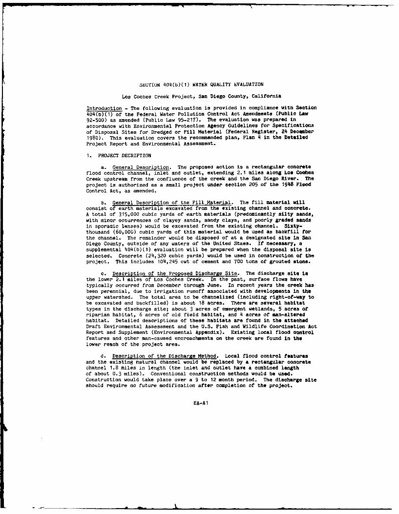
SECTION 4014(b)(1) WATER QUALITY EVALUATION
Los Coches Creek Project, San Diego County, California
Introduction - The following evaluation is provided In compliance with Section404(b)(1) of the Federal Water Pollution Control Act Amendments (Public Law92-500) as amended (Public Law 95-217). The evaluation was prepared inaccordance with Environmental Protection Agency Guidelines for Specificationsof Disposal Sites for Dredged or Fill Material (Federal Register, 24I December1980). This evaluation covers the recommended plan, Plan 14 in the DetailedProject Report and Environmental Assessment.
1. PROJECT DECRIPTION
a. General Description. The proposed action is a rectangular concreteflood control channel, inlet and outlet, extending 2.1 miles along Los CoohesCreek upstream from the confluence of the creek and the San Diego River. Theproject is authorized as a small project under section 205 of the 19148 FloodControl Act, as amended.
b. General Description of' the Fill Material. The fill material willconsist of earth materials excavated from the existing channel and concrete.A total of' 315,000 cubic yards of earth materials (predominantly silty sands,with minor occurrences of clayey sands, sandy clays, and poorly graded sandsin sporaoic lenses) would be excavated from the existing channel. Sixty-thousand (60,000) cubic yards of this material would be used as backfill forthe channel. The remainder would be disposed of at a designated site in SanDiego County, outside of any waters of the United Staes. If necessary, asupplemental 404(b)(1) evaluation will be prepared when the disposal site isselected. Concrete (214,320 cubic yards) would be used in construction of theproject. This includes 1014,245 cwt of cement and TOO tons of grouted stone.
c. Description of the Proposed Discharge Site. The discharge site isthe lower72.1 miles of Los Coches Creek. In the past, surface flows havetypically occurred from December through June. In recent years the creek hasbeen perennial, due to irrigation runoff associated with developments in theupper watershed. The total area to be channelized (including right-of-way tobe excavated and backfilled) is about 18 acres. There are several habitattypes in the discharge site; about 3 acres of emergent wetlands, 5 acres ofriparian habitat, 6 acres of old field habitat, and 14 acres of man-alteredhabitat. Detailed descriptions of these habitats are found in the attachedDraft Environmental Assessment and the U.S. Fish and Wildlife Coordination ActReport and Supplement (Environmental Appendix). Existing local flood controlfeatures and other man-caused encroachments on the creek are found in thelower reach of the project area.
d. Description of the Discharge Method. Local flood control featuresand the exsting natural channel would be replaced by a rectangular concretechannel 1.8 miles in length (the inlet and outlet have a combined lengthof about 0.3 miles). Conventional construction methods would be used.Construction would take place over a 9 to 12 month period. The discharge siteshould require no future modification after completion of the project.
EA-Al

2. FACTUAL DETERMINATION
a. Physical Substrate Determination. Construction of the project wouldresult in the replacement of the existing substrate with a reinforced concretechannel. In areas not altered by the existing flood control structure, thiswould eliminate erosion of the existing natural stream bed and banks. Thiswould also result in the elimination of any benthic community in the stream.
b. Water Circulation. Fluctuation, and Salinity Determinations.Construction of the project would not have a significant effect on thesalinity, water chemistry, clarity, color, odor, taste, dissolved gas levels,nutrients or eutrophication of water of Los Coches Creek. Waters would nolonger percolate through the creekbed into groundwater in lower Los CochesValley; instead, they would be conveyed into the San Diego River whererecharge would occur.
c. Suspended Particulate/Turbidity Determinations. The proposedproject is expected to have both short and long-term effects on the creek'sturbidity. Construction activities should result in increased turbity dueto disruption of the existing environment. Once the project is completed,turbidity should decrease because the bed and banks will not be erodible.
d. Contaminant Determinations. No contaminants would be introduced toLos Cookies Creek as a result of the project. Since the discharge materialis uncontaminated, It is exempt from further chemical or biological testing(Federal Register, 241 December 1980, 40 CFR Part 230).
e. Aquatic Ecosystem and Organism Determination. The proposed projectwould result in the destruction of all existing habitat along the creek withinthe project area. This would include the elimination of about 3 acres ofemergent wetlands. There are no endangered species within the project area(see USFWS letter dated 4 August 1983 in the Environmental Appendix). Theproject would also deny wildlife in the vicinity of the project area accessto Los Coches Creek. To mitigate for this (and other) impacts of the project,20 acres of suitable riparian or wetland habitat would be acquired andpreserved outside of the project area and a wildlife water source or "guzzler"would be constructed west of the creek between Del Sol Road and Los CochesCreek bridge.
f. Proposed Disposal Site Determinations. The project would violate noapplicable water quality standard and would not affect human use of the creek.The water of Los Coches Creek is not used for any municipal or private watersupply. The creek is not suitable for either fishing (the only fish observedin the creek are mosquito fish--Gambusia affinis) or water relatedrecreation. Aesthetic impacts of the project are adverse in the upstreamreach of the project area, where the natural-appearing channel would bereplaced by a concrete channel. No Parks, National and Historic Monuments,National Seashores, Wilderness Areas, Research Sites, or similiar areas arelocated in the project area.
g. Determination of Cumulative and Secondary Effects on the AquaticEcosystem. Not applicable.
EA-A2

FINDING OF COMPLIANCE FOR THE LOS COCHES CREEK REPOIT
1. No significant adaptations of the guidelines were made relative to this
evaluation.
2. No feasible alternative was available that would have had a lesser impacton the project area. No-action would not solve the existing flood problem.Relocation and floodproofing are not economically feasible. An earth bottomchannel was not feasible from an engineering standpoint. A shorter channelwas neither technically feasible nor acceptable to the local community. Thefour alternatives studied in detail all had very similiar impacts to theproject area (see the Detailed Project Report and the Environmental Assessmentfor additional details).
3. The proposed project would not violate any applicable State water qualitystandard or the Toxic Effluent Standards of Section 307 of the Clean WaterAct.
4. The proposed project would not harm any endangered species.
5. The proposed project would not result in significant adverse effects onhuman health and welfare, including municipal and private water supplies andrecreation or commercial fishing. Significant adverse impacts on the ecosystemof the creek would be mitigated through the preservation of offsite lands for
Umitigation; 30 acres of riparian and wetland habitat is the coordinated,proposed mitigation for this project. In addition a wildlife water source or"guzzler" would be constructed.
6. On the basis of the guidelines, the proposed channelization of Los CochesCreek is in compliance with Section 40'4(b)(1) of the Clean Water Act with theinclusion of appropriate mitigation for adverse impacts on the aquaticecosystem.
EA-A3

ATTACIDT 3
LETiU CONIWM AND R15?OI8
LOS Cocs. Clu DffAnxD PaisJcT 33cm?F~l WI~3UTLAWSUUT

R Letters of Comment
U.S Environmental Protection Agency
U.S. Fish and Wildlife Service
State of California
Office of Resources, Energy, and Permit AssistanceThe Resources Agency
County of San Diego
Association of GovernmentsDepartment of Health SercicesFlood Control District - Zone Advisory CommissionBoard of Supervisors Resolution
City of Santee
Lakeside Chamber of Commerce
Lakeside Community Planning Group
Lakeside Residents' Coalition
Los Coches Creek Flood Victims Association
Conrock Co.
Drs. Samuel Sloan and Susan Homesley
Ms. Irene Basel
Ms. Dorothy Robinette
Ms. Doris Wynne
Gray, Cary, Ames and Frye
EA-B1

00C
CC.0 C *4. 0 0 140.
4. O~ AJt C . 059teC .. C . .a C
* 01
a~ .. ,c u*0. 0 .-41u1 a0. 50 4 rOS 0.4.3
U ~ ~ ~ 4 ac-4.* a-3.
0C
* .c . - ..*.5 o- u"4C 0 00-3 -.
o * Coro.u- SO v
o 0511. - CA ... 00 .0
CI '0 -2 24S 0 w a
c43 m* &0.''0c & -Cc 4 1--. - .. oo.- &u I
*woe -- v v4. we3 SI. go. roj seg w3.J0tC.33am
W4 .. SC 0M0 o a C a
IC-0 C403 MA 0. I'S
Cu US h..3. O7 '0 tOw. x 0t.0 wO .. 1.& N
o ~ a AC S 0 %-
S SCoUC"X C.C)' 0 t16 c - a 1360 a,
a C C U.CC 19 0-= f , ..
3.36 m3 3.40
5.46*400 0.CCCM
hi ~ 3 0. . a C
cm c
00 4
4.3 4.4l A O S .3t V M
I- C .
COO a C A 4-4. I : u0 -
04H g S 4 a
M e 0 S 0*4
0 a "
S 0 .103 0 .0* 4t V 13AN43 '4

". I t
!61 EA. .I
AA
• = oo, 8f! :,I
.: tglrh ..- a,o0 .4
I .
A .01.0.4 .0.

00 s~g jw
* - - A
s0 00 0 o 9
Iu I t.00..>00 ''I 1 01004 00.
-0 _
2~ 0. 1.1 1
00 0. .1 0 00.~
.01C - -H .000 00 0
U.W rIO- 1. flU 00 US. .1S.C> .3 .1 lo1..
IS 4 S. . ~ .. 0.. 0
u
o .9 04 0
111 00. 0 L 1 0
*~ oU 0 -000
U Ct. 0e00 3 1 .1 - 1..4 f000

044 S ~is -o..~
~~ (I
4 -44 44.
1. S i d . ,,
t4 44* 404
o ~ ~ :. -o I 4 4 0...

II
I 1
: go ! i ,i
I ' Il° ' J~
'•

."T
c vo
I g0 a
So t
8 CN Qg 3-all Its
h a.
LI 21,d m

.0-.'
to 1
0 cO L v'4 040.4' ,
4-. 0.0 00
.0445405 r114~ 11( OS 4 5. 4
I., 1 0"
40 44 c. 0
5.00 A w 0
0300 o c '
.0 0 04A314 '5
si 01- 0 s44
0.445.40u 54.- 0,
0O 440 Mc o c- o
44 44.0.4.4 -(to
444(4~a I4fl I4, .44 .3 iJ
0 ~~ ~ r FO N44 s'0 4
0 ~ O m4 0004 44 a4-4
3.4- IC '.44 . 0 o0
0.00 1454
4444~Ir v4 4

~g
i~w
I - ~ a.
~ji ~Ia
~ ,uI~~I zCPU
* jaO~
SE '
I a; 2
L

-- 01
tieI 11111
-- a.
L-0 ii -IL
I IK
UE.
z0 Z
Alibii 146' 4

S
IOi
iiIIIa
___-- j44
VI.
4 -< r
4~ .4 4 .4"
4 '4,,
44 ~' 44.4 4
4 - a -".4--'; C4 ~ 4
4 4444

iU to
A000 0 A MAX-A AA o100A0 04
.- :0 .- ** t** 0 tRo
mmmH IEE1f -A 3
C- oct Li4Lc t aaa ~~ ~
I o
0 0' 4 l.
a a - 00 -
...... 00 ....00 I *, ~ . 0 0 0 0
a,. 1.-0- 1 10
Ewe -MOWN~0t o tt t~e l

* (40
1* Ii~ a*
3.- 0
;0
I 1~
I- - - 4

0~ ~ If. t'.o0. .04 0 1
0.0~ ~~ ~~~~ 0m..,. 4. 400.0
4.000.0,40 0.0 - , N0 4. 024 .4
3300o~ 0I 00 .0 0 0 CO41 0.
0~~~ 0... 0 -' O .00440
~~~~~ 0. 4,0,1.4,,
4.0..C..4 0*4-4.04004, 34,.40 0 0 ,34
0 30 4 3. 000 000.o 00ZOO4
4.~ ~ z0 0 0. 0 .4 . o v
* AC0.0 Co 4-4004-.- .0 00. 000 04.00
C 1 0,440 .00.0.0 0 ,0.00 0 0
C ~ ~ ~ 1. a,04400. U.04 .... 000.' ,,
C 4.4* .... 04.~~~~I 04,...0... 00 0- 004 .0C 3400 0-0 0~ 004.0 4., 0

A
V3t
LI -
r t
fi IIt
Eu
C.
ii
C a
VIi-II
I.~ I~- I gc4* -. p * -
*~- -- II gg~I :1 ii4 tilijI
1 4 - 4-. .9 i~ii I JP~Ji Dii
iii 4
E o 1 1.41~~o -.. 1 1 4
41- I - 4 00~ 1.
o o + . .. . . .
4 0..... ..0 0o+ + A 0.00. 04(.0- 00 - 4I -... . . .. + 04
7 i . ol.: ,
.-000 041 0 -e 4...'4,, . oO... . 0. ,,+ ,,'04, 0 .... .o 0-... o. o.00 +
o2@
A+ 4. l e l, '404 041 -, +- 0 , 4... 4, a040E 414,, , ...,0Ooo-o..... .. 00 0o+= 00 0
+, 41 ,...,... .
0..5 .
3 , ,+ . 00 . ,, . ... .. =104. .0++ ''=o,. . 0" .....,+,+,,,4,004o0 ° '0',....0 .....
Ou. . 0400.'.. Fo .0.... .00, 00 ,,
iB. .. +" 3 J. 0.. 000
, E
. ~ 0 Z 0o 0 ,<,++ ' + .+ + , ::
• I_.. 441.1. -
, -s £ ~ 2 ..+ t ,., t' 0 - .sr0 .. 0r'0
41.4 0.041 '0 1.0. 04.0040410.. As. . ...0. P.0.. 0 00 - '0.., 0 4,
O 4 0 4 0 .. 0004. ' . .O . 0 .0 ,041 .0 -+ .
*4 . 0 . 0010. ...40 0+0o .- 0 o. 410C~o.. + 00. 0. 0' (.4' -+ ,,o. 0.0. > ,
.... ~ t O .. 4.. . 00* 00 00. (4..411 41 Al 0: o o 3 0 , 000.. 5..4 0A 441 0 1 4, 0. ,

I! .0 0. I
o OOO.O'~'~ ~ -. ~ -
- 0 .~.4 0.00 I 0 . ~ 000 ~ 000.40.
0. 0.4 ~ 0- - a ~ ~ -0 000!C0~~ ~
0000.,...,! Z~x -
0 ~ ~"'R ~pp~a 0
0.. E~o00 0.0.0 OOa j
00 - at.0004 0.0 .-. ~00.0 ~ 0.0 E ~'
-~ ~ ~o ~oo~ *.0 ~ ~ aS~" 0 ~ ag..o.~ 00a a aO.oo
*0 '000 Se0.o ~fr 0~0.000 Oana to,. - 0.0.
.-- ~ 0~I0 ~ ~'3 ~ 00
~ ~0.5 ~0.00 0.04~0.a
0' *.00 -,.0Z 0.9
*~ ~00~ao~ ~0.~o0 ~.00 00a ~ ~ 08aO ~ ~ ~
.'o~ lo 0.
0~o0 ~
~ 00!., a~ ~40'~ 0 a 00.0 04'~W.-4t000ooco ~. -~000 ~ aoao. - p L~ ?'I -~~8A~ ~
-- 00 0.00 004
00 00 0
00.: 0, .0
00 0:0 0040 0 000 000 0
O 0
000 00 0
00 0)040.0 0.0 o. 0%00 Boo 000 0.0 0.~ -00 .0.0..,~ ~ 0 0.0 i
.0 .0.000 0 0 *-. au 000 00000 too.
I .1 ~ a ,00 48d 0.4 0 sCa
0 00 0 or.,
0000 0..:00 ~.00
0) 000. 0.00 0 * 00 00 S
o 000 000.~.0~ ~. ~ 0O~~00 *0000yo~ -. -~ 0 a.0 0. o~..u .00 0
00 0. 0~ 00.0 0.O >00 0 -0..00. 001 ~ 0 0 ~ !'~. ~~ ;~ ~: -
'~ '0 0. *0.000 .. ~ * 0.
01 ~
0

0~ 0.
Mil--* 0
- 4 ~ ~ ' 0 1 ~ 0
o
0 10~ .2 o
s o.so
4.4 o.0 o4 o
4'.04 *04 43 4 0.2 .. 0 .0 .4. - 0 4 4' .0 0 4. 4. 4. 4.a 44 0So
InA
o a w 00 I
*0 p.. -93

I AD-Ai79 305 L$~CECEBSNDEO Om C LO HA KgLii
I () NN EGILUDIINCILO
UNCLASSIFIED F/C L3/2 HL
wL
MICROCOPY RESOLUTION TEST CHARTNATIONAL BUREAU Of STANbARDS-1963-A
i 4

22I
fa 0 In
4- .0
- -s .,.... - a. -"
It I 6=-2 Km -o a
0 419. c Ao
.. IV aAILS
.o~ .4U M
'4 h 04.
005 me 6. ;
a at *~
-~a lie~,
0055 it -I-
( v to ' o V ,45C em 0!N
Ia~ 6
-4).- H,-- IM, iUi 055 4. 4PS
04. ~ ~ ~ 0 o 40 *'4
H4 0 k oW0 o
tai A", .4. H o
'4 *1! V U4 -1 U ~ .4 1--1
Az d'95 EMU . .9

I m
.4 0
0 k 0 9.
4,4~~I I L 4 .4
'13 040 0 St - Lii~~ I.t d
Af t 90 0 0 - 0 0 2
1 4 4. 0 .*4
-~~A 0, ft44.l 4
0 0 0 4
3 goo 00 '0.

Ut 0 I Sp ~ I
! ~~i! !;?; S-CO S
~
I 0)'"'
&~A~~ sr~! ~ .3
p -. C -* ~0 00 0~ ~ p V!*~ ~
e ~ ~ -.0, .3~i3S *~0,~ 0I. ~ 0,
* 0 00-M C.~2 ~ I
;~;~; §:3'Pvcfl- -
ihx.3 ~2205 ~:3 4~hO *~00' & OL.
4U S
- 3-UCO S-, ~ ~-~r ~z p~s' ~So~
IS ~ ;~ U '~
* ~ 1,,.~i * p~ ,3fl~ eja0-. 00 1. .ELEL ~

* - - - - - - -* I - - -
Ii'ii' if tII. ~I ~I? 4
ii 'i~ 1i*~I ~IjII~II4il *~t?ii Eli
31111!~ Iii~1iii ~ n.H

1040 0
14 0. l 1.
lo I
.0 5.~~t l .4 a O 4 0
en E4, 444 0 0 4.
Fn 0,0 L P 0
O~ ~~~ g44-~. 8 ' 8 o,
aill 00 1. v
44i 50,0 I4 .n 0
ag. . .o ..
0, ~ ~ ~ ' 1a 4. 4.nS V
a .44 Id,
4 4 .04, M44 0
3.. .0
0 0 m 0
0 0 X ".' -
p
3.30 C30
0m 0 o333C
C 00
OW 00 1 3
013 03. C o . 0 -303
e) 0 0 3 .0 0 23"
M4 0 0
03.0f - .0 m u~ 03 w l '" .00OVw 0-0
00. 00 0
030 1. -0 0' 0 0- . v a ~.3 0 0 0 4 - u. . .

8L0 CO, C
~ C
... 0 0
., . - 8a E.9~ *a
o * AA a-.- ~
I*-0~ ~ 540
a .,.. *~ ~ -
* f,,sb-.a aa &a0a0 04~ a
* QV)0 004 aa 00.0 C- UC.CC mta.1a ~ 4a0~
~-~-
0. S0 a 40.aO 0.0
*~ Sg~3 4a0~. S-~ ~ 3 -a-. z a
sac -ua a
~ a aCa C0.4 a~,.A4~5 C0S~V
- 0 . a3j ~j8~ ~ p

0' -
* 0* U 39 0C .
x 8 0' 0 20.
c- z SO c 4, 0 C 0 24 OC.O 9.
0 U 0 "a.SU SO0 OU r 0 5M
C 055 0~ ~ U 6o o 0 q-0 0
o. 0 g 9*C 0 0
C C I) !- .1. 1. * O
0 !
o 00*-q- eA, CICO U 4 S .0;l- 4 to I
0 L CO - s I I C0 0 1
o 090M 1 I L .
3~ 0 9 0 - C.
a' 2 Cc 00
CO cc 1 V 6 0 .U r OM 1.x .C 9- . C ;) CC' 00 6 U C - 0 S. , 0b
0- .~ z~ -: ! SC C- a
1 0M U I , I* D 0 C
8w U
U~ ~~ ~ U CC3S 0,Q .S. 0.. c~
9~~ U. z O 4 5 CO~ ~ CC 0 0 5C-C C
-L ,2 - U'99- - . 0
O~~~~ 0.0 0 £ 0 O S 0 0A~ ~~~ a .5 0 >. CDo CO so Z0 S O C a
C.-0. 5
U5 000
U 'o a o5.a 0 O- UM-
C Z9 U CU &- L 5 v u 0 0
&~ Us9U- 0b 03CC. U. 0 OC
u> CJ 00 CU U 0(CC a. 0 OM - 0 OOU0 C- U - 0 U C- . 0
U~ 0 .5 C0 U U
'C8 1 . - S 9-0,I
0 SC C0 01 U C
00 00 a5 I U * 5- 'a00 .0 o ...- o 09 0 .S 0
U 00> 0 . C- I .9 . 0C0 .a c 0 0 0 C--a U its
0 , cC 0 . C C
C- S - CC 9 5 0 C0 0
L 5 0 C 0 U C- *0 C-S 4 r 0 QOC g. 6 a 0 OS 'A0 Jo0 0. 04 -- 0
Co UC 05 0-- U U c 1 099 . o
*~0 !' U .0 a.. I£0 vS r C m O 1. Do 0 a' , S U 0
C -: U S 0 5c U -C 00 5 5 O
C-9 . C CCC -30 -C M 0 LU U U 0 0 C C 0

-iS
'IA
I
i
I.,,

-U~~ 0.-a s c
OC 0 rC. 0. t 1 SE 0 0 0 .4 D-0
L 0 D 001. .6 0 Ct - 1C. 0C ~l. C . £,6 4 >L-. D 4 0 C0 u C
0' - L t . 9s. 0 3 PIC os o 1 'cC~~tO 04 ~ o - t. o. OP
.o . . q . aan 0..Oo4 .4. >r-a v 0..C 0 .
C. 6 F -0 .5 CC 00. P zC4 D 00-
0 0 Ot.0 0 tt a. Cs V. a0 CS00 !4- : ) tMCODC0-0 0:00"§. 00)00Eo 40u
c 4~~ c UC 0. -1- a.. ,00L-aDCOUc I ;t ;000 C CO CU .6G 0 I
.5 ,- >0 E0 C a Cv. 900- 0 4:"0 :D0, 0 a 0080 40 O 4.C a.C0~F 3! CtCPC- r qroo o twur. ona-a. -
194.(0 ta.. SAt xcc, ..t L *a Ito
0 .C 0
-. O 4 n ca - C C O444 E-CO 00 C 00> C000- CaoOGOS , 0-- 0- . a 4040 00 0 a 4 a . t f 0)01 J04. L. i >4- 0 .0 00 CC 4.~ . 2, -.0 t O
a CODE 0 L m0" -Sc 0 040 C0 IcC~ 50IS0 L5 .. 0 0 01 0-1 C - ... C Wt
U t !.0-.0 .a So C .- COtZ 000 0-0 ( tC t .CO~~E. ....C ma.45a *O V 0 o n- - 4 2
o(0%0 , 00.4 ' 40o so 294C C "V T0 004 '-
am~~ .-- i. IC(C 4 0 -a SD ICC-. u..LC 0.0 40 C xU 4 0C4 Q- >C 4-> 0 0
5k 0 -- C 00000 5 0 UM .4 4 00am0004551 (0.OC 'O~ a.t4"a Xt, OC- 2 r-. , a',a
a. o 0 t ou O~0 1o0 .CC rq 000.-. 0
22 0 tO 04 00a0 to; x 4 L a o 05 4.co v so ao ...-L00 uL D oC>ta 4.IC 2 200 C
1, C U 0 z.c4 r
U zO 0 Ca 80t,v ~ ~ ~ 4.- 410-1 u0u8 oi' v 04 .2
0 0
-4 .4 00,
.. .to t4 .0 %- 41 . 40 r
0I0.CO . >C"4 06C -0r.
O ~ S 4.I. -COO4c. Lo 00. 6'.,* Cj.Ca
6C N0 a0 0 0 4 , -
Cab~ ~ 0, 00 CZS. 04 00o o, L *r. 10 r xuC
5- C - O-r 04..404 24 0C 44 v , Ma 4 00L 00
o 10 . 0~k 6 a1z I!t0 0- 4. i C L 0 a ~ g -I-
0 a L0 0 0. 0aCO*04L aU0 . 4, t CO C I 10 1 C*t v..O 00 W L 0tSOOa.cc
002 4,0 c a t C-C tt
a ow a Una-- tsr at.0
m 0 00004 CQ
I. 50 C >C--0-1
0 6 z 0(a0 000c
C0O CO 024 .C 0404. 0
% 0 CCC Ct 21 09 1.0~t 20c a L0 ot W. U OC.-.
0-000 00 40 t E LC 0C 0
00 -a Sa 000 00 a 'U4LC..seas oao 00 Lon OtO y. I 0 5M 4.5M C0
COCO SW& 1 - w UC . I &IcI 4 0
!, 00W 94; 00 1, 00 00
a0LUZ 3010I 400 cDI, -040220z04
0 0 0 0 1 -C'1 44,. - c *5 3 -0
* u' 4 - C L.4 - 4 0. a 1 C(10 cc. 1. *.1L CM 4.0 CO -
o C - *40 cS CI C-- . 0U l c- tt 0 0 'O 0* 14 tCI .c*0 -au ce.0 0 0 0£ 41.0 0ebos.uC 0-1 C 100 0 1 oi cc -
I-L. c a.. -"r0 SCO 1. 6 z 1.SOCi-SO- 40 & -400. Coe*~ 3 LS.r-044 0111 0 0 w- C 1.0- ,C. O . 45
-~-O4 T.:.:. C O- x 00 -aC r C-z-zCc 0.s -a w o 0 v >- vo ss~co O-~ C 6- 0u -e £. 4-r a a-.UsC0 0 .6 M 0M
"o~~~ ec uI 51-04 L.-.D- C14 55
-'O c OOOODZ2 0 6 95L10*a0 £0 L OSM0*4OD0 ..- l CM1-4L.40 A ). a, be Mu- -
C- c Lc 4 v-~ 0r '4 .C- 4 4CCC 5130 5 ~ 0 1.0 c-C SL-SO M14 -0
O. .~ - -bc a aCO- c r u CI$09C1 10 C MM I- b 1- CE 44. 01C 04 0CCC0M0L >i C B 1 0 a L 0.a C 804 a 404. M1tS O S -, t -S scLa 0 c0 0 . * M 14 SC -b C C
aS L Ui Z 0 Uc 0 D C 00 L :S-0 CS-004 C2.41 'I*.o C M-C 4C L.-.. L.- 0
040.. 0M -- -'C c40 a W SCL3 M- Lz-OC ag v1 Mci 4 c L IU-0..-o . U CM fS. S -. 4 .e -
04 0 0 1 Id mMC ar a.4 be la CC ObU.S00 .-. I -0 c.4S c-caO CCC.1.4L-6~b C- LI C &- 1.-- a 0 0
tZ --- 0 0: O DMCC CC c cub CO -t- fl
vbI0I M, a v .. 0axonv 0ac0 .CID 4. - UC S.e4cC 0 .4 1 1 I- c0S 0 :.- 0. & .c t I
1;00 1 I U- 0-lIC s' ba L ~S. U4 e 0. 4.
C! *-I 0. II L4a. Cec 0 4- C O 0
1...0 C- rl 0.5 0 a0- 80. CaCCx1.OS CCrO
0- U,4 01 r a 40. 0 0-C 0a 04 0.- u0b -M i- u- vCC S 0 u 1.C ; 9 c b o O pI441.. 0' V-C 0~r C C e Co au coo-c
*~~ ~ 0401. 1-I rD c-.O ui 0.u C ' -
S.. 0 -'aD..ct b 11. * 0.. ao-C -
Oi; -cD0.a 0S "M C&
02 Co. aAM0 HOa;uu 4 u 3 1. . ,
C0 5 0
14 C. cz 0- C D0CCS
MC 0 0 2 00I - Ob sc t A0 - . MD;44.. r C c U C 0M 5 I- S C- 00 0
I10 U C- Ci20c u40 4 0 Mo - 0'aA04I"r1CC- r ro c -.-- 1 0.0. S V> CC -- 163 010. 0C LC "EJ110 0 M C 0 C Z0"0 1 Oi0I C 0C 0 SM Le m 0c0
I r c . -0t c M M C v Z re6 0.dVI.a'Si -CS4SMC 4. 0 ~ LC CD CS 0 M 04
C0, 0 b OCES* MZ 0 . 0 >cC a00. -oNecu~C- 4. c44- 0 - *C! 0 . S 2.- -6SL V0
0o ! ; q u -C 0 - I C - 03 M0 C E 015 ~ CCC 00..C -6
O 00 C' 30 I- 0100 4I C 1- - 4 00.-.bOICOC 6MOb C3 M 0 U . 0I I ~ I-C U M c-4.0 c - c C 00I.0 0 - SC L U 40 CD0 4-4- . b CC O~ * a> VC S.. U1 O
L >01 - IC 4.0 3 2 4 01 uc0 U .C C'-4 00C 9- C-6o b 00 00 a20 0 6 mC
C- CUbW 0 4 C L 8 4a L at 0 U4 c CCC
L S I > I I C - : v 00 C b O OOMI-900 - -v OC.-0 4 M
cb 101Cob0-- r 4.-D cC eODI1 1 t
V0 cZ e CC J- -C9 . Cr
>~O C 2 0 COO-Ue a 01 L - . 1
C ES OLC .b00 0O r 0 C I ee.1- 044 C 40 14 10b C
V>. C E 0 -Cr -U4. 4. SI 00
21 oro .J c0. C~ 0 0 4-O ES - .-. 0! CM ct C 0 00 a .1-0 t4 t
0iIU E p00 4 140 0- £u Co u *' C1. -000 1.r5 DcCrI o;04* b-c 4 C0 SU"O Z - I l
4 CsocCL cC'aeUr,.-I.-I1zM04 00 40,Z 0 ! 0 U; 0L0 Z4 c I6

0t CC V L
tea
0POOL & - .14
W - I..t: !p6k2
o 02 U o *
*a.ao 0~*- 0 6 LC t
a4 . ;~ Sr
AO 1 . g - v . LLOif ue:Z La 4 a"5 ~ at~ Iu;do.,OgoL
0'a'0 S
C. .r a -ONU 0 Cd: r - 4iP 0
*I Pd LUVP.6. 4 CU Z L 0 U-. 1 .o 6.0 .£ 0
to -o 0 4.64 to6 0 Lo S S~ a0 u ~ c 0 0I£ L C 0.4.&A 3 C .0oP - L C - 0 6 . £ 0 6 C
rL ..... ml 4'. . a. 0 0C L 6 0
0- -cn P0 0 5 g6U o 1a & 0 0
0: N !l 6;1: c 1 Sac u, , . ~ C
CC~ 2 04 0 C 0 C;.;at0035~ ~~~ aC ... 060 0 ' *6 O6. ac -o S0 f£ .1 0 0 450 0 0
06 C .L. S 0 t 4. 60 0 a a. t 3.L 0 0t 66 Cu. 0 0 f -56 up.,5 Itc . .0 4 . 1 * 4 c. 4 6. 6 . C P ) . 6 . C4 0 0
Ifl0. a~~t 2.4 D2a L26.
6 5v. £ > 0 6 L £ 0 L, W.0 . , t L a U . 1;~ ~ .U -- 0 .0.C t%0.- . 1 0 ! 0 Mft.S.I LC r04C. - (U > 24.. t
LS 6 . .0 - 6 g . s ~ ; ~ S C t
2ur v * -- Nac o x 0 .. 04o O. .a 0 .4 0 L0 0 r L
I-SL -4 0 4L.0 2 0 - a-
os0.10 0"CC. Claa ih 1 1cdbc. . s 1,. 0 J1 8 g£50 Lx .6- : £0 .. 0. L aC 0u u>c2

0 0 .0
0-
a'
0 8.
V o 0. s

iti
o M -a1:
A II I l ~
gigI 1 ~1 11
8 : j 81 1i $'d~1.9 1
AM ~1 i

II
a
ii=3
ii
I

olo
t.0 4 0 ,
Oc .1 'g -
0. 5" "
C 0
Oi 041. 00 C a0 00
MA00 s C -0. a. to-S . 0, -0 *um0 i o. I' a ..0 04 at gtons " 2 4. 4, V..
0 .4 0. 2t0 6 o 0
Cc A 00 -3u M 1. *Sfll.-O 10.C U
me C624 0 MCC0 00 056 5 tOtoo toO -Wo tooJt. 4 -. Im
1..4 0 4 .V ... 6 00.4 o0. 0
-" ill 0~ >41 ~C S . N-.-x ouc6 *p ~ c cUCt 040 - .00 C 0 654
DO UO "a 80 . . S 05. 0 04.*0 tO t. 0 6 P 4 60 4 0
.- 0 ~ ~ ~ ~ C6 : OS .4 oO.460.4 jt0
cc.4 0 PC .. .42 0C Ut .V 6
:Iu60 c5. oo4000.4 500 0aC -o~ 0). UOO CC 04
-0 O..ooO a,4 5 50 .U
S ~ ~ ~ ~ 'w- V o4.oq.os . .. LOF O Z 0 . A 0 Ut F
u .0 .4.0 z. .oo.o.c
2 .. 40 )..U6-.to~~ 00 025=-000 4 P S t
.4 66046
5.46 p. ~.~U04 0'
C.SP-4 00.4. ..0 P5
60 - 62 0 6& 0 - 6004 e5~ 2..SSCI t.

J aU
IA I,.,
,. V
V
4 ii~9 K,~ j
'4 'S
~ -~
~4iU ~N 11ii:
k." I~1
aII2~
-~
0~
~~-
'~ .'~'~a I>~' N
'~N~~~ 'IKP
K '4U

Ii'~~Z
.. '.' 0~* - an
*n --
Ia
~~~~*0~~
43
I.. a.SL
S* U4. .bC
~-, ~ -
a g*~iS
1)
4~4j

A
I
"aI
fn
U.'-A *.~ ~ 4,
A 2I
Aid~ ~*1 "'4 * ,.:, ~

x --4-
A..... - 644J0: ,
a.- ~ Ce. 4--- 0444
v044 034 44 0 0A v * 04
44 ~4 04 mua a 4 0 ago..0.* 0.0- 040 0'. .'..a.
eq os. 0a a a: . a .
* *444* 4.0' -4- 4. 000 -4 . 4 p j4 44
a-2'te. mGoo 0 .- t,O MAOo 4444400 0u4 .U a4 . 44- 0100 44A
S ~ 1 0444 0
: 6 0 : 4 0C44 00 0C
66c*-44 0 0 0" 4 4..4 0
44-.444*0 .0 044 0A44 OO 4 &a -aum t* A ' -40.
00. 4. 00 0z . 0 a
0 4 4 44.44 3 0 4
*~ ~~~~ I4s.-0-- 44 * 44 444 00 4 404~0 .404440 90440~ >U -4 4 44 .4 44 0 -A 0o ~ ~~~~ 4-046444 444- 0.4-4 "m 4 0 c )3 ~ ~~~~~ 44 M44.44004 0..04 Z~- 4. 0c 0 0 4
4. M 4. 044 . ... 44 .
4~ C 0 44400
0.1 U 0 44 -4 aK 4 V 4 0 40C -4WV4 00 4U 420444 S 44.4
"o . .0 .4I4I400 3.0 44444 4 4AU044A 0 0 c-4. 0A .. 0 04 4 0.6 4413. 4 404 44w 44 0-4 4
it.f0P04444M 44 06 0 444.44 04 W0.44 044 0 444 044 444 0 46
1 - -304 0. 044 44 0 044.4- 0 -.0.4IA. 5 .0 .44-04 A 00. 0440 .04-oA
44> 00.0.9 O 44044
441~ ~ Ai - 0 044.44 U : 80.644w 66 0-
.4 ~ VK V444 00 4 44.2" 0
P. 44 mu 4444 "4400440002'! 8 .. .4 :. : : 0~.40 VANm 6. - -. .404 4uSc v 0 0 .44.A - 0 831 .Z4
44 4000440~ .. 644 44 04 . .
4 044 0 3 444. U 00.46 ma oc 44 0 . 0 . 0 404- .0 M20.444 - a0 40.60 am D. w
U~ 6 4444 4.0 0.04 04 .0 6
4~~ ~ ~ 01. - .044 0 m 44 0 6 A j c 0 40
4444, 400
All! i 4I.4 - 6Pm 044 .q 0 0 -40.4

C.
- AlI ~
I I..
iiiI
-d
I~:~
~
-~ - a

Plates
IA, 4

I I i"5S'00e 11652 30
M . 52 36~
SAN I / lKI.
.1 1 5 / <
L APs r-- 15
V x
10 0
AA
R so I X
7- i

I I 1*0 00"
LO NEE
/a
LO'AGEE
R, SAN DIEGO LESD
''1 ~- BOUNDARr or DRAINAE AREA
TI -It-- BOUNDARY OF DRAIWACC SUB4REASUBA.REA Des/GNdrIoN
0- ~- ® CON~ENrAT/.4ON P0/PT ND/OR10* LOCATION NUMBER
A JUPDATED EXISTING URANIZATIONAJON AS OP 1950
'I, - ~EXPECTED AVXIMUM DEVELOPMENTr
/ LAKESIDE
C, 'I 6
~ 5'7C DRAINAGE AREA~ .~'~"~BOUNDARIES
OASC LICCS RE,.ESEN, I- OT COI0 u __________________________________
US ARMY CORPS OF ENGINEERSLOS ANGELES DISTRICT
PLATE I

SAN D'EG>
50 YEAR FLOOD (ESTIMATED) ' ..
---- 100 YEAR FLOOD (ESTIMATED)
MILE

A
LOS ANGELES
LAKESIDE
SAN DIEGO
\~ ~ ALAKESIDE -k
LA JOLLA -
NATIONAL CITY
C-UA VISTA
LOS COCHES CREEKSA IEGO COUNTY, CALIFORNIA
ILE
OVERFLOW AREA
US ARMY CORPS OF ENGINEERSLOS ANGELES DISTRICT
PLATE 2

SI
_ _ i~id*4
MILE

.16TWF LOS ANGELES
*LAKESIDESAN DIEGO
LAKESIE I'~LA JOLLAJO5
NATIOAL CITY
44.
LOS COCHES CREEKSAN DIEGO COUNTY, CALIFORNIA
RECOMMENDED PLANDESIGN CONCEPT
US ARMY CORPS OF ENGINERLOS ANGELES DISTRIC
PLATE 3

-'
4
IC
Photographs
I
I~c. Sk~
p -
I

_,,~~~ .. .,.............•tim
Floodwaters from the February 1980 flood overtop the JulianAvenue crossing.
iMt
'
Floodwaters from the February 1980 flood completely fill thechannel and barely clear this bridge by the Harvest Templelocated on Woodside Avenue.

Flooding due to the February 1980 storm.
Broken fence due to the February 1980 flood. Note high watermarks on porch screens.

.
-
Fences at this residence on Castle Court acted like a debris trap(February 1980 flood).
Note the high water mark on this fence on Julian Avenue causedby the February 1980 flood.

(0
0
C0
0
0
0S0-JC
(0S0E0
Va0
0
.0SU.S
S
S0C4
b

Mud and debris from the February 1980 floodwaters buried thisfence at a residence on Julian Avenue.
Floodwaters from the February 1980 flood undercut thefoundation of this structure causing it to slip into the channel.

Local resident shovels mud deposited by the February 1980 flood from the side of his houseon Julian Avenue.

Mud a
Mud and debris from the February 1980 flood covered this car at a residence on Castle Court.

Floodwaters from the February 1980 flood inflicted interiordamage to a residence on Los Coches Road. Note high watermark.
Similar Interior damages from the February 1980 flood are madeevident by the high water mark at a Julian Avenue residence.

Looking east on flooded Woodside Avenue from the SecurityPacific Bank parking lot during the February 1980 flood.
~Lk .6MP
Looking downstream from Del Sol Road during the 1979 flood.

=2,
52
-;2~22
24
Draft Agreement
(IV
25
=2k I

16 July 1984e
DRAFT AGREEMENT BETWEEN THE UNITED STATES OF AMERICA
AND THE COUNTY OF SAN DIEGO, BOARD OF SUPERVISORS
THIS AGREEMENT entered into this __ day of ___ 19-, by and
between the UNITED STATES OF AMERICA (hereinafter called the "Government"),
represented by the Contracting Officer executed this Agreement, and the County
of San Diego, Board of Supervisors (hereinafter called the "county").
WITNESSETH THAT:
WHEREAS, construction of the Los Coches Creek Flood Control Project
(hereinafter called the "Project") was authorized by the Chief of Engineers,
U.S. Army on the __ day of ___ 19-; and in accordance with Section
205 of the 1948 Flood Control Act (PL 80-858) and its amendments; and
WHEREAS, the County hereby represents that it has the authority and
capability to furnish the non-Federal cooperation required by applicable law.
NOW, THEREFORE, the parties agree as follows:
1. The County agrees that, if the Government shall commence construction
of the Los Coches Creek Flood Control Project under the authority of Section
205 of the 19148 Flood Control Act and its amendments substantially in
accordance with the Detailed Project Report authorizing such work, the County
shall, in consideration of the Government commencing construction of such
Project, fulfill the requirements of non-Federal cooperation specified in
applicable law, to wit:

a.Provide, without cost to the United States, all lands, easements, and
rights-of-way necessary for construction of the project, including lands
necessary for mitigation for project effects, and borrow and spoil disposal
areas.
b. Provide, without cost to the United States, all necessary modification
or relocation of structures, transportation facilities, bridges, utilities and
drainage facilities required in connection with the project.
c. Provide, without cost to the United States, all necessary
modification, operation, and maintenance of the mitigation lands estimated to
be about 30 acres.
(i) The operation and maintenance (0&M) of the mitigation area is to
be performed for the purpose of protecting wildlife resource values and (O&M)
plans are subject to Corps and USFWS review; only those activities compatible
with wildlife protection shall be allowed.
(ii) Land use management of the mitigation area and adjacent wetlandsf shall protect the natural resource values of those wetlands.
d. Contribute a cash contribution for all funds in excess of the Federal
limitations in Section 205 of the 1948 Flood Control Act (PL 80-858) and its
amendments.
e. Maintain and operate all the works after completion in accordance with
regulations prescribed by the Secretary of the Army.
f. Hold and save the United States free from damages caused by the
construction and operation of the project, excluding damages due to the fault
or negligence of the United States or its contractors.
2
g. Adjust all water-rights claims resulting from construction of the
project.
h. Prescribe and enforce regulations to prevent obstruction or
encroachment on flood control works that would reduce their flood-carrying
capacity or hinder maintenance and operation.
2. The County hereby agrees that it will comply with all applicable
provisions of the Uniform Relocation Assistance and Real Property Acquisition
Policies Act of 1970, Public Law 91-64i6, approved January 2, 1971, in
acquiring lands, easements, and rights-of-ways for construction and subsequent
maintenance of the Project, and inform affected persons of pertinent benefits,
policies and procedures in connection with said Act. All records concerning
acquisition under Title III of the Law and the offering of and payment of
Title II benefits available under the law are to be made available to the
Government for review and approval.
3. The County hereby gives the Government a right to enter upon, at
reasonable time and in a reasonable manner, lands which the County owns or
controls, for access to the Project for the purpose of inspection, and for the
purpose of repairing and maintaining the Project, if such inspection shows
that the County for any reason is failing to repair and maintain the Project
in accordance with the assurances hereunder and has persisted in such failure
after a reasonable notice in writing by the Government delivered to the County
official. No repair or maintenance by the Government in such event shall
operate to relieve the County of responsibility to meet its obligations as set
forth in Paragraph 1 of this Agreement, or to preclude the Government from
pursuing any other remedy by law or equity.
4. This Agreement is subject to the approval of the Chief of Engineers,
U.S. Army
3

IN WITNESS WHEREOF, the parties hereto have executed this contract as of'
the day and year first above written.
THE UNITED STATES CO)UNTY OF SAN DIEGO
ByColonel, Corps of Engineers ByChairman, Board of' DirectorsDistrict CommnanderContracting Officer
DATE:____________ ATTEST:
APPROVED: By_________________Clerk of the Board of Directors
____________________________ DATE:_______________FOR THE CH~IEF OF ENGINEERS
I, ____________________,do hereby certify that I am(name)
the Chief Legal Officer of the County of San Diego that the County of San
Diego is a legally constituted public body with full authority and legal
capability to perform the terms of' the agreement between the United States of
America and the County of San Diego in connection with Los Coches Creek
Project, and to pay damages, if necessary, in the event of the failure to
perform in accordance with Section 221 of Public Law 91-611 and that the
person(s) who have executed the contract on behalf of the County of San Diego
have acted within their statuary authority.
In Witness Whereof, I have made and executed this Certificate this
day of______
County Counsel, San Diego County
4

Environmental
Appendix I
Ame
____ _ __ ____ ____ ____ ____ ____ __

APPENDIX I
KNV IkUNIENTAL
CRSODENC~NE ...........................
Calculation of Mitigation Requirements .................6
Supplemental Fish~ & Wildlife Coordination Act Keport ..........10
Corps Response to F&W Coordination Act Report ........................ 19

July 11, 1983
';' PD-RP
fir. Gail KobetichArea Office, Fish and Wildlife Service1230 14. Street, 14th FloorSacramento, California 95814
Dear fir. Kobetich:
The U. S. Army Corps of Engineers, Los Angeles District, Is conductinginvestigations concerning flood control for two projects in San Diego County,California. One is Los Coches Creek, located in the community of Lakeside.The other is the "San Diego County Streams Flowing into the Pacific Ocean"project. Streams currently being studied under this second authority are LasChollas Creek in the city of San Diego and Loma Alta Creek in the city ofOceanside. Project naps are enclosed.
Please advise the Los Angeles District of any rare, threatened, orendangered species which should be considered in the planning effort for theseprojects. If you have any questions, please contact Jim Duff In theEnvironmrental Planning Section at FTS 796-5421 or conmercial number(213) 688-5421.
Thank you for your assistance in this matter.
Sincerely,
Carl F. EnsonChief Planning Division
Enclosures
Al-I

United States Department of the InteriorRiSH AND SU.DLJD SEMVICE
SACRUANTO 20MGER.D SPECIES OFFICE1230 Or Street, lath Floor
S creaente, Caiformna 95il6
AUG 4 183b reply refer to: $50
Mr. Carl F. Enson #1-r-83-SP-517, #1-1-83-SP-518,Chief Planning Division *1-1-83-SP-519"Department of the ArmyLos Angeles DistrictCorps of EngineersP.O. Box 2711Los Angeles, California 90053
Subject: Request for List of Endangered and Threatened Species:Los Caches Creek (#1-1-83-SP-517), Las Cho'llas Creek(#1-1-83-SP-518), and Loma Alta Creek (#1-1-83-SP-519)
hear Mr. Enson:
This to in reply to your letter 91 July 11, 1983, requestln" alist of listed aid proposed esdaprered end troatened species that mayoccur within the area of the msjeet project. Tour request and thisresponse are uaSe pursuant to Section 7(c) of the Endangered Species Actof 1973 as amended (L 95-632).
We have reaveved the most recast Information and to the best of ourkmowledge there are no listed or proposed species within the area of theproject. We appreciate your concern for endangered species end lookforvard to continued coordination. f you have further questions.please contact Hr. Ralph Swanson of our office at (FTS) 448-2791 or(916) 440-2791.
Sincerely,
Project laider
Al-2

July 19t3
SPLPD-ILP
District CanservatiolatSoll Conservation Service1132 North Second StreetIL Cajon, California 92021
Dear Mr. Parkiass
The Los Angeles District, U.S. Army Corps £nineers is currently st44nvflood control of Los Caches Creek In the comunity of Lakeside.,snd Lee ChollasCreek to ia city of San Diego. In accoroance vitb recommendations from theCouncil on Envtronmental Quallty, we are requesting your assistane tnidenttfying say prime or unique farmlands i the project areas, aod indetermining any impacts associated with construction t &my of the proposedalternatives.
leaps of the project areas are enclosed, one fcr ,elineotirm prime orunique farmlands for us and one for your records. If you have any ques lons,please contact Mr. Jim Puff, in Enviromental Planning Section, at (213) 66E-5421 or ITS 798-5421.
Thauk you for your assistance In this mattter.
Slicerely,
Carl F. LzuoChief, Planniag Division
P.1-3

Unted States Si 1132 North Second', Department of Conservation El Cajon, CA 92021\ Agriculture Service Phone: 442-059
August 2, 1983
Carl F. EnsonChief, Planning DivisionDepart. of the ArmyLos Angeles District, Corps of EngineersP.O. Box 2711Los Angeles, CA 90053
Dear Mr. Enson,
In response to your request for assistance, dated July 14, 1983, to identifyany prime or unique farmlands on two flood control areas, we have reviewed thedesignated sections of Los Coches Creek, near Lakeside, and Las Chollas Creekin San Diego.
Our first observation is that none of the land in the designated reaches iscurrently being used for farmland. Then study of boil maps shows us that noneof the land fits criteria for either prime, statewide importance, or uniquefarmlands.
Leray M. ParkinsDistrict Conservationist
A1-4
A 'e Sod Co"iwealn,, SweCe SCS-AS-1,9 I i 0oncy o 0-79SOeprim tii of Acultuee

C
DEPARTMENT OF THE ARMYLOS ANGELES DISTRICT. CORPS OF ENGINEERS
P. 0. box a71 1LOS ANGELES. CALIFORNIA 90053
August 17, 1983RF L To AUGAT T NTION OF
18
Dr. Knox Mellon
State Historic Preservation OfficerP.O. Box 2390Sacramento, California 95811
Dear Dr. Mellon:
The Corps of Engineers plans to construct a concrete channel in thefloodway of Los Coches Creek west of Los Coches Road from near Ha-Hana Road tothe San Diego River. Construction is scheduled to begin in 1984.
A cultural resources survey that was performed in 1979 by San Diego StateUniversity under contract to the Corps identified three archeological and twohistoric sites near the project area. These are described in the enclosedrep(rt submitted to the Corps by San Diego State University and previouslyprovided to your office in 1981 (Encl 1). Subsequently, the Department ofPublic Works, CounLy of San Diego, resurveyed the project area, relocatingthree of these sites (Encl 2). In the original report, SDi-5048 was describedas a historic site. However, in the later survey, a prehistoric component wasnoted. Department of Public Works archeologists also inventoried and testedSDi-5047, which is located near project boundaries. They determined that theartifact density is very light and is in a disturbed context. In July of 1983,a field check of the project area by a Corps of Engineers archeologistconfirmed the recorded site locations.
Of the sites located in these surveys, none is located within theimmediate impact zone. Three are well away from project boundaries. The sitetested by Department of Public Works archeologists, SDi-5047, and a historicsite, SDi-6883, are located near project boundaries. Constructionspecifications will stipulate that these two areas will be avoided by allconstruction activities. Therefore, the Corps of Engineers has determinedthat No Effect on significant cultural resources will occur as a result of theproposed project. The Corps requests your concurrence with this determination.
Sincerely,
CalF. nZ'IChief, Planning Division
Enclosures
I CONCUR E :DATE
Al-5

SPLPD-RP 21 October 1983
MEMORANDUM FOR RECORD
SUBJECT: Mitigation Required for the Loss of Habitat Caused by the Los CochesCreek Project.
1. The purpose of this memorandum is to describe how the recommendedmitigation plan for habitat loss caused by the Los Coches Creek Project wasdeveloped. To develop this mitigation plan, existing habitat was evaluated,project impacts were quantified, and based on a U.S. Fish and Wildlife Service(USFWS) formula, mitigation requirements were developed.
2. Existing Habitat within the project area.
a. Areal extent of each existing habitat type in the project area wasmeasured from aerial photography of the project area taken in 1980. Aerialphotographs were checked against a 1981 USFWS habitat map of the reach of theproject upstream of Castle Court. In addition, field checks in the summer of1983 confirmed that the 1980 aerial photographs are a reasonablerepresentation of current conditions in the project area. A 1981 San DicgoCounty Ordinance prohibits new development in the Los Coches Creek watershed,due to the flooding problem.
b. The various habitat types found in the project area have beenassigned quantitative values by the USFWS. These habitat values weredeveloped by consideration of the existing habitat conditions and factors inthe project area. Factors considered include the following:
(1) Diversity and number of plant and animal species.
(2) Size and interrelationship of various habitats.
(3) Local and regional availability of similar habitats.
(4) Habitat vulnerability and replaceability.
(5) Food, cover, and water resources.
(6) Human disturbance and alteration of habitats.
No formal habitat evaluation procedure was used, so the assigned habitatquality values are somewhat subjective based on best professional judgement.Table I gives the existing acreages and Table 2 the habitat quality values ofthe various habitat types subject to impacts by the project. In these tables,the project is separated into two areas (upstream and downstream of CastleCourt Drive) because of the greatly different ecological value of habitats inthe two areas.
Al-6

SlLl'U-RP~ 21 October 1983
SUBJECI: Iiitigation Required for the Loss ol Habitat Caused by the Los Cociies
Creel, Project.
Tabl i - Existin liabitat in the Los Coches 1.; c Project Area
Habitat Type .xisting Ouantity
Upstream of Downstream of TotalCastle Court Castle Court
Drive Drive
Riparian/Emergent Wetland 5.3 2.3 7.6Old Field 65 6 71
*These two habitat types occur together in a mosaic pattern, and are difficult
to separate on aerial photographs.
Table 2 - Ouality of Habitat Types in the Los ;oches Creek Project Area
Habitat Type Habitat ()uality Value
Upstream of Downstream ofCastle Court Castle Court
Drive Drive
Riparian/Emergent Wetland .63 0.2old Field 0.4 0.2
This is a weighted average of riparian (value 0.7) and emergent wetland(Value 0.5) habitats.
3. Project Impacts
a. Direct Impacts: Construction of the recommended plan -,Ali result inthe direct elimination of about 18 acres of habitat. This includes all thewetland and riparian habitat within the project area (7.6 acrP ). Inaddition, 6.4 acres of old field habitat and 4.2 acres of man-altered habitat
would be destroyed by construction of the project. The man-altered habitatfound in the project area is not considered a significant biological resource,and its loss need not be mitigated. These numbers were calculated from aerialphotography and the alinements of the proposed flood control plan. A separatecalculation was made for each plan considered in detail.
b. Indirect Impacts: The project will also result in the indirect
elimination of old-field habitat within the current 100-year flood plain ofLos Coches Creek. This land, not currently developable under a San DiegoCounty Board of Supervisor's policy, presumably would be developed inaccordance with the existing local community plan. If this occurs, old field
habitat would become residential housing. For the recommended plan, this
Al-7

SPLPD-RP 21 October 1983SUbJECT: titigation Required tot the Loss of 6abitat Caused by the Los (oches
Creek Project.
would be a loss of 65 acres of old field habitat. This quantity was computedfrom aerial photography and the existing 100-year flood plain of Los CochesCreek.
4. Mitigation Requirements
a. A USFWS method was used to calculate mitigation requirements for eachalternative plan. Since the preservation of one unified parcel is preferableto the acquisition of several parcels of the various habitat types, mitigationacreages for old field habitat were converted to mitigation acreages for thehigher quality riparian habitat using a ratio of the respective habitatquality values (o.4/0.7). Because of the greater habitat quality of riparianhabitat, it is possible to adequately maitigate project-caused losses withfewer acres of riparian habitat than would be required if acreages werecomprised of other, less valuable habitat. The calculation is made asfollows:
(I) Take the number of acres of each type of habitat to beeliminated and multiply this by the habitat quality value. This total is themitigation acreage for each habitat type.
(2) Take the old-field habitat acreage and multiply this value bythe ratio of old field habitat quality value to the riparian habitat value(i.4/0.7). This converts the mitigation requirement for old field habitatinto a riparian habitat quantity, resulting in fewer acres needed in order tomitigate impacts.
(3) Use of this method and the information in Tables 1 and 2resulted in a total mitigation requirement of 20 acres for both direct and
indirect impacts of the recommended plan.
b. The above calculation was done for each plan considered in detail.Impacts are essentially the same for each of the plans considered in detail.Calculations will be kept on file in the L.A. District Office.
5. Conclusion
The process outlined in this memorandum was used to determine aquantitative mitigation requirement for habitat loss caused by construction ofthe Los Coches Creek project. The process of assigning habitat quality valuesis somewhat subjective and depends upon the professional judgement of USFWSand Corps environmental staff personnel. However, it is the best methodavailable since time and funding were not available for use of a formal
Al-3

I I
SPLPD-RP 21 October 1983SUBJECT: Mitigation Required for the Loss of Habitat Caused by the Los Coches
Creek Project.
habitat evaluation procedure. Project impacts, direct and indirect, of therecommended plan were calculated as 8 acres of riparian/emergent wetland
habitat and 71 acres of old field habitat. Use of the formula in Section 4results in a total mitigation requirement of 20 acres of riparian vegetation
for the recommend plan and each alternative plan considered in detail.
JIM DUFFGeographerEnvironmental Resources Branch
JULIA WITZGeographerEnvironmental Resources Branch
Al-9

United States Department of the InteriorFISH AND WII)I IFE SERVI('E
ECOLOGICAL SERVICES
24600 Avila RoadLaguna Niguel, California 92677
September 26, 1983
CommanderLos Angeles DistrictCorps of EngineersP.O. Box 2711Los Angeles, California 90053
Re: Supplement to Final Fish and Wildlife Coordination ActReport on the Los Coches Creek Flood Control Project, San DiegoCounty, California
Dear Sir:
Enclosed is a supplement to the U.S. Fish and Wildlife Service(FWS) Final Fish and Wildlife Coordination Act Report on the LosCoches Creek Flood Control Project (dated September 1981), SanDiego County, California. This document was prepared in accord-ance with the Fiscal Year 1983 Scope of Work agreed to by ouragencies and it is being provided for equal consideration of fishand wildlife conservation in the planning of the project. Find-ings herein are based largely on information contained in theFinal Fish and wildlife Coordination Act Report, the County ofSan Diego Initial Study for Los Coches Creek Flood ControlChannel dated January 5, 1982, project surveys on May 27 and July26, 1983, and information provided by Corps of Engineers' (Corps)personnel. This document is of a planning aid nature and does notconstitute the report of the Secretary of the Interior on theproject within the meaning of Section 2(b) of the Fish andWildlife Coordination Act (FWCA), P.L. 91-190.
A. iLA flUkRSz2=
1. PROJECT LOCATION AND PURPOSE
The Corps - Los Angeles District is proposing a project to pro-
vide flood protection by structural means for existing and futuredevelopments along 2.1 miles of Los Coches Creek in the unincor-porated community of Lakeside, San Diego County, California.
Lakeside is located approximately 18 miles northeast of downtownSan Diego (Fig. 1). The project area extends from Los Coches
Creek Road to the San Diego River.
Al-1O

Q94
pacific ocean
m.~.Bos gPrOiCt aWea
General Location Of Project AreaFigure I
Al-li
2. PROJECT ALTERNATIVES
Twelve project alternatives were initially formulated by theCorps. Four of these alternatives were considered in greaterdetail for technical, economic, and environmental reasons.
Plan 4, the selected alternative, consists of the followingfeatures: an inlet structure immediately downstream of the LosCoches Road bridge, a 1.8 mile rectangular concrete channel 12feet deep and 26 to 34 feet wide, and an outlet structure adja-cent to the San Diego River. The plan would provide 100-yearflood protection for the community of Lakeside. Structureslocated in the floodplain upstream of the project would remainsubject to inundation by flooding.
Other alternatives which were considered in detail include plans2, 5, and 9. These alternatives are similar to the selected planin that they would have a similar length, inlet structure, andoutlet structure at the San Diego River. Plan 2 features includea rectangular concrete structure having a base width of 24 to 36feet and a depth of 9.5 feet. The plan is designed to control the50-year peak discharge. Plan 5, designed to control the SPF peakdischarge, consists of a rectangular concrete structure with abase width of 32 to 60 feet and a depth of 9 to 12 feet. Plan 9features would include 1 mile of trapezoidal concrete channel and0.8 miles of rectangular concrete channel. The trapezoidal chan-nel section would have a base width of 32 feet, a top width of 60feet, and a depth of 10 feet. The rectangular channel sectionwould be 12 feet deep and 29 to 34 feet wide. Plan 9 is designedto control the 100-year peak discharge.
&. FIQ1,QrhL EVAJUATIONS
1. EXISTING CONDITIONS
Existing conditions in the project area were adequately describedin the final FWCA report but are briefly summarized here forreaders not having ready access to the earlier report.
a. AUg ResourceThe Los Coches Creek and its adjacent riparian vegetation com-prise the wetlands within the 2.1-mile project length. Thesewetlands are sustained by seasonal rainfall and urban and agri-cultural runoff. In the past the creek has typically had surfaceflow from December through June, but in recent years flows havecontinued year-round due to irrigation runoff associated withnew developments in the upper watershed. Only mosguitofish areknown to inhabit the creek.
Nost of the wetlands along Los Coches Creek have been previouslyaltered by channel maintenance activities. Bank stabilization hasbeen attempted along most of the residential areas bordering thecreek using sandbags and rock gabion structures. Dense stands ofgiant reed grow along the top of the bank in many of these
Al-12

stabilized areas. Giant reed occupies a significant acreage alongthe creek in the project area but provides low quality wildlifehabitat.
About 3 acres of riverine and palustrine emergent wetlands occuralong Los Coches Creek. Cattail, bulrush, and watercress aretypical species found in these habitat types. Intermixed with theemergent wetlands are about 4 acres of forested and scrub-shrubwetlands, consisting of willow, cottonwood, sycamore, mulefat,and giant reed.
A diversity of animals are associated with the wetland habitatsalong the creek. Principal mammalian species include coyote,gray fox, bobcat, raccoon, striped skunk, opossum, ornate shrew,Audubon's cottontail, California meadow mouse, and pocket mouse.Bird species which utilize the creek wetlands include songsparrow, yellow-rumped warbler, Brewer's blackbird, red-wingedblackbird, green-backed heron, Anna's hummingbird, marsh wren,house finch, brown towhee, mourning dove, California quail,killdeer, loggerhead shrike, northern oriole, northern mocking-bird, bushtit, black phoebe, lesser goldfinch, black-headedgrosbeak, phainopepla, northern rough-winged swallow, and housesparrow. Pacific treefrog, gopher snake, California kinganake,side-blotched lizard, and western fence lizard are common amphib-ians and reptiles of the creek wetlands.
b. Terruestial ResourceThe terrestrial resources of Los Coches Creek consist of coastalsage scrub, old field, and man-altered habitats.*Coastal sagescrub habitat occurs primarily on the east-west facing hillsidesalong Los Coches Creek and among areas of less disturbed oldfield habitat in the lower floodplain. About 2 acres of thishabitat occurs within the project area. The coastal sage scrubcommunity is dominated by California sagebrush, flattop buck-wheat, and grasses. California quail, brown towhee, bushtit,loggerhead shrike, California thrasher, and red-tailed hawk arecommonly observed bird species in this habitat. Common mammalsinclude western harvest mouse, deer mouse, dusky-footed wood rat,Audubon's cottontail, and long-tailed weasel. Western fencelizard, side-blotched lizard, gopher snake, California kingsnake,and southern Pacific rattlesnake are expected reptile inhabitants.
Old field habitat is one of the most common habitat types foundin the project area. It includes fallow cropland, disturbedgrassland, roadsides, or cleared areas which assume the characterof brushy or weedy fields. Common plant species include bromegrasses, wild oats, dallis grass, bull nettle, red clover,pimpernel, coyote melon, mustards, wild radish, Russian thistle,sweet-clover, telegraph weed, sweet fennel, and tree tobacco.
Old field habitats support insect and seed-eating birds such aswestern meadowlark, horned lark, sparrows, house finch, andmourning dove, It also provides foraging habitat for raptors suchas red-tailed and red-shouldered hawks and predatory mammals
Al-13

including coyote, raccoon, and long-tailed weasel. This habitattype also serves as a corridor for wildlife moving betweenhillside habitats and the creek.
Man-altered habitat consists of open areas where man has elimi-nated natural communities. Vegetation is often sparse or conposedof exotic, weedy, or cultivated species. Common species includecrabgrass, bermuda grass, common sunflower, Russian thistle, andtelegraph weed. Habitat values for wildlife are low with speciessuch as striped skunk, opossum, Norway rat, house mouse, feralcats and dogs, house finch, and house sparrow being common.
C. Sens~itive isneiiaNo threatened or endangered species are known to occur within theproject area.
2.* FUTURE WITHOUT THE PROJECT
Without the project the Los Coches Creek area would probablychange very little. Lakeside zoning laws state that no turtherdevelopment will be permitted in the Los Coches Creek floodplainuntil flood protection is provided. The Lakeside community hasalso expressed a desire to maintain its rural character. Conse-quently, fist. and wildlife habitat will remain much the same inquantity and quality. it is expected that' continued channelmaintenance activities will prevent any significant improvementin wildlife habitat and will keep the area in a rather disturbedcondition. Development will undoubtedly continue outside of thefloodplain thus reducing habitat for upland dwelling wildlifewhich use the creek as a source of water.
3.* FUTURE WITH THE PROJECT
Project impacts would be quite similar with any of the variousalternatives. As a result, impacts discussed in this sectionapply to all alternatives unless otherwise indicated.
Existing wildlife habitats within the channel right-of-way willbe greatly altered by construction and greatly reduced in habitatvalue. Construction of a concrete channel and inlet structurewould eliminate about 8 acres of wetland habitat, essentially allwetlands in the project area. wildlife and fish utilizing thesehabitats would be eliminated or displaced during channel con-struction. The abundance and diversity of wildlife and fish inthe project area would be reduced. Those animals forced to relo-cate may be totally eliminated if similar habitats in the regionare already at their carrying capacity.
Terrestrial species which have in the past used the creek assource of water may be precluded from drinking from the floo(I
Al-14

channel after project construction. Most birds will probablycontinue to utilize the channel as a water source, but Californiaquail chicks, mammals, and reptiles will be precluded from reach-ing the water by the 9-12 foot high vertical walls of the floodcontrol channel. Elimination of this water source may cause theseanimals to rely more heavily on lawn and garden irrigation waterat private residences or may cause them to abandon the area.Attraction to residential irrigation water may subject thesespecies to a greater degree of predation by domestic dogs andcats.
Construction of plan 4 or 5 would directly eliminate 6 acres ofold field habitat. Construction of plan 2 or 9 would result inthe elimination of 3 and 9 acres of old field respectively.Development induced by the construction of the flood channel willprobably eliminate the remainder of the old field habitat in theproject area (about 71 acres). Under plan 2, 51-year flood pro-tection, up to 65 acres will probably be developed. The loss ofold f ield habitat through development is a secondary impact ofthe project.
Development of the old field habitat will result in the displace-ment and likely elimination of animals currently inhabiting thiscommunity. it will also mean the loss of foraging habitat forsongbirds, raptors, and predatory mammals.
Under plans 4 or 5, four acres of man-altered area would bedeveloped. Two acres of man-altered area would be lost with plan2, and 6 acres would be developed with plan 9. Man-altered areasprovide low habitat values for wildlife, so there would be nosignificant impacts under any of the above plans.
In summary, 8 acres of wetland, 65-71 acres of old field habitat,and about 4 acres of man-altered area will1 be lost directly orindirectly as a result of the project. In accordance with the FWSMitigation Policy, we considered the habitat values within theproject site and the concomitant mitigation goals. Evaluationspecies for the project area are migratory birds, raptors, andmammals. In the project area the wetland communities are withinresource category 3. The associated mitigation goal is no netloss of habitat value while minimizing the loss of in-kindhabitat value. The old field habitat and man-altered areas arewithin resource category 4. Its mitigation goal is to minimizethe loss of habitat values.
.Q. MCOKEDAlQZI
Af ter re-evaluating the project in light of current conditionsand the FWS mitigation policy, we recommend the following meas-
ures be implemented to avoid or minimize the adverse impacts ofthe project upon public fish and wildlife resources.
Al-15

1. Twenty acres of upland adjacent to the San Diego Riverwetlands near the project area should be acquired, excavated, andrevegetated to create a riparian wetland.
2. The mitigation area riparian wetland should be experi-mental in nature and used to develop effective techniques for re-creating or establishing riparian wetlands in coastal southernCalifornia.
a. The study to develop rip*rian establishment tech-niques should be funded for at least a 5-year period to allowfor: the collection of baseline data; the establishment ofseveral initial planting treatments; and the monitoring of thesite for at least 3 years after planting.
b. Study proposals should be solicited from qualifiedsouthern California colleges and universities and recognizedauthorities in the field of riparian ecosystems.
c. Annual progress reports and a final report shouldbe required of the contractor conducting the study.
d. The 20-acre compensation site should be totallyrevegetated prior to the conclusion of the study.
e. The FWS would like to work with the Corps indeveloping and evaluating the study proposal and in monitoringthe progress of the study.
3. A wildlife water source (*guzzler") should be locatedon the west side of the flood channel about mid-way between DelSol Road and the Los Coches Road bridge.
Please call Mr. Gary Wheeler or me at FTS 796- 4270, if you haveany questions about the report.
Sincerely yours,
Wayne .WhiteActing Field Supervisor
cc: CDFG, Reg. 5, Long Beach, CACDFG, Reg. 5, Escondido, CA (Attn: Harold McKinnie)CDPG, Sacramento, CACE, Env. Planning Br., Los Angeles, CA (Attn: Jim Duff)CE, Water Resources Br., Los Angeles, CA
AI--16
_mI - I II

Appendix Table 1
COMMON AND SCIENTIFIC NAMES OF SPECIESINCLUDED IN THIS REPORT
Common Name Sceniicam
PLANTS:Bermuda grass Cynodon dactylonBrome grass Bomus spp.Bull nettle 1rtica holosericaaBulrush Scirias sp.California sagebrush Artemisia FcalitonicCattail T2ha sp.Common sunflower 1aanthus AnnUajCottonwood sp.Coyote melon Cucurbita foetidissimaCrabgrass Digitaria BaniUiinalDallis grass kaaaja di1al atFlattop buckwheat EriogoQum fasciculatumGiant reed Arund donaxMulefat aBAc is g.litin.aMustard Assica spp.Pimpernel AnagaliarvensiaRed clover T u ens.Russian thistle Salsola ibericaSweet fennel Foeniculum vulgareSweet-clover MeliJ.otus indLcusSycamore Platanus zAasATelegraph weed Heterotheca crAndifloaTree tobacco Ni tiana g lcuaWatercress RoriR a nasturtium-aauatLcumWild oats Arena spp.Wild radish RAphIADA sativusWillow Salix sp.
AMPHIBIANS:Pacific treefrog ZYuA Xmgaj
REPTILES:California kingsnake LamReltis ge tuluGopher snake Pituoph eSide-blotched lizard Uta LAnja2H/naSouthern Pacific rattlesnake Crotalus viridisWestern fence lizard as.e.loQz. .gdn.atalia
FISHES:Mosquitofish GambaUauAffinis
BIRDS:Anna's hummingbird CaiytK~ aBlack phoebe gacnja ,dgaicangBlack-headed grosbeak Pheucti usBrewer's blackbird ZUahMR GY
Al-17

Appendix Table 1 (continued)
commaNA fiint ! aMe
Brown towhee flijn. 10fjjaijBushtit ualtriparus UiiWCalifornia quail Cj zpla californicCalifornia thrasher T rediMixuGreen-backed heron Butoridgs striaSHorned lark Emobila glpestriHouse finch carpoics zsxja~auHouse sparrow Pa=r dUeticserKilldeer Cbrdis A ea
Lesser goldfinch ca.d1is paltriaLoggerhead shrike L.Ani"A ludovicignusMarsh wren jtj MMourning dove ISAkW macgoaaNorthern mockingbird MimA Roli ttooNorthern oriole Lcteru aalbulNorthern rough-winged swallow ste lidotev serrioennisPhainopepla PhainoiP.1 DijlenRed-shouldered hawk Bute flinetusRed-tailed hawk Bute jamaicensigRed-winged blackbird fgelaium RhonicemaSong sparrow iIQAPAM U3IQdiaWestern meadowlark sunneila nelgcPtaYellow-rumped warbler Dninioa coronat
MAMMALS :
Audubon's cottontail s 1vilAgga Aada WBobcat 14= rufusCalifornia meadow mouse LMi .al&ALCoyote VDeer mouse RarouscJa epp.Dusky-footed wood rat RAgLQm fiaaipesGray fox flgfl cinerioaraentpupRouse mouse X"L nuasuluLong-tailed weasel. Mstela LrnataNorway rat Ra kUM noryagiaaopossum ULejAIh yirginiAnAOrnate shrew 52= natAAPocket mouse PuxalnAhuz spp.Raccoon Pro jot..Striped skunk Rephitin 3AhWWestern harvest mouse RethrodontoMya &egA.W
Al-18

SPLPD-RP 19 October 1983
MEMORANDUM FOR RECORD
SUBJET: Response to U.S. Fish and Wildlife Recomendations in the Los Coches
Creek Supplemental Coordination Act Report
1. This memorandum presents the Corps of Engineers environmental staff
response to the recommendations found in the U.S. Fish and Wildlife Service
(USFWS) Supplemental Coordination Act Report, for the Corps' proposed Los
Coches Creek flood control project in San Diego, California.
2. Recommendation No. I - to acquire 20 acres of upland by the San Diego
River and revegetate this land to create a riparian wetland. The Corps
concurs with the acquisition of 20 acres of riparian or wetland vegetation.
There are two methods of obtaining this land:
a. Acquire 20 acres of existing riparian habitat that is currently
subject to development.
b. Acquire 20 acres of degraded habitat and restore this habitat as a
part of the project.
3. Recommendation No. 2 - to study revegetation success of the mitigationlands. Implementation of this recommendation will depend on the type ofhabitat acquired. If good quality habitat is obtained, then a study is not
considered necessary. If poor quality habitat is acquired, then a study ofrevegetation success may be appropriate. Such a study would be coordinated
with the USFWS and the California Department of Fish and Game.
4. Recommendation No. 3 - to provide a wildlife water source or "guzzler."The Corps concurs with this recommendation. Funding should be provided for
the guzzler.
JIM DUFFGeographer
Environmental Resources Branch
Al-19

September 14, 19b3
SPLPD-RP
Itr. !.. J. L:assman, DirectorSun Diego County Department of Public Uorks
Building 11o. 25555 overland Avenue
San Diego, California 92123
Dear 11r. lassman:
This letter concerns the proposed flood control project for Los Cothes
Creek in the community of Lakeside, a joint effort of the San Diego County
Oepartnent of Public Works and the U. S. Army Corps of Engineers, Los Angeles
District. Current plans call for channelization of Los Caches Creek
downstrean from Fa liana Road. The construction of a concrete channel will
result directly in the destruction of about 8 acres of existing riparian or
wetland habitat and about 6 acres of old field habitat. In addition,
channelization of the creek would allow developnient of about 65 acres of old
field haoitat located within the project area that currently cannot be
developed under the existing moratorium on subdivision and developuent within
the Los Caches Creek watershed.
Compliance with current Federal laws and regulations indicates that
mitigation will be required for the lost habitat if the Federal Governrent is
involved in tie project. Pecause the concrete channel will eli inate the
natural channel, it appears that mitigation within the specific project area
(onsite mitigation) is infeasible. Lands will need to be acquired outside the
project area (oifaite mitigation). This letter is to request that you assist
us in locating suitable lands for offsite mitigation of habitat loss caused by
channelization of Los Coches Creek.
Suitable lands should :.eet the following criteria. Suitable lands for
mitigation should be either existing habitat in danger of beinf, lost through
impending development or dauaped habitat that could be restored to good
quality habitat as part of the project (for example, land for.erly nsed for
sand and gravel rining). The land would have to be acquired and dedicated to
environmental purposes in perpetuity. Lands acquired for mitigation pnrnoses
may be either publicly or privately otmed, so long as the land is not
currently managed for environmental purposes. An estinate of the reauired
acreage has been developed by Corps personnel in consultation with thc '..
Fish and Wildlife Service. About 20 acres of riparian habitat will provide
mitigation for the project. Suitable habitat may be available in the SanDiego liver, near the project area, or tfirther upstream along Los Coches
Creek.
Al-20

The cost of lands for uitigation is shared in the same nanner as floodcontrol costs. Notever, required rAiti;.ation does not change the naxinumFederal contribution of Y4 raillion for a snail project. Since lands neededfor nitigation would be owned and nanaiged by the local sponsor, it isrequested that -ou reply to this letter with a letter of intent stating thatyou are willing, to acquire the necessary lands and provide assurance thatthese lands will be managed for environmental purposes.
Please coordloate this effort with our environmental planning staff. Inthis way, suitable nitigation lands can be located and acquired at a minimumexpenditure of time and m.oney. If there are any question, please contact11r. Jim Duff, Environmental Coordinator, telephone (213) 688-5421. Thank youior your consideration in this matter.
Sincerely,
Carl r. LnsonChief, Planning Division
Copies Furlished :
CDRGPLPD
SPLI'D-R'.SPLFD-RP (2)
SPLPD-WA (Ganzfried)USFUS
Al-21

DA E


