
A Wilderness Survey: Laying out the Rideau Canal, 1826 · PDF fileA Wilderness Survey: Laying...
23
Document généré le 24 mai 2018 22:54 HSTC Bulletin A Wilderness Survey: Laying out the Rideau Canal, 1826-1832 Robert W. Passfield Volume 7, numéro 2, mai 1983 URI : id.erudit.org/iderudit/800165ar DOI : 10.7202/800165ar Aller au sommaire du numéro Éditeur(s) HSTC Publications ISSN 0228-0086 (imprimé) 1918-7742 (numérique) Découvrir la revue Citer cet article Passfield, R. (1983). A Wilderness Survey: Laying out the Rideau Canal, 1826-1832. HSTC Bulletin, 7(2), 80–97. doi:10.7202/800165ar Ce document est protégé par la loi sur le droit d'auteur. L'utilisation des services d'Érudit (y compris la reproduction) est assujettie à sa politique d'utilisation que vous pouvez consulter en ligne. [https://apropos.erudit.org/fr/usagers/politique- dutilisation/] Cet article est diffusé et préservé par Érudit. Érudit est un consortium interuniversitaire sans but lucratif composé de l’Université de Montréal, l’Université Laval et l’Université du Québec à Montréal. Il a pour mission la promotion et la valorisation de la recherche. www.erudit.org Tout droit réservé © Canadian Science and Technology Historical Association / Association pour l'histoire de la science et de la technologie au Canada, 1983
Transcript of A Wilderness Survey: Laying out the Rideau Canal, 1826 · PDF fileA Wilderness Survey: Laying...
Document généré le 24 mai 2018 22:54
HSTC Bulletin
A Wilderness Survey: Laying out the Rideau Canal,1826-1832
Robert W. Passfield
Volume 7, numéro 2, mai 1983
URI : id.erudit.org/iderudit/800165arDOI : 10.7202/800165ar
Aller au sommaire du numéro
Éditeur(s)
HSTC Publications
ISSN 0228-0086 (imprimé)
1918-7742 (numérique)
Découvrir la revue
Citer cet article
Passfield, R. (1983). A Wilderness Survey: Laying out theRideau Canal, 1826-1832. HSTC Bulletin, 7(2), 80–97.doi:10.7202/800165ar
Ce document est protégé par la loi sur le droit d'auteur. L'utilisation des servicesd'Érudit (y compris la reproduction) est assujettie à sa politique d'utilisation que vouspouvez consulter en ligne. [https://apropos.erudit.org/fr/usagers/politique-dutilisation/]
Cet article est diffusé et préservé par Érudit.
Érudit est un consortium interuniversitaire sans but lucratif composé de l’Universitéde Montréal, l’Université Laval et l’Université du Québec à Montréal. Il a pourmission la promotion et la valorisation de la recherche. www.erudit.org
Tout droit réservé © Canadian Science and TechnologyHistorical Association / Association pour l'histoire de lascience et de la technologie au Canada, 1983
80
A WILDERNESS SURVEY: LAYING OUT THE RIDEAU CANAL, 1826-1832*
Robert W. Passfield** (Received 15 May 1983. Revised/Accepted 17 August 1983.)
INTRODUCTION When Lieutenant Colonel John By of the Royal Engineers arrived at the Rideau Falls in September 1826 to construct the Rideau Canal, the whole of the 125-mile-wide area between the Ottawa River at the Rideau Falls and Kingston on Lake Ontario was a veritable wilderness interrupted only by a handful of one or two family settlements and clearings scattered along the interior rivers. To guide his work, Colonel By had a rough sketch map made by the Royal Engineers in 1816,^ an early 1793 township survey of the lower Rideau River based on the work of Deputy Surveyor General Stegman of Upper Canada,2 and a preliminary survey of the proposed canal route completed in 1823-24 by a Canadian civil engineer, Samuel Clowes. Clowes1 survey showed that a canal could be carried through the Rideau wilderness from the Ottawa River to Kingston via the Rideau and Cataraqui Rivers, but it would have to overcome a total elevation difference of about 443 feet — 287 feet on the Rideau ascent and 156 feet on the Cataraqui descent.3
According to instructions received from the British Army's Board of Ordnance, Colonel By was to prepare a detailed plan and estimate, and undertake the construction of, a gunboat canal on the route selected by Clowes. The canal was to have masonry locks 20 feet wide by 108 feet long on a five-foot-deep navigation which, in linking up with the several short canals under construction on the Ottawa River and the new Lachine Canal at Montréal, would provide a secure interior water communication for moving troops and supplies to the defence of Upper Canada in wartime.^ The first task faced by Colonel By was the surmounting of the high rock cliffs where the Rideau Falls fell into the Ottawa River. After reconnoitring the Ottawa shoreline, he rejected Clowes' proposed canal entrance several hundred yards downstream of the falls in favour of a small bay a mile upstream. Sleigh Bay was at the base of a ravine stretching up through the cliffs to a height of 83 feet above the low water level of
* This is a slightly modified version of a paper that appeared in the Ce.ntznnA.al Convention ?loc£2.dtng6, Vol. I (Ottawa: Canadian Institue of Surveying, April 1982) .
** National Historic Parks and Sites Branch, Environment Canada, Ottawa K1A 1G2.
81
the Ottawa River.5 Once the new entrance valley was cleared, the canal survey commenced using the low water mark as the zero vertical datum. A new town — thereafter called Bytown — was laid out on either side of the proposed line of canal, and Colonel By sent his engineering staff to determine if the canal could be carried directly inland at the 80-foot level for a distance of about seven miles to join the Rideau River at the 100-foot level on a long stretch of deep Stillwater, a short distance above the Hog's Back rapids.6
In effect, re-locating the canal entrance to a natural ravine had saved a good deal of rock excavation up through the cliffs, but a preliminary survey then had to be undertaken to map the topography of the interior and route the canal through to the Rideau River in such a way as to minimize all excavating and embanking work, and hopefully avoid any change in level until the Stillwater was reached. The survey was to be carried out by John Mactaggart, a Scots civil engineer who had worked under John Rennie on British canal construction projects.7 But in directing the Rideau Canal survey, Colonel By was to draw heavily on his own military surveying experience,^ and that of his engineering officers who were trained in the surveying methods in use on the British Army's topographical survey.^
SURVEYING IN THE BRITISH ARMY On the topographical survey in Britain, the Royal Engineers used a trigonometrical survey to obtain the lay of the land. After carefully measuring a baseline with an 100-foot steel chain, areas to be mapped were covered by an extended system of triangulation using a theodolite to take the bearings. The survey would commence with the engineers taking an overview of the area from a high eminence and setting out levelling stakes — marked at the height of the theodolite telescope — on the top of hills, along ridges and watercourses, and at significant objects, selected as appropriate triangulation stations. While taking the bearings, field notes and rough sketches were made of the area surrounding each station for future reference when plotting the features on a map, and conspicuous objects within the main triangles were fixed by running secondary and tertiary triangulations.10 Interior details were mapped directly on the site using a plane table or portfolio sketch-book and compass.11 For general mapping purposes, the latitude and longitude of several of the survey stations were taken by astronomical observations.!2 In heavily wooded or rugged areas where triangulations would be difficult to establish, the Royal Engineers ran theodolite traverses. Prominent features of the terrain to either side of the traverse were sketched and their position fixed by running traverse legs using simply a compass or sextant to take the bearing angle, and the 66-foot Gunter chain to measure the distance. Theodolite traverses were also run where a linear, rather than an areal, survey was required such as in routing a road or canal through an area previously mapped.13 On the British topographical survey in the 1820s, levelling was done by sighting on the levelling stakes and recording the angles of elevation or depression.1^ where marked changes
82
occurred in the terrain between stations, sightingswere taken along the bearing line using a levelling staff with a target set at the height of the optical axis of the telescope, and the distances were chained along the ground slope. A calculation was then made to determine the number of links to deduct from each chain to obtain the true horizontal distance.15 Bench Marks — the Ordnance's board arrow perpendicular to a horizontal groove — were established on boundary stones, painted on rocks, or occasionally blazed on trees, at stations about one-half mile apart to provide fixed reference points for the survey. 16 The levels were taken at the same time as the triangulations were run, using a single instrument — the theodolite — set at the triangulation stations, and the altitude readings obtained were sufficiently accurate for topographical mapping.1^ However, where highly accurate levels were required such as in surveying for the construction of fortifications or canals, the Royal Engineers used a different instrument in a system of levelling favoured by civil engineers.18
On construction projects, whether civil or military, theodolites were generally employed for mapping the ground, and levelling was done separately using a spirit level to trace horizontal lines between levelling staffs. To expedite the levelling and eliminate any errors due to refraction and curvature, the spirit level was positioned equidistant between two levelling staffs, with the back station staff and instrument being leapfrogged forward and set up in the same manner after each set of readings. The difference in any set of readings yielded directly the difference in elevation, and the readings were easily plotted in preparing profiles. All elevations were customarily recorded with respect to a selected datum level to facilitate the computing of embanking and excavation work, and a comparison by eye with the actual terrain. 19 Moreover, distances were invariably measured by horizontal chaining, breaking chain on steep slopes, so as to eliminate any need for further calculations.20
After completing a preliminary survey to determine the most appropriate routing for the canal, a more detailed survey followed to fix the position of the canal structures and stake out the canal cuts. The canal was laid out by positioning 1 level pegs1 along one side of the proposed canal cut and a 'middle range1 of stakes, or pickets, down the centre line. The level pegs, set two or three chains apart, had a cross piece to indicate the height of the embankment. Prior to the commencement of the excavation work, small embankments — slope holds — were thrown up along both sides of the cut and narrow trenches — lock spits — were dug across the canal at intervals to indicate the required slope of the embankment.21 Locks were given lifts from seven to ten feet to overcome corresponding differences in elevation, and were grouped in flights where required to surmount greater heights.22
These were the surveying systems known to the Royal Engineers, and John Mactaggart, on undertaking the survey and laying out of the Rideau Canal; but on first penetrating into the heavily-forested Rideau interior, the British-trained engineers were as yet totally inexperienced in surveying in a wilderness. It
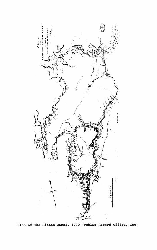
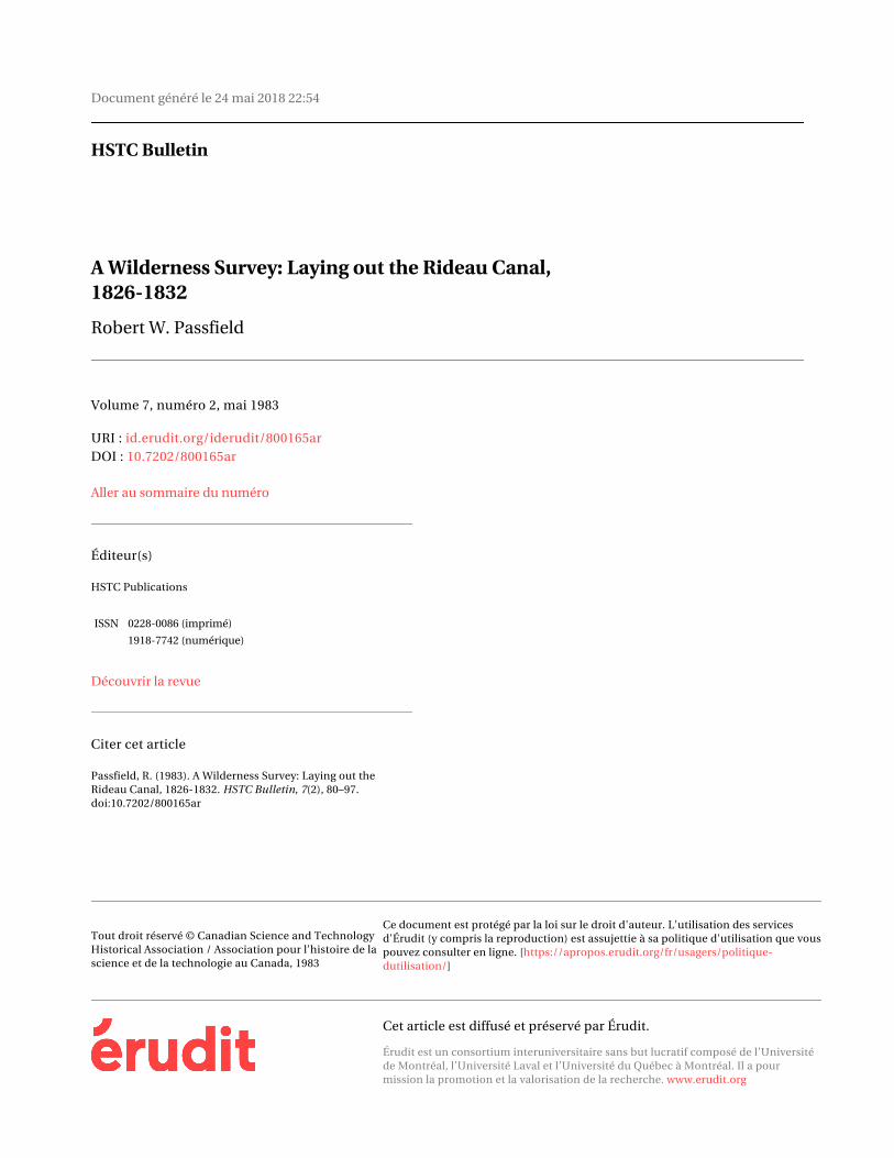
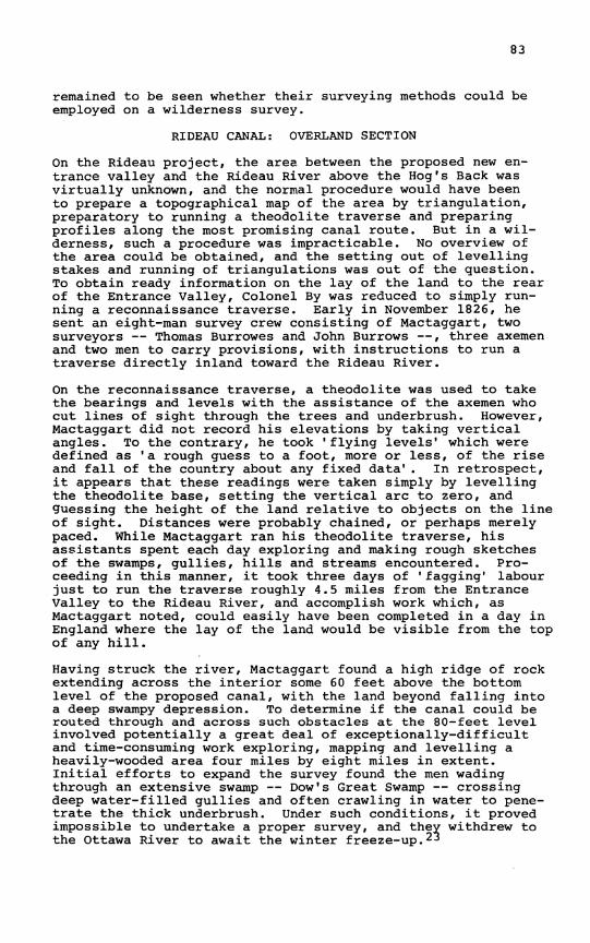
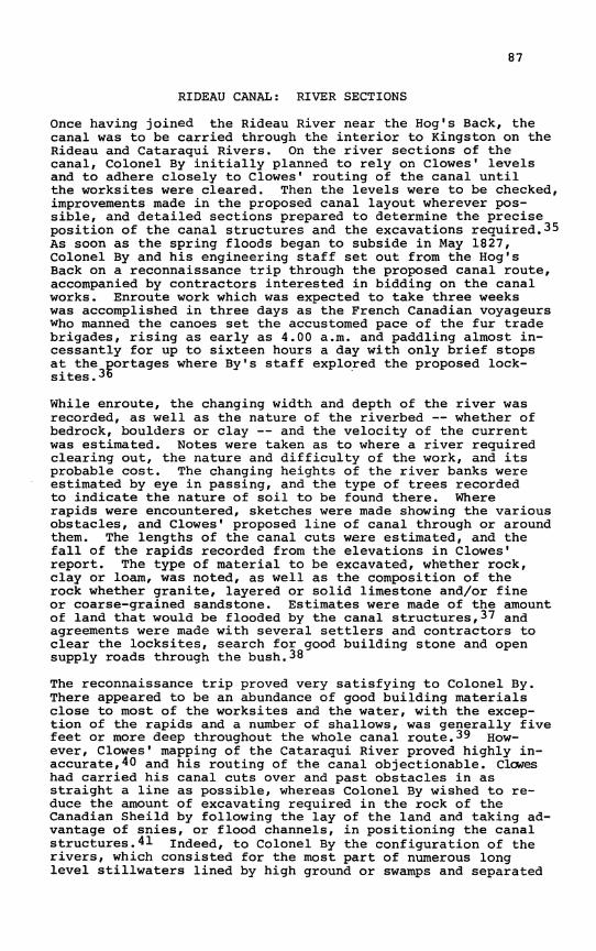
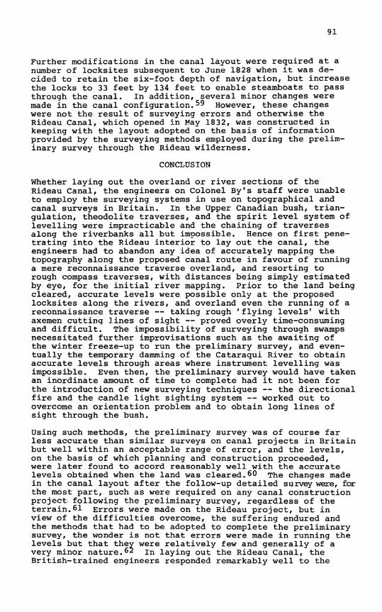
Plan of the Rideau Canal, 1830 (Public Record Office, Kew)
!
' ^ ' ■ c : . . .
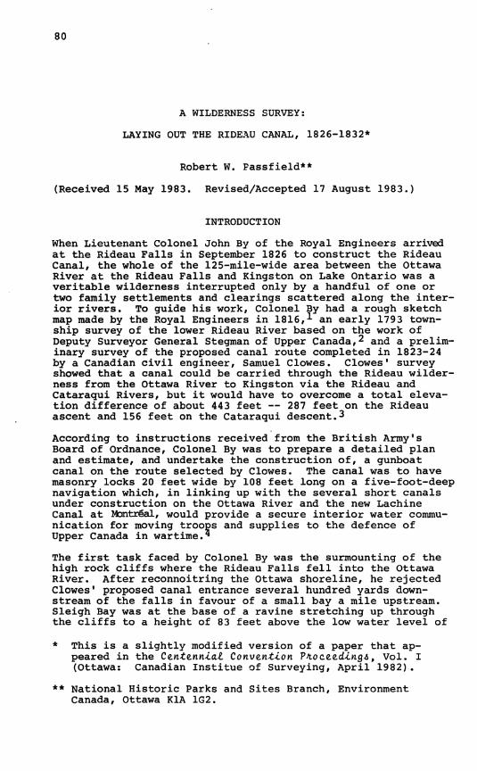
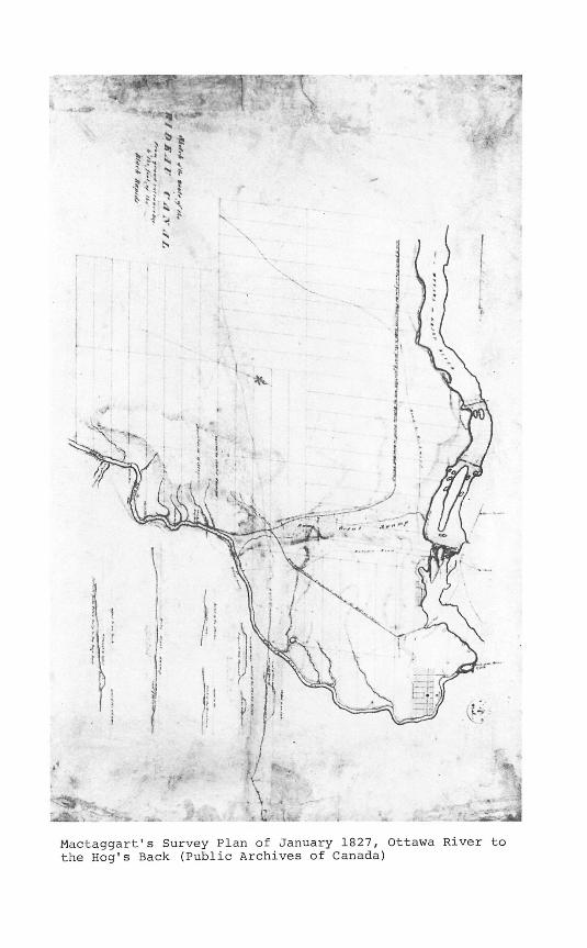
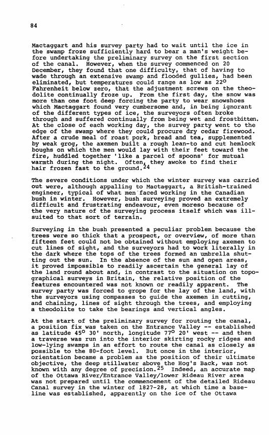
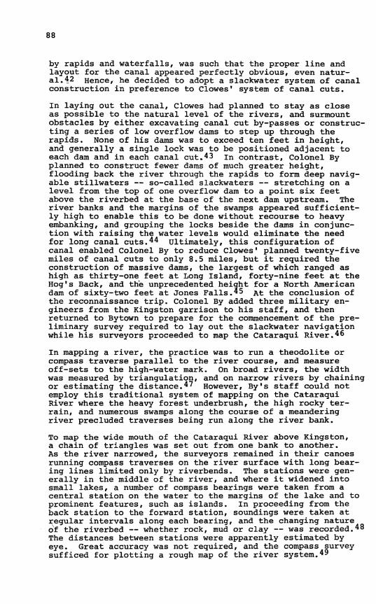
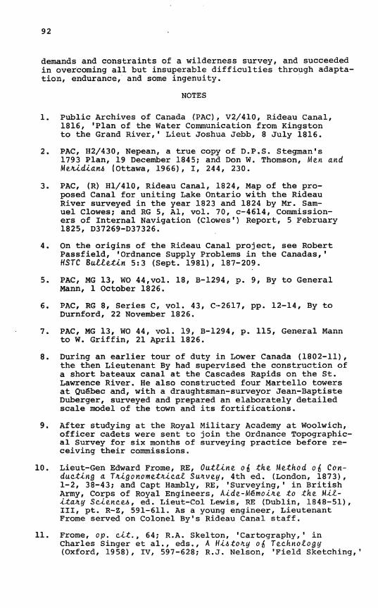
àâ Mactaggart's Survey Plan of January 1827, Ottawa River to the Hog's Back (Public Archives of Canada)
•
.••/"«et., . ; /.
' . ■ '
'" ' "c ' ,J^ {
ft | I » ■ I
sSF
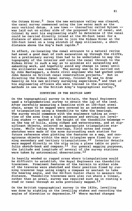
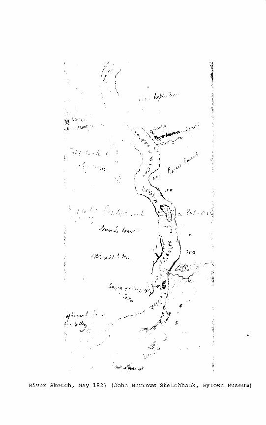
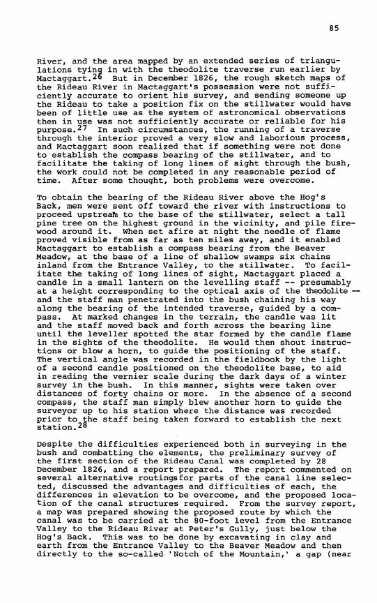
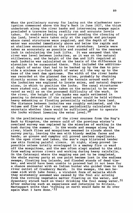
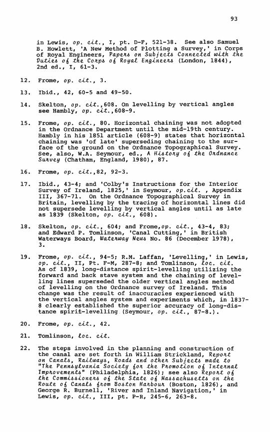
River Sketch, May 1827 (John Burrows Sketchbook, Bytown Museum)
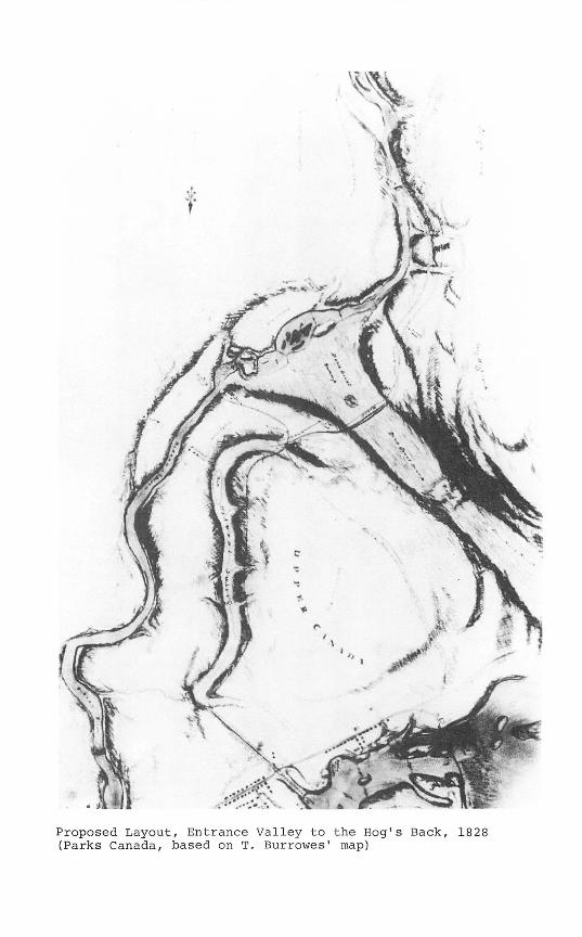
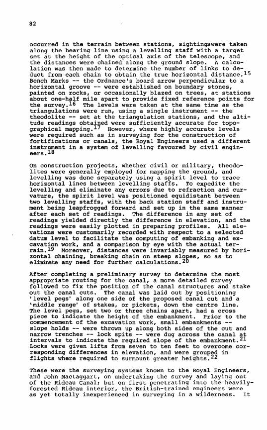
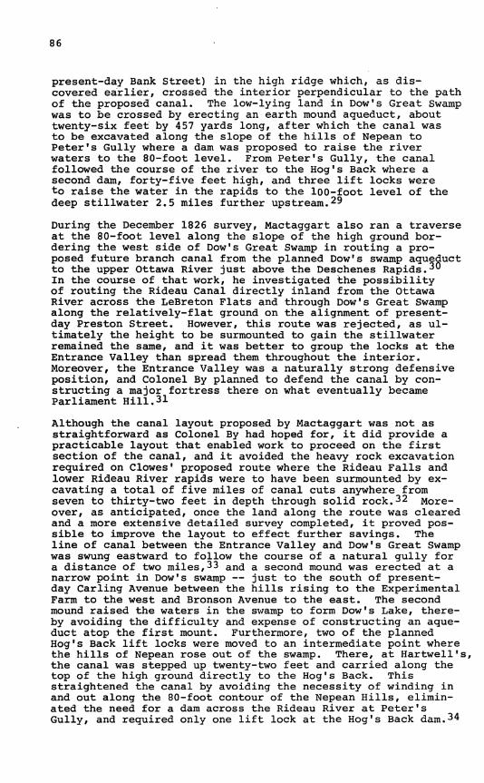
Proposed Layout, Entrance Valley to the Hog's Back, 1825 (Parks Canada, based on T. Burrowes' map)
83
remained to be seen whether their surveying methods could be employed on a wilderness survey.
RIDEAU CANAL: OVERLAND SECTION On the Rideau project, the area between the proposed new entrance valley and the Rideau River above the Hog's Back was virtually unknown, and the normal procedure would have been to prepare a topographical map of the area by triangulation, preparatory to running a theodolite traverse and preparing profiles along the most promising canal route. But in a wilderness, such a procedure was impracticable. No overview of the area could be obtained, and the setting out of levelling stakes and running of triangulations was out of the question. To obtain ready information on the lay of the land to the rear of the Entrance Valley, Colonel By was reduced to simply running a reconnaissance traverse. Early in November 1826, he sent an eight-man survey crew consisting of Mactaggart, two surveyors — Thomas Burrowes and John Burrows — , three axemen and two men to carry provisions, with instructions to run a traverse directly inland toward the Rideau River.
On the reconnaissance traverse, a theodolite was used to take the bearings and levels with the assistance of the axemen who cut lines of sight through the trees and underbrush. However, Mactaggart did not record his elevations by taking vertical angles. To the contrary, he took 'flying levels' which were defined as 'a rough guess to a foot, more or less, of the rise and fall of the country about any fixed data* . In retrospect, it appears that these readings were taken simply by levelling the theodolite base, setting the vertical arc to zero, and guessing the height of the land relative to objects on the line of sight. Distances were probably chained, or perhaps merely paced. While Mactaggart ran his theodolite traverse, his assistants spent each day exploring and making rough sketches of the swamps, gullies, hills and streams encountered. Proceeding in this manner, it took three days of 'fagging1 labour just to run the traverse roughly 4.5 miles from the Entrance Valley to the Rideau River, and accomplish work which, as Mactaggart noted, could easily have been completed in a day in England where the lay of the land would be visible from the top of any hill.
Having struck the river, Mactaggart found a high ridge of rock extending across the interior some 60 feet above the bottom level of the proposed canal, with the land beyond falling into a deep swampy depression. To determine if the canal could be routed through and across such obstacles at the 80-feet level involved potentially a great deal of exceptionally-difficult and time-consuming work exploring, mapping and levelling a heavily-wooded area four miles by eight miles in extent. Initial efforts to expand the survey found the men wading through an extensive swamp — Dow1s Great Swamp — crossing deep water-filled gullies and often crawling in water to penetrate the thick underbrush. Under such conditions, it proved impossible to undertake a proper survey, and they withdrew to the Ottawa River to await the winter freeze-up.2^
84
Mactaggart and his survey party had to wait until the ice in the swamp froze sufficiently hard to bear a man's weight before undertaking the preliminary survey on the first section of the canal. However, when the survey commenced on 20 December, they found that one difficulty, that of having to wade through an extensive swamp and flooded gullies, had been eliminated, but temperatures could range as low as 22° Fahrenheit below zero, that the adjustment screws on the theodolite continually froze up. From the first day, the snow was more than one foot deep forcing the party to wear snowshoes which Mactaggart found very cumbersome and, in being ignorant of the different types of ice, the surveyors often broke through and suffered continually from being wet and frostbitten. At the close of each working day, the survey party went to the edge of the swamp where they could procure dry cedar firewood. After a crude meal of roast pork, bread and tea, supplemented by weak grog, the axemen built a rough lean-to and cut hemlock boughs on which the men would lay with their feet toward the fire, huddled together 'like a parcel of spoons' for mutual warmth during the night. Often, they awoke to find their hair frozen fast to the ground.*4
The severe conditions under which the winter survey was carried out were, although appalling to Mactaggart, a British-trained engineer, typical of what men faced working in the Canadian bush in winter. However, bush surveying proved an extremely difficult and frustrating endeavour, even moreso because of the very nature of the surveying process itself which was ill-suited to that sort of terrain. Surveying in the bush presented a peculiar problem because the trees were so thick that a prospect, or overview, of more than fifteen feet could not be obtained without employing axemen to cut lines of sight, and the surveyors had to work literally in the dark where the tops of the trees formed an umbrella shutting out the sun. In the absence of the sun and open areas, it proved impossible to readily ascertain the general lay of the land round about and, in contrast to the situation on topographical surveys in Britain, the relative position of the features encountered was not known or readily apparent. The survey party was forced to grope for the lay of the land, with the surveyors using compasses to guide the axemen in cutting, and chaining, lines of sight through the trees, and employing a theodolite to take the bearings and vertical angles. At the start of the preliminary survey for routing the canal, a position fix was taken on the Entrance Valley — established as latitude 45° 30' north, longitude 77° 20' west — and then a traverse was run into the interior skirting rocky ridges and low-lying swamps in an effort to route the canal as closely as possible to the 80-foot level. But once in the interior, orientation became a problem as the position of their ultimate objective, the deep Stillwater above the Hog's Back, was not known with any degree of precision.25 indeed, an accurate map of the Ottawa River/Entrance Valley/lower Rideau River area was not prepared until the commencement of the detailed Rideau Canal survey in the winter of 1827-28, at which time a baseline was established, apparently on the ice of the Ottawa
85
River, and the area mapped by an extended series of triangulations tying in with the theodolite traverse run earlier by Mactaggart. 2*> But in December 1826, the rough sketch maps of the Rideau River in Mactaggart1s possession were not sufficiently accurate to orient his survey, and sending someone up the Rideau to take a position fix on the Stillwater would have been of little use as the system of astronomical observations then in use was not sufficiently accurate or reliable for his purpose.27 In such circumstances, the running of a traverse through the interior proved a very slow and laborious process, and Mactaggart soon realized that if something were not done to establish the compass bearing of the Stillwater, and to facilitate the taking of long lines of sight through the bush, the work could not be completed in any reasonable period of time. After some thought, both problems were overcome.
To obtain the bearing of the Rideau River above the Hog's Back, men were sent off toward the river with instructions to proceed upstream to the base of the Stillwater, select a tall pine tree on the highest ground in the vicinity, and pile firewood around it. When set afire at night the needle of flame proved visible from as far as ten miles away, and it enabled Mactaggart to establish a compass bearing from the Beaver Meadow, at the base of a line of shallow swamps six chains inland from the Entrance Valley, to the Stillwater. To facilitate the taking of long lines of sight, Mactaggart placed a candle in a small lantern on the levelling staff — presumably at a height corresponding to the optical axis of the theodolite — and the staff man penetrated into the bush chaining his way along the bearing of the intended traverse, guided by a compass. At marked changes in the terrain, the candle was lit and the staff moved back and forth across the bearing line until the leveller spotted the star formed by the candle flame in the sights of the theodolite. He would then shout instructions or blow a horn, to guide the positioning of the staff. The vertical angle was recorded in the fieldbook by the light of a second candle positioned on the theodolite base, to aid in reading the vernier scale during the dark days of a winter survey in the bush. In this manner, sights were taken over distances of forty chains or more. In the absence of a second compass, the staff man simply blew another horn to guide the surveyor up to his station where the distance was recorded prior to the staff being taken forward to establish the next station.28
Despite the difficulties experienced both in surveying in the bush and combatting the elements, the preliminary survey of the first section of the Rideau Canal was completed by 28 December 1826, and a report prepared. The report commented on several alternative routingsfor parts of the canal line selected, discussed the advantages and difficulties of each, the differences in elevation to be overcome, and the proposed location of the canal structures required. From the survey report, a map was prepared showing the proposed route by which the canal was to be carried at the 80-foot level from the Entrance Valley to the Rideau River at Peter's Gully, just below the Hog's Back. This was to be done by excavating in clay and earth from the Entrance Valley to the Beaver Meadow and then directly to the so-called 'Notch of the Mountain,1 a gap (near
86
present-day Bank Street) in the high ridge which, as discovered earlier, crossed the interior perpendicular to the path of the proposed canal. The low-lying land in Dow1s Great Swamp was to be crossed by erecting an earth mound aqueduct, about twenty-six feet by 457 yards long, after which the canal was to be excavated along the slope of the hills of Nepean to Peter's Gully where a dam was proposed to raise the river waters to the 80-foot level. From Peter's Gully, the canal followed the course of the river to the Hog's Back where a second dam, forty-five feet high, and three lift locks were to raise the water in the rapids to the 100-foot level of the deep Stillwater 2.5 miles further upstream.29
During the December 1826 survey, Mactaggart also ran a traverse at the 80-foot level along the slope of the high ground bordering the west side of Dow's Great Swamp in routing a proposed future branch canal from the planned Dow's swamp aqueduct to the upper Ottawa River just above the Deschenes Rapids.30
In the course of that work, he investigated the possibility of routing the Rideau Canal directly inland from the Ottawa River across the LeBreton Flats and through Dow's Great Swamp along the relatively-flat ground on the alignment of present-day Preston Street. However, this route was rejected, as ultimately the height to be surmounted to gain the Stillwater remained the same, and it was better to group the locks at the Entrance Valley than spread them throughout the interior. Moreover, the Entrance Valley was a naturally strong defensive position, and Colonel By planned to defend the canal by constructing a major fortress there on what eventually became Parliament Hill.31
Although the canal layout proposed by Mactaggart was not as straightforward as Colonel By had hoped for, it did provide a practicable layout that enabled work to proceed on the first section of the canal, and it avoided the heavy rock excavation required on Clowes' proposed route where the Rideau Falls and lower Rideau River rapids were to have been surmounted by excavating a total of five miles of canal cuts anywhere from seven to thirty-two feet in depth through solid rock.32 Moreover, as anticipated, once the land along the route was cleared and a more extensive detailed survey completed, it proved possible to improve the layout to effect further savings. The line of canal between the Entrance Valley and Dow's Great Swamp was swung eastward to follow the course of a natural gully for a distance of two miles,33 and a second mound was erected at a narrow point in Dow's swamp — just to the south of present-day Carling Avenue between the hills rising to the Experimental Farm to the west and Bronson Avenue to the east. The second mound raised the waters in the swamp to form Dow's Lake, thereby avoiding the difficulty and expense of constructing an aqueduct atop the first mount. Furthermore, two of the planned Hog's Back lift locks were moved to an intermediate point where the hills of Nepean rose out of the swamp. There, at Hartwell's, the canal was stepped up twenty-two feet and carried along the top of the high ground directly to the Hog's Back. This straightened the canal by avoiding the necessity of winding in and out along the 80-foot contour of the Nepean Hills, eliminated the need for a dam across the Rideau River at Peter's Gully, and required only one lift lock at the Hog's Back dam.34
87
RIDEAU CANAL: RIVER SECTIONS Once having joined the Rideau River near the Hog's Back, the canal was to be carried through the interior to Kingston on the Rideau and Cataraqui Rivers. On the river sections of the canal, Colonel By initially planned to rely on Clowes' levels and to adhere closely to Clowes' routing of the canal until the worksites were cleared. Then the levels were to be checked, improvements made in the proposed canal layout wherever possible, and detailed sections prepared to determine the precise position of the canal structures and the excavations required.35 As soon as the spring floods began to subside in May 1827, Colonel By and his engineering staff set out from the Hog's Back on a reconnaissance trip through the proposed canal route, accompanied by contractors interested in bidding on the canal works. Enroute work which was expected to take three weeks was accomplished in three days as the French Canadian voyageurs who manned the canoes set the accustomed pace of the fur trade brigades, rising as early as 4.00 a.m. and paddling almost incessantly for up to sixteen hours a day with only brief stops at the portages where By's staff explored the proposed lock-sites.3^
While enroute, the changing width and depth of the river was recorded, as well as the nature of the riverbed — whether of bedrock, boulders or clay — and the velocity of the current was estimated. Notes were taken as to where a river required clearing out, the nature and difficulty of the work, and its probable cost. The changing heights of the river banks were estimated by eye in passing, and the type of trees recorded to indicate the nature of soil to be found there. Where rapids were encountered, sketches were made showing the various obstacles, and Clowes' proposed line of canal through or around them. The lengths of the canal cuts were estimated, and the fall of the rapids recorded from the elevations in Clowes' report. The type of material to be excavated, whether rock, clay or loam, was noted, as well as the composition of the rock whether granite, layered or solid limestone and/or fine or coarse-grained sandstone. Estimates were made of the amount of land that would be flooded by the canal structures,37 and agreements were made with several settlers and contractors to clear the locksites, search for good building stone and open supply roads through the bush.38
The reconnaissance trip proved very satisfying to Colonel By. There appeared to be an abundance of good building materials close to most of the worksites and the water, with the exception of the rapids and a number of shallows, was generally five feet or more deep throughout the whole canal route.3^ However, Clowes' mapping of the Cataraqui River proved highly inaccurate, 40 and his routing of the canal objectionable. Clowes had carried his canal cuts over and past obstacles in as straight a line as possible, whereas Colonel By wished to reduce the amount of excavating required in the rock of the Canadian Sheild by following the lay of the land and taking advantage of snies, or flood channels, in positioning the canal structures.41 Indeed, to Colonel By the configuration of the rivers, which consisted for the most part of numerous long level Stillwaters lined by high ground or swamps and separated
88
by rapids and waterfalls, was such that the proper line and layout for the canal appeared perfectly obvious, even natural. 42 Hence, he decided to adopt a slackwater system of canal construction in preference to Clowes' system of canal cuts. In laying out the canal, Clowes had planned to stay as close as possible to the natural level of the rivers, and surmount obstacles by either excavating canal cut by-passes or constructing a series of low overflow dams to step up through the rapids. None of his dams was to exceed ten feet in height, and generally a single lock was to be positioned adjacent to each dam and in each canal cut.43 in contrast, Colonel By planned to construct fewer dams of much greater height, flooding back the river through the rapids to form deep navigable stillwaters — so-called slackwaters — stretching on a level from the top of one overflow dam to a point six feet above the riverbed at the base of the next dam upstream. The river banks and the margins of the swamps appeared sufficiently high to enable this to be done without recourse to heavy embanking, and grouping the locks beside the dams in conjunction with raising the water levels would eliminate the need for long canal cuts.44 ultimately, this configuration of canal enabled Colonel By to reduce Clowes' planned twenty-five miles of canal cuts to only 8.5 miles, but it required the construction of massive dams, the largest of which ranged as high as thirty-one feet at Long Island, forty-nine feet at the Hog's Back, and the unprecedented height for a North American dam of sixty-two feet at Jones Falls.45 ^t the conclusion of the reconnaissance trip. Colonel By added three military engineers from the Kingston garrison to his staff, and then returned to Bytown to prepare for the commencement of the preliminary survey required to lay out the slackwater navigation while his surveyors proceeded to map the Cataraqui River.46 In mapping a river, the practice was to run a theodolite or compass traverse parallel to the river course, and measure off-sets to the high-water mark. On broad rivers, the width was measured by triangulation, and on narrow rivers by chaining or estimating the distance.47 However, By's staff could not employ this traditional system of mapping on the Cataraqui River where the heavy forest underbrush, the high rocky terrain, and numerous swamps along the course of a meandering river precluded traverses being run along the river bank. To map the wide mouth of the Cataraqui River above Kingston, a chain of triangles was set out from one bank to another. As the river narrowed, the surveyors remained in their canoes running compass traverses on the river surface with long bearing lines limited only by riverbends. The stations were generally in the middle of the river, and where it widened into small lakes, a number of compass bearings were taken from a central station on the water to the margins of the lake and to prominent features, such as islands. In proceeding from the back station to the forward station, soundings were taken at regular intervals along each bearing, and the changing nature of the riverbed — whether rock, mud or clay — was recorded.48 The distances between stations were apparently estimated by eye. Great accuracy was not required, and the compass survey sufficed for plotting a rough map of the river system.49
89
When the preliminary survey for laying out the slackwater navigation commenced above the Hog's Back in June 1827, the thick underbrush along the river banks and intervening swamps again precluded a traverse being readily run and accurate levels taken. To enable planning to proceed pending the clearing of the land, levels were taken only at the rapids and portages where canal structures were required, and the depth of the water was sounded immediately above and below the rapids and at shallows encountered on the river stretches. Levels were taken as accurately as possible and rounded off to the nearest inch in calculating the lock lifts. It was assumed that the river was level between locksites, as it was on the natural stillwaters, and the height of the dam and lift required at each locksite was calculated on the basis of the difference in elevation to be surmounted there. This included the additional depth of water that had to be backed up by the dam to provide a minimum six-foot depth of water all the way up to the base of the next dam upstream. The width of the river banks was recorded at the planned dam sites, probably by chaining directly across the rapids, and the terrain around each of the locksites was explored to locate snies, and natural depressions, in which to position the locks. The canal structures were staked out, and notes taken on the material to be excavated as well as on the presumed difficulty of the work. On the river, the height of the banks was again estimated in passing to determine if the raised water could be held without heavy embanking or flooding potentially valuable farm land. The distance between locksites was roughly estimated, and the volume and flow of the river was periodically calculated to ascertain whether there would be sufficient water to operate the locks without lowering the water level.50 On the preliminary survey of the river courses from the Hog's Back to Kingston, the severe cold of the previous winter's overland survey was replaced by the miseries of working in the bush during the summer. In the woods and swamps along the river, black flies and mosquitoes swarmed in clouds about the survey party, leaving the men with bloody swollen faces and hands, as grease and camphor oil proved useless repellants. On the open river and lakes, the sun's rays blistered tender raw skin forming painful ulcers. At night, sleep proved impossible unless totally envelopped in a smokey fire uo ward off the mosquitoes, and the men often slept soaked to the skin from wading across rivers and working during heavy rainfalls. On the Cataraqui where the mapping was yet to be completed, the whole survey party at one point became lost in the endless swamps, floating bog islands, and flooded stands of dead timber, and would have been unable to proceed had it not been for a chance encounter with an Indian hunter who guided them to the river outlet of Cranberry Marsh. In the swamps, the men became sick with lake fever, a virulent form of malaria which they mistakenly assumed was caused by the foul air arising from the rotting vegetable matter floating on the water, and dysentery struck hard on their drinking the foul swamp water.51 After enduring such an experience and returning to Britain, Mactaggart wrote that 'nothing on earth would make me do over again what I have done.'52
90
Regardless of the miseries endured, with the system adopted for conducting the preliminary river survey there were few problems that could not be overcome. The course of the rivers did not have to be mapped in detail or accurately levelled throughout during the preliminary survey and at the lock-sites, where accurate levels were required, the relatively short distances could be readily measured by chaining horizontally along the bank or in the river rapids with lines of sight being quickly cut where needed to facilitate the taking of levels with a spirit level/levelling staffs. In this manner, the preliminary river survey was completed as of 3 August,53 and by 25 October 1827, plans were prepared for every lock-site showing the layout and elevation of the canal structures required there.54 By the spring of 1828, all of the works were contracted out with payment to be made as the work progressed at a contracted rate per cubic yard of excavation in rock and earth, and per cubic foot of masonry laid in the wall.55 rphe only unfinished work, insofar as the preliminary river survey was concerned, was to obtain levels for the descent of the Cataraqui River through several two-mile-long rifts, or riffles, in a swampy area where levelling had proved totally impossible. There a rough estimate had to be made of the drop in the river at each site.56 Subsequent efforts to run the levels during the winter were frustrated by the floating bushes, bogs and decayed vegetable matter which prevented the ice from freezing solid in the swamps. Eventually accurate levels were only obtained by the laborious effort of constructing a series of temporary timber crib dams across the river to flood back the water through the rifts and swamps.57 Once the land was cleared at the locksites, a detailed survey was undertaken and a continuous series of levels run through the whole line of canal. This resulted in minor changes being made in the canal layout, to take better advantage of the terrain or to compensate for levelling errors and/or erroneous estimates made during the preliminary survey. At the lock-sites, small errors of several inches were discovered in some of the recorded levels, and the assumption that the river was level between locksites resulted in the difference of elevation to be surmounted being in error by from one to two feet at several locksites. At Nicholson's, a gross error of 4,2" was discovered.
The minor errors in level were readily overcome by raising, or lowering, the planned height of the dam and lock lift while construction proceeded, and fortunately the river banks at Nicholson's admitted of the water level being raised sufficiently to compensate for the error without extensive embanking. The most costly mistakes occurred in several instances where the height of the riverbanks between locksites was overestimated. This necessitated either heavy embanking work to hold the raised water, or the lowering of the dam and lock lift in conjunction with excavation work in the riverbed upstream to obtain a navigable depth of water. Where the riverbanks proved appreciably higher than estimated, as was the case above Clowes' Quarry and Kingston Mills, the height of the dam and the lock lift were increased substantially to flood back the water over rapids immediately upstream, thereby eliminating the need for planned canal structures there.58
91
Further modifications in the canal layout were required at a number of locksites subsequent to June 1828 when it was decided to retain the six-foot depth of navigation, but increase the locks to 33 feet by 134 feet to enable steamboats to pass through the canal. In addition, several minor changes were made in the canal configuration.59 However, these changes were not the result of surveying errors and otherwise the Rideau Canal, which opened in May 1832, was constructed in keeping with the layout adopted on the basis of information provided by the surveying methods employed during the preliminary survey through the Rideau wilderness.
CONCLUSION Whether laying out the overland or river sections of the Rideau Canal, the engineers on Colonel By1s staff were unable to employ the surveying systems in use on topographical and canal surveys in Britain. In the Upper Canadian bush, triangulation, theodolite traverses, and the spirit level system of levelling were impracticable and the chaining of traverses along the riverbanks all but impossible. Hence on first penetrating into the Rideau interior to lay out the canal, the engineers had to abandon any idea of accurately mapping the topography along the proposed canal route in favour of running a mere reconnaissance traverse overland, and resorting to rough compass traverses, with distances being simply estimated by eye, for the initial river mapping. Prior to the land being cleared, accurate levels were possible only at the proposed locksites along the rivers, and overland even the running of a reconnaissance traverse — taking rough 'flying levels' with axemen cutting lines of sight — proved overly time-consuming and difficult. The impossibility of surveying through swamps necessitated further improvisations such as the awaiting of the winter freeze-up to run the preliminary survey, and eventually the temporary damming of the Cataraqui River to obtain accurate levels through areas where instrument levelling was impossible. Even then, the preliminary survey would have taken an inordinate amount of time to complete had it not been for the introduction of new surveying techniques — the directional fire and the candle light sighting system — worked out to overcome an orientation problem and to obtain long lines of sight through the bush.
Using such methods, the preliminary survey was of course far less accurate than similar surveys on canal projects in Britain but well within an acceptable range of error, and the levels, on the basis of which planning and construction proceeded, were later found to accord reasonably well with the accurate levels obtained when the land was cleared.60 The changes made in the canal layout after the follow-up detailed survey were, for the most part, such as were required on any canal construction project following the preliminary survey, regardless of the terrain.61 Errors were made on the Rideau project, but in view of the difficulties overcome, the suffering endured and the methods that had to be adopted to complete the preliminary survey, the wonder is not that errors were made in running the levels but that they were relatively few and generally of a very minor nature.6* jn laying out the Rideau Canal, the British-trained engineers responded remarkably well to the
92
demands and constraints of a wilderness survey, and succeeded in overcoming all but insuperable difficulties through adaptation, endurance, and some ingenuity.
NOTES
1. Public Archives of Canada (PAC), V2/410, Rideau Canal, 1816, 'Plan of the Water Communication from Kingston to the Grand River,' Lieut Joshua Jebb, 8 July 1816.
2. PAC, H2/430, Nepean, a true copy of D.P.S. Stegman's 1793 Plan, 19 December 1845; and Don W. Thomson, l\an and MziidianA (Ottawa, 1966), I, 244, 230.
3. PAC, (R) Hl/410, Rideau Canal, 1824, Map of the proposed Canal for uniting Lake Ontario with the Rideau River surveyed in the year 1823 and 1824 by Mr. Samuel Clowes; and RG 5, Al, vol. 70, c-4614, Commissioners of Internal Navigation (Clowes') Report, 5 February 1825, D37269-D37326.
4. On the origins of the Rideau Canal project, see Robert Passfield, 'Ordnance Supply Problems in the Canadas,' HSTC Bulletin 5:3 (Sept. 1981), 187-209.
5. PAC, MG 13, WO 44,vol. 18, B-1294, p. 9, By to General Mann, 1 October 1826.
6. PAC, RG 8, Series C, vol. 43, C-2617, pp. 12-14, By to Durnford, 22 November 1826.
7. PAC, MG 13, WO 44, vol. 19, B-1294, p. 115, General Mann to W. Griffin, 21 April 1826.
8. During an earlier tour of duty in Lower Canada (1802-11), the then Lieutenant By had supervised the construction of a short bateaux canal at the Cascades Rapids on the St. Lawrence River. He also constructed four Martello towers at Québec and, with a draughtsman-surveyor Jean-Baptiste Duberger, surveyed and prepared an elaborately detailed scale model of the town and its fortifications.
9. After studying at the Royal Military Academy at Woolwich, officer cadets were sent to join the Ordnance Topographical Survey for six months of surveying practice before receiving their commissions.
10. Lieut-Gen Edward Frome, RE, Outline ol the Method oi Conducting a Trigonometrical Survey, 4th ed. (London, 1873) , 1-2, 38-43; and Capt Hambly, RE, 'Surveying,' in British Army, Corps of Royal Engineers, Aide-Memo tut to the Military Science*, ed. Lieut-Col Lewis, RE (Dublin, 1848-51), III, pt. R-Z, 591-611. As a young engineer, Lieutenant Frome served on Colonel By's Rideau Canal staff.
11. Frome, op. cit., 64; R.A. Skelton, 'Cartography,' in Charles Singer et al., eds., A History o{ Technology (Oxford, 1958), IV, 597-628; R.J. Nelson, 'Field Sketching,'
93
in Lewis, op. cit., I, pt. D-F, 521-38. See also Samuel B. Howlett, 'A New Method of Plotting a Survey,1 in Corps of Royal Engineers, Papen* on Subject* Connected with the Vatic* oi the Coftp* oi Royal Engineer (London, 1844), 2nd éd., I, 61-3. Frome, op. cit., 3. Ibid., 42, 60-5 and 49-50. Skelton, op. cit.,60S. On levelling by vertical angles see Hambly, op. cit.,608-9. Frome, op. cit., 80. Horizontal chaining was not adopted in the Ordnance Department until the mid-19th century. Hambly in his 1851 article (608-9) states that horizontal chaining was 'of late' superseding chaining to the surface of the ground on the Ordnance Topographical Survey. See, also, W.A. Seymour, éd., A HI*tony o£ the Ordnance Survey (Chatham, England, 1980), 87. Frome, op. cit.,82, 92-3. Ibid., 43-4; and 'Colby's Instructions for the Interior Survey of Ireland, 1825,■ in Seymour, op.clt. , Appendix III, 367-71. On the Ordnance Topographical Survey in Britain, levelling by the tracing of horizontal lines did not supersede levelling by vertical angles until as late as 1839 (Skelton, op. cit., 608). Skelton, op. cit., 604; and Frome,op. cit., 43-4, 83; and Edward P. Tomlinson, 'Canal Cutting,' in British Waterways Board, Waterway New* No. 86 (December 1978), 3. Frome, op. cit., 94-5; R.M. Laffan, 'Levelling,' in Lewis, op. cit., II, Pt. F-M, 287-8; and Tomlinson, loc. clt. As of 1839, long-distance spirit-levelling utilizing the forward and back stave system and the chaining of levelling lines superseded the older vertical angles method of levelling on the Ordnance survey of Ireland. This change was the result of inaccuracies experienced with the vertical angles system and experiments which, in 1837-8 clearly established the superior accuracy of long-distance spirit-levelling.(Seymour, op. cit., 87-8.). Frome, op. cit., 42. Tomlinson, loc. clt.
The steps involved in the planning and construction of the canal are set forth in William Strickland, Report on Canal*, Railway*, Road* and other Subject* made to "The Penn*ylvanla Society fan. the Promotion o& Internal Improvement*" (Philadelphia, 1826); see also Report o£ the Comml**lonen* o& the State o& Ma**achu*ett* on the Route oi Canal* in.om Bo*ton Harbour (Boston, 1826), and George R. Burnell, 'River and Inland Navigation,' in Lewis, op. cit., Ill, pt. P-R, 245-6, 263-8.
John Mactaggart, Three years In Canada: An Account o£ the Actual State o£ the Country In 1826-7-8 comprehending Its Resources, Productions, Improvements, and Capabilities and Including Sketches oi the State o£ Society, Advice to Emigrants, etc. 2 vols. (London, 1829)/ I, 48-52. On preliminary surveys for the construction of fortifications in heavily-forested areas, the Royal Engineers generally used a grid system. Profiles of the groung were prepared by running a single longitudinal traverse, and a series of cross traverses perpendicular to it at from 100 to 300-foot intervals. Axemen cut lines of sight, and the surveying was done in the fall of the year when the leaves were off the deciduous trees (PAC, MG 13, WO 44, vol. 18, B-1294, pp. 118-9, Col Durnford to Col Wright, 14 October 1826). A grid system, however, would have been too time-consuming and difficult in the vast area of the Rideau interior. On grid surveying, see Harry Bouchard, Surveying, 5th éd., rev. (Scranton, Pa., 1965), 474-6. Mactaggart, op. cit., I, 50-54. Ibid., 49-51 and II, 94-5. PAC, Hll/410, Rideau Canal, 1827-29, "Survey of the Proposed Route of the Rideau Canal from the Ottawa River to Black Rapids,1 Thomas Burrowes. On the Rideau project, Col By had only one theodolite. The detailed mapping of the Ottawa/lower Rideau rivers may well have been done by positioning a plane table over the survey stations directly on the ice. The detailed surveying in the interior may also have been done by plane tabling once the sites were cleared. The National War Museum in Ottawa has an instrument of Colonel By's that was used for taking angles with a plane table. The only way Mactaggart could have taken a position fix was with a sextant and Nautical Almanac tables, using the lunar distance method. This system was used by Hudson's Bay Company explorers; but it could err by as much as fifteen miles. The pocket chronometer was not in use when Mactaggart surveyed the canal. I am indebted to Lou Sebert, former Head, Mapping Program Section, Topographical Survey Directorate, Enery, Mines and Resources, for this information. Mactaggart, op. cit., I, 50-2, and II, 94-5. The candle light method of taking a long line of sight was probably suggested by a similar technique used by Upper Canadian land surveyors for taking pole-star observations at night. See Lou Sebert, éd., 'Early Surveying in Upper Canada,' The Canadian Surveyor, supplement (June 1977), 196. Mactaggart, op. cit., I, 105-18; and PAC, H2/410, n.d., 'Sketch of the Route of the Rideau Canal from the Entrance Bay to the foot of Black Rapids.' Ibid., I, 110. Mactaggart found that the proposed branch
95
canal could be run on the 80-foot level for almost five miles to Lake Deschenes where two locks were required to step down thirteen feet. Lake Deschenes was sixty-seven feet above the Ottawa River at the base of the Chaudière Falls, but still below the proposed level of the canal in Dow■s Swamp. Ibid., I, 107-8, 330. A.D.H. Ross, in Ottawa: Vaht and Vicient (Toronto, 1927) , 56-7, attributes the abandonment of the LeBreton Flats route solely to the exorbitant price Capt LeBreton demanded for his land; but his was a minor, if not totally insignificant factor in routing the canal. PAC, RG 5, Al, vol. 70, Clowe's Report, pp. D37304-8. PAC, V2/410, Rideau Canal, 7 July 1827, 'Sketch showing the proposed line of the Rideau Canal from the River Ottawa to the Head of Long Island with the position of various works required to complete the navigation for 44 miles, carrying the level of the canal 144 feet above the level of the Ottawa.' PAC, MG 29, B6, Andrew Drummond Papers, vol. 1, Rideau Canal, General Route Plan, Ottawa River to Maitland's Rapids. A guard lock, having no lift, was also constructed at the upper end of the Hog's Back lift lock. PAC, RG 8, Series C, Vol. 43, C-2618, p. 14, By to Durn-ford, 22 November 1826. Ibid., p. 215, By to Major Darling, 14 April 1827; and John Burrows, 'Sketch Book,' (original in Bytown Museum, Ottawa; copy in PAC, MG 24, H12), 102-21. The customary pace of the voyageurs is described in Eric Morse, Van. Tuadc Canod Routt* oi Canada, Than and Novo (Ottawa, 1969), 8. Burrows,toe. clt.
PAC, MG 13, WO 44, B-1294, vol. 19, p. 80, By to General Mann, 1 November 1827. PAC, RG 8, Series C, vol. 44, C-2618, pp. 80-9, By to Mann, 6 July 1827. PAC, MG 13, WO 44, vol. 19, B-1294, pp. 99-100, By to Durnford, 21 May 1827. Burrows, op. cit., 106 and comments on 146-52. By to Mann (see note 39) . PAC, RG 5, Al, vol. 70, Clowe's Report, D37396-373404. Mactaggart, op. cit., I, 162.
96
45. In 1829, Colonel By decided to construct waste weirs to control water levels, and the high overflow dams were raised about four feet to prevent water flower over them.
46. PAC, MG 13, WO 44, vol. 19, B-1294, pp. 99-100, By to Dtlrnford, 21 May 1827.
47. John Love, Geodae*la: or, the Art o& Surveying and Mea*ur-Ing oi land made ea*le *howlng by plain and pn.actA.cal rule*, how to *urvey, pn.otn.acz, ca*t up, reduce on. divide and piece o& land what* oeven., with new table* ion. the ea*e o\ the *urveyor In reducing the mea*ure* oi land (London, 1688), 185-9; and W. Davis Haskoll, CE, Land &nd Marine Surveying In reference to the preparation o& plan* ion. Road* and Railway*, Canal*, Riven.*, Town** Water Supplie*, Dock* and Harbour*, with Ve*crlptlon and U*e oi Surveying ln*trument* , 2nd éd., rev. (London, 1886), plate 10a, 'Traverse Surveying.1
48. PAC, Hll/410, Rideau Canal, n.d., 'Proposed route of the Rideau Canal from Cataraqui Bay towards Brewer's Mills' (three sections).
49. Two decades later, the Canadian Geological Survey used compass traverses on the river surface to map rivers in heavily-forested areas, but by then a micrometer (Rochon's Micrometer) was employed to measure distances (see Geological Survey of Canada, Report ol Vrogre** &or the Vear 1S44 ). In 1826-32, the Royal Engineers did not have micrometers, and the telescope of theodolites was not equipped with stadia hairs at that time. Early experiments with measuring distances using the telescope and a reading staff are set forth in Edmund Bowman, 'On Measuring Distances by the Telescope,' The Civil Engineer and Architect1* Journal IV (1841), 424-8, and William Bray, 'Measuring Distances by Telescope,' Minute* oi Proceeding* oi the ln*tltutlon oi Civil Engineer* XXI (1862), 34-7.
50. Mactaggart, op. cit., I, 119-55; and Burrows, op. cit., 127-54.
51. Mactaggart, op. cit., I, 52-8, 179, 184; and Burrows,op.cit., 129-30, 136, 142 and 148.
52. Mactaggart, op. cit., I, 54. 53. Ibid., 119. 54. PAC, Rideau Canal, AA Plan Series, dated 7th July and 25th
October 1827. 55. PAC, MG 13, WO 55, B-2811, vol. 865, p. 209, By to Durnford,
1 April 1828. 56. Mactaggart, op. cit., I, 153-4.
97
PAC, MG 13, WO 55, B-2811, vol. 865, p. 209, By to Durnford, 14 January 1832. Ibid. At Nicholson's a second lock was added, and the two locks positioned separately to suit the longitudinal section of the ground. Above Clowes, a planned lock/dam at Phillip's Bay was eliminated. At Kingston Mills an extra lock was added along with the raising of the dam, to do away with the proposed Jack's Rifts and Billidore's Rifts locksites upstream. After 1829, a water weir was added at each locksite, and to reduce rock excavation work the summit level of the canal was raised 4'-10" by adding a lock at Newboro and a lock and dam at the Narrows. See Robert Passfield, EnglntzKlng the. Ve.£e.nce. o£ the. Canada*: It. Col. John By &nd tko. Rldzau Canal (Parks Canada, Manuscript Report No. 425, 1980), 152-5. As of 1832, the Rideau Canal consisted of forty-seven masonry locks grouped at twenty-two locksites, twenty-three dams and waste weirs, seventeen major embankments, and 8.5 miles of canal cuts. Mactaggart, op. cit., II, 95. See Re.poKt o£ Comml^&lonefu, 106-7; and Burnell,op. cit., 268. This is precisely the assertion made by Colonel By. See PAC, RG 8, Series C, vol. 51, C-2619, p. 32.


![Rideau Reflections - Fall/Winter 2014 · 2015-03-27 · Friends of the Rideau – Rideau Reflections Fall/Winter 2014 Page 2 breadth 83 yards, from its south [north] entrance to the](https://static.fdocuments.us/doc/165x107/5f0c604f7e708231d4351830/rideau-reflections-fallwinter-2015-03-27-friends-of-the-rideau-a-rideau-reflections.jpg)

