

A New View to the Sanborn Map Collection of Wayne County, Indiana 2013 Indiana GIS Day & Conference...
23
Sanborn Map Collection of Wayne County, Indiana 2013 Indiana GIS Day & Conference Shaun N. Scholer, GISP GIS Manager, Wayne County/Richmond GIS Interlocal 401 E Main St. Richmond , IN 47374 Office: 765-973-9385 [email protected] Gunty Atkins, GISP GIS Coordinator, Wayne County Surveyor’s Office 401 E Main St. Richmond , IN 47374 Office: 765-973-9483 [email protected]
-
Upload
antonio-sundy -
Category
Documents
-
view
217 -
download
2
Transcript of A New View to the Sanborn Map Collection of Wayne County, Indiana 2013 Indiana GIS Day & Conference...

A New View to the Sanborn Map Collection
of Wayne County, Indiana
2013 Indiana GIS Day & Conference
Shaun N. Scholer, GISP
GIS Manager,
Wayne County/Richmond GIS Interlocal
401 E Main St. Richmond , IN 47374
Office: 765-973-9385
Gunty Atkins, GISP
GIS Coordinator,
Wayne County Surveyor’s Office
401 E Main St. Richmond , IN 47374
Office: 765-973-9483
• IndianaView Funding
• Beneficiaries
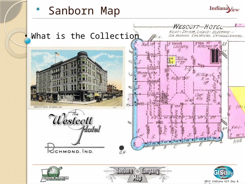
• What is the Sanborn Map Collection?
• Confined to Books
• Indiana’s Digital Archiving Project
• Old Maps with a Modern View
2013 Indiana GIS Day & Conference

IndianaView Internal Grant Program• Administrator: Larry Biehl, Purdue
University
• Funding Source: Grant from the U.S. Geological Survey
• AmericaView: Nationwide partnership of remote sensing scientists supporting remote sensing research, K-12 and higher education.
• Partnerships: IGIC and Indiana Spatial Data Portal 2013 Indiana GIS Day &
Conference
1886
2013 Indiana GIS Day & Conference
19092013
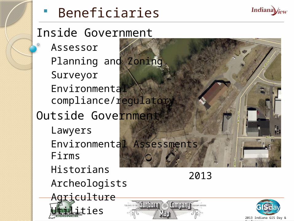
Inside GovernmentAssessorPlanning and ZoningSurveyorEnvironmental compliance/regulatory
Outside GovernmentLawyersEnvironmental Assessments FirmsHistoriansArcheologistsAgricultureUtilities
Beneficiaries

• Confined to Books
Sanborn Map
Sanborn Map
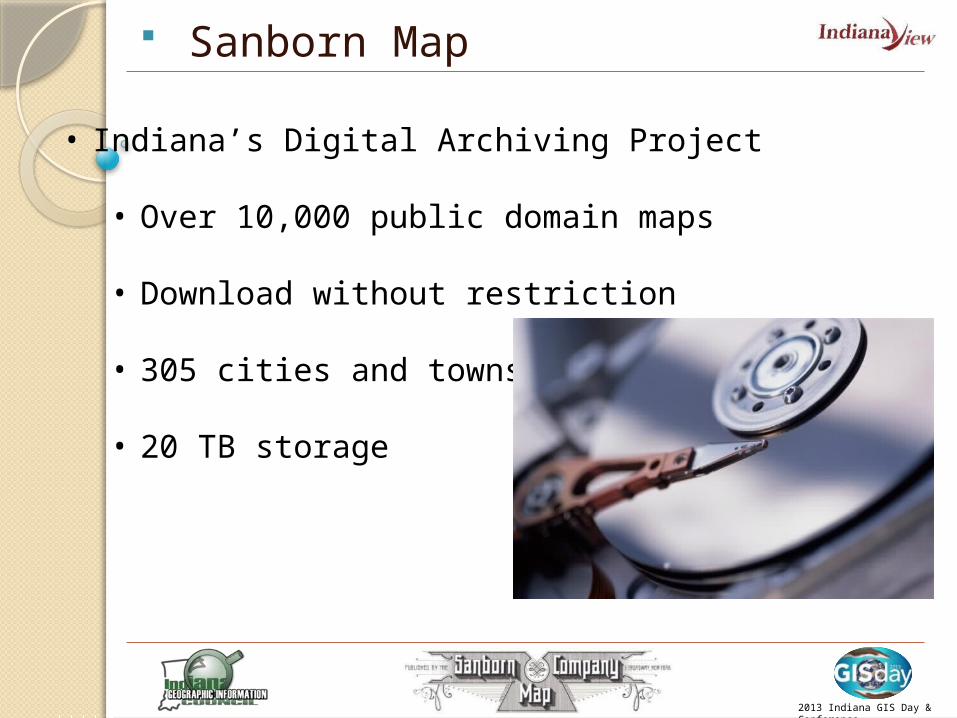
• Indiana’s Digital Archiving Project
• Over 10,000 public domain maps
• Download without restriction
• 305 cities and towns
• 20 TB storage
2013 Indiana GIS Day & Conference

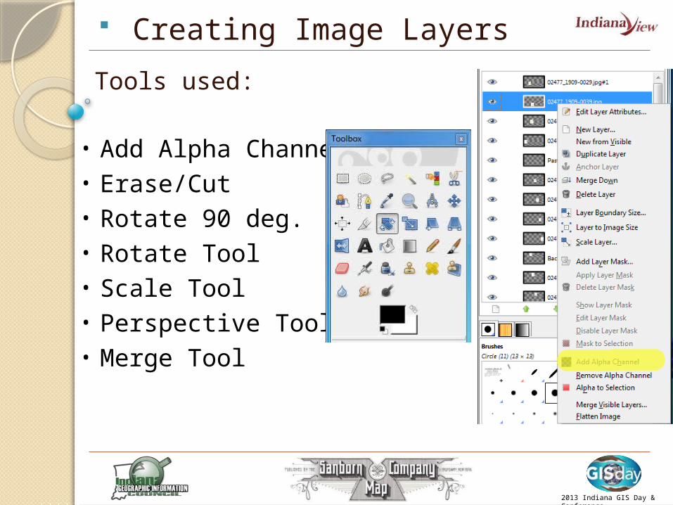
Creating Image Layers
Software used:• GIMP (manipulating images)
• ArcGIS Desktop (Rectification and clipping)
2013 Indiana GIS Day & Conference
•Open source•Best of all it is FREE!•http://www.gimp.org
•Most GIS systems already use ArcGIS
Creating Image Layers
2013 Indiana GIS Day & Conference
Tools used:
• Add Alpha Channel• Erase/Cut• Rotate 90 deg.• Rotate Tool• Scale Tool• Perspective Tool• Merge Tool

Creating Image Layers
Two Methods:
2013 Indiana GIS Day & Conference
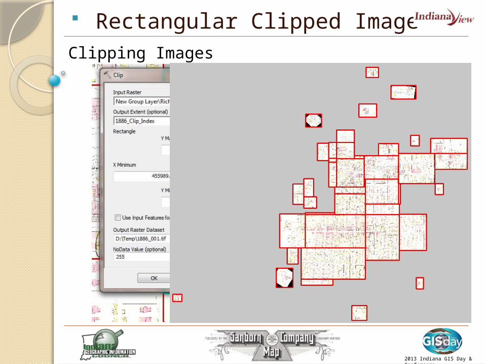
• Rectangular Clipped Images
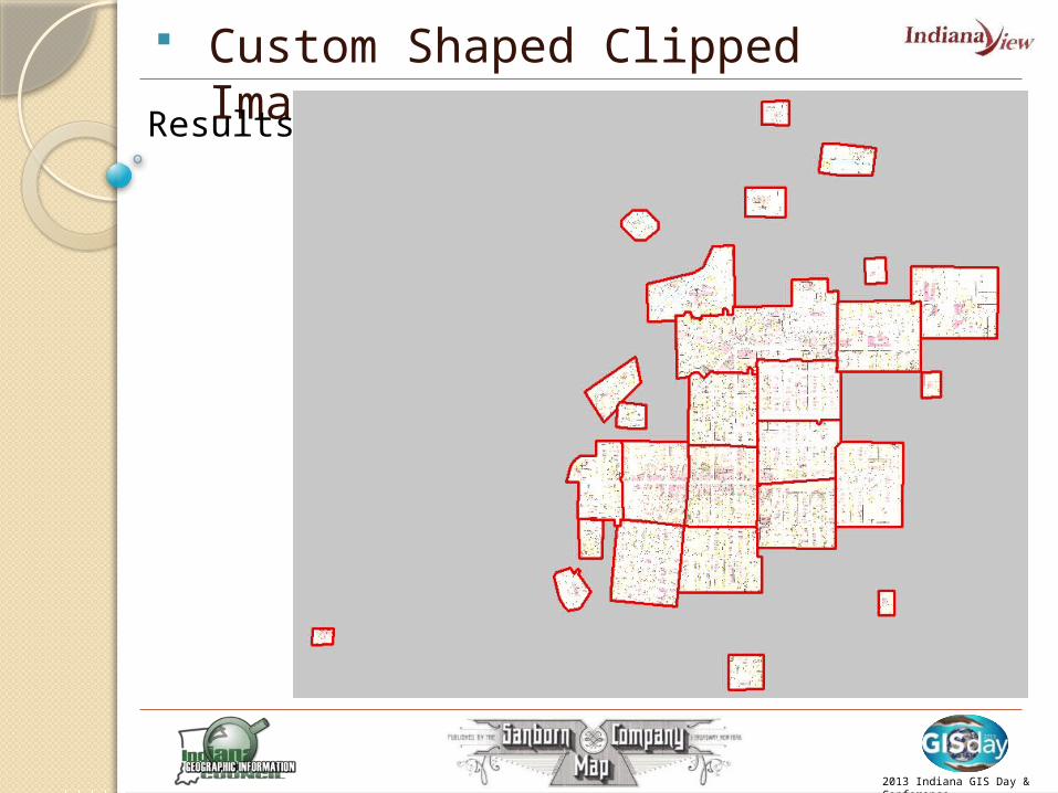
• Custom Shape Clipped Images
• Method Wayne Co used
• Works well with various software- Map Guide, AutoCad, Microstation Etc
• Complex in creating• Works well within the
ArcGIS world of raster mosaic datasets

• Rectangular Clipped Images
Preplanning• Would like to
keep clipped edges in road right of ways
• Determine which map pages to merge to create good North South break lines
2013 Indiana GIS Day & Conference
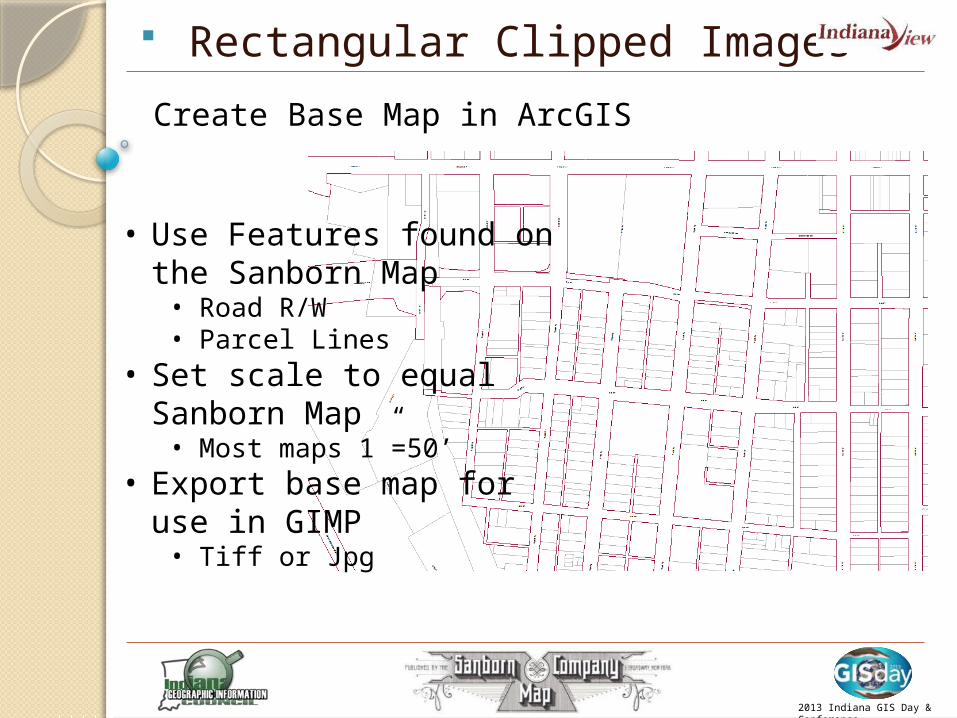
Rectangular Clipped Images
2013 Indiana GIS Day & Conference
Create Base Map in ArcGIS
• Use Features found on the Sanborn Map• Road R/W• Parcel Lines
• Set scale to equal Sanborn Map• Most maps 1”=50’
• Export base map for use in GIMP• Tiff or Jpg

Rectangular Clipped Images
2013 Indiana GIS Day & Conference
Add map pages and base map to GIMP• Rectify against base map• Rotate, Stretch, Erase• Cut and paste data that might get lost in
the clipping process
Rectangular Clipped Images
2013 Indiana GIS Day & Conference
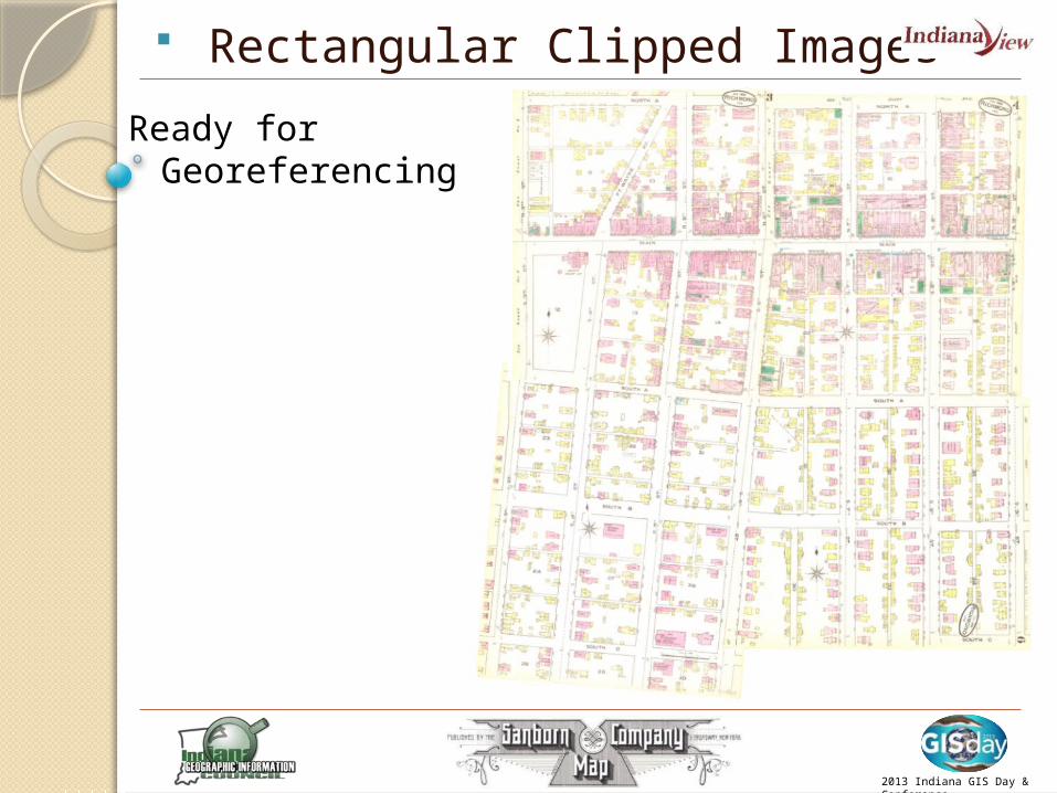
Ready for Georeferencing

Rectangular Clipped Image
2013 Indiana GIS Day & Conference
Georeferencing Images

• Custom Shape Clipped Images
Hit theEasy Button
2013 Indiana GIS Day & Conference

Sanborn Map
Conclusion
• Geo-referenced Mosaic for Each Map Set in Wayne County
Indiana Spatial Data Portal
2013 Indiana GIS Day & Conference

Sanborn MapShaun N. Scholer & Gunty Atkins
Wayne County/Richmond GIS Interlocal
401 E Main St. Richmond , IN 47374
Office: 765-973-9201
Grant Provided by:
IndianaView Consortium
Larry Biehl
Purdue University
Information Technology at Purdue (ITaP)
IGIC
Philip S. Worrall
Executive Director
Indiana Geographic Information Council, Inc.
317.504.4389
Partnerships:
Indiana Spatial Data Portal
Anna Radue
Indiana University
2013 Indiana GIS Day & Conference