A New Set of Cartographic Symbols for IMSMA and...
67
A New Set of Cartographic Symbols for IMSMA and Humanitarian Demining John Kostelnick Jerry Dobson Steve Egbert Matt Dunbar University of Kansas Department of Geography Lawrence, KS U.S.A. American Geographical Society Workshop on Humanitarian Demining Symbology Reston, VA November 7, 2005
Transcript of A New Set of Cartographic Symbols for IMSMA and...
A New Set of CartographicSymbols for IMSMA and Humanitarian Demining
John Kostelnick Jerry Dobson Steve Egbert Matt Dunbar
University of Kansas
Department of Geography
Lawrence, KS U.S.A.
American Geographical Society Workshop on Humanitarian Demining Symbology
Reston, VA
November 7, 2005
Project Overview
Study of map symbols used in humanitariandemining activities
Sponsored by the Geneva International Centrefor Humanitarian Demining (GICHD)
Final Report and Recommendations:September 2004

Final Report and Recommendations
www.gichd.ch

Project Objectives
To investigate the need for a common set ofcartographic symbols to support humanitariandemining.
To research and catalog existing map symbols usedby humanitarian and military organizations to depictlandmines, minefields, and mine actions.
To develop and propose an improved set ofcartographic symbols that may be implemented inIMSMA for possible standardization.
Standardized Map Symbols
Symbols on maps serve as a graphicallanguage
Multiple symbol sets may cause confusion
Standardized symbols = Communication viathe same graphical language

Standardized Map Symbols
Benefits of Standardized Symbols for Demining
Consistent method for marking hazards on maps
Increase efficiency in operations
Aid in the exchange of maps and informationbetween organizations
Other standards for humanitarian demining,International Mine Action Standards (IMAS)

Standardized Map Symbols
Important Questions:
How similar or different are landmine, minefield, andmine action map symbols between organizations?
How can IMSMA symbols be designed in a manner tolead efforts in standardizing a set of symbols forhumanitarian demining?

Existing Humanitarian DeminingMap Symbols
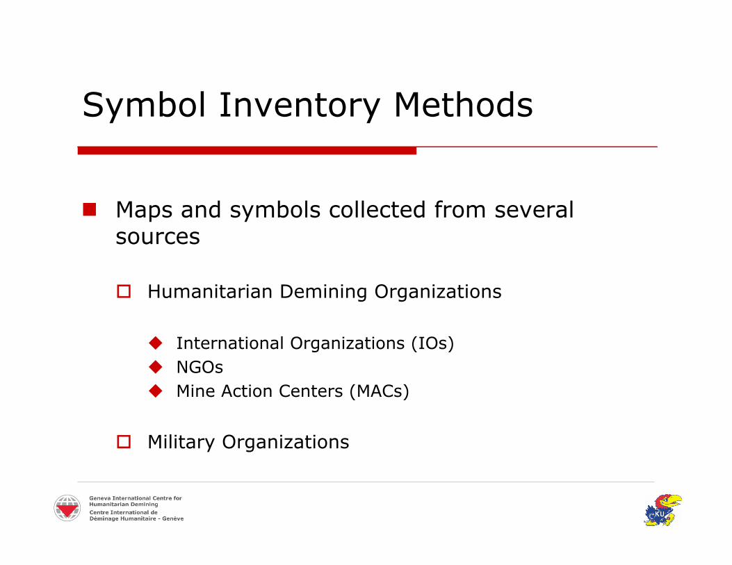
Symbol Inventory Methods
Maps and symbols collected from severalsources
Humanitarian Demining Organizations
International Organizations (IOs) NGOs Mine Action Centers (MACs)
Military Organizations
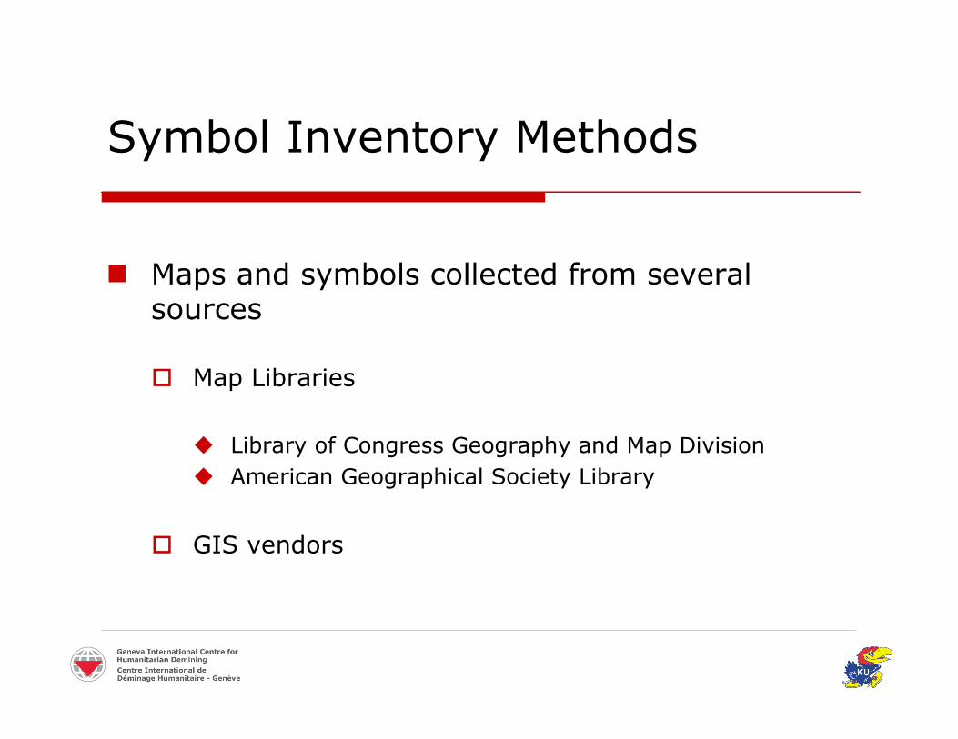
Symbol Inventory Methods
Maps and symbols collected from severalsources
Map Libraries
Library of Congress Geography and Map Division American Geographical Society Library
GIS vendors

Symbol Inventory Methods
E-mail request sent to each organization
European Union in Humanitarian Demining(EUDEM2) e-mail listserve and website posting
Maps and symbols gathered from websites
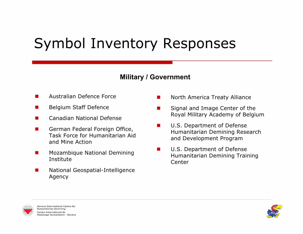
Symbol Inventory Responses
Australian Defence Force
Belgium Staff Defence
Canadian National Defense
German Federal Foreign Office,Task Force for Humanitarian Aidand Mine Action
Mozambique National DeminingInstitute
National Geospatial-IntelligenceAgency
North America Treaty Alliance
Signal and Image Center of theRoyal Military Academy of Belgium
U.S. Department of DefenseHumanitarian Demining Researchand Development Program
U.S. Department of DefenseHumanitarian Demining TrainingCenter
Military / Government
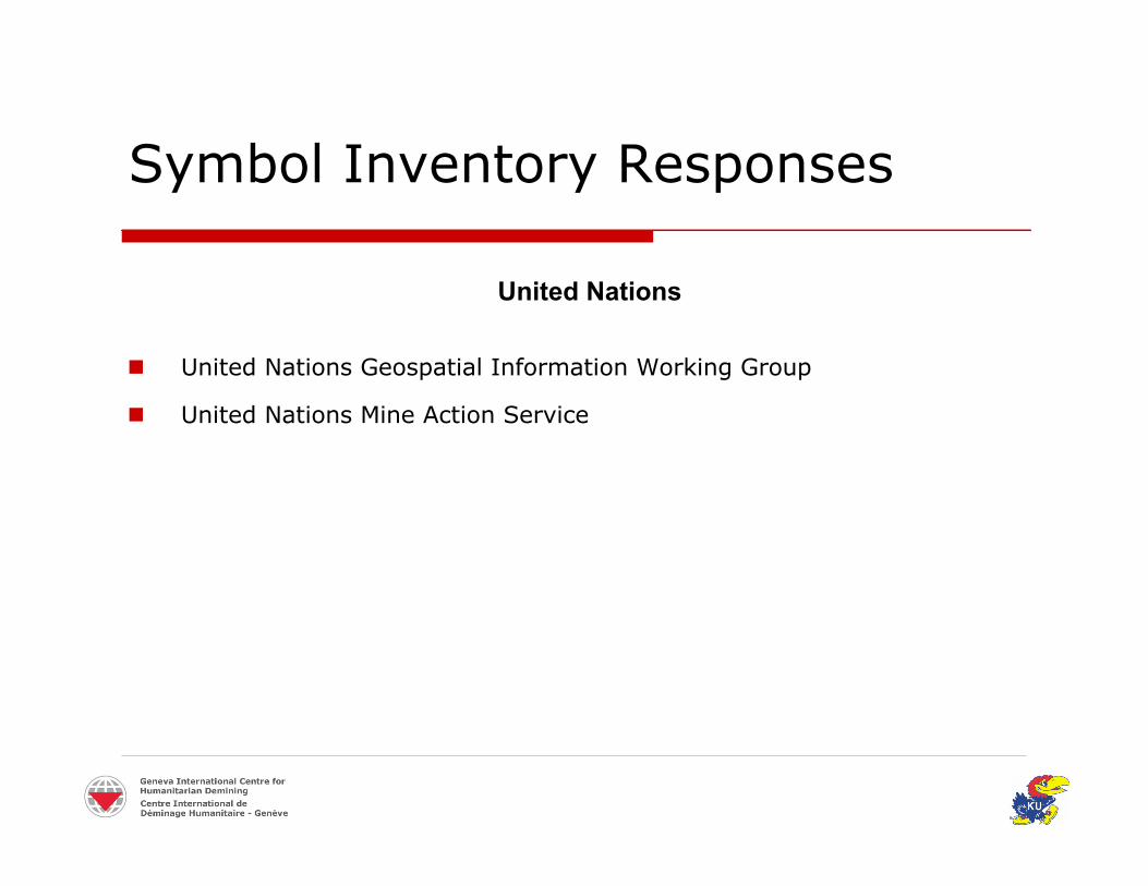
Symbol Inventory Responses
United Nations Geospatial Information Working Group
United Nations Mine Action Service
United Nations
Symbol Inventory Responses
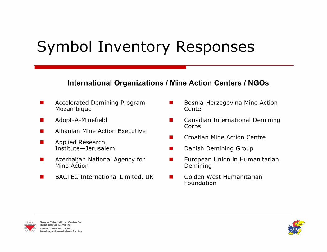
Accelerated Demining ProgramMozambique
Adopt-A-Minefield
Albanian Mine Action Executive
Applied ResearchInstitute—Jerusalem
Azerbaijan National Agency forMine Action
BACTEC International Limited, UK
Bosnia-Herzegovina Mine ActionCenter
Canadian International DeminingCorps
Croatian Mine Action Centre
Danish Demining Group
European Union in HumanitarianDemining
Golden West HumanitarianFoundation
International Organizations / Mine Action Centers / NGOs
Symbol Inventory Responses
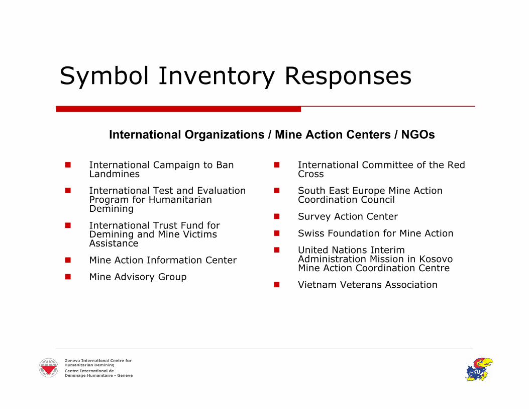
International Campaign to BanLandmines
International Test and EvaluationProgram for HumanitarianDemining
International Trust Fund forDemining and Mine VictimsAssistance
Mine Action Information Center
Mine Advisory Group
International Committee of the RedCross
South East Europe Mine ActionCoordination Council
Survey Action Center
Swiss Foundation for Mine Action
United Nations InterimAdministration Mission in KosovoMine Action Coordination Centre
Vietnam Veterans Association
International Organizations / Mine Action Centers / NGOs
Symbol Inventory Responses
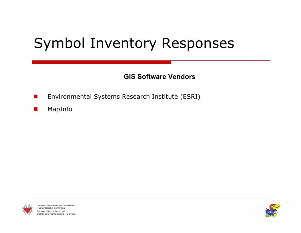
Environmental Systems Research Institute (ESRI)
MapInfo
GIS Software Vendors
Symbol Inventory Results
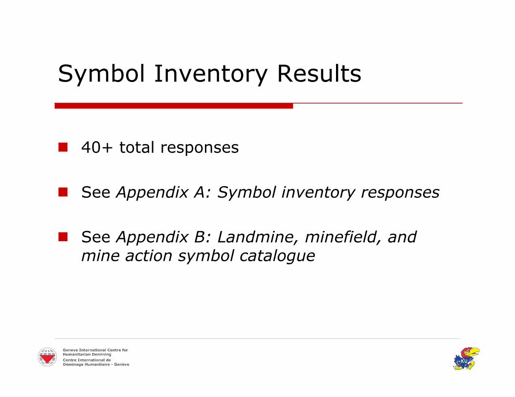
40+ total responses
See Appendix A: Symbol inventory responses
See Appendix B: Landmine, minefield, andmine action symbol catalogue

Sample Military Symbols
AT Minefield
Mined Area
UXO Area
AP Minefield
Minefields
GEN 150B-GL-331-003/FP-001
STANAGAPP-6AFM 101-5-1MIL-STD-
1477CMIL-STD-
2525BSource
AustralianNational Defence
CanadianNationalDefense
NATOU.S. ArmyU.S. DoDU.S. DoD
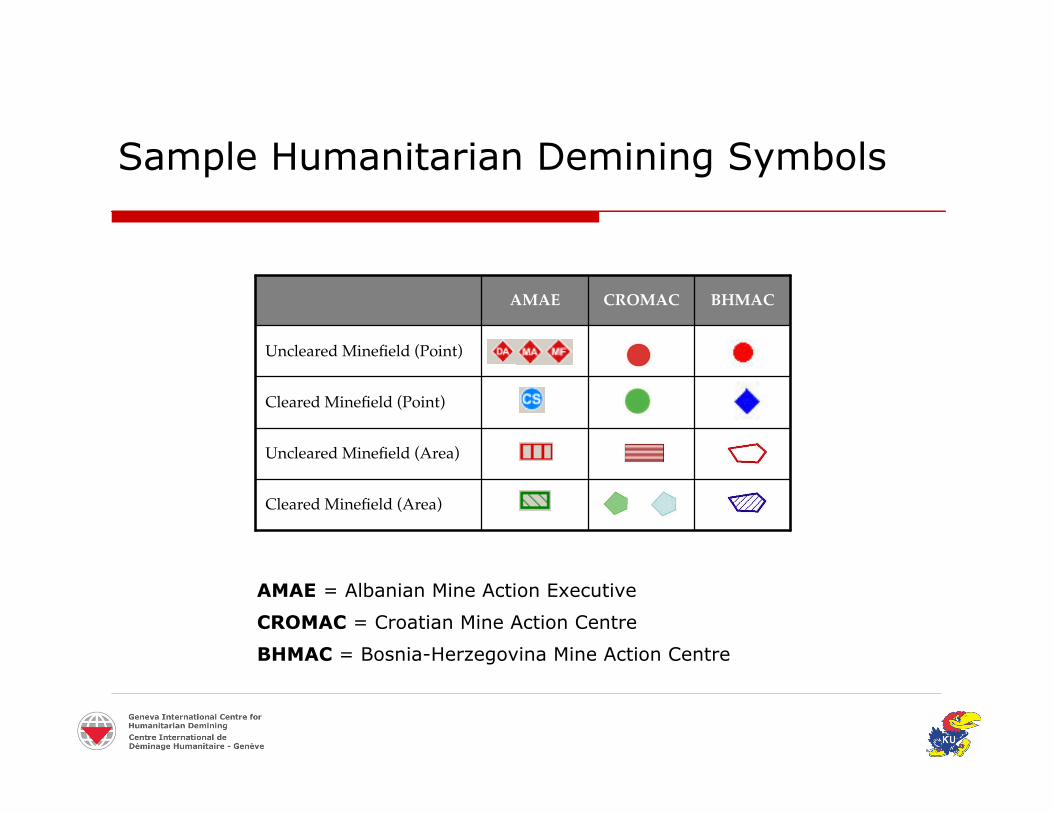
Sample Humanitarian Demining Symbols
Uncleared Minefield (Area)
Cleared Minefield (Area)
Cleared Minefield (Point)
Uncleared Minefield (Point)
BHMACCROMACAMAE
AMAE = Albanian Mine Action Executive
CROMAC = Croatian Mine Action Centre
BHMAC = Bosnia-Herzegovina Mine Action Centre

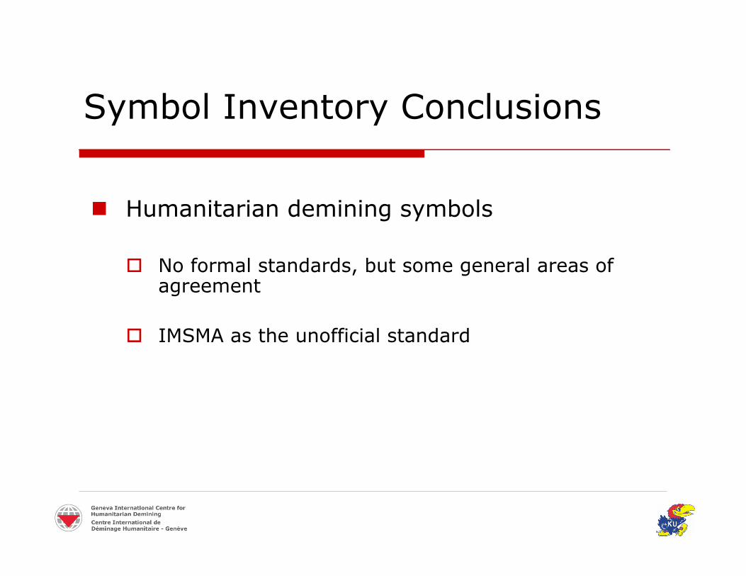
Symbol Inventory Conclusions
Military symbols
Symbols formally standardized (e.g., APP-6A)
Drawbacks of extending military symbols intohumanitarian demining
Symbol Inventory Conclusions
Humanitarian demining symbols
No formal standards, but some general areas ofagreement
IMSMA as the unofficial standard

IMSMA 3.x Map Symbols

IMSMA Map Symbol Categories
Hazards (points/areas)
Processes(points/areas)
Mine Risk Education Impact Survey Technical Survey Clearance Completion Survey
Accidents/Victims(points)
Locations (points)
Towns (points)
≈ 150 total symbols

IMSMA GIS Module (ArcView 3.x)
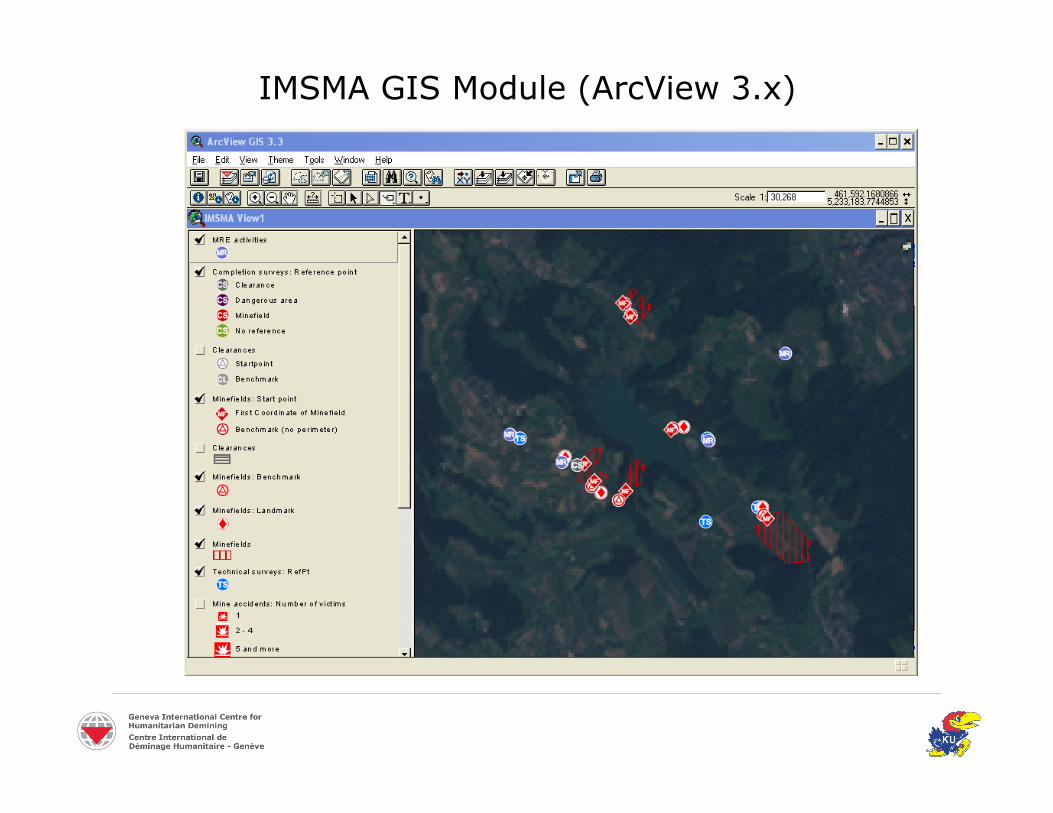
IMSMA GIS Module (ArcView 3.x)

IMSMA 3.x Symbols
Limitations
Non-intuitive
Few general symbols
Black and white printing limitations
Duplication of symbols

New Symbol Set for IMSMA andHumanitarian Demining
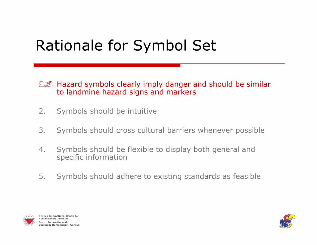
Rationale for Symbol Set
Hazard symbols clearly imply danger and should be similarto landmine hazard signs and markers
2. Symbols should be intuitive
3. Symbols should cross cultural barriers whenever possible
4. Symbols should be flexible to display both general andspecific information
5. Symbols should adhere to existing standards as feasible
Rationale for Symbol Set
6. Symbols should be based on cartographic and perceptualresearch of symbols and colors
7. Symbols should print and photocopy in black and white
8. Symbols should be legible when displayed on topographicmaps, aerial photographs/orthophotos, and satellite images
9. Symbol set should accommodate multiple map scales
10. Symbols should adhere to symbolization limitations ofcommon GIS software

Rationale for Symbol Set
Hazard symbols should clearly imply dangerand should be similar to landmine hazardsigns and markers
May improve recognition of hazards on maps
IMAS 08.40 “Marking Mine and UXO Hazards”

Minefield Hazard Marker Signs
IMAS 08.40, 2nd edition, p. 7IMAS 08.40, 2nd edition, p. 8
Minefield sign in Chile Minefield sign in BosniaMinefield sign in Africa
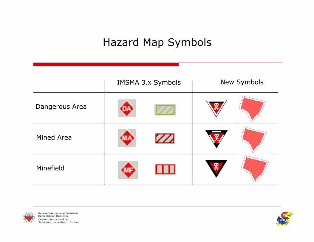
Hazard Map Symbols
IMSMA 3.x SymbolsIMSMA 3.x Symbols New SymbolsNew Symbols
Dangerous Area
Mined Area
Minefield
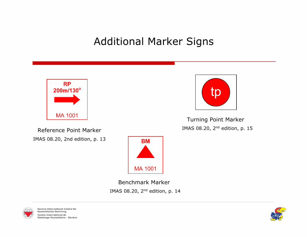
Additional Marker Signs
IMAS 08.20, 2nd edition, p. 13
IMAS 08.20, 2nd edition, p. 15
Turning Point Marker
Benchmark Marker
Reference Point Marker
IMAS 08.20, 2nd edition, p. 14

Additional Marker Signs
IMAS 08.20, 2nd edition, p. 13
IMAS 08.20, 2nd edition, p. 15
Turning Point Marker
Benchmark Marker
Reference Point Marker
IMAS 08.20, 2nd edition, p. 14
Rationale for Symbol Set
Symbols should be intuitive
Intuitive, pictorial icons developed whenever possible
Icons may be especially useful for symbols that mustspan culture and language differences

Intuitive Symbols for Clearance Operations
Manual Clearance Mine Dog Clearance
Mechanical Clearance

Intuitive Symbols for Clearance Operations
Manual Clearance Mine Dog Clearance
Mechanical Clearance
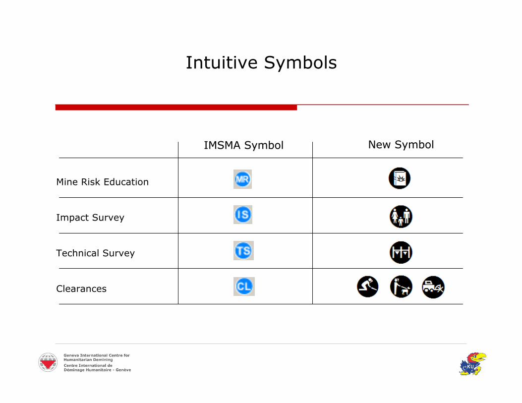
Intuitive Symbols
IMSMA SymbolIMSMA Symbol New SymbolNew Symbol
Mine Risk Education
Impact Survey
Technical Survey
Clearances

EOD IS Survey Handheld System
Laser Rangefinder Binoculars
Digital CameraPocket PC
Digital from start to finish
GPS Receiver

Rationale for Symbol Set
4. Symbols should be flexible to display bothgeneral and specific information
Tiered or hierarchical structure
Creates a logical order to symbols

Tiered or Hierarchical Structure
Graphic AttributesGraphic Attributes
Point SymbolPoint Symbol Area SymbolArea Symbol
IconIcon
Fill ColorFill Color
Frame/BorderFrame/Border
ShapeShapeOutlineOutline IconIcon
Fill ColorFill Color
Fill PatternFill Pattern
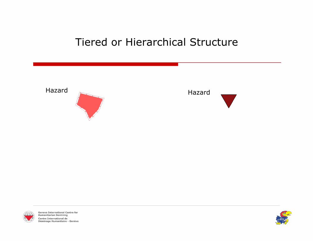
Tiered or Hierarchical Structure
Hazard Hazard

Tiered or Hierarchical Structure
Hazard
Minefield
Hazard
Minefield

Tiered or Hierarchical Structure
Hazard
Minefield
Grenades
Hazard
Minefield
Rationale for Symbol Set
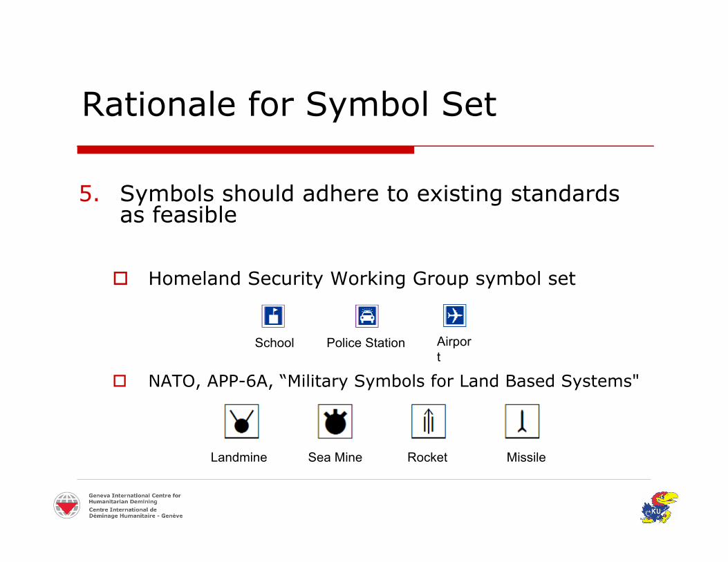
5. Symbols should adhere to existing standardsas feasible
Homeland Security Working Group symbol set
NATO, APP-6A, “Military Symbols for Land Based Systems"
Landmine Sea Mine Rocket Missile
School Police Station Airport

Rationale for Symbol Set
5. Symbols should adhere to existing standardsas feasible
Military symbols are not ideal for humanitariandemining in all cases
Minefields
Mined Area
NATO (APP-6A) SymbolsNATO (APP-6A) Symbols Recommended SymbolRecommended Symbol
Rationale for Symbol Set
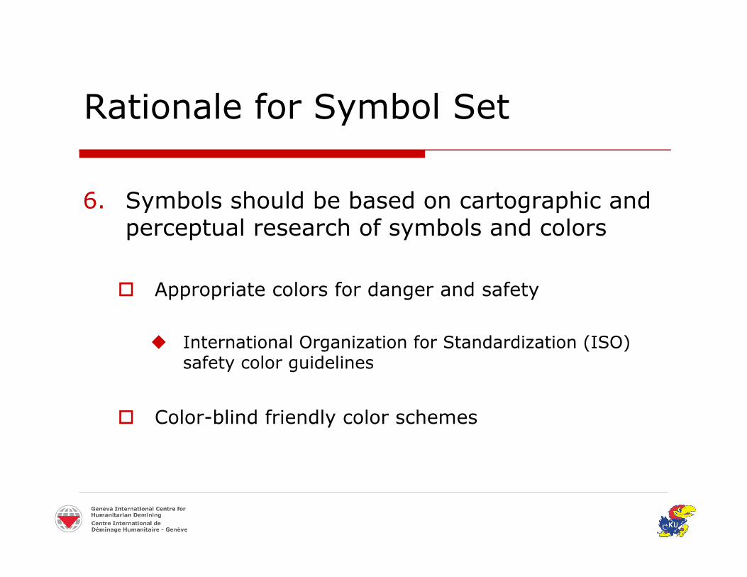
6. Symbols should be based on cartographic andperceptual research of symbols and colors
Appropriate colors for danger and safety
International Organization for Standardization (ISO)safety color guidelines
Color-blind friendly color schemes

Color Schemes
ColorColor ExampleExample
Mine Risk Education
Impact Survey
Technical Survey
Clearance
Completion Survey/Cleared Areas
FeatureFeature
Hazards/Accidents/Victims
Rationale for Symbol Set
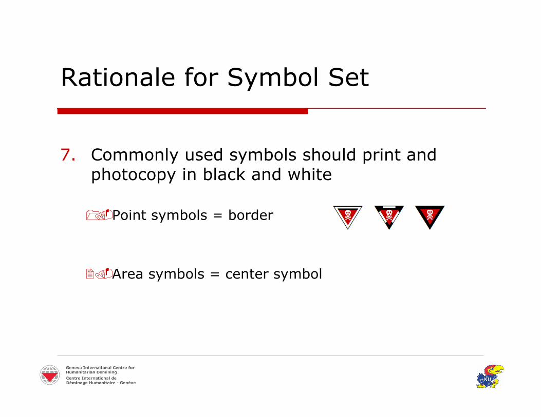
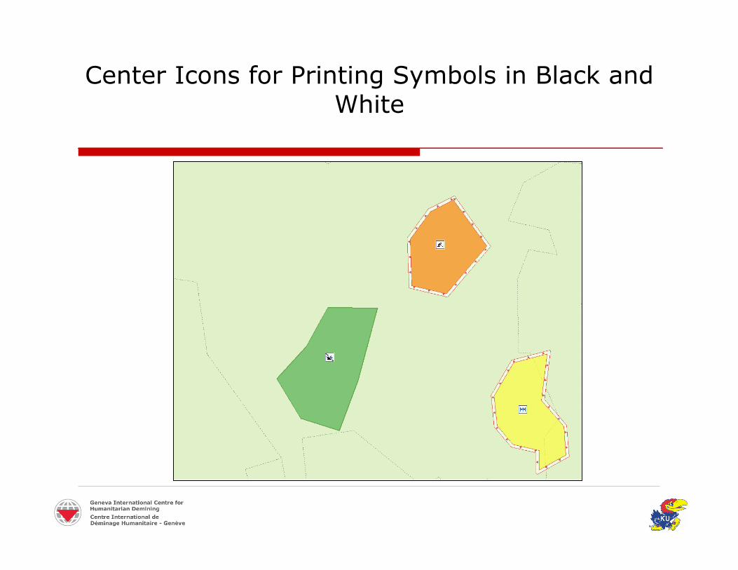
7. Commonly used symbols should print andphotocopy in black and white
Point symbols = border
Area symbols = center symbol

Center Icons for Printing Symbols in Black andWhite
Center Icons for Printing Symbols in Black andWhite

Center Icons for Symbolizing MultipleAttributes

Center Icons for Symbolizing MultipleAttributes

Center Icons for Symbolizing MultipleAttributes
Rationale for Symbol Set
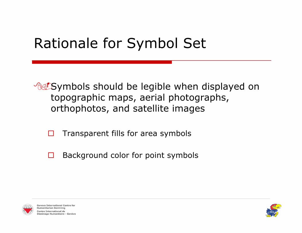
Symbols should be legible when displayed ontopographic maps, aerial photographs,orthophotos, and satellite images
Transparent fills for area symbols
Background color for point symbols
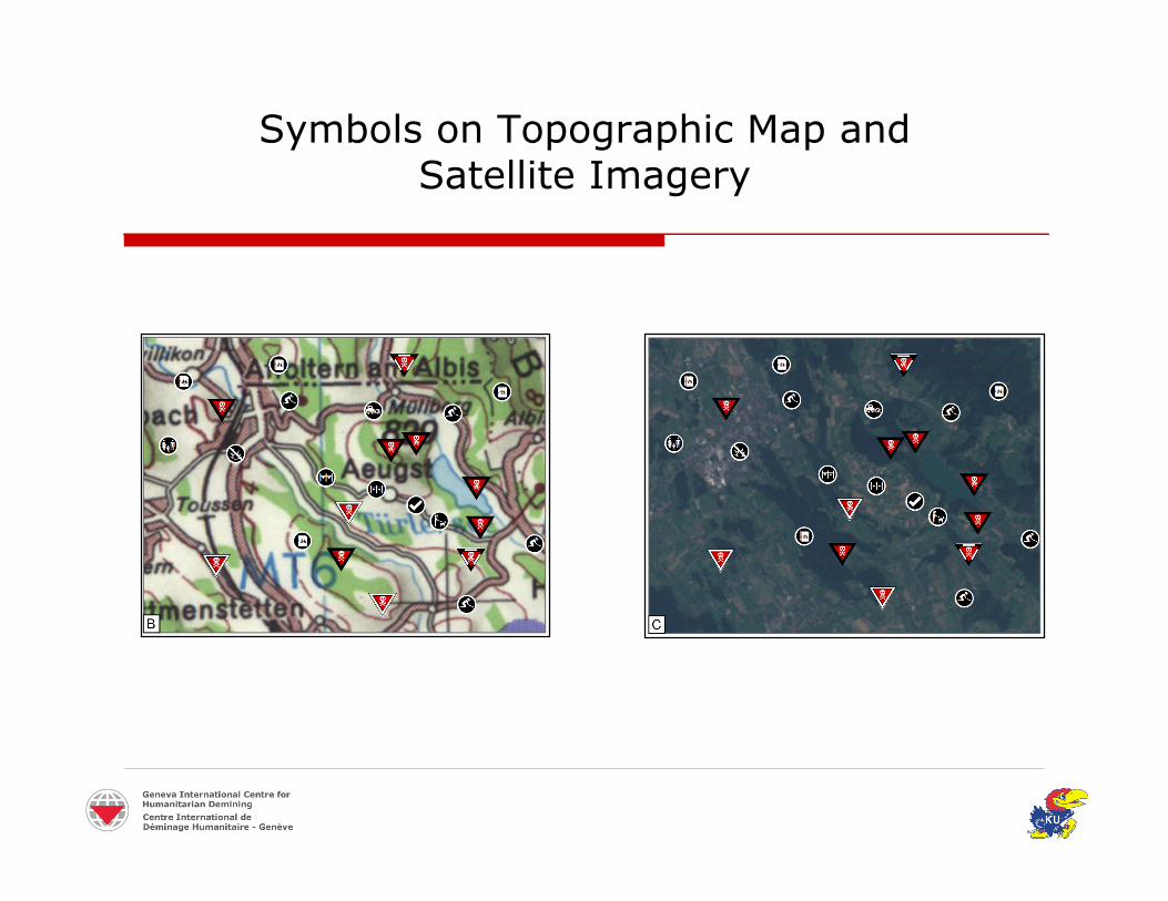
Symbols on Topographic Map andSatellite Imagery
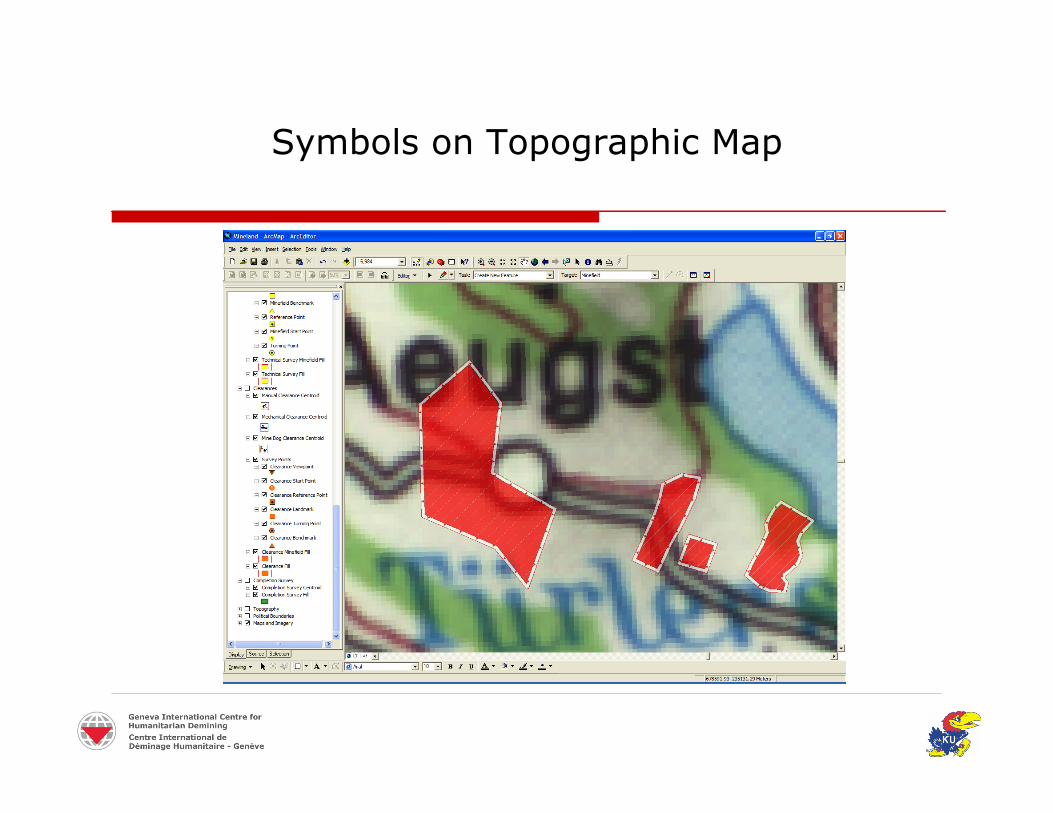
Symbols on Topographic Map

Rationale for Symbol Set
9. Symbol set should accommodate multiple mapscales
Point symbols for overview maps of a larger area
Area symbols for more detailed maps of a smallerarea

Symbols Varying with Map Scale
Zoom InZoom Out
Evaluation of Symbol Set
Symbol Evaluation
IMSMA Summer Workshop
July 2004, Geneva, Switzerland
21 Participants from 17 countries
Group discussion about symbology
Symbol evaluation form
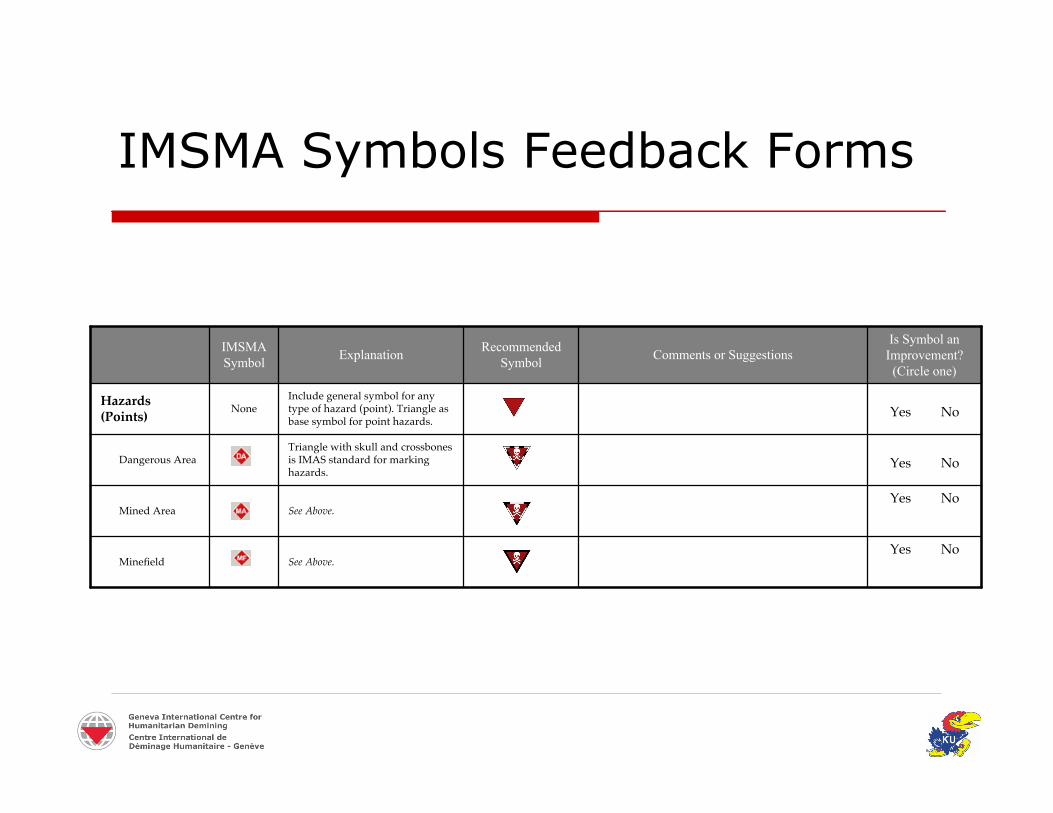
IMSMA Symbols Feedback Forms
Yes NoSee Above. Minefield
Yes NoSee Above. Mined Area
Yes NoTriangle with skull and crossbonesis IMAS standard for markinghazards.
Dangerous Area
Yes NoInclude general symbol for anytype of hazard (point). Triangle asbase symbol for point hazards.
NoneHazards(Points)
Is Symbol anImprovement?(Circle one)
Comments or SuggestionsRecommendedSymbolExplanationIMSMA
Symbol

Symbol Evaluation Results
“Is the recommended symbol an improvement?”
Hazards Processes
20/21 (95%)
20/21 (95%)
20/21 (95%)
16/21 (76%)
15/21 (71%)
16/21 (76%)
15/21 (71%)
14/21 (67%)

Symbol Evaluation Results
Impact of Symbol Evaluation
Modifications to preliminary symbol designs
Identification of additional symbols to includein the symbol set

Implementation of the Symbolsand Conclusions
Implementation of the Symbols
True Type Font
ESRI Style File
Demonstrations
Symbols in ArcMap
New IMSMA release
Conclusions
A common set of map symbols can fill animportant void in humanitarian demining
Map symbols should be designed in a mannerto support safety
Map symbols should be flexible for multipleuses in humanitarian demining