4.3.4 Spatial Data Integration 1 UPA Package 4, Module 3 SPATIAL DATA INTEGRATION.
22
1 4.3.4 Spatial Data Integration UPA Package 4, Module 3 SPATIAL DATA INTEGRATION
-
Upload
isabella-bell -
Category
Documents
-
view
231 -
download
0
Transcript of 4.3.4 Spatial Data Integration 1 UPA Package 4, Module 3 SPATIAL DATA INTEGRATION.

14.3.4 Spatial Data Integration
UPA Package 4, Module 3
SPATIAL DATA INTEGRATION

24.3.4 Spatial Data Integration
Spatial Data Integration
• Project and Process GIS• Spatial Data Integration and Spatial Data Infrastructure (SDI)• Implementation of a local SDI and Local Urban
Observatories• Introduction exercise 4.3.4

34.3.4 Spatial Data Integration
Project and Process GIS
Project GIS• Examples: research, pilot projects, ad-hoc, lack of
continuation, stand-alone GIS, GIS at operational level, mushrooming of intra-institutional GIS projects, data duplication
• BUT clear focus and effective to reach project objectivesProcess GIS• Clear vision, benefits for the organization, stability, capability,
realistic approach (operational GIS first, analytical GIS second), reliable large (national) spatial and other data producers (mapping, cadastre, statistics)
• Institutional embedding, stable institutional/political environment

44.3.4 Spatial Data Integration
Project and Process GIS
Project GIS
Process GIS

54.3.4 Spatial Data Integration
Compatibility of Databases

64.3.4 Spatial Data Integration
Spatial Data Infrastructure
• (Local) Spatial Data InfrastructureA combination of technologies, policies and inter-institutional relations to facilitate access to spatial datawww.gsdi.org
• (GEO)Information and Communication TechnologyPeople Operational, Analytical, Management, StrategyData maps, databases, compatibility, up-to-dateTechnology Hard-Software, networks, support Institutions Collaboration, data sharing, political /
institutional stability$ Benefits, costs, cost reduction, revenue
generation, efficiency gains

74.3.4 Spatial Data Integration
Spatial Data Infrastructure
Application storage
Clearin
gh
ou
se Fu
nctio
n
Geospatial DataService Centre
(for this domain)Integrity:Harmonization/standardsGDI administration/operationsPolicy implementationOperational:Transformation servicesAdvisory services
InformationPolicy
Direction
GD
SC
s for o
ther d
om
ains
Framework Data
(Foundation Data)
Real estatemanagement
Physicalplanning
Environmentprotection
Other domainapplication
Domain Applicaiton
Other Data Providers
Administrativeboundary
Transportation
Hydrogrphy
Cadastral data
Land use/cover
Geodetic control
DEM
Orthoimagery
Topographic template
Geographic name
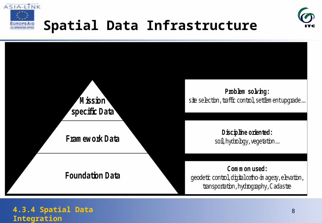
84.3.4 Spatial Data Integration
Spatial Data Infrastructure
Missionspecific Data
Framework Data
Foundation Data
Problem solving:site selection, traffic control, settlement upgrade...
Discipline oriented:soil, hydrology, vegetation...
Common used:geodetic control, digital ortho-imagery, elevation,
transportation, hydrography, Cadastre
Data User Data Content

94.3.4 Spatial Data Integration
Model Intranet GIS Arnhem

104.3.4 Spatial Data Integration
Gradual Development of a GIS
Setting up the system:1 Equipment2 Mapping Group
3 Inventory
5 Thematic Maps 6 Suitability / Sensitivity Maps
KISARAWE
BAGAMOYO
KIBAHA
6 40
7 00
39 00 39 20
Legend
Highly Available
Moderately Available IIA
Less available
Not suitable
in km / 1:n
1062
Dar es Salaam - Suitability for Urban Agriculture
EDar es Salaam City Commission (DCC)
Sustainable Dar es Salaam Project (SDP)Source: xxx
January 1998uasuit.prj
4 Basic Map
KISARAWE
BAGAMOYO
KIBAHA
6 40
7 00
39 00 39 20
Legend
Seasonal Rivers & Seasonal Streams
Main and Minor Roads
Railway
in km / 1:n
1062
Dar es Salaam
EDar es Salaam City Commission (DCC)
Sustainable Dar es Salaam Project (SDP)Source: xxx
mo 1997xy.prj
KISARAWE
BAGAMOYO
KIBAHA
6 40
7 00
39 00 39 20
Legend
Seasonal Rivers & Seasonal Streams
Main and Minor Roads
Railway
in km / 1:n
1062
Dar es Salaam
EDar es Salaam City Commission (DCC)
Sustainable Dar es Salaam Project (SDP)Source: xxx
mo 1997xy.prj
7 Overlay
Project Design
Site Selection
Development Pattern8 Public Information
Exhibitions
The Web
Publications
9 MaintainingUpdating
Training
Institutionalisation

114.3.4 Spatial Data Integration
Spatial Data Integration
The base/topographical map is the base layer for other thematic GIS layers (see also foundation and framework data
• Basic landforms• Grid lines• Road network• Hydrological network
common cartographic standards(scale, legend, and layout)

124.3.4 Spatial Data Integration
Thematic Maps
Thematic maps are…
• showing strictly factual information• derived from research

134.3.4 Spatial Data Integration
Thematic Map
Malaria Prone Areas

144.3.4 Spatial Data Integration
Suitability / Sensitivity Maps
• defines areas suitable for certain purposes according to “conditions” and “rules”
• provides a number of optionsKISARAWE
BAGAMOYO
KIBAHA
6 40
7 00
39 00 39 20
Legend
Highly Available
Moderately Available IIA
Less available
Not suitable
in km / 1:n
1062
Dar es Salaam - Suitability for Urban Agriculture
EDar es Salaam City Commission (DCC)
Sustainable Dar es Salaam Project (SDP)Source: xxx
January 1998uasuit.prj
KISARAWE
BAGAMOYO
KIBAHA
6 40
7 00
39 00 39 20
Legend
Highly Available
Moderately Available IIA
Less available
Not suitable
in km / 1:n
1062
Dar es Salaam - Suitability for Urban Agriculture
EDar es Salaam City Commission (DCC)
Sustainable Dar es Salaam Project (SDP)Source: xxx
January 1998uasuit.prj
ClassArea
Ha
High suitable 1,467Moderately suitable 3,170Less suitable 1,118Constraints areas 8,564Research area 5,755Total study area 14,319
154.3.4 Spatial Data Integration
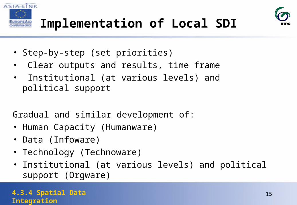
Implementation of Local SDI
• Step-by-step (set priorities)• Clear outputs and results, time frame• Institutional (at various levels) and political support
Gradual and similar development of:• Human Capacity (Humanware)• Data (Infoware)• Technology (Technoware) • Institutional (at various levels) and political support (Orgware)
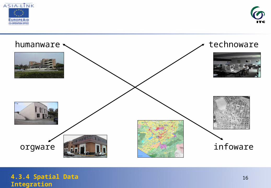
164.3.4 Spatial Data Integration
humanware
orgware
technoware
infoware

174.3.4 Spatial Data Integration
Exercise 4.3.4
• Data Aggregation of Single data sets• Integration of National Statistical and Local data sets• Integration of Neighborhoods with postcode areas• Disaggregation of variables from neighborhood to postcode
level• Visualization of aggregation, integration and disaggregation

184.3.4 Spatial Data Integration
Spatial Data Incompatibility

194.3.4 Spatial Data Integration
Which is the correct map?

204.3.4 Spatial Data Integration
Exercise 4.3.4
Part of the Municipality of Enschede, showing the boundaries of the neighbourhoods (thick lines) and postcode 5 level boundaries (thin lines)Boundaries don’t coincide
Problem: how to disaggregate data from the neighbourhood level to the postcode level

214.3.4 Spatial Data Integration
Exercise 4.3.3
Part of the Municipality of Enschede, showing the boundaries of the neighbourhoods (thin lines) and postcode 4 level boundaries (thick lines)

224.3.4 Spatial Data Integration
Most Frequent Problems in the Development of a GIS