


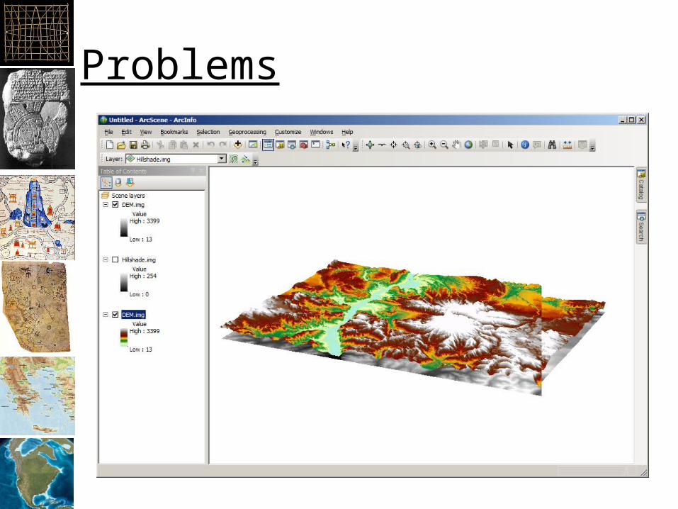


3D GIS
25
3D GIS • So far, all data has had x, y coordinates – North-south and east-west • 3D requires a z value – Elevation and/or depth Mt. Everest Wordpress.com
-
Upload
abdul-nash -
Category
Documents
-
view
18 -
download
1
description
3D GIS. So far, all data has had x, y coordinates North-south and east-west 3D requires a z value E levation and/or depth. Mt. Everest Wordpress.com. Elevation: Height of land. Typically: Elevation above “mean sea level” By default, from the ellipsoid defined in the datum - PowerPoint PPT Presentation
Transcript of 3D GIS
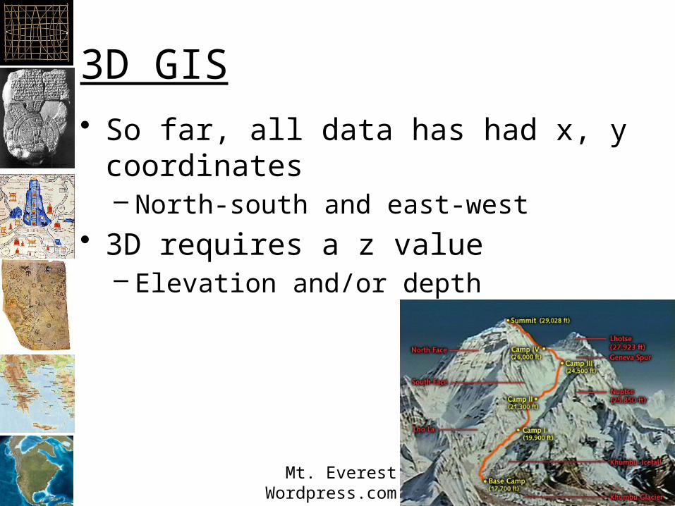
3D GIS• So far, all data has had x, y coordinates
– North-south and east-west• 3D requires a z value
– Elevation and/or depth
Mt. EverestWordpress.com
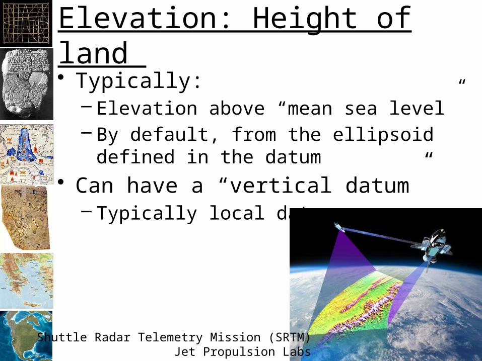
Elevation: Height of land • Typically:
– Elevation above “mean sea level”– By default, from the ellipsoid defined in the
datum• Can have a “vertical datum”
– Typically local datums
Shuttle Radar Telemetry Mission (SRTM)Jet Propulsion Labs

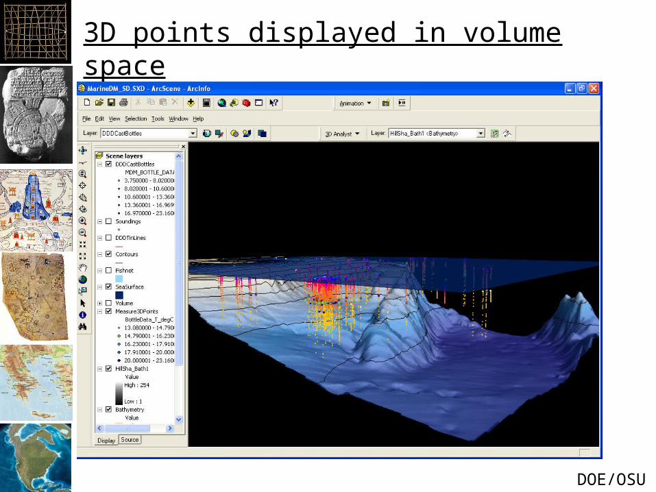
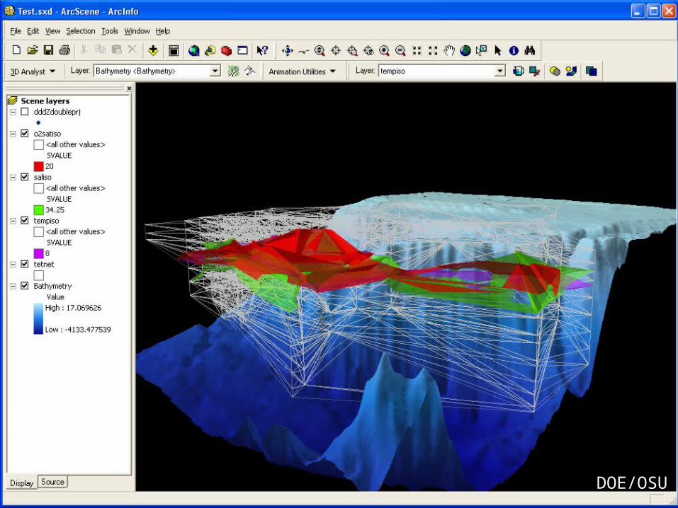
Bathymetry• Depth below “mean sea level”
Frank A. Palmer and Louise B.Crary, that collided and sank in Massachusetts Bay in 1902.
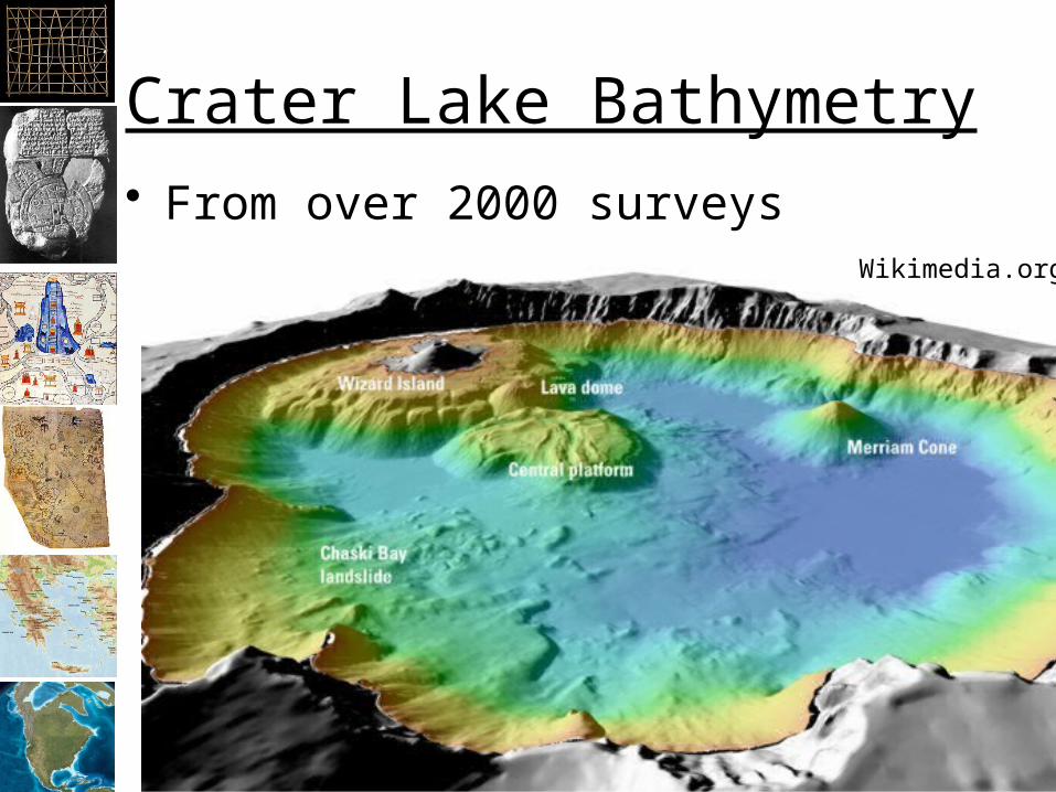
Crater Lake Bathymetry• From over 2000 surveys
Wikimedia.org

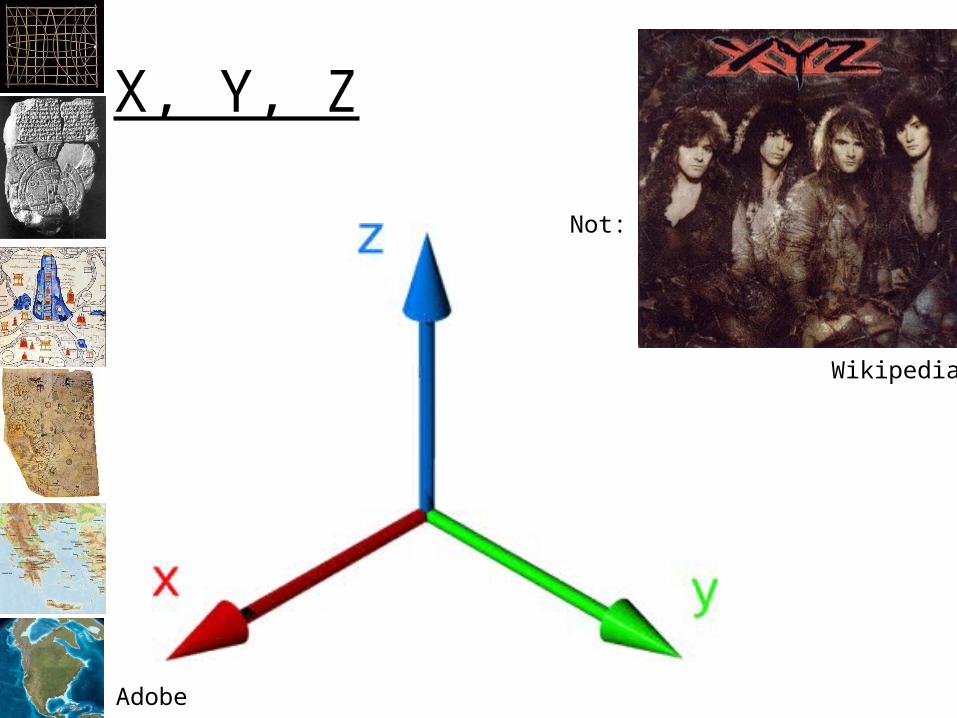
Three Dimensions: X, Y, Z
• Six degrees of freedom!
Wikipedia

Can also create animations• See youtube• http://
www.youtube.com/watch?v=qzkBnCBpQAM– Artificial terrain fly through (not ArcScene)
• http://www.youtube.com/watch?v=nhXaScaT87o– With music in ArcScene (you can do better)
• Note: ArcScene is not a gaming engine!
Temporal Data• Adding temporal data to visualizations:
– Land use change over time (NLCD)• Elevation and remotely sensed changes• Esri has added some temporal features:
– Date/Time attributes– ArcMap is still basically a 2D application
• More complex temporal analysis and visualizations require special software