3. Zan Laetoli.PPT - ts-den.aluka.org
27
School of Architecture, Planning and Geomatics University of Cape Town Laetoli Trackway
Transcript of 3. Zan Laetoli.PPT - ts-den.aluka.org

School of Architecture, Planning and Geomatics
University of Cape Town
Laetoli Trackway


Laetoli Trackway


G1
G2/3
9 m
9 m
3 m
1.5 m lateralshift
The Laetoli Hominid Trackway
1995
1996
hipparion

The Recording Process• Precise Engineering Survey
– control points accuracy < 0.2 mm
• analog photogrammetry
• digital photogrammetry
• 3-D modeling
• Spatial Information System

Survey of individualfootprints
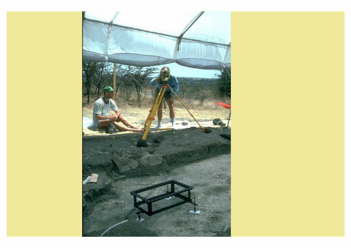

Camera Configuration for footprintphotogrammetry


Project Statistics
• Theodolite readings
• Images
– Digital DCS
– Analog UMK
– Analog Hasselblad
• Files generated
• Final Data stored
> 5000
: 1220
: 650
: 160
: 410
> 15 000
> 4 GBytes

Photogrammetric Results
Control
Points
Individual
Imprint points
trackway
Number Accuracy
96 + 80 0.1- 0.2 mm XYZ
10 000 - 0.2 - 0.4 mm
20 000 per print
< 0.5 mm

Hard copyand Artefacts
Digital Data
Reference SystemDigit. Documents
Ref. Syst.Dig. Docs
Ref. Syst.Dig. Docs
Paper Documents
Micro Fiche
Scientists Report
Digital Maps& Images
Physical Items
Maps &Photographs
Ref. Syst.
Hardcopy - Artifacts - Digital Data
Software
Components
Archiving
Dig. Ref. System
Data Bases
Spatial & AttributeData for GIS
GIS
Dig Maps &
ImagesImage Processing System
Visualisation/ Animation
Virtual Reality
Laetoli
Home Page
OPEN
GIS
LAETOLI- H I S

An ortho photograph of thefootprint is draped over the 3D
surface model which wasgenerated using photogrammetric
methods.
A colour coded 3Drepresentation (differentcolours show different
heights


Information Screen: Footprint Conservation
Description of footprint condition andinterventions (Word® document)
Footprintconditiongraphic(displayed inArcView®)
ArcView®custom menu
Click to view footprintplans in ArcView®