25th Edition July - December 2016 WASPADA Edition | July - December 2016 WASPADA de Flitsvloed in...
29
catastrophe newsletter 25th Edition | July - December 2016 WASPADA de Flitsvloed in Zwitserse van Java Garut flood report Earthquake in The Last Fortress Pidie, 7 Desember 2016 Information Technology Development and Cyber Risk Threat
Transcript of 25th Edition July - December 2016 WASPADA Edition | July - December 2016 WASPADA de Flitsvloed in...

catastrophe newsletter
25th Edition | July - December 2016
WASPADAde Flitsvloed in Zwitserse van Java Garut flood report
Earthquake in The Last Fortress Pidie, 7 Desember 2016
Information Technology Development and Cyber Risk Threat

Your Reliable Partner in Catastrophe Risk Transfer

Foreword Happy New Year 2017
2016 has been passed imperceptibly with many of memories, achievements and award that we
have achieved. In 2016, MAIPARK has turned 13 years old, a fairly mature stage to prove its
progress and competence in insurance industry, both nationally and globally. MAIPARK was born
in Indonesia, which is a disaster prone area to earthquake, tsunami, landslide, and tornado (also
known as puting beliung). MAIPARK is a form of insurance industry togetherness to bear
financial risks arising from natural disaster, which could lead to financial losses due to earthquake.
This positive act from all MAIPARK stakeholders realize MIAPARK growth and development
from 2004 till today.
MAIPARK developments continue today and will be improved in all aspect, from human resource
aspect, infrastructure, employee welfare and other startegic aspects, such as improving partnership
quality with stakeholders, improving reinsurance protection needs and enriching the analysis of
MAIPARK Catastrophe Modeling (MCM).
Therefore, we gladly present our WASPADA bulletin to all MAIPARK stakeholders and strategic
partners. Hopefully, our bulletin can be a useful for knowledge sharing to all readers.
We thank you all for the support and partnership that goes well all this time.
Regard, Yasril Rasyid President Director

WASPADA25th Edition | July - December 2016
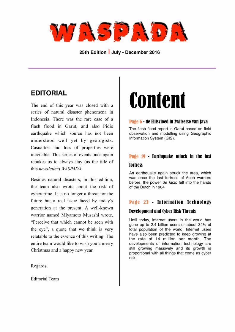
Page 6 - de Flitsvloed in Zwitserse van JavaThe flash flood report in Garut based on field observation and modelling using Geographic Information System (GIS).
Page 19 - Earthquake attack in the last
fortress
An earthquake again struck the area, which was once the last fortress of Aceh warriors before, the power de facto fell into the hands of the Dutch in 1904
Page 23 - Information Technology
Development and Cyber Risk Threats
Until today, internet users in the world has gone up to 2.4 billion users or about 34% of total population of the world. Internet users have also been predicted to keep growing at the rate of 14 million per month. The developments of information technology are still growing massively and its growth is proportional with all things that come as cyber risk.
ContentEDITORIALThe end of this year was closed with a series of natural disaster phenomena in Indonesia. There was the rare case of a flash flood in Garut, and also Pidie earthquake which source has not been understood well yet by geologists. Casualties and loss of properties were inevitable. This series of events once again rebukes us to always stay (as the title of this newsletter) WASPADA.
Besides natural disasters, in this edition, the team also wrote about the risk of cybercrime. It is no longer a threat for the future but a real issue faced by today’s generation at the present. A well-known warrior named Miyamoto Musashi wrote, “Perceive that which cannot be seen with the eye”, a quote that we think is very relatable to the essence of this writing. The entire team would like to wish you a merry Christmas and a happy new year.
Regards,
Editorial Team

de Flitsvloed in Zwitserse van Java Dennish Ari Putro, Adib Putra Pradewa, Juan Mikha Prasetyo dan, Aditya Billy C. Hutapea.
“Hujan teh teu raat - raat ti bada magrib, ngagebret eta hujan teh Kang, tabuh sapuluhan
nembe raat hujan teh mung girimis lah, langsung abdi teh ngahurungkeun motor, uih ka Talaga Bodas bisi hujan deui. Lalampahan ka bumi teh ngalangkung jembatan cimanuk Kang, tah basa abdi meuntas eta jembatan, ereun abdi di tengah jembatan teh, bakating ku reuwasna
abdi teh ku sora ngaguruh, duka ti mana eta sora. Luak-lieuk abdi teh, ka kanan, ka kiri, jol eta cai ngagulidag belekbek, ngaleled naon weh anu diliwatan kawas tsunami. Sok Kang, kumaha teu soak Kang, ieu jembatan teh aya mereun 15 meter mah jangkungna ti sungai teh. Jol aya cai sakitu ageungna ngalimpas dugi ka jembatan.”
The rain had not stopped since after magrib prayer, the rain got heavier, at around ten at night the
rain stopped and turned into a drizzle, I immediately turned my motorcycle on to go home to
Telaga Bodas area (Wanaraja -red) fearing that it would rain again later. My journey to home
through Cimanuk Bridge (Maktal Area-red), when I was crossing the bridge, I stopped in the
middle of it because I was shocked by a rumbling sound out of nowhere. I looked to the right and
left, suddenly unbelievable swift water flowed and pounded everything it passed through like a
tsunami. How was I not to be taken aback? The height of the bridge is 15 meters above the river.
Suddenly such a great amount of water came across the bridge.
Above is a part of our interview with Mr. Sutarsa about the flash flood which had happened in
Garut Regency on Wednesday, 21 September 2016, at 01:00 IWST. The flash flood passed
through Bayongbong, Tarogong Kidul, Tarogong Kaler, Banyuresmi, and Karangpawitan Sub-
districts.
Garut Regency
Garut Regency is located in Jawa Barat Province; it is ± 75 km southeast of Bandung City.
Geographically, Garut borders with Sumedang Regency on its north, Tasikmalaya Regency on its
east, Indian Oceans on its south, and Cianjur Regency and Bandung Regency on its west.

Garut has a nickname which is Zwitserse van Java or Swiss City in Java because its
geomorphologic and topographic conditions of most areas in Garut are mountains, similar to
Swiss. Only southern part of Garut is lowland. Some mountains which surround Garut are Mount
Papandayan, Mount Guntur, Mount Cikuray, and Mount Galunggung.
However, this charming natural condition can make us complacent and forget the potential
dangers that Garut has had for a long time. Besides the danger of the eruption of the four
volcanoes, there is also the danger of flash flood that lurks it. Based on a book titled Roosseno:
Jembatan dan Menjembatani published by Yayasan Obor Indonesia in 2008, it is recorded that
there was a flash flood that happened and hampered the construction work of Cimanuk Leuwidaun
Bridge to increase capacity in 1939.
Based on the data of Indonesian National Board for Disaster Management or Badan Nasional
Penanggulangan Bencana (BNPB), there was a flash flood in 2003 resulting in 168 houses
heavily damaged. In addition, in 2002 related to the eruption of Papandayan Volcano, there was a
cold lava flood which resulted in 638 houses damaged. These historical events should be adequate
to make Garut alert of the potential for flash floods.
Flash Flood
Flash flood, according to BNPB, is a flood that comes suddenly with a great water discharge
because the river flow in the river channel is bunged up. Meanwhile, according to National
Weather Service (NWS), which is one of components in National Oceanic and Atmospheric
Administration (NOAA), flash flood is a flood caused by a heavy rain in a short amount of time,
generally less than 6 hours, marked by a very swift water flow after a heavy rain, which passes
through the river, urban streets, or mountain valleys and sweeps everything it passes through.
We try to identify and analyze the event of flash flood in Garut Regency based on NWS’s
definition, identification is done to the affected areas, rainfall before the event, and the topography
of Garut Regency; then the mechanism of the flash flood occurrence including stream network
and land cover of the watershed of Cimanuk upper catchment area which is thought to be one of
the causes of the flash flood.

Figure 1. Map of sub-districts affected by the flash flood in Garut Regency.
Identification of Affected Areas
The team conducted early identification of affected areas by using disaster news from BNPB
which stated that the flash flood struck Bayongbong, Tarogong Kidul, Tarogong Kaler,
Banyuresmi, and Karangpawitan Sub-districts.
From the stream network data and affected locations, identification was conducted by estimating
the flood extents using buffer method to generally discover the flood extents. The use of this
method is meant to focus the identification of affected areas in the next step using remote sensing
method.

Next, remote sensing would be done using images from Landsat 8 to estimate the extent of
affected areas qualitatively and quantitatively. In terms of qualitatively, Landsat images were only
seen for the alteration of images
between before and after the
event. The quantitative was done
by calculating the difference of
pixel value in the images so that
the different values between
before and after the event can be
known. The difference between
these values is an indication of
that the areas were affected by
the flash flood. Figure 2. The use of buffer method to observe affected area in a simple view, red-colored areas are a buffer with a distance of 50 meters and yellow with a distance of 100 meters from the river levee.
Figure 3. On the top are the natural images of Landsat 8 t o c o m p a r e t h e s t a t e before (left) and after (right) the event, on the bottom are t h e q u a n t i t a t i v e identification of the images from Landsat 8. Red circles show areas with significant changes before and after the event.

�10
Figure 4. Topographic Condition of Cimanuk upper catchment area.
Topographic Condition
The data of Shuttle Radar Topography Mission (SRTM) was used to observe the topographic
condition of Garut Regency. From the SRTM data, delineation was conducted to see hydrologic
parameters including stream network and watershed to find out the extent of areas which
contributed to the river flow. The topographic condition of Garut Regency shows a great chance
for this area to possess many main rivers with tributaries converging in Cimanuk River.
The identification result of Cimanuk watershed shows the scope of areas of ±440 km2, arcing, and
surrounding the center of Garut Regency, from Mount Guntur–Darajat Crater – Mount Kendang –
Mount Papandayan – Cikajang – Mount Cikuray. River delineation using SRTM r e s u l t e d i n
f o u r m a i n r i v e r s w h i c h a r e Cimanuk River, Cipanday River, Cibereum River, and
Cikamiri River. From each river, time of concentration (tc) was calculated to find the time
required by flowing water from the upper catchment area to the downstream or the control point.

�11
The calculation result of tc shows unexpected values; there are two rivers which tc is less than two
hours. This is more dangerous because the momentum which will be influenced by water volume
has not been taken into account yet. If a heavy rain occurs in the upper catchment area, the water
might flow faster to the downstream.
Another interesting thing from the topographic condition of Garut Regency is the upper catchment
area of Cimanuk River which is located in Cikajang. This river becomes a spot for water from the
hill in the southern part, Mount Cikurai in the eastern part, and Mount Papandayan in the western
part, to converge. Accumulation of rainfall concentrated in this river, so the volume resulted is huge,
enabling the tc to change from ±5 hours to only 2-3 hours.
Reach Name tc (Hours)
Cimanuk 5.078
Cipanday 1.641
Cibeureum 1.882
Cikamiri 2.593
Table 1. Tc values of the four main rivers in Cimanuk watershed.
Figure 5. Cimanuk upper catchment area in Cikajang Area which obtains input from three plateaus, the black arrows show the directions of water flow going to Cimanuk River.

�12
Rainfall
The flash flood happened at around 01:00 IWST on 21 September 2016. Based on the definition
from NWS, the flood is caused by a heavy rain in a short amount of time, usually less than 6
hours. Thus, the identification of the rain before the event was done for between around 18:00
IWST until 19:00 IWST on 20 September 2016. The identification used data from Global Satellite
Mapping of Precipitation (GSMaP) which provided data with a time resolution of an hour.
GSMaP data show that the rain movement which started at 18:00 IWST until 01:00 IWST to the
northwest. The rain had happened since 18:00 IWST, and there was also a heavy rain that seemed
to occur during that time. A heavy rain was formed at 19:00 IWST and progressed until 20:00
IWST, the rain system then moved to the northwest.
Figure 6. The growth and movement of cloud systems arcing in CImanuk upper catchment area. The movement of the rain system indicated that the four main rivers resulted from delineation had an equal chance to contribute water volume and flow rate leading to the flash flood.

�13
Figure 6 shows that the heavy rainfall system has a movement towards Cimanuk watershed and
following its arc. This movement indicates that the four main rivers resulted from the delineation
have the same probabilities to contribute the water volumes and flow rate leading to the flash
flood.
Floodplain and Damage
The mapping survey of the floodplain on the location of the incident was focused on two
locations, which were: Doktor Slamet Public Hospital and Cimacan Village located near Guntur
Garut Terminal. The enormity of discharge resulted during the incident destroyed the building that
the water passed through.
The enormity of water volume
resulted during the incident caused
the extent of flooded areas to exceed
the simple approximation done with
buffer method. Copong Dam was
even overtopping, and the water was
e v e n o v e r f l o w i n g t h e d a m
infrastructure.
The height of the flood stage during
the incident was in average of 110
cm in around the river levee. Thus,
floodplain would go further to the
land and exceed the approximation
using the buffer method. The
mapping survey result shows that the
flood entered the land until 300
meters from the river levee to the
public hospital’s area, and 270
meters for Cimacan area.
Figure 7. Copong Dam, the occurring of overtopping in the dam as seen by the red arrow (middle), the height of sediments from the flash flood (bottom).

�14
Condition of Cimanuk Upper Catchment Area
In the identification interval, the rain system had a movement following the arc of Cimanuk
watershed (Figure 6.). Based on this movement, it can be concluded that the four main rivers
resulted from the delineation have an equally great chance to cause the flash flood. We tried to
conduct an observation to the upper catchment area to figure out the morphology, historic weather,
and the state of the river during the incident. The four main rivers are divided into six observation
locations as shown in Figure 8.
The first location, Cikajang S u b - d i s t r i c t i s located ±30 km from Garut City. In this sub-
district, on 23 September 2016 or two days after the flash flood incident in Garut City, there was a
flood occurrence caused by a heavy rain and the saturated ground level. We conducted a search
through the river from the location of the flood in this sub-district to look for the remaining or
traces of the flash flood on 21 September in the river basin. In our search, some traces that signal
that there was a swift water flow were found by seeing the physical alteration in the river basin.
This is in accordance with the information given by the local residents. However, the change of
water discharge of this location is not very significant to result in the flash flood as what happened
in Garut City. The second location, Papandayan is located ±30 km from Garut City. This location
is reported as the main
source of the flash
flood. Accompanied by
an old friend, we were
involved the SAR
(Search and Rescue)
operation in Mount
Kendang and also by
an officer from the
Forestry Service, we
moved to through the
Figure 8. Six survey locations in Cimanuk upper catchment area.

�15
river headed in Mount Papandayan. Based on the information gathered, there was no significant
change of water discharge in this river to trigger the occurrence of the flash flood in Garut City.
The increase of water discharge did happen on 21 September, same as the data we have obtained
from the survey in Cikajang upper catchment area. The search was then continued to the
downstream until we found a change of the river’s slope. The slope of the river caused the change
of water flow rate significantly. The river has a small tc, so the water can reach Garut City in a
relatively short time.
The third and fourth locations are one of Cimanuk watersheds, which is Cipanday sub catchment
located around Darajat Crater and Bayongbong Sub-district. In this location, three river flows with
high water surface and discharge were found, so with this huge water discharge, it was highly
possible if the water flow from this sub catchment was the main component factor of the flash
flood in Garut City.
The fifth and sixth locations are Cikamiri sub catchment as one of the tributaries of Cimanuk
River. In this location, two tributaries were found to undergo a great increase of water surface with
the water flow rate above the normal rate. Tc for this location has an average value, but the great
water volume has made this sub catchment as the second component causing the flash flood.

�16
Flood simulation of the flash flood in Garut Regency was done
using the SRTM data as elevation value input. The data was
delineated to obtain the hydrologic parameters such as stream
network, the river cross-section, and its depth. Next, the GSMaP
rainfall data was then derived using a hydrologic model to
obtain the value of the river’s water discharge. Flood simulation
provides adequately satisfying results especially for areas of the
public hospital which were almost 100% congruence (Figure 9).
How about the destructive characteristics of the flash flood? We
tried to conduct water flow rate simulation. The result of the
simulation (Figure 10) shows that the maximum water flow rate
was 3 m/s in the river basin. As a comparison, water flow rate of
±4 m/s is almost equal to a wind speed of ±430 km/s. The
average water flow rate of the flash flood was 2.7 m/s, strong
enough to overturn a ±50 kg stone.
The water flow rate of 3 m/s caused many debris to be dragged
by the flood, so it could pull out trees from their roots. The
debris (stones, woods, etc.) was the ones making the flash flood
far more dangerous. In each affected location, there were found many tree stems which caused
damages to the rivers and the buildings.
Figure 9. Flood simulation for the public hospital area, Cimacan and Copong Dam.
Figure 10. The value of water flow rate resulted from hydraulic simulation for areas of the public hospital.

�17
AnalysisCimanuk River upper catchment area has around 35
tributaries scattered from Mount Guntur to Mount
Cikuray. The mechanism of flash flood was caused
by the increasing height of water level in each
tributary which then flown and gathered in the main
river almost simultaneously. This mechanism was
possible for the tributaries from Cikajang Sub-
district and Mount Papandayan. Meanwhile, the
water flow in Cipandaywatershed did undergo a
significant alteration of water level height and water flow rate.
The water crashed the affected areas simultaneously from each tributary; for Cipanday and
Cikamiri watersheds, there was no significant difference of tc so that simultaneous arrival in the
affected areas is most likely.
Using the images from Landsat 8, the condition of the land cover can be seen, and the extent of
catchment area can be known. Figure 11 shows the condition of the land cover of some forests,
condition of Cimanuk River upper catchment area does not have any ideal catchment area. Land
cover in form of a constructed area eases the occurrence of a runoff on the surface and the water to
flow to lower area. In addition, land cover in form of an agricultural land or plantation has the
characteristic of accommodating rainwater for quite a long time before then absorbed into the
ground. Nonetheless, if the capacity to contain the water volume is exceeded, the water will be a
runoff with a great volume. The area of Cimanuk watershed is predominately used as agricultural
lands or plantations.
In the event of 21 September flash flood with the rain system which was happening for ±6 hours
with heavy intensity requires a high infiltration capacity to avoid a runoff on the surface. In reality,
the rainwater became a runoff right away due to the absence of absorption capacity on the surface.
This was compounded by the fact that each tributary underwent the same mechanism (heavy rain
and lack of infiltration capacity) so that causing a significant increase of water level height and
water flow rate in Cimanuk River which consequently caused the flash flood in Garut.
Figure 11. Land cover in Cimanuk upper catchment area obtained from Landsat 8 images.

�18

�19
Hypocenter location of the earthquake is
estimated to be on 96.1080 East Longitude and
5.2810 North Latitude. Figure 2.1 shows the
projection of the epicenter, whereas the dots on
the figure shows locations of earthquakes that
have occurred in the area. The red dots are
earthquakes with shallow depths between 0-69
km. The red line is the Sumatera Fault which is
the mainland earthquake source which has been
included in SNI earthquake map in 2010. The
focal mechanism from USGS (Figure 2.2)
shows that the dominant mechanism of this earthquake was the
right lateral (dextral) strike slip. The position of the earthquake
that was far from the subduction zone with a very shallow depth
(only 8.2 km) and dominant mechanism of strike slip show
that the earthquake was not from a subduction. However, the
position of the earthquake was also quite far from Sumatera
Fault which has been observed, so it was estimated that the
earthquake was also not from the main fault as shown in Figure 2.1.
Earthquake Attack in the Last Fortress Haikal Sedayo & Arief Sontani
We stepped aside, for a moment to enjoy the river that cleaves Batee Iliek. 7 December 2016, an earthquake again struck this area, which was once the last fortress of Aceh warriors before, the power de facto fell into the hands of the Dutch in 1904. This area and its surrounding were well-known for its courageous local residents, but not many could be done when the earthquake occurred. The worst damage happened in Pidie and Pidie Jaya, places that we had just passed through before we arrived in Batee Iliek from Banda Aceh.
Figure 2.1. Epicenter position of Pidie 7 December 2016 earthquake (red star) and other earthquakes that have happened in the area.
Figure 2.2. Focused mechanism of Pidie Earthquake

�20
It is very likely that the earthquake was from Samalanga – Sipopok Fault, but there is still a
possibility that there are still other active faults in this area that have not been mapped yet. Some
researchers call the source of this earthquake by the name of Pidie Fault (Kompas, 8/12/2016). It is
clear that further research about this matter is required. General insurance exposure of the areas
that experienced the earthquake reaches 5.16 trillion rupiahs, but in Pidie and Pidie Jaya which
were affected the worst, it was around 66 billion rupiahs. Shake map of the modeling done by
MAIPARK estimates that the maximum earthquake intensity in Pidie Jaya is VII in MMI scale
(Figure 2.4). Loss in insurance
estimation of this incident is in the
range of 10-138 billion rupiahs.
Meanwhile, the estimation of
generally, the loss from residential
buildings in affected areas is
estimated to reach 100-500 billion
rupiahs.
Figure 2.3. Some damages of residents’ houses and public facilities in Pidie Jaya, the area with the most severe impacts.
Figure 2.4. Shake map of Pidie earthquake 7 December 2016.

�21
This incident brings us back to the earthquake that had happened in Bantul in 2006, a disaster that
took up more than 6.000 casualties. The main similarity is that both earthquakes came from
sources that have not been observed and understood well when they occurred. Although the
material loss and casualties were not as much as those during the in Bantul, basically mitigation
effort has failed to be planned, furthermore conducted. If only the 2015 framework, which is a
framework reference for international disaster management now puts the understanding of risk as
its first priority. In relation to earthquake management, the failure of understanding the source is a
failure to recognize the object being managed, and catastrophic insurance business is not an
exception.

�22

�23
Information Technology Development and Cyber Risk Threats
Shofianina Dwi Ananda Putri, Fiza Wira Atmaja
The development of the internet (interconnected network) is inevitably able to rapidly affect the development of information technology and how humans live. Many changes can be perceived in daily routines, including in communication, interaction through the social media, banking, and shopping for daily needs. Until today, users of the internet in the world has gone up to 2.4 billion users or about 34% of total population of the world. Internet users have also been predicted to keep growing at the rate of 14 million per month. The connection between billions of devices is also predicted to be connected in 2020. In Indonesia itself, 132.7 million of total 250 million Indonesian citizens are recorded as active internet users.
Digitalization era, commercialization, and globalization will also be used as a chance for
businessmen to grab on market and reach their consumers through the advancement of information
technology, one of which is the application of the online system. Online processing, which has
been well-developed includes internet banking and mobile banking, enables the customers to
access bank or conduct any banking transactions (unless cash withdrawal). From the businessmen’s
side, this utilization is much cheaper and less time-consuming than having to open branches or
provide additional services in certain locations. In addition, government institutions have also used
information technology as a tool to run the government system since long time ago, both for a
more effective information distribution or effort to improve public services. For instance, there was
the enactment of E-Government in Indonesia which refers to Presidential Decree Number 3 year
2003.
Another example is e-commerce. For this one, the market scope is very wide, both for sellers of
goods and services. In Indonesia itself, the recent growth of e-commerce is rapid.

�24
According to Matthew Driver, the
president of MasterCard for Southeast
Asia, Indonesia has become one of the
countries with the most rapid growth of e-
commerce market in Pacific-Asia.
Imp lemen ta t i on and i n fo rma t ion
technological development that are
expanding and able to support business
make its utilization and management
become crucial and considered to have high
asset value due to its ability to influence
business process directly.
Not to mention, the implementation of “Internet of Things” concept supported with the
availability of broadband internet and cheaper connection cost make its growth feel significantly
real. However, it is important to realize that all things come with risks, and so do the development
and management of an information technology.
Cyber RiskCyber risk is defined as risks that could occur due to the cybercrime with the use of
technology or computer network, so that disruption of business operations, damaged
reputation of a brand or an organization, and financial loss occurs. Some examples of
cybercrime cases include fraud of e-commerce transaction, check forgery, credit card fraud
(carding), confidence fraud, identity fraud, unauthorized server break-in, private data theft,
virus attack to a computer to damage the system or destroy data, and other potential
attacks. These risks are categorized as complex risks which will keep changing along with
their developments. In Indonesia, some cybercrime cases such as carding, fraud, threat and
blackmailing through emails, defamation via internet media, and also deface or hacking
are regulated by the Criminal Code.
Figure 1. Statistic of internet user in Indonesia, source : Asosiasi Penyelenggara Jaringan Internet indonesia (AAPJI)

�25
Figure 2. Estimation of cost due to Cyber Crimes in 10 famous countries in the world (Source: Allianz Global Corporate & Speciality “A Guide to Cyber Risk).
A company or an organization is vulnerable to cyber-attacks. The impacts caused by cyber-attacks
can be both financial and legal. In the banking industry, for instance, if a bank is hacked by a
cybercriminal, it is highly possible that the bank will get penalty fines from the government. They
will have to bear some cost to cover the legal risk and decreasing reputation among the people.
Not only the banking industry, but other organizations that have been integrated to information
technology are vulnerable to cyber-attacks.
Allianz Global Corporate & Speciality (AGCS) states that a couple of last decades, data theft
(including private data theft) has become a concern in both private and public organizations.
Identity Theft Resource Center reports as many as 5,029 cases of data theft have happened in the
USA since 2005. Although the statistics for data theft cases outside the USA have not been
adequate yet, Center for Media, Data & Society estimated that there are around 200 cases of data
theft happening in Europe. Figure 3 shows the costs spent economically due to cybercrimes by 10
well-known countries.
The result of cyber-attacks has been reported to have immobilized some companies in the USA,
such as Sony Pictures which had to suffer loss because their system was down, and some of their
recent films were exposed publicly before they had to be; JP Morgan, a financial institution from
the USA has lost information from USD 76 million of housing data and USD 7 million of
company information due to cyber-attacks; Home Depot suffered financially as

�26
much as USD 43 million. The
most recent cyber-attack was
experienced by Anthem, in which 80
million of accounts were stolen by
some cybercriminal
M c A f e e reports that the loss due
to cyber-attacks which happened for
only 9 hours in the Persian Gulf was
USD 45 million.
A single attack can also cause
financial loss up to USD 1.3
million in the UK. Banks in Brazil also report their customers’ loss which reaches up to millions
of dollars each year. Moving to Asia, CERT India records that 308,371 websites have been
successfully hacked by hackers, which is not a unique case anymore. In Indonesia, based on the
data from ID-SIRTII, the number or cyber-attacks doubled up in the past few months at the end of
2015. Financial Services Authority (OJK) also records reports of banking semesters fraud related
to the impacts of information technology development, there were 3,173 cases in June 2015 which
resulted in the loss of Rp104.58 million.
In the world, the loss as an impact of cyber-attacks has been predicted by McAfee to keep
increasing and estimated to cost USD 6 trillion until 2021. Allianz Risk Barometer reports the
cyber risk to increase from year to another year, and in 2016, it has become the third biggest risk
in the business world. This state causes concern because any threat can attack sophisticatedly.
Mitigation steps are required as prevention or management of these risks. According to AGCS,
there are 10 steps to decrease cyber risks which are:
1. Applying an effective government structure and producing information safety policies
2. Developing policies of mobile work processes
Figure 3. Annual increment of cyber risk.

�27
3. Providing education and training which can improve awareness of cyber risks
4. Incident management procedures which include response and recovery of IT system
5. Procedures and policies upon network safety
6. Management and supervision on users’ access rights
7. Supervision of the use of removable media
8. Supervision on policies and procedures of all systems and networks
9. Safe configuration references
10. Protective procedures against malware
UK Government Communication Headquarters (GCHQ) states that almost 80% of cyber-attacks
could have been prevented by applying the basic concepts of risk management above so that the
companies or organizations could focus on the rest 20%. One of the risk mitigation steps that can
be done is by transferring the risk through cyber insurance.
Cyber InsuranceIn Indonesia, government companies or organizations still tend to use technology such as anti-
virus or firewall as risk mitigation steps of cyber-attacks, whereas cyber insurance which is a step
to transfer risks is still rarely used. If compared to the USA, the government through the
Homeland Security has suggested each organization have cyber insurance. This aims to anticipate
the potential loss suffered by the organizations.
Generally, there are some things that can be protected by the cyber insurance, including:
1. Loss compensation upon data loss cost or insured funds
2. Funds needed to investigate details of data theft
3. Loss due to business disruption and other additional funds caused by the damage of
the computer systems

�28
4. Extortion, loss compensation upon “blackmailing” funds, if there are other parties
who demand some fund related to defacement of private data.
5. Funds upon loss of data and the recovery.
Cyber insurance is not a replacement for applying cyber security, but it can provide protection in
case the worst case happens. IT security is still a crucial thing that cannot be omitted, and
organizations cannot just focus on the reliability of an insurance coverage. Cyber insurance
develops as fast as information technology. Everything covered now, might not have been able in
the past few years. Additions to cyber insurance coverage will also keep being negotiated in the
market every day because the data violation and cyber risks keep accruing along with the
advancement of technology information.
References:Asosiasi Penyelenggara Jasa Internet Indonesia (APJII). 2016. Survei Internet APJII 2016.
www.apjii.or.id (accessed at December 13th, 2016)
Allianz Global Corporate & Speciality. 2015. A Guide to Cyber Risk.
Allianz Global Corporate & Speciality. 2015. Allianz Risk Barometer 2016.
McAfee, Center for Strategic and International Studies. 2014. Net Losses: Estimating the Global
Cost of Cybercrime (Economic Impact of Cyber Crime II.
The Government Communication Headquarters GCHQ. 2012. 10 Steps to Cyber Security. United
Kingdom: CESG.
Munich Re. 2016. Cyber Risk Insurance for Small Businesses.

�29
BULLETIN WASPADAPT Reasuransi MAIPARK Indonesia Multivision Tower 8th FloorJl. Kuningan Mulia Blok 9B Jakarta Indonesia - 12920(+62) 21 2938 [email protected] www.maipark.com
SUPERVISORYasril Y. Rasyid
EDITORIAL STAFFFiza Wira Atmaja, Haikal Sedayo, Ruben Damanik, Shofianina Dwi Ananda, Indah Nurina, Hengki Eko Putra