2002 ANNUAL OPERATING PLAN FOR COLORADO RIVER … · 2015-05-21 · This 2002 annual operating plan...
49
2002 ANNUAL OPERATING PLAN FOR COLORADO RIVER SYSTEM RESERVOIRS
Transcript of 2002 ANNUAL OPERATING PLAN FOR COLORADO RIVER … · 2015-05-21 · This 2002 annual operating plan...

2002 ANNUAL OPERATING PLAN
FOR
COLORADO RIVER SYSTEM RESERVOIRS

INTRODUCTION
Authority
This 2002 annual operating plan (AOP) was developed in accordance with Section 602 of The Colorado River Basin Project Act (Public Law 90-537), and the Criteria for Coordinated Long-Range Operation of Colorado River Reservoirs Pursuant to the Colorado River Basin Project Act of September 30, 1968 (Operating Criteria), promulgated by the Secretary of the Interior pursuant thereto, the Record of Decision, Colorado River Interim Surplus Guidelines Final Environmental Impact Statement (Interim Surplus Guidelines) (66 FR 7772), and other applicable statutes. In accordance with The Colorado River Basin Project Act and the Operating Criteria, the AOP must be developed and administered consistent with applicable Federal laws, The Utilization of Waters of the Colorado and Tijuana Rivers and of the Rio Grande, Treaty Between the United States of America and Mexico, signed February 3, 1944 (1944 U.S.-Mexico Water Treaty), interstate compacts, court decrees, and other documents relating to the use of the waters of the Colorado River, which are commonly and collectively known as “The Law of the River.”
The Operating Criteria and Section 602 of The Colorado River Basin Project Act mandate consultation with representatives of the Governors of the seven Basin States and such other parties as the Secretary may deem appropriate in preparing the annual plan for operation of the Colorado River reservoirs. In addition, The Grand Canyon Protection Act of 1992 (Title XVIII of Public Law 102-575) requires consultation to include the general public and others. Accordingly, the 2002 AOP was prepared by the Bureau of Reclamation (Reclamation) in consultation with the seven Basin States Governors’ representatives; the Upper Colorado River Commission; Native American Tribes; appropriate Federal agencies; representatives of the academic and scientific communities, environmental organizations, and the recreation industry; water delivery contractors; contractors for the purchase of Federal power; others interested in Colorado River operations; and the general public, through the Colorado River Management Work Group (CRMWG).
Purpose
The purposes of the AOP are to determine: (1) the projected operation of the Colorado River reservoirs to satisfy project purposes under varying hydrologic and climatic conditions; (2) the quantity of water considered necessary as of September 30, 2002, to be in storage in the Upper Basin reservoirs as required by Section 602(a) of The Colorado River Basin Project Act; (3) water available for delivery pursuant to the 1944 U.S.-Mexico Water Treaty and Minute No. 242 of the International Boundary and Water Commission, United States and Mexico (IBWC); (4) whether the reasonable consumptive use requirements of mainstream users in the Lower Division States will be met under a “normal,” “surplus,” or “shortage” condition as outlined in Article III of the Operating Criteria; and (5) whether water apportioned to, but unused by one or more Lower Division States exists and can be used to satisfy beneficial consumptive use requests of
October 15, 2001 1

mainstream users in other Lower Division States as provided in the 1964 U.S. Supreme Court Decree in Arizona v. California (Decree), and the Interim Surplus Guidelines.
Consistent with the above determinations and in accordance with other provisions of “The Law of the River,” the AOP was developed with “appropriate consideration of the uses of the reservoirs for all purposes, including flood control, river regulation, beneficial consumptive uses, power production, water quality control, recreation, enhancement of fish and wildlife, and other environmental factors” (Operating Criteria, Article I(2)).
Since the hydrologic conditions of the Colorado River Basin can never be completely known in advance, the AOP addresses the operations resulting from three different hydrologic scenarios: the probable maximum, most probable, and probable minimum reservoir inflow conditions. River operations under the plan are modified during the year as runoff predictions are adjusted to reflect existing snowpack, basin storage, and flow conditions.
Summary
Upper Basin Delivery. Storage equalization and the avoidance of spills will control the annual releases from Glen Canyon Dam in accordance with Article II(3) of the Operating Criteria unless the minimum objective release criterion in Article II(2) is controlling.
Lower Basin Delivery. Downstream deliveries and/or flood control parameters are expected to control the releases from Hoover Dam.
Taking into account (1) the existing water storage conditions in the basin, (2) the most probable near-term water supply conditions in the basin, and (3) that the beneficial consumptive use requirements of Colorado River mainstream users in the Lower Division States are expected to be more than 7.5 million acre-feet (MAF) or 9,250 million cubic meters (MCM), and specifically (4) the Interim Surplus Guidelines, the Full Domestic Surplus condition is the criterion governing the operation of Lake Mead for calendar year 2002 in accordance with Article III(3)(b) of the Operating Criteria, Article II(B)(2) of the Decree and Section 2(B)(2) of the Interim Surplus Guidelines.
AnyLower Division State may be allowed to utilize water apportioned to, but unused by, another Lower Division State in accordance with Article II(B)(6) of the Decree and Section 1(B) of the Interim Surplus Guidelines.
1944 U.S.-Mexico Water Treaty Delivery. A volume of 1.5 MAF (1,850 MCM) of water will be allowed to be scheduled for delivery to Mexico during calendar year 2002 in accordance with Article 15 of the 1944 U.S.-Mexico Water Treaty and Minute No. 242 of the International Boundary and Water Commission.
October 15, 2001 2

2001 OPERATIONS SUMMARY AND RESERVOIR STATUS
Water year 2001 was the second consecutive year with dry hydrologic conditions in the Colorado River basin. The distribution of precipitation and snowpack throughout the basin varied, however. Snowpack and runoff conditions in the northern portions of the basin were much below average, while near average conditions existed in the south. April through July runoff into Flaming Gorge Reservoir, for instance, was only 36 percent of average, while runoff for the same period was 107 percent of average for Navajo Reservoir.
While water year 2001 ended up being drier than normal in the Colorado River basin, hydrologic conditions appeared favorable as water year 2001 began. Upper Colorado basinwide snowpack on January 1, 2001 was 92 percent of average. Early season inflow projections for Colorado River reservoirs were also near average. Drier than normal conditions, with below average precipitation, were observed in the late winter and spring, however. During the April through July runoff period, periods of warm windy weather compounded the situation, contributing to loss of snowpack and reducing runoff efficiency. Unregulated April through July inflow to Lake Powell in 2001 ended up being only 4.30 MAF (5,304 MCM) or 56 percent of average. This was nearly identical to the 4.35 MAF (5,370 MCM) of April through July unregulated inflow observed in water year 2000.
Water year 2001 unregulated inflow into Lake Powell was 6.96 MAF (8,580 MCM), or 59 percent of average. This below average inflow resulted in a decrease of approximately 1.80 MAF (2,230 MCM) of storage in Lake Powell. Storage in reservoirs upstream of Lake Powell decreased by approximately 0.02 MAF (25 MCM). In Lower Basin reservoirs, storage decreased by approximately 2.48 MAF (3,060 MCM). Total Colorado River system storage decreased by approximately 4.31 MAF (5,310 MCM) during water year 2001. Even with this decrease in storage, Colorado River reservoirs remain relatively full with total system storage at 76 percent of capacity as of September 30, 2001. During 2001, all deliveries of water to meet valid obligations pursuant to applicable provisions of “The Law of the River” were maintained.
Tables 1(a) and 1(b) list the October 1, 2001, reservoir vacant space, live storage, water elevation, percent of capacity, change in storage, and change in water elevation during water year 2001.
October 15, 2001 3

-------------- ------ ------- --------- --------- ------- -------
Table 1(a). Reservoir Conditions on October 1, 2001 (English Units)
Reservoir Vacant Live Water Percent of Change in Change in Space Storage Elevation Capacity Storage Elevation
(MAF) (MAF) (feet) (percent) (MAF) (feet)
Fontenelle 0.180 0.165 6,479 48 -0.060 -10.1
Flaming Gorge 0.789 2.960 6,019 79 -0.050 -1.5
Blue Mesa 0.232 0.597 7,492 72 0.037 4.8
Navajo 0.286 1.410 6,065 83 0.053 4.0
Lake Powell 5.187 19.135 3,665 79 -1.804 -12.9
Lake Mead 7.504 19.873 1,178 73 -2.571 -18.7
Lake Mohave 0.200 1.610 640 89 0.087 3.3
Lake Havasu 0.052 0.567 447 92 0.001 0.1
* *
Totals 14.431 46.317 76 -4.307 * From October 1, 2000 to September 30, 2001.
Table 1(b). Reservoir Conditions on October 1, 2001 (Metric Units)
Reservoir Vacant Live Water Percent of Change in Change in Space Storage Elevation Capacity *Storage *Elevation
(MCM) (MCM) (meters) (percent) (MCM) (meters)
Fontenelle 222 204 1,975 48 -74 -3.1
Flaming Gorge 973 3,651 1,835 79 -62 -0.5
Blue Mesa 287 736 2,284 72 46 1.5
Navajo 353 1,739 1,849 83 65 1.2
Lake Powell 6,398 23,603 1,117 79 -2,225 -3.9
Lake Mead 9,256 24,513 359 73 -3,171 -5.7
Lake Mohave 247 1,986 195 89 107 1.0
Lake Havasu 64 699 136 92 1 0.0
-------------- ------ ------- --------- --------- ------- -------
Totals 17,800 57,132 76 -5,313 * From October 1, 2000 to September 30, 2001.
October 15, 2001 4

2002 WATER SUPPLY ASSUMPTIONS
For 2002 operations, three reservoir unregulated inflow scenarios were developed and analyzed and are labeled as probable maximum, most probable, and probable minimum. The attached graphs show these inflow scenarios and associated release patterns and end of month contents for each reservoir.
Although there is considerable uncertainty associated with streamflow forecasts and reservoir operating plans made a year in advance, these projections are valuable in analyzing possible impacts on project uses and purposes. The magnitude of inflows in each of these three inflow scenarios for 2002 are near, but moderately below, the historical upper decile, mean, and lower decile (10 percent exceedance, 50 percent exceedance, and 90 percent exceedance, respectively). With the exception of Navajo Reservoir, the volume of inflow is reduced in each of the three scenarios, due to dry antecedent conditions in the Colorado River basin resulting from two consecutive years of below average precipitation. Most probable inflow for Lake Powell for water year 2002 is 11.0 million acre-feet (13,600 million cubic meters) or 94 percent of average. The three inflow scenarios for Lake Powell are shown in Tables 2(a) and 2(b).
The volume of inflow resulting from these assumptions was used as input into Reclamation's monthly reservoir simulation model. This model is used to plan reservoir operations for the upcoming 24-month period. Projected water year 2002 inflow and October 1, 2001 reservoir storage conditions were used as input to this model and monthly releases were adjusted until release and storage levels accomplished project purposes.
October 15, 2001 5

Table 2(a). Projected Unregulated InflowInto Lake Powell for Water Year 2002
(English Units: MAF)
Time Period
Probable Maximum
Most Probable
Probable Minimum
10/01 - 12/01 1.284 1.030 0.875
1/02 - 3/02 1.747 1.197 0.719
4/02 - 7/02 12.781 7.683 3.384
8/02 - 9/02 1.656 1.088 0.646
10/02 - 12/02 1.500 1.500 1.500
WY 2002 17.468 10.998 5.624
CY 2002 17.684 11.468 6.249
Table 2(b). Projected Unregulated InflowInto Lake Powell for Water Year 2002
(Metric Units: MCM)
Time Period
Probable Maximum
Most Probable
Probable Minimum
10/01 - 12/01 1,584 1,271 1,079
1/02 - 3/02 2,155 1,476 887
4/02 - 7/02 15,765 9,477 4,174
8/02 - 9/02 2,043 1,342 797
10/02 - 12/02 1,850 1,850 1,850
WY 2002 21,547 13,566 6,937
CY 2002 21,813 14,146 7,708
October 15, 2001 6

2002 RESERVOIR OPERATIONS
The regulation of the Colorado River has had effects on downstream aquatic and riparian resources. Controlled releases from dams have modified temperature, sediment load, and flow patterns, resulting in increased productivity of some introduced aquatic resources and the development of economically significant sport fisheries. However, these same releases have detrimental effects on endangered and other native species. Operating strategies designed to protect and enhance downstream aquatic and riparian resources have been established at several locations in the Colorado River basin.
Consultations with the Fish and Wildlife Service in compliance with Section 7 of the Endangered Species Act (Section 7 consultations) on the operation of the Aspinall Unit on the Gunnison River, Navajo Dam on the San Juan River, Flaming Gorge on the Green River, and Glen Canyon Dam will continue in 2002. Studies associated with these consultations will be used to better understand the flow related needs of endangered species of fish.
Modifications to planned operations may be made based on changes in forecast conditions. However, due to the Recovery Implementation Program for Endangered Fish Species in the Upper Colorado River Basin, Section 7 consultations, and other downstream concerns, modification to the monthly operation plans may be based on other factors in addition to changes in streamflow forecasts. Decisions on spring peak releases and downstream habitat target flows may be made midway through the runoff season. Reclamation and the Fish and Wildlife Service will initiate meetings with interested parties, including representatives of the Basin States, to facilitate the decisions necessary to finalize site-specific operations plans.
Reclamation completed Section 7 consultation with the Fish and Wildlife Service in April 1997 on current and projected discretionary routine lower Colorado River operations and maintenance activities for a period of up to 5 years. On an annual basis, Reclamation’s compliance with environmental commitments related to the April 1997 Biological Opinion are reported to the Fish and Wildlife Service. The most recent report documenting Reclamation’s compliance with these commitments is dated October, 2000. Reclamation’s compliance with additional environmental commitments, related to adoption of the Interim Surplus Guidelines, will be addressed in future annual reports, as appropriate. Reclamation and the Fish and Wildlife Service have also formed a partnership with other federal, state, and private agencies to develop the Lower Colorado River Multi-Species Conservation Program. This program permits both nonfederal and federal parties to participate under Sections 7 and 10 of the Endangered Species Act.
The following paragraphs discuss the operation of each of the reservoirs with respect to compact, decree, and statutory water delivery obligations, and instream flow needs for maintaining or improving aquatic resources, where appropriate.
October 15, 2001 7

Fontenelle Reservoir
Precipitation and ensuing runoff in the Upper Green River Basin during water year 2001 was well below average. The April through July runoff into Fontenelle during water year 2001 was 0.283 MAF (349 MCM), or 33 percent of normal. Inflow peaked at 4,400 cfs (126 cms) on May 18, 2001. Releases in excess of powerplant capacity were not required from Fontenelle Reservoir in 2001. Maximum releases in 2001 were powerplant capacity releases of approximately 1400 cfs (40 cms). Fontenelle Reservoir reached a peak elevation of 6,484.8 feet (1,976.6 meters), 21.2 feet ( 6.5 meters) from the crest of the spillway. This occurred on June 20, 2001.
Because the mean annual inflow of 1.229 MAF (1,516 MCM ) far exceeds Fontenelle’s storage capacity of 0.345 MAF (426 MCM), significant power plant bypasses are expected under the most probable and maximum probable inflow scenarios. Additionally, there is little chance that the reservoir will not fill during water year 2002. In order to minimize high spring releases, and to maximize downstream resources and power production, the reservoir will most likely be drawn down to minimum pool elevation, 6,463 feet (1,970.0 meters), which corresponds to a volume of 0.093 MAF (115 MCM) of live storage.
Flaming Gorge Reservoir
Inflow into Flaming Gorge was below average during water year 2001. April through July unregulated inflow was 0.428 MAF (528 MCM), or 36 percent of normal. This is the second consecutive year of below average inflow. In water year 2000, April through July unregulated inflow was only 47 percent of average. Flaming Gorge Reservoir did not fill in 2001. The reservoir reached a peak elevation of 6,022.4 feet (1,835.6 meters) on May 12, 2001 (17.6 feet from full).
Powerplant capacity releases of 4,600 cfs (130 cms) were made for a period of 1 week in May, 2001 as called for in the 1992 Final Biological Opinion on the Operation of Flaming Gorge. These powerplant capacity releases were successfully timed to meet peak flows on the Yampa River. The Yampa River peaked at approximately 9,800 cfs (278 cms) on May 18, 2001. Flows on the Green River near Jensen, an important reach of the Green River for endangered fish, peaked at about 14,800 cfs (419 cms) on May 19, 2001.
In September 2000, a final report entitled “Flow and Temperature Recommendations for Endangered Fishes in the Green River Downstream of Flaming Gorge Dam” (Flaming Gorge Flow Recommendations) was published by the Upper Colorado River Recovery Program. The report, prepared by a multi-disciplinary team, synthesizes research conducted on endangered fish in the Green River under the Upper Colorado River Recovery Program and presents flow recommendations for three reaches of the Green River. Reclamation is currently conducting a National Environmental Policy Act (NEPA) process on the implementation of an operation at Flaming Gorge Dam that meets these flow recommendations. A Notice of Intent to prepare an Environmental Impact Statement (EIS) was filed on June 6, 2000, in the Federal Register. The
October 15, 2001 8

draft EIS is scheduled to be published in April 2002. The completion of the final EIS and Record of Decision (ROD) is scheduled to occur late in 2002 or early in 2003.
In water year 2002, Flaming Gorge will be operated in accordance with the Biological Opinion on the Operation of Flaming Gorge (BOFG), issued in November 1992. The BOFG calls for high spring releases to occur each year, timed with the peak of the Yampa River, so as to mimic historic Green River flows. Releases from Flaming Gorge Dam, under the most probable scenario, in the winter and early spring months of 2002 will be relatively low (approximately 1000 cfs) in order to conserve reservoir storage.
Blue Mesa, Morrow Point, and Crystal Reservoirs (Aspinall Unit)
In water year 2001, the April through July unregulated runoff into Blue Mesa Reservoir was 0.506 MAF (624 MCM), or 72 percent of average. Water year 2001 unregulated inflow was 0.762 MAF (940 MCM), or 78 percent of average. Water year 2001 powerplant bypasses were approximately 0.021 MAF (26 MCM) at Crystal. Of the total bypass volume, about 0.014 MAF (17 MCM) was the result of annual system maintenance and the remaining 0.007 MAF (8.6 MCM) was provided for purposes of fulfilling a flow request by the Fish and Wildlife Service. Releases up to 3,050 cfs (86 cms) occurred at Crystal, with flows in the river below the tunnel in excess of 2,030 cfs (57 cms). Blue Mesa Reservoir reached a peak elevation of 7,501.9 feet (2,286.6 meters), 17.5 feet (5.3 meters) from full, on July 1, 2001.
In January 2000, a final draft report entitled “Flow Recommendations to Benefit Endangered Fishes in the Colorado and Gunnison Rivers” was submitted to the Upper Colorado River Recovery Program Biology Committee. The report synthesizes research conducted on endangered fish in the Gunnison River and Colorado River under the Upper Colorado River Recovery Program. This report presents flow recommendations for two different river reaches, one for the Lower Gunnison River near Grand Junction, Colorado, and the other one for the Colorado River downstream from the Gunnison River. The Final Flow Recommendations report will most likely be finalized by the Upper Colorado River Recovery Program in 2002. Reclamation intends to initiate a NEPA process to implement the finalized flow recommendations or a reasonable alternative to them. An EIS will be prepared which describes the effects of operating the Aspinall Unit to achieve the finalized flow recommendations.
The National Park Service has completed data collection to quantify its reserved water right for the Black Canyon of the Gunnison National Park, located along the Gunnison River below Crystal Dam. Application to quantify the reserved right was filed by the Justice Department on January 17, 2001.
For water year 2002 operations, Blue Mesa Reservoir will be drawn down to at least an elevation of 2,283 meters (7,490 feet) by December 31, 2001, in order to minimize icing problems in the Gunnison River. Blue Mesa will continue to be drawn down through April 2002 to a level that will accommodate the current most probable inflow scenario and accomplish the release objectives with minimal powerplant bypasses at Crystal.
October 15, 2001 9

The minimum release objectives of the Aspinall Unit are to meet the delivery requirements of the Uncompahgre Valley Project, to keep a minimum of 300 cfs (8.5 cms) flowing through the Black Canyon of the Gunnison National Park, and to maintain a minimum flow of 300 cfs (8.5 cms) below the Redlands Diversion Dam (located on the Gunnison River, 2.3 miles [3.7 kilometers] upstream of the confluence with the Colorado River) during the summer months. Under the most probable and maximum probable inflow scenarios, Blue Mesa is expected to fill in the summer of 2002 and flows through the Black Canyon of the Gunnison National Park are expected to be above the minimum release objective during the summer months. The forecasted runoff for the spring of 2002 will be closely monitored to achieve these objectives. To protect both the blue ribbon trout fishery in the Black Canyon and recreation potential, releases during 2002 will be planned to minimize large fluctuations in the daily and monthly flows in the Gunnison River below the Uncompahgre Tunnel Diversion.
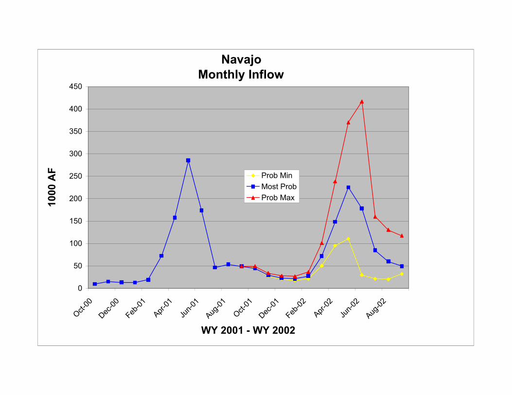
Navajo Reservoir
Runoff in the San Juan River basin in water year 2001 was above average. This reversed a two year dry trend. April through July unregulated inflow to Navajo Reservoir in water year 1999 and 2000 was 81 and 44 percent of average, respectively. The April through July unregulated inflow into Navajo Reservoir in water year 2001 was 0.826 MAF (1,019 MCM), or 107 percent of average. Water year 2001 unregulated inflow was 1.04 MAF (1,280 MCM) or 96 percent of average. Navajo Reservoir reached a peak elevation in 2001 of 6,069.8 feet (1,850.0 meters), 15.2 feet (4.6 meters) from full on July 2, 2001.
The final report titled “Flow Recommendations for the San Juan River,” which outlines flow recommendations for the San Juan River below Navajo Dam, was completed by the Biology Committee of the San Juan River Basin Recovery Implementation Program (SJRIP) in May 1999. The report synthesizes research conducted on endangered fish in the San Juan River over a 7-year period. The purpose of the report is to provide flow recommendations for the San Juan River that promote the recovery of the endangered Colorado pikeminnow and razorback sucker, maintain important habitat for these two species, as well as the other native species, and provide information for the evaluation of continued water development potential in the basin. It is anticipated that implementation of the flow recommendations, or reasonable alternative to it, will allow for a non-jeopardy biological opinion to be issued by the Service for the operations of Navajo Dam.
Reclamation has begun a National Environmental Policy Act (NEPA) process on the implementation of an operation at Navajo Dam that meets these flow recommendations or a reasonable alternative to them. A Notice of Intent to prepare an Environmental Impact Statement (EIS) was filed on October 1, 1999, in the Federal Register. The draft EIS is scheduled to be published in October 2001. The completion of the final EIS and Record of Decision is scheduled to occur in 2002.
During the spring, a large release of up to 5,000 cfs (142 cms) was made during May and June to coincide with the peak flows of the Animas River as prescribed by the flow recommendations.
October 15, 2001 10

Releases of 5,000 cfs (142 cms) were maintained for 27 days. After the completion of the large spring releases, releases were gradually reduced to 500 cfs (14 cms). Except for a low flow test conducted in July, releases were held at 500 cfs (14 cms) for the remainder of 2001.
As part of the EIS process, Reclamation performed a low flow test during July of 2001. Releases during this test were 250 cfs (7 cms). The test was conducted to gather physical, chemical, hydrologic, and hydraulic engineering data to evaluate the effects of a 250 cfs (7 cms) low-flow. After completion of the low flow test, releases were again restored back to 500 cfs (14 cms).
In water year 2002, Navajo Reservoir is expected to nearly fill under the most probable inflow scenario. Releases from the reservoir will be held near 500 cfs (14 cms) through the fall and winter months and large releases will likely be made in May and June pursuant to the flow recommendations to improve the habitat and provide better spawning conditions for endangered fish in the San Juan River.
Lake Powell
Lake Powell began water year 2001 with 20.9 MAF (25,800 MCM) of storage (86 percent of capacity). From October 2000 through June 2001, releases from Glen Canyon Dam were scheduled to achieve equalization of storage between Lake Mead and Lake Powell by the end of water year 2001 in accordance with Article II(3) of the Operating Criteria. Hydrologic conditions became drier as water year 2001 progressed, however. Forecasted April through July unregulated inflow to Lake Powell in January, 2001 was 92 percent of average. By July, 2001, forecasted inflow had dropped to 4.30 MAF (5,304 MCM) or 56 percent of average. This forecast was sufficiently low that storage equalization no longer became the governing criterion in the operation. From July 2001 through the end of the water year, releases were scheduled to maintain the minimum release objective from Lake Powell of 8.23 MAF (10,150 MCM) for water year 2001 in accordance with Article II(2) of the Operating Criteria.
April through July unregulated inflow into Lake Powell in water year 2001 was 4.30 MAF (5,300 MCM), or 56 percent of average. Water year 2001 unregulated inflow was 6.96 MAF (8,580 MCM), or 59 percent of average. Lake Powell reached a peak elevation of 3,673.0 feet (1,119.5 meters) on July 1, 2001 (27.0 feet from full). Lake Powell ended water year 2001 with 19.1 MAF (13,600 MCM) of storage (79 percent of capacity).
On 7 days during water year 2001, Glen Canyon Dam responded to stage III power emergencies in California. These responses occurred on February 15, March 19, March 20, May 7, May 8, May 31 and July 2. During most of these responses, generation was increased by about 300 megawatts (approximately 7,000 cfs) above that prescheduled. Ascending ramp rates and daily fluctuations exceeded the parameters of the ROD for the Glen Canyon Dam Final Environmental Impact Statement (GCDFEIS) preferred alternative on each of these occasions. Emergency exception criteria in the ROD, however, allow powerplant operations to exceed the parameters of the preferred alternative when necessary to respond to emergency situations. On each of the
October 15, 2001 11

days that Glen Canyon responded to the stage III power emergencies, there was insufficient available generation capacity on the interconnected power system.
During water year 2002, releases greater than the minimum release objective of 8.23 MAF (10,152 MCM) will likely be made to avoid anticipated spills and/or to equalize the storage between Lakes Powell and Mead. Under the most probable inflow conditions, releases of 9.57 MAF (11,800 MCM) will be made, while under the probable maximum inflow scenario, approximately 12.4 MAF (15,300 MCM) will be released. Under the minimum probable inflow scenario, or under a scenario of below average inflow where projected September 30, 2002 Lake Powell storage is less than that of Lake Mead, the minimum release objective of 8.23 MAF (10,152 MCM) will be maintained. Because of less than full storage conditions in Lake Powell, resulting from two consecutive years of below normal runoff, releases above powerplant capacity are not likely in 2002. Nonetheless, should 2002 be a year with very high inflow, releases above powerplant capacity are still possible. Such releases would be made consistent with the 1956 Colorado River Storage Project Act, the 1968 Colorado River Basin Project Act, and the 1992 Grand Canyon Protection Act. Reservoir releases in excess of powerplant capacity required for dam safety purposes during high reservoir conditions may be used to accomplish the objectives of the Beach/Habitat Building Flow according to the terms contained in the Glen Canyon Dam ROD, and as published in the Glen Canyon Dam Operating Criteria (62 Federal Register 9447, Mar. 3, 1997).
Releases from Lake Powell in water year 2002 will continue to reflect consideration of the uses and purposes identified in the authorizing legislation for Glen Canyon Dam. Powerplant releases and Beach/Habitat Building Flows will reflect criteria based on the findings, conclusions, and recommendations made in the ROD for the GCDFEIS pursuant to the Grand Canyon Protection Act of 1992. As discussed in the Interim Surplus Guidelines Record of Decision, an experimental flow program is being considered by the Glen Canyon Dam Adaptive Management Program. In 2002, the Adaptive Management Work Group may forward recommendations, required by the Interim Surplus Guidelines Record of Decision, on this matter for the Secretary’s consideration.
Daily and hourly releases will continue to be made according to the parameters of the ROD for the GCDFEIS preferred alternative, and the Glen Canyon Dam Operating Criteria, as shown in Table 3. Exceptions to these parameters may be made during power system emergencies, or for purposes of humanitarian search and rescue.
October 15, 2001 12

Table 3. Glen Canyon Dam Release Restrictions
Parameter
Maximum flow (1)
Minimum flow
Ramp rates
ascending
descending
Daily fluctuations (2)
(cfs)
25,000
5,000
8,000
4,000
1,500
5,000 / 8,000
(cms)
708.0
141.6
226.6
113.3
42.5
141.6 / 226.6
conditions
nighttime
7:00 am to 7:00 pm
per hour
per hour
Lake Mead
For calendar year 2001, the surplus condition was the criterion governing the operation of Lake Mead in accordance with Article III(3)(b) of the Operating Criteria and Article II(B)(2) of the Decree. The amount of additional mainstream water made available during calendar year 2001 was limited to a maximum of 0.630 MAF (777 MCM). A volume of 1.5 MAF (1,850 MCM) of water was scheduled for delivery to Mexico in accordance with Article 15 of the 1944 U.S.-Mexico Treaty and Minute No. 242 of the International Boundary and Water Commission.
Lake Mead began water year 2001 at elevation 1,196.72 feet (364.76 meters), with 22.4 MAF (27,673 MCM) in storage, 87 percent of the conservation capacity of 25.877 MAF (31,919 MCM). During the year, Lake Mead reached its maximum elevation of 1,197.27 feet (364.93 meters) at the end of January, 2001, with 22.5 MAF (27,782 MCM) in storage, 87 percent of capacity. Lake Mead reached its minimum elevation of 1,177.95 feet (359.04 meters) at the end of September 2001.
(1) May be exceeded during beach/habitat building flows, habitat maintenance flows, or when necessary to manage above average hydrologic conditions.
(2) Daily fluctuations limit is 5,000 cfs (141.6 cms) for months with release volumes less than 0.600 MAF (740 MCM); 6,000 cfs (169.9 cms) for monthly release volumes of 0.600 to 0.800 MAF (740 to 987 MCM); and 8,000 cfs (226.6 cms) for monthly volumes over 0.800 MAF (990 MCM).
October 15, 2001 13

The total release from Lake Mead through Hoover Dam during water year 2001 was 10.492 MAF (12,942 MCM), with an additional 0.311 MAF (383.62 MCM) being diverted from Lake Mead by the Robert Griffith Water Project.
Under the most probable inflow conditions during water year 2002, Lake Mead will be at its maximum elevation of 1,179.40 feet (359.48 meters) at the beginning of the water year and will decline during the water year to reach its minimum elevation of 1,168.87 feet (356.27 meters) in June 2002, dropping approximately 10 feet (3.05 meters). After June, Lake Mead will slowly rise to end the water year at an elevation of 1,172.92 feet (357.51 meters).
The Interim Surplus Guidelines Record of Decision included conservation measures. One such conservation measure specified in Article X(4)(2) includes provisions for spawning razorback suckers in Lake Mead.
No flood control releases are required during water year 2002 under the three inflow scenarios.
As Lake Mead remains near capacity and flood control releases may be required by the Hoover Dam Flood Control Regulations, consideration will be given to making these releases over the fall and winter months of 2002 to avoid high flow releases during the January through July runoff season in year 2003. This distribution of water reduces the chance of bypassing hydroelectric powerplants below Hoover Dam and avoids the adverse impacts of higher flood control releases on property, river stabilization, recreation, and water quality.
Lakes Mohave and Havasu
At the beginning of water year 2001, Lake Mohave was at an elevation of 636.42 feet (193.98 meters), with an active storage of 1.523 MAF (1,879 MCM). The water level of Lake Mohave was regulated as needed between elevation 629 feet (191.72 meters) and 644 feet (196 meters) throughout the water year, ending at an elevation of 639.73 feet (194.99 meters) with 1.61 MAF (1,986 MCM) in storage. The total release from Lake Mohave through Davis Dam was 10.076 MAF (12,429 MCM) for downstream water use requirements.
For water year 2002, Davis Dam is expected to release 9.735 MAF (12,008 MCM). The water level in Lake Mohave will be regulated between an elevation of 630 feet (192 meters) and 643 feet (196 meters).
Lake Havasu started water year 2001 at an elevation of 447.25 feet (136.32 meters), with 0.566 MAF (698 MCM) in storage. The water level of Lake Havasu was regulated as needed between elevation 445 feet (135.6 meters) and 449 feet (136.9 meters). During the year, 7.256 MAF (8,950 MCM) was released from Parker Dam. In addition to these releases, 1.589 MAF (1,960 MCM) was diverted from Lake Havasu into the Central Arizona Project (CAP) and 1.263 MAF (1,558 MCM) by the Metropolitan Water District (MWD).
October 15, 2001 14

For water year 2002, Parker Dam is expected to release 7.109 MAF (8,769 MCM). Diversions from Lake Havasu by MWD and CAP are expected to be 1.25 MAF (1.542 MCM) and 1.407 MAF (1,736 MCM), respectively.
Mohave and Havasu Reservoirs are scheduled to be drawn down in the late summer and winter months to provide storage space for local storm runoff and will be filled in the spring to meet higher summer water needs. This drawdown will also correspond with maintenance at both Davis and Parker powerplants which is scheduled for September through February. During 2002, Lake Mohave will continue to be operated under the constraints as described in the Biological and Conference Opinion on Lower Colorado River Operations and Maintenance. Reclamation, as provided in the Interim Surplus Guidelines Record of Decision, will continue these existing operations in Lake Mohave that benefit native fish through the effective period of the Interim Surplus Guidelines and will explore additional ways to provide benefits to native fish. The normal filling pattern of these two reservoirs coincides well with the fishery spawning period. Since lake elevations will be typical of previous years, normal conditions are expected for boating and other recreational uses.
Reclamation is the lead agency in the Native Fish Work Group, a multi-agency group of scientists attempting to augment the aging stock of the endangered razorback sucker in Lake Mohave. Larval suckers are captured by hand in and around spawning areas in late winter and early spring for rearing at Willow Beach Fish Hatchery below Hoover Dam. The following year, one year old suckers are placed into predator-free, lake-side backwaters for rearing through the spring and summer. When the lake is normally drawn down during the fall, these fish are harvested from these rearing areas and then released to the lake. The suckers grow very quickly, usually exceeding ten inches in length by September.
Senator Wash and Laguna Reservoirs
Operations at Senator Wash Reservoir allow regulation of water deliveries to United States and Mexican water users downstream at Imperial Dam. The reservoir is utilized as an off-stream storage facility to meet downstream water demands and to conserve water for future uses in the United States and the scheduled uses of Mexico in accordance with the Treaty obligation. Senator Wash Reservoir is the first storage facility below Parker Dam. Senator Wash Dam is located approximately 142 river miles downstream of Parker Dam. Operational objectives are to store excess flows from the river which have been caused by water user cutbacks and sidewash inflows due to rain. Stored waters are utilized to meet irrigation, recreational, and Treaty demands. Elevation restrictions on Senator Wash Reservoir reduce the flexibility of water storage in the lower reaches of the river. An elevation restriction of 240.0 feet at Senator Wash Reservoir, due to potential piping at West Squaw Lake Dike and Senator Wash Dam, had been in place. A test-fill occurred September 15 to October 19, 2000 and had to be stopped due to piping concerns at West Squaw Lake Dike. Since the test-fill a new elevation restriction has temporarily decreased the storage elevation to 235 feet, with normal operations ranging from 218 to 233 feet. Data from this initial test-fill have been analyzed. Hydrologic analysis indicates the
October 15, 2001 15

best time of year to do the restoration is from March to July, to reduce excess administrative deliveries. The earliest the restoration and subsequent test fill could occur is March 2002.
Laguna Reservoir is a regulating storage facility located approximately 7 river miles downstream of Senator Wash. Operational objectives are similar to those for Senator Wash Reservoir. The storage capability of Laguna Reservoir is currently diminished due to sediment accumulation and vegetation growth. Sediment accumulation in the reservoir has occurred primarily due to flooding that occurred in 1983 and 1984. Dredging of the Laguna Reservoir to increase its storage capability is scheduled to begin in water year 2002.
Imperial Dam
Imperial Dam is the last diversion dam on the Colorado River for United States water users. From its headworks flow the diversions into the All American Canal on the California side, and into the Gila Gravity Main Canal on the Arizona side. These diversions supply all the irrigation districts in the Yuma area and in the Wellton-Mohawk, Imperial, and Coachella Valleys.
Yuma Desalting Plant
The Yuma Desalting Plant (YDP) was not operated in 2001. The U.S. recognizes that it has an obligation to replace, as appropriate, the bypass flows. The U.S. is exploring options for replacement of the bypass flows, including options that would not require operation of the Yuma Desalting Plant.
Most of the damage to the YDP’s associated facilities caused by the 1993 Gila River flood has been repaired. Those associated facilities are the Main Outlet Drain (MOD), the Main Outlet Drain Extension (MODE), and the Bypass Drain, which extends from the YDP to the Cienega de Santa Clara on the coast of the Sea of Cortez. The first half mile section of the MODE was damaged during the 1993 Gila River flood. This section is operable and the damage is not affecting the operation of the MODE or YDP. This section has not been repaired to date because of the high costs involved associated with dewatering the area. Seepage from the drain is less than one percent of the ground water flow in the area and is not affecting the quality of the ground water. Since the 1993 flood, a levee has been built between the MODE and the Gila River channel to direct flood flows away from the damaged area. Minor repair work is accomplished each year to replace isolated, broken panels and to clean debris from the drain system. At this time, repair for the first half mile reach of the MODE has not been included in any future budgets. All Wellton-Mohawk Irrigation & Drainage District drainage flows are expected to be diverted into the MODE in 2002. There is a potential that a portion of the drainage return flows may be diverted to the Colorado River during short periods while repairs to the MODE and Bypass Drain are being made. These releases are not expected to impact meeting the requirements of the salinity differential of Minute 242 of the International Boundary and Water Commission (IBWC).
October 15, 2001 16

The Water Quality Improvement Center (WQIC) processes about one million gallons per day of drainage water, delivered either from the MODE, pumped from an on-site well, or diverted from the Cooper Lateral. The water is used for Reclamation facilities, including the WQIC, education center and administrative offices. The WQIC will continue to operate during calendar year 2002. An Education Center affiliated with the WQIC was constructed during 1999 and currently offers classes to the public in water treatment by reverse osmosis. The first class started in August 1999 in cooperation with Arizona Western College in Yuma and graduated in the spring of 2001.
Colorado River Channel Aggradation Below Gila River Confluence
The 1993 Gila River flood deposited approximately 10 million cubic yards of sediment in the Colorado River between its confluence with the Gila and Morelos Dam. An additional unspecified volume of sediment was deposited in the river channel below Morelos Dam. The aggradation of the channel has substantially reduced the river’s capability to carry flood flows, to act as a drain for groundwater, and has occasionally caused operational problems with the delivery of Treaty water to Mexico at Morelos Dam.
The Yuma Area Office developed a project proposal to address the aggradation problems in cooperation with local irrigation districts, the IBWC, Native American Tribes, local environmental organizations, local governments, and other state and federal agencies.
The overall project has been developed in phases. Phase 1 of the project was completed in late 1997 so the channel below Morelos Dam could accommodate flood control releases from Hoover Dam during the winters of 1997 and 1998. Phase 1 consisted of limited clearing of a flow path in the channel below Morelos Dam, and realignment of the channel upstream of Yuma at River Mile 31, where the levee was in danger of being breached during high flows.
Phase 2 of the project began in September 1999. Phase 2 consisted of dredging a sediment basin in the river channel immediately upstream of Morelos Dam to a location about one mile above the NIB. The sediment basin will alleviate most of the operational problems due to sediment laden waters being delivered to Mexico at Morelos Dam. Phase 2 was completed in April of 2001.
The need for completing Phases 3 and 4 of the project is currently being reviewed and studied. The space building and flood control releases experienced during the winters of 1997, 1998, and 1999, as well as the natural dynamic nature of the river system, make this review prudent.
Limitrophe Division Below Morelos Dam
The IBWC has initiated the development of an Environmental Impact Statement (EIS) to address the work necessary to develop and undertake a boundary preservation project within the Limitrophe section of the Colorado River. The flood events of 1983 and 1993 have changed the course of the river and deposited approximately 10 million cubic yards of material
October 15, 2001 17

within the first 5.5 miles of the river below Morelos Dam, affecting the carrying capacity of the river and contributing to higher groundwater levels in the Yuma Valley. The EIS will identify the best U.S./Mexico alternative to be undertaken for the proposed project.
The following schedule is proposed for the EIS.
Feb 3, 1999 Meeting with cooperators and resource agencies
May 21, 1999 Notice of Intent
Jun 9, 1999 Public scoping meeting
Aug 15, 2000 Development of maps for boundary alignments and significant habitat
Dec 7, 2001 Bi-national meeting on proposed alignments and land use and environmental data from Mexico
Jan 18, 2002 Presentation to all Resource agencies on preliminary alignment alternatives/plan
May 10, 2002 Notice of availability of draft EIS in Federal Register
May 31, 2002 Public meeting on draft EIS
Sep 13, 2002 File final EIS
Dec 20, 2002 Record of Decision
October 15, 2001 18

2002 DETERMINATIONS
The AOP provides guidance regarding reservoir storage and release conditions during the upcoming year, based upon Congressionally mandated and authorized storage, release, and delivery criteria and determinations. After meeting these requirements, specific reservoir releases may be modified within these requirements as forecast inflows change in response to climatic variability and to provide additional benefits coincident to the projects’ multiple purposes.
Upper Basin Reservoirs
The Operating Criteria provide that the annual plan of operation shall include a determination of the quantity of water considered necessary to be in Upper Basin storage at the end of the water year. Taking into consideration all relevant factors required by the Operating Criteria, and further considering information submitted to Reclamation by the Colorado River Basin States (65 Federal Register 48537, August 8, 2000) which would utilize a value not less than 14.85 million acre-feet (elevation 3,630 feet) for Lake Powell, it is determined that the active storage in Upper Basin reservoirs forecast for September 30, 2002, exceeds the storage required under Section 602(a) of the Colorado River Basin Project Act under any reasonable range of assumptions which might be applied. Therefore, “602(a) Storage” is not the criterion controlling the release of water from Glen Canyon Dam during water year 2002.
Section 602(a)(3) of the Colorado River Basin Project Act provides for the storage of Colorado River water in Upper Basin reservoirs that the Secretary of the Interior finds necessary to assure deliveries to comply with Articles III(c) and III(d) of the 1922 Colorado River Compact, without impairment to the annual consumptive use in the Upper Basin. Pursuant to Section 602(b), as amended, the Secretary is required to make this determination after consultation with the Upper Colorado River Commission and representatives from the three Lower Division States, and after taking into consideration all relevant factors including historic stream flows, the most critical period of record, the probabilities of water supply, and estimated future depletions. Water not required to be so stored will be released from Lake Powell:
� to the extent it can be reasonably applied in the States of the Lower Division to the uses specified in Article III(e) of the 1922 Colorado River Compact, but these releases will not be made when the active storage in Lake Powell is less than the active storage in Lake Mead,
� to maintain, as nearly as practicable, active storage in Lake Mead equal to the active storage in Lake Powell, and
� to avoid anticipated spills from Lake Powell.
The spill avoidance and/or the storage equalization criteria in accordance with Article II(3) of the Operating Criteria will control the releases from Glen Canyon Dam during water year 2002
October 15, 2001 19

unless the minimum objective release criterion in Article II(2) is controlling. Under the most probable inflow scenario, Glen Canyon Dam will release 9.57 MAF (11,800 MCM).
Lower Basin Reservoirs
Pursuant to the Operating Criteria and consistent with the Decree, water shall be released or pumped from Lake Mead to meet the following requirements:
(a) 1944 U.S.-Mexico Water Treaty obligations;(b) Reasonable beneficial consumptive use requirements of mainstream users in
the Lower Division States; (c) Net river losses; (d) Net reservoir losses; (e) Regulatory wastes; and (f) Flood control.
The Operating Criteria provide that after the commencement of delivery of mainstream water by means of the CAP, the Secretary of the Interior will determine the extent to which the reasonable beneficial consumptive use requirements of mainstream users are met in the Lower Division States. The reasonable beneficial consumptive use requirements are met depending on whether a normal, surplus, or shortage condition has been determined. The normal condition is defined as annual pumping and release from Lake Mead sufficient to satisfy 7.500 MAF (9,251 MCM) of consumptive use in accordance with Article III(3)(a) of the Operating Criteria and Article II(B)(1) of the Decree. The surplus condition is defined as annual pumping and release from Lake Mead sufficient to satisfy in excess of 7.500 MAF (9,251 MCM) consumptive use in accordance with Article III(3)(b) of the Operating Criteria and Article II(B)(2) of the Decree.
The Interim Surplus Guidelines, which serve to implement the narrative provisions of Article III(3)(b) of the Operating Criteria and Article II(B)(2) of the Decree for the period when the Interim Surplus Guidelines are effective, became effective on February 26, 2001. These specific interim surplus guidelines will be used annually to determine the conditions under which the Secretary would declare the availability of water for use within the Lower Division States.
Article II(B)(6) of the Decree allows the Secretary to allocate water that is apportioned to one Lower Division State, but is for any reason unused in that State, to another Lower Division State. This determination is made for one year only and no rights to recurrent use of the water accrue to the state that receives the allocated water. As provided in the Interim Surplus Guidelines, Section 1(B), before making a determination of a surplus condition under these Guidelines, the Secretary will determine the quantity of apportioned but unused water from the basic apportionments, based on the best available information at the time. Reclamation does not anticipate any available unused apportionment for calendar year 2002 at this time. The Secretary shall allocate any available unused apportionments for calendar year 2002 in accordance with Section 1(B) of the Interim Surplus Guidelines.
October 15, 2001 20
The determination of surplus conditions for calendar year 2002 is based on these Interim Surplus Guidelines. Consistent with Section 7 of the Interim Surplus Guidelines, the August 24-Month Study was used to project the January 1, 2002, Lake Mead reservoir water surface elevation. Based on this projection, the Full Domestic Surplus will govern releases for use in the States of Arizona, Nevada, and California during calendar year 2002, as defined in Section 2 of the Interim Surplus Guidelines. The amount of this Surplus shall equal:
a. For Direct Delivery Domestic Use by MWD, 1.250 MAF reduced by the amount of basic apportionment available to MWD.
b. For use by SNWA, the Direct Delivery Domestic Use within the SNWA service area in excess of the State of Nevada’s basic apportionment.
c. For use in Arizona, the Direct Delivery Domestic Use in excess of Arizona’s basic apportionment.
For informational and planning purposes, Reclamation has estimated the amount of surplus water expected to be pumped or released from Lake Mead during calendar year 2002 under the Full Domestic Surplus. It is not expected to exceed 0.640 MAF (789.44 MCM). The actual amount of surplus could be less than this amount (in the likely event of the use of any available unused apportionment) and could also, based on actual Direct Delivery Domestic use, exceed this projected amount.
As provided in Section 3 of the Interim Surplus Guidelines, the Secretary shall undertake a “mid-year review” pursuant to Article I(2) of the Operating Criteria, allowing for the revision of the current AOP, as appropriate, based on actual runoff conditions which are greater than projected, or demands which are lower than projected. The Secretary shall revise the determination for the current year only to allow for additional deliveries. Any revision in the AOP may occur only after a reinitiation of the AOP consultation process as required by law.
For informational purposes, the natural inflow required to reach a Quantified Surplus (70R value strategy) on January 1, 2002, is 24.892 MAF, which has been exceeded in the historical record only 1 percent of the time. As provided in Article IV(1) of the Interim Surplus Guidelines, the 70R strategy involves assuming a 70-percentile inflow into Lake Powell, subtracting out the consumptive uses and system losses and checking the results to see if all of the water could be stored or if flood control releases from Lake Mead would be required. If flood control releases from Lake Mead would be required, additional water is made available to the Lower Division states beyond a full domestic surplus. The notation 70R refers to the natural inflow into Lake Powell that has been exceeded 30 percent of the time (17.4 MAF).
1944 U.S.-Mexico Water Treaty
Under most probable inflow conditions, water in excess of that required to supply uses in the United States will not be available, therefore there will be no Colorado River surplus, as defined by the 1944 U.S.-Mexico Water Treaty, for delivery to Mexico. Vacant storage space in mainstem reservoirs is substantially greater than that required by flood control regulations.
October 15, 2001 21

Therefore, a volume of 1.5 MAF (1,850 MCM) of water will be allowed to be scheduled for delivery to Mexico during calendar year 2002 in accordance with Article 15 of the 1944 U.S.-Mexico Water Treaty and Minute No. 242 of the International Boundaryand Water Commission. Calendar year schedules of the monthly deliveries of Colorado River water are formulated by the Mexican Section of the IBWC and presented to the United States Section before the beginning of each calendar year.
October 15, 2001 22

.........................................................................................................
DISCLAIMER
Nothing in this Annual Operating Plan is intended to interpret the provisions of The Colorado River Compact (45 Stat. 1057), The Upper Colorado River Basin Compact (63 Stat. 31), The Utilization of Waters of the Colorado and Tijuana Rivers and of the Rio Grande, Treaty Between the United States of America and Mexico (Treaty Series 994, 59 Stat. 1219), the United States/Mexico agreement in Minute No. 242 of August 30, 1973, (Treaty Series 7708; 24 UST 1968), the Decree entered by the Supreme Court of the United States in Arizona v. California et al. (376 U.S. 340), as amended and supplemented, The Boulder Canyon Project Act (45 Stat. 1057), The Boulder Canyon Project Adjustment Act (54 Stat. 774; 43 U.S.C. 618a), The Colorado River Storage Project Act (70 Stat. 105; 43 U.S.C. 620), The Colorado River Basin Project Act (82 Stat. 885; 43 U.S.C. 1501), The Colorado River Basin Salinity Control Act (88 Stat. 266; 43 U.S.C. 1951), The Hoover Power Plant Act of 1984 (98 Stat. 1333), The Colorado River Floodway Protection Act (100 Stat. 1129; 43 U.S.C. 1600), or The Grand Canyon Protection Act of 1992 (Title XVIII of Public Law 102-575, 106 Stat. 4669).
October 15, 2001 23

Attachment. Monthly inflow, monthly release, and end of month contents for Colorado River reservoirs (October 2000 through September 2002) under the probable maximum, most probable, and the probable minimum inflow scenarios, and historic end of month contents.
October 15, 2001 24

Fontenelle Monthly Inflow
0
100
200
300
400
500
600
700
Oct-00
Dec
-00
Feb-01
Apr-
01
Jun-0
1 Aug
-01
Oct-01
Dec
-01
Feb-02
Apr-
02
Jun-0
2 Aug
-02
WY 2001 - WY 2002
1000
AF
Prob Min Most Prob Prob Max

Fontenelle Monthly Releases
0
50
100
150
200
250
300
350
400
450
Oct-00
Dec
-00
Feb-01
Apr-
01
Jun-0
1 Aug
-01
Oct-01
Dec
-01
Feb-02
Apr-
02
Jun-0
2 Aug
-02
WY 2001 - WY 2002
1000
AF
Prob Min Most Prob Prob Max

Fontenelle Monthly Storage
0
50
100
150
200
250
300
350
Oct-00
Dec
-00
Feb-01
Apr-
01
Jun-0
1 Aug
-01
Oct-01
Dec
-01
Feb-02
Apr-
02
Jun-0
2 Aug
-02
WY 2001 - WY 2002
1000
AF
Prob Min Most Prob Prob Max

Flaming Gorge Monthly Inflow
0
100
200
300
400
500
600
700
800
900
Oct-00
Dec
-00
Feb-01
Apr-
01
Jun-0
1 Aug
-01
Oct-01
Dec
-01
Feb-02
Apr-
02
Jun-0
2 Aug
-02
WY 2001 - WY 2002
1000
AF
Prob Min Most Prob Prob Max

Flaming Gorge Monthly Releases
0
50
100
150
200
250
300
350
400
450
Oct-00
Dec
-00
Feb-01
Apr-
01
Jun-0
1 Aug
-01
Oct-01
Dec
-01
Feb-02
Apr-
02
Jun-0
2 Aug
-02
WY 2001 - WY 2002
1000
AF
Prob Min Most Prob Prob Max

Flaming Gorge Monthly Storage
2800
2900
3000
3100
3200
3300
3400
3500
3600
Oct-00
Dec
-00
Feb-01
Apr-
01
Jun-0
1 Aug
-01
Oct-01
Dec
-01
Feb-02
Apr-
02
Jun-0
2 Aug
-02
WY 2001 - WY 2002
1000
AF
Prob Min Most Prob Prob Max

Blue Mesa Monthly Inflow
0
50
100
150
200
250
300
350
400
450
500
Oct-00
Dec
-00
Feb-01
Apr-
01
Jun-0
1 Aug
-01
Oct-01
Dec
-01
Feb-02
Apr-
02
Jun-0
2 Aug
-02
WY 2001 - WY 2002
1000
AF
Prob Min Most Prob Prob Max

Crystal Monthly Releases
0
50
100
150
200
250
300
350
Oct-00
Dec
-00
Feb-01
Apr-
01
Jun-0
1 Aug
-01
Oct-01
Dec
-01
Feb-02
Apr-
02
Jun-0
2 Aug
-02
WY 2001 - WY 2002
1000
AF
Prob Min Most Prob Prob Max

Blue Mesa Monthly Storage
0
100
200
300
400
500
600
700
800
900
Oct-00
Dec
-00
Feb-01
Apr-
01
Jun-0
1 Aug
-01
Oct-01
Dec
-01
Feb-02
Apr-
02
Jun-0
2 Aug
-02
WY 2001 - WY 2002
1000
AF
Prob Min Most Prob Prob Max
Navajo Monthly Inflow
0
50
100
150
200
250
300
350
400
450
Oct-00
Dec
-00
Feb-01
Apr-
01
Jun-0
1 Aug
-01
Oct-01
Dec
-01
Feb-02
Apr-
02
Jun-0
2 Aug
-02
WY 2001 - WY 2002
1000
AF Prob Min
Most Prob Prob Max

Navajo Monthly Releases
0
50
100
150
200
250
300
350
Oct-00
Dec
-00
Feb-01
Apr-
01
Jun-0
1 Aug
-01
Oct-01
Dec
-01
Feb-02
Apr-
02
Jun-0
2 Aug
-02
WY 2001 - WY 2002
1000
AF
Prob Min Most Prob Prob Max

Navajo Monthly Storage
1000
1100
1200
1300
1400
1500
1600
1700
Oct-00
Dec
-00
Feb-01
Apr-
01
Jun-0
1 Aug
-01
Oct-01
Dec
-01
Feb-02
Apr-
02
Jun-0
2 Aug
-02
WY 2001 - WY 2002
1000
AF
Prob Min Most Prob Prob Max

Lake Powell Monthly Inflow
0
1000
2000
3000
4000
5000
6000
Oct-00
Dec
-00
Feb-01
Apr-
01
Jun-0
1 Aug
-01
Oct-01
Dec
-01
Feb-02
Apr-
02
Jun-0
2 Aug
-02
WY 2001 - WY 2002
1000
AF
Prob Min Most Prob Prob Max

Lake Powell Monthly Releases
0
200
400
600
800
1000
1200
1400
1600
Oct-00
Dec
-00
Feb-01
Apr-
01
Jun-0
1 Aug
-01
Oct-01
Dec
-01
Feb-02
Apr-
02
Jun-0
2 Aug
-02
WY 2001 - WY 2002
1000
AF
Prob Min Most Prob Prob Max

Lake Powell Monthly Storage
0
5000
10000
15000
20000
25000
Oct-00
Dec
-00
Feb-01
Apr-
01
Jun-0
1 Aug
-01
Oct-01
Dec
-01
Feb-02
Apr-
02
Jun-0
2 Aug
-02
WY 2001 - WY 2002
1000
AF
Prob Min Most Prob Prob Max

Lake Mead Monthly Inflow
0
200
400
600
800
1000
1200
1400
1600
1800
Oct-00
Dec
-00
Feb-01
Apr-
01
Jun-0
1 Aug
-01
Oct-01
Dec
-01
Feb-02
Apr-
02
Jun-0
2 Aug
-02
WY 2001 - WY 2002
1000
AF
Prob Min Most Prob Prob Max

Lake Mead Monthly Releases
0
200
400
600
800
1000
1200
1400
Oct-00
Dec
-00
Feb-01
Apr-
01
Jun-0
1 Aug
-01
Oct-01
Dec
-01
Feb-02
Apr-
02
Jun-0
2 Aug
-02
WY 2001 - WY 2002
1000
AF
Prob Min Most Prob Prob Max

Lake Mead Monthly Storage
0
5000
10000
15000
20000
25000
Oct-00
Dec
-00
Feb-01
Apr-
01
Jun-0
1 Aug
-01
Oct-01
Dec
-01
Feb-02
Apr-
02
Jun-0
2 Aug
-02
WY 2001 - WY 2002
1000
AF
Prob Min Most Prob Prob Max

Fontenelle
0
50
100
150
200
250
300
350
400
1966 1971 1976 1981 1986 1991 1996 2001
Monthly Storage
1000
AF
1966 - 2001

Flaming Gorge
0
500
1000
1500
2000
2500
3000
3500
4000
1963 1968 1973 1978 1983 1988 1993 1998
Monthly Storage
1000
AF
1963 - 2001

Blue Mesa
100
200
300
400
500
600
700
800
900
1969 1974 1979 1984 1989 1994 1999
Monthly Storage
1000
AF
1969 - 2001

Navajo
0
200
400
600
800
1000
1200
1400
1600
1800
2000
1963 1968 1973 1978 1983 1988 1993 1998
Monthly Storage
1000
AF
1963 - 2001

Lake Powell
0
5000
10000
15000
20000
25000
30000
1964 1969 1974 1979 1984 1989 1994 1999
Monthly Storage
1000
AF
1964 - 2001

Lake Mead
10000
12000
14000
16000
18000
20000
22000
24000
26000
28000
30000
1941 1946 1951 1956 1961 1966 1971 1976 1981 1986 1991 1996 2001
Monthly Storage
1000
AF
1941 - 2001