1.4Understand how moving ice acts as an agent of erosion and deposition. (Chapter 2) There are two...
36
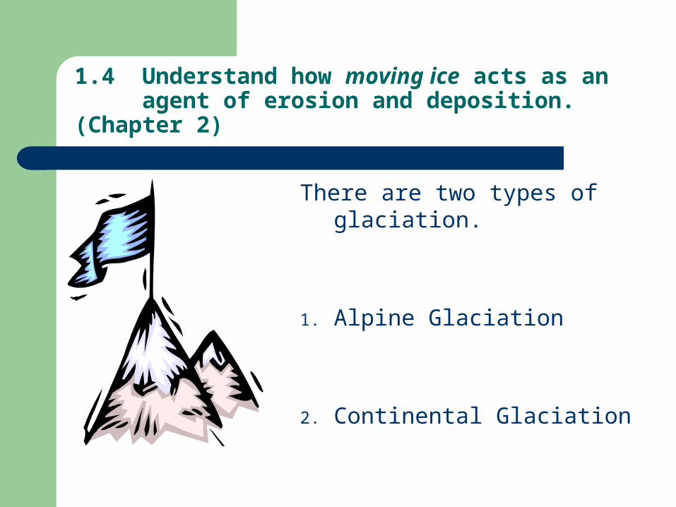
1.4 Understand how moving ice acts as an agent of erosion and deposition. (Chapter 2) There are two types of glaciation. 1. Alpine Glaciation 2. Continental Glaciation
-
Upload
nigel-randall -
Category
Documents
-
view
219 -
download
1
Transcript of 1.4Understand how moving ice acts as an agent of erosion and deposition. (Chapter 2) There are two...
1.4 Understand how moving ice acts as an agent of erosion and deposition. (Chapter 2)
There are two types of glaciation.
1. Alpine Glaciation
2. Continental Glaciation

1.6.1 Distinguish between the terms alpine glaciation and continental glaciation. (P.32)
Alpine Glaciers = form high in mountain
valleys above the snow-line
Continental Glaciers= cover parts of
continental land masses near poles; eg Greenland & Antarctica

Similarities & Differences between Alpine & Continental Glaciation
Similarities Both move (gravity, friction) Both cause erosion in 3 ways
– Bulldozing– Glacial striations– Freeze-n-pluck
Both change the landscape (denudes, deposits)
Both developed in constantly cold < 0 0C
Differences Location
– Alpine = mountain– Continental = earth poles
Size– Alpine = smaller– Continental = larger
Types of features formed (see next slides)
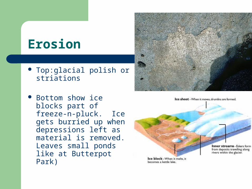
Erosion
Top:glacial polish or striations
Bottom show ice blocks part of freeze-n-pluck. Ice gets burried up when depressions left as material is removed. Leaves small ponds like at Butterpot Park)

Glaciers of the world
Continental glaciers
Alpine Glaciers

Surface of a glacier
Below, Torgat Mtns Lab Side, Alaska
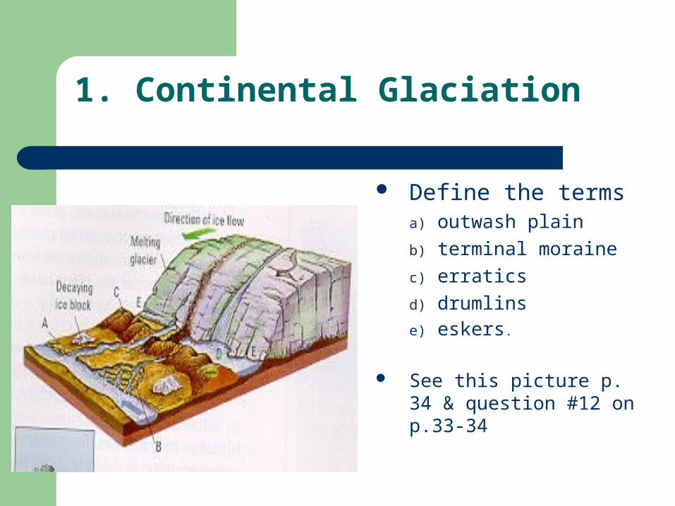
1. Continental Glaciation
Define the terms a) outwash plain
b) terminal moraine
c) erratics
d) drumlins e) eskers.
See this picture p. 34 & question #12 on p.33-34
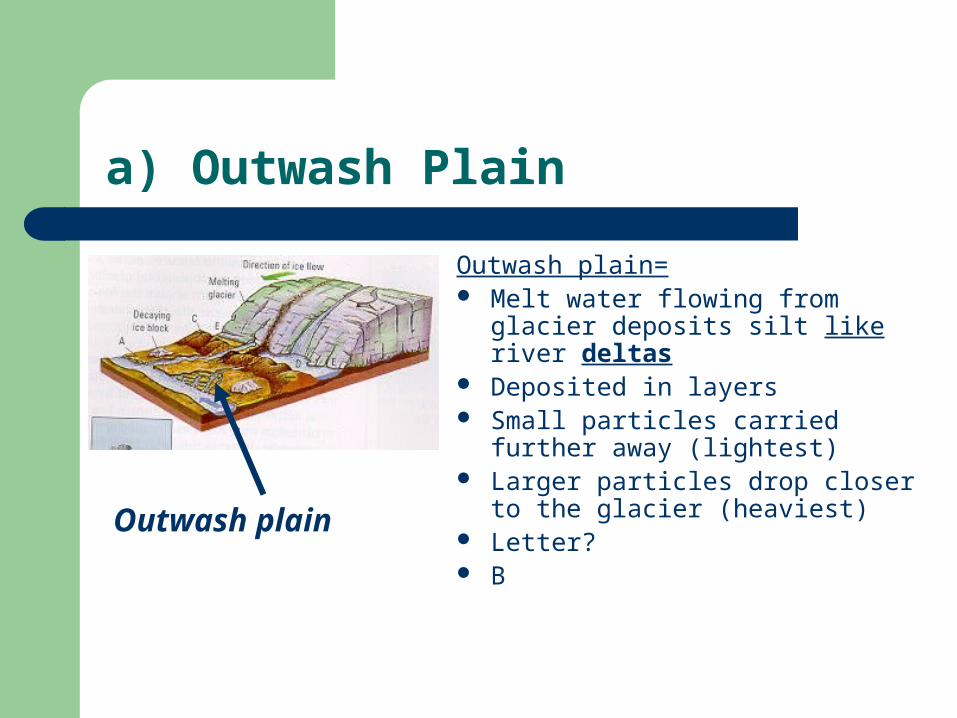
a) Outwash Plain
Outwash plain= Melt water flowing from glacier
deposits silt like river deltas Deposited in layers Small particles carried further away
(lightest) Larger particles drop closer to the
glacier (heaviest) Letter? B
Outwash plain

b) Terminal Moraine
Terminal Moraine Heap or ridge of bulldozed gravel that
marks the end of the forward motion of a glacier
**Think of loads of dirt dumped by a dump truck
This bulldozing happens at the snout. Letter for snout?
E As glacier retreats it deposits
debris/gravel in ridge perpendicular to flow
Letter for moraine? C

c) Erratics
Erratics = Large boulders that were
transported long distances and dropped
They now sit in a region and look very much out-of-place.
Letter? H
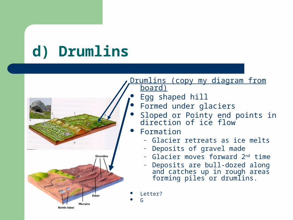
d) Drumlins
Drumlins (copy my diagram from board) Egg shaped hill Formed under glaciers Sloped or Pointy end points in direction
of ice flow Formation
– Glacier retreats as ice melts– Deposits of gravel made– Glacier moves forward 2nd time– Deposits are bull-dozed along and
catches up in rough areas forming piles or drumlins.
Letter? G
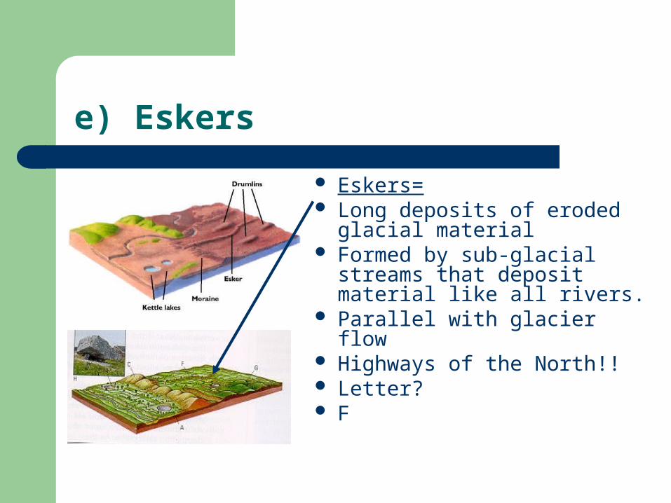
e) Eskers
Eskers= Long deposits of eroded
glacial material Formed by sub-glacial streams
that deposit material like all rivers.
Parallel with glacier flow Highways of the North!! Letter? F

Examine evidence for the direction of movement of glaciers. (P. 34 question # 13)
Evidence for direction of movement?
1. Sloped end of drumlin**
2. Location of terminal moraine (could be from 2 directions)
3. Eskers (only tells axis)
What is direction of glacier movement in this picture?

Identify the following continental features. (1)
Drumlin in Alberta Drumlins may rise
to elevations exceeding 30 m and extend, at least, to lengths of 800 m.
This feature shown above is about 35 m high, and at least 250 m long.
In which direction did the glacier travel?

Identify the following continental features.(2)
Esker, NWT
In which direction did the glacier travel?

Identify the following continental features.(3)
Glacial delta at Hermitage, Hermitage Peninsula.
The great mass of sand and gravel on which the village is situated was deposited at the margin of a glacier which, during the final retreat of the Newfoundland ice sheet, stagnated in Hermitage Bay on the north side of the peninsula. At that time the sea stood more than 20 m higher and the meltwater from the glacier built a large flat-topped delta and terrace. Depressions in the gravel mass (kettles) formed as blocks of buried glacier ice melted.

Identify the following continental features.(4)
Drumlin in Burgeo
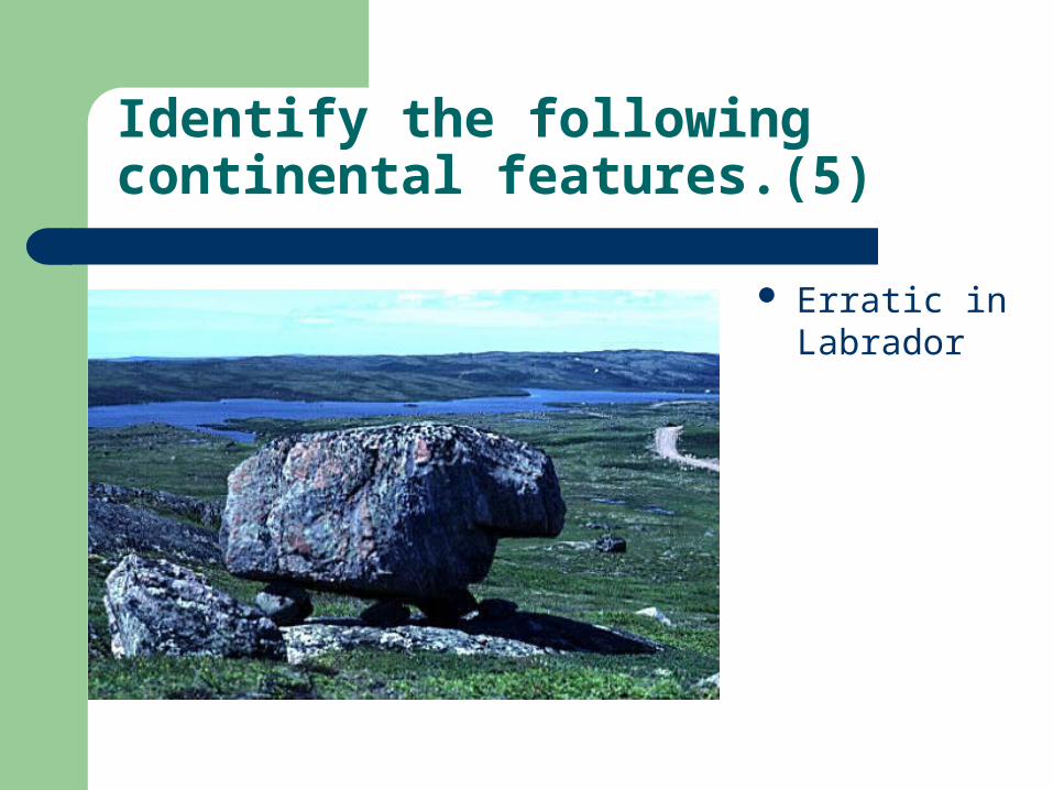
Identify the following continental features.(5)
Erratic in Labrador

Identify the following continental features.(6)
See long thin lines of deposits?
Eskers or glacial river deposits
A common sight on transatlantic flights, the narrow sinuous branching ridges are eskers composed of gravel and sand that was deposited by glacial meltwater in tunnels beneath an ice sheet.

Alpine glaciers
Alpine glaciers are like very slow moving rivers of ice flowing down high mountain valleys.

2. Alpine Glaciation
Define the terms
a) cirque,
b) arête,
c) hanging valley
d) Lateral & medial moraine
e) terminal moraine.
• Read pages 34-7, see diagram page 36, chart page 37 & question #14 page 36
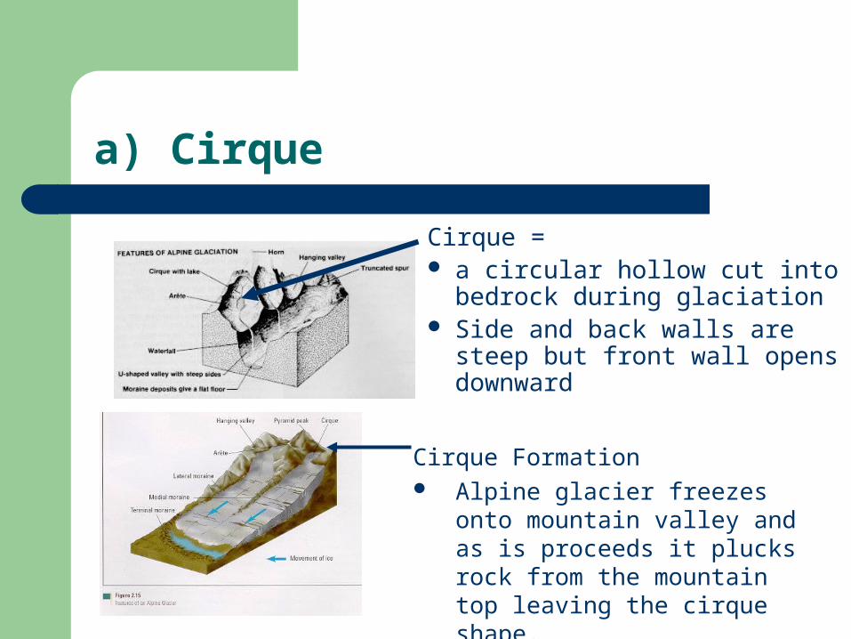
a) Cirque
Cirque = a circular hollow cut into
bedrock during glaciation Side and back walls are steep
but front wall opens downward
Cirque Formation Alpine glacier freezes onto
mountain valley and as is proceeds it plucks rock from the mountain top leaving the cirque shape.

b) Arête
Arête= Steep knife edged ridge
between two cirques in a mountainous region.

c) Hanging Valley
Hanging Valley = A high level tributary
valley from which the ground falls sharply to the level of the lower, main valley.
The depth of the lower valley is due to more severe glaciation.
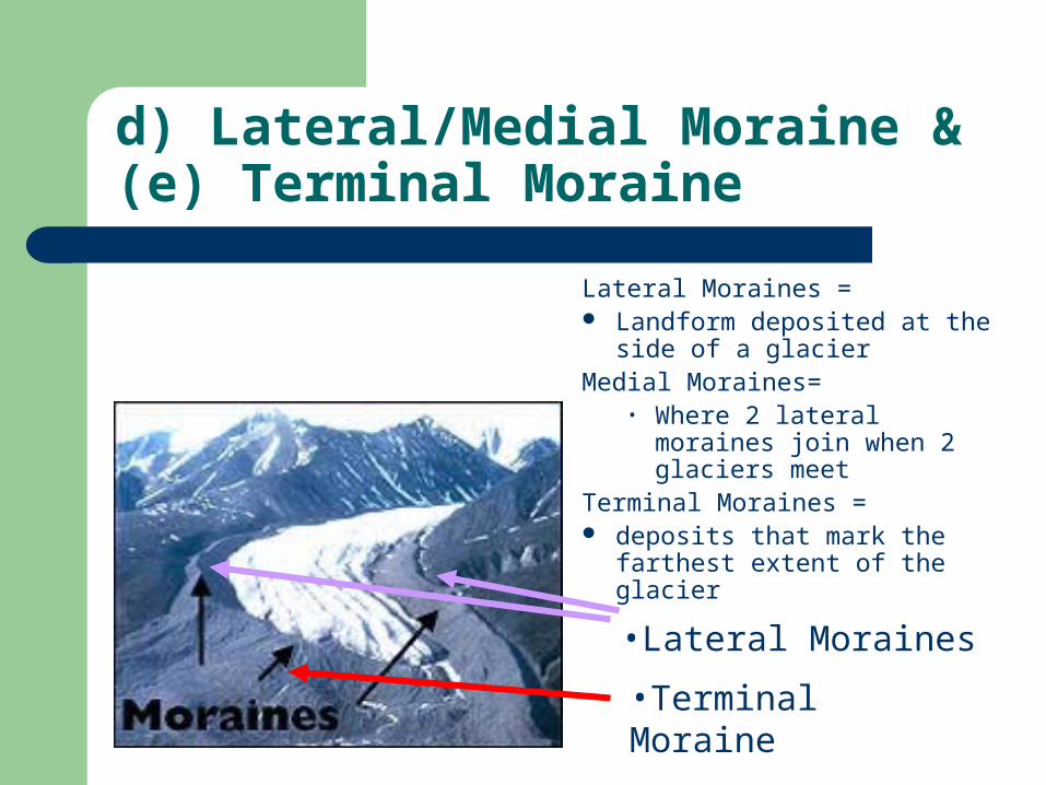
d) Lateral/Medial Moraine & (e) Terminal Moraine
Lateral Moraines = Landform deposited at the
side of a glacierMedial Moraines=
• Where 2 lateral moraines join when 2 glaciers meet
Terminal Moraines = deposits that mark the
farthest extent of the glacier
•Lateral Moraines
•Terminal Moraine
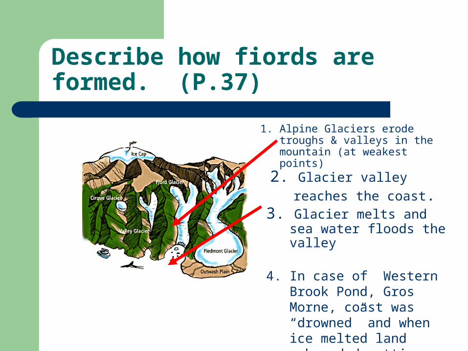
Describe how fiords are formed. (P.37)
1. Alpine Glaciers erode troughs & valleys in the mountain (at weakest points)
2. Glacier valley reaches the
coast.3. Glacier melts and sea water
floods the valley
4. In case of Western Brook Pond, Gros Morne, coast was “drowned” and when ice melted land rebounded cutting off fiords form ocean.

Name the alpine feature? (1)
See the black lines in the middle of the ice itself
Medial moraine
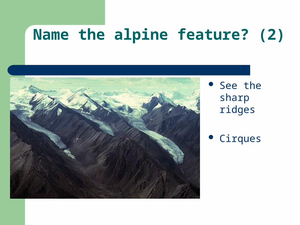
Name the alpine feature? (2)
See the sharp ridges
Cirques

Name the alpine features? (3 & 4)
Now covered in vegetation Name? CIRQUE
•Erratic (continental feature)

Name the Alpine feature? (5)
Right: Hanging Valley at Trout River Pond in Gros Morne National park .
Left: Hanging valleys in Western Brook Pond (see next slide)

Aerial view of Western Brook trough, Newfoundland
This great chasm cuts the margin of the flat plateau called the Long Range Mountains.
This gorge originated simply as a normal river valley that drained the plateau while it was near sea level in preglacial time.
As the plateau was raised by crustal uplift and the ice age began, the valley was progressively deepened and widened by powerful outlet glaciers, which drained a local ice cap.
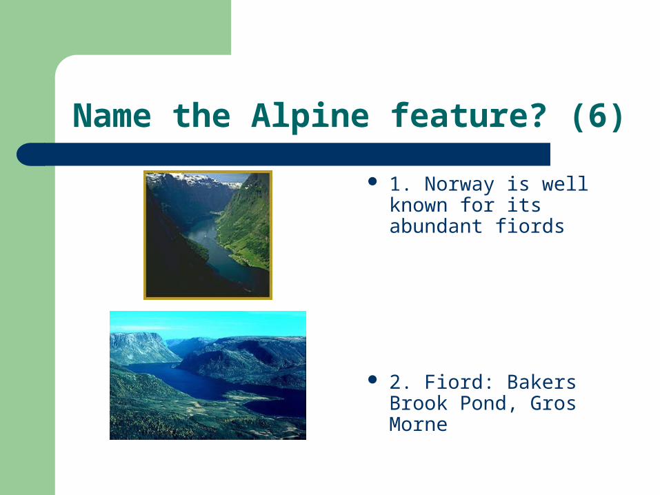
Name the Alpine feature? (6)
1. Norway is well known for its abundant fiords
2. Fiord: Bakers Brook Pond, Gros Morne

Name the Alpine feature? (7)
Center arrow? Terminal moraine
Outside arrows? Lateral moraines
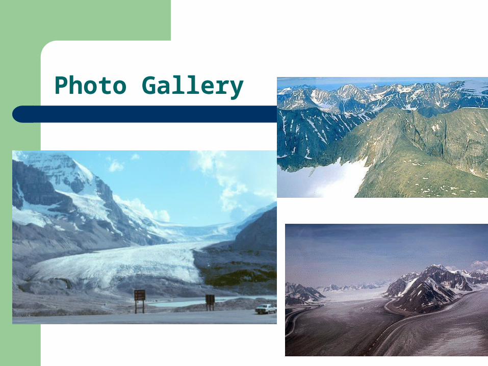
Photo Gallery

Photo Gallery

Glaciers done!
Now complete xword & related sheets