1 Virginia Geographic Information Network Virginia’s Elevation Framework Layer Upcoming LiDAR...
19
www.vita.virginia. gov 1 Virginia Geographic Information Network Virginia’s Elevation Framework Layer Upcoming LiDAR Projects and the Elevation FIAT John Scrivani Geospatial Projects Manager VGIN Board Meeting April 7, 2010 www.vita.virgin ia.gov 1
-
Upload
millicent-dawson -
Category
Documents
-
view
215 -
download
0
Transcript of 1 Virginia Geographic Information Network Virginia’s Elevation Framework Layer Upcoming LiDAR...
www.vita.virginia.gov 1
Virginia Geographic Information Network
Virginia’s Elevation Framework Layer Upcoming LiDAR Projects and the
Elevation FIATJohn Scrivani
Geospatial Projects Manager
VGIN Board Meeting April 7, 2010
www.vita.virginia.gov 1
www.vita.virginia.gov 2
Virginia Geographic Information Network
Topics• Framework Layers & Spatial Data
Infrastructure (SDI)• Elevation Data – NED and Elevation for the
Nation• Virginia LiDAR Projects• Elevation Framework Initiative Action Team
(Elevation FIAT)
Virginia Geographic Information Network
www.vita.virginia.gov 3
Virginia Geographic Information Network
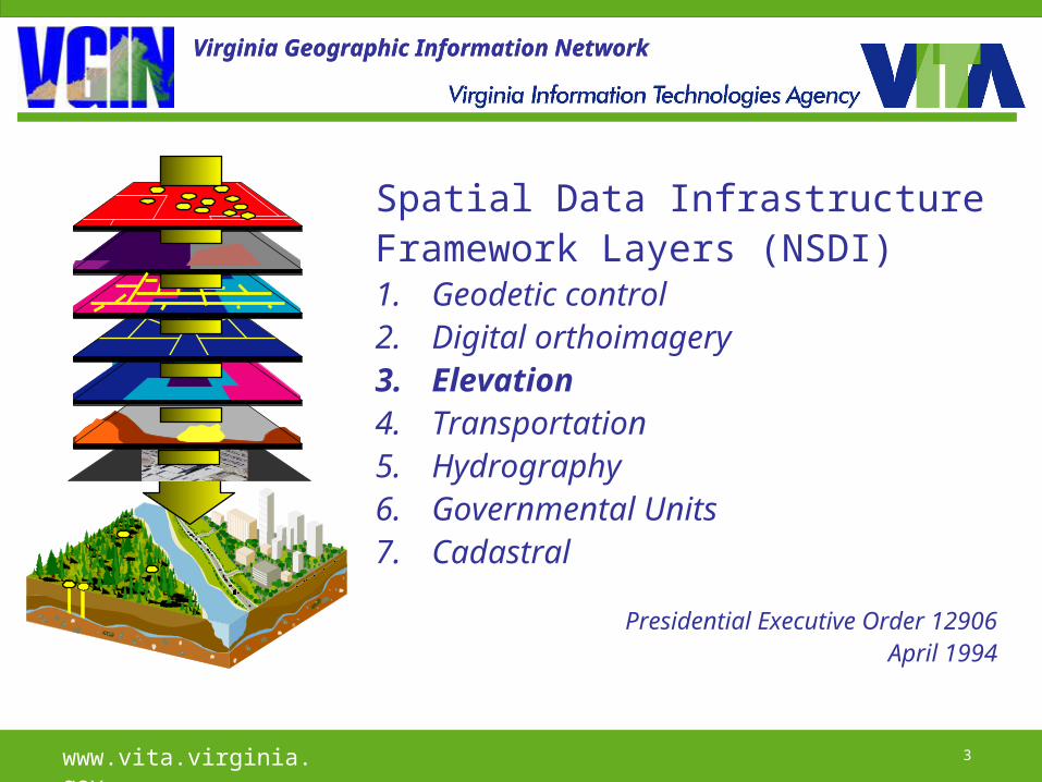
Spatial Data InfrastructureFramework Layers (NSDI)1. Geodetic control2. Digital orthoimagery3. Elevation4. Transportation5. Hydrography6. Governmental Units7. Cadastral
Presidential Executive Order 12906April 1994
Virginia Geographic Information Network

www.vita.virginia.gov 4
Virginia Geographic Information Network
Why “Infrastructure”?In the information age digital data is a
basis for economic growth, public safety, public health, and environmental protection;
Akin to asphalt roadways, metal pipes and public buildings.
www.vita.virginia.gov 5
Virginia Geographic Information Network
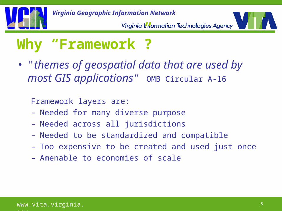
Why “Framework”?• "themes of geospatial data that are used
by most GIS applications“ OMB Circular A-16
Framework layers are:– Needed for many diverse purpose– Needed across all jurisdictions– Needed to be standardized and compatible– Too expensive to be created and used just once– Amenable to economies of scale
www.vita.virginia.gov 6
Virginia Geographic Information Network
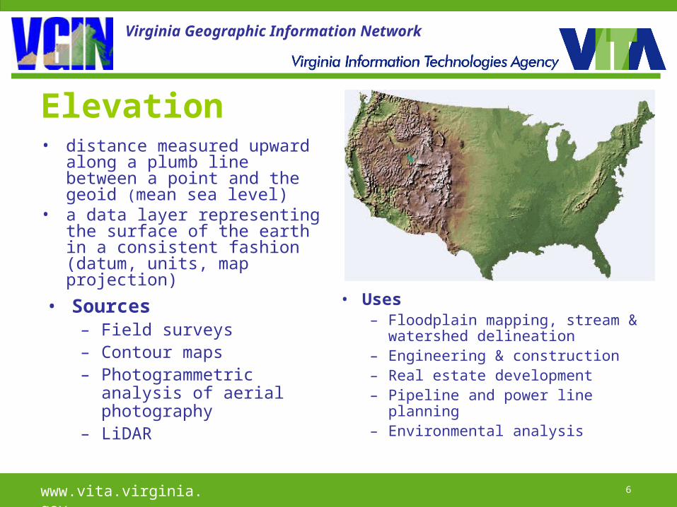
Elevation• distance measured upward
along a plumb line between a point and the geoid (mean sea level)
• a data layer representing the surface of the earth in a consistent fashion (datum, units, map projection)
• Sources– Field surveys– Contour maps– Photogrammetric
analysis of aerial photography
– LiDAR
• Uses– Floodplain mapping, stream &
watershed delineation– Engineering & construction– Real estate development– Pipeline and power line
planning– Environmental analysis
www.vita.virginia.gov 7
Virginia Geographic Information Network
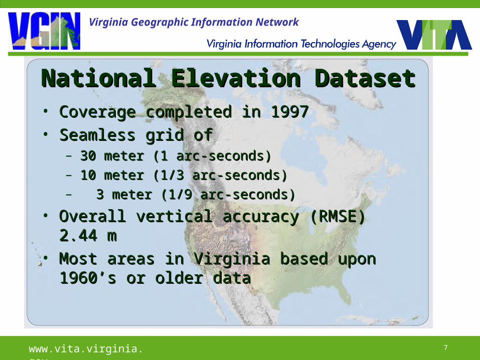
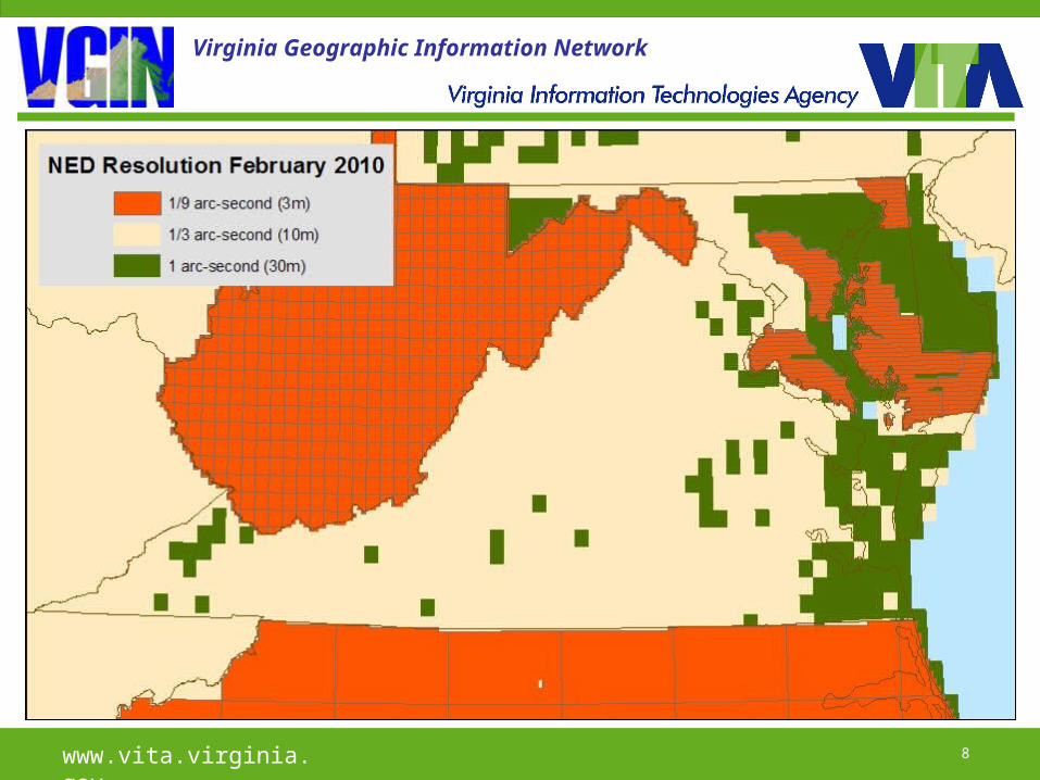
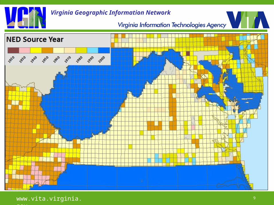
National Elevation DatasetNational Elevation Dataset• Coverage completed in 1997Coverage completed in 1997• Seamless grid of Seamless grid of
– 30 meter (1 arc-seconds)30 meter (1 arc-seconds)– 10 meter (1/3 arc-seconds)10 meter (1/3 arc-seconds)– 3 meter (1/9 arc-seconds)3 meter (1/9 arc-seconds)
• Overall vertical accuracy (RMSE) 2.44 mOverall vertical accuracy (RMSE) 2.44 m• Most areas in Virginia based upon 1960’s Most areas in Virginia based upon 1960’s
or older dataor older data
www.vita.virginia.gov 8
Virginia Geographic Information Network
www.vita.virginia.gov 9
Virginia Geographic Information Network
www.vita.virginia.gov 10
Virginia Geographic Information Network
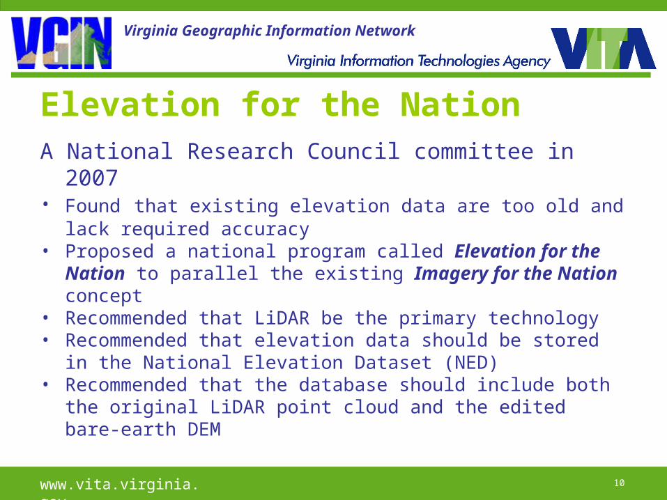
Elevation for the NationA National Research Council committee in 2007 • Found that existing elevation data are too old and lack
required accuracy• Proposed a national program called Elevation for the
Nation to parallel the existing Imagery for the Nation concept
• Recommended that LiDAR be the primary technology• Recommended that elevation data should be stored in the
National Elevation Dataset (NED)• Recommended that the database should include both the
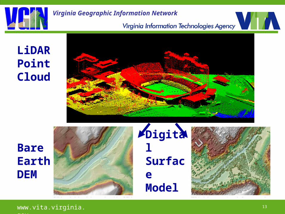
original LiDAR point cloud and the edited bare-earth DEM
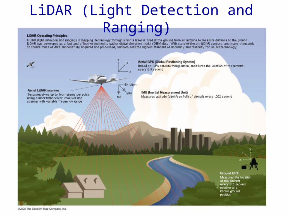
LiDAR (Light Detection and Ranging)
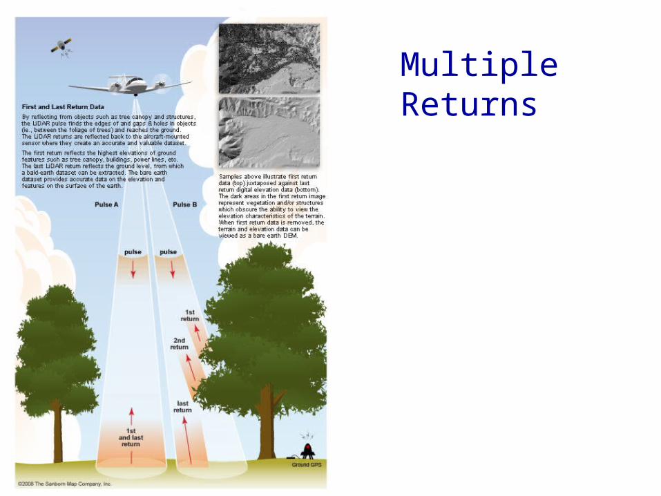
Multiple Returns
www.vita.virginia.gov 13
Virginia Geographic Information Network
LiDAR Point Cloud
Bare Earth DEM
Digital Surface Model
www.vita.virginia.gov 14
Virginia Geographic Information Network
www.vita.virginia.gov 15
Virginia Geographic Information Network
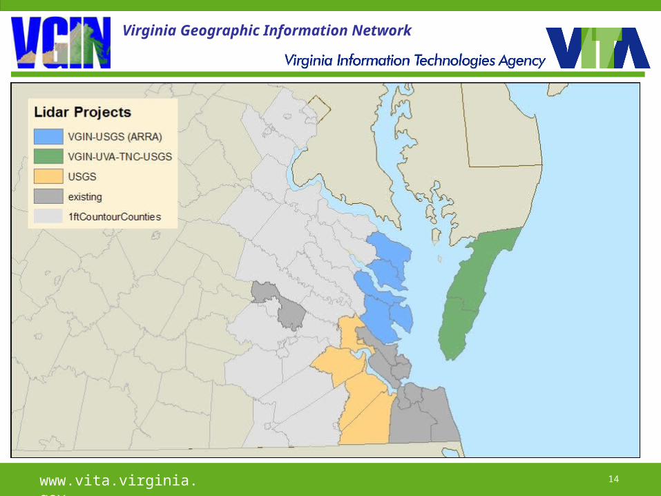
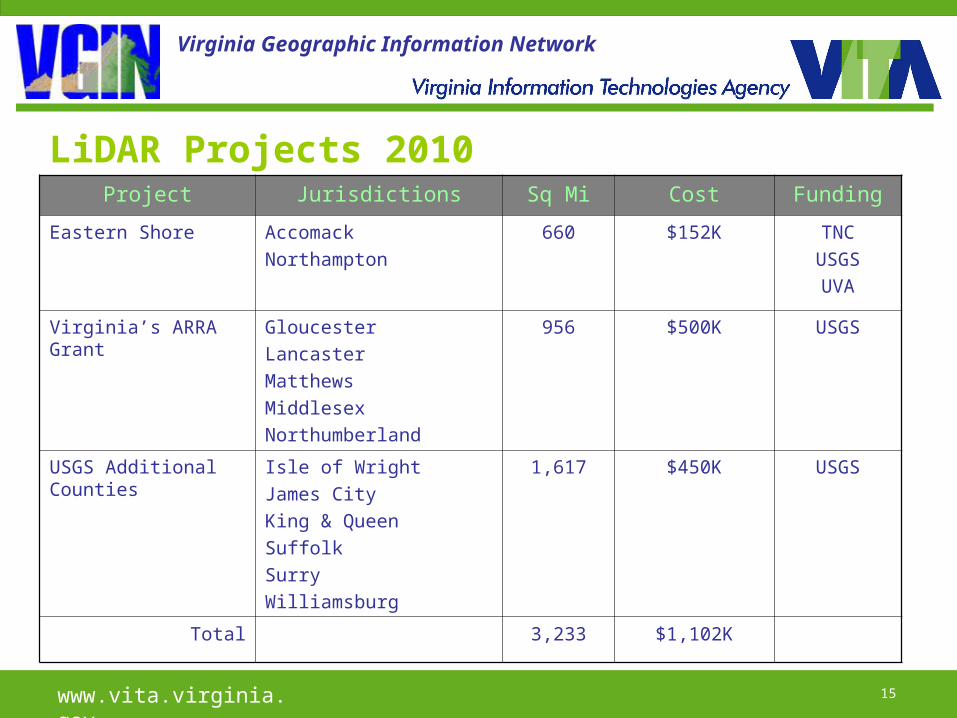
LiDAR Projects 2010Project Jurisdictions Sq Mi Cost Funding
Eastern Shore AccomackNorthampton
660 $152K TNCUSGSUVA
Virginia’s ARRA Grant
GloucesterLancasterMatthewsMiddlesexNorthumberland
956 $500K USGS
USGS Additional Counties
Isle of WrightJames City King & QueenSuffolkSurryWilliamsburg
1,617 $450K USGS
Total 3,233 $1,102K

www.vita.virginia.gov 16
Virginia Geographic Information Network
Elevation Data Clearinghouses• Bare-earth DEM
– NED National Elevation Dataset (USGS)
• Point-cloud data– CLICK Center for LiDAR Information
Coordination and Knowledge (USGS)
www.vita.virginia.gov 17
Virginia Geographic Information Network
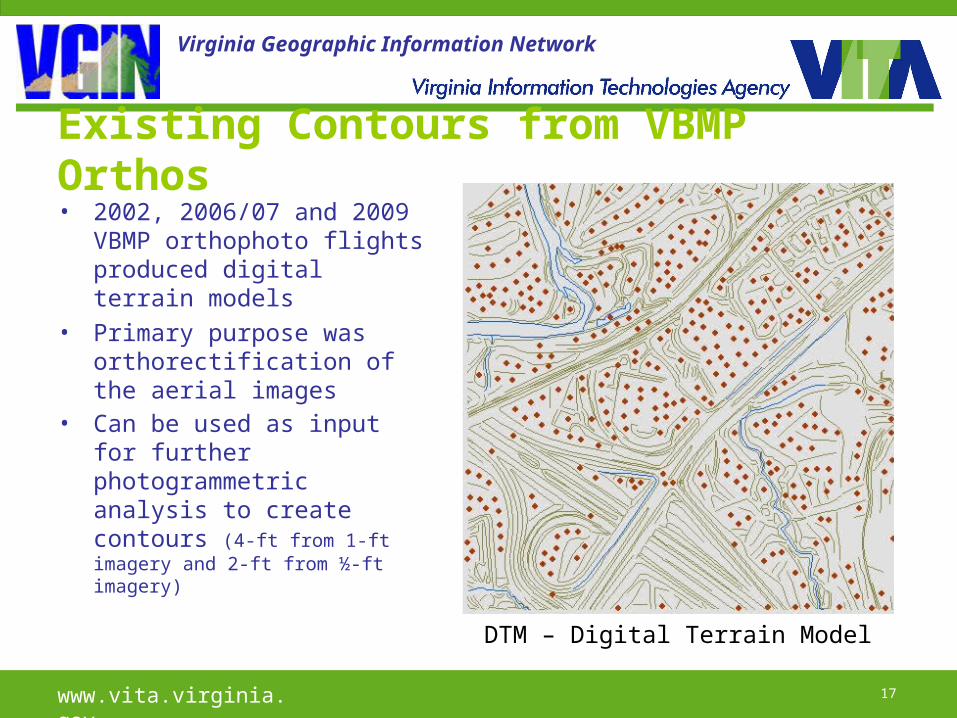
Existing Contours from VBMP Orthos• 2002, 2006/07 and 2009
VBMP orthophoto flights produced digital terrain models
• Primary purpose was orthorectification of the aerial images
• Can be used as input for further photogrammetric analysis to create contours (4-ft from 1-ft imagery and 2-ft from ½-ft imagery)
DTM – Digital Terrain Model
www.vita.virginia.gov 18
Virginia Geographic Information Network
Elevation FIAT• The first Framework Initiative Action Team (FIAT) arising
from VGIN’s recently adopted 2010-2015 strategic plan• Implements Initiative 5 – Provide framework data layers• FIAT Tasks:
– Conduct an inventory of existing elevation datasets– Recommend elevation data standards and best practices– Promote coordination and collaboration on the development of
new elevation datasets– Promote data sharing and incorporate elevation data in the
existing clearinghouses
www.vita.virginia.gov 19
Virginia Geographic Information Network
Thank You!
Questions?