1 Copyright © 2012 eGIS Associates, Inc. All rights reserved. Tips for using and import CAD Data in...
17
1 Copyright © 2012 eGIS Associates, Inc. All rights reserved. Tips for using and import CAD Data in ArcGIS
-
Upload
cecil-philip-parks -
Category
Documents
-
view
215 -
download
2
Transcript of 1 Copyright © 2012 eGIS Associates, Inc. All rights reserved. Tips for using and import CAD Data in...
1Copyright © 2012 eGIS Associates, Inc.
All rights reserved.
Tips for usingand importCAD Data in
ArcGIS
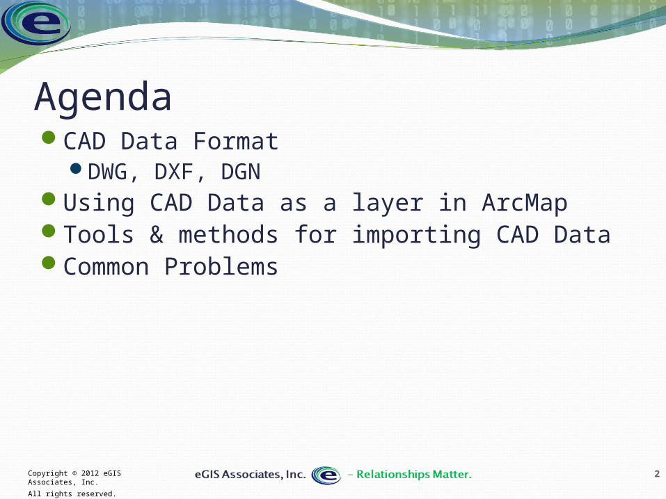
2Copyright © 2012 eGIS Associates, Inc.
All rights reserved.
AgendaCAD Data Format
DWG, DXF, DGNUsing CAD Data as a layer in ArcMapTools & methods for importing CAD DataCommon Problems
3Copyright © 2012 eGIS Associates, Inc.
All rights reserved.
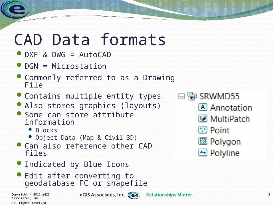
CAD Data formatsDXF & DWG = AutoCADDGN = MicrostationCommonly referred to as a Drawing FileContains multiple entity types Also stores graphics (layouts) Some can store attribute information
Blocks Object Data (Map & Civil 3D)
Can also reference other CAD files Indicated by Blue IconsEdit after converting to geodatabase FC
or shapefile

4Copyright © 2012 eGIS Associates, Inc.
All rights reserved.
CAD data formatsContains multiple entity
types Points Lines Polygons Attributes Text styles Plot layouts Projection/Coordinate
Systems References to external files
5Copyright © 2012 eGIS Associates, Inc.
All rights reserved.
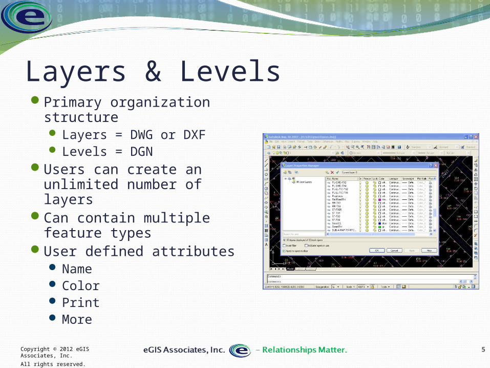
Layers & LevelsPrimary organization
structure Layers = DWG or DXF Levels = DGN
Users can create an unlimited number of layers
Can contain multiple feature types
User defined attributes Name Color Print More

6Copyright © 2012 eGIS Associates, Inc.
All rights reserved.
On to a demo
7Copyright © 2012 eGIS Associates, Inc.
All rights reserved.
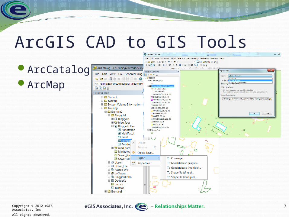
ArcGIS CAD to GIS ToolsArcCatalogArcMap
8Copyright © 2012 eGIS Associates, Inc.
All rights reserved.
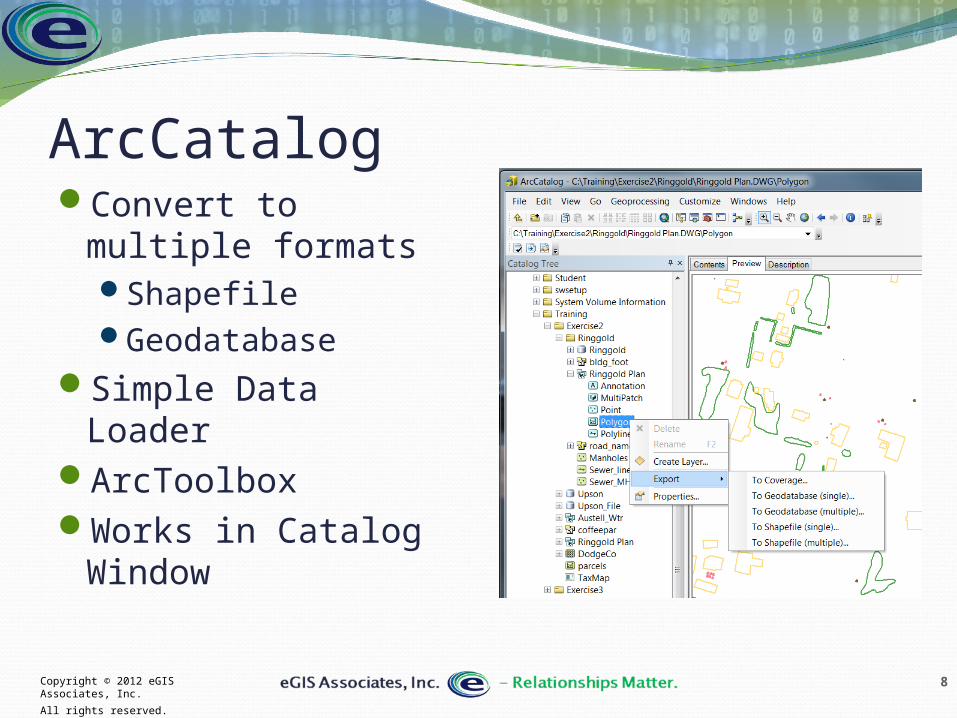
ArcCatalogConvert to multiple
formatsShapefileGeodatabase
Simple Data LoaderArcToolboxWorks in Catalog
Window
9Copyright © 2012 eGIS Associates, Inc.
All rights reserved.
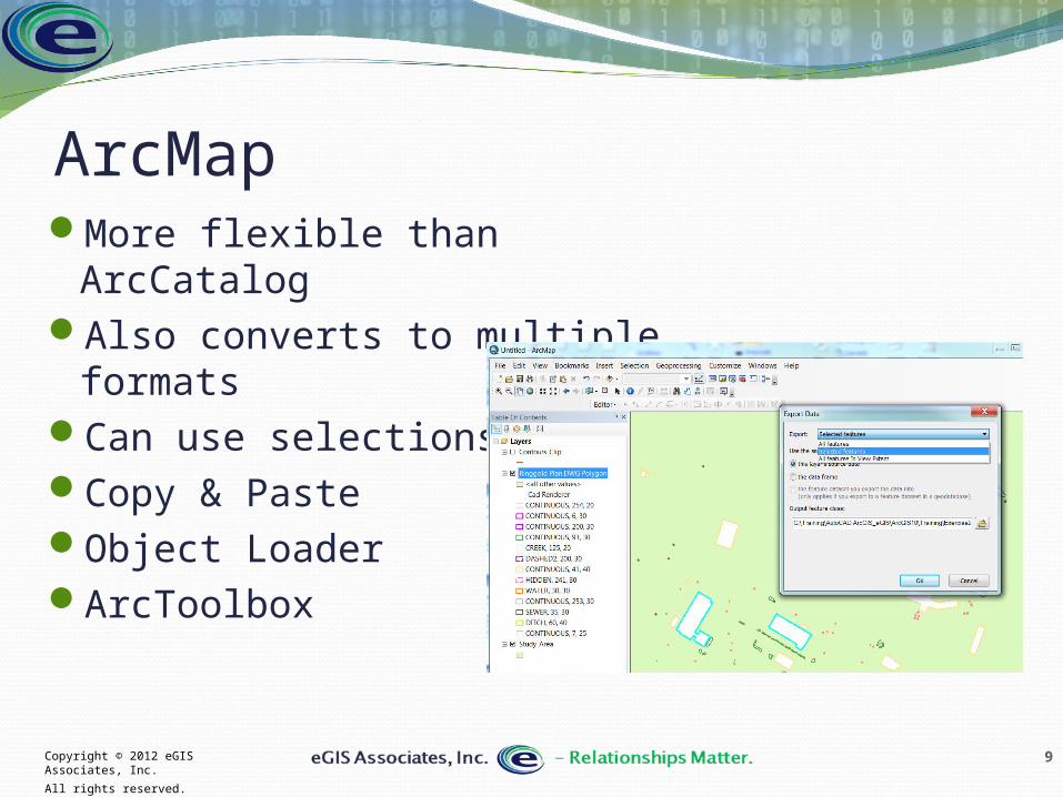
ArcMapMore flexible than ArcCatalogAlso converts to multiple
formatsCan use selectionsCopy & PasteObject LoaderArcToolbox
10Copyright © 2012 eGIS Associates, Inc.
All rights reserved.
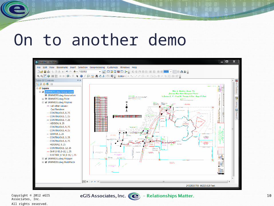
On to another demo
11Copyright © 2012 eGIS Associates, Inc.
All rights reserved.
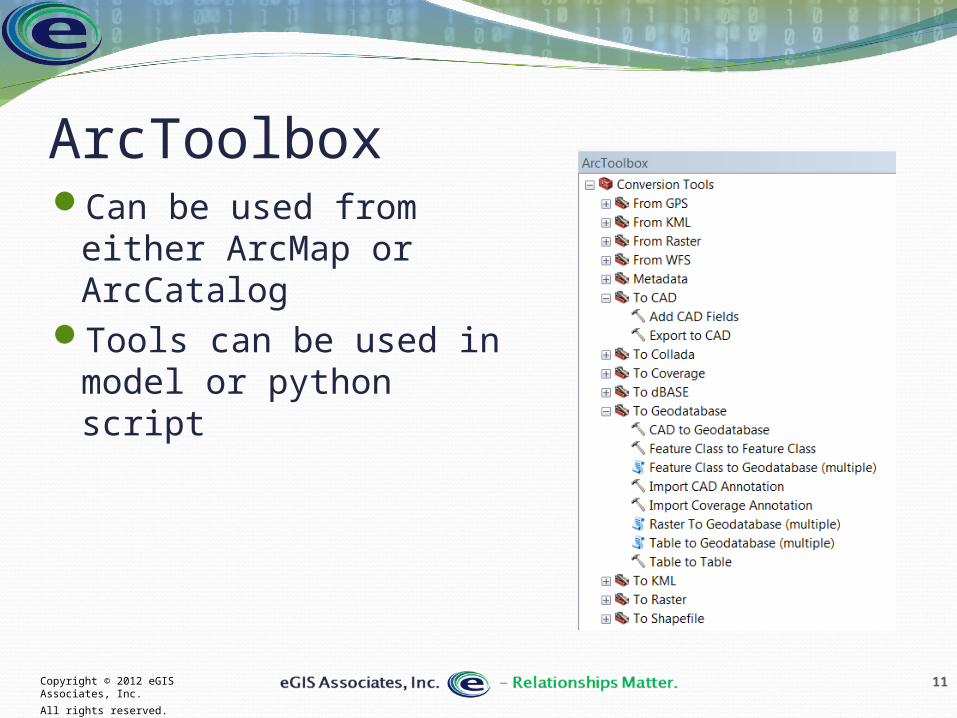
ArcToolboxCan be used from either
ArcMap or ArcCatalogTools can be used in
model or python script
12Copyright © 2012 eGIS Associates, Inc.
All rights reserved.
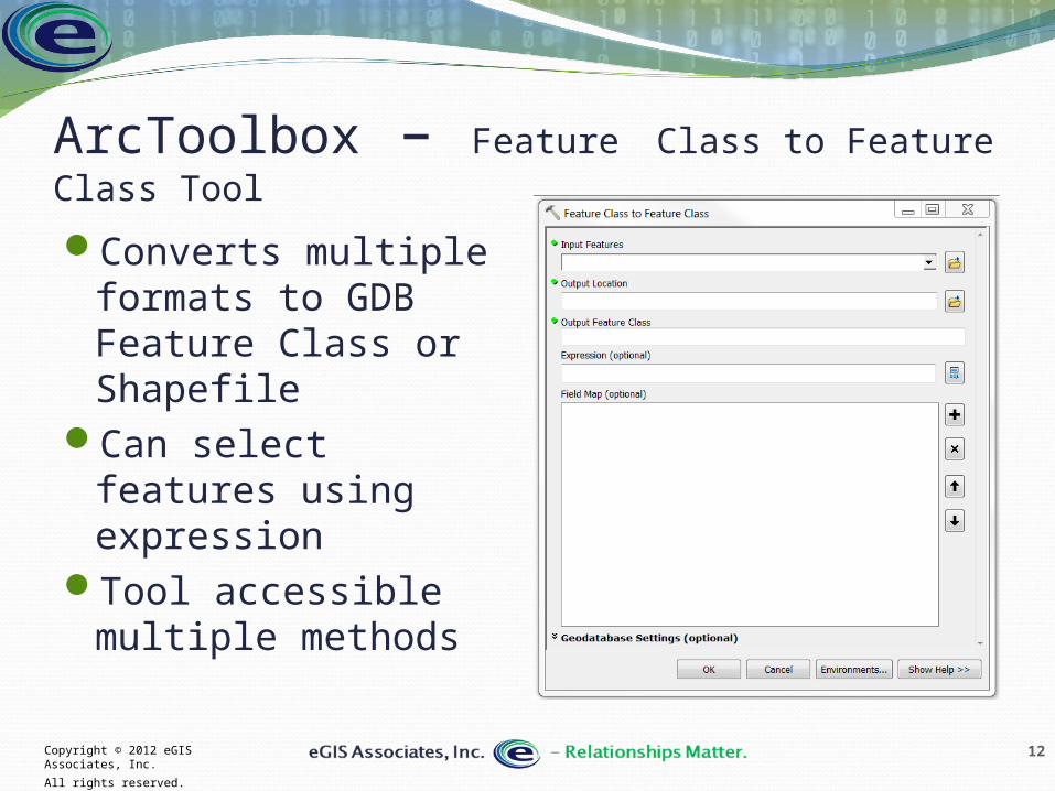
ArcToolbox – Feature Class to Feature Class Tool
Converts multiple formats to GDB Feature Class or Shapefile
Can select features using expression
Tool accessible multiple methods
13Copyright © 2012 eGIS Associates, Inc.
All rights reserved.
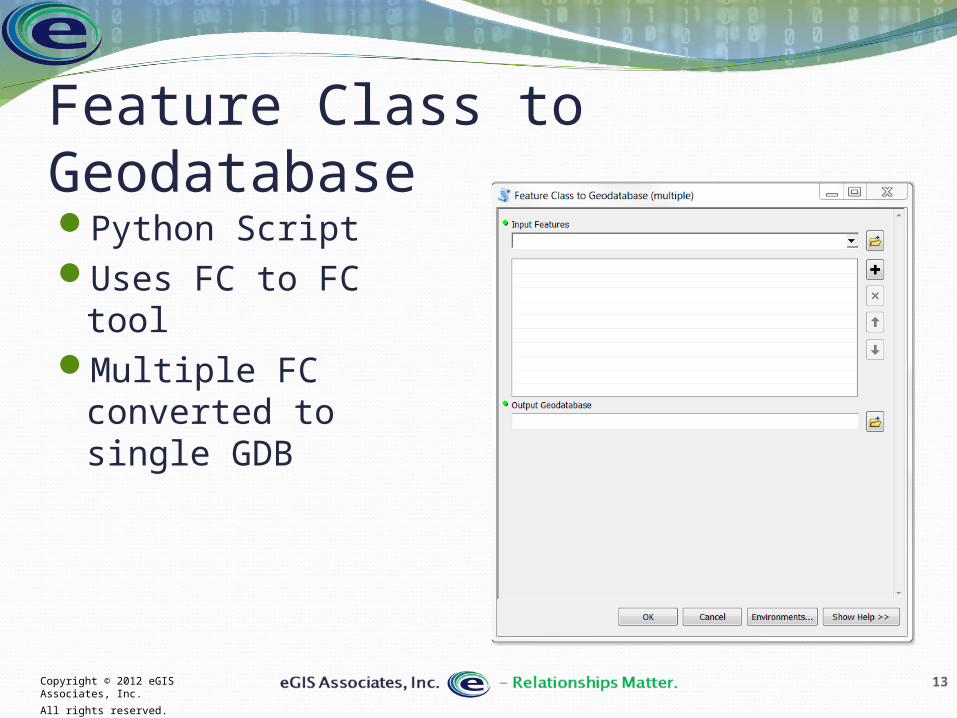
Feature Class to GeodatabasePython ScriptUses FC to FC toolMultiple FC
converted to single GDB
14Copyright © 2012 eGIS Associates, Inc.
All rights reserved.
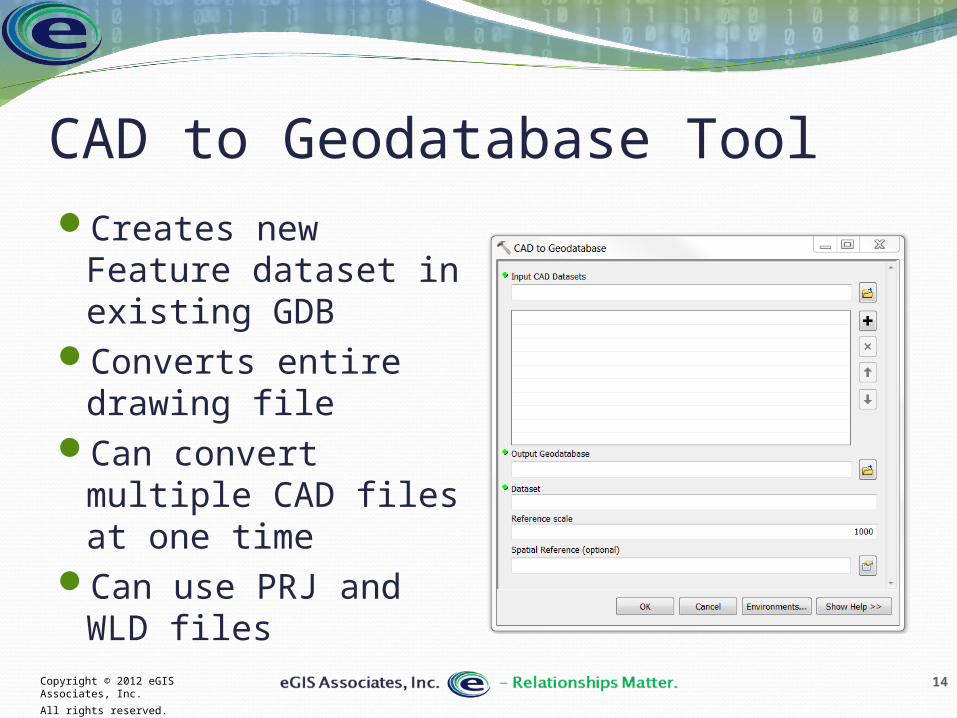
CAD to Geodatabase ToolCreates new Feature
dataset in existing GDB
Converts entire drawing file
Can convert multiple CAD files at one time
Can use PRJ and WLD files

15Copyright © 2012 eGIS Associates, Inc.
All rights reserved.
Import CAD Annotation ToolConverts CAD Annotation
to GDB AnnotationDesktop Basic has limited
functionalityCan covert CAD Layers to
individual feature classes (Standard or Advanced) or merge to single FC
If used in ArcMap, you can use layers as input
16Copyright © 2012 eGIS Associates, Inc.
All rights reserved.
Common ProblemsUnlimited drawing area for DWG & DXFNew release formats (2013 most current
AutoCAD)Specialty objects (arcs, ellipses, splines)Data not on correct layer or levelGIS cannot access layout (Paper Space - DWG
or DXF) informationUse of XrefsOften not georeferenced
18Copyright © 2012 eGIS Associates, Inc.
All rights reserved.
Questions & ContactTripp Corbin, CFM, GISPCEOeGIS Associates, [email protected] ext 21www.egisassociates.com