
1.droppdf.com1.droppdf.com/files/zfCjV/encyclopedia-of-water-science... · 2015-09-02 · Product...
173
Transcript of 1.droppdf.com1.droppdf.com/files/zfCjV/encyclopedia-of-water-science... · 2015-09-02 · Product...


U•X•L ENCYCLOPEDIA OF
water science
Volume3 10/6/04 10:09 AM Page 1

U•X•L ENCYCLOPEDIA OF
Volume 3Issues
water science
K. Lee Lerner and Brenda Wilmoth Lerner, Editors
Lawrence W. Baker, Project Editor
Volume3 10/6/04 10:09 AM Page 3

Project Editor Lawrence W. Baker
Editorial Charles B. Montney
Permissions Denise Buckley, Shalice Shah-Caldwell, Ann Taylor
Imaging and Multimedia Lezlie Light, Kelly A. Quin, DanNewell
Product Design Jennifer Wahi
Composition Evi Seoud
Manufacturing Rita Wimberley
U•X•L Encyclopedia of Water ScienceK. Lee Lerner and Brenda Wilmoth Lerner, Editors
©2005 by U•X•L. U•X•L is an imprintof Thomson Gale, a division ofThomson Learning, Inc.
U•X•L® is a registered trademarkused herein under license. ThomsonLearning™ is a trademark used here-in under license.
For more information, contact:Thomson Gale27500 Drake Rd.Farmington Hills, MI 48331-3535Or you can visit our Internet site athttp://www.gale.com.
ALL RIGHTS RESERVEDNo part of this work covered by thecopyright hereon may be reproducedor used in any form or by anymeans—graphic, electronic, ormechanical, including photocopying,recording, taping, Web distribution,
or information storage retrieval sys-tems—without the written permis-sion of the publisher.
For permission to use materialfrom this product, submit yourrequest via Web at http://www.gale-edit.com/permissions, or you maydownload our Permissions Requestform and submit your request by faxor mail to:
Permissions DepartmentThomson Gale27500 Drake Rd.Farmington Hills, MI 48331-3535Permissions Hotline:248-699-8006 or 800-877-4253, ext.8006Fax: 248-699-8074 or 800-762-4058
Cover photographs reproducedcourtesy of Photodisc by GettyImages (volume 1, sailboats), courtesyof Digital Vision Ltd. (volume 2,pump), and by permission of Corbis,photograph by Lester Lefkowitz (vol-ume 3, Hoover Dam).
While every effort has been made toensure the reliability of the informa-tion presented in this publication,Thomson Gale does not guaranteethe accuracy of data contained here-in. Thomson Gale accepts no pay-ment for listing; and inclusion in thepublication of any organization,agency, institution, publication, serv-ice, or individual does not implyendorsement by the editors or pub-lisher. Errors brought to the attentionof the publisher and verified to thesatisfaction of the publisher will becorrected in future editions.
This title is also available as an e-book.ISBN 0-7876-9398-7 (set)
Contact your Thomson Gale sales representative for ordering information.
Printed in the United States of America10 9 8 7 6 5 4 3 2 1
LIBRARY OF CONGRESS CATALOGING-IN-PUBLICATION DATA
UXL encyclopedia of water science / K. Lee Lerner and Brenda Wilmoth Lerner, editors ; Lawrence W. Baker, project editor.
p. cm.Includes bibliographical references and index.ISBN 0-7876-7617-9 (set : hardcover : alk. paper) — ISBN 0-7876-7673-X (v. 1 : hard-cover : alk. paper) — ISBN 0-7876-7674-8 (v. 2 : hardcover : alk. paper) — ISBN 0-7876-7675-6 (v. 3 : hardcover : alk. paper)
1. Water—Encyclopedias, Juvenile. 2. Hydrology—Encyclopedias, Juvenile. I. Lerner, K.Lee. II. Lerner, Brenda Wilmoth. III. Baker, Lawrence W.
GB662.3.U95 2005553.7—dc22 2004021651
water_fm 10/20/04 10:54 AM Page iv

Chapter 12Environmental Issues
Acid RainAcid rain is a general term describing the pollution that
occurs when acids fall out of the atmosphere (mass of air sur-rounding Earth). The principal pollutants that produce acids inthe atmosphere are sulfur dioxide (SO2) and nitrogen oxides,like nitrogen oxide (NO) and nitrogen dioxide (NO2). Thesecompounds combine with water in the atmosphere to form sul-furic acid (H2SO4), and nitric acid (HNO3). Acid rain has sig-nificantly affected the waters that flow into lakes and rivers, aswell as the lakes and rivers themselves. In turn, the plants andanimals that depend on lakes, rivers and oceans are harmed byacid rain.
When describing acid rain, scientists use the more preciseterm acid deposition. Scientists distinguish between two typesof acid deposition: dry and wet. Dry deposition includes acidicgases and solid particles containing sulfuric and nitric acid thatsettle out of the air and land on the ground or other surfaces.Dry deposition usually occurs very close to the point where thepollutants are released. Wet deposition occurs when precipita-tion, such as rain, sleet, fog, and snow, becomes acidic and fallsto the ground. Wet deposition can occur hundreds of miles(kilometers) from the place where the air pollution originates.
Acid rain and the pH scaleThe scale that is used to measure the acidity of a substance
is called the pH scale. The pH scale runs from 0 to 14. If a mate-rial has a pH of 7 it is neutral, meaning that it is neither acidicnor alkaline (basic). Substances with pH values less than 7 areacidic and substances with pH values greater than 7 are alka-
377
S
SS
water_ch12 10/20/04 10:52 AM Page 377

line. Distilled water is neutral, with a pH of7. Lemon juice and vinegar are both acidic;they have pH values of 2.3 and 3.3, respec-tively. Baking soda, with a pH of 8.2, andmilk of magnesia, with a pH of 10.5, are bothalkaline. Combining an alkaline substancewith an acidic substance results in a sub-stance with a pH value that is closer to 7 thaneither of the original substances. This iscalled neutralization.
A substance that has a pH of 3 is ten timesmore acidic than a substance that has a pH of4; a substance that has a pH of 3 is one hun-dred times more acidic than a substance witha pH of 5, and so on. Given their respectivepH values of 2.3 and 3.3, lemon juice is a tentimes stronger acid than vinegar.
Natural rain water is slightly acidic.Chemical reactions between pure water andcarbon dioxide in the atmosphere result in aweak acid. The pH of natural rainwater isbetween 5 and 6. This acidity is usefulbecause when the rain falls to the ground, itcan dissolve minerals in the soil that plantsuse to grow. Acid rain is anywhere from tento ten thousand times more acid than naturalrain, with a pH between 4.5 and 1.5.
The major sources of acid deposition Acid deposition forms from the burning of fossil fuels, which
are used in cars, factories, electricity generation, and otherindustries. Fossil fuels were formed over thousands of years bydead plants and animals. After these plants and animals diedthey were buried under sediments (particles of sand, silt, andclay). The intense pressure and increases in temperature underthese sediments chemically changed the dead plants and animalsinto the fuels that are used to drive cars and generate electricitytoday. When fuel is burned it not only releases the energy that isused to power electrical devices, but it also releases chemicals,such as sulfur dioxide and nitrogen oxides that form acid rain.
Car exhaust is a major source of the nitrogen oxides in the air.A second major source of nitrogen oxides in the air come in smelt-ing plants (factories that process metal), electrical facilities, andfactories. Factories and power plants are also the major source of
U•X•L Encyclopedia of Water Science378
WORDS TO KNOW
SAcid deposition: The collec-tive term for dry deposition andwet deposition of acids as aresult of air pollution.
SDry deposition: Acidic gasesand solid particles containingacids that settle out of the airand land on surfaces.
SWet deposition: Precipita-tion that has become acidic asa result of air pollution.
SSSArt and Acid Rain
Acid deposition is extremely corrosive,especially to soft stones. Many famousbuildings throughout the world show signs ofacid damage. For example, the Parthenon inAthens, the Coliseum in Rome, and the TajMahal in India have all been damaged byacid deposition. Monuments in Poland andstained glass windows in Sweden have alsosuffered from corrosion. Several famouscathedrals in England including St. Paul’s,York Minster and Westminster Abbey haveshown the effects of acid deposition. Most ofthis damage is the result of dry deposition.
All of the acid damage on famous struc-tures results in very high restoration costs.In 1984 the Statue of Liberty in New Yorkharbor had to be dismantled at substantialcost because of damage to its metal frameand copper covering by acid deposition. Astudy in England showed that if sulfur emis-sions were reduced by 30%, the savings inrepair to these famous buildings could be ashigh as $20 billion.
water_ch12 10/20/04 10:52 AM Page 378

Acid Rain
sulfur compounds that cause acid rain. The U.S. EnvironmentalProtection Agency (EPA) reports that about two-thirds of all sul-fur dioxide and one-quarter of all nitrogen oxides in the atmos-phere originate from coal burning electric power plants.
Acid deposition in lakes and riversUnder natural conditions, rainwater, which is slightly acidic,
runs through the soils near a lake. These soils often contain
379
Acid rain and other pollution scar a village monument inDerby, England. © Chinch
Gryniewicz/Corbis. Reproduced
by permission.
water_ch12 10/20/04 10:52 AM Page 379

limestone or calcium, which is alkaline and neutralizes theacid. The water in a healthy lake usually has a pH around 6.5,which allows for the growth of a variety of plants, invertebrates(animals without a backbone), and fish.
When acid rain falls on the ground and runs into lakes, ini-tially it is neutralized by the alkaline substances in the soils.Eventually however, these substances are used up and the waterthat runs into lakes and rivers is extremely acidic. This causeslakes to become acidic as well. This acidity is highly damagingto the plants and animals that live in lakes. For example, at pHvalues lower than about 6, crustaceans, mollusks, snails,salmon, rainbow trout, many insects, and plankton cannot sur-vive. At pH values lower than about 5.5, small fish such aswhitefish and grayling will die. At pH values lower than about4.5, all but the hardiest life dies.
In addition, as more acidic water passes through the soils,chemical reactions occur in the soils that cause harmful miner-als such as aluminum to be released. These minerals run intothe lake where they are taken up by plants and invertebrates.The plants and invertebrates are then eaten by fish, which areconsumed by birds that live nearby. Because the birds must eatso many fish in order to survive, the aluminum is concentratedin their bodies. High levels of aluminum cause the birds to layeggs with very fragile shells. Often the eggs break or becomedry inside. Other times, baby birds are born with physicaldeformities.
The EPA completed a survey of one thousand lakes in theUnited States in areas where acid deposition is suspected to be aproblem. They found that 75% of the lakes surveyed did sufferfrom acidity. In addition, nearly half the streams sampledshowed evidence of acidity. The major places where acid depo-sition was found to be a problem in the United States wereAdirondacks and Catskill Mountains in New York State, theAppalachian mountains along the east coast, the northernMidwest, and mountainous areas of the Western United States.The report also mentioned that air pollution in the United Statescontributed to acidification of lakes and streams in Canada.
Acid deposition in oceansBecause of its chemical composition, the nitrogen and sulfur-
based acids that cause acid deposition in fresh water lakes andrivers do not have a strong effect on the acidity of the ocean.However, carbon compounds in the atmosphere are responsiblefor increased acidity. Burning of fossil fuels releases carbon diox-
U•X•L Encyclopedia of Water Science380
water_ch12 10/20/04 10:52 AM Page 380

Acid Rain
ide (CO2) into the atmosphere. Carbon diox-ide levels in the atmosphere are currently thehighest they have been in 55 million years.When it combines with seawater, this carbondioxide produces carbonic acid, which makesseawater more acidic. This acidity will have avery negative effect on all marine organismsthat make shells out of calcium carbonate,such as corals and mollusks, because itreduces the availability of calcium ions (thebuilding blocks of shells) in seawater.
Acid deposition in forestsThe ways that acid rain harms forests are
complicated and interconnected. Acid rainharms both the soils that trees use to growand the trees themselves. As acid rain falls onthe soil in a forest, it washes away nutrientssuch as calcium and magnesium that areneeded by trees to grow. In addition, acid rainreleases from the soil toxic (poisonous) min-erals such as aluminum that are thenabsorbed by the plants’ roots. This causessevere damage to the trees’ roots and weakensthe trees. As acid rain falls on the trees them-selves, it burns the needles at the top and at the tips of branch-es, which are then shed. This reduces the ability of the trees tomake food from photosynthesis (process of converting the ener-gy of sunlight into food) and to grow. Trees are then more vul-nerable to environmental stresses like disease, drought(prolonged periods of dry weather), and insects. A tree that isexposed to acid rain will absorb extra alkaline substances fromthe soil, making the soil acidic. This means that the acid rainfalling on the soil makes the soil even more acidic, compound-ing the problems of acid rain.
Decline in forests due to acid rain has been a serious prob-lem throughout the Northern Hemisphere. In the 1990s sur-veys of the Black Forest in Germany showed that half of thetrees were dead or dying as a result of acid deposition. Between1970 and 1998 nearly half the red spruce trees in the north-eastern United States died. Many sugar maples in Canada andthe United States are also dying. Throughout Scandinavia,forests are dying because of acid rain. Most of the acid rain thataffects these countries travels hundreds of miles (kilometers)from its sources in other parts of Europe.
381
Acid rain damage in a German forest. © Boussu
Regis/Corbis Sygma.
Reproduced by permission.
water_ch12 10/20/04 10:52 AM Page 381

Corrosion due to acid depositionAcid deposition damages most surfaces on
which it falls. In particular, dry depositionetches the paint on cars, corrodes metals, anddeteriorates stone. In particular, buildingsmade of limestone and marble contain a lot ofcalcium carbonate. The acid in dry deposi-tion, reacts with the calcium carbonate toform a powder. This powder is easily washedaway when it rains. A variety of famous build-ings and sculptures, especially in Europe,have been damaged by acid deposition.
The acid rain programIn 1990 the EPA established the Acid Rain
Program as part of the Clean Air Act. The goalof the program is to reduce the emissions ofsulfur dioxide and nitrogen oxides. Much ofthe work in this program involves creating thecorrect economic incentives for factories andelectrical plants to improve the quality of thematerials they release into the air. Companiesdecide how they want to achieve emissionsreductions. Some may choose to install spe-cial devices on their smokestacks that cleansethe pollutants out of the emissions. Othersmay use fuel that is less polluting or may userenewable energy sources. Finally, companies
can trade for emissions allowances (the amount of pollutants thatcan be legally released) from companies that have alreadyreduced their emissions below the standard levels.
The Acid Rain Program has been more successful at control-ling sulfur pollutants than nitrogen pollutants. Since 1980 sul-fur emissions from large factories have fallen by nearly one-half,from 9.4 to 4.7 million tons of sulfur dioxide a year. Much ofthese improvements in emissions have occurred in the parts ofthe country where pollution is the biggest problem, such as inOhio and Indiana. As a result the concentration of sulfuric acidin the Northeast and the Mid-Atlantic states has fallen by about25% and lakes in these regions are showing signs of recovery.The emissions of nitrogen oxides have remained fairly constantover the last decade. As a result, the deposition of nitric acid intothe environment has remained essentially unchanged.
Juli Berwald, Ph.D.
U•X•L Encyclopedia of Water Science382
SSSBlack Forest
Beginning in the 1960s scientists noticedthat many of the trees of Central Europewere dying. In particular, in the Black Forest,which is located in Southwestern Germany, alarge number of trees showed signs of weak-ening and dying. The term daldsterben, ortree death, was coined to describe the prob-lem. The first trees to be struck with theaffliction were the pines, followed by decidu-ous trees (trees that lose their leaves eachyear). By 1990 at least half the trees in theBlack Forest were harmed. Many trees driedout and died, while others dropped leaves orbecame discolored. The problem was even-tually attributed to acid deposition in the for-est. Although several types of remediationtechniques, such as replanting trees, weretried, none have yet been successful.Scientists assume that the damage to thesoil has made it so acidic that new trees canno longer grow in these ancient forests undercurrent conditions.
water_ch12 10/20/04 10:52 AM Page 382

Beach Erosion
For More Information
BooksMorgan, Sally. Acid Rain (Earth Watch). London: Franklin
Watts, 1999.
Raven, Peter H., Linda R. Berg, and George B. Johnson.Environment. 2nd ed. Fort Worth, TX: Saunders CollegePublishing, 1998.
Sylvester, Doug. The Environment: Global Warming, Ozone,Acid Rain And Pollution. San Diego: Rainbow Horizons,1998.
Periodicals“Acid Oceans Spell Doom for Coral.” The Daily Star (August
31, 2004): 1A. This article can also be found online athttp://www.thedailystar.net/2004/08/31/d40831011715.htm(accessed on September 3, 2004).
Websites“Acid Rain.” Encyclopedia of the Atmospheric Environment.
http://www.ace.mmu.ac.uk/eae (accessed on September 3,2004).
“Acid Rain.” U.S. Environmental Protection Agency. http://www.epa.gov/airmarkets/acidrain (accessed on September 3, 2004).
United States Geological Survey. “Acid Rain: Do You Need to Start Wearing a Rainhat?” Water Science for Schools.http://ga.water.usgs.gov/edu/acidrain.html (accessed onSeptember 3, 2004).
Beach ErosionErosion is the removal of soil and sand by the forces of wind
and water and it has occurred for as long as land has met water.Erosion is a continual natural process; material is constantlybeing shifted around to change the shape of a stream, river-bank, or beach. Today, when much available land bordering theocean (coastlines) is developed for housing, the erosion ofbeaches is an important concern. Wave action can cause ero-sion that can remove the support for a house, causing it to tum-ble into the ocean. Along the 80,000 miles (128,748kilometers) of coastline in the United States, beach erosion hasbecome a big problem. While erosion is a natural process,humans have caused the rate of erosion to increase. The mainfactor causing the increased erosion damage is development.
383
S
water_ch12 10/20/04 10:52 AM Page 383
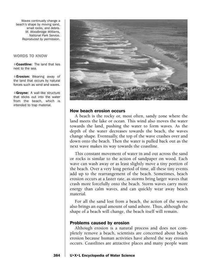
How beach erosion occursA beach is the rocky or, most often, sandy zone where the
land meets the lake or ocean. This wind also moves the watertowards the land, pushing the water to form waves. As thedepth of the water decreases towards the beach, the waveschange shape. Eventually, the top of the wave crashes over anddown onto the beach. Then the water is pulled back out as thenext wave makes its way towards the coastline.
This constant movement of water in and out across the sandor rocks is similar to the action of sandpaper on wood. Eachwave can wash away or as least slightly move a tiny portion ofthe beach. Over a very long period of time, all these tiny eventsadd up to the rearrangement of the beach. Sometimes, beacherosion occurs at a faster rate, as storms bring larger waves thatcrash more forcefully onto the beach. Storm waves carry moreenergy than calm waves, and can quickly wear away beachmaterial.
For all the sand lost from a beach, the action of the wavesalso brings an equal amount of sand ashore. Thus, although theshape of a beach will change, the beach itself will remain.
Problems caused by erosionAlthough erosion is a natural process and does not com-
pletely remove a beach, scientists are concerned about beacherosion because human activities have altered the way erosionoccurs. Coastlines are attractive places and many people want
U•X•L Encyclopedia of Water Science384
Waves continually change abeach’s shape by moving sand,
small rocks, and debris. M. Woodbridge Williams,
National Park Service.
Reproduced by permission.
WORDS TO KNOW
SCoastline: The land that liesnext to the sea.
SErosion: Wearing away ofthe land that occurs by naturalforces such as wind and waves.
SGroyne: A wall-like structurethat sticks out into the waterfrom the beach, which isintended to trap material.
water_ch12 10/20/04 10:52 AM Page 384

Beach Erosion
to live or visit there. Many beaches are now completely lined bybuildings, parking lots, and roads. The beachfront areas ofMiami Beach, Atlantic City, and Honolulu, are three examplesof heavily developed beaches in the United States. The largearea of land covered by concrete does not allow rainwater tosoak into the ground and gently trickle out over the beach atmany different points. Instead, the water empties onto thebeach at only a few streams. The streams wear away selectedportions of the beach, which can make erosion more severe.
Development and erosionThe desire for a home right on the ocean has lead many peo-
ple to literally build their houses on top of sand dunes, which arehills of sand heaped up by the wind. Dunes are not permanentstructures; they naturally wear away. To attempt to reduce ero-sion, people have built structures like seawalls and narrow strips
385
Carolina Outer Banks
SSS
Beach erosion makes seaside homes more vulnerableto storm surges. Families must often evacuate whenhurricanes threaten. © Jason Reed/Reuters/Corbis.
Reproduced by permission.
The Outer Banks are series of dunes thatstretch for 130 miles (209 kilometers) in thesea off the coast of North Carolina. Among thewell-known attractions of the Outer Banks isKitty Hawk, site of Orville and Wilbur Wright’sfamous 1903 flight, and a series of distinctivelighthouses.
The Cape Hatteras lighthouse is also anexample of the power of erosion. When thelighthouse was built in 1870 it stood about1,500 feet (457 meters) back from the wavescrashing on the beach. By 1999 erosion hadbrought the waves to within 150 feet (46meters) of the lighthouse. To preserve thestructure, engineers picked up the lighthouse,put it on a movable treadmill similar to theones used to transport Apollo spacecraft to thelaunch pad in the 1970s, and moved the light-house further inland.
One of the reasons that erosion claimed somuch land was a manmade attempt to stopthe process. In the 1970s the United StatesNavy built two groynes just north of the light-house. The groynes were put there to protect abuilding. Unfortunately, they accelerated theerosion downstream to the point where movingthe lighthouse was necessary to save it.
water_ch12 10/20/04 10:52 AM Page 385

that jut out into the water (a groyne). Thesestructures break the pattern of the waves in asmall area. The United States governmentspends over $150 million each year to buildbeach-protective structures. Homeownersalso spend a great deal of money.
While a small section of a beach may beprotected by these structures, other areas ofthe beach are often more affected by theresulting interrupted wave action. To com-pensate, sand must often be added to abeach if the beach is to be preserved. Inparts of Florida, beach repair of this typeaverages about $1 million per mile of beachevery year.
The use of seawalls, in some areas, espe-cially where they are built by homeownersintermittently along a coast, has proven to beunwise. Rather than allowing the incomingenergy of a wave to disappear over the area ofa beach, a seawall can actually accelerate thespeed of incoming water flowing around orover it. This speeds up the removal of mate-rial from the beach. In some areas where sea-walls have been in place for many years, thebeach has often completely disappeared andthe waves lap the base of the wall. Whereseawalls are built along a large, continuousarea such as in Galveston, Texas, and areconstructed high enough that waves do notcrash over them, they cause less slow beach
erosion. The Galveston seawall also protects against the rapidbeach erosion that occurs during hurricanes.
Reducing beach erosionMany areas have passed laws to prevent the destruction of
sand dunes, which serve as a natural protective barrier againsterosion during storms. Where sand dunes are destroyed byhumans or erosion, artificial barriers of wire or tree limbssecured in dune-forming areas help to speed their formation.Protected dunes along seashores are rich in plant life, whichserves to further strengthen the dunes because of the root net-works of the tall grass-like plants. Although dunes provide lit-tle protection for narrow beaches, they help decrease erosion inbroad beaches, such as those in Florida and Texas.
U•X•L Encyclopedia of Water Science386
SSSCoastal Development Laws
and ActsThe need to protect coastlines from ero-
sion and overdevelopment has lead theUnited States to enact various rules andregulations.
In 1972 the federal government createdthe Coastal Zone Management Act. This vol-untary program helped encourage coastalstates to make changes that would helpprotect beaches by sharing the cost of someof this development. In the years since then,the act has been revised to make moneyavailable to projects that seek to restorecoastal areas to a more natural state and tokeep beaches from being bought by privateowners.
The state of California has a series of reg-ulations that together make up theCalifornia Coastal Act. The rules help controlwhat type of development can occur alongthe coast and how much of the coast isavailable to the general public. A similarcoastal management program exists inAtlantic coast states including Maine andNew Jersey.
water_ch12 10/20/04 10:52 AM Page 386

Bioaccumulation of Heavy Metals
A strategy that scientists are evaluating to reduce erosion isto build up the bottom of the ocean farther out from the beach,creating an off-shore ridge with sand and materials such as steelfrom aircraft and ships, or stone. Incoming waves break overthe ridge of piled up material instead of breaking on the beach.Researchers are examining whether this disrupts the naturalenvironment in a negative manner.
The most popular method to keep the sandy beaches that areso desirable to homeowners and recreational beachgoers is tobring sand to the beach. Often sand will be taken from theocean bottom further away from shore and sent through a pipeto the beach. This temporary measure only delays the effects oferosion, and is often repeated.
Brian Hoyle, Ph.D.
For More Information
BooksCambers, Gillian. Coping with Beach Erosion. Paris: United
Nations Educational, Scientific and Cultural Organization,1998.
Douglas, Scott L. Saving America’s Beaches: The Causes of andSolutions to Beach Erosion. Singapore: World ScientificPublishing Company, 2002.
Steele, Philip W. Changing Coastlines (Earth’s ChangingLandscape). North Mankato, MN: Smart Apple Media, 2004.
Wood, Timothy. Breakthrough: The Story of Chatham’s NorthBeach. Chatham, MA: Hyora Publishers Publishers, 2002.
WebsitesDeVitt, Terry. “Beach Erosion.” The Why Files. http://whyfiles.
org/091beach/credits.html (accessed on September 7, 2004).
Bioaccumulation of Heavy MetalsSome of the substances that make up Earth’s crust are ele-
ments, substances that cannot be naturally broken down intosimpler substances. A few of these elements are poisonous evenif present in a low concentration. These are known as heavymetals. Examples of heavy metals include mercury, cadmium,arsenic, chromium, thallium, and lead.
387
S
water_ch12 10/20/04 10:52 AM Page 387

The heavy metal-water connectionThere is a connection between heavy metals and water.
Because heavy metals are part of Earth’s crust, they can beworn away by the action of weather. When they are worn offof rock, they can collect in surface or groundwater (fresh waterin rock and soil layer beneath Earth’s surface). Depending onthe chemistry of the water, the metals might stay in the water,or come out of the water and gather on an available surfacesuch as plants. Heavy metals can, therefore, enter peoples’ bod-ies via drinking water and food.
Heavy metals get into fresh and salt water when water orother fluids are added to the water body. Examples includeindustrial waste, sewage (even treated sewage can contain highlevels of heavy metals), run-off (water that flows over surfaces)after a rainfall and from mining operations.
Microorganisms, plants, and animals depend on water for life.Heavy metals can bind to the surface of microorganisms andmay even penetrate to the inside of the cell. Inside the microor-ganism, the heavy metals can be chemically changed as themicroorganism uses chemical reactions to digest food. A well-known example is the ability of some bacteria to change mercu-ry to a modified form called methylmercury. Methylmercury canbe absorbed much more easily than mercury into the bodies ofinsects and other small organisms. When these small organismsare eaten by bigger living organisms such as fish, the heavy met-als enter the fish. But, instead of staying in the fish for only ashort time, the metals can remain in the fish for extended peri-
U•X•L Encyclopedia of Water Science388
A school of bluefin tuna snaggedduring a mattanza (a mass tuna
catch) that periodically occurs offthe coast of Sicily, Italy.
© Jeffrey L. Rotman/Corbis.
Reproduced by permission.
WORDS TO KNOW
SBioaccumulation: The build-up of a substance in a livingthing to a concentration that isgreater than the concentrationof the substance in the naturalenvironment.
SHeavy metal: A group ofmetal elements that are poi-sonous even when present inlow concentrations.
water_ch12 10/20/04 10:52 AM Page 388
Bioaccumulation of Heavy Metals
ods. As the fish eats more of the smallerorganisms, the amount of heavy metalsincreases. As bigger organisms eat the small-er organisms (making up the food chain), theheavy metals build-up in concentration in thelarger living things. This increase in concen-tration of substances over time and in biggerliving organisms is called bioaccumulation.For example, at the top of the ocean foodchain, fish such as tuna can contain signifi-cant quantities of mercury.
The effects of heavy metalsBioaccumulation of heavy metals is dan-
gerous to human health. Lead, cadmium,cobalt, nickel, and mercury can affect the for-mation of blood cells. The build-up of heavymetals can cause malfunctions in the liver,kidneys, the circulatory system (responsiblefor the circulation of blood throughout thebody), and the movement of nerve signals.Some heavy metals may also play a role in thedevelopment of various cancers.
Lead The lead atom (smallest component ofan element having the chemical properties ofthe element) is similar in size and shape tothe calcium atom. Lead can substitute in thebody for calcium, particularly in bone. Inchildren, where bones are still developingand the child is not taking in the requiredamount of calcium, the lead can becomestored in the bone. If the lead gets out of thebone, as can happen when a child gets a suit-able amount of calcium, the free lead cancause damage to nerves and to the brain.
Mercury Mercury, especially the form methylmercury, is verydangerous to people. Methylmercury is produced by microor-ganisms that live in the water. A lengthy exposure to mercury(such as can occur when mercury-containing fish are eaten) candamage the liver and cause brain damage. If a pregnant womentakes in too much mercury it can cause birth defects in her child.
Effect of bioaccumulation on water organismsMany organisms that live in fresh and salt water are harmed
when heavy metals accumulate inside them. Shellfish do not
389
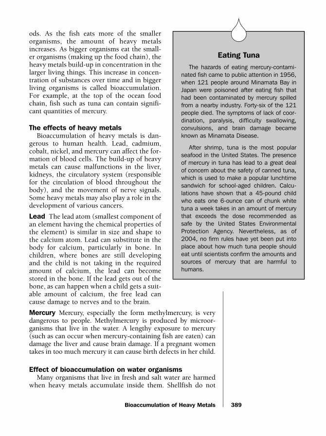
SSSEating Tuna
The hazards of eating mercury-contami-nated fish came to public attention in 1956,when 121 people around Minamata Bay inJapan were poisoned after eating fish thathad been contaminated by mercury spilledfrom a nearby industry. Forty-six of the 121people died. The symptoms of lack of coor-dination, paralysis, difficulty swallowing,convulsions, and brain damage becameknown as Minamata Disease.
After shrimp, tuna is the most popularseafood in the United States. The presenceof mercury in tuna has lead to a great dealof concern about the safety of canned tuna,which is used to make a popular lunchtimesandwich for school-aged children. Calcu-lations have shown that a 45-pound childwho eats one 6-ounce can of chunk whitetuna a week takes in an amount of mercurythat exceeds the dose recommended assafe by the United States EnvironmentalProtection Agency. Nevertheless, as of2004, no firm rules have yet been put intoplace about how much tuna people shouldeat until scientists confirm the amounts andsources of mercury that are harmful tohumans.
water_ch12 10/20/04 10:52 AM Page 389
have any mechanism to prevent bioaccumulation. This actuallymakes the shellfish a good indicator to scientists that a problemof heavy metal accumulation may exist in a certain area. If shell-fish are found with unacceptably high levels of heavy metal, sci-entists are alerted to the possibility of contamination inorganisms throughout the body of water.
The problem of bioaccumulation of heavy metals is provingdifficult to solve. Much work still needs to be done by scientiststo develop reliable methods of detecting the presence of unac-ceptable levels of heavy metals, and in protecting waterwaysfrom exposure to heavy metal-containing pollution.
Brian Hoyle, Ph.D.
For More Information
BooksBotkin, Daniel B., and Edward A. Keller. Environmental
Science: Earth as a Living Planet. New York: Wiley, 2002.
Gedicks, Al. Resource Rebels. Cambridge, MA: South EndPress, 2001.
Smol, John. Pollution of Lakes and Rivers. London: ArnoldPublishers, 2002.
Websites“Eutrophication (Nutrient Pollution).” University of Manitoba,
Experimental Lakes Area. http://www.umanitoba.ca/institutes/fisheries/eutro.html (accessed on September 1, 2004)
“Eutrophication.” U.S. Environmental Protection Agency.http://www.epa.gov/maia/html/eutroph.html (accessed onSeptember 1, 2004)
DesertificationDesertification is a term used to describe the gradual
changes that take place over a region or area of land that ulti-mately result in the formation of a desert. Although manyplaces in the world are called deserts, scientists usually define adesert as a region or area that receives less than 10 inches (25.4centimeters) of water from precipitation (rain, slow, sleet, orhail) during a year.
Desertification harms many people. During the late 1960sand early 1970s, desertification brought on by a severe drought
U•X•L Encyclopedia of Water Science390
S
water_ch12 10/20/04 10:52 AM Page 390

Desertification
(an extended period with little or no rain) in the Sahel regionof Africa devastated the local agriculture of six African coun-tries located on the southern border of the Sahara Desert.International relief measures were unable to prevent the deathof thousands of people who suffered from the resulting famine(lack of food). Millions of animals that normally relied uponeating the grass that grew in the already dry region also died.The deaths of the animals resulted in further starvation of thepeople living in the region.
391
WORDS TO KNOW
SDesert: An area of land thatreceives less than ten inches(25.4 centimeters) of precipita-tion per year.
SPrecipitation: Transfer ofwater as rain, slow, sleet or hailfrom the atmosphere to theland or ocean surface.
1930s U.S. Dustbowl
SSS
A cloud of topsoil lifts from drought stricken farms andcontributes to the accelerated loss of soil during the1935 Dust Bowl. AP/Wide World Photos. Reproduced by
permission.
During the Great Depression of the 1930s,the United States and Europe suffered diffi-cult economic times. Jobs were scare andunemployment was high. Farms failed andmany farmers were forced to abandon theland that had once supported their familiesand communities. In some areas of theUnited States, people suffered from malnutri-tion and starvation.
In addition to economic hardships, there wasalso a severe drought (an extended period oftime with little or no rain over an area) over largeportions of the Midwest throughout the 1930s.The drought also contributed to farm failures.
The combination of lack of irrigation (thewatering of land and crops), and naturaldrought resulted in the loss of topsoil (aprocess scientists call deflation of the soil).The topsoil dried it became lighter and easilyblown by the wind. As a result, great wind-storms of dry dust blew millions of pounds oftopsoil from once fertile farms and the largeportions of the American Midwest, particularlyOklahoma and Kansas, became known as theDust Bowl.
In some areas, the amount of dust and top-soil in the air was so great that dust stormsdecreased the visibility to just a few feet. Thedust in the air became so choking that it waslife-threatening to babies, small children, theelderly, and the sick. According to the 1934Yearbook of Agriculture, nearly 35 million acresof cultivated land (land normally plowed andwatered by farmers) became desertlike andunable to support the growth of crops. Morethan 200 million additional acres of land alsoshowed signs of becoming desert-like and werein the process of desertification.
An improved economy late in the decadeand the return of normal levels of rainfall,reversed the process of desertification overmost of the Dustbowl region.
water_ch12 10/20/04 10:52 AM Page 391

Dry areas of North America—particularlyin the southwestern and western UnitedStates—are also vulnerable to desertification.Some scientists estimate that up to nine out often such areas can be described as undergoingsome form of desertification.
How desertification changes the envi-ronment
As the process of desertification takesplace, the land loses its ability to supportagriculture. Areas that were once arid (dry),but that could still support the growth ofsome crops or the grazing of animals,become barren as the desertification pro-gresses. For example, grasslands may under-go desertification to become deserts.
During desertification, an area undergoesmany changes, but it does not lose its abili-ty to support crops or animals all at once.Neither does it completely lose its ability tosupport life. Even a desert can support thesparse growth of vegetation that live inareas with little moisture. As desertificationproceeds, however, the land gradually loses
its ability to support plants that require higher levels of water,and only plants that are able to live and thrive on less watersurvive.
The loss of water also changes the way the land responds towind and occasional rains. Over time, desertification results inchanges to the landscape that result in the formation of areas ofhigh erosion (areas where soil and rock are lost or worn awayby water) and the formation of dramatic land features (such asflat-topped mesas or buttes). As desertification continues, thetopsoil (uppermost layer of soil) dries and becomes lighter. It iseasily blown away by the wind is and the remaining sand or soilmay form dunes (hills of sand created by wind). The wind overthe region or area then shapes the dunes in very specific ways.For example, scientists can look at the pattern of dunes and tellhow the winds blow throughout the year.
The loss of water over time also changes the chemistry of theland. As the land becomes drier, the concentration of saltincreases in the water that does remain. If the concentration ofsalt become too high (a process termed salinization), the
U•X•L Encyclopedia of Water Science392
A farmer surveys the parchedsoil of his drought stricken
South Texas farm. Jim Sugar
Photography/Corbis-Bettmann.
Reproduced by permission.
water_ch12 10/20/04 10:52 AM Page 392

Desertification
remaining water can become too salty for humans to drink oruse for watering crops.
Causes of desertificationIn addition to a decline in the amount of rain that falls each
year, a number of other factors are important in determiningwhether a region or area will undergo desertification. Factorssuch as wind, amount of sunlight, and use of the land alsoinfluence how fast desertification takes place.
Desertification can be caused or reversed by natural forces andcycles in the climate such as rainfall and wind patterns. Forexample, rainshadow deserts may form in area with little precip-itation because a barrier such as a mountain range causes mois-ture-rich winds to lose their moisture before reaching the area.
Improper use or overuse of water resources by humans canalso cause desertification. If, for example, humans overusewater to water lawns, not enough water may remain availablein local groundwater or aquifers support surrounding areasneeding water to grow grasses that support cattle and othergrazing animals. In addition, if too many animals are intro-duced into an area, they can overgraze by eating too much ofthe available vegetation. The loss of too much natural grass andvegetation can speed up the processes of land erosion, whichwill speed up the process of and desertification.
Other human activities such as deforestation (the over-cutting of trees) and mining may cause desertification. Theintroduction of new species of plants and animals not native(naturally occurring) to a region or area—especially plants oranimals that may require more water than the native speciesalready living in the area—may result in desertification.
Halting desertificationUnder the right conditions, if the use of land is carefully reg-
ulated and special practices are started to conserve water, deser-tification can be greatly slowed or even reversed. In this way,water conservation helps keep lands productive.
In many dry regions, water conservation practices are new tothe societies that live there and it remains the custom to simplyabandon dry lands in search of areas with more water availableto support crops and animals. As the world’s populationincreases, however, this practice cannot continue indefinitely,and water conservation practices have become increasinglyimportant.
393
water_ch12 10/20/04 10:52 AM Page 393

Desertification can also be reversed by natural forces andcycles in the climate.
K. Lee Lerner
For More Information
BooksBurroughs, William, ed. Climate: Into the 21st. Century. New
York: Cambridge University Press, 2003.
Bush, Mark B. Ecology of a Changing Planet. Upper SaddleRiver, NJ: Prentice Hall, 1997.
Websites“From the Dust Bowl to the Sahel.” National Atmospheric and
Space Administration: Earth Observatory. http://earthobserva-tory.nasa.gov/Study/DustBowl (accessed on September 7,2004).
“National Weather Service Climate Prediction Center.”National Oceanic and Atmospheric Administration.http://www.cpc.ncep.noaa.gov/ (accessed on September 7,2004).
“Surviving the Dust Bowl: The American Experience.” PublicBroadcasting System/WGBH. http://www.pbs.org/wgbh/amex/dustbowl/ (accessed on September 7, 2004).
“Water.” National Environment Research Council Centre forEcology and Hydrology. http://www.ceh.ac.uk/science_topics/water.htm (accessed on September 7, 2004).
“World Climates.” Blue Planet Biomes. http://www.blueplanet-biomes.org/climate.htm (accessed on September 7, 2004).
EutrophicationEutrophication is a process in which a body of water
changes with time as deposits of nutrients and sediments (par-ticles of sand, silt, and clay) from the surrounding area accu-mulate.
The process of eutrophicationIn euthrophication, the chemical characteristics of the water
changes. The biology of the water, in terms of the types oforganisms that can live in that water body, also changes.Eutrophication involves an increase in the level of plants’ food
U•X•L Encyclopedia of Water Science394
S
water_ch12 10/20/04 10:52 AM Page 394

Eutrophication
sources in the water. Younger water bodies that have lower lev-els of nutrients do not support much life. As the nutrientsincrease, more life can develop in the water. Indeed, the wordeutrophic comes from the Greek word eu meaning “well” andtrophic, meaning “feeding.” The term eutrophic, therefore, liter-ally means “well nourished.” At the other end of the scale is anovergrowth of plants including the microscopic chlorophyll-containing algae, which will rob the lake of oxygen and causethe deaths of animals and other aquatic life.
Consequences of eutrophicationWhile eutrophication is a natural process that occurs over
thousands of years, it has become associated with what canhappen to water when human activities alter the water compo-sition. This form of eutrophication has sometimes been calledcultural eutrophication.
The human-made form of eutrophication occurs when foodsources for plants and microorganisms find their way into thewater. Fertilizer, cleaning detergents, and other human prod-ucts contains compounds such as phosphorus, nitrogen, andcarbon that cause the growth of plants and specifically of algae.Rain washes these compounds off of farm fields, lawns, golfcourses, roads, and parks into stream, rivers, ponds, lakes, andocean waters.
Eutrophication that is artificially accelerated, mainly becauseof the addition of fertilizer from agricultural run-off and home-owner’s lawns and other chemicals from paved surfaces such asparking lots, can destroy the recreational quality of a lake for peo-ple. A formerly beautiful lake can become a smelly dead zone.
In the 1970s and 1980s in a benchmark series of studies thathas set the standard for the discipline, Canadian scientists stud-ied the effects on the controlled addition of various fertilizers toa series of small lakes. Because the lakes were isolated, the scien-tists were able to study what affect each fertilizer had on thehealth of the lake. These studies demonstrated that, among thevarious compounds that were added to test sections of lakes,phosphorus was the key chemical that drove the eutrophicationprocess. One lake was split in half by a plastic divider. Carbonand nitrogen were added to one half of the lake and carbon,nitrogen, and phosphorus were added to the other half. The halfthat received phosphorus developed huge numbers of a type ofmicroorganism called blue-green algae. This rapid and hugeincrease in numbers of algae is called an algal bloom. The result-ing algal bloom used much of the available oxygen in the water,
395
WORDS TO KNOW
SAlgal bloom: The rapid andhuge increase in numbers ofalgae that can occur in thepresence of a food source suchas phosphorus.
SEstuary: An area where afreshwater body meets the sea.
SPhosphorus: An elementused as a food source by avariety of plants and microor-ganisms.
water_ch12 10/20/04 10:52 AM Page 395

causing the death of fish and other creaturesthat depend on oxygen for survival. Thisexperiment was key in convincing peoplearound the world that the addition of phos-phorus compounds to water was a problem.Later, laws were enacted in Canada thatbanned the use of most phosphorus com-pounds in laundry detergent (phosphoruswas initially added to laundry detergent toadd softness to clothes). As well, these studieshave helped drive the creation of environ-mental regulations elsewhere.
Another source of nitrogen and phospho-rus is sewage. In many large cities through-out the world, millions of gallons of rawsewage are still pumped into local watersevery day. Whether rain-washed or flushed,nitrogen and phosphorus compounds enter-ing a water body can be used as a source offood by microorganisms in the water, in par-ticular algae.
Effects of eutrophicationThe human-made form of eutrophication
occurs much faster than natural eutrophica-tion. Instead of a water body changing overthousands of years, a lake undergoingeutrophication as a result of excess runoff(surface water that flows off land) of nitro-gen-, phosphorus- and carbon-containingcompounds can go from being clean, clear,and home to a variety of life, to a green algae-filled body in only a few years. Reversing thedamage from human-made eutrophication ina body of water can be a difficult process.This is especially true in lakes where thereplacement of water, as water flows into thelake at one end and flows out at the other,occurs slowly. During the 1960s Lake Erieunderwent eutrophication. For over adecade, scientists assumed that the lake
might never recover. Fortunately, environmental measures suchas reducing the use of detergents that contain phosphorus andcareful management of agriculture near the lake has helpedrestore Lake Erie to health.
U•X•L Encyclopedia of Water Science396
SSSGulf of Mexico
In the Gulf of Mexico eutrophication hasoccurred on a vast scale. The eutrophic“dead zone,” an area where the oxygen con-tent in the water is too low to support manyfish and plants that normally live in the Gulf,extends along the coasts of Louisiana andTexas for hundreds of miles (kilometers). Thezone grows larger in the summer months asthe tropical waters become warmer, andshrinks in the fall as the water temperaturecools. The excess nutrients are deposited bythe waters that flow into the Gulf of Mexicofrom the Mississippi River, and large oxygen-depleting algal blooms are the result.
Surveys have shown that the eutrophicarea during summer months is about 6,950square miles (18,000 square kilometers), orabout the size of New Jersey. The fishingindustry along the Gulf that normally bringsin over $26 billion dollars worth of shrimp,crab, and fish each year has felt an impactof the dead zone. Fishing fleets are forced totravel farther out to sea for their catch,around or past the barren area.
A number of government organizationsincluding the U.S. Environmental ProtectionAgency are working to understand the caus-es of the Gulf eutrophication and to lessenthe damage. This task is challenging as theMississippi River delivers water from a largeportion of the central United States, and theMississippi River basin contains over half ofall U.S. farms. Controlling the nutrientsentering the Mississippi will be a multi-stateeffort between federal, state, and local gov-ernments.
water_ch12 10/20/04 10:52 AM Page 396

Floods and Flood Control
Harmful effects of eutrophication are also found in theChesapeake Bay. The bay, located in Maryland, is a large estu-ary (area where freshwater meets saltwater). In the 1970s thebay was healthy and home to a wide variety of underwater life.But as massive amounts of nutrients from agricultural andurban activities slowly washed into the bay, the blooms of algaecut off sunlight and reduced the oxygen in the water. As aresult, animal life in the bay, such as the famous Marylandcrabs, are reducing in numbers. Citizen groups and governmentagencies are joining forces to restore the water quality of theChesapeake bay by reducing the amount of sediments andnutrients that are introduced into the bay, and by protecting thenearby forests and wetlands that serve as natural filters for con-taminants. Their joint goal is to restore the Chesapeake waterquality to a level that will sustain its natural plant and animalinhabitants by the year 2010.
Brian Hoyle, Ph.D.
For More Information
BooksDennis, Jerry. The Living Great Lakes: Searching for the Heart of
the Inland Seas. New York: Thomas Dunne Books, 2003.
National Research Council. Clean Coastal Waters:Understanding and Reducing the Effects of Nutrient Pollution.Washington: National Academy Press, 2000.
Websites“Eutrophication (Nutrient Pollution).” University of Manitoba.
http://www.umanitoba.ca/institutes/fisheries/eutro.html(accessed on September 1, 2004).
“Eutrophication.” U.S. Environmental Protection Agency.http://www.epa.gov/maia/html/eutroph.html (accessed onSeptember 1, 2004).
“Tributary Strategies: Charting the Path to a Healthy Bay.”Chesapeake Bay Program. http://www.chesapeakebay.net/wqctributarytech.htm (accessed on September 1, 2004).
Floods and Flood ControlFloods occur when a normally drier land area is temporar-
ily submerged in water overflowing from rivers, dams (barrierto contain the flow of water), runoff, or tides. Runoff is water
397
S
water_ch12 10/20/04 10:52 AM Page 397

that accumulates and flows after heavy rainstorms orsnowmelts. Floods occur in all fifty states and around theworld. Floods can be caused by several factors: heavy rainfallover a short period, moderate rainfall over a long period, melt-ing snow, hurricane storm surge (a dome of water that buildsup as a hurricane moves over water), ice or debris jams onrivers, and dam failures.
Floods can cause great harm to people and property. Floodsare the deadliest form of natural disasters, killing moreAmericans every year than tornados, lightning, earthquakes,and forest fires combined. Due to the potential harm, govern-ment agencies work to prevent and predict floods.
Describing floodsScientists describe floods according to three criteria: the
maximum height of the water above normal levels during theflood, the time period required for the flood waters to rise andfall, and the size and frequency with which similar floods arelikely to occur.
Height of the floodwater. In describing the maximum heightof a flood, scientists refer to the crest of a river (its maximumheight during a flood) or the height of the floodwaters over thefloodplain. A floodplain is a low-lying area near a water sourcethat is normally dry, but is subject to overflow by a river, lake, orwater from a man-made water barrier. In Florence, Italy in 1966for example, the Arno River crested at about 20 feet (6 meters)over flood stage (the level at which water leaves its banks andbegins to flood), and filled the nearby Santa Croce church, hometo countless masterpieces of art, with over 8 feet (2.4 meters) ofwater and mud. Watermarks indicating the height of the floodare still visible today along the walls of the church.
When describing floods according to the time periodrequired for the water to rise and fall, scientists often refer toflash floods. Flash floods are floods that occur in only a fewhours or even minutes, usually due to heavy rainfall or a dambreak. Flash floods can also occur when ice or debris toobstruct the flow of river water, causing water to back upupstream. When the ice or debris breaks loose, a wall of waterrushes downstream and can cause flash floods.
Speed of the flood. Flash floods are dangerous because theyare usually accompanied by fast moving water. Fast movingwater usually occurs in drainage ditches, canyons, and in riversand creeks. Flash floods can produce fast-moving walls of waterup to 20 feet (6 meters) high. However, it does not take 20 feet
U•X•L Encyclopedia of Water Science398
WORDS TO KNOW
SCrest: The highest waterlevel during a flood; also thehighest level of floodwaters dur-ing a flood.
SDam: A physical barrier con-structed across a river or water-way to control the flow or raisethe level of water.
SDrainage basin: Land areafrom which surface runoffdrains into a stream or lake.
SFlash flood: Flood that risesand dissipates rapidly with littleor no advance warning, usuallyas the result of intense rainfallover a relatively small area.
SFloodplain: Low-lying areanear a water source that is nor-mally dry, but is subject to over-flow by a river, lake, or waterfrom a man-made water barrier.
SLevee: A long, narrow em-bankment usually built to pro-tect land from flooding.
SNational Weather Service:Government agency that pre-dicts the weather and warnsthe public of dangerous weath-er situations and their conse-quences, including severeweather and flood warnings.
water_ch12 10/20/04 10:52 AM Page 398
Floods and Flood Control
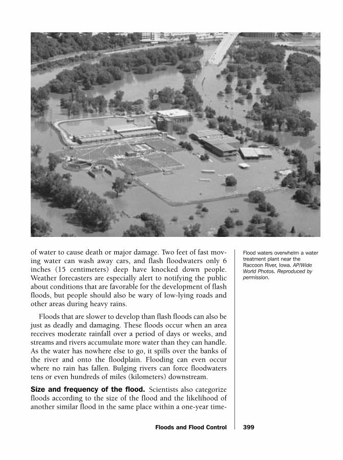
of water to cause death or major damage. Two feet of fast mov-ing water can wash away cars, and flash floodwaters only 6inches (15 centimeters) deep have knocked down people.Weather forecasters are especially alert to notifying the publicabout conditions that are favorable for the development of flashfloods, but people should also be wary of low-lying roads andother areas during heavy rains.
Floods that are slower to develop than flash floods can also bejust as deadly and damaging. These floods occur when an areareceives moderate rainfall over a period of days or weeks, andstreams and rivers accumulate more water than they can handle.As the water has nowhere else to go, it spills over the banks ofthe river and onto the floodplain. Flooding can even occurwhere no rain has fallen. Bulging rivers can force floodwaterstens or even hundreds of miles (kilometers) downstream.
Size and frequency of the flood. Scientists also categorizefloods according to the size of the flood and the likelihood ofanother similar flood in the same place within a one-year time-
399
Flood waters overwhelm a watertreatment plant near theRaccoon River, Iowa. AP/Wide
World Photos. Reproduced by
permission.
water_ch12 10/20/04 10:52 AM Page 399

frame. For example the 1966 flood in Florence, Italy wasdescribed as a 100-year flood, which means that the chance ofa similar flood occurring within the same year in Florence was1 in 100. A 5-year flood has a 5 in 100, or 20% chance of a sim-ilar flood happening in the same place within a year. The clas-sifications of 5-year flood, 10-year flood, 25-year flood, 50-yearflood, 100-year flood, or 500-year flood, actually refer more tosize of the flood than to predictions when a similar one willhappen again in the future. The water volume of the floodincreases along the scale as the frequency decreases. A 5-yearflood is almost always a mild occurrence, whereas a 500-yearflood tends to have very high and violent water flow, and cov-ers a wide area of the floodplain.
Flood damageSince the 1970s, an average of 140 Americans have died in
floods every year. The deadliest flood in American historyoccurred in Johnstown, Pennsylvania, a town that was built onthe floodplain near the fork of the Little Conemaugh and StonyCreek Rivers. On May 31, 1889 an upstream dam on the LittleConemaugh ruptured. The wall of water that rushed down-stream resulted in a flash flood that killed 2,200 people when itreached Johnstown. In 1972 232 people died in Rapid City,South Dakota, during a flash flood. Many of the people thatwere killed were spectators who were swept away while admir-ing the floodwaters.
Floods can also cause significant property damage. Flooddamage includes damage and destruction of houses, business-es, automobiles, crops, and personal property. Floods areresponsible for over $2 billion of damage every year in theUnited States. The Great Midwest Flood of the Mississippi andMissouri Rivers in 1993 caused between $15 and $20 billion indamages and 50 deaths. This slow-forming flood covered thou-sands of square miles (kilometers) with water in mostMidwestern states. Residents downstream placed sandbagsalong the banks of the river to create a barrier before the flood-waters reached them, but the river engulfed large parts of farm-land and cities all along its floodplain. The floodwatersremained for 144 days.
Flood watches and warningsThe National Weather Service issues four types of flood
warnings: flood watches; flash flood watches; flood warnings;and flash flood warnings. The National Weather Service is agovernment agency that predicts the weather and warns the
U•X•L Encyclopedia of Water Science400
water_ch12 10/20/04 10:52 AM Page 400

Floods and Flood Control
public of dangerous weather situations. Knowing what thesewatches and warnings mean can save lives.
A flood watch means that weather conditions are favorablefor floods to form. A flood watch is usually issued during longperiods of moderate rainfall. A flash flood watch means thatflooding could occur within six hours or less after the rainends. Flash flood watches are usually issued during periods ofheavy rainfall when waters may rise quickly.
A flood warning means that flooding is occurring. Rivers andcreeks are rising. People in low-lying areas should be prepared
401
Venice in Peril
SSSVenice, Italy, is built in a lagoon (a shallow
body of water separated from the ocean by asandbank or by a strip of low land) bordered bythe Adriatic Sea and tidal marshland. The city’scanals and seaport made Venice a successfulseaport and center of trade for centuries.However the same sea that allowed Venice toflourish also threatens its historic architecture.Venice is sinking.
The lagoon around Venice floods as manyas 200 days a year. These floods routinelysend water into Venice’s squares and build-ings. The frequency of floods in Venice hasincreased over the last century. Venice nowfloods 30 times more often than it did over100 years ago.
There are several reasons for the sinking ofVenice and the resulting floods. Groundwater(fresh water in the rock and soil layers beneathEarth’s land surface) in the area around Venicewas pumped out at a great rate during thetwentieth century. The removal of groundwaterlowered the water table (level below the landsurface at which spaces in the soil and rockbecome saturated with water) in Venice, result-ing in soil compaction. Soil compaction refersto the same amount of soil being packed intoa smaller space. Soil compaction in Venice led
the city to sink. This sinking process is alsoknown as subsidence. Since 1950 Venice hassunk nearly 8 inches (20 centimeters).Flooding in Venice may have also increaseddue to a ship canal that was dug in the 1950s.Many scientists also calculate that rising sealevels that result from climate change may alsolead to increased flooding.
Scientists have developed several plans tosave Venice from ruin. Construction is under-way on a mobile flood barrier where the lagoonmeets the Adriatic Sea. Large gates will beattached to the sea floor at these locations.When sea levels are expected to rise and floodVenice, these large gates will rise up and pre-vent seawater from entering the lagoon. Thisfour-billion-dollar project is expected to becompleted in 2011. These mobile flood barri-ers will protect Venice from rising seawater forthe next 100 to 150 years.
Scientists are also studying the possibility ofraising Venice by injecting fluids into the soil farbelow the city. Fluid pumping would replacewater that was removed from Venice’s watertable during the twentieth century. Engineershope the fluid pumping can raise the city 8 to12 inches (20 to 30 centimeters).
water_ch12 10/20/04 10:52 AM Page 401

to evacuate if waters in their area begin to rise. A flash floodwarning means that water levels are rising quickly and willthreaten life and property within six hours. Upon receiving aflash flood warning, people in low-lying areas or areas nearcreeks and rivers should move to higher ground immediately.
Forecasters advise people to remain indoors during a floodwatch or warning and go out only if necessary to evacuate.Keep a weather radio nearby and have an escape plan. Neverwalk through running water; find a way around it. Even a smallcreek or drainage ditch can be deadly during a flood. Also,never drive across a road that has water on it, even if it lookssafe to do so. Judging the depth of water over a road is difficult,especially at night. In the United States more flood victims diein their cars than anywhere else.
Flood controlGiven the awesome and destructive power of flood waters,
humans have long sought to tame rivers and streams to preventfuture flooding. Rivers that have many streams that feed themare more likely to flood than rivers with few streams. In theUnited States, the Mississippi River drainage basin accommo-dates more water than any other drainage basin. A drainagebasin is an area of land in which all of the creeks, streams, andrivers drain into a common source. The Mississippi Riverdrainage basin is the third largest drainage basin in the world.Approximately 41% of all water in the lower 48 states drain intothe Mississippi River. The Mississippi River drainage basin cov-ers over 1.2 million square miles (3.1 million square kilome-ters) and all or part of 31 states. This results in the MississippiRiver handling a great amount of water. Flood waters anywherein the drainage basin will eventually all flow into theMississippi River, potentially causing it to flood as well.
Spanish explorers recorded flooding of the Mississippi Riverin 1543. The floodwaters remained for 80 days. Flooding in theearly twentieth century devastated the lower Mississippi Riverdrainage basin. In 1927 floodwaters covered over 26,000 squaremiles (67,300 square kilometers). This huge flood led Congressto pass a law called the Flood Waters Control Act of 1928,which sought to control the waters of the lower MississippiRiver. The result of this law was the Mississippi River andTributaries Project. The project sought to allow the MississippiRiver to handle a flood 11% larger than the flood of 1927. Theproject was designed to prevent flooding along about 600 miles(957 kilometers) of the river from Cape Girardeau, Missouri toNew Orleans, Louisiana.
U•X•L Encyclopedia of Water Science402
water_ch12 10/20/04 10:52 AM Page 402

Floods and Flood Control
The project led to the construction of a series of dams andlevees (walls built to hold back and channel flood water) tocontrol the Mississippi River. Deep channels called floodwaysalso provide a path for floodwaters. Dams can be opened toallow water out of the river and into these floodways. Mostfloodways are located near areas that flood easily (low-lyingfloodplains).
The Tennessee Valley Authority, a government agency thatcontrols dams and generates electricity, also runs a flood con-trol program. The Tennessee Valley Authority controls 34 damsthat prevent flooding along the Tennessee River, Ohio River,and Mississippi River. The dams release water from reservoirsbefore flood season. A reservoir is the water that is backed upbehind a dam. Lowering the reservoirs allows them to holdmore water during the flood season. The floodwaters are thenslowly released from behind the dams to prevent floodingdownstream. The Tennessee Valley Authorities flood controlsystem prevents over $200 million in flood related damageevery year.
Joseph P. Hyder
For More Information
BooksDuden, Jane and Kay Ewald. Floods! Rising, Raging Waters.
Des Moines, IA: Perfection Learning, 1999.
McCullough, David. The Johnstown Flood. New York: Simon &Schuster, 1968.
Websites“Flood Control.” Tennessee Valley Authority. http://www.tva.gov
/river/flood.htm (accessed on September 7, 2004).
“Floods.” Federal Emergency Management Agency for Kids.www.fema.gov/kids (accessed on September 7, 2004).
“Floods.” National Oceanographic and AtmosphericAdministration. http://www.noaa.gov/floods.html (accessedon September 7, 2004).
“The Mississippi River and Tributaries Project.” US ArmyCorps of Engineers. http://www.mvn.usace.army.mil/pao/bro/misstrib.htm (accessed on September 7, 2004).
“The Sinking City of Venice—NOVA Online.” PBS.http://www.pbs.org/wgbh/nova/venice/ (accessed onSeptember 7, 2004).
403
water_ch12 10/20/04 10:52 AM Page 403

Global Climate ChangeGlobal climate change, often simply referred to as “global
warming,” is a complex and scientifically controversial issuethat attributes an increase in the average annual surface tem-perature of Earth to increased concentrations of carbon dioxideand other gases in the atmosphere (air surrounding Earth).Many scientists disagree on how to best interpret data related toclimate change. Scientists also argue about which data (forexample, measurements of changes of thickness in arctic ice,measurements of sea temperatures at critical locations, or meas-urements of certain chemicals in the atmosphere, etc.) shouldbe used to make informed decisions about the extent and rateof global climate change.
Climate describes the long-term conditions or averageweather for a region. Throughout Earth’s history, there havebeen dramatic and cyclic changes (changes that repeat them-selves in cycles that can last from thousands to millions ofyears) in climatic weather patterns corresponding to cycleswhere glaciers of ice advance and retreat over the landscape.These glacial cycles occur on the scale of 100,000 years.However, within these larger glacial cycles are shorter dura-tion warming and cooling trends that last from 20,000 to40,000 years.
Scientists estimate that approximately 10,000 years haveelapsed since the end of the last ice age, and examination ofphysical and biological evidence establishes that since the endof the last ice age there have been fluctuating periods of globalwarming and cooling.
Concerns over global warmingGlobal warming actually describes only one of several com-
ponents involved in climate change and specifically refers to awarming of Earth’s surface outside of the range of normal fluc-tuations that have occurred throughout Earth’s history.
Measurements made of weather and climate trends duringthe last decades of the twentieth century raised concern thatglobal temperatures are rising not in response to natural cycles,but rather in response to increasing concentrations of atmos-pheric gases that are critical to the natural and life-enablinggreenhouse effect.
The greenhouse effect describes a process wherein infraredradiation (a form of light) from the Sun is reflected off Earth’ssurfaces, but then trapped by clouds to warm Earth’s atmos-
U•X•L Encyclopedia of Water Science404
WORDS TO KNOW
SClimate: Long-term meteor-ological conditions or averageweather.
SCyclic changes: Changesthat repeat themselves overtime.
SEvaporation: The processwhereby water changes to agas or vapor.
SGreenhouse effect: Theprocess where light from theSun is reflected off Earth’s sur-faces and then trapped byclouds to warm Earth’s atmos-phere and surface.
SGreenhouse gases: Gasesin Earth atmosphere’s thatinclude water vapor and carbondioxide, methane, nitrousoxides, ozone, halogens(bromine, chlorine, and fluo-rine), halocarbons, and othertrace gases (gases found invery relatively small amounts).
SRespiration: Process inwhich an organism uses oxygenfor its life processes.
STranspiration: Evaporationof water from the leaves orstems of plants.
SWater vapor: Water in theform of gas in the atmosphere.
S
water_ch12 10/20/04 10:52 AM Page 404

Global Climate Change
phere and surface (the light is reflected through the atmosphereand back towards Earth’s surface). Although the greenhouseeffect is essential to life on Earth, if changes result in too stronga greenhouse effect, the changes in Earth’s climate could be dra-matic and occur much faster than do natural cycles.
Observations collected over the last century indicate that theaverage land surface temperature increased by 0.8–1.0°F(0.45–0.6°C). The effects of temperature increase, however,cannot be easily identified or measured because an overallincrease in Earth’s temperature may actually cause tempera-tures at certain locations to decrease because of increased cloudcover associated with increased precipitation (the transfer ofwater as rain, slow, sleet, or hail from the atmosphere to the sur-face of Earth).
Measurements and estimates of global precipitation and thesea level changes (the height of Earth’s oceans) indicate thatprecipitation over the world’s landmasses has increased byapproximately 1% during the twentieth century. Further, aspredicted by many global warming models, the increases in pre-
405
Fongafale Island, the capital ofTuvalu—one of the smallestcountries in the world—isthreatened by rising sea levels.© Matthieu Paley/Corbis.
Reproduced by permission.
water_ch12 10/20/04 10:52 AM Page 405

cipitation were not uniform. High latitude regions (regions farnorth or south of the equator) tended to experience greaterincreases in precipitation, while precipitation declined in trop-ical areas.
U•X•L Encyclopedia of Water Science406
Arctic Melting
SSS
Evidence of melting pack ice located in the CanadianArctic. © Eric and David Hosking/Corbis. Reproduced by
permission.
Reliable information concerning changes inArctic and Antarctic ice is difficult to obtain andscientists do not always draw the same con-clusions from the data. As a result, conflictinginformation and ideas exist about the causesand state of Arctic and Antarctic melting. Somescientists argue that ice melting could be dueto short-term fluctuations in climate or oceancurrents. Many more scientists, however, agreethat global climate warming is contributing tothe loss of polar ice.
Observations and measurements that indi-cate ice is melting in the Arctic Sea, and inthe ice surrounding Antarctica, is supportedby submarine based measurements. Sonarreadings (a measuring device that can sendout sound signals and measure how longthose signals take to travel to objects, bounceback, and return) show that the distancebetween the surface of the ocean and thebottom of the ice is decreasing and that ice in
some areas is 40% thinner than it was just 40years ago.
Because ice takes up more room than doesliquid water, when Arctic ice melts, it does notdirectly raise the level of the oceans. In con-trast, because much of it is over land, meltingAntarctic ice can contribute liquid water to theoceans. Along with other factors, melting icecan result in sea level increases that threatencoastal areas with flooding.
Scientists at the National Aeronautics andSpace Administration (NASA) use satellites tomeasure ice cover, and their results also showArctic ice cover decreasing. Between 1978and 2000, half a million square miles (1.3 mil-lion square kilometers) of apparently perma-nent Arctic ice melted away. At that rate ofloss, some scientists argue that the permanentice caps may be in danger of disappearingbefore the end of the century. As more ice dis-appears, it increases the temperature of Arcticwaters because, while ice reflects the majorityof the Sun’s rays back into space, darker blueocean waters are capable of absorbing muchmore heat-generating light from the Sun.
Although the long-term economic conse-quences may be dire, over the short term,some companies may try to exploit the meltingice to increase shipping through the Arctic sea.Many potential routes that now require expen-sive icebreakers offer significantly shorterroutes (and thus lower cost routes) betweenparts of Europe and the Far East when com-pared to southerly routes through the Panamaor Suez canals.
water_ch12 10/20/04 10:52 AM Page 406

Global Climate Change
Measurements and estimates of sea level show increases of6–8 inches (15–20 centimeters) during the twentieth century.Geologists and meteorologists (scientists who study Earth’sprocesses, climate, and weather) estimate that approximately25% of the sea level rise resulted from the melting of mountainglaciers. The remainder of the rise can be accounted for by anincrease in the amount of ocean water in response to higheratmospheric temperatures.
Changes in the normal greenhouse effectBecause the majority of data clearly show that Earth’s tem-
perature has risen over the last century, the key question for sci-entists is whether increases in global temperature are part of anatural cycle of change or whether human activity is responsi-ble for the changes.
Estimates of greenhouse gases (those gases that contribute tothe greenhouse effect) in the atmosphere that existed prior tothe nineteenth century (estimates that are made from currentmeasurements of arctic ice) indicate that over the last few mil-lion years the concentration of greenhouse gases remained rel-atively unchanged prior to the European and Americanindustrial revolutions (the time in history, roughly since 1850,when large scale industry and manufacturing that relied onmachines powered by gas and oil began).
During the last 150 years, however, increased emissions frominternal combustion engines and the use of certain chemicalshave increased concentrations of greenhouse gases. Althoughmost greenhouse gases occur naturally, the evolution of anindustrial civilization has significantly increased levels of thesenaturally occurring gases. Many scientists argue that theseincreases are responsible for an abnormal amount of globalwarming.
Greenhouse gasesImportant greenhouse gases in the modern Earth atmosphere
include water vapor and carbon dioxide, methane, nitrousoxides, ozone, halogens (bromine, chlorine, and fluorine),halocarbons, and other trace gases (gases found in very rela-tively small amounts).
The sources of the greenhouse gases are both natural andman-made. For example, ozone is a naturally occurring green-house gas found in the atmosphere. Ozone is constantly pro-duced and broken down in natural chemical reactions that takeplace in the atmosphere. In contrast, some chemicals that can
407
water_ch12 10/20/04 10:52 AM Page 407

alter the ozone’s chemical reactions enter the atmosphere pri-marily as the result of human use of products that contain chlo-rofluorocarbon gases (CFCs), such as in cans of hairspray orspray paint (CFCs in spray cans are not permitted in the UnitedStates). There is scientific evidence that CFCs can lead to anoverall reduction in ozone.
Alterations in the concentrations of greenhouse gases resultfrom either the overproduction or underproduction of natural-ly occurring chemicals such as ozone.
Water vapor (water in the form of gas) and carbon dioxideare natural components of respiration (the process in which anorganism uses oxygen for its life processes), transpiration(evaporation of water from the leaves or stems of plants), evap-oration (the process whereby water changes to a gas or vapor),and decay processes. Carbon dioxide is also a by-product of
U•X•L Encyclopedia of Water Science408
Kyoto Treaty
SSSThe Kyoto Protocol is an agreement
between governments to reduce the amount ofgreenhouse gases emitted by developed coun-tries. The protocol is intended to be the firstlegally binding global agreement to cut green-house gas emissions and was part of theUnited Nations Framework Convention onClimate Change (UNFCCC). The agreement,reached in December 1997 at a UnitedNations conference in Kyoto, Japan, seeks toreduce the amount of greenhouse gases emit-ted by developed countries by 5.2% below their1990 levels by the year 2012.
More than 100 countries fully accepted theagreement. The United States, however, ulti-mately rejected the Kyoto Protocol becausemany legislators thought the costs to theAmerican economy would be too high. In addi-tion to economic worries, U.S. lawmakers wor-ried that the protocols ignored emissions fromdeveloping countries. Emissions from develop-ing countries are predicted to become a highlysignificant percentage of global greenhousegas emissions by 2015. In 2003, President
George W. Bush (1946–) said that the UnitedStates would not ratify (fully accept and imple-ment into law) the Kyoto Protocol. The U.S.rejection was critical because the protocol onlycomes into force when 55 leading countries,representing 55% of the greenhouse gas emis-sions produced by developed countries, ratifythe agreement. The United States is a largestemitter of greenhouse gases—with one of thehighest levels of emissions per capita (per person)—and accounts for 36.1% of all emis-sions. Without U.S. cooperation, the proto-cols—fully accepted by countries and groups ofcountries represented by the EuropeanUnion— fall short of the 55% target. As of July2004, the accepting leading countriesaccounted for only 44.2% of emissions.
Although environmentalists in America andEurope argue that the treaty is an essential firststep toward saving Earth’s climate, many sci-entists now argue that the Kyoto protocols,even if fully implemented, will be ineffective inslowing the increases in greenhouse gases andthat much stricter limits will be needed.
water_ch12 10/20/04 10:52 AM Page 408

Global Climate Change
combustion (burning). The amount of watervapor released through evaporation increasesdirectly with increases in the surface temper-ature of Earth. Within normal limits,increased levels of water vapor are usuallycontrolled by increased warming and precip-itation. Likewise, concentrations of carbondioxide (and other gases such as methane)are usually maintained within normal limitsby a variety of physical processes and chem-ical reactions.
Although occurring at lower levels thanwater vapor or carbon dioxide, methane isalso a potent greenhouse gas. Nitrous oxides,enhanced by the use of nitrogen fertilizers,nylon production, and the combustion oforganic material—including fossil fuels—have also been identified as contributing to astronger greenhouse effect.
Measurements made late in the twentiethcentury showed that since 1800, methaneconcentrations have doubled and carbondioxide concentrations are now higher thanat any time during the last 160,000 years. Infact, increases in carbon dioxide over the last200 years—up until 1973—were greaterthan at any time in Earth’s history. Although the rate has slowedsince 1973, corresponding to the time when widespread pollu-tion controls were first introduced, the rate remains high rela-tive to other periods in Earth’s history.
The debate over global climate changeThe fact that increased levels of greenhouse gases have
occurred at the same time as recent increases in global tem-perature has generally strengthened arguments predictingincreased global warming over the next few centuries. In 2001,the United Nations Intergovernmental Panel on ClimateChange (IPCC) asserted that human activity was responsiblefor much of the recent climate change resulting in globalwarming.
In the alternative, some scientists remain skeptical becausethe Earth has not actually responded to the same extent asexpected. For example, some estimates based upon the rate ofchange of greenhouse gases predicted a global warming of .8°F
409
A school of fish hovers about acoral reef in the Indian Ocean.Even slight global climatechange can affect fragileecosystems such as coral reefs.© Stephen Frink/Corbis.
Reproduced by permission.
water_ch12 10/20/04 10:52 AM Page 409
to 2.5°F (0.44°C to 1.39°C) over the last century. However, theactual increase—if measured at .9°F (.5°C)—is significantlyless. Moreover, this amount of global warming may be withinthe natural variation of global temperatures. Most scientistsagree, however, that an enhanced greenhouse effect will resultin some degree of global warming.
Whether recent global warming and changes in sea levels arenatural, induced my human activity, or a mixture of natural andhuman-induced is an important scientific argument. Althoughthe causes are debated, however, there is good agreement thatevents that normally take place over much longer periods(thousands of years) are now occurring over hundreds of years,even as quickly as decades. Most importantly, the global warm-ing trend is unarguably altering ecosystems, sometimes harm-fully to both life and economies.
Global warming results in melting ice at the North and SouthPoles that increase sea levels of water. Small changes in sea lev-els can quickly make land unusable for agriculture (salt water,for example, can destroy rice fields.)
Paul Arthur and K. Lee Lerner
For More Information
BooksAlley, Richard. The Two-Mile Time Machine. Princeton, NJ:
Princeton University Press, 2002.
Burroughs, William, ed. Climate: Into the 21st Century. NewYork: Cambridge University Press, 2003.
Weart, Spencer R. The Discovery of Warming. Cambridge, MA:Harvard University Press, 2003.
Websites“Antarctic Ice Shelves and Icebergs in the News.” National
Snow and Ice Data Center. http://nsidc.org/iceshelves/(accessed on September 7, 2004).
“Global Warming: Frequently Asked Questions.” NationalOceanic and Atmospheric Administration. http://www.ncdc.noaa.gov/oa/climate/globalwarming.html (accessed onSeptember 7, 2004).
“Global Warming.” United States Environmental ProtectionAgency. http://yosemite.epa.gov/oar/globalwarming.nsf/content/index.html (accessed on September 7, 2004).
U•X•L Encyclopedia of Water Science410
water_ch12 10/20/04 10:52 AM Page 410

Groundwater
GroundwaterMany of Earth’s groundwater supplies are threatened, main-
ly by human population growth and contamination.Groundwater is freshwater that resides underground; it collectsfollowing the movement of water from the surface downthrough soil and rock. As the water moves downward, a zoneor line is formed underground, above which the spaces in thesoil and rock are filled with air and water (called the zone ofinfiltration) and below which water occupies every availableopening (called the zone of saturation). The water table is at thetop of the zone of saturation, and groundwater lies beneath thewater table.
In a desert, groundwater is a vital source of life to plants,which can produce roots that are dozens of feet (meters) long,to reach down from the dry surface to the water below.Groundwater is also important to humans for drinking water,growing crops (irrigation), and other uses. For example, in theyear 2000, about 21% of the 408 billion gallons of water usedin the United States each day came from underground sources.Over the course of a year, that adds up to about 32 trillion gal-lons of groundwater!
Threats to groundwaterThe main reason that groundwater is threatened has to do
with the chemistry of water. Many other compounds (sub-stances formed by the joining of two or more elements) can eas-ily dissolve into the liquid form of water. Liquids into whichother compounds dissolve in are called solvents, and water isknown as the “universal solvent.” If there is a toxic (poisonous)chemical near to groundwater, chances are good that it will alsobe able to dissolve into and contaminate the groundwater.Toxins (poisonous substances) that cannot dissolve in water(such as oils), can still ruin the quality of groundwater ifexposed to an underground water source.
“Out of sight, out of mind.” Because many areas have a plen-tiful supply of groundwater, this resource can easily be over-looked. In Canada for example, before 1990, water scientistsfound that although 30% of Canadians relied on groundwaterfor their drinking water, the government had not formed lawsto help protect groundwater quality. Since that time, the num-ber of Canadians depending upon groundwater for drinkingwater has increased, but Canada still has no groundwater pro-tection policy.
411
WORDS TO KNOW
SAquifer: Underground rockor sediment layer that yieldswater of adequate quantity andpurity for human use.
SIrrigation: In agriculture, aprocess where dry land or cropsare supplied with water.
SPesticides: Substancesused to kill or harm unwantedplants, insects, or rodents.
SSinkhole: A crater thatforms when the roof of a caverncollapses; usually found inlimestone rock.
SSolvent: A substance, mostoften a liquid, into which othercompounds can dissolve.
SWater table: Level belowwhich all pore space in rocksand soil are filled with water;also the top of the zone of sat-uration.
SZone of infiltration: Soiland rock layers above whichthe spaces in the soil and rockare filled with air and water.
SZone of saturation: Soiland rock layers with porespaces that are completelyfilled with fluid.
S
water_ch12 10/20/04 10:52 AM Page 411

Individual versus community groundwater use. A wellthat supplies one house does not usually harm a groundwatersource. This is because the amount of water that is taken fromthe ground is more than balanced out by the amount of waterthat goes back into the ground as rainfall, melting snow, flood-water or other sources. However, when a community relies onone or a series of wells for its water supply, the total amount ofwater that is withdrawn from the groundwater source can belarge. If an area experiences a drought (prolonged shortage ofrainfall), water consumption rises, or wells are placed too closetogether, then more groundwater can be taken than is replen-ished. Rather than drawing water from different parts of the geo-graphical area where water from the region collects (the aquifer),wells very near one another can draw water from the same partof the aquifer, depleting it faster than if the wells were furtherapart.
These imbalances cannot continue indefinitely or thegroundwater supply will run out. The city of Las Vegas, Nevadais an example of a community whose demand for water is caus-ing problems to the underground supply of water. So muchgroundwater has been taken from the ground around Las Vegasdue to a growing population’s demand for water, that areas ofthe land have dropped by over five feet (1.5 meters) in the pastcentury.
Other sources of groundwater depletion. Some industriesuse large amounts of groundwater. In the oil industry, for exam-ple, groundwater (along with surface water) is forced down intooil wells to help bring the hard-to-pump oil up to the surface.While much of this water is eventually returned to the ground,some is lost, mainly through evaporation, or is so polluted thatit cannot be put back into the environment. Mines that aremade by digging huge holes in the ground (quarries) also helpdeplete groundwater. Groundwater will often leak out of thewalls of the quarry and pool in the bottom of the hole. Thequarry acts as a sponge, drawing water out of the surroundingground. Even though the water can be pumped out andreturned to the surrounding ground, the rate of water loss fromthe ground is sometimes higher than the rate at which the waterreturns to the ground.
Nature is another source of groundwater depletion, in theform of a drought. Without rainfall to replenish the groundwa-ter, an underground water source can quickly run dry with con-tinued use.
U•X•L Encyclopedia of Water Science412
water_ch12 10/20/04 10:52 AM Page 412

Groundwater
Groundwater contaminationMost of the chemicals and microorgan-
isms in water will be removed as it seepsdown through layers of soil and rock toreach the water table. Soil and rocks filter thechemicals and microorganisms in water bysticking to the contaminants or because theyare too large to pass through the tiny cracksin the rock. This cleaning effect is not, how-ever, always foolproof. There can be breaksin the soil-rock barrier that allow chemicalsand microorganisms to rapidly move downto the groundwater, where they collect andcontaminate the groundwater.
Pesticides in groundwater. Only a fewgenerations ago, the contamination ofgroundwater by chemicals designed to killweeds and other pests (pesticides) was not aconcern. But as the population of the UnitedStates has grown, and with the demand toproduce more crops from each acre of land,scientists began to develop chemical pesti-cides. The use of pesticides has increased theamount of food that can be grown. Indeed,the United States has become the largest pro-ducer of food in the world, partially due tothe fact that crops are protected from destruc-tion by insects and other pests with the use of pesticides.
This increase in production has come with a big disadvan-tage, the contamination of groundwater (along with surfacebodies of water and soil) by the pesticides. Because pesticidescan take decades to get from the surface to groundwater, theproblem with pesticides in groundwater could become worse inthe future. Organizations such as the U.S. EnvironmentalProtection Agency are working to understand pesticide con-tamination of groundwater and to try to set standards for howmuch pesticide can be safely applied to the land.
Other sources of groundwater contamination. Anotherexample of how groundwater can be contaminated is via a sink-hole; a crater formed on the surface when the rook of a cavernlocated directly below collapses. The sinkhole creates a kind ofwater freeway; water can move easily down through the manyopen spaces in the rock to the groundwater zone. Sinkholesoften occur in limestone rock. In states enriched in limestone,
413
A scientist tests a sample ofgroundwater taken from a landfill in California. © Jim
Sugar/Corbis. Reproduced by
permission.
water_ch12 10/20/04 10:52 AM Page 413

such as Iowa, sinkhole-related contamination of groundwater isa concern. In just the northeast part of Iowa, almost 13,000sinkholes are known to exist.
Groundwater can also be contaminated when undergroundstorage tanks, such as the tanks located underneath gas sta-tions, develop a leak. As the toxin leaks out of the tank, it canmake its way to the groundwater. When the chemicals disperse(spread) in the groundwater, a wide area (many city blocks)around the tank can become contaminated. As this type ofgroundwater contamination is harder to detect, most commu-nities have systems in place to check underground storagetanks for leaks on a regular basis.
Since water moves downward to the groundwater, any con-taminant that is on the surface may also be carried down. Alongwith pesticides, surface contaminants can also include wells infields that are designed to help drain excess water, water con-taining salt that is applied to roads in northern climates to pre-vent ice from forming, old uncovered wells that contain animalor other waste, and the burial of waste material in landfills.
Brian Hoyle, Ph.D.
For More Information
BooksGlennon, Robert. Water Follies: Groundwater Pumping and the
Fate of America’s Fresh Waters. Washington, DC: IslandPress, 2004.
WebsitesEnvironment Canada. “Groundwater.” The Green Lane.
http://www.ec.gc.ca/water/en/nature/grdwtr/e_gdwtr.htm(accessed on September 1, 2004).
“Get Informed.” The Groundwater Foundation. http://www.groundwater.org/gi/gi.html (accessed on September 1, 2004).
U.S. Geological Survey. “Pesticides in Ground Water.” WaterScience for Schools. http://ga.water.usgs.gov/edu/pesticidesgw.html (accessed on September 1, 2004).
Habitat Loss and Species ExtinctionHabitat (natural environment) loss is the number one threat
to the survival of many animal species (organisms that share aunique set of characteristics), and water is part of any habitat.
U•X•L Encyclopedia of Water Science414
S
water_ch12 10/20/04 10:52 AM Page 414

Habitat Loss and Species Extinction
Coastal marshes and wetlands in the United States and else-where are shrinking every year. Wetlands are areas of landwhere water covers the surface for at least part of the year andcontrols the development of soil; marshes are wetlands domi-nated by grass-like plants. Wetlands in particular support agreat variety of bird, fish, and other animal life, and can be usedby migrating (periodic traveling) birds as a stop-off point ontheir long journeys. Without the wetlands, the number ofspecies that can live on the land declines. Habitat loss is prima-rily caused by human activities, such as logging, development,fishing, and recreation.
Edward Wilson (1929–), a renowned entomologist (scientistwho studies insects) has written that the current rate at whichlife is becoming extinct has not been seen since the time of thedinosaurs 65 million years ago. Wilson estimates that the cur-rent rate of extinction (the rate at which every member of aspecies dies) is 100,000 times faster that what is considered thenatural rate and that, in the next 25 years, one of every fivespecies of insect, bird, and animal could die out. Along with theloss of diversity, the possible extinction of even one insect hasgreat importance. Insects, for example, are near the bottom of anatural system of life in which creatures of prey are eaten bypredator creatures, called the food web, or the food chain. If thebottom of the food chain is disturbed, it could impact animalsalong the rest of the chain, including humans.
Development and overuseCoastal marshes and wetlands in the United States and else-
where are shrinking in areas where development occurs. Thedesire for oceanfront property is so great that coastal beachesand the wetland areas where rivers flow into the ocean are oftenpaved over.
Other human activities in coastal areas alter the habitat ofthe creatures that live near the ocean. Many species of crus-taceans, especially ghost crabs, live in the dunes and providefood for birds such as sea gulls and other terns. When plantsthat naturally grow and strengthen sand dunes are destroyed,the sand is more easily blown away by wind or washed away bywaves. Overuse of a beach by people can remove vegetationwhen beachgoers climb sand dunes. On some beaches, a popu-lar pastime is to drive dune buggies and all-terrain vehicles overthe dunes, both of which destroy dune vegetation and eventu-ally, the dune itself.
415
WORDS TO KNOW
SClearcut: The total removalof trees and much of the vege-tation from a section of forest.
SDiversion: Changing thedirection of a water body suchas a stream or river by buildingcanals, dams, or channels.
SErosion: Wearing away ofsoil, rock, sand or other materi-al by the action of wind andwater.
SExtinction: The total disap-pearance of a species; the irre-versible loss of a living species.
SFood web: The predator andprey relationships between ani-mals and plants.
SHabitat: The environment inwhich a species naturally ornormally lives and grows.
SSpecies: A group of livingorganisms that share a uniqueset of characteristics and havethe ability to reproduce andproduce offspring with thesame set of characteristics.
water_ch12 10/20/04 10:52 AM Page 415

Fishing and habitat lossHabitat destruction can also occur under-
water. Fishing with dragnets, for example,destroyed underwater habitats in the 1970s.This method involved dragging a huge netalong the bottom of the ocean. The front ofthe net often had a heavy bar attached to it tokeep the net open and to deliberately clearout any obstacles that might snag the net,including beneficial plants and coral. Thescrapping of the ocean floor completelydestroyed habitats of some lobsters, crabs,and fish off the eastern coast of Canada.
In many areas of the United States, theCanadian mid-west, and other countries thesmall family farm has been largely replaced byfarms that are owned and run by large com-panies. Corporate-owned farms are oftenthousands of acres (square meters) in size.The plowing under of wetlands to create moreland for farming and farming practices such asthe use of pesticides has disturbed water habi-tats. Erosion (wearing away) and the run-offof chemicals from the fields have contaminat-ed both surface and ground waters.
Growth of citiesMost of the world’s cities are growing in size and population.
Often the most rapid growth takes place on the edges of citieswhere many people live. Roads and other transportation routesare continually being built to bring suburban commuters clos-er to the working center of the city. This new developmentturns fields, forests, and wetlands into more expanses of pave-ment. In some cities earth and rock is dumped into the water tocreate new land for housing.
All this change can be bad news for a habitat. In Californiain the 1990s, growth of cities reduced the amount of a plantcalled the coastal sage shrub by over 90%. One of the creaturesthat lives in the coastal sage shrub is the California gnatcatch-er, an insect that is now threatened with extinction.
Logging and miningLogging, or removing trees for wood, can be accomplished in
a way that does not harm a habitat. Removing only selected tress
U•X•L Encyclopedia of Water Science416
Leatherneck turtles arethreatened by a loss of habitat,
especially near sensitivebreeding areas. © Kennan
Ward/Corbis. Reproduced
by permission.
water_ch12 10/20/04 10:52 AM Page 416

Habitat Loss and Species Extinction
and hauling the tress out by horse or smalltractor can actually help create more sunlightin a forest, and so encourage growth of newtrees. However this does not supply enoughtrees for the needs of large lumber compa-nies. Instead, often all the trees in an area ofa forest are removed and hauled away. This iscalled clearcutting and it can devastate entirehabitats. With no roots left to hold the soilerosion can quickly occur, clogging streamswith soil. The biggest threat to the survival ofthe grizzly bear in Alaska is logging and thebuilding of roads for logging trucks.
Mining, especially where huge pits aredug in the ground, can also destroy naturalhabitats. The water that runs off from a minesite can contain harmful metals that causeillness if present in the body even in smallamounts (heavy metals) and can be so full ofacid that it can burn skin and pollute nearbywaters. A gold mine located in northernIdaho, for example, is leaking low levels of atoxic (poisonous) chemical called cyanideinto a part of the South Fork Salmon Riverfor years. This has contaminated an area ofthe river where chinook salmon breed, andhas threatened the entire salmon populationin the South Fork Salmon River.
Changing waterwaysBuilding dams, constructing channels,
and changing the direction of a river orstream (diversion) for flood control will allchange water habitats, forcing animals toadapt to the changed habitat or find a newhome. In the Pacific Northwest, the buildingof dams on the Columbia River has reducedthe number of chinook, coho, chum, sock-eye, and pink salmon populations. Two largeriver fish that were used by NativeAmericans for food and fertilizer, the bony-tail and the razorback sucker, have suffered from changes to theColorado River imposed by dams and diversion. The bonytail isnearly extinct and the razorback sucker is threatened. InCalifornia the use of water for agriculture has caused a toxic
417
SSSKesterson National Wildlife
Refuge and SeleniumThe Kesterson National Wildlife Refuge is
a system of wetlands, grassy regions andsurface water pools that cover almost11,000 acres (4,452 hectares) in the SanJoaquin Valley of central California. Therefuge was created in 1969 to provide anarea where waters draining from surroundinghigher land could gather and be protected.The area was also an important stop on thenorth-south migration route of some birds.
In the 1970s the agriculture nearbybegan to affect the water draining into therefuge. The agricultural operations removedlarge amounts of underground freshwaterand the water draining into the refuge con-sisted of more runoff water from the cropfields. By 1981 almost all the water enteringthe refuge was the leftover agricultural water.This water contained high amounts of an ele-ment called selenium. Selenium naturallyexists in some soils. As surface water in therefuge evaporated, the selenium that wasleft behind accumulated to levels that werepoisonous. Before scientists learned of theproblem and diverted the water away fromthe refuge, many birds that nested in therefuge died or hatched with physical defects.
The poisoning that occurred at theKesterson refuge alerted scientists to thefact that along with pesticides and otherchemicals in agricultural runoff, naturallyoccurring compounds could also pose aproblem to habitats if the water flow in anarea changed.
water_ch12 10/20/04 10:52 AM Page 417

compound called selenium to build up in the soil. Runoff(water that flows over ground surface to bodies of water) ofselenium into the Kesterson National Wildlife Refuge hascaused the deaths of large numbers of birds.
Preventing species lossSome local governments are working to plan development
along coastlines in order to preserve wetland, marsh, beach,and dune habitats. The U.S. Environmental Protection Agencymonitors water quality in threatened habitats, and privateorganizations such as the Nature Conservancy create refuges bybuying both wetland habitats and saltwater marshes for con-serving as natural areas. So far, several sea turtle species havebenefited from these efforts, as well as the dwarf seahorse andthe Florida manatee.
Brian Hoyle, Ph.D.
For More Information
BooksDavidson, Olsha Gray. The Enchanted Braid: Coming to Terms
with Nature on the Coral Reef. New York: Wiley, 1998.
Kerley, Barbara. A Cool Drink of Water. Washington, DC:National Geographic Society, 2002.
Locker, Thomas. Water Dance. New York: Voyager Books, 2002.
Websites“How You Can Help.” National Save the Sea Turtle Foundation.
http://www.savetheseaturtle.org/HowYouCanHelp.htm(accessed on September 1, 2004).
“The State of Disappearing Species and Habitat: A Sierra ClubReport.” Sierra Club. http://www.sierraclub.org/wildlife/species/habitat_report/intro.asp (accessed on September 1,2004)
Industrial and Commercial WasteMany everyday activities create waste. Even cutting the lawn
makes grass clippings that can stress water bodies such as streamsand rivers if too much washes into the water. This is because thegrass is food for in the water. Microorganisms can grow quicklyin great numbers, and rob the water of the oxygen that is neededby fish and other living creatures inhabiting the water.
U•X•L Encyclopedia of Water Science418
S
water_ch12 10/20/04 10:52 AM Page 418

Industrial and Commercial Waste
One person alone might not produce enough waste materialto contaminate a water source. However, a community of manypeople and large industries produce large amounts of waste.For example, the city of Halifax, Nova Scotia, on Canada’s eastcoast still directly discharges sewage into the harbor. Eventhough the city is relatively small (approximately 300,000 peo-ple), millions of gallons of raw sewage pour into the water eachday. If enough waste gets into a stream, river, pond, lake, orother body of water, the water can become contaminated andunhealthy for animals and humans who use the water as asource of drinking water or for recreation. Some of this wastecan also move down through the soil and rock to contaminatewater present below the surface (groundwater).
Waste water can carry large numbers of bacteria that nor-mally live in the intestinal tract. Some of these such asSalmonella and Shigella can cause serious diseases if ingested.As well, waste water can carry compounds like mercury, leadand other metals that can be dangerous to health if ingested.
Commercial wasteCommercial operations are those that provide a service or
sell a product. A feature that is common to most commercialoperations is a paved parking lot. Grocery stores, restaurants,shopping malls, movie theatres, office buildings, and libraries,typically have spots where vehicles are parked. Vehicles canleak oil, antifreeze, and other fluids that are used to keepengines running smoothly, brakes operating safely, and wind-shields clean. These fluids gather on the pavement and arewashed away in rains or when accumulated snow melts. If awater body is located nearby, the wastes could flow into thewater. Wastes accumulated on concrete are particularly washedaway during heavy rainstorms, as drains that are usually placedin the parking lot cannot hold all of the sudden, heavy flow of water.
Excess packaging can also become a source of commercialwaste, especially when a careless individual discards it as litter.Paper and plastic products that litter the ground can be blownor carried by runoff (water that flows over ground surface) to awater body. In the water litter can alter or even stop the naturalflow of the natural streams that drain larger bodies of water.Litter in the water also harms animals and other organisms. Forexample, the plastic rings that keep soft drinks and beer togeth-er in six or eight-packs can become entwined around the necksor beaks of birds and choke them.
419
WORDS TO KNOW
SGroundwater: Water thatmoves from the surface downthrough the soil and rock togather below the surface.
SSuperfund: A program man-aged by the EnvironmentalProtection Agency that identi-fies, investigates, and cleansup the worst hazardous wastesites in the United States.
SSurface water: Water thatis present on the surface.Examples include rivers, lakesand oceans.
water_ch12 10/20/04 10:52 AM Page 419

Many businesses store liquids near the workplace. Gas sta-tions have large underground tanks to store the gas. Businessesrequiring heat during colder winter months may have largestorage tanks for oil. Both above ground and underground stor-age tanks can develop cracks and the chemicals inside can leak.When this happens nearby surface waters are threatened.Groundwater is also at risk for contamination, especially whenthe leak is from an underground tank. Contaminants ingroundwater can flow sideways, spreading for hundreds of
U•X•L Encyclopedia of Water Science420
Love Canal
SSS
Hazardous waste contamination closes a school in LoveCanal, near Niagara Falls, New York. © Galen
Rowell/Corbis. Reproduced by permission.
Love Canal is a neighborhood in NiagaraFalls, New York, that has become a symbol ofthe hazards to groundwater from industrialwaste. The nickname “Love Canal” honors aman named William Love, who in 1896attempted to dig a canal linking Lake Ontarioand Lake Erie that would be used to generateelectrical power. The project was never com-pleted and the canal was left unused.
From 1947 to 1952 the Hooker ChemicalCompany, which had a plant located next tothe canal, dumped the left-over liquids from itschemical making operation into the canal. Intime the canal became full of the waste. It wascovered up and the land was sold to the city of
Niagara Falls for $1.00. A school and houseswere built over the buried waste.
By the 1970s, over a thousand familieswere living in the 15-acre (6 hectares) LoveCanal neighborhood. Some began to complainof similar health problems. A high rate of birthdefects occurred in the area. Many trees andother vegetation in the Love Canal neighbor-hood turned unusual colors and died. In 1977chemicals that were leaking out of the canalwere discovered. The same chemicals werealso discovered leaking from the groundwaterinto the basements of some homes. In 1978President Jimmy Carter declared the LoveCanal site a disaster area. Eventually 239 fam-ilies who lived next to the buried canal weremoved out of their homes at governmentexpense. In 1980 the evacuation of over 700more families was ordered.
In 2004, the canal is still off-limits and thewaterway is buried under a plastic liner, clay,and topsoil. After clean-up efforts that took 20years and over $350 million, some surroundingareas, especially north of the canal, are beingrebuilt. The Love Canal environmental disastertriggered the formation of a program called theSuperfund, managed by the EnvironmentalProtection Agency. The Superfund programlocates, investigates, and cleans up the worstsites of hazardous waste in the United States.
water_ch12 10/20/04 10:52 AM Page 420

Industrial and Commercial Waste
yards (meters) away from the site of the spill. Most communi-ties require chemical storage tanks to be regularly checked forleaks to prevent groundwater or surface water sources fromcontamination by commercial waste.
The sewage from commercial and industrial facilities, aswell as water that has been used in the manufacturing process-es, usually ends up in a plant that is designed to treat thewastewater before it is released back to the environment. Thetreatment removes the solid material and many of the microor-ganisms and chemicals from the water. In large cities, millionsof gallons of this wastewater are treated every day. However,there are still some big cities in North America and around theworld where untreated wastewater is dumped directly into nat-ural waters.
Industrial wasteIndustries such as manufacturing often generates large
amounts of solid and liquid waste. Water is often used to coolmachinery and mixes with the oils, greases, and other chemi-cals in manufacturing plants. Some, but not all of the water canbe treated to remove the chemicals, and some of the wastewatercan be released to the environment. Some water is too contam-inated to release back to the environment. This water can beretained in storage lagoons. Of course, as time goes by and thevolume of this water increases, the storage capacity of suchlagoons will be reached.
Some industrial waters, such as those used in various manu-facturing processes, contain metals that can make humans illeven if ingested in low amounts. These so-called heavy metalsare recognized as a hazard, and many federal, state and munic-ipal governments have rules in place to limit the amount ofheavy metals that can be in industrial wastewater. The regula-tions governing the level of contaminants that are consideredacceptable varies from country to country. Some jurisdictionsenact regulations that are stricter than found elsewhere. Forexample, the manufacturing zone in Mexico near the borderwith the United States has regulations that are relatively lax.Much environmental damage is occurring in this region.
Many industries treat the water that is released from the fac-tory. Water can be treated physically, such as by passing thewater through a barrier that contains tiny holes in it (a filter).The filter allows water to pass, but traps larger chemicals.Water can also be passed through materials, which will bind tosubstances like metals. These and other techniques help ensure
421
water_ch12 10/20/04 10:52 AM Page 421

that the industrial water is reduced in the amount of harmfulmolecules.
Brian Hoyle, Ph.D.
For More Information
BooksBotkin, Daniel B., and Edward A. Keller. Environmental
Science: Earth as a Living Planet. New York: Wiley, 2002.
Kerley, Barbara. A Cool Drink of Water. Washington, DC:National Geographic Society, 2002.
Smol, John. Pollution of Lakes and Rivers. London: ArnoldPublishers, 2002.
Websites“About Superfund.” U.S. Environmental Protection Agency.
http://www.epa.gov/superfund/about.htm (accessed onSeptember 1, 2004).
U.S. Geological Survey. “Wastewater Treatment Water Use.”Water Science for Schools. http://ga.water.usgs.gov/edu/wuww.html (accessed on September 1, 2004).
LandfillsLandfills are areas where solid garbage is buried. The con-
struction, use, and maintenance of landfills can impact aquifersand groundwater that lie underneath and around the landfill.Groundwater is fresh water in the rock and soil layers beneathEarth’s land surface; aquifers are a type of groundwater sourcethat yields water suitable for drinking. The material inside alandfill can contain harmful chemicals and microorganisms. Assome of the material in a landfill decomposes (breaks down),other harmful chemicals can be created and released. One well-known example is methane gas; another is leachate, the acidicliquid that contains water and contaminants from the productsof decomposition.
Landfills are a necessary part of life in highly developedcountries such as the United States. The United States has over3,000 landfills that are being filled with trash and over 10,000landfills that have already been filled, according to the U.S.Environmental Protection Agency. The need for all this garbagestorage is because the amount of garbage produced every day inthe United States averages four pounds for each American.
U•X•L Encyclopedia of Water Science422
S
water_ch12 10/20/04 10:52 AM Page 422

Landfills
That’s over 200 million tons every year, more than twice thetrash produced in many other countries. Some of it can be recy-cled or burned but most, about 150 tons per year in the UnitedStates, is left over. While some of these leftovers will breakdown over time into the basic chemicals that make up thematerial, without a landfill, the result can be a stinky mess thatlies in the open air.
What is a landfill?A landfill is a carefully designed structure that is built into
the ground or as a pile above the ground. The garbage that isadded to the landfill does not contact the surrounding soil androck. Rather, a layer of pounded-down clay or a film of plasticor other material is used to line the outside of the landfill. Thepurpose of this liner is to prevent what is inside the landfillfrom escaping into the nearby soil. A landfill can be thought ofas a vault in which trash is locked away forever
Some landfills have only the clay zone barrier. These areknown as sanitary landfills. Other landfills use the plastic bar-rier, and these are called municipal solid waste landfills. Thereare some landfills that use both barriers, although this processis more expensive. Ideally, the break down of material in a land-fill should hardly occur as the inside of the landfill is supposedto be dry, although small amounts of moisture within thegarbage itself contributes to the breakdown of some materials,resulting in an acidic solution of water and dissolved chemicalscalled leachate. Leachate is drained into a collection pond andis eventually treated similar to sewage or other wastewater.
When landfills work properly they are an efficient means tohide trash. They can even be put to some use. In the Canadiancity of Toronto, Ontario, one landfill has been turned into asmall ski resort that is locally known as “Garbage Hill.”However, a badly designed or malfunctioning landfill can resultin the escape or runoff (water that flows on the surface) of con-taminated material, and can pollute nearby water sources.
Construction of a landfillIn most areas of the world careful planning and safety rules
are in place to spell out how a landfill is constructed. In theUnited States, before a landfill can be built a survey mustdemonstrate that the landfill will not disturb the environmentin an unacceptable manner (environmental impact study).Some things that an environmental impact study examinesinclude the proposed location for the landfill, nearby animal
423
WORDS TO KNOW
SAquifer: A underground res-ervoir of water that is the col-lection area for the water in acertain geographical area.
SCell: Small sections of land-fills.
SEnvironmental impact study:A survey conducted to deter-mine if a landfill project couldhave negative effects on theenvironment.
SGroundwater: Freshwaterthat resides in rock and soil lay-ers beneath Earth’s land sur-face.
SLeachate: An acidic waste-water that contains contami-nants from decomposed mate-rials in a landfill.
SLiner: A sheet of plastic orother material that is put on topof clay on the inside of a land-fill to prevent material fromleaking out of the landfill.
water_ch12 10/20/04 10:52 AM Page 423

habitats, the location of nearby surface water sources, the direc-tion in which material escaping the landfill would flow, andhow close to the surface any underground water supply lies.
A properly constructed landfill will include the liner, collec-tion areas to trap any liquid that escapes, and a method ofreleasing gases such as methane that build up inside the land-fill. Efficient landfills are constructed in small sections (cells)that are filled up with trash that is compressed by bulldozersand other equipment, which drive back and forth over it. Onecell is sealed off before another cell is filled. Ultimately, a land-fill is completely sealed with a plastic layer, and at least 6 inch-es (15 centimeters) of soil and grass is planted over it.
Landfill monitoringIt is important to make sure that a landfill is not disturbing
the environment, both during its construction, as it is filled,and in the years after the site is closed. Pipes are usually placedinto the ground at many sites throughout a landfill and thesepipes are connected to a water source for regular testing. If thewater temperature is higher than normal, it may indicate that
U•X•L Encyclopedia of Water Science424
Landfill seepage and runoff maycontaminate groundwaters,nearby streams and rivers. © Terry W. Eggers/Corbis.
Reproduced by permission.
water_ch12 10/20/04 10:52 AM Page 424

Non-point Sources of Pollution
decomposing material is leaking into the water. Additionally,chemical tests are conducted to ensure that harmful chemicalsare not leaking into the groundwater. Careful records of landfillsites are also maintained in order to determine which landfillsites can be reused.
Brian Hoyle, Ph.D.
For More Information
BooksRiley, Karen. Landfill Lunchbox. Indio, CA: S.C.R.A.P. Gallery,
2001.
Strasser, Susan. Waste and Want: A Social History of Trash. NewYork: Owl Books, 2000.
WebsitesFreudenrich, Craig C. “How Landfills Work.” How Stuff
Works. http://people.howstuffworks.com/landfill.htm(accessed on September 1, 2004).
“MSW Disposal.” U.S. Environmental Protection Agency.http://www.epa.gov/epaoswer/non-hw/muncpl/disposal.htm(accessed on September 1, 2004).
Non-point Sources of PollutionNon-point source pollution is pollution that enters water
from many different sites, rather than from just one site.Examples of non-point source pollution are contaminated rainfalling from the sky, polluted melting snow, runoff (water flowon land) of polluted water, and impure water draining downinto the groundwater from many different sites on the surface.In contrast, an example of point source pollution is a pollutedriver flowing into a lake.
Because non-point source pollutants enter a water body suchas a stream, river, or lake at different locations, the control andprevention of non-point pollution can be much more difficultthan when the contaminants are entering at a single site. As thewater runs over the land or through the ground on its way tothe body of water, it can pick up a variety of pollutants. Thesechemicals and undesirable microscopic organisms in the waterpollute the water into which they flow. The flow of the pollut-ed water can also harm plants and carry soil into the water,which can change the shape and flow of the current (steadyflow of water in a prevailing direction) in a water body.
425
S
water_ch12 10/20/04 10:52 AM Page 425

According to the U.S. Environmental Protection Agency,about 40% of all U.S. freshwater sources that have been sur-veyed (mapped) have been damaged by non-point source pol-lution. The damage in many areas is enough that the water isunhealthy for swimming and fish caught from the water shouldnot be eaten.
Types of non-source pollutantsSediment. Sediment is small particles of soil, rock, or dirt car-ried and deposited by water. This material can enter water frommany sources, such as fields, construction sites, mining or log-ging operations that scour off surface vegetation, and erosion(wearing away) of riverbanks or other land.
Nutrients. A nutrient is a food source and all organisms needthese to survive. Non-point source pollution carries a greaterflow of nutrients into a water body from croplands, nurseries,orchards, livestock and poultry farms, lawns, and landfills thatcan disrupt the balance of life in the water. This disruption canchange the chemistry of the water so that it is no longer able tosustain fish and plant life.
Heavy metals. Heavy metals, such as lead or mercury, are poi-sonous if present in too high a concentration in the body. Fluidsthat leak out of vehicles and runoff from mine sites, roads, andparking lots can all contain heavy metals.
Toxic chemicals. Toxic (poisonous) chemicals can enterwater from the runoff from farmland, nurseries, orchards, con-struction sites, and lawns and landfills. They can kill or harmorganisms in the water, such as fish, and sicken animals andpeople who eat these organisms. In 2002 scientists foundunhealthy levels of mercury in salmon taken from waters off thePacific Northwest and urged the public to limit consumption ofsalmon to one serving per week.
Pathogens. Pathogens are microorganisms that can cause dis-ease. Examples of pathogens include certain types of bacteria,viruses, and protozoa. Water that is contaminated with humanor animal feces (such as sewage, waste from farms, and fluidleaking from landfills) often contains harmful microorganisms.If the microorganisms are not removed from the water thenpeople who drink the water can become ill.
Origins of non-source pollutionUrban areas. Cities and towns contain a lot more people perarea than rural areas and many people in one place mean that
U•X•L Encyclopedia of Water Science426
WORDS TO KNOW
SEutrophication: A processin which a body of waterchanges with time as depositsof nutrients and sedimentsfrom the surrounding areaaccumulate.
SHeavy metal: Elementssuch as lead and mercury thattend to be toxic to plant andanimal life, even when presentin a low concentration.
SNon-point source pollution:Pollution that enters water frommany different sites.
SPoint-source pollution:Water pollution that enters thewater body from a particularsite.
SRunoff: Excess water whenthe amount of precipitation(water falling to Earth’s surface)is greater than the ability of theland to soak up the water.
water_ch12 10/20/04 10:52 AM Page 426

Non-point Sources of Pollution
there are more potential sources of pollution. In urban areasone of these sources is the home. When a lawn is sprayed withpesticide (chemicals to harm pests) to kill weeds, rain or otherwater can cause of the poison to flow into the sewer pipes,which drain excess water off the streets. In many cities thesewer water runs directly into a nearby water body. Fertilizerthat is applied to the lawn to help grass grow can contain nutri-ents for organisms in the water (such as nitrogen and phos-phorus). The pollution of water by fertilizer is also a bigproblem in agricultural areas.
The waste left behind on the lawn by the family dog can bewashed away. This fecal material can contain pathogens. Waterthat is flushed down toilets or drains from sinks can also con-tribute to pollution. Even though many communities will treatthis wastewater, some contaminants can make it through thetreatment process. For example, studies that have been done inthe 1990s have found oil, grease, some harmful metals, andeven antibiotics (chemicals that kill bacteria) in the water thatleaves treatment plants.
Another major source of non-point source pollution inmore northern urban areas is the salt that is spread to keeproads free of ice during winter. In the city of Toronto, Canada,the runoff of salt into Lake Ontario was so great one winter in the 1990s that scientists found that portions of the lakecontained plants that are normally found along ocean coast-lines. Also, oil and gasoline can seep from cars and trucks.These pollutants are washed away and will end up in a near-by water body.
Rural and industrial areas. The nitrogen and phosphoruscomponents of many fertilizers, which are food sources for thecrops, can also be a rich source of food to microorganisms suchas algae. The rapid growth and huge increase in the numbers ofthe microorganisms can use up much of the oxygen in thewater. Creatures such as fish that depend on oxygen for theirsurvival will die. As well, the lack of oxygen disrupts the nor-mal chemical processes that keep the water healthy. Thisprocess is called eutrophication.
In some areas of North America farms contain tens of thou-sands of poultry or pigs. The waste material and huge amountsof water used in the farm operation are typically stored in largelagoons (shallow bodies of water that are separated from the seaby a reef or narrow island). There have been cases where alagoon wall has ruptured, allowing the contaminated water topour into a nearby stream or river, or to seep down into the
427
water_ch12 10/20/04 10:52 AM Page 427

groundwater. Much effort is being directed at trying to find bet-ter and safer ways to store and safely dispose of this contami-nated water.
Control of non-point source pollutionAlthough it is impossible to prevent all runoff from entering
water, steps can be taken to reduce the pollutants in the runoff.At a national level the U.S. federal government created waterpollution control measures in 1972 known as the Clean WaterAct. The regulations of the act help restrict the harmful com-pounds that enter water, by setting acceptable water qualitystandards, by making the presence of certain compounds inwater illegal and by penalizing polluters. States and communi-ties can also have their own standards and regulations.
In 1990 the federal government also passed legislationknown as the Coastal Zone Act Reauthorization Amendments,which was directed at the problem of the non-point source pol-lution of coastal waters. The regulations help federal and stateofficials manage the development and use of land that bordersthe streams, lakes, and rivers that empty into the sea. The intent
U•X•L Encyclopedia of Water Science428
Algal blooms, such as the bloomin the Florida Keys (viewed fromthe space shuttle Discovery) are
often fed by agricultural runoffand other non-point sources of
pollution. © 1996 Corbis.
Reproduced by permission.
water_ch12 10/20/04 10:52 AM Page 428

Non-point Sources of Pollution
is to make the freshwater that enters the seaas free of pollution as possible.
There are actions that everyone can taketo reduce non-point source pollution.Alternatives can be found to many toxiccleaners and other household chemicals.Lawn care products need not be toxic towater; environmentally friendly weed killerscan be used, as can the manual way ofpulling weeds by hand. When toxic chemi-cals need to be disposed of they should betaken to a facility, such as a fire station, thatcan safely deal with the chemicals ratherthan dumping the liquid down the drainPicking up after the dog is another way toreduce microorganisms from getting intowater bodies. Finally, learning more aboutwater pollution and taking actions both per-sonally and by helping change the behaviorof others can help reduce non-point sourcepollution.
Brian Hoyle, Ph.D.
For More Information
BooksU.S. Environmental Protection Agency. EPA
833-K-98-001: Wastewater Primer.Washington, DC: U.S. EPA Office ofWastewater Management. Also availableat http://www.epa.gov/owm/primer.pdf(accessed on September 3, 2004).
Wolverton, B. C., and J. D. Wolverton.Growing Clean Water: Nature’s Solution toWater Pollution. Picayune, MS: WolvertonEnvironmental Services, 2001.
Websites“Acid Rain.” U.S. Environmental Protection
Agency. http://www.epa.gov/airmarkets/acidrain (accessed on September 3, 2004).
“Agricultural Runoff Management.” Wisconsin Department ofNatural Resources. http://www.dnr.state.wi.us/org/water/wm/nps/animal.htm (accessed on September 3, 2004).
429
SSSAgricultural Runoff
Agricultural runoff is the main source of pollution in U.S. streams and lakes and is the third leading cause of pollution to the zone where freshwater mixes with salt-water (estuary), according to the U.S.Environmental Protection Agency.
Treating the polluted water once it hasentered a stream, river, or lake is ineffective.The best strategy is to try and prevent the pol-lution in the first place. Agricultural runoffoccurs when the amount of precipitation(water falling to Earth’s surface) is greaterthan the ability of the land to soak up thewater. The capacity of land to act as a spongeis increased when vegetation (plant life) ispresent. This is why leaving a border of treesand grass along a watercourse that runsthrough an agricultural area is a wise idea.Another effective strategy is to reduce theloss of the topsoil, called erosion. Farmlandsin North America lose an estimated 10 tonsor more of soil per acre every year.
Many regions of the U.S. are affected byagricultural runoff. One well-known exampleis the Chesapeake Bay in Maryland. Once athriving place, Chesapeake Bay has longbeen receiving runoff that contains agricul-tural fertilizer and manure. The large growthof algae that occurs in the presence of thisfood source (algal blooms) saps the oxygen,resulting in the death of species like fish andcrabs. Concerned residents and politiciansare working hard to try to reverse the deteri-oration of Chesapeake Bay before the waterbecomes a “dead zone” incapable of sup-porting plant and animal life.
water_ch12 10/20/04 10:52 AM Page 429

Goo, Robert. “Do’s and Don’ts Around the Home.” U.S.Environmental Protection Agency. http://www.epa.gov/owow/nps/dosdont.html (accessed on September 3, 2004).
“Managing Urban Runoff.” United States EnvironmentalProtection Agency. http://www.epa.gov/OWOW/NPS/facts/point7.htm (accessed on September 3, 2004).
Oil SpillsOil is a critical resource for the world. Millions of barrels of
oil are shipped from where the oil is taken from the Earth towhere it is processed (refined) into substances varying fromfuel to plastics. Because the world’s demand for crude oil isgreat, oil must be shipped in large quantities by oceanictankers, barges on inland waters, and pipelines that run overthe land and under the sea. When there is a mistake or accidentthat causes oil to spill from any of these means of transport,damage to the water, beaches, and economy can be devastating.
Oil (also known as petroleum) is a naturally occurring thickliquid mixture of the elements hydrogen and carbon combinedto form chemicals known as hydrocarbons. The oil taken fromthe ground (or seafloor) is called crude oil. Crude oil is thenpumped or shipped to plants (refineries) where the crude oil isconverted into fuels such as gasoline and home heating oil, orturned into chemicals that are used in hundreds of other prod-ucts such as plastic.
In addition to accidental spills, oil can also be spilled duringroutine processes of cleaning ships and pipelines as well aswhen loading and unloading ships. Evidence is mounting thatthe combined effects of these small spills in ports or localwaters can cause substantial damage over time. More spectacu-lar and damaging, however, are the sudden spills associatedwith the sinking or damage to an oil tanker or oil drilling plat-form at sea.
Oil pollution of watersThe total spillage of petroleum into the oceans through
human activities is estimated to range from one million tons totwo million tons of oil every year. Although this is less thanabout one-thousandth of the amount of oil shipped every year(0.1%), the effects can be very damaging if the concentration ofoil (for example, the amount of oil in a liter or gallon of water)in a small area becomes too large.
U•X•L Encyclopedia of Water Science430
WORDS TO KNOW
SDetergent: A chemical usedas a cleaning agent because itencourages the formation of anoil-in-water emulsion.
SDispersant: A chemicalagent that reduces the surfacetension of liquid hydrocarbons,encouraging the formation ofan oil-in-water emulsion. Thisreduces the volume of residualoil on shorelines or the watersurface after a spill.
SMousse: A water-in-oil emul-sion that is formed by turbu-lence of the surface water aftera petroleum spill to the aquaticenvironment.
SPetroleum: A naturally occur-ring, liquid mixture of hydrocar-bons that is mined and refinedfor energy and the manufactur-ing of chemicals, especiallyplastics. Also known as crudeoil.
S
water_ch12 10/20/04 10:52 AM Page 430

Oil Spills
The most damaging oil spills arise fromdisabled ocean tankers or drilling platforms,from barges or ships on inland waters, orfrom blowouts of wells or damagedpipelines. Damage is also caused by the rela-tively frequent spills and discharges fromrefineries. Large quantities of oil are alsospilled when tankers clean out the petroleumresidues from their huge storage compart-ment, sometimes dumping the oil and watermixture directly into the ocean.
Accidents and spillsSome the largest oil spills from ocean
supertankers include:
ü Amoco Cadiz, which went aground in theEnglish Channel in 1978, spilling253,000 tons (230,000 metric tons) ofcrude oil
ü Torrey Canyon, which ran aground in1967 off southern England, spillingabout 129,000 tons (117,000 metrictons) of crude oil
ü Braer, which spilled 93,000 tons (84,000metric tons) of crude oil off the ShetlandIslands of Scotland in 1993
ü Prestige, which split in half off Galicia,Spain, in November 2002, spilling about67,000 tons (61,000 metric tons) ofcrude oil
ü Metula, which wrecked in 1973 in theStrait of Magellan and spilled 58,000tons (53,000 metric tons) of petroleum
ü Exxon Valdez, which ran onto a reef inPrince William Sound in southernAlaska in 1989 and discharged 39,000 tons (35,000 metrictons) of petroleum.
All of the tankers involved in these spills were of the oldersingle hull (the frame or body of a ship) design. New-doublehulled tankers are designed to reduce the chances of a spill fol-lowing an accident.
431
SSSPrestige Oil Spill Near SpainDespite rescue efforts, the oil tanker
Prestige sank off the coast of Spain inNovember 2002. Oil washed ashore alongthe coasts of Spain, Portugal, and France.The spill threatened hundreds of miles ofwildlife-rich coasts. Scientists and environ-mentalists compared the damage from thePrestige spill to the damage caused by the1989 Exxon Valdez spill in Alaska.
Although the final estimate on the size ofthe spill is debated, most petroleum engi-neers estimate that about 67,000 tons(61,000 metric tons) of fuel oil spilled. Thetanker broke apart as it was being towed todeeper waters. Engineers initially hoped thatmost of the oil might solidify (form tar balls)inside the sunken Prestige tanker’s com-partments in the colder and deeper water,but later estimates showed that most of theoil escaped.
The oil spilled was far more toxic (poison-ous) than the type of oil carried by the Exxon
Valdez.
Experts predict that marine and bird lifewill suffer death and disease caused by thePrestige spill well into 2012. In addition tothose species directly harmed, otherspecies in the food chain will also suffer,either from lack of food or from eating otherpoisoned animals.
The preliminary cost for cleanup and losteconomic activity is estimated at $42 million.
water_ch12 10/20/04 10:52 AM Page 431

Significant oil spills have also occurredfrom offshore drilling or production plat-forms. In 1979, the IXTOC-I exploration wellhad an uncontrolled blowout that spilledmore than 551,000 tons (500,000 metrictons) of petroleum into the Gulf of Mexico.Smaller spills include one that occurred in1969 off Santa Barbara in southernCalifornia, when about 11,000 tons (10,000metric tons) were discharged, and theEkofisk blowout in 1977 in the North Sea offNorway, which totaled 33,000 tons (30,000metric tons) of crude oil.
Wartime spillsEnormous quantities of petroleum have
also been released during warfare. Becausepetroleum and its refined products are crit-ically important to economies and industry,enemies have commonly targeted tankersand other petroleum-related facilities dur-ing wars. For example, during World War II(1939–45), German submarines sank 42tankers off the east coast of the UnitedStates, causing a total spillage of about460,000 tons (417,000 metric tons) ofpetroleum and refined products. Therewere 314 attacks on oil tankers during the
Iran-Iraq War of 1981–87, 70% of them by Iraqi forces. Thelargest individual spill during that war occurred when Iraqdamaged five tankers and three production wells at the off-shore Nowruz complex, resulting in the spillage of more than287,000 tons (260,000 metric tons) of petroleum into theGulf of Arabia.
The largest-ever spill of petroleum into the marine environ-ment occurred during the brief Gulf War of 1991. In that inci-dent, Iraqi forces deliberately released an estimated 0.6–2.2million tons (0.5–2 million metric tons) of petroleum into thePersian Gulf from several tankers and an offshore tanker-load-ing facility known as the Sea Island Terminal. An additional,extraordinarily large spill of petroleum to the land and atmos-phere also occurred as a result of the Gulf War, when more than700 production wells in Kuwait were sabotaged and ignited byIraqi forces in January 1991. The total spillage of crude oil wasan estimated 46 to 138 million tons (42 to 126 million tons).
U•X•L Encyclopedia of Water Science432
A worker releases a sorbentboom in an attempt to contain
an oil slick from the 1989 Exxon
Valdez oil spill. © Natalie
Fobes/Corbis. Reproduced
by permission.
water_ch12 10/20/04 10:52 AM Page 432

Oil Spills
Much of the spilled petroleum burned in spectacular atmos-pheric infernos, while additional, massive quantities accumu-lated locally as lakes of oil, which eventually contained 5.5–23million tons (5–21 million tons) of crude oil. Large quantitiesof petroleum vapors were dispersed to the atmosphere. Aboutone-half of the free-flowing wells were capped (closed) by May,and the last one in November 1991.
After the spillAfter oil is spilled into the environment, it spreads out or
sinks (dissipates) in a number of ways. Spreading refers to theprocess by which spilled petroleum moves and disperses itselfover the surface of water. The resulting slick can then be trans-ported away from the initial site of the spill by currents andwinds. The rate and degree of spreading are affected by thethickness (viscosity) of the oil, wind speed, and waves.
433
Exxon Valdez
SSSThe most damaging oil spill ever to occur in
North American waters was the 1989 Exxon
Valdez accident.
More than most tanker accidents, this onewas very preventable. It was caused when thecaptain (who was later found to have beendrinking alcohol) gave temporary command ofthe supertanker to an unqualified and inexperi-enced subordinate, who quickly made a mis-take in navigation and ran the ship agroundonto a well-known reef. The spilled oil affectedabout 1,200 miles (1,900 kilometers) ofshoreline of Prince William Sound and its vicin-ity, causing especially great ecological damage.
Large numbers of sea mammals and birdswere also affected in offshore waters. An esti-mated 5,000–10,000 sea otters were presentin Prince William Sound, and at least 1,000 ofthese charismatic mammals were killed by oil-ing. About 36,000 dead seabirds of variousspecies were collected from beaches and otherplaces, but the actual number of killed birds
was probably in the range of 100,000–300,000. At least 153 bald eagles died frompoisoning when they consumed the carcassesof oiled seabirds.
Great efforts were expended in cleaning upthe oiled shoreline, almost entirely using man-ual and physical methods, rather than disper-sants and detergents. In total, about 11,000people participated in the cleanup, and about$2.5 billion was spent by the ship owners and$154 million by the U.S. federal government.This was by far the most expensive cleanupever undertaken after an oil spill. Within a yearof the spill, the combined effects of thecleanup and winter storms had removed mostof the residues of the Exxon Valdez spill fromthe environment. However, in August 2002,the Exxon Valdez Trustee Council released areport stating that many fish and wildlifespecies injured by the spill had still not fullyrecovered.
water_ch12 10/20/04 10:52 AM Page 433

If a spill is near enough to land, a mixture of oil and watercalled a mousse can wash up on the shore. The mousse com-bines with sand on the shore to form sticky patties that canharden into asphalt like lumps (material similar to that used tomake roads).
At sea, the mousse eventually forms tar balls and in thevicinity of frequently traveled tanker routes world-wide, tarballs can be commonly found floating offshore and on beaches.
Ecological damages of oil spillsEven small oil spills can cause important change in ecologi-
cally sensitive environments. For example, a small discharge ofoily bilge (wastewater) washings from the tanker Stylis duringa routine cleaning of its petroleum-storage compartmentscaused the deaths of about 30,000 seabirds, because the oil wasspilled in a place where the birds were abundant.
Studies made after large oceanic spills have shown that theecological damage can be severe. After the Torrey Canyon spillin 1967, hundreds of miles of the coasts of southern Englandand the Brittany region of France were polluted by oily mousse.The oil pollution caused severe ecological damage and manydifferent life forms suffered from exposure to petroleum. Theecological damages were made much worse by some of thecleanup methods, because of the highly toxic detergents anddispersants that were used.
The effects of oil spills can be harmful both immediately andover time. For example, the Torrey Canyon spill caused thedeaths of at least 30,000 birds, but it also resulted in a largepopulation of surviving birds that experienced difficulty in lay-ing eggs for many years after the spill.
The damage caused by detergents and dispersants (chemicalsused to break up spills) during the cleanup of shorelines pol-luted by the Torrey Canyon spill provided an important lesson.Subsequent cleanups of oil spills involved the use of less toxicchemicals.
In 1978, the Amoco Cadiz was wrecked in the same generalarea as the Torrey Canyon. Considerable ecological damagewas also caused by this accident. However, the damage wasless intense than that caused by the Torrey Canyon becauseless-toxic detergents and dispersants were used during thecleanup.
William J. Engle and William Arthur
U•X•L Encyclopedia of Water Science434
water_ch12 10/20/04 10:52 AM Page 434

Overuse
For More Information
BooksKeeble, John Out of the Channel: The Exxon Valdez Oil Spill in
Prince William Sound. 2nd ed. Cheney: Eastern WashingtonUniversity Press, 1999.
WebsitesU.S. Environmental Protection Agency. “Oil Program.”
http://www.epa.gov/oilspill/ (accessed on September 8, 2004).
OveruseIn countries like the United States, where some states are
dotted with countless lakes and many people live within easyreach of an ocean, it may be easy to assume that drinking andrecreational waters are limitless. This is not the case. In manyareas of the world, water is a preciously limited resource and insome cases, water scarcity is the result of human activity. Inmany countries in which the water supply is scare, water isbeing used faster than it is being renewed, often for agricultureor to supply water for a growing population.
Agricultural overuseAbout 30% of all the freshwater used in the United States and
60% of the world’s available supply of freshwater is used to growcrops. Crops require a large volume of water for production. Forexample, to produce 2.2 pounds (1 kilogram) of rice requiresabout a bathtub full of water. Only about half of the billions ofgallons of water applied to crops each year makes it back to thesurface or underground. The rest is lost to the air as evaporation(the change of water from liquid to vapor) and transpiration(evaporation of water from plant leaves), leaks, and spills.
The oldest known method of irrigation (watering crops) isthe most wasteful. Flooding fields with water has been usedsince ancient times, and still is the method of choice for cropslike rice. Only about half of all the water added to a field, how-ever, actually reaches the plant. Some modern refinements toflood irrigation have made the process less wasteful, but floodirrigation still contributes to the overuse of water.
Residential overuseFlying over a western city like Phoenix, Arizona, can be an
eye-opening experience. Sitting in the middle of a desert is an
435
WORDS TO KNOW
SAquifer: An undergroundreservoir of water that is thecollection area for the water ina certain geographical area.
SGroundwater: Freshwaterthat resides in rock and soil lay-ers beneath Earth’s land sur-face.
SIrrigation: In agriculture, aprocess where dry land or cropsare supplied with water.
S
water_ch12 10/20/04 10:52 AM Page 435

oasis (fertile area) where many houses have the distinctive bluepatch in the backyard that is a swimming pool, and where hun-dreds of streaks of green golf course fairways stand out againstthe surrounding brown land. None of this would be possiblewithout water. In naturally arid (dry areas with little annualrainfall) cities like Phoenix, the recreational use of water is aconcern. Just to the south, the city of Tucson has water policewho patrol the city searching for people who break rules thatare designed to prevent water waste. Infractions such as aiminga water sprinkler at the sidewalk or watering the lawn in hotperiods of the day can cost a homeowner or business hundredsof dollars for a first offense.
The water used around the home in swimming pools, wash-ing the car, washing dishes and laundry, running a lawn sprin-kler, taking a bath or shower, and even flushing the toilet all usea tremendous amount of water. Statistics gathered by the gov-ernment of Canada tell the tale. Canada and the United Statestop the world list of average daily domestic water use. Canadian
U•X•L Encyclopedia of Water Science436
Overfishing
SSSFishing provides the main food source for
200 million people around the world. In somepoorer countries, one in five people lives main-ly on fish. But the catching of more fish than isproduced, called overfishing, is threateningmany of the ocean’s stocks of fish.
One example lies in the Grand Banks, whichis off the coast of the Canadian province ofNewfoundland. The shallower water and near-by warm waters of the Gulf Stream combinedto make the Grand Banks home to a hugenumber of fish. Photographs taken in the1940s show fishing nets bulging with cod andother fish. This bounty caused many to regardthe waters as an endless source of fishing.Wasteful fishing practices and the use of hugefactory trawlers capable of harvesting millionsof fish in a short time took their toll. By the1970s, it was apparent that the Grand Banksfishery was in trouble; numbers of fish weredwindling. In the early 1990s, the Canadian
government closed the cod fishery. People inNewfoundland whose families had fished thewaters for a hundred years lost their jobs.
The fishery closing was intended to be atemporary measure to allow the numbers of codto rebound to their former numbers. This hasnot happened, and the cod fishery off the eastcoast of Canada continues to yield few fish.
In the United States, scientists and citizensgroups such as the National Coalition forMarine Conservation (NCMC) are also workingto bring the issue of overfishing to the forefrontof lawmakers. In 2000, the NCMC convincedcongress to outlaw the practice of killing sharksfor their fins in an effort to protect shark popu-lations in U.S waters. Many laws that were oncedesigned solely to support the fishing industryhave also been redefined to limit catches ofthreatened species of fish and to regulate fish-ing techniques that disrupt their habitat.
water_ch12 10/20/04 10:52 AM Page 436

Overuse
households use an average of 91 US gallons each day, whileAmerican households use just over 100 gallons. Contrast thisto Israel, where water supplies are limited, which uses an aver-age of only 36 gallons per household per day.
Overuse in North America is potentially due to the view thatwater is a plentiful and economical resource. Community feesthat people pay to use water in North America are much lowerthan those in other developed countries. Germans, for example,pay an average of $2.15 per volume of water, while in the U.S.,that same volume averages only 80 cents.
Community overuseWhen a community gets its water supply from one or more
wells or surface water sources such as a nearby lake, theamount of water that can be withdrawn can be very large. Theamount of water taken out can be more than the amount ofwater that flows back into the source. For example, if wells areplaced too close together they can draw water from the sameunderground fresh water source (aquifer). This can sap waterfrom the area much faster than if the wells are further apart anddrawing water from separate aquifers.
The city of Las Vegas, Nevada, has grown from a small deserttown to a city of over one million people in only about 60 years,and the population continues to skyrocket. As well, millions ofpeople flock to the city every year for recreation. Water use inLas Vegas has increased to the point where nearby surface andunderground sources of water strain to keep up with thedemand. The amount of groundwater (freshwater in rock and
437
Modern fishing methods oftencontribute to overfishing. © Brojan Brecelj/Corbis.
Reproduced by permission.
water_ch12 10/20/04 10:52 AM Page 437

soil layers beneath the surface) that has been removed hascaused some areas of the land near Las Vegas to sink more than5 feet (1.5 meters) in the past 100 years.
In contrast to the sailors of a few centuries ago, humans nowknow that the water supply is not endless. Residential and com-munity water use is managed in more communities throughoutthe developed world with the goal that the water supply is usedat a rate that will ensure its availability for future generations,the ultimate goal.
Brian Hoyle, Ph.D.
For More Information
BooksGlennon, Robert. Water Follies: Groundwater Pumping and the
Fate of America’s Fresh Waters. Washington, DC: IslandPress, 2004.
Locker, Thomas. Water Dance. New York: Voyager Books,2002.
WebsitesU.S. Environmental Protection Agency. “How Excessive Water
Use Affects Water Quality.” Cleaner Water ThroughConservation. http://www.epa.gov/OW/you/chap2.html(accessed on September 1, 2004).
U.S. Environmental Protection Agency. “How to ConserveWater and Use It Effectively.” Cleaner Water ThroughConservation. http://www.epa.gov/watrhome/you/chap3.html(accessed on September 1, 2004).
Sediment ContaminationThe bottom of streams, rivers, lakes, ponds, mudflats, and
even oceans is made up of materials that were deposited thereby the natural forces of currents (a constant flow of water in apredominant direction), gravity (attraction between two mass-es), and flows of incoming streams and rivers. This material,consisting of soil, pebbles, silt, clay and other material, isknown as sediment. Sedimentation (the deposit of sediments)becomes a problem if it is contaminated by toxic (poisonous)chemicals or harmful microorganisms. Just as soil and othermaterial is carried to the bottom of water bodies, harmfulchemicals or organisms can collect on the sediments.
U•X•L Encyclopedia of Water Science438
S
water_ch12 10/20/04 10:52 AM Page 438

Sediment Contamination
The problem of sediment contaminationis increasing in many areas throughout theworld. The United States EnvironmentalProtection Agency (EPA) conducted a sur-vey across the country in 1998 in whichthey found hundreds of contaminated sites.Many of these were located in coastal areas,which are rich habitats for plant and ani-mal life. According to the EPA, every majorharbor in the United States has somedegree of contamination in the local sediment.
Consequences of sediment contamina-tion: bioaccumulation
Sediment is often a rich source of food forthe living creatures in fresh or salt water. Forexample, rivers deposit large amounts of sediment into deltas,the point where the river enters the sea. When the tide goesout, the sediment is uncovered. This muddy region can behome to clams, which in turn become food for animals such as seals.
Toxic materials in the sediment can be taken in by smallcreatures such as mussels or clams. When many of these small-er animals are eaten by a larger animal (such a seal), the toxinsbecome more concentrated in the larger creature. This patterncan be repeated as predator organisms eat the usually smallerprey organisms (a relationship that is called the food web orfood chain), and the concentration of the harmful chemicalbecomes greater. The increasing concentration of harmful sub-stances accumulated through the food web is known as bioac-cumulation. Bioaccumulation of toxic substances can causeillness, birth defects, or death to affected organisms, includinghumans.
In the 1950s, people in Japan whose diet contained sever-al servings of tuna per week suffered nerve and brain damagefrom eating tuna that contained high levels of the metal mer-cury. In 2004 the U.S. Federal Drug Administration pub-lished new recommendations about including tuna and otherfish in the diets of young children and women who are ofchildbearing age. The recommendations suggest that personsin these age groups should limit light tuna to two six-ounce(170 grams) servings per week, and that canned albacoretuna and fresh tuna be limited to one six-ounce serving per week.
439
This river near San Juan, PuertoRico, carries silt, a form ofsediment, into the ocean. Anycontaminants in the silt are alsodeposited in the ocean. William
Folsom, National Oceanic and
Atmospheric Administration/
Department of Commerce.
Reproduced by permission.
WORDS TO KNOW
SBioaccumulation: Tendencyfor substances to increase inconcentration in living organ-isms as they take in contami-nated air, water, or food.
SDelta: Sedimentary depositthat forms at the mouth of ariver.
SGroundwater: Freshwaterthat resides in rock and soil lay-ers beneath Earth’s land sur-face.
SPesticide: Chemical thatkills a plant or animal pest.
water_ch12 10/20/04 10:52 AM Page 439

Other examples of sediment contaminationBy the 1960s pesticides (chemicals designed to kill or harm
insects and pests) became more popular and were used in agri-culture, on recreational areas such as golf courses, and neigh-borhood lawns. Correspondingly, pesticides began to appear inwater and sediment.
Polycyclic aromatic hydrocarbons (PAH) are harmful chemi-cals produced when coal, oil and gas, garbage, or other sub-stances such as tobacco or charbroiled meat are burned. ManyPAHs are caused by natural events such as forest fires and vol-canoes, but most of the PAH particles in the air come from theexhaust of automobiles. PAH compounds have a structure thatis difficult to break apart in water. As PAH particles come intocontact with surface water, either from the air or through indus-trial or municipal (community) wastewater, their solid structurecauses them to sink and stick to sediment particles. PAH parti-
U•X•L Encyclopedia of Water Science440
WORDS TO KNOW
SPolychlorinated biphenyls(PCBs): Group of several hun-dred compounds once used inU.S. industry that are known tocause a variety of illnesses inhumans and wildlife.
SSediment: Material such assoil and rock that has beendeposited by natural processes.
PCB Effects on Bird Populations
SSS
Sediment contamination can adversely impact waterquality and the food chain upon which other speciessuch as this Bald Eagle depend. © John Conrad/Corbis.
Reproduced by permission.
Polychlorinated biphenyls (PCBs) were plas-tic materials made in the United States begin-ning in 1929 and ending in 1977, althoughsome other countries continue to use PCBs.
The persistence of PCBs in sediment and insediment-dwelling creatures is well document-ed. The effects that these compounds have onbirds higher up in the food chain are a concernto scientists, but are less clear.
Studies have shown that female birds thatcontain higher than normal level of PCBs layeggs that have thinner and more fragile shells.When the mother bird sits on the eggs to keepthem warm, the eggs can break, killing thedeveloping chick. As well, PCBs appear to causemalfunctioning in the structure of the geneticmaterial. Defects that have occurred in offspringof female birds that were exposed to PCBinclude beaks that cross (making it hard tofeed), extra toes, malformed feet, and liver dis-ease. Together, these various defects make sur-vival of the bird species more difficult. Somespecies affected in the past or currently affectedby PCB contamination include the bald eagle,some raptors, some owls, and the kestrel.
water_ch12 10/20/04 10:52 AM Page 440

Sediment Contamination
cles can also move through soil layers to contaminate ground-water (freshwater in rock and soil layers beneath Earth’s surface)
Heavy metalsMany heavy metals (metallic elements such as mercury and
lead) can cause illness even if present in humans at low levels.Heavy metals including lead, cadmium, cobalt, nickel, andmercury, which can all gather in sediment, can alter blood cellformation. As well, heavy metals can damage the liver, kid-neys, blood circulation, nerves, and may also be a trigger ofcancer. Heavy metals have been found in sediments down-stream from many of the world’s major cities, such as theLimmat River downstream from Zürich, Switzerland, and thePearl River Delta between Hong Kong and Macao, China.Industrial wastes, sewage, litter, marine boat traffic, and runofffrom mines are all potential sources for heavy metal contami-nation of sediment.
Historical sediment contaminationBecause chemicals can stay in sediment for decades or
longer, sediment contamination is sometimes due to activitiesthat were ended years ago. For example, the pesticides chlor-dane and DDT were recognized as a threat to the environmentand were banned from use in North America in the 1960s. Yetthese chemicals are still recovered in small numbers from somesediments.
The knowledge that sediment contamination can be a long-term problem makes the effort to reduce sediment contamina-tion challenging for scientists. Even though the levels of sometoxic compounds are likely to remain high in sediment forsome years to come, the outlook is promising. The restricteduse of unhealthy pesticides and other chemicals should eventu-ally reduce their levels in the sediment.
Brian Hoyle, Ph.D.
For More Information
BooksMiller, Benjamin. Fat of the Land: The Garbage of New York:
The Last Two Hundred Years. New York: Four Walls EightWindows, 2000.
Postel, Sandra, and Brian Richter. Rivers for Life: ManagingWater for People and Nature. Washington, DC: Island Press,2003.
441
water_ch12 10/20/04 10:52 AM Page 441
Websites“Contaminated Sediment.” U.S. Environmental Protection
Agency. http://www.epa.gov/waterscience/cs (accessed onSeptember 1, 2004).
U.S. Department of Health and Human Services and U.S.Environmental Protection Agency. “EPA-823-R-04-005:What You Need to Know About Mercury in Fish andShellfish.” U.S. Food and Drug Administration Center forFood Safety and Applied Nutrition. http://www.cfsan.fda.gov/˜dms/admehg3.html (accessed on September 1, 2004).
Species IntroductionDaily life in most environments, including the watery envi-
ronments of salty oceans and freshwater streams, rivers, lakes,ponds, and wetlands is a balance between all the living thingsin the particular environment (ecosystem). Changing the mixof these living things can upset the ecosystem and have unde-sirable consequences.
Sometimes the change is accidental. A new species (a classi-fication of related organisms that can reproduce) can happen tofind its way into a new environment where the conditionsinclude plenty of food, few enemies, and an ideal temperature.The change can also be deliberate, due to humans’ attempts tocontrol one undesirable species by adding another. Sometimes,the introduced species thrives in the environment and becomesthe dominant species. This can reduce the biodiversity (the vastrange and number of different species) of the environment, asthe introduced species outcompetes other species. But, this isnot always the case. Species that are already present can adaptto the introduced species, survive, and even thrive.
The problem of species introductionIntroducing one organism into a new environment can often
lead to disastrous results. For example, rice farmers in thePhilippines have had their crops chewed up by the water-lovinggolden apple snail. The appetite of this snail, which was notnative (natural to an environment) to the area, but which hastaken over, has cost the farmers an estimated $1 billion. Somewater-loving plants can also disturb the biodiversity of an area.For example, the water hyacinth and water lettuce are twoplants (normally considered weeds) that grow well in water.Their growth crowds out other plants that are being grown for
U•X•L Encyclopedia of Water Science442
WORDS TO KNOW
SBallast water: Water that ispumped into the hull of a shipto keep the ship balanced cor-rectly in the water when it isempty.
SBiodiversity: The vast rangeand number of different speciesthat usually occurs in a healthyenvironment.
SNative species: A speciesnaturally-occurring in an envi-ronment.
SSpecies: Classification ofrelated organisms that caninterbreed to produce like, fer-tile offspring.
S
water_ch12 10/20/04 10:52 AM Page 442

Species Introduction
food. In Africa, about $60 million is spenteach year battling these two plants.
A century ago, the problem of speciesintroduction was more of a local issue. Anundesirable plant could have flowed down-stream in the river to come ashore and takeroot, for example. Spread of organisms couldoccur over a wider area, such as on logs drift-ing in an ocean current. Natural barriers,however, such as oceans, differing climates,and soil conditions often prevented a newspecies from widespread drift. The worldremained mostly distinctive in its distribu-tion of life from place to place (think of allthe exotic creatures that are found inAustralia and nowhere else).
In today’s world of rapid international trav-el, the spread of unwanted species occurs allover the globe. When a foreign species entersa new environment, there may be few othercreatures that can outgrow it or find it a goodsource of food. So there may be little to stopthe explosive growth of the new species.
A major cause of species introduction:ballast water
Water is the perfect container to transport many organismsfrom one environment to another. Ocean-going ships use waterto weigh down and balance the weight of the ship. This water(ballast) is typically pumped into a ship in one harbor after theship unloads its cargo. When cargo is loaded at a new harbor,the ballast water is pumped out to reduce the weight of theship, which reduces the amount of fuel needed to power theship through the ocean water. This practice of filling up withwater in one harbor and dumping the water in another harbormeans that water, and the living things in that water, can bemoved all over the world from one environment to an entirelydifferent environment.
Huge amounts of ballast water can be shifted from place toplace. Big ocean-going tankers and cargo ships can hold millionsof pounds of ballast water. In the water, a wide variety of crea-tures (anything small enough to make it through the pumps)can travel with the ship. Scientists have estimated that a typicalload of ballast water can carry at least 7,000 different species of
443
Scientists form the Untied StatesFish and Wildlife Service monitorlake trout and other fish nearLudington, Michigan to measurethe impact of sea lampreyinfestation. © James L.
Amos/Corbis. Reproduced
by permission.
water_ch12 10/20/04 10:52 AM Page 443

microorganisms, plants, and other livingthings! While all do not survive the journey,many species do survive.
The spread of species in ballast water isnow recognized by agencies such as theUnited Nations as being a threat to the healthof the oceans, freshwaters, and to the econo-my of many countries. Unlike an oil spill thatcan be quickly detected and whose damagecan be at least partly reversed, the spread ofspecies in water is often invisible until theproblem is already difficult to treat. Some-times, an introduced species reproduces sosuccessfully in its new environment that theresulting problems are irreversible.
Examples of species introductionStudies have shown that ballast water can
transport a type of bacteria called Vibriocholera from place to place. If this microor-ganism sounds familiar, it is because of its lastname. Vibrio cholera is the cause of cholera, aserious disease of the intestines that can causeloss of body fluids in the form of diarrhea andlead to death in severe cases. Cholera is still abig problem in some areas of the world, suchas India. People around the world are suscep-tible to the bacteria (the bacteria can causedisease in everyone), but are not exposed tothe bacteria, as it is not found in local watersin numbers large enough to cause disease.When Vibrio cholera is introduced and repro-duces in new waters, a cholera outbreakamong the local population can result.
Of course, ballast water is not the solemeans of transport of the bacterium. In thedeveloping world, where the bacteriumexists naturally in the warm water, choleraremains a big problem. The disease can alsobe spread through contaminated food such
as fish and shellfish, and via feces.
Another example of troublesome species introductioninvolves the Japanese shore crab. While the nature of its intro-duction is not known, the outcome of its presence has been dis-
U•X•L Encyclopedia of Water Science444
SSSZebra Mussels in the Great
LakesZebra mussels are a type of shellfish
related to clams and oysters that were nor-mally found in the Caspian Sea area of Asia.Scientists hypothesize that in the mid1980s some of the mussels got into ballastwater of a ship that sailed from that area ofthe world to a port in the Great Lakes. Thatport was likely the city of Detroit, Michigan,since the zebra mussel was first discoverednearby in 1988 in Lake St. Clair (a relative-ly small lake that is located in between LakeErie and Lake Huron).
In the new environment, where there wereno natural competitors to control the numbersof the zebra mussels, their population explod-ed very quickly. In about a decade, the mus-sels spread to all of the Great Lakes, as wellas into waterways that connect to the lakes.
A big reason for the spread of zebra mus-sels is their remarkable ability to latch ontosurfaces. They can attach so tightly that theycan clog up the intake of water into pipes andcan slow down the rotation of ship propellers.
The huge numbers of zebra mussels inthe Great Lakes has reduced the numbers ofmicroscopic plants and animals that are themain food source of other creatures. Aswell, the mussels can produce a toxin (poi-son) that sickens fish and wildlife that eatsthem. The result has been a drastic andundesirable change in the balance of life inthe Great Lakes. Numbers of some nativespecies have dwindled, while the zebra mus-sel continue to thrive.
water_ch12 10/20/04 10:52 AM Page 444

Water Conservation
turbing for the natural population in the coastal waters. Thisspecies of crab is rapidly growing in numbers along the Atlanticcoast of the United States around Cape Cod, Massachusetts.This is bad news for the crabs and other creatures that natural-ly live in the area, as they must now compete with a growingnew population for the same amount of available food.
Brian Hoyle, Ph.D.
For More Information
BooksMcNeely, Jeffrey, ed. Great Reshuffling: Human Dimensions of
Invasive Alien Species. Gland, Switzerland: IUCN, 2001.
Mooney, Harold A, and Richard J. Hobbs, eds. Invasive Speciesin a Changing World. Washington, DC: Island Press, 2000.
Websites“Alien Species.” Secretariat of the Convention on Biological
Diversity, United Nations Environment Programme.http://www.biodiv.org/programmes/cross-cutting/alien(accessed on September 8, 2004).
“Ships’ Ballast Water and Invasive Marine Species.” UN Atlasof the Oceans. http://www.oceansatlas.org/servlet/CDSServlet?status=ND0yMzU0Jjc9ZW4mNjE9KiY2NT1rb3M˜ (accessed on September 8, 2004).
Water ConservationConservation is the philosophy that natural resources
should be used cautiously so that they will remain availablefor future generations of people. In practice, conservation isthe act of protecting, managing, and restoring shared earthresources such as soil, air, forests, minerals, petroleum,wildlife, and water—one of humans’ most essential resources.Water conservation can be as simple as one person usingwater sparingly during a drought (prolonged period of dryweather), or as complex as a multi-national committee developing a long-term water distribution plan for an entirecontinent.
The word conservation means different things to differentpeople, and a workable conservation plan for a particularregion or resource usually involves a compromise between sev-eral interest groups. Consider, for example, a forest. To a log-
445
S
water_ch12 10/20/04 10:52 AM Page 445

ging company, forest conservation means developing a systemof cutting and replanting healthy, fast-growing trees thatensures continuing profits. To a forest ecologist (a person whostudies relationship between organisms and their environment)it means restoring a forest to a more natural state that supportsa healthy community of plants and animals, along with pro-tecting its most fragile areas and species. To a homeowner con-servation means preserving the natural beauty of the forest andsafeguarding property from forest fires. And to a preservation-ist it means letting nature manage the forest with little or nohuman intervention.
Conservation generally involves managing natural resourcesto serve people, whether by providing materials for essentialneeds (water, food, shelter, and energy) and consumer products(cars, clothing, computers, furniture), or simply by protectingwild areas where people can enjoy nature and outdoor recre-ation. While most scientists do not argue with using Earth’s nat-ural resources to meet human needs, most scientists also agreewith the general idea that shared natural resources should beprotected from overuse and pollution, and wisely managedusing sound scientific information.
Need for water conservationWater is Earth’s most plentiful natural resource. It covers
almost three-quarters of our planet’s surface. Astronauts sayEarth looks like a “blue marble” from space with its blue oceansand white swirls of water droplets (clouds) in the atmosphere(mass of air surrounding Earth). Water is also a renewableresource. Water moves endlessly within the hydrologic cycle,and is almost never destroyed in the process. When humansdraw water from lakes, rivers, oceans, or groundwater reser-voirs (aquifers), new water replaces it. Water is even self-cleansing. When it evaporates, it leaves pollution and saltsbehind and forms clouds that produce fresh rainwater. Newwater that flows into polluted lakes and rivers acts to dilute(lower the concentration or amount) and disperse (spread out)pollutants.
Why then, if water is so abundant and easily replenished, dopeople need to conserve it? First, fresh, liquid water that is suit-able for human use only makes up a small percentage of Earth’stotal water supply. Almost all (97%) of Earth’s water is undrink-able salt water that resides in the oceans. In addition to beingtoo salty to drink, seawater corrodes (wears away) metals andgums up machinery, making it unsuitable for most otherhuman uses. Much of the remaining 3% is frozen in glaciers
U•X•L Encyclopedia of Water Science446
WORDS TO KNOW
SConservation: Protection,management, or restoration ofnatural resources such as soil,forests, wetlands, minerals,and water.
SNatural resources: Econo-mically valuable materials thathumans extract from the Earth;water is one of humans’ mostessential natural resource.
SPreservationist: One whoargues for the protection ofwilderness, historical sites, orendangered species againsthuman exploitation and devel-opment.
SSustainable development:Resource and social manage-ment scheme that balancesshort-term needs with long-term environmental and eco-nomic interests of futuregenerations.
water_ch12 10/20/04 10:52 AM Page 446

Water Conservation
(slow moving mass of ice) and ice in the North and SouthPoles. Second, fresh water is distributed unevenly on Earth’ssurface. Some regions have abundant freshwater resources andothers are arid (dry) deserts where water is scarce. Third,though water is a renewable resource in a general sense, localand even regional water supplies can run dry from overuse.Finally, human activities that add chemical substances to sur-face water, groundwater and the oceans can pollute water to theextent that it is unsafe for human use and damages the largerecosystem. For all these reasons, water conservation and man-agement are extremely important, especially in places where alarge human population depends on a limited water supply.
Water conservation in historyHumans have shared public water resources since they first
settled in permanent villages thousands of years ago. Early peo-ples however, usually solved water supply or contaminationproblems by simply moving their villages. When wells ran dryfrom overuse, or rivers became polluted with human waste,they just relocated to a new, unspoiled location. Ancient civi-lizations in the arid Middle East, Africa, and China, who need-ed to supply water to the residents of large cities and topermanent agricultural lands were the first true water conser-vationists.
Throughout history societies have succeeded, in part,because of water management plans that ensured a steady sup-ply of unpolluted water through periods of drought (prolongedshortage of rain) and flood. The desert empires of Mesopotamiaand Egypt flourished by using elaborate irrigation (crop water-ing) and plumbing systems to distribute water from the riversTigris, Euphrates, and Nile to cities and croplands. The AncientGreeks constructed drainage systems and huge stone sewers atthe palace of King Minos at Knossos on the island of Cretealmost 5,000 years ago. Water engineering was one of the greathallmarks of the Roman Empire. The Romans built aqueducts,canals, irrigation systems, city sewers, and indoor plumbingthroughout their vast empire. (The modern English wordplumber comes from the Latin word for lead, plumbus, and theingenious Roman lead workers, plumberium, who engineeredthe world’s first reliable indoor plumbing.)
Civilizations and empires have also failed because of poorwater conservation practices or water management.Populations that have overused their water supplies or haveallowed their water to become polluted have suffered seriousconsequences. Many archeologists attribute the mysterious dis-
447
water_ch12 10/20/04 10:52 AM Page 447

appearance of the Anasazi people from the American Southwestto inadequate water supply. Diseases caused by poor sanitationand poisoning from lead pipes were ironically, two factors thatcontributed to the fall of the Roman Empire. Improper wastemanagement has also played a major role in the spread of dis-eases such as the bubonic plague that killed millions ofEuropeans during the Middle Ages. Waterborne diseases suchas cholera, typhoid, typhus, and dysentery thrive where sewersbearing waste from infected persons empty into a public watersupply. Scientists only began to understand the dangers ofmicroscopic bacteria in sewage-polluted water after an epidem-ic of cholera killed thousands of people in Europe and theUnited States in the 1830s.
History of the American conservation movement. Theidea of conservation only began to gain popularity in theUnited States at the end of the 1800s. Until then the NorthAmerican frontier had provided seemingly inexhaustible natu-ral resources, including abundant fresh water. By the 1890showever, European settlement had reached across the entirecontinent, and the census of 1890 declared the American fron-tier closed. Unrestricted sport hunting had slaughtered thebison herds of the Great Plains and killed off the flocks of pas-senger pigeons that once migrated (traveled periodically) downthe Atlantic coast. Logging, grazing, mining, and hydropower(power from water energy) development threatened America’smost dramatic national landmarks. Niagara Falls, for example,nearly lost its untamed water flow.
The Gilded Age at the end of the nineteenth century was alsoa time of unregulated resource exploitation and social inequal-ity that made conservation an appealing idea to the generalAmerican public and to government leaders. Powerful busi-nessmen of the mining, timber, railroad, and ranching indus-tries became immensely wealthy as they laid waste to America’spristine forests, prairies, wetlands and waterways. At the sametime, most Americans saw their living standards decline.Without government oversight, laborers, owners of small busi-nesses, and independent settlers were at the mercy of the eco-nomically and politically powerful industrialists. While thepowerful of the gilded age enjoyed luxurious estates and thediversions of high society, average Americans received lowwages, worked in poor conditions, and lived in crowded citiesand towns.
Gifford Pinchot (1865–1946) founded the conservationmovement in the United States in the late 1890s. Pinchot
U•X•L Encyclopedia of Water Science448
water_ch12 10/20/04 10:52 AM Page 448

Water Conservation
argued that the best use of nature was to improve the life ofcommon citizens. Pinchot’s ideas were inspired by his observa-tions of environmental destruction and social inequality thatresulted from unregulated wilderness exploitation during the1800s. He was also influenced by the writings of other nine-teenth century explorers and naturalists including GeorgePerkins Marsh and John Wesley Powell. Pinchot had greatinfluence during the presidency of Theodore Roosevelt(1901–9), and he helped to steer conservation policies from theturn of the century until the 1940s. (Roosevelt was an avidhunter and an ardent conservationist in his own right.) Pinchotbecame the first head of the U.S. National Forest Service whenit was established in 1905. Its motto, “The Land of Many Uses”reflects Pinchot’s philosophy.
Conservation efforts have continued in the United Statessince the era of Roosevelt and Pinchot. Government agencies,groups of private citizens, and even business leaders havedeveloped strategies to protect America’s natural resources. TheU.S. government has set aside millions of acres of public landas national forests and parks, and a large group of agencies nowmanage the nation’s natural resources in a scientifically andeconomically reasonable manner. Universities and professionalschools offer courses in resource management and natural sci-ences such as biology and geology. The discipline of ecology,the study of communities of plants and animals that live andinteract in a specific environment, blossomed as scientists,engineers, and policy makers sought to understand the naturalenvironments they were charged to protect.
Some early conservation strategies may seem strange bymodern standards, and have had unintended negative conse-quences. For example, extreme flood control measures alongthe Mississippi river system exposed a large human populationto catastrophic mega-floods. However early environmentalpolicies were based on the science of the time, and wereunquestionably fairer and less destructive than the uncheckedindustrial development they replaced.
Water conservation programs and projects played a majorrole in President Franklin D. Roosevelt’s (1882–1945) “NewDeal” plan to revive the United States economy during and afterthe Great Depression of the 1930s. Government-sponsoredhydroelectric projects such as the Tennessee Valley Authority(TVA), which dammed the Tennessee River for flood controland electricity generation, provided work for thousands ofunemployed engineers and laborers. The Bureau of
449
water_ch12 10/20/04 10:52 AM Page 449

Reclamation, a government agency that manages the surfacewater west of the Rocky Mountains, constructed more than 600dams during 1920s and 1930s, including Hoover Dam on theColorado River, and Grand Coulee Dam on the Columbia River.East of the Rockies, the Army Corps of Engineers helped putthe American public back to work by building dams and otherwater control structures in the Mississippi River system. TheSoil Conservation Service was established to advise farmers inmaintaining and developing their farmland.
Conservation or preservation? Pinchot and other earlyconservationists fundamentally disagreed with early preserva-tionists who thought that some wilderness should be protectedsolely to preserve its beauty or its natural ecosystem. John Muir,an eloquent writer who worked to protect Yosemite Valley inCalifornia, led the early preservationist movement. He bitterlyopposed Pinchot’s vision of the nation’s wilderness and water-ways as warehouses of useful materials. Because of its moremoderate stance, Pinchot’s conservation became the more pop-ular position and it has since guided U.S. environmental policy.The preservationists did however, strike a chord with theAmerican public and some of their ideas were incorporated intoa mainstream conservation movement. In the 1960s, environ-mentalists echoed Muir’s arguments when they raised objec-tions to conservation’s anthropocentric (human-centered)emphasis. Late twentieth century naturalists such as RachelCarson (1907–1964), Edward Abbey (1927–1989), AldoLeopold (1913–1983), as well as more radical environmentalgroups, including Greenpeace and Earth First!, owe much oftheir legacy to the turn of the century preservationists.
Water conservation in the United StatesWater is by far the most carefully managed natural resource
in the United States today. The average American uses about 100gallons (378.5 liters) of water each day for direct purposes suchas drinking, cooking, bathing, washing clothes and dishes,watering lawns, and washing cars. Per person water use is evengreater when including indirect uses such as irrigation for a per-son’s food and water used to manufacture consumer products. Acomplex system of local, state, and national water boards andagencies manages the U.S. water supply to ensure that all 280million Americans have access to a steady supply of fresh water.
It is only a slight exaggeration to say that every drop of riverwater in the United States encounters a human water controlstructure or system of some sort before eventually reaching theocean or evaporating into the atmosphere. All of the nation’s
U•X•L Encyclopedia of Water Science450
water_ch12 10/20/04 10:52 AM Page 450

Water Conservation 451
The Hetch-Hetchy debate: What Use Is the Use of Wilderness?
SSS
Rafting the Tuolumne River below Yosemite NationalPark, California is one of many tourist activities thatenvironmentalists fear might endanger conservationefforts in sensitive habitats. © Galen Rowell/Corbis.
Reproduced by permission.
The Hetch-Hetchy valley of the ToulumneRiver in California’s Yosemite National Park wasthe subject of one of America’s first andfiercest environmental debates. James Phelan(1861–1930), the mayor of San Francisco,and Pinchot, at that time head of the U.S.Forest Service, stood on one side of the bar-gaining table. Muir, founder of the Sierra Club,stood on the other.
In 1901, Mayor Phelan proposed dammingthe Tuolumne River to create a reservoir in theHetch-Hetchy valley that would supply SanFrancisco with much-needed fresh water. ToPinchot and other early conservationists, theproject was an example of the wise use of nat-ural resources to improve the lives of commoncitizens. Most of the common citizens of SanFrancisco had never heard of Hetch-Hetchy, letalone made the 150-mile (241-kilometer) tripby carriage to enjoy its natural beauty. Theywere however, very interested in ending the per-petual water shortages and outbreaks of water-borne illness that plagued their booming city.
To Muir, the Hetch-Hetchy dam was heresy.He wrote, in a 1908 Sierra Club bulletin,“Hetch-Hetchy valley, far from being a plain,common, rock-bound meadow ... is a grandlandscape garden, one of Nature’s rarest andmost precious mountain mansions.... DamHetch-Hetchy! As well dam for water-tanks thepeople’s cathedrals and churches, for no holi-er temple has ever been consecrated by theheart of man.” Muir campaigned tirelesslyagainst the Hetch-Hetchy project. He wrotepassionately in defense of Yosemite’s naturalbeauty and spiritual worth. He took his appealto lawmakers in Sacramento and Washington,D.C., and enlisted thousands of supporters.
To Mayor Phelan, John Muir was insensitiveto the needs of people, and a thorn in the sideof reasonable progress. Phelan’s Hetch-Hetchy1901 proposal was turned down, and Muir’scampaign stalled the plan again in 1903,1905, and 1907. Phelan wrote of Muir, “He[John Muir] is a poetical gentleman. I am surehe would sacrifice his own family for the sakeof beauty. He considers human life verycheap.” Phelan eventually triumphed in theaftermath of the 1906 San Francisco earth-quake. The quake ruptured gas lines and fueltanks and fires raged throughout the city.Residents assumed that city firefighters’ inade-quate water supply was one of the reasons forthe total destruction.
Hetch-Hetchy reservoir was filled in 1913.Muir died, disappointed, a year later. Muir’slegacy, however, remained. His book andessays continue to inspire new generations ofnature lovers and environmental activists. JohnMuir was America’s first environmentalists.
water_ch12 10/20/04 10:52 AM Page 451

major rivers and most of its smaller rivers and streams aredammed, constricted by levees, or both to protect humans fromfloods, provide hydroelectric power, and hold back reservoirs(artificial lakes) that contain local water supplies. Engineersand water managers control river flows in the United States tosuch an extent that many floods and shortages are today an actof man as well as nature.
Water is one of the most economically valuable resources. Inthe bone-dry American West and Southwest, booming citiessuch as Phoenix, Las Vegas, and Los Angeles share scarce watersupplies with large-scale agricultural regions such asCalifornia’s San Joaquin Valley. Central California receives onlya few inches (centimeters) of rain each year, but with irrigationwater imported from the Sierra Mountains and the ColoradoRiver, it has become “America’s salad bowl.” Much of the pro-duce (lettuce, tomatoes, avocadoes) stocking the grocery storeshelves in the United States comes from irrigated fields in thedeserts of California and Texas. The Colorado River is so heav-ily used by the states along its path (Colorado, Utah, Arizona,Nevada, and California) that it contains only a trickle of waterwhere it crosses the Mexican border and it no longer reachesthe ocean. (In fact, because the Colorado River water distribu-tion plan was agreed upon during a relatively wet period, theriver actually contains less water than was promised to its var-ious human users.)
Water use is strictly regulated according to local, state, andnational laws. With the exception of small lakes and streams onprivate property, bodies of surface water are public property. Inmost states private landowners must allow the general public touse water from rivers or lakes on their property. Furthermore,they must abide by the same water quality and withdrawalguidelines as the rest of their water district.
Unlike surface water groundwater usually belongs legally tothe owner of the overlying land. Most groundwater laws werewritten before scientists understood groundwater moves inunderground reservoirs, and that single users can overuse orpollute shared groundwater resources. Individuals, industries,and communities that abuse groundwater usually face few legalconsequences, especially compared to users who pollute oroveruse surface water. If for example, a city’s water reservoirruns low during a dry spell the regional water district can legal-ly purchase water from other sources, and can require thewhole community to take water-saving measures like restrict-ing summertime lawn irrigation and car washing. If on the
U•X•L Encyclopedia of Water Science452
water_ch12 10/20/04 10:52 AM Page 452

Water Conservation
other hand, a farm’s well goes dry after the farmer’s neighborlowers the water table (level below which rocks and soils aresaturated with water) by over pumping, no legal action couldbe taken against the neighbor and the farmers would likelyneed to drill a deeper well.
International water conservationAlthough water shortages, floods, pollution, and water-relat-
ed legal conflicts are relatively common in the United States,water conservation policies generally ensure that Americanscan trust their water supply. People in other parts of the worldare not so fortunate, particularly in the developing nations ofAfrica, South America, and Asia. In many regions arid climate,rapid population growth, poverty, and political instability are arecipe for water shortages and pollution. Two-thirds of theworld’s population lives on less than 13 gallons (49 liters) ofwater per day. (Remember that an average American uses abouteight times that much water.) When political tension becomeswar or an already dry climate gets drier, people who were sur-viving with limited freshwater are faced with famine (foodshortages leading to starvation) and disease.
In recent decades conservation has become a critical issue forthe international community. Organizations such as the UnitedNations Environment Program (UNEP), the InternationalUnion for the Conservation of Nature and Natural Resources(IUCN), and the World Wildlife Fund (WWF) are working tohelp individual countries plan for the maintenance and protec-tion of their resources. Their strategy, called sustainable devel-opment, is based on a philosophy that is very similar toPinchot’s original conservation ideal. Earlier international pro-grams viewed environmental protection and economic devel-opment as an “either-or” decision between preserving natureand human prosperity. Sustainable development schemes aimto address humans’ most pressing social issues like poverty,famine, and disease by solving environmental problems such aswater scarcity and pollution. New strategies for coping withenvironmental issues also involve providing economic incen-tives that encourage economically powerful nations and indus-tries to act for the common good.
Laurie Duncan, Ph.D.
453
water_ch12 10/20/04 10:52 AM Page 453

For More Information
BooksBixler, Patricia E. Gifford Pinchot. Historic Pennsylvania Leaflet
No. 39. Edited by Harold L. Myers. Harrisburg, PA:Pennsylvania Historical & Museum Commission, 1976.Also available at http://www.dep.state.pa.us/dep/PA_Env-Her/pinchot_bio.htm (accessed on September 3, 2004).
McPhee, John. The Control of Nature. New York: Farrar, Strausand Giroux, 1989.
Muir, John. The Yosemite. New York: The Century Company,1912.
Pipkin, Bernard, W. and D. D. Trent. “Fresh-water Resources.”In Geology and the Environment. Pacific Grove, CA:Brooks/Cole, 2001.
Websites“Conservation: Fresh Water.” National Geographic.com.
http://magma.nationalgeographic.com/education/gaw/frwater (accessed on September 3, 2004).
Daughtry, Hill. Theplumber.com. http://www.theplumber.com(accessed on September 3, 2004).
“Hetch Hetchy.” The Sierra Club.http://www.sierraclub.org/ca/hetchhetchy/history.asp(accessed on September 3, 2004).
United Nations Environment Programme. http://www.unep.org(accessed on September 3, 2004).
United States Department of Agriculture Forest Service.http://www.fs.fed.us (accessed on September 3, 2004).
United States Geological Survey. “Earth’s Water.” Water Sciencefor Schools. http://ga.water.usgs.gov/edu/mearth.html(accessed on September 3, 2004).
Water Politics: Issues of Use and AbuseAll communities are based around a source of water,
whether an ocean, lake, river, stream, or well. Individuals needwater for drinking, bathing, cooking, cleaning, and aiding thedisposal of waste. Agriculture uses water for irrigation (watercrops), aiding the production of a plentiful harvest even whenrainfall is less than normal. Industry uses water for the produc-
U•X•L Encyclopedia of Water Science454
S
water_ch12 10/20/04 10:52 AM Page 454

Water Politics: Issues of Use and Abuse
tion of electricity and the manufacturing of goods. Becausewater is so essential, nations, states, cities, and even individu-als that share a water source must cooperate to protect theirwater from pollution and overuse, while ensuring a useablesupply of water.
How much fresh water communities or nations consume oruse is known as their water footprint. Individuals and commu-nities in different parts of the world use different amounts ofwater. For example, communities in the United States are someof the world’s largets consumers of water, while communities inNorthern Africa are among those who consume the least.Studying water footprints helps scientists see how communitiesuse water. Studying water footprints also shows where water iswasted, helping communities conserve water. Sustainability, orusing a natural resource in a manner that satisfies the immedi-ate need while preserving the resource for future generations, isthe ultimate goal for maintaining water resources.
In developed nations, fresh, clean water is supplied by amunicipal (local) water works or individual well. A large net-work of pipes carries clean water to its destination for use,while another network of pipes carries wastewater away.Wastewater is cleaned and treated before being released backinto the environment.
For some people, getting water may be easy as turning on afaucet; expelling wastewater as simple as lifting the stopper ona bathtub drain. However nearly 1 out of every 3 people in the
455
A billboard along I-94 inMichigan depicts fourstereotypical characters fromother parts of America allsucking water from Michigan’sGreat Lakes through straws toemphasize that Michigan’s waterwas shared and used by otherparts of the country. © 2002
Mark D. Heckman. Reproduced
by permission.
WORDS TO KNOWSAquifer: An underground rockformation that contains water.
SWastewater: Water left overafter it has been used; forexample, any water that emp-ties into a drain or sewer iswastewater.
SWater footprint: The amountof water used by an individual,business, community, or nation.
SWater mining: The appear-ance of a cone-shaped depres-sion at the base of an aquiferwhen too much water ispumped from the aquifer at toorapid a rate.
water_ch12 10/20/04 10:52 AM Page 455

world do not have access to clean drinking water on a dailybasis Many more do not have a sanitary and safe way of dis-posing of waste and wastewater without polluting nearby watersources. Unsafe and unclean water can transmit diseases.Polluted water used for irrigation can ruin crops. Several inter-national organizations, including the United Nations work toincrease access to clean, safe, freshwater around the world.
Using and protecting surface watersSurface waters include rivers, lakes, streams, wetlands,
ponds, and the oceans. Oceans, rivers, and lakes that touch orflow through several nations require international cooperationto protect them from pollution and overuse. Internationalagreements keep one nation from polluting or overusing awater source, such as a river, before it flows into another nationthat is also dependent on the river as a water source.
In the United States, the Colorado River is a major source offreshwater for many arid (extremely dry) western states. TheColorado River also flows into Mexico. Parts of Arizona,California, Colorado, Nevada, New Mexico, Utah, andWyoming currently depend on some water from the ColoradoRiver, its headwaters (source) or one of the tributaries (smallrivers that flow from the main river). Use of water from theriver sustains agriculture, provides water for use in peopleshome (residential water use), and produces electricity.
The Colorado River is an example of a water source that isstretched to its limits. The growth of large cities, especially inCalifornia, demands an ever-increasing supply of water for res-idential use. Recent laws state that California must find anoth-er source of water for its southern cities. By 2015, California isscheduled to lose much of its access to Colorado River water.Agriculture in the dry region requires significant assistancefrom irrigation, which also uses river water. So much water isdiverted from the river for residential, industrial, and agricul-tural use that the large river is the size of a stream by the timeit reaches the national border with Mexico.
Shrinking river volume and diminishing supply is not theonly problem facing the Colorado river. The low volume of flowhas made the water in the river more saline. Saline water has ahigh amount of minerals, the most common of which is salt. Asthe water become more saline it requires more treatment beforebeing used for drinking water. Towards the end of the river, themineral content of the water makes it unsuitable for irrigatingsome types of crops.
U•X•L Encyclopedia of Water Science456
water_ch12 10/20/04 10:52 AM Page 456

Water Politics: Issues of Use and Abuse
Using and protecting groundwaterGroundwater is also a source of water for
residents, businesses, and agriculture. Large,underground, water-bearing rock formationsare called aquifers. Aquifers are a source ofclean, freshwater that replenishes when sur-face water from rain and snow seeps into theground. This rate may be very slow, howev-er. Fossil aquifers cannot replenish them-selves or only do so after tens of thousandsof years. Some of the largest and most usedaquifers in the world are fossil aquifers, suchas the Artesian Basin in Australia and theOgallala aquifer in the United States. Otherfossil aquifers lie beneath the surface ofAfrica’s Sahara and Kalahari deserts.
In many parts of the world aquifers areendangered by over-use. The supply of waterin an aquifer lowers when water is pumpedout of an aquifer at a faster rater than it isreplenished. If water is taken rapidly from anaquifer, then a cone-shaped trench may format its bottom. As this depression grows andmore water is drawn from the aquifer, thewater level inside the aquifer will drop fasterthan it would with pumping alone. This isknown as mining or water mining.
Taking too much water from an aquifercauses the water table to drop. The watertable is the level underground at which waterfills every space in the underlying rock. Asthe water table drops, surface soil oftenbecomes drier. A low water table can killtress and vegetation whose roots can nolonger reach enough water. People whodepend on a well for water may have to dig new wells or deep-en their existing wells. Aquifer depletion also affects the level oflocal streams, springs, and rivers fed by the aquifer. Water forhousehold, industrial, and recreational use could becomescarce if the aquifer is the only local source of water. The sys-tem of water rights decides who gets to pump what amount ofgroundwater from an aquifer and what uses of water are mostimportant for the community as a whole.
Adrienne Lerner
457
SSSOgallala Water Mining
The Ogallala aquifer is one of the world’slargest fossil aquifers. Located on theAmerican high plains in Nebraska, it pro-vides irrigation for some of the most pro-ductive farmland in the United States. Waterfrom the aquifer sustains 25% of thenation’s cotton crop, 15% of its corn andwheat, and nearly half of all cattle raised forfood. As more residents move into theregion water is increasingly mined from theaquifer. The Aquifer is a key source of water,but people are pumping water from theaquifer eight times faster then the aquifercan refill itself. By the year 2050, half of theOgallala aquifer’s supply of fresh water willhave been pumped out of the ground.
Eventually the aquifer could be pumpedcompletely dry, depriving the region aroundthe aquifer without the water necessary tosustain large farms or cities. Recent lawshave set out to better govern the pumpingand use of Ogallala aquifer water, butbecause it is the main source of clean,freshwater in the region, pumping cannotbe stopped. Scientists are experimentingwith a system to artificially recharge theaquifer by pumping in rainwater. While thiswill aid the overall water level it is unlikely toreplace most of the water mined from theOgallala aquifer.
water_ch12 10/20/04 10:52 AM Page 457

For More Information
BooksFradkin, Philip L. A River No More: The Colorado River and the
West. Berkeley: University of California Press, 1996.
Opie, John. Ogallala: Water for Dry Land (Our SustainableFuture Series). Lincoln: University of Nebraska Press, 2001.
Websites UNESCO. Water Footprint Project.
http://www.waterfootprint.org (accessed on September 8,2004).
USGS. “Special Topics.” Water Science for Schools.http://ga.water.usgs.gov/edu/specials.html (accessed onSeptember 8, 2004).
Water PollutionPollution is defined as the addition of harmful substances
into the ecosystem (the network of interactions between livingorganisms and their environment). Pollutants might be slightlyharmful to humans, but very harmful to aquatic life. Forinstance, in certain lakes and rivers when acid rain (rain pol-luted with acidic chemicals) falls upon them, toxic (poisonous)metals that cause fish to die are released from sediments (parti-cles of soil, sand, and minerals, and animal or plant matterwashed from land into water). These metals—chromium, alu-minum, and mercury are just a few—are harmful to fish. Buthumans would have to ingest much larger quantities than theaquatic or marine life. The toxins also accumulate in the tissuesof fish as they eat other fish (ingest) or plants containing tox-ins. If one were to catch and eat a fish that has a high contentof toxins in them the human is affected too. Metals are not theonly pollutants that are of concern, as evidenced by oil spillsthat kill marine life in large quantities and persist on beachesand in sediments for a long time. Industrial processes produceharmful waste, and often this is discharged into a nearbystream, river, or ocean. There are many ways to cause pollutionand many types of pollutants.
Levels of pollutionTransportation is a leading source of pollution, both in the
atmosphere (mass of air surrounding Earth) and in waterreserves. Every time oil or gasoline is spilled on the roadway, it
U•X•L Encyclopedia of Water Science458
S
water_ch12 10/20/04 10:52 AM Page 458

Water Pollution
eventually is transported to the nearest waterreserve. Many of these reserves are ground-water. Groundwater is freshwater thatresides in rock and soil layers beneathEarth’s land surface, and groundwater caneventually transport pollutants into rivers,streams, and the sea. Thus, pollutants cancome from large areas or specific areas.These are referred to as non-point source andpoint-source pollution, respectively.
If the source of pollution is able to beidentified and “pointed” to, the source ofpollution is point-source. Point sourcesinclude drainage pipes from factories, leakyunderground gasoline tanks, and placeswhere people discard used motor oil. Non-point sources are far more reaching, such asthe transportation example. Not only dotoxic chemicals come from leaky automo-biles and gasoline spills, they come fromexhaust fumes that are taken into the atmos-phere and then are brought back down toearth in rain. A smokestack that releases haz-ardous gasses into the air might very well beresponsible for acid rain many miles away,but it would be hard to identify the source ifthe factory was a sufficient distance from thesite of the rainfall event.
How do pollutants affect the world around us? An oil spillrenders seabirds flightless, because the oil coats their feathers.Oil makes areas of waterfront land uninhabitable, and someanimals (turtles) bury eggs in the sand and thus they are affect-ed too. Metal contamination from industrial processes—likethe ones mentioned above as well as lead, arsenic, antimony,and cadmium—are by-products of the manufacturing of manytypes of goods. It turns out that chemicals contained in oil andgasoline are carcinogenic, which means they can cause cancer.The metals, known as heavy metals, can cause damage to manyorgans in one’s body, most notably the liver and the brain.
Even “land based” pollutants eventually make their way intogroundwater, streams, and rivers. Many older houses werepainted with paint that contained lead, and that anyone whoeats paint chips from these older homes can develop mental dif-ficulties because lead is very toxic. Mercury is used in thermo-stats in many homes, in thermometers, and in industry. It is
459
Young children play near astream of sewage on a beach inGaza. © Ed Kashi/Corbis.
Reproduced by permission.
WORDS TO KNOW
SAcid rain: The result ofacidic chemicals reacting in theatmosphere with water andreturning to earth as contami-nated rain, fog, or snow.
SEcosystem: The network ofinteractions between living or-ganisms and their environment.
SGroundwater: Freshwaterthat resides in rock and soil lay-ers beneath Earth’s land surface.
water_ch12 10/20/04 10:52 AM Page 459
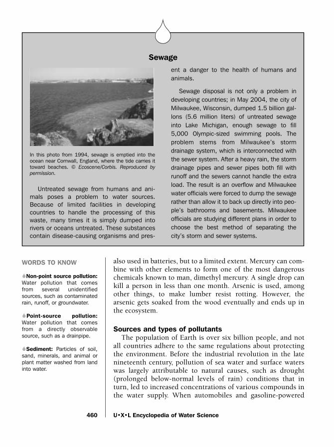
also used in batteries, but to a limited extent. Mercury can com-bine with other elements to form one of the most dangerouschemicals known to man, dimethyl mercury. A single drop cankill a person in less than one month. Arsenic is used, amongother things, to make lumber resist rotting. However, thearsenic gets soaked from the wood eventually and ends up inthe ecosystem.
Sources and types of pollutantsThe population of Earth is over six billion people, and not
all countries adhere to the same regulations about protectingthe environment. Before the industrial revolution in the latenineteenth century, pollution of sea water and surface waterswas largely attributable to natural causes, such as drought(prolonged below-normal levels of rain) conditions that inturn, led to increased concentrations of various compounds inthe water supply. When automobiles and gasoline-powered
U•X•L Encyclopedia of Water Science460
WORDS TO KNOW
SNon-point source pollution:Water pollution that comesfrom several unidentifiedsources, such as contaminatedrain, runoff, or groundwater.
SPoint-source pollution:Water pollution that comesfrom a directly observablesource, such as a drainpipe.
SSediment: Particles of soil,sand, minerals, and animal orplant matter washed from landinto water.
Sewage
SSS
In this photo from 1994, sewage is emptied into theocean near Cornwall, England, where the tide carries ittoward beaches. © Ecoscene/Corbis. Reproduced by
permission.
Untreated sewage from humans and ani-mals poses a problem to water sources.Because of limited facilities in developingcountries to handle the processing of thiswaste, many times it is simply dumped intorivers or oceans untreated. These substancescontain disease-causing organisms and pres-
ent a danger to the health of humans andanimals.
Sewage disposal is not only a problem indeveloping countries; in May 2004, the city ofMilwaukee, Wisconsin, dumped 1.5 billion gal-lons (5.6 million liters) of untreated sewageinto Lake Michigan, enough sewage to fill5,000 Olympic-sized swimming pools. Theproblem stems from Milwaukee’s stormdrainage system, which is interconnected withthe sewer system. After a heavy rain, the stormdrainage pipes and sewer pipes both fill withrunoff and the sewers cannot handle the extraload. The result is an overflow and Milwaukeewater officials were forced to dump the sewagerather than allow it to back up directly into peo-ple’s bathrooms and basements. Milwaukeeofficials are studying different plans in order tochoose the best method of separating thecity’s storm and sewer systems.
water_ch12 10/20/04 10:52 AM Page 460

Water Pollution
machinery became available, pollution surged, due toincreased output of consumer goods and machinery.Conservation laws in many developed countries have helpedto correct pollution in many air and water sources since thetime of the industrial revolution. Some developing countriesstill use highly-polluting products such as fuel with lead com-ponents, and environmental scientists are now concentratingtheir efforts in studying the long-term effects of water and airpollution on a worldwide scope.
Not all pollution is attributed to oil spills, industry, andtransportation. Humans contribute to pollution in the course ofeveryday activities. Washing automobiles, lawn fertilizers,cleaning products eventually end up in the water supply. Thesoap and shampoo from bathing, disinfectants for cleaning thekitchen and bathroom, nail polish, and the waxes and oils forcleaning floors are just a few examples of home products thatcontribute to the pollution of the water supply. Lawnmowersare very inefficient when it comes to cleaning exhaust, so thegasses end up in the atmosphere and fall to Earth in rain.Medical products, such as antibiotics contain substances thatare helpful to some organisms but not to others, and the intro-duction of these substances can result in the killing of aquaticlife or altering the reproductive cycles of various species.
Based on many years of scientific studies, there are regula-tions from the U.S. government as to acceptable levels of par-ticular pollutants. For instance, the human body needschromium, but very little of it, and a person gets it automati-cally from eating a balanced diet. Iron is critical for making sure
461
Plastic material dumped in the water chokes the neck of a Royal shroud bird.Anthony F. Amos. Reproduced
by permission.
water_ch12 10/20/04 10:52 AM Page 461

oxygen gets transported with blood cells but too much iron isdangerous. The Environmental Protection Agency (EPA) is aU.S. government division that monitors the levels of contami-nants (pollutants) in the ecosystem. Based on studies with ani-mals, plants, and humans, the EPA has determined what levelsof many pollutants can be ingested with no proven risk ofhealth trouble. Adhering to these standards is expensivebecause industries that produce pollutants must buy expensiveequipment to filter the harmful chemicals (as well as gasses)from the waters they discharge. The price is passed along to theconsumer by raising product prices. This was the case in theearly 1980s with gasoline, when adding a lead-based compoundto gasoline prolonged engine life. The risks of the added leadoutweighed the benefits, and the government decided to banlead-products in gasoline and replace them with a chemical thatessentially does the same job, but is non-toxic.
Laurie Duncan, Ph.D.
For More Information
BooksMaclean, Norman. A River Runs Through it. Washington, DC:
Island Press, 2003.
U•X•L Encyclopedia of Water Science462
Ocean Dumping
SSS
Cholera infested garbage and chemical waste covers abeach in Lima, Peru. © Gustavo Gilabert/Corbis SABA.
Reproduced by permission.
A major concern of the damage of the qual-ity of ocean waters is the dumping of garbage.It is a common practice to load barges withmillions of pounds of refuse every day and sailoffshore for several miles, then dump the con-tents into the sea. Many items in thesegarbage barges are toxic, such as metals fromold batteries and medical waste. Other items,such as decaying foodstuffs, are dangeroussources of bacteria that are harmful for all life.Although dumping garbage far out to sea issupposed to result in natural degradation(breaking apart), various currents, storms, andother physical events often lead to garbagewashing back to shore, where it again entersthe pollution cycle.
water_ch12 10/20/04 10:52 AM Page 462

Watersheds
Postel, Sandra, and Brian Richter. Rivers for Life: ManagingWater for People and Nature. Washington, DC: Island Press,2003.
Vigil, Kenneth M. Clean Water: An Introduction to WaterQuality and Pollution Control. 2nd ed. Corvallis: OregonState University Press, 2003.
Websites“Facts About Water Pollution.” Project Clean Water, County of
Santa Barbara. http://www.countyofsb.org/project_cleanwater/facts.htm (accessed on September 8, 2004).
United States Geological Survey. “Acid Rain: Do You Need toStart Wearing a Rainhat?” Water Science for Schools.http://ga.water.usgs.gov/edu/acidrain.html (accessed onSeptember 8, 2004).
WatershedsA watershed is a connected series of streams, rivers, and
lakes that collects water from a specific area of land.Watersheds are important habitats for animals and plants, andoffer a source of drinking and recreational water for many com-munities. The quality of the water in a watershed, also some-times referred to as the health of the watershed, is important topreserve or remediate (to repair after damage). Water qualitygenerally refers to the appearance, smell, and, above all, abilityto serve as drinking water (a quality known as potability).
At the beginning of the twentieth century, most watershedswere unaffected by man-made pollution; pollution occurredonly from natural sources such as animal waste. Beforeincreased levels of man-made contamination, most watershedswere able to dilute pollutants or filter them out through sur-rounding wetlands (grassy areas that hold water throughoutmost of the year). Today, pristine and uncontaminated water-sheds are rarely observed. Pressures from modern urban devel-opment, mainly runoff of pollution and decreased air quality,make monitoring water quality a necessity.
Water qualityA number of factors determine water quality. Scientists
measure levels of chemicals and observe living creatures whosepresence (or in some cases, absence) in water indicates that the
463
S
water_ch12 10/20/04 10:52 AM Page 463

water is contaminated. A well-known example of a contamina-tion is from the bacterium Escherichia coli.
Escherichia coli (commonly referred to as E. coli) lives in thedigestive tract of humans and other warm-blooded animals.The bacteria do not usually survive or thrive (exist in highnumbers) in other environments, such as fresh water. Highnumbers of the bacteria in water is usually evidence of con-tamination by human or animal intestinal waste. Because thedetection of E. coli requires simple and relatively inexpensivetests, such testing is a fundamental part of programs that mon-itor fresh water quality.
In addition to the detection of E. coli, there are other waysto determine water quality exist. For example, determining thenumber of species in a certain area of a stream can provideinformation on upstream water quality, especially if the speciesdo not live and reproduce in contaminated water.
Tests to measure water quality are performed at different sitesalong the watershed at different times. Repeated test sites andtest times are necessary to develop a watershed history. Also,results can vary according to location. For example, a low levelof E. coli at one point in a stream does not necessarily guaran-tee that another area is uncontaminated.
Inorganic, or non-living, indicators of water quality (forexample, amounts of certain chemicals) tend to be easier tomeasure throughout the course of the watershed. Scientistsoften used a combination of tests to determine water quality.
One important inorganic measurement determines the levelof nitrates in the water. Nitrate (NO3) is a chemical form of theelement nitrogen. Another chemical form of nitrogen, nitrites(NO2), form important compounds that permit the growth ofalgae and some plants. Nitrate is hard to measure directly, butcan be determined from nitrite levels. Too much nitrate leads tothe explosive growth of algae, which overuses the availableoxygen in the water, crippling the survival of other waterspecies.
The dissolved oxygen level is another chemical indicator ofwater quality. The level of oxygen in the water can be loweredby chemical conditions or the presence of biological materialsuch as sewage. If maintained, the low amount of oxygenmakes the watershed incapable of supporting life.
Other measurement tools measure the presence of otherimportant chemicals in the watershed such as salt (the salinity
U•X•L Encyclopedia of Water Science464
WORDS TO KNOW
SDeforestation: Large-scaleremoval of trees form a wood-land.
SErosion: Wearing away bywater and wind.
SPotability: Water quality thatmakes it suitable for drinking.
SRiparian zone: Narrow stripof vegetation that is foundbounding the edge of a naturalwater body such as a stream orriver.
SWetlands: Grassy areas thathold water most of the year.
water_ch12 10/20/04 10:52 AM Page 464

Watersheds
of the water) and phosphorus (a component of agricultural fer-tilizers that can enter watersheds via runoff from lawns, golfcourses, and agricultural land). Phosphorus is another nutrientthat can stimulate the explosive growth of algae.
Some tests are performed because of the location of thewatershed. For example, if the watershed is near a mine, thenmonitoring to detect the acid that can flow from mining activi-ties may be warranted. Alternatively, if the watershed is near anuclear power plant or uranium facility, testing for the presenceof radioactive compounds is often warranted. Watersheds thatincorporate urban areas are often monitored for the presence ofpetroleum. Watersheds in rural areas are monitored for thepresence of farm fertilizer and pesticides.
Historically, local, regional, and federal governments con-ducted most watershed quality monitoring. Increasingly, how-ever, citizens groups and committees are seeking funding toconduct tests. Governments generally support such civicefforts, and training is available in many areas for those desir-ing to learn proper sampling techniques. The quality of fresh-water in watershed areas is often improved with civic awarenessand involvement.
Restoring watershedsRestoration of a watershed returns the ecosystem to as
close as possible to its state prior to a specific incident or peri-od of deterioration. If a watershed has deteriorated abruptlydue to a sewage spill, restoration may consist of only a fewprocedures. When deterioration of a watershed occurs gradu-ally, however, restoration can require lengthy, complicated,and costly operations.
The restorative process includes the remediation of the waterquality, repairing the source of the water damage, and repopu-lating the watershed with animal, fish, or bird species. In somecases, it is sufficient to make the restored habitat attractive tonative species and to allow natural repopulation.
Watershed restoration is important, not only for the benefitof the species living in the area, but also for those who will usethe water that emerges from the watershed. A contaminatedwatershed affects all the watersheds downstream from the con-tamination site. Communities that are miles away from a con-taminated watershed can be adversely affected.
Restoration can be divided into two broad categories,reestablishment and rehabilitation. Reestablishment is the
465
water_ch12 10/20/04 10:52 AM Page 465

alteration of the various characteristics of a watershed inorder to restore the site’s former function. Reestablishmentcan involve construction to rebuild physical parts of thewatershed. Often, reestablishment results in the enlargementof the total area of the watershed, as acreage that has falleninto disuse is reutilized to restore the former dimensions ofthe watershed.
Rehabilitation seeks to repair the watershed, not necessarilyto restore its original function. Correcting the damage from asewage spill, for example, is considered watershed rehabilita-tion. The rehabilitated portion of the watershed does not nec-essarily function at its previous best (optimum) level.Nonetheless, the short-term damage is repaired.
The restoration of watershed ecosystems is increasing, as therealization grows of the importance of the watersheds to thehealth of animals and plants that are part of the ecosystem andto the communities that depend on the watershed for their
U•X•L Encyclopedia of Water Science466
Former loggers on the OlympicPeninsula in Washington work to
repair damaged watersheds forsalmon runs. © Macduff
Everton/Corbis. Reproduced
by permission.
water_ch12 10/20/04 10:52 AM Page 466
Watersheds
drinking water. For example, the U.S. government has commit-ted to improve or restore 100,000 acres of wetlands each yearand 25,000 miles of stream shoreline.
Risks in restorationScientists are increasingly aware of the dangers of not using
native plant and animal species during restoration efforts. Inmany places around the world, the introduction of a non-indigenous (nonnative) species has caused trouble. The foreignspecies, which may not have any competition or natural ene-mies, can grow explosively and out-compete the native species.The fast-growing kudzu plant, for example, was planted in thesoutheastern United States during the 1930s as a means to pre-vent soil erosion (wearing away). Native to China and Japan,and without its natural controls, the kudzu proved hardier thanexpected and by 2002, kudzu occupied an estimated two mil-lion acres of forest and watershed land in the United States.Kudzu can grow up to one foot per day, and densely coverstrees and other vegetation, eventually causing their death fromlack of sunlight. Kudzu eradication efforts remain an ongoingconcern in southern states.
Impact of fire and logging on watershedsThe presence of forests in a watershed enhances the capabil-
ity of a watershed to acquire and retain water. Conversely, theloss of trees, whether naturally due to fire, or deliberately suchas the removal of trees for lumber or to permit construction ofa road, can have adverse impacts on a watershed.
The presence of trees and other vegetation contributes to thewater-bearing capacity of the watershed. The roots of the treesand other plants stabilize the soil. Roots also help retain mois-ture. Additionally, watershed vegetation shades and cools theground, minimizing the loss of moisture. Moisture in the formof rainfall is gathered on the leaves of trees and trickles slowlyto the soil. The slow addition of moisture to the soil allows thesoil to retain more water because the soil does not become sat-urated (holding the maximum amount of water), as would hap-pen if it were deluged with water.
The riparian zoneAn example of the importance of forests to a watershed is the
riparian zone. The riparian zone is a narrow strip of vegetationthat is found bounding the edge of a natural water body such asa stream or river. The riparian zone enhances watershed stabil-
467
water_ch12 10/20/04 10:52 AM Page 467

ity and quality because plant roots minimize erosion of theshoreline. A water body that is clear of mud is better able tosupport fish and other life. The riparian vegetation is also thesource of wood and larger debris that helps create pools in thewater body. Such pools enhance the ability of the water to sup-port life.
The loss of the riparian vegetation can be detrimental to awater body. Erosion of the shoreline is increased because thereis no supporting network of roots to stabilize the bank. Largesections of the shoreline may give way in a landslide. Runoff ofmaterial into the water is also increased. The cloudier waterwill contain less oxygen; therefore, sunlight cannot penetrate asfar into the water. The result is a habitat that is less suitable forlife. Torrential rains can also lead to flooding because the flood-waters are not held back by vegetation.
DeforestationAn event such as a forest fire represents a natural means of
deforestation (the large-scale removal of trees from a wood-land). Typically, a forest fire does not removal all the vegetation.Rather, the effect is to thin out the forest, which can lead to pro-motion of future growth by the opening up of space and thenutrient supply created by the decomposition of the treeremains. A natural removal of forests by fire can actually havebeneficial results for a watershed.
In contrast, the unnatural deforestation and loss of vegeta-tion associated with clear cut lumbering (removing all treesfrom an area for their wood) is never beneficial for a watershed.The mass loss of vegetation often lowers. Loss of surroundingforest can also alter the movement of water through the water-shed. A healthy watershed will have a fairly constant rate ofwater movement. Without the water retention provided byforests, rainfall can result in flooding.
A fluctuating water supply can also be a serious concernwhen a watershed supplies drinking water for communities. Asa result, many communities are passing legislation to protecttheir watersheds. Development, logging and road constructionare restricted or kept to a minimum in the watershed zone. Ifhouses are built, often barriers to minimize erosion and runoff(excess water that does not soak into the soil) must be main-tained. Some communities require riparian zones to remainundisturbed before and after construction.
Brian D. Hoyle, Ph.D.
U•X•L Encyclopedia of Water Science468
water_ch12 10/20/04 10:52 AM Page 468

Watersheds
For More Information
BooksUnited States Department of the Interior. Wetlands and
Groundwater in the US. Washington, DC: Library ofCongress, 1994.
Websites“Monitoring and Assessing Water Quality.” United States
Environmental Protection Agency. http://www.epa.gov/owow/monitoring (accessed on September 8, 2004).
“What is Restoration?” United States Environmental ProtectionAgency. http://www.epa.gov/owow/wetlands/restore/defs.html (accessed on September 8, 2004).
Wheeling Jesuit University/NASA Classroom of the Future.“Water Quality: Methods for Monitoring.” Exploring theEnvironment. http://www.cotf.edu/ete/modules/waterq/methods.html (accessed on September 8, 2004).
469
water_ch12 10/20/04 10:52 AM Page 469
Chapter 13Legal and Political Issues
Endangered Species LawsA species (group of like organisms that can reproduce) is
listed as endangered if it is in immediate danger of extinctionthroughout all or a significant part of its habitat. Fossils showthat many plants and animals have become extinct over mil-lions of years. As of 2004, there are about 400 animals and 600plants that are native to the United States listed as endangered.Over 125 animals and nearly 150 plants are currently listed asthreatened. A species is listed as threatened if that species islikely to become endangered in the foreseeable future.
Many species of plants and animals become endangered andextinct naturally, usually due to changes in climate or loss offood sources. However, over the last several centuries, humanshave posed a new threat to plants and animals. Human activi-ties have resulted in the extinction of thousands of species.Human activities, such as hunting and pollution, continued toendanger many species. Worldwide, over 1,500 species ofplants and animals are listed as endangered. Nearly 200 of theseendangered species are fish or other aquatic animals.
Causes of species’ extinctionThe rapid growth of the human population over the last sev-
eral centuries led humans to develop more land. The develop-ment of land for farming often leads to clearing native forestsand jungles. Clearing these lands leads to the destruction of thehabitats of many species. The destruction of a species’ habitatmay lead to their endangerment and extinction due to the lossof food and shelter.
471
S
SS
water_ch13 10/20/04 10:53 AM Page 471

Human activities that have caused pollution have also led toloss of habitat and the endangerment and extinction of species.Human advancements in technology have increased greatlyfrom the mid-eighteenth century. During the IndustrialRevolution (1750–1900) humans shifted from economies basedon agriculture and small businesses to industry and large cor-porations. Coal and petroleum, which cause pollution, poweredthe machines of the Industrial Revolution and today. Pollutioncan cause the extinction and endangerment of species by harm-ing that species’ shelter, food source, and water supply.
Whether for food or sport, humans have also hunted severalspecies into endangerment and extinction. The dodo, a flight-less bird, was hunted into extinction by humans and nonnativeanimals that invaded its habitat. Between 1850 and 1910, set-tlers in the western United States hunted the American bisonuntil it was endangered. In the twentieth century, poachersthreaten the survival of the African elephant and rhinoceros.Poachers are hunters who illegally kill wild animals in order toprofit from the sale of the furs, hides, tusks, or other parts ofthe animals.
Humans have had an even more severe impact on marinewildlife. Pollution, in particular, has taken a great toll on aquat-ic animals, because these species are often more sensitive tochanges in habitat than plants and animals on land.Commercial fishing and whaling also threatened the existenceof fish and whale species. The survival of the Atlantic salmonfor example, is threatened in the wild today. Fishing and whal-ing were some of the first areas to face strict government con-trols and laws to protect species from further endangerment.
Endangered Species Protection Act of 1966By the mid-twentieth century, the negative influence of
humans on plants and animals became apparent. With thou-sands of species facing extinction, many nations passed laws tosave these species. The United States Congress passed theEndangered Species Preservation Act in 1966 and theEndangered Species Conservation Act in 1969. These two lawswere a major step towards recognizing the need for humans toact in order to prevent the extinction of plants and animals.
Despite the positive step forward of the Endangered SpeciesPreservation Act and the Endangered Species Conservation Act,the two acts did little to prevent the extinction of species. TheEndangered Species Preservation Act of 1966 only allowed for
U•X•L Encyclopedia of Water Science472
WORDS TO KNOW
SConvention on InternationalTrade in Endangered Speciesof Wild Fauna and Flora(CITES): A 1973 treaty thatrestricts international com-merce between participatingnations for plant and animalspecies that are believed to beharmed by trade.
SEndangered: A species thatis in danger of becoming extinctwithin the foreseeable futurethroughout all or a significantportion of its natural habitat.
SEndangered Species Act:Law passed in 1973 that iden-tifies species that face possibleextinction and implements mea-sures to prevent extinction;species may be listed as eitherendangered or threatened underthe act.
SExtinction: The total disap-pearance of a species.
SHabitat: The environment inwhich a species naturally or nor-mally lives and grows, consist-ing of climate, food, and shelter.
SIndustrial Revolution: Periodof rapid industrial growth, usu-ally dated from 1750 to 1900,that resulted in a shift fromeconomies based on agricul-ture and small businesses toeconomies based on industryand large corporations.
SMarine Mammal ProtectionAct: Law that seeks to increasethe population of marine mam-mal species by prohibiting thehunting, capture, or killing ofmarine mammals.
water_ch13 10/20/04 10:53 AM Page 472

Endangered Species Laws
animals native to the United States to be listed as endangered.Once a species was identified as endangered, the EndangeredSpecies Preservation Act offered little protection for thatspecies. The Endangered Species Conservation Act of 1969allowed for species around the world to be listed as endangered.The law also prohibited the import of endangered species intothe United States.
Heightened need for protection of endangered speciesRealizing the need for increased protection of endangered
species, Congress passed the Endangered Species Act of 1973.After signing the Endangered Species Act into law, PresidentRichard Nixon (1913–1994) stated, “Nothing is more pricelessand worthy of preservation than the rich array of animal lifewith which our country has been blessed.”
473
WORDS TO KNOW
SSpecies: Group of livingorganisms that share a uniqueset of characteristics and havethe ability to reproduce.
SThreatened: A species thatis likely to become endangeredin the foreseeable future.
Marine Mammal Protection Act of 1972
SSS
A manatee, one of many endangered species of marinemammals, swimming in waters off of Florida. © Brandon
D. Cole/Corbis. Reproduced by permission.
By the mid-twentieth century, human activi-ty threatened the existence of numerousmarine mammals. Familiar marine mammalsinclude otters, walruses, dolphins, manatees,and seals. In 1972, Congress passed theMarine Mammal Protection Act, a law designedto protect marine mammal populations.
The Marine Mammal Protection Act estab-lished a halt on the hunting, capturing, andkilling of marine mammals by anyone in UnitedStates waters. The Act also prevents UnitedStates’ citizens from hunting, capturing, andkilling marine mammals anywhere in theworld, not just in United States waters. TheMarine Mammal Protection Act also prohibitsthe import of marine mammals or marinemammal products into the United States.Marine mammal products include walrus tusksand seal furs.
Two government agencies, the Departmentof the Interior and the Department ofCommerce’s National Marine FisheriesService, share the responsibility of enforcingthe Marine Mammal Protection Act. Theseagencies also measure the number of marinemammals in U.S. waters. If the population of aparticular species of marine mammal is toolow, then steps are taken to increase thatspecies’ population.
water_ch13 10/20/04 10:53 AM Page 473

Under the Endangered Species Act, species may be listed asendangered or threatened. Once a species is listed as endan-gered or threatened, the Endangered Species Act provides forstrict protective action to be taken in order to preserve thatspecies. Recovery plans prevent hunters and fishers from killingan endangered species or threatened species. Landowners arealso required to avoid taking any action that would threaten thesurvival of an endangered or threatened species. Landownersmay not clear land or remove water from an area that is a nat-ural habitat for the endangered or threatened species.
One of the primary goals of the Endangered Species Act is toprovide protection that allows the population of a species torecover. Once the population of the species has rebounded, it isremoved from the list of endangered or threatened species. Anendangered species may also be downgraded to threatened asits numbers increase.
The Endangered Species Act has been successful in prevent-ing the extinction of species in the United States. However it hashad limited success in population recovery and removal fromthe list of endangered or threatened species. Over 1,300 species
U•X•L Encyclopedia of Water Science474
Endangered Species Act of 1973
SSSThe Endangered Species Act is adminis-
tered by both the United States Department ofthe Interior and the United States Departmentof Commerce. The Department of the Interior’sUnited States Fish and Wildlife Serviceenforces the Endangered Species Act to pre-serve all land and freshwater species, includingthe California condor, gray wolf, and southernriver otter. The Department of Commerce’sNational Marine Fisheries Service enforces theEndangered Species Act for all marine species,including Atlantic salmon, blue whale, hump-back whale, and the leatherback sea turtle.
The government also works with privatelandowners to conserve the habitat of endan-gered and threatened species. The Fish andWildlife Service and National Marine FisheriesService use the best scientific and commercial
data available when determining whether to lista species as endangered or threatened. This isoften a difficult process. Years of study areoften required to identify a group of animals asa distinct species.
Once the Fish and Wildlife Service or theNational Marine Fisheries Service lists aspecies as endangered or threatened, theywork to create a plan to preserve the species.Recovery of the species’ population is the ulti-mate goal. These preservation plans are themost controversial part of the EndangeredSpecies Act. The most important part of theseplans is the preservation of the species’ natu-ral habitat. Habitat conservation plans ofteninvolve preventing the construction of buildingsor roadways that would destroy the habitat ofthe species.
water_ch13 10/20/04 10:53 AM Page 474

Endangered Species Laws
have been listed on the Endangered Species Act’s list of endan-gered or threatened species. Only 30 species as of 2004 have hadpopulation recoveries that allowed their removal from the list.
The Endangered Species Act also signals the United States’ par-ticipation in the Convention on International Trade inEndangered Species of Wild Fauna and Flora, or CITES. Alsopassed in 1973, CITES restricts international trade of plant andanimal species that are endangered or threatened by such trading.Perhaps the best-known example is a ban on the trade of elephantivory. The Endangered Species Act lists nearly 600 endangered orthreatened plants and animals that are not native to the UnitedStates. Under the Endangered Species Act and CITES, it is illegalfor anyone in the United States to buy, sell, or trade these plantsand animals or any product that contains them.
Joseph P. Hyder
475
CITES
SSS
Endangered species laws seek to protect animals suchas the California Sea Otter. © Ron Sanford/Corbis.
Reproduced by permission.
In 1963 The World Conservation Unioncalled for an international meeting to discussthe trade of endangered species, and TheEndangered Species Conservation Act of 1969repeated this call. In 1973 eighty nations metin Washington, D.C. and wrote the Conventionon International Trade in Endangered Speciesof Wild Fauna and Flora (CITES). CITES wentinto effect in 1975.
Every year, billions of dollars worth of plantsand animals are traded. Most of this tradeinvolves the shipment of food, leather goods,and wood. Much of this trade is “harmless,” ornot related to endangered species. CITESensures that the trade of these goods is con-ducted in a way that will not reduce the num-ber of the plant or animal too quickly.
CITES has been relatively successful. Over30,000 species of plants and animals are pro-tected under CITES. Since CITES went intoeffect in 1975, no species listed under CITEShas become extinct. CITES has not been ableto stop the illegal trade of plants and animals.In 2004, nearly one-fourth of all plant and ani-mal trade was illegal. Stopping the illegal tradeof plants and animals requires the cooperationthat participate with CITES. In 2004, 166nations were members of CITES. Customsagents for each CITES member are responsiblefor preventing illegal plants and animals fromentering or leaving that country.
water_ch13 10/20/04 10:53 AM Page 475

For More Information
WebsitesConvention on International Trade in Endangered Species of Wild
Fauna and Flora. http://www.cites.org (accessed onSeptember 8, 2004).
“Endangered Species Related Laws, Regulations, Policies &Notices.” U.S. Fish and Wildlife Service. http://endangered.fws.gov/policies (accessed on September 8, 2004).
“Legislation.” NOAA Fisheries. http://www.nmfs.noaa.gov/legislation.htm (accessed on September 8, 2004).
Exclusive Economic ZonesFor centuries, coastal nations have sought control over the
oceans near their shores. These countries have also sought theright to control the ocean’s valuable resources as coastal nationshave long valued coastal waters with large amounts of fish.Fishing is important for food and trade. Coastal nations quick-ly realized that they must control and defend their coastalwaters in order to protect their ocean resources. In modern day,countries have established exclusive economic zones, or EEZs.An EEZ gives a coastal nation the sole right to explore andextract all natural resources from the ocean for 200 miles (322kilometers) off its shores. That nation also has the duty to con-serve and responsibly use the ocean resources within its EEZ.
Establishing territorial watersBy the seventeenth century, laws governing the ocean began
to develop. The ocean was divided into two categories: territo-rial waters and the open ocean. Territorial waters are the part ofthe ocean just off a nation’s coast over which that nation mayexercise any right. The nation in control of the territorial watersmay defend those waters from other nations. Only the nation incontrol of its territorial waters could remove resources fromthose waters. The open ocean, or high seas, is the expansive,deep part of the ocean. Every nation had the right to travel overthe open ocean and remove any resources.
From the seventeenth century until the mid-twentieth cen-tury, territorial waters extended for 3 miles (4.8 kilometers) offof a nation’s coastline. There were two main reasons for this 3-mile (4.8-kilometer) limit. First, a nation could not claim anarea larger than it could protect. Some scholars theorize that
U•X•L Encyclopedia of Water Science476
S
water_ch13 10/20/04 10:53 AM Page 476

Exclusive Economic Zones
this 3-mile (4.8-kilometer) limit developed because a seven-teenth century cannon mounted on land could only fire a can-nonball that far. Therefore even nations without a strong navycould easily defend the ocean for 3 miles (4.8 kilometers).Second, the 3-mile (4.8-kilometer) limit supplied most coastalnations with all of the ocean resources that they needed. Untilthe twentieth century, the main resources that nations tookfrom the oceans were fish and whales. Usually an abundantsupply of fish could be found within 3 miles (4.8 kilometers) ofthe coast. If a sufficient supply of fish or whales were not with-in that limit, that nation’s fishermen or whales could easily trav-el out into the open ocean.
By the mid-twentieth century, new technology allowed fish-ing vessels to travel thousands of miles and remain at sea formonths. This led to overfishing (catching fish at a greater ratethan they can breed) and overwhaling in many areas. With fishstocks dwindling, coastal nations sought protection beyond thetraditional 3 miles (4.8 kilometers) limit.
Oil and natural gas exploration on the seabed also led manynations to look beyond their territorial waters. New technologyallowed nations to extract oil and gas from the seabed. Most ofthis oil and gas lay under the continental shelf and beyond the3-mile (4.8 kilometer) limit. In 1945, the United States becamethe first country to abandon the 3-mile (4.8 kilometer) limit.President Harry S. Truman (1884–1972) declared that theUnited States had the right to all of the ocean resources thatexisted on the continental shelf. A continental shelf is a gentlysloping, underwater plain that quickly drops off to the deepopen ocean sea floor.
Many nations followed the United States’ lead and aban-doned the traditional 3-mile (4.8 kilometer) limit. Like theUnited States, some nations claimed all resources on their con-tinental shelves. Some nations extended their territorial watersto 12 miles (19.3 kilometers), and others claimed a 200-mile(322-kilometer) zone.
United Nations and the Law of the SeaBy the 1960s it was apparent that nations would not give up
their claims to additional ocean resources. Demand now out-paced supply for fish, minerals, oil, and gas. The UnitedNations stepped in to help establish a consistent system ofocean resource management. The United Nations is an interna-tional organization of nations established in 1945 designed topromote peace and security.
477
WORDS TO KNOW
SContinental shelf: The edgeof a continent that gentlyslopes in relatively shallowwater before dropping offsteeply to the great depths ofthe open ocean.
STerritorial waters: Oceanwaters governed by a nation;territorial waters in most coun-tries extend for 12 miles from anation’s coastline.
SUnited Nations: Establishedin 1945, the United Nations isan organization of most of thecountries of the world designedto promote peace and security.
water_ch13 10/20/04 10:53 AM Page 477

In 1973 the United Nations held the Third United NationsConference on the Law of the Sea. The conference aimed to set-tle issues of navigation rights and dividing the ocean’sresources. In 1982 the conference resulted in the UnitedNations Convention on the Law of the Sea, which set laws forhow nations could use the oceans. Perhaps the most ground-breaking part of the United Nations Convention of the Law ofthe Sea was its establishment of EEZs.
Some ocean resources lie in the open ocean. Open oceanresources are resources that do not lie within any nation’s EEZ.Resources in the open ocean are considered to belong to everynation. Therefore any nation may extract resources from theopen ocean.Occasionally, two nations will have EEZs that over-lap. When this occurs, those nations may enter into agreementson sharing the resources within that EEZ, or the United Nationsmay redraw the lines for those nations’ EEZs.
The Law of the Seas also allows for transit passage of navalships through the territorial waters of another country. Transitpassage means that a naval vessel may pass through the territori-al water of another country if the ship does so innocently andquickly. Without the right of transit passage, naval and even mer-chant ships could be forced to travel thousands of miles (kilo-meters) as a detour to avoid another country’s territorial waters.
Many nations that claim all of the resources found on theircontinental shelves opposed the 200-mile (322-kilometer) EEZlimit. The continental shelf extended beyond 200 miles (322kilometers) from the shore in some places. A compromise wasmade at the Third United Nations Conference on the Law of theSea that allowed a nation to extend its EEZ up to 350 miles(563 kilometers) to the edge of its continental shelf.
Exclusive economic zones benefit coastal nations. Most ofthe ocean’s resources lie on continental shelves and an estimat-ed 87% of undersea oil and gas reserves fall under the EEZ ofsome nation. Almost all of the world’s fishing grounds also fallwithin an EEZ, but some nations, including the United States,have not ratified (approved and adopted) the Law of the Sea.Opponents argue that the Law of the Sea could provide theUnited Nations with authority over waters that a nation con-siders in its domain. Nevertheless, the United States in 1983enacted its own exclusive economic zone proclamation similarto those under the Law of the Sea, establishing a 200-mile (322kilometer) economic zone in most coastal waters.
Joseph P. Hyder
U•X•L Encyclopedia of Water Science478
water_ch13 10/20/04 10:53 AM Page 478

Fishing, Commercial Regulation (Fresh and Salt Water)
For More Information
BooksBirnie, Patricia W. and Alan E. Boyle. International Law and the
Environment. New York: Oxford University Press, 2002.
Websites“Exclusive Economic Zones.” United Nations Atlas of the
Oceans. http://www.oceansatlas.org/servlet/CDSServlet?status=ND0xMjI3MSY3PWVuJjYxPSomNjU9a29z (accessedon September 1, 2004).
United Nations. “United Nations Convention on the Law ofthe Sea.” United Nations Division for Ocean Affairs and theLaw of the Sea. http://www.un.org/Depts/los/convention_agreements/convention_overview_convention.htm(accessed on September 1, 2004).
Fishing, Commercial Regulation (Fresh and Salt Water)Fishing regulations are government restrictions on where
and how fish may be caught. Typically fishing regulationsaddress the time of year, place, and how many fish of a certaintype of fish may be caught. Commercial fishers have to followmany fishing regulations. A commercial fisher is a companythat seeks to make a profit from the sale of fish.
Commercial fishing regulations are necessaryWorldwide, one out of every five people relies on fish as their
primary source of protein. A decrease in fish populations couldlead to malnutrition in human populations. Fishing is also eco-nomically important, as over 200 million people work in thefishing industry. Fishing regulation seek to minimize thedecrease in fish populations and harm done to the ocean envi-ronment.
Overfishing. Until the mid-1800s humans did not have theability or the need to catch extremely large numbers of fish.Advancements in fishing capabilities and technology changedthis situation. In the mid-nineteenth century, steam poweredships began to replace sailboats. Steam ships could travel fasterand remain at sea for long periods, catching more fish than sail-boats. In the twentieth century, diesel powered ships replacedsteam ships. Diesel ships could travel faster and farther thansteam ships. Steel and iron replaced wood as the primary build-
479
S
water_ch13 10/20/04 10:53 AM Page 479

ing material for ships after about 1850. The use of steel and ironallowed ship builders to make larger ships capable of storingmore catch. By 1950 fishing ships had become large, fast shipsthat could remain at sea for months at a time. These fishing shipsused refrigeration to keep their enormous catches fresh for thevoyage home. The invention of refrigeration and freezing unitsalso allowed fish to be sent to areas far inland. Before refrigera-tion, only people who lived close to the coast could eat fish.
The ability to catch larger numbers of fish and the increasedmarket proved to be an unfortunate combination for manyspecies of fish. In the 1990s the populations of cod, haddock,and flounder in the North Atlantic Ocean fell by over 90%. Codfishing off the Canadian waters was restricted by law in orderto encourage the species to rebound in numbers but as of 2004,the cod population had not recovered.
Overfishing is one of the largest threats to the ocean ecosys-tem in the twenty-first century. An ecosystem is a communityof plants, animals, and other organisms that interact with eachother and with their physical environment. Overfishing occurswhen fish are caught faster than they can reproduce.Overfishing results in a loss in number of fish and threatensmany species of fish with extinction (disappearance). A speciesis a group of organisms that have a unique set of characteristics,such as body shape and behavior, and that can reproduce.Around the world, scientists estimate that more than half of allfish species that humans use for food are overfished.
Overfishing also contributes to the destruction of habitat.Many fishing methods destroy coral reefs. A coral reef is a trop-ical marine feature created by numerous colonies of tiny coralanimals. Many different species of fish live in coral reefs. Oncea coral reef is destroyed many marine animals die.
Pollution. Pollution also threaten many species of fish withextinction. Pollution destroys or alters the habitats of manyspecies of fish. This kills fish, because they lose their sources offood, shelter, and protection.
Despite regulations to control ocean pollution adopted bymost developing countries, pollution still threatens the survivalof many species of fish. Pollution usually does not directly killmost species of fish. Pollution destroys food sources that thefish rely on for survival. When the primary food source for aspecies decreases, the population of that fish species will alsodecrease. The decrease in food supply also forces the survivingmembers of that species to look for food in new areas. This may
U•X•L Encyclopedia of Water Science480
WORDS TO KNOW
SBiodiversity: The variety ofliving organisms and theecosystems in which theyoccur.
SCoral reef: Tropical marinefeature created by numerouscolonies of tiny coral animals;coral reefs contain a greatdiversity of marine animals
SEcosystem: Community ofplants, animals, and otherorganisms that interact witheach other and with their phys-ical environment
SFishing regulation: Restric-tions placed on where, when,and how fish may be caught.
SFood chain: Relationship oforganisms in an ecosystem inwhich each member speciesfeeds on other species.
SOverfishing: Catching aspecies of fish faster than it cannaturally reproduce resulting ina decline in the overall popula-tion of that species.
SSpecies: Group of organ-isms that have a unique set ofcharacteristics, such as bodyshape and behavior, and arecapable of reproducing witheach other and producing off-spring.
SUnited Nations: An associa-tion of countries founded in1945 that is devoted to thepromotion of peace, security,and cooperation betweennations.
water_ch13 10/20/04 10:53 AM Page 480

Fishing, Commercial Regulation (Fresh and Salt Water)
put that species in competition with other fish species for thesame food supply.
Destruction of coral reefsCoral reefs are an important habitat for many marine species.
Coral reefs abound with many different species of marine plantsand animals. Coral reefs only cover about 0.2% of the world’soceans, yet they contain 25% of the marine plant and animalspecies. Most of the world’s large coral reefs lie near Australia,the United States, and in the Caribbean.
Overfishing has had a major impact on coral reefs.Commercial fishing operations naturally want to go to the placeswhere they can catch the most fish, and often choose to fish nearcoral reefs. Coral reef ecosystems evolved over millions of yearsto achieve a balance within the food chain. When overfishingupsets this ecosystem, the entire coral reef ecosystem could col-lapse. Some of the world’s most sensitive coral reefs are in devel-oping nations with few fishing regulations. In these nations,commercial fishers often use dynamite to create an explosion onthe bottom of the reef, stunning vast numbers of fish and caus-ing them to float to the water surface for an easy catch.Dynamite fishing destroys plants and coral, as well as fish.
Fishing regulationsOverfishing, pollution, and loss of habitat all contribute to a
dangerously quick decrease in fish populations. A populationdecrease of a particular species may strain the population(reduce the numbers) of other fish species. Each marine animalplays an important part in the food chain, which is an impor-tant factor for biodiversity (variety of living organisms). Thefood chain is a sequence of organisms in an ecosystem in whicheach member feeds on the member below it. The animals nearthe top of the food chain rely on the animals near the middle ofthe food chain for food.
In order to prevent overfishing, in the 1990s, the UnitedNations and individual nations began to take action. TheUnited Nations is an association of countries founded in 1945that is devoted to the promotion of peace, security, and cooper-ation between nations. The United Nations and many countriesbegan to pass two types of commercial fishing resolutions: no-take zones and fishing limits.
No-take zones. A no-take zone is an area of the sea where nofishing may take place. No-take zones are usually created toprotect a certain species of fish in its natural habitat. The
481
water_ch13 10/20/04 10:53 AM Page 481

United Nations has had limited success in establishing no-takezones, also called marine protection areas, due to the numbersof countries who oppose them because the country’s citizensdepend on fishing for their living. As a result of this opposition,less than 1% of the world’s oceans are included in a UnitedNations Marine Protection Area.
In some areas where no-take zones have been established,certain fish populations have recovered quickly. In the FloridaKeys National Marine Sanctuary, no-takes zones were estab-lished in 1997 for the spiny lobster, and for the yellowtail snap-per and grouper, both reef fish. By the end of 1998, all threespecies had shown significant increases in their populations,and the coral reef in which they live showed increased vitality.
Fishing limits. The creation of fishing limits has been a morepopular solution to overfishing than no-take zones. Unlike no-take zones, limits do not completely ban fishing within a cer-tain area, but seek to conserve fish populations by restrictingwhen a species of fish may be caught and limiting the size of thecatch. Fishing limits also prohibit catching a fish before itreaches a targeted size. This provides the fish an opportunity toreproduce before being caught.
In order for fishing limits to be effective, the governingagency must rely on accurate scientific data. Fish populationsare closely monitored and if the population of a certain speciesshrinks, additional limits may be placed for that species. If pop-ulations recover, catch limits may be raised for the monitoredspecies. Limits often restrict the time of year when a certainspecies can be caught, creating a season for the fishing of mon-itored species. These restrictions are usually based on thebreeding season for that species of fish. Fishing limit regula-tions also create a total weight limit that may be harvested with-in a season. When calculating the weight, all of the fish caughtby all fishers is taken into account. Once the weight limit ismet, the season on that species is closed.
While fishing limits are usually set by individual nations,fish do not remain in one place. Large schools (groups) of fishcan migrate (periodically travel) over great distances that mighttake them from the waters of one nation to the waters of anoth-er. Overfishing by one country can affect fishing in othernations. The United Nations addressed this issue by passing theAgreement on Straddling Fish Stocks and Highly MigratoryFish Stocks. This treaty, which went into effect December 2001,limits the amount of fish that nations can take from largeschools of fish that may travel to the waters of other countries.
U•X•L Encyclopedia of Water Science482
water_ch13 10/20/04 10:53 AM Page 482

Nonprofit International Organizations
In order to prevent pollution and habitat loss from commer-cial fishing, in 1982, the International Maritime Organizationput into practice an agreement known as MARPOL 73/78. Partof the MARPOL agreement banned fishing boats from dis-charging sewage, garbage, and other substances identified asnoxious (harmful) into the sea. Broken and used fishing gearare classified as garbage and cannot be dumped into the sea,where they could hook untargeted fish species or, in the case ofsome nets, become entangled and damage an entire local habi-tat such as coral.
Freshwater fishing regulationsCommercial fishing regulations on species of freshwater fish
are not as common as regulation on marine fish. Freshwaterfish are usually not overfished by commercial fishers, as fresh-water fish usually do not travel in huge schools and large fish-ing boats cannot travel easily on rivers. Most regulations toprotect freshwater fish involve pollution control, destruction ofhabitat, and limiting catches in specific lakes or rivers by indi-viduals.
Joseph P. Hyder
For More Information
WebsitesJason Education Project at Texas A&M University. “Coral Reef
Destruction and Conservation.” Ocean World. http://ocean-world.tamu.edu/students/coral/coral5.htm (accessed onSeptember 8, 2004).
“Overfishing.” The Ocean Conservancy. http://www.oceancon-servancy.org/site/PageServer?pagename=issues_overfishing(accessed on September 8, 2004).
United Nations. “Overfishing: A Threat to Marine Diversity.”Ten Stories the World Should Hear More About. http://www.un.org/events/tenstories/story.asp?storyID=800 (accessed onSeptember 8, 2004).
Nonprofit International OrganizationsAn international organization is a group that includes two or
more countries and that operates in more than one country.Non-profit organizations operate for the public good, ratherthan for monetary gain. Many international non-profit organi-
483
S
water_ch13 10/20/04 10:53 AM Page 483

zations share the latest techniques and knowledge about man-aging the water resources of the world. These internationalorganizations focus mainly on improving the water supply, pre-venting and treating water pollution, and educating the publicabout conserving water.
A significant part of humanity, especially in developingcountries, lives in areas where water is in short supply. Over 1billion people in the world are without access to enough water,and over one-third of all people on Earth lack proper sanitationfacilities, including the means to purify water and wastewater(water used by humans, animals, or industry). As a result, morethan 3 million people die each year from diseases caused bycontaminated water.
Reasons for water shortagesIn large portions of Africa, Asia, and the Americas, the cli-
mate is usually arid (dry). Human life in desert and semi-desertregions of the world can be difficult due to lack of rain. Someregions of the Atacama Desert in Chile, for example, have nothad rain for over 400 years! Although few, if any, people live inthe Atacama Desert, the overall dry climate affects regions near-by where people live. When rain does fall in some desert areas,such as in many parts of Arizona, the soil cannot absorb therainwater quickly enough to contribute to the water supply.This results in fast-moving floods that further erode (wearaway) the soil surface, contributing to desert conditions. Lakesin arid areas, such as the Great Salt Lake in Utah, sometimescontain water that is too salty to drink or water crops. Becausewater evaporates faster in dryer conditions, the concentrationof salt increases in the water that remains in the lake.
Regions that are not arid can also experience shortages offresh water due to natural and man-made causes. In karst (areasof soluable rocks) regions, rainwater often does not have thechance to accumulate on the surface, as it sinks into porous(leaky) beds of rock such as limestone and gypsum. Limestoneand gypsum can partially dissolve in water, and the water thatseeps into these rocks often forms channels (passages for flow-ing water) and caves. Little water remains on the surface inkarst regions, and although stores of water remain deep insidethe rocks, technology must be used to reach the water. Otherareas of the world with sufficient rainfall do not have suitabletechnology to purify their water. In some remote areas of Indiaand Indonesia, for example, surface waters naturally containenough pathogens (disease-causing organisms) to be deadly tosome people. Some of these organisms can survive at extreme
U•X•L Encyclopedia of Water Science484
WORDS TO KNOW
SDrought: A temporary butextended period of abnormallylow rainfall.
SInternational organization:A group that includes two ormore countries and that oper-ates in more than one country.
SKarst: Landscapes and geo-logic layers that have beenchemically eroded by rainwater.
SPathogen: Organism capa-ble of causing disease.
SSustainability: The use of anatural resource in a mannerwhere it can be maintained andrenewed for future generations.
SWastewater: Water thatmust be cleaned after it isused.
water_ch13 10/20/04 10:53 AM Page 484

Nonprofit International Organizations
conditions (such as high temperatures) and it is difficult to dis-infect the water containing them.
Besides climate, the most common reasons for water short-ages are caused primarily by human activity. Water pollutioncan occur from both industry and leaking of septic (waste)water into the water supply system. In both cases, the watermay become dangerous for the health of the people and unus-able for industry. Purification of industrial waste is expensive,and sometimes, economic interests may conflict with protect-ing the environment. Many developing countries cannot affordproper water purification because their main concern is sur-vival rather than the quality of the environment. Pollution,however, is a global concern and affects people in other coun-tries besides the source of the pollution. People everywherehope to secure a clean and safe environment for their children,therefore international efforts are underway to reduce pollutionin the world’s waters.
Working for sustainable water suppliesThe goal of any international water-relief agency is to help to
achieve sustainable (able to be replenished or workable for thelong term) water projects in the community. Internationalorganizations such as the International Water and SanitationCenter, Water and Sanitation Program, Water Supply andSanitation Collaborative Council, and WaterPartnersInternational help to solve problems in countries where wateris in short supply. Other organizations receive the help of theUnited Nations (UN), an international organization dedicatedto promoting peace and security, to aid in water supply efforts.The United Nations Development Program and the UnitedNations International Children’s Fund are two examples of UNagencies that deal with providing relief from water shortages.
Managing the water supplyIn order to achieve a sustainable water supply, it is necessary
to carefully manage the water resources that are available.Purifying wastewater is important so that available water can bereused. Systems for irrigating (watering) crops must also beefficient in arid (dry) areas to prevent salts from building up inthe soil and local waters.
International organizations such as the United NationsEnvironment Program- Fresh Water Unit, the InternationalWater Management Institute, the Global Water Partnership, theInternational Institute for Land Reclamation and Improvement,
485
water_ch13 10/20/04 10:53 AM Page 485

the International Hydrological Program, and the InternationalCommission on Irrigation and Drainage help to manage waterresources by bringing new technologies for building a watersupply, reusing it, and keeping the water clean. Additionally,the Water Resources Program of the World MeteorologicalOrganization predicts upcoming floods and droughts (extend-ed periods of dry weather), allowing scientists to respondbefore the water becomes contaminated or in short supply.
When irrigation, drainage, and flood control systems areimproved in developing countries, then land can be used moreefficiently. Farmers can grow more crops, and the food supplyis increased. This, in turn, reduces poverty and allows farmersto devote more resources to maintaining a clean and efficientwater supply.
U•X•L Encyclopedia of Water Science486
Nature Conservancy
SSSThe Nature Conservancy uses different
strategies to protect lands and waters thanmost other international organizations. Byworking with local communities and busi-nesses, the Nature Conservancy purchasesfragile lands in order to preserve the naturalenvironment. As of mid-2004, the NatureConservancy has protected more than 117million acres around the world. Scientists thenwork in the preserved areas to restore nativeplants and animals, and protect the land andwater that they need to survive.
The Nature Conservancy also promotes eco-tourism (vacationing without harming the envi-ronment) and education about protecting theland and water. Some everyday things peoplecan do to help protect the quality of their localrivers and waters, according to the NatureConservancy, include:
ü Reduce the amount of water used in eachtoilet flush by placing a jar or containerfilled with water in the toilet tank. This dis-places water and reduces the amount ofwater that fills the tank.
ü Collect rainwater by placing containerswhere gutters meet the ground. Use therainwater for watering gardens.
ü Install low-flow heads in showers and low-flow spigots in sinks. Some water compa-nies in the United States provide themwithout cost.
ü Use brooms or blowers to sweep patiosand sidewalks instead of water and thewater hose.
ü Inspect home for leaky faucets. One leakyfaucet can waste up to 50 gallons ofwater in one day!
ü Encourage family and community to land-scape with native plants rather thangrass. This reduces the amount of waterneeded for the garden, and attracts but-terflies and birds.
ü Encourage family and community to limitthe use of pesticides (chemicals that con-trol pests), which can be carried into thewater supply by precipitation.
water_ch13 10/20/04 10:53 AM Page 486

Nonprofit International Organizations
Pollution prevention and conservationMany international organizations are focus on water quality
throughout the water cycle, causes of water contamination,and preventing water pollution. Their goal is to protect andconserve the environment by controlling pollution at itssource, and to development new treatment processes. Theseorganizations promote environmental cleanup and help restorethe natural balance of plant and animal life to lakes, rivers, andthe oceans, along with preventing further pollution. Suchorganizations include the United Nations EnvironmentProgram-Water Branch, the International Water Association,the International Association for Environmental Hydrology,the International Commission on Water Quality, theWorldwatch Institute, the World Water Council, and theWorld Conservation Union.
Water that has been contaminated with pathogens can causemajor outbreaks of illnesses such as cholera and typhoid.Organizations such as the U.S. Centers for Disease Control, theWorld Health Organization, and Médecins sans Frontières(Doctors Without Borders) quickly send teams of scientists andphysicians worldwide to care for the sick, identify the cause ofthe outbreak, and stop the spread of disease, often by treatingthe water.
When efforts to manage the world’s fresh or salt water sup-plies and environments are questioned or politically charged,international citizen groups such as Greenpeace have sometimesbecome involved. On occasion, one or more of these citizen
487
Pierce Island, in Oregon, is aNature Conservancy Preserve. © Gary Braasch/Corbis.
Reproduced by permission.
water_ch13 10/20/04 10:53 AM Page 487

groups has resisted beyond established laws, by actions such asblockading other ships or entering unauthorized waters.
EducationSome international organizations provide education, train-
ing, and share research in the fields of water and the water envi-ronment. The International Water Resources Association,UNESCO-IHE Institute for Water Education, WaterEnvironment Federation, and Global Water all develop publiceducation programs in classrooms, forums, and businesses topublicize water problems and encourage the public to invest inresolving the world’s water needs. WaterWeb also seeks to cre-ate a global community, bringing together educational, govern-mental, nonprofit, and commercial groups interested in waterresearch, conservation, and management.
Yavor Shopov, Ph.D.
For More Information
BooksGleick, Peter H. The World’s Water 2002–2003: The Biennial
Report on Freshwater Resources. Washington, DC: IslandPress, 2003.
Websites“Water, Sanitation and Health.” World Health Organization.
http://www.who.int/water_sanitation_health/en (accessedon September 8, 2004).
WaterWeb Consortium. http://www.waterweb.org (accessed onSeptember 8, 2004).
The World’s Water. http://www.worldwater.org (accessed onSeptember 8, 2004).
International Water Laws andEnforcementAn international water law is an agreement between two or
more nations that regulates activity on the seas. Most interna-tional laws come into effect after the participating nationssign a treaty. A treaty is an international agreement betweentwo or more nations in written form and governed by inter-national law.
U•X•L Encyclopedia of Water Science488
S
water_ch13 10/20/04 10:53 AM Page 488

International Water Laws and Enforcement
United Nations Law of the SeaUntil the twentieth century, nations did not have the ability
to protect their coastlines and waters for a great distance.Nations also did not require or have the ability to use vastamounts of ocean resources, such as fish or crude oil. For thesereasons nations observed only a 3-mile (4.8-kilometer) territo-rial water zone until 1900. A territorial water zone is an areaoff the coast or on a nation’s border in which a nation candefend and enforce its laws.
By 1850, military progress enabled nations to defend watersfar beyond the traditional 3 mile (4.8 kilometer) territorialwaters. Modern fishing ships also had the ability to remain atsea for months at a time and catch tons of fish. These develop-ments led many nations to consider extending their territorialwaters. After the discovery of oil and natural gas deposits underthe ocean floor, the United States, in 1945, became the firstnation to abandon the 3-mile (4.8 kilometer) territorial waterslimit. Other nations soon joined the race to claim as much ofthe ocean and its resources as they could.
For several decades nations made different claims on theirwater laws and how they would enforce those laws. This multi-tude of laws caused confusion among cargo ships and navalvessels. Realizing the need for standard laws, the UnitedNations held the Third United Nations Conference on the Lawof the Sea in 1973. The United Nations is an internationalorganization of nations designed to promote peace and securi-ty. The goals of this conference were to define a modern limitfor territorial waters and develop international laws of naviga-tion rights. Navigation rights involve whether or not a countrywill allow ships from another country to pass through its terri-torial waters.
After nearly a decade of debate the conference produced theUnited Nations Law of the Sea in 1982. The United NationsLaw of the Sea established a structure within which all mar-itime activities may occur. The Law of the Sea defined territori-al waters as extending for 12 miles (19.3 kilometers) from acoastal nation’s shoreline. Nations are free to enforce their lawswithin their territorial waters. Essentially territorial waters arepart of that nation. The Law of the Sea also contained a provi-sion for “exclusive economic zones.” An exclusive economiczone is an area that extends for 200 miles (322 kilometers)from a nation’s coast. A nation has the right to all of the natu-ral resources contained within its exclusive economic zone,including fishing rights, and oil and gas rights.
489
WORDS TO KNOW
SExclusive economic zone:A 200-mile (322 kilometers)area extending from a nation’scoastline that permits thatnation to extract resourcessuch as oil, gas, and fish and topass laws to protect thoseresources.
SNavigation rights: The rightof the ships from one nation topass through certain waters,particularly the territorial watersof another nation.
STerritorial water: Oceanwaters governed by a nation;most territorial waters extendfor 12 miles (19.3 kilometers)from a nation’s coastline.
STreaty: An internationalagreement between two ormore nations in written formand governed by internationallaw.
SUnited Nations: Establishedon October 24, 1945 as anorganization of most of thecountries of the world designedto promote peace and security.
SUnited Nations Law of theSea: International law thatgoverns the rights and respon-sibilities of nations and theirapproach to the oceans.
water_ch13 10/20/04 10:53 AM Page 489

The United Nations Law of the Seas also addressed the rightof ships to navigate the seas. Nations with large navies wereconcerned that an increase of territorial waters to 12 miles(19.3 kilometers) would limit the free movement of navalships. A 12-mile (19.3-kilometer) territorial jurisdiction zonewould have allowed many smaller nations to block ships frompassing through strategically important straits, forcing the ves-sels to travel hundreds or thousands of miles (kilometers) as adetour. A strait is a narrow body of water that connects twolarger bodies of water. For example, either Spain or Moroccocould have blocked access to the Mediterranean Sea from theAtlantic by preventing ships from passing through the Strait ofGibraltar, which is only 8 miles (13 kilometers) wide. Also,nations made up of many islands, such as the Philippines orIndonesia, could have forced ships to travel thousands of miles(kilometers) to go around all of their islands. Each islandwould have had its own 12-mile (19.3-kilometer) territorialwater zone. To avoid such divisive issues the Convention allowsfor transit passage through another country’s territorial waterswith few restrictions.
U•X•L Encyclopedia of Water Science490
“Boat people”—Haitian refugeesfrom economic and political
oppression—sail on a ricketyboat in Biscayne Bay, Florida, as
they seek asylum in the UnitedStates © Nathan Benn/Corbis.
Reproduced by permission.
water_ch13 10/20/04 10:53 AM Page 490

International Water Laws and Enforcement
The Law of the Sea has been modified several times. Thesechanges speak to new issues as they arise. Perhaps the mostimportant change to the Law of the Sea was the Conventionrelating to the Conservation and Management of Straddling FishStocks and Highly Migratory Fish Stocks in 1995. This lawaddressed one of the major holes in the original Law of the Sea.Large groups, or schools, of fish migrate. Migration is seasonaltravel over great distances. The actions of one country couldgreatly affect another country. If one country overfished (caughttoo many fish) a large school of fish, then other countries wouldbe affected when the fish moved into their waters. TheConvention relating to the Conservation and Management ofStraddling Fish Stocks and Highly Migratory Fish Stocks set lim-its on how much fish a country could take from schools of fish.
491
U.S. Coast Guard
SSS
U.S. Coast Guard vessels patrol U.S. territorial watersand supply homeland security service, law enforcement,and rescue services. © Joel W. Rogers/Corbis.
Reproduced by permission.
Founded in 1790, the U.S. Coast Guard isone of the five branches of America’s military.Besides performing the familiar search andrescue missions, the Coast Guard protectsAmerica’s waterways and enforces America’slaws near the coast. In 2001 the Coast Guardassumed a major role in homeland security.The Coast Guard is responsible for inspectingships entering the United States to make surethey are not carrying dangerous cargo.
Another Coast Guard mission is to preventillegal drugs from being brought into the UnitedStates on boats and airplanes. The CoastGuard uses aircraft and ships to stop the flowof drugs. The center of most of the CoastGuard’s anti-drug efforts lies in the “transitzone.” The transit zone is a 6 million squaremile area in the Gulf of Mexico, Caribbean Sea,and Atlantic Ocean. The Coast Guard seizesabout $10 million of illegal drugs every day.
Another mission of the Coast Guard is toenforce all of the United States’ laws at sea.The Coast Guard prevents illegal migrants fromentering the United States by boat. The CoastGuard stops these migrants and returns themto their country of origin, unless they are polit-ical refugees. Most of the migrants stopped bythe Coast Guard come from the Caribbean,especially from Cuba, Haiti, and theDominican Republic. The Coast Guard alsoenforces international treaties that the UnitedStates has signed. The Coast Guard ensuresthat other nations do not fish or drill for oil inAmerica’s waters.
water_ch13 10/20/04 10:53 AM Page 491

The Law of the Sea set up a unique methodof enforcement, which is a way of makingsure that everyone obeys the law. Everynation that participates in the Law of the Seaagrees to a process called arbitration. Duringarbitration the nations that have a disagree-ment go before an independent party, whopresides like a judge. After hearing from thedisagreeing nations, the independent partydecides what to do about the situation. Underthe terms of the Law of the Sea, the disagree-ing nations are then bound by this decision.As of mid-2004, 144 nations have ratified(approved and adopted) the Law of the Sea.The United States announced a proclamationin 1982 containing some similarities to theLaw of the Sea, including a 200-mile exclu-sive economic zone, but has not ratified theLaw of the Sea. Opponents question the prac-ticality of giving the United Nations authori-ty to make laws in a sovereign (independent)country’s territorial waters.
United Nations Environment ProgramIn 1973 the United Nations Environment Program began to
seek ways to prevent destruction of the ocean environment.The United Nations Environment Program helps nations with-in a particular region of the world solve problems that areunique to that area. The United Nations Environment Programformed the Regional Seas Conventions. The Regional SeasConventions are a series of agreements between nations. Eachagreement has two or more participating nations. Each agree-ment addresses environmental problems that are of major con-cern in that particular part of the world.
Other international water lawsThe United Nations has passed numerous other internation-
al water laws. The International Convention for the Regulationof Whaling addresses the issue of killing whales. Whalesmigrate over vast areas of the ocean. Overwhaling in the past200 years brought many species of whales near extinction. TheInternational Convention for the Regulation of Whaling pro-hibits whaling, except in limited circumstances. Other interna-tional laws under the United Nations include the Conventionon the Transboundary Movement of Hazardous Wastes (BaselConvention), and the Convention on the Prevention of Marine
U•X•L Encyclopedia of Water Science492
After removing and arresting thecrew, U.S. Navy and Coast Guard
vessels destroy a vessel filledwith illegal drugs. © Airman
Jeffrey/US Navy/ZUMA/Corbis.
Reproduced by permission.
water_ch13 10/20/04 10:53 AM Page 492

Strategies for Sustainable Water Development
Pollution by Dumping of Wastes and Other Matters (LondonDumping Convention). The Basel Convention addresses thesafety of dangerous cargo that is transported over the seas. TheLondon Dumping Convention seeks to prevent nations fromdumping their trash and chemicals into the oceans.
Another major focus of international water laws is the right touse rivers. Freshwater is rare in many parts of the world. Animportant river might flow through several countries, providingpeople with water for drinking and irrigation (watering crops).Over the last century increases in population and economicdevelopment have led nations to use more freshwater. If a coun-try upstream uses too much water from a river, then that rivermight only be a trickle when it reaches a country downstream.
India and Pakistan for instance, have been at odds for over50 years regarding the use of the Indus River, which flows fromIndia to Pakistan. In 1960, India and Pakistan signed the IndusWater Treaty. Problems have continued however, with Pakistanclaiming violations of the treaty by India.
Joseph P. Hyder
For More Information
Websites“Regional Seas.” United Nations Environment Programme.
http://www.unep.ch/seas (accessed on September 3, 2004).
United Nations Division for Ocean Affairs and the Law of theSea. http://www.un.org/Depts/los/index.htm (accessed onSeptember 3, 2004).
United States Coast Guard. http://www.uscg.mil (accessed onSeptember 3, 2004).
Strategies for Sustainable WaterDevelopmentIn a time when water supplies are being contaminated and
overused, the need to guarantee that future water demands willbe met is very important. One approach to this challenge is towork towards setting up a balance in the use and supply ofwater. The amount of water used should be less or about thesame as the amount of water that is returning to the watersource. This approach is an example of sustainability, the use ofa natural resource in a manner that it can be renewed or pre-served for future generations.
493
S
water_ch13 10/20/04 10:53 AM Page 493

Strategies for sustainable water development that can beused by communities, businesses, or people in their ownhomes include conservation, re-directing excess water, anddesalination.
ConservationConservation involves using less of a resource. By decreas-
ing the amount of water used, the amount of water that isremoved from a surface water or groundwater source isreduced. While this does not guarantee that the amount ofwater flowing back into the sources is more than is beingremoved, conservation is a first step in managing a limitedwater supply. Strategies for water conservation around thehome include a person turning off the faucet while brushinghis teeth, which can save gallons of water each day, and repair-ing leaking faucets. A tap that is dripping at a rate of 1 dropevery 30 seconds will waste almost a gallon of water everymonth. Low-flush toilets can save a great deal of water. Puttinga brick or container of water in a regular toilet tank will reducethe amount of water used in each flush by reducing theamount of water that the tank can hold.
Bath or shower water can also be reused. This so-called“gray water” is suitable to water lawns or plants. The plumb-ing from a bathtub is redesigned so it does not drain to thepipe leading from the building into the municipal system. Newhouses in many parts of the world are being built this way. Fornow, those in an older home can put pails at the base of theoutside drains; collected rainwater is another good source ofgarden water.
Industry and municipalities are also employing strategies toconserve water. Many industries that use water in their manu-facturing processes are cooling and recycling water that wouldnormally be put into the municipal sewer system early duringthe manufacturing process. Most textile (cloth goods) indus-tries, for example, now use filters to remove large quantities ofsalt and other materials from water used during the manufac-turing process, enabling the reuse of some of the water.Irrigation systems used in agriculture have been improved toreduce evaporation while watering crops. Municipalities edu-cate the public about water conservation methods and enforcelaws designed to promote water conservation, such as requiringlow-flush toilets in new construction.
U•X•L Encyclopedia of Water Science494
WORDS TO KNOW
SAquifer: Underground rockor sediment layer that yieldswater of adequate quantity andpurity for human use.
SDesertification: Gradualchanges that take place over aregion or area of land that ulti-mately result in the formationof a desert.
SGray water: Water that hasbeen used for bathing, in thekitchen, or other purposes thatdo not generate highly-contam-inated wastewater.
SGroundwater: Freshwaterthat resides in rock and soil lay-ers beneath Earth’s land sur-face.
SIrrigation: In agriculture, aprocess where dry land or cropsare supplied with water.
SSustainability: The use of anatural resource in a mannerwhere it can be maintained andrenewed for future generations.
water_ch13 10/20/04 10:53 AM Page 494

Strategies for Sustainable Water Development
Re-directing excess waterOn a larger scale there are steps that can be taken to help
replenish the water that moves from the surrounding area to itsfinal underground location (aquifer). During the rainy time ofyear water is often taken from a river or other surface watersource and deliberately stored underground for use during driertimes. In southwest Florida this strategy has been successful.After surface water is treated to remove harmful chemicals andmicroorganisms it is pumped into an area of the aquifer that iskept separate from the rest of the underground water. This is asafety measure that protects the rest of the underground waterin case the added water proves to be contaminated. Whenneeded, this added water can be pumped out and used.
In a similar move water is often taken from surface watersources during the times of year when there is more rain andwater levels are higher. Instead of pumping the water under-ground however, the water is stored above ground in tanks,holding ponds, and other storage areas. Again, the water will beavailable in times of need.
495
A man drinks from a well dugwith United Nations Children’sFund (UNICEF) funds. © Liba
Taylor/Corbis. Reproduced by
permission.
water_ch13 10/20/04 10:53 AM Page 495

DesalinationAnother strategy that is proving valuable in areas located
near salt water is the removal of minerals such as salt from thewater (desalination). There are more than 7,500 desalinationplants operating in the world, with some 4,500 in the MiddleEast alone. The technique used for desalination can producewater that is near drinking-water quality from sewage water.Although people may not wish to drink this water it is fit foruse on crops, which saves water from surface and undergroundfreshwater supplies.
The technique of desalination uses a material that containsmany tiny holes to filter the water. Water molecules are smallenough to pass through the filter but molecules of sodium(salt) are too big, and so pile up on one side of the filter.Powerful pumps force the water through the holes of the filter,producing water that is almost free from salt.
U•X•L Encyclopedia of Water Science496
UN Role in Sub-Saharan Africa
SSSForty-seven countries make up the sub-
Saharan region (generally defined as the areabelow the Sahara desert) of Africa. Two-thirdsof the people live outside cities and rely on theland and the natural water supplies for theirsurvival. The population is one of the fastestgrowing in the world, and is predicted to beover a billion people by 2025. Ensuring a plen-tiful and continuing water supply is a greatchallenge and priority for sub-Saharan Africa.
As part of this effort, every sub-Saharancountry except South Africa has pledged towork towards meeting the goals set out in theUnited Nations UN Framework Convention onClimate Change, which will encourage environ-mental issues such as water conservation andprotection to be a fundamental part of a coun-try’s future policies.
The UN has long been involved with waterissues in the sub-Saharan region through the
UN Educational Scientific and CulturalOrganization (UNESCO). The agency is active inassisting the region battle drought (prolongedshortage of rain), loss of land due to erosion(wearing away due to wind or water), andreducing the destruction of forests by humans.In the sub-Saharan region, poor farmers oftenburn forestland in order to grow crops for foodand trade. In an already dry climate, the loss offorest trees and plants leads to desertification(the process of desert formation). The loss oftrees and other vegetation whose root systemshold topsoil in place also results in less waterbeing held in the ground. Areas that were oncedry but that could still support the growth ofsome crops or the grazing of animals becomebarren as the desertification progresses. Theloss of farmland to deserts in Sub-SaharanAfrica could soon threaten the water supply foran estimated 135 million people.
water_ch13 10/20/04 10:53 AM Page 496

Strategies for Sustainable Water Development
Additional strategies for water supply sustainabilityA great deal of water is used to put on fields of crops (irriga-
tion). A popular means of irrigation is to spray the water ontothe fields. However this method wastes water as leakage andevaporation remove almost half of the water before it reachesthe ground. The wasting of freshwater in irrigation can bereduced by burying the water pipe at the roots of the plants. Aswater oozes out of the pipe, the liquid can be soaked up by theroots. If spraying is necessary, directing the sprayer closer to thecrop or dripping water onto the crop can reduce water loss dueto the change of liquid water-to-water vapor (evaporation). Ifchannels of water (a passage for water dug into the earth) areused in a field, covering the channels from sunlight alsoreduces evaporation.
In Chile, a project has adapted a centuries-old technique thatuses the plentiful clouds of water vapor (fog) in the mountain-ous villages to supply water for drinking and irrigation. The vil-lagers string up mesh nets between two posts. As the cloudspass through what look like big volleyball nets, water formsbeads on the mesh. The droplets drain down to gutters thatempty into a storage tank. This simple system naturally pro-duces up to 4,000 gallons (15,141 liters) of water per day,enough water to fill over 100 bathtubs.
Some public water suppliers reduce the use of water and helppay for keeping surface and groundwater supplies clean andplentiful by charging extra fees for increased water use. Thisencourages industry and people in their homes to conservewater. Many communities also work to educate citizens aboutthe importance of a sustainable water supply.
Brian Hoyle, Ph.D.
For More Information
BooksHunt, Constance Elizabeth. Thirsty Planet: Strategies for
Sustainable Water Management. London: Zed Books, 2004.
Locker, Thomas. Water Dance. New York: Voyager Books,2002.
WebsitesNapier, David. “Foggy Weather, Bright Future.” Sustainable
Times. http://www.sustainabletimes.ca/articles/fog.htm(accessed on September 8, 2004).
497
water_ch13 10/20/04 10:53 AM Page 497

“A Sustainable Water Supply.” Southwest Florida WaterManagement District. http://www.swfwmd.state.fl.us/about/isspapers/watersupply.html (accessed on September 8,2004).
Surface and Groundwater RightsImagine that a group of friends are camping in a hot and
dry place with one container of water. The water is necessaryfor drinking, cooking, and washing. The group must decidethe how much each person will receive and for what purposesthe water will be used. The individual portion of water is calleda water allotment. The laws that govern to whom water allot-ments are given, and for what purposes water allotments areused, are called water rights. A water right is a use of water ora water source. Everyday, large nations and small communitiesalike must decide how to allocate their available sources ofwater. Negotiations similar to those in the camping exampleare conducted between individuals, cities, and countries todecide who has rights to water on a nation’s land or within itsborders.
In the United States, all navigable waterways, waterwaysupon which vessels are able to travel, are considered public. Noindividual or business can own a river or large stream. Waterrights permit use of the water without granting ownership ofthe waterway. Water rights distribute water in an organizedmanner, according to international agreements or national,state, and local laws. Water rights allow communities, busi-nesses, and individuals to use a certain amount of water (theirallotment). Water rights may restrict where people obtainwater, how much they use, and for what purpose they use thewater. The goal of water rights is to ensure that many peoplehave access to sources of fresh water and to ensure the sourcesare protected from pollution or overuse.
The two main sources of freshwater (non-salty water) onEarth are surface water and groundwater. Surface water is waterfound above ground. Rivers, lakes, streams, ponds, and wet-lands are all sources of fresh surface water. Groundwater isfreshwater that resides in rock and soil layers beneath Earth’sland surface. Surface and groundwater rights cover both thestorage and active use of these waters.
U•X•L Encyclopedia of Water Science498
S
water_ch13 10/20/04 10:53 AM Page 498

Surface and Groundwater Rights
Types of water rightsJust as water is used in different ways by nations, cities,
businesses, and individuals, there are different kinds of waterrights. These types of water rights are called doctrines. A doc-trine is a set of basic rules that is the foundation for laws.Environmental and human factors influence which waterrights doctrine a certain area follows. For example, a hot, dryarea that is far from a major river will have restrictive waterright laws. These laws will usually allow people to take, store,and use less water than areas with abundant rainfall and manystreams.
Riparian doctrine. The riparian doctrine is most common-ly used in places with abundant surface and groundwatersupplies. Riparian rights are laws that grant individuals whoown the land upon which a water source is located unlimit-ed use of the water. Even in places with a plentiful water supply, riparian water rights can cause conflicts. Examples of riparian doctrine conflicts include water sources locatedon the land of several individuals in conflict, and people whoare granted riparian water rights and exhaust their source of water.
Reasonable use doctrine. The reasonable use doctrine issimilar to the riparian doctrine. It tries to avoid the problemsresulting from competition among owners or overuse of a watersource. There are no limits on water use when the supply ofwater is abundant for landowners under a reasonable use doc-trine. However, reasonable use rights limit certain uses of waterwhen water is scarce. Specific laws state how much watershould be stored or used for certain purposes. Reasonable uselaws consider environmental and human factors when decidingthe most important uses for water. For example, during adrought (an extended, but temporary period with less than nor-mal rainfall) water rights under a reasonable use doctrine maylimit the amount of water that can be used for watering plants,washing cars, or filling swimming pools.
Prior appropriation doctrine. Under the prior appropria-tion doctrine, the first person to use a water source and claimthe water rights, has first use of the water when the supply islimited. The prior appropriation doctrine is also called “first intime, first in right.” Usually, the person with the first right(prior appropriation) can use as much of the water as heneeds. This may mean that to protect a source from overuse,other people will not be allowed to use the source. For exam-
499
WORDS TO KNOW
SAquifer: Underground rockformations that contain water.
SDoctrine: Set of basic rulesthat are the foundation forlaws.
SGroundwater: Freshwaterthat resides in rock and soil lay-ers beneath Earth’s land sur-face.
SRiparian: Pertaining to thebanks of a river, stream, orwaterway.
SSurface water: All waterabove ground, including rivers,lakes, streams, ponds, wet-lands, seas, and oceans.
SWater allotment: An indi-vidual portion of water grantedby a water right.
SWater right: Grants a rightto use water but not ownershipof the waterway.
water_ch13 10/20/04 10:53 AM Page 499

ple, cities or states may prohibit people from drilling wells intoa source of groundwater if more water users would deplete the source.
The prior appropriation doctrine is the oldest type of indi-vidual water right. It also can cause many problems amonglandowners. Returning to the camping example, what if theoldest person in the group was permitted to use as much of thewater as she wished? Would there be enough water for every-one else?
Combination of water rights. Some locations seek to bal-ance water use with water conservation by combining waterrights doctrines. Landowners may have rights to the water ontheir land, but the whole area surrounding and contributing tothe water source is also protected. This area is called a water-shed. Watersheds are the areas of land drained by a river orstream. Watersheds are protected because use and abuse ofwater in a local stream watershed can affect other people’s useand enjoyment of the river into which it drains. For example, ifa business has a water right over a stream and dumps chemicalsinto that stream, then those chemicals would eventually end upin the river. The river water may become unsafe for drinking orkill plants and other wildlife. Draining and over-use of small,local water sources also can also influence larger watersheds.Due to the movement of water in watersheds, these effects canbe felt hundreds of miles (kilometers) away and has made thecombination of water rights doctrines necessary.
U•X•L Encyclopedia of Water Science500
Groundwater supplies a large-scale aquifer in Arizona that
supplies water to manycommunities. © Andrew Brown;
Ecoscene/Corbis. Reproduced
by permission.
water_ch13 10/20/04 10:53 AM Page 500

Surface and Groundwater Rights
Areas that govern water usage with a combination of waterrights doctrines may allow individuals and businesses to claimwater rights under the prior appropriation doctrine when wateris plentiful. When water is scarce governments may pass lawsthat limit water use and water storage. This is called shortagesharing. People may be restricted from using certain watersources or using too much water. Laws may prohibit certainwater uses, such as watering lawns or golf courses so that morewater is available for irrigation (watering crops).
Ensuring a water supplyBecause assessing the availability of water and assigning
water rights is a complex issue, many national and local gov-ernments have developed special agencies that administerwater rights. In local areas a water commissioner may overseewater rights and regulate water use. National governments mayalso employ agents like water commissioners but also may havescientists who study, test, and monitor water sources. Some-times, nations that share a surface water or groundwater sourcemay form an agreement or treaty about how to best use andprotect that water source.
In times of shortage some uses of water are preferred. Waterrights help make sure that water is put to the best, most nec-essary uses, but that people have sufficient water. Drinkingwater and water for crop irrigation are favored uses whenwater supplies are low. Watering lawns, filling pools, andwashing cars are disfavored. When water is abundant, waterrights protect the water source while permitting free use of thewater by many people.
Adrienne Wilmoth Lerner
For More Information
BooksDe Villers, Marq. Water: The Fate of Our Most Precious
Resource. Boston: Mariner Books, 2001.
Websites“Right to Water.” World Health Organization, Water, Sanitation
and Health. http://www.who.int/water_sanitation_health/rightowater/en (accessed on September 3, 2004).
United States Geological Service. “Ground Water Use in theUnited States.” Water Science for Schools. http://ga.water.usgs.gov/edu/wugw.html (accessed on September 3, 2004).
501
water_ch13 10/20/04 10:53 AM Page 501

U.S. Agencies and Water IssuesWater is among Earth’s most important natural resources.
All life depends upon water. Humans require water for drink-ing, food production, and sanitation. People also use water forpower production, industry, and recreation, and often peoplecompete for water use. Because water is a limited resource,there sometimes is not enough water to satisfy all of thesedemands. This problem is complicated by pollution, which canmake water unusable for almost any purpose. In the UnitedStates, the government has founded agencies that work to pro-tect and conserve water supplies.
PollutionWater pollution is one of the most serious problems with the
water supply in the United States. Excessive levels of pollutionin water make water non-potable (undrinkable) for humansand other animals. Pollution kills aquatic plants and animals,and could eventually threaten plants and animals with extinc-tion (no longer living). High levels of pollutants in fish andshellfish pose a health risk to humans. Fish or shellfish mayabsorb pollutants, such as mercury. These pollutants can makethe fish unsafe for consumption by humans, who could beharmed by the effects of mercury or other toxins in the fish. Inaddition to health risks, the fishing industry is also harmed bypollution. Fishing is restricted if contaminants are discoveredin a fish population.
U•X•L Encyclopedia of Water Science502
Radioactive wastes and pollutionare a long term threat to waterquality. The United States and
former Soviet Union banned suchtesting in 1962. In 1996, France
conducted the last underwatertest near a South Pacific atoll.
UPI/Corbis-Bettmann.
Reproduced by permission.
WORDS TO KNOW
SAcid rain: The result of sulfurdioxide and nitrogen oxidesreacting in the atmosphere withwater and returning to earth ascontaminated rain, fog, or snow.
SEnvironmental ProtectionAgency: Federal agency re-sponsible for enforcing lawsdesigned to protect the envi-ronment, including air quality,water quality, wetlands, haz-ardous wastes, and other envi-ronmental matters.
SIrrigation Diverting freshwa-ter from lakes and rivers for usein agriculture to provide waterfor crops.
SPotable: Water that is safeto drink.
S
water_ch13 10/20/04 10:53 AM Page 502

U.S. Agencies and Water Issues
Additionally, water pollution threatenscrops. Many farmers rely on surface water(sources of water above ground such as riveror lakes) to irrigate (water) their crops. Thewater used for irrigation is often pumpeddirectly out of rivers or lakes. If this watercontains too many salts or other pollutants,then the water can kill the crops. The pollu-tion can remain in the ground for severalyears. This may prevent farmers from grow-ing crops in contaminated fields while thepollution remains in the ground.
Acid rainAir pollution may get into the water sup-
ply and cause many of the same problems aspollutants that run directly into water.Certain types of air pollution can join withwater droplets in the air. These waterdroplets then bring the pollutants to theearth in the form of acid rain. The pH scaleis a standard in chemistry used to measurethe acidity of a substance. Most lakes andrivers naturally have a fairly neutral pHbetween 6 and 8. On the pH scale, a pH of 7is neutral. A pH below 7 indicates that a sub-stance is acidic. Most fish eggs cannot hatchin water that has a pH of 5 or below. Acidrain has reduced the pH of some lakes tonearly a pH of 4.
Most acid rain is produced by the exis-tence of sulfur dioxide and nitrous oxide gases in the air, whichmainly come from burning fossil fuels such as gasoline. Afterfalling to the ground, acid rain contaminates the water supplyby running into rivers or soaking into the water table (levelbelow the land surface at which spaces in the soil and rockbecome saturated with water). Acid rain then increases thelevel of acid in rivers and lakes. Aquatic plants and animals maydie if the water becomes too acidic.
Most water systems (including groundwater that seps throughsoil and porus rock) have the ability to absorb a certain amountacid. Acid is removed as water filters through the soil. If acid rainflows into a river quickly after falling, then the soil has little timeto decrease the level of acid. Also, if the acid rain is very acidicthen the soil cannot remove all of the acid. When this happens,
503
WORDS TO KNOW
SU.S. Department of theInterior: Department in theU.S. government that isresponsible for the conserva-tion of natural resources andthe administration of govern-ment owned land.
SU.S. Geological Survey:Division of the U.S. Departmentof the Interior that is responsi-ble for the scientific analysis ofnatural resources, the environ-ment, and natural disasters.
SSSU.S. Geological Survey
The U.S. Geological Survey (U.S.G.S.)conducts scientific research on issuesinvolving natural resources in the UnitedStates. The Department of the Interior, par-ent agency of the U.S.G.S., and other gov-ernment agencies use the informationgathered by the U.S. Geological Survey tomake decisions regarding the use of naturalresources and the environment. Scientificinformation gathered by the U.S. GeologicalSurvey focuses on several areas, includingnatural disasters, the environment, and nat-ural resources.
The U.S. Geological Survey analyzes thelikely occurrence of several forms of naturaldisasters including earthquakes, floods, hur-ricanes, droughts, and diseases of aquaticspecies. It then attempts to find solutions tolessen or eliminate the impact of these nat-ural disasters.
The U.S. Geological Survey also analyzesthe availability of natural resources includingfresh water and aquatic plants and animals.It then recommends ways to properly usethese resources.
water_ch13 10/20/04 10:53 AM Page 503

the acid rain dissolves aluminum in the soil.The aluminum then flows into rivers andlakes. Aluminum is highly poisonous to manyaquatic plants and animals.
Water supply shortagesIn some parts of the United States, the
water supply cannot meet the demands forfreshwater imposed by people for personaland industrial use. There are relatively fewmajor river systems in the western UnitedStates. The rapid population increase in thewestern United States has placed a tremen-dous demand on several water systems,including the Colorado River and SnakeRiver.
Industry and citizen demand for water inthe western United States has drained theColorado River to where it no longer flows toits previous outlet at the Sea of Cortez on aregular basis. In 1929 California agreed tolimit its use of water from the ColoradoRiver. Growth in population, agriculture,and industry led California to exceed itspromised water withdrawal for severaldecades. In 2003 California agreed to limitits dependence on the Colorado River.California hopes to develop new water sup-ply sources and comply with its 1929 agree-ment by the year 2015.
Many western states are developing new water supplysources. Desalinization (the process of removing salt fromwater) and new reservoirs will relieve some demand on watersystems in the western United States. Many areas still facesevere water shortages even with these new water systems. In2004, the U.S. Department of the Interior projected majorwater supply problems in parts of Arizona, California,Colorado, Nevada, New Mexico, Texas, and Utah over the nexttwenty years.
Water agenciesSeveral government agencies work to relieve the water
issues facing the United States. The Environmental ProtectionAgency (EPA) regulates pollution of the environment. The
U•X•L Encyclopedia of Water Science504
U.S. president George W. Bush(right), EPA administrator ChristieWhitman (center) and homelandsecurity director Tom Ridge (left)
tour a water treatment plant in Kansas City, Missouri,
June 2002. © Reuters/Corbis
water_ch13 10/20/04 10:53 AM Page 504

U.S. Agencies and Water Issues
EPA enforces laws that protect the environment and seeks toimprove the quality of water and air in the United States. TheEPA works closely with state environmental agencies toimprove local environmental problems. About 40–50% of the EPA’s budget is given to state and local environmental agencies.
The U.S. Department of the Interior administers all landowned by the United States. The federal government ownsabout 15% of all land in the United States. The Department ofthe Interior manages much of this land as national parks ornational wildlife refuges. National parks and national wildliferefuges are areas designed to preserve the environment. Lawslimit pollution in these areas and protect wildlife. TheDepartment of the Interior also administers water supply issuesin the United States. The Department of the Interior’s Water2025 project aims to relieve some of the water supply issues inthe western United States.
Joseph P. Hyder
505
Environmental Protection Agency (EPA)
SSS
Environmental Protection Agency (EPA) officialsemployed innovative technologies to tackle the clean upof hazardous waste at the French Limited site in Texas.© Greg Smith/Corbis SABA. Reproduced by permission.
If someone breaks an environmental pro-tection law of the United States, then theEnvironmental Protection Agency (EPA) mayimpose sanctions. Sanctions are fines or
restrictions that are used to make a violatorobey the law. If the violator does not obey thelaw in a timely manner the EPA may imposeadditional sanctions including closing down abusiness or imposing clean-up costs.
The EPA is responsible for enforcing theClean Water Act. The Clean Water Act sets thelevel of pollution that water can contain. Thisprotects the environment and human drinkingwater from water pollution.
The EPA also conducts scientific researchto determine current and future environmentalconcerns such as acid rain and maintaining anadequate supply of fresh water for a growingpopulation. The EPA works to eliminate threatsto the environment and find a solution underexisting laws. The EPA may push for a new lawif current laws prove inadequate to addressthe issue.
water_ch13 10/20/04 10:53 AM Page 505

For More Information
BooksGraham, Ian. Water: A Resource Our WorldDepends On. Burlington, MA: Heinemann,2004.
Websites“Environmental Kids Club.” United StatesEnvironmental Protection Agency.http://www.epa.gov/kids (accessed onSeptember 8, 2004).
“United States Department of the Interior.”http://www.doi.gov (accessed on September8, 2004).
United States Environmental ProtectionAgency. http://www.epa.gov (accessed onSeptember 8, 2004).
United States Fish and Wildlife Service.http://www.fws.gov (accessed on September8, 2004).
“United States Geological Survey.”http://www.usgs.gov (accessed onSeptember 8, 2004).
Water Quality and ContaminationCleanupFor some purposes, it is not necessary for water to be
potable (drinkable). For example, the water that is pumpeddown oil wells to help recover the hard-to-reach oil can havechemicals and microorganisms present. However, drinkingwater that comes from underground (groundwater) or fromsources on the surface (surface water) must meet a higher stan-dard of cleanliness. When harmful chemicals and microorgan-isms get into the water it is considered contaminated.Contaminants that cause disease must be taken out of the waterthat humans drink in order for the water to be potable. If not,drinking the water can cause intestinal upsets such as diarrheaif the water contains harmful bacteria, protozoa or viruses. If
U•X•L Encyclopedia of Water Science506
SSSU.S. Department of the Interior
Nearly one-fifth of all land in the UnitedStates is owned by the U.S. government. TheDepartment of the Interior manages and en-forces all laws within these lands. The Depart-ment of the Interior manages 388 nationalparks and 544 national wildlife refuges.
The Department of the Interior also pro-tects endangered animals through the U.S.Fish and Wildlife Service, a division of theDepartment of the Interior. The Fish andWildlife Service enforces the EndangeredSpecies Act. The Endangered Species Act is alaw that lists plants or animals as endangeredspecies if they are in danger of becomingextinct. The Endangered Species Act providesstrict protection for plants and animals thatare endangered.
The Department of the Interior controlsmuch of the water supply in the United States.The Department of the Interior manages 824dams that supply water to 31 millionAmericans. The Department of the Interioralso manages water resources for the genera-tion of nearly a third of America’s electricity.
S
water_ch13 10/20/04 10:53 AM Page 506

Water Quality and Contamination Cleanup
the contaminant is a compound such as mercury or lead, thenthe water can be poisonous. For example, mercury-laden watercan cause nervous system difficulties.
Water contaminationBecause many different types of chemicals can dissolve in
water, water is easily contaminated. Many communities havemonitoring programs in place, where the surface and ground-water sources that supply the community with water arechecked for contamination on a regular basis. Usually the wateris checked for microorganisms more often than for chemicals.This is because microorganisms can quickly enter the waterthrough human and animal body waste. As chemicals general-ly must move down through the soil and rock to reach thegroundwater, chemical contamination may appear in waterover a longer period time. Often, chemicals will be filtered bythe layers of rock and soil and will be removed before reachingthe groundwater level.
Water scientists consider chemical contamination detectedin groundwater a significant problem, as groundwater makesup 22% of Earth’s total freshwater supply. Breaks in the soil-rock barrier sometimes allow chemicals and microorganisms torapidly move down to the groundwater layer, where they col-lect and remain.
Groundwater contamination can occur naturally or as aresult of man-made processes. For example, if a cavity (or sink-hole) collapses in the rocky limestone layer beneath a cow pas-
507
Environmental cleanupspecialists take readings of airand water near the RockyMountain Arsenal, located nearDenver, Colorado. © John
Olson/Corbis. Reproduced
by permission.
WORDS TO KNOW
SBioremediation: The clean-up of a contaminated site usingmicroorganisms, usually bacte-ria, which take in the contami-nants.
SContamination: Polluted orcontaining unwanted sub-stances.
SGroundwater: Freshwaterthat resides in rock and soil lay-ers beneath Earth’s land sur-face.
SIn situ: In place.
SPotable Water that is safe todrink.
water_ch13 10/20/04 10:53 AM Page 507

ture, then the microorganisms accompany-ing the animal waste can contaminate thegroundwater below. The cavity creates amore direct route for fluids to move down tothe groundwater. In a man-made process, anunderground tank such as the gas storagetank below a local gas station, can develop aleak. As the gasoline or oil leaks out of thetank, it moves down to the groundwater.Because the tank is below the surface, a slowleak may not be detected until it has con-taminated the groundwater. As water movesdownward to the groundwater, any contami-nant that is on the surface, such as pesti-cides, road salt, or toxic (poisonous)chemicals buried in a landfill can also threat-en the nearby groundwater.
Contamination cleanupSeveral technologies exist to clean up sites
that have been contaminated with gas, oil, orother chemicals. Some of these methodsattempt to fix the problem without removingthe contaminated soil or groundwater. Thisis an “in place” or in situ cleanup. Othercleanup methods require the contaminatedsoil to be dug up, removed, and the ground-water pumped out of the ground. Treatmentis then done at another site. The method thatis selected often depends upon the nature ofthe problem, how urgently the cleanup isneeded, the characteristics of the site, andthe amount of money available for the cleanup project.
Generally contaminated groundwater is pumped to the sur-face, treated to remove the harmful chemicals and then pumpedinto a nearby surface water body. The treatment can involve aprocess where the contaminants are transferred from the waterto the air, or passed through filters that remove the harmfulchemicals. In some cases, contaminated water can be sentthrough the normal wastewater treatment process at a treat-ment plant.
Surface water is more accessible, and so is easier to cleanthan groundwater. Nevertheless, if the surface water contami-nation originates from the surrounding land, then clean up can
U•X•L Encyclopedia of Water Science508
SSSCERCLIS Superfund
Just a few decades ago most peoplewere unaware that a variety of industrial andagricultural chemicals were seeping intowater sources and soil. Incidents such asLove Canal in Niagara Falls, New York, whena community that lived over a chemicaldump site had to be evacuated because ofhealth problems that developed amongmany residents, alerted people to the threatof chemical contamination.
In the United States alone, there arethousands of abandoned sites that containtoxic chemicals. Mounting concern overthese sites in the 1980s led the Congress topass an act called the ComprehensiveEnvironmental Response, Compensationand Liability Act (CERCLA). It is more popu-larly known as the Superfund Program.
The program was designed to seek outand identify toxic sites and rapidly clean upthe most harmful sites. The identificationprocess created a database that was calledthe Comprehensive Environmental Response,Contamination and Liability InformationSystem (CERCLIS). This list of the worst sitesis used to decide which sites got priority inthe cleanup schedule. The CERCLIS list con-tains more than 40,000 sites.
water_ch13 10/20/04 10:53 AM Page 508

Water Quality and Contamination Cleanup
be complicated, and can involve correcting the problem fromthis surrounding territory.
In situ cleanup of soil. In situ methods are usually lessexpensive than the methods that truck the contaminated soiland water away for treatment. On the other hand, in situ treat-ment is usually a lengthy process.
In one in situ method, known as soil venting, wells aredrilled and air is injected in the soil. The air evaporates the liq-uid that contains the contaminated chemicals, making thechemicals easier to remove.
Another method uses microorganisms that occur naturally inthe soil or which have been specially designed. These microor-ganisms (usually bacteria) can use the contaminating chemicalas a food. Even radioactive compounds can be chewed up bycertain bacteria. This approach is known as bioremediation,and has also been used in some oil spills.
Bioremediation can also occur naturally. If the bacteria nec-essary for bioremediation live naturally in the soil, the contam-inated area may be sealed off and left undisturbed, giving thebacteria time to act. In other cases, bacteria may need to beadded to the contaminated site. In these cases, bacteria thathave been grown in a watery solution are pumped into the con-taminated soil. Over time, samples of the contaminated site aretaken to check that the level of the contaminating chemicals isdropping.
Off-site cleanup of soil. When soil is taken from the groundto another site to be treated, several methods are used to cleanit. Sometimes the soil is mixed with asphalt to encase it. Othertimes, the soil is spread out in a thin layer on pavement or plas-tic to let the toxic chemicals pass off into the air. Both methodsare accomplished at specially qualified sites, and the processesare monitored to make sure that surrounding air, water, and soilis not being harmed. Another off-site clean-up method involvesheating the soil to cause the contaminating chemicals to movefrom the soil into the air. The air is collected in a device wherethe contaminants are burned. The remaining soil can be re-usedor returned to the original contamination site. Contaminatedsoil may also be disposed of by burying it in a landfill. This isan expensive option and is not frequently used.
Ground- and surfacewater treatment by isolation. Whencurrent methods are not sufficient to clean contaminatedgroundwater, surface waters, or soil, it is sometimes necessary
509
water_ch13 10/20/04 10:53 AM Page 509

to seal the site off from the surrounding area. This is a measureof last resort, as the area is lost to other uses for generations.
Brian Hoyle, Ph.D.
For More Information
BooksHunt, Constance Elizabeth. Thirsty Planet: Strategies for
Sustainable Water Management. London: Zed Books, 2004.
Locker, Thomas. Water Dance. New York: Voyager Books,2002.
WebsitesNapier, David. “Foggy Weather, Bright Future.” Sustainable
Times. http://www.sustainabletimes.ca/articles/fog.htm(accessed on September 8, 2004).
“A Sustainable Water Supply.” Southwest Florida WaterManagement District. http://www.swfwmd.state.fl.us/about/isspapers/watersupply.html (accessed on September8, 2004).
U•X•L Encyclopedia of Water Science510
water_ch13 10/20/04 10:53 AM Page 510

Where to Learn More Books Barry, Roger, et. al. Atmosphere, Weather, and Climate. 8th ed.
New York: Routledge, 2003.
Bauer, K. Jack. A Maritime History of the United States: The Roleof America’s Seas and Waterways. Columbia: University ofSouth Carolina Press, 1988.
Berger, Melvin, and Berger, Gilda. What Makes an Ocean Wave?:Questions and Answers About Oceans and Ocean Life. New York:Scholastic Reference, 2001.
Birnie, Patricia W., and Alan E. Boyle. International Law and theEnvironment. New York: Oxford University Press, 2002.
Burroughs, William, ed. Climate: Into the 21st Century. NewYork: Cambridge University Press, 2003.
Bush, Mark B. Ecology of a Changing Planet. Upper Saddle River,NJ: Prentice Hall, 1997.
Byatt, Andrew, et al. Blue Planet. London: DK Publishing, 2002.
Cousteau, Jacques. Jacques Cousteau: The Ocean World. NewYork: Harry N. Abrams, 1985.
Cousteau, Jacques-Yves. The Living Sea. New York:HarperCollins, 1963.
Cronkite, Walter. Around America: A Tour of Our MagnificentCoastline. New York: W. W. Norton, 2001.
Cunningham, William P., and Barbara Woodworth Saigo.Environmental Science: A Global Concern. Boston:WCB/McGraw-Hill, 1999.
li
SS
water_biblio 10/20/04 10:43 AM Page li

Davenport, John, et al. Aquaculture: The Ecological Issues.Malden, MA: Blackwell Publishers, 2003.
Day, John A., et al. Peterson First Guide to Clouds and Weather.Boston: Houghton Mifflin, 1999.
Doris, Helen. Marine Biology (Real Kids, Real Science). NewYork: Thames & Hudson, 1999.
Earle, Sylvia. Atlas of the Ocean: The Deep Frontier (NationalGeographic). Washington, DC: National Geographic, 2001.
Farndon, John. Water (Science Experiments). Salt Lake City, UT:Benchmark Books, 2000.
Garrison, Tom. Oceanography. 3rd ed. New York: Wadsworth,1999.
Gemmell, Kathy, et al. Storms and Hurricanes. Tulsa, OK: E.D.C.Publishing, 1996.
Gleick, Peter H. The World’s Water 2002–2003: The BiennialReport on Freshwater Resources. Washington, DC: Island Press,2003.
Graham, Ian. Water: A Resource Our World Depends On.Burlington, MA: Heinemann, 2004.
Graves, Don. The Oceans: A Book of Questions and Answers. NewYork: Wiley, 1989.
Gross, Grant M. Oceanography: A View of the Earth. 5th ed.Englewood Cliffs, NJ: Prentice-Hall, 1990.
Haslett, Simon K. Coastal Systems. New York: Routledge, 2000.
Josephs, David. Lakes, Ponds, and Temporary Pools. New York:Franklin Watts, 2000.
Kennett, James. Marine Geology. Upper Saddle River, NJ:Prentice-Hall, 1981.
Kozloff, Eugene. Invertebrates. Philadelphia: Saunders CollegePublishing, 1990.
Levinton, Jeffrey S. Marine Biology: Function, Biodiversity,Ecology. 2nd ed. New York: Oxford University Press, 2001.
Marek, Lee, and Lynn Brunelle. Soakin’ Science. Toronto:Somerville House, 2000.
Marx, Robert F. The Underwater Dig: An Introduction to MarineArchaeology. 2nd ed. Oakland, CA: Pisces Books, 1990.
McLeish, Ewan. Wetlands. New York: Thomson Learning, 1996.
McManners, Hugh. Water Sports: An Outdoor AdventureHandbook. New York: DK Publishers, 1997.
U•X•L Encyclopedia of Water Sciencelii
water_biblio 10/20/04 10:43 AM Page lii

Where to Learn More
McPhee, John. The Control of Nature. New York: Farrar, Strausand Giroux, 1989.
Morgan, Sally, and Pauline Lalor. Ocean Life. New York: PRCPublishing Ltd., 2000.
National Audubon Society. National Audubon Society PocketGuide to Clouds and Storms. New York: Knopf, 1995.
Pielou, E.C. A Naturalist’s Guide to the Arctic. Chicago:University of Chicago Press, 1995.
Pipkin, Bernard W. Geology and the Environment. St. Paul, MN:West Publishing Company, 1994.
Postel, Sandra, and Brian Richter. Rivers for Life: ManagingWater for People and Nature. Washington, DC: Island Press,2003.
Raven, Peter H., Linda R. Berg, and George B. Johnson.Environment. 2nd ed. Fort Worth, TX: Saunders CollegePublishing, 1998.
Rowland-Entwistle, Theodore. Rivers and Lakes. Morristown,NJ: Silver Burdett Press, 1987.
Sayre, April Pulley. Lake and Pond. New York: Twenty-FirstCentury Books, 1996.
Sayre, April Pulley. River and Stream. New York: Twenty-FirstCentury Books, 1996.
Sayre, April Pulley. Wetland. New York: Twenty-First CenturyBooks, 1996.
Steele, Philip W. Changing Coastlines (Earth’s ChangingLandscape). Minneapolis: Smart Apple Media, 2004.
Sunk! Exploring Underwater Archaeology. Minneapolis:Runestone Press, 1994.
Taylor, Leighton. Aquariums: Windows to Nature. New York:Prentice Hall, 1993.
U.S. Department of the Interior. Wetlands and Groundwater inthe U.S. Washington, DC: Library of Congress, 1994.
U.S. Environmental Protection Agency. The Water Sourcebooks:K-12. Washington, DC: USEPA, 2000.
Vasquez, Tim. Weather Forecasting Handbook. 5th ed. Austin,TX: Weather Graphics Technologies, 2002.
Websites “About Ecology.” Ecology.com. http://www.ecology.com
(accessed on October 7, 2004).
liii
water_biblio 10/20/04 10:43 AM Page liii

“About Water Levels, Tides and Currents.” NOAA/NOS Centerfor Operational Oceanographic Products and Serviceshttp://www.co-ops.nos.noaa.gov/about2.html (accessed onOctober 7, 2004).
“Boston Museum of Science. Water on the Move.” Oceans Alive.http://www.mos.org/oceans/motion/index.html (accessed onOctober 7, 2004).
“Chapter 8a. Physical Properties of Water.” Physical-Geography.net. http://www.physicalgeography.net/fundamentals/8a.html (accessed on October 7, 2004).
“Chemistry Tutorial. The Chemistry of Water.” Biology Project.University of Arizona. http://www.biology.arizona.edu/biochemistry/tutorials/chemistry/page3.html (accessed onOctober 7, 2004).
“Conservation: Fresh Water.” National Geographic.com.http://magma.nationalgeographic.com/education/gaw/frwater(accessed on October 7, 2004).
“The Hydrologic Cycle: Online Meteorology Guide.” WW2010Department of Atmospheric Sciences. University of Illinois atUrbana-Champagne. http://ww2010.atmos.uiuc.edu/(Gh)/guides/mtr/hyd/home.rxml (accessed on October 7, 2004).
“Meteorology, the Online Guides.” Weather World 2010,University of Illinois at Urbana-Champagne Department ofAtmospheric Sciences.http://ww2010.atmos.uiuc.edu/(Gh)/guides/mtr/home.rxml (accessed on October 7, 2004).
“National Weather Service Climate Prediction Center.”National Oceanic and Atmospheric Administration. http://www.cpc.ncep.noaa.gov/ (accessed on October 7, 2004).
“National Weather Service.” National Oceanic and AtmosphericAdministration. http://www.nws.noaa.gov/ (accessed onOctober 7, 2004).
“National Weather Service, Tropical Prediction Center.”National Hurricane Center. http://www.nhc.noaa.gov (accessedon October 7, 2004).
“NOAA National Ocean Service. Marine Navigation.” NationalOceanic and Atmospheric Administration. http://oceanservice.noaa.gov/topics/navops/marinenav/welcome.html (accessedon October 7, 2004).
“An Ocean of Sound.” Oceanlink. http://oceanlink.island.net/oinfo/acoustics/acoustics.html (accessed on October 7, 2004).
Shaner, Stephen W. “A Brief History of Marine Biology andOceanography.” University of California Extension Center for
U•X•L Encyclopedia of Water Scienceliv
water_biblio 10/20/04 10:43 AM Page liv

Where to Learn More
Media and Independent Learning. http://www.meer.org/mbhist.htm (accessed on October 7, 2004).
“This Dynamic Earth: The Story of Plate Tectonics.” U.S.Geological Survey (USGS). http://pubs.usgs.gov/publications/text/dynamic.html (accessed on October 7, 2004).
U.S. Environmental Protection Agency. “How to ConserveWater and Use It Effectively.” Cleaner Water ThroughConservation. http://www.epa.gov/watrhome/you/chap3.html(accessed on October 7, 2004).
U.S. Geological Survey. “Water Basics.” Water Science forSchools. http://ga.water.usgs.gov/edu/mwater.html (accessedon October 7, 2004).
“Water Resources of the United States.” U.S. Geological Survey.http://water.usgs.gov (accessed on October 7, 2004).
lv
water_biblio 10/20/04 10:43 AM Page lv

��
Above: Waves continually changea beach's shape by moving sand,small rocks, and debris. See“Beach Erosion” entry. M. Woodbridge Williams, NationalPark Service. Reproduced by permission.
Right: A school of fish hoversabout a coral reef in the IndianOcean. Even slight global climatechange can affect fragile ecosys-tems such as coral reefs. See “Global Climate Change” entry. © Stephen Frink/Corbis.Reproduced by permission.
WaterResourcesV3 10/21/04 12:02 PM Page 1

��
Above: A manatee, one of manyendangered species of marinemammals, swimming in waters offof Florida. See “EndangeredSpecies Laws” entry. © Brandon D.Cole/Corbis. Reproduced by permission.
Left: A farmer surveys theparched soil of his drought- stricken south Texas farm. See“Desertification” entry. Jim SugarPhotography/Corbis-Bettmann.Reproduced by permission.
WaterResourcesV3 10/21/04 12:02 PM Page 2

��
Above: Plastic material dumpedin the water chokes the neck of aroyal shroud bird. See “WaterPollution” entry. Anthony F. Amos.Reproduced by permission.
Right: This river near San Juan,Puerto Rico, carries silt, a form ofsediment, into the ocean. Anycontaminants in the silt are alsodeposited in the ocean. See“Sediment Contamination” entry. William Folsom, National Oceanicand Atmospheric Administration/Department of Commerce.Reproduced by permission.
WaterResourcesV3 10/21/04 12:02 PM Page 3

��
Right: Evidence of melting packice located in the Canadian Arctic.See “Global Climate Change”entry. © Eric and DavidHosking/Corbis. Reproduced by permission.
Below: A school of bluefin tunasnagged during a mattanza (a mass tuna catch) that periodi-cally occurs off the coast of Sicily,Italy. See “Bioaccumulation ofHeavy Metals” entry. © Jeffrey L.Rotman/Corbis. Reproduced by permission.
WaterResourcesV3 10/21/04 12:02 PM Page 4

��Right: Algal blooms, such as thebloom in the Florida Keys viewedfrom the space shuttle Discovery,are often fed by agricultural runoffand other non-point sources ofpollution. See “Non-point Sourcesof Pollution” entry. © 1996Corbis. Reproduced by permission.
Below: Sediment contaminationcan adversely impact water qualityand the food chain upon whichother species such as this baldeagle depend. See “SedimentContamination” entry. © JohnConrad/CORBIS. Reproduced bypermission.
WaterResourcesV3 10/21/04 12:02 PM Page 5

��Left: After removing and arrest-ing the crew, U.S. Navy and CoastGuard vessels destroy a vesselfilled with illegal drugs. See“International Water Laws andEnforcement” entry. © AirmanJeffrey/U.S. Navy/ZUMA/Corbis.Reproduced by permission.
Below: Endangered species lawsseek to protect animals such asthe California sea otter. See“Endangered Species Laws” entry.© Ron Sanford/Corbis. Reproducedby permission.
WaterResourcesV3 10/21/04 12:02 PM Page 6

��Above: In this photo from 1994,sewage is emptied into the oceannear Cornwall, England, wherethe tide carries it toward beaches.See “Water Pollution” entry.© Ecoscene/Corbis. Reproduced bypermission.
WaterResourcesV3 10/21/04 12:02 PM Page 7

��Below: Acid rain damage in aGerman forest. See “Acid Rain”entry. © Boussu Regis/CorbisSygma. Reproduced by permission.
WaterResourcesV3 10/21/04 12:02 PM Page 8
Index Italic type indicates volume number; boldface indicates main entries and their page numbers; illustrations aremarked by (ill.).
lvii
A Abalone, 1: 71 Abbey, Edward, 3: 450 Abiotic part, 2: 237 Abyssal plains, 1: 52 Abyssopelagic zone, 1: 66,
68–69 Acid deposition, 3: 377. See
also Acid rain corrosion due to, 3: 379
(ill.), 382 in forests, 3: 381, 382 (ill.) in lakes and rivers, 3:
379–80 in oceans, 3: 380–81 sources of, 3: 378–79
Acid mine drainage, 2: 228–29 Acid rain, 3: 377–83, 458,
503–4 (ill.). See also Aciddeposition
art and, 3: 378, 379 (ill.) pH scale and, 3: 377–78
Acid Rain Program (EPA), 3:382
Acidic substances, 3: 377 Acoustic tomography, 2: 272 Active volcanoes, 1: 55 Adirondack Mountains, acid
deposition in, 3: 380
Advanced Marine BiologicalSystems (AMBS) program, 1: 75
Aeration systems, 2: 234 Africa
rivers in, 1: 128 savannah in, 1: 175
Agar, 1: 64 Agricultural runoff, 2: 228 Agriculture
overuse in, 3: 435 runoff in, 3: 429 water use in, 2: 275–78,
320; 3: 454–55 Aguellas Current, 1: 36 Aircraft, danger of ice on, 1:
180 Air currents, 1: 194, 196 Air mass, 1: 197 Air pollution, 1: 118, 146; 2:
325 Alaskan gold rush, 1: 129–30 Aleutian Islands, 1: 55 Alexandria (Egypt), 2: 220,
252, 252 (ill.), 363, 368 Algae
blue-green, 3: 395 brown, 1: 62; 2: 280 defined, 2: 257 in estuaries, 1: 143
in lakes and ponds, 1: 106,123
red, 1: 63–64 in rivers, 1: 102 size of, 1: 62
Algae blooms, 3: 395–96, 397,428 (ill.)
Alkaline substances, 3: 377–78 Alpine glaciers, 1: 159 Alternating current (AC), 2:
215 Altocumulus castellanus
clouds, 1: 181 Altocumulus clouds, 1:
178–79, 180, 181 Altostratus clouds, 1: 178–79,
180, 181 Aluminum in water pollution,
3: 458 Alvin (submersible), 1: 26; 2:
263 Amazon basin, 1: 130, 175 Amazon River, 1: 126, 128,
130, 131; 2: 243 Ambergris, 2: 329 American bittern, 1: 148 American Falls, 2: 345–46 America’s Cup, 2: 348 Amictic lakes, 1: 115 Amoco Cadiz (ship), 3: 431, 434
SS
water_index 10/20/04 10:54 AM Page lvii

Amoeba, 1: 84 Amsterdam, 2: 370 Amundsen, Roald, 1: 170 Amur River, 1: 129 Anadromous fish, 1: 103 Anasazi people, 2: 366; 3: 448 Ancient world, inventions and
discoveries in, 2: 364–65 Andes Mountains, 1: 52 Aneroid barometer, 1: 195 (ill.) Angel Falls, 1: 138 Angler fish, 1: 47 Animal Feeding Operations
(AFOS), 2: 228 Animals
in arid climates, 2: 352–54 in estuaries, 1: 143–44 impact of sound on marine,
2: 273 in lakes and ponds, 1:
107–8, 124 in rivers and streams, 1:
103–4 in the seas, 2: 339 on the tundra, 1: 156–57
Annapolis Royal (Nova Scotia),2: 223
Annelida (segmented worms),1: 69
Anoxia, 2: 355 Antarctic Circumpolar Current
(ACC), 1: 37 Antarctic ice sheet, 1: 160, 169 Antarctic melting, 3: 406 Antarctica, 1: 159, 168, 169–70 Anticyclones, 1: 196 Antikythera Mechanism, 2: 364 Appalachian Mountains, acid
deposition in, 3: 380 Aquaculture, 2: 279–83
drawbacks to, 2: 280,282–83
economics of, 2: 282–83 Aquaculture center, 2: 282 (ill.) Aqualung, 2: 357 Aquarists, 2: 234 Aquariums, 2: 233–37
development of modern, 2:234–36
in the home, 2: 235, 235(ill.)
Aquatic life, 1: 100 Aqueducts, 1: 98; 2: 199–203,
202 (ill.), 205, 299, 366–67 ancient, 2: 199–200 innovations in technology,
2: 200–202 Roman, 2: 201, 201 (ill.) today, 2: 203
Aquifers, 2: 243, 287–88, 289;3: 422
confined, 1: 112 defined, 1: 1, 109–12, 113 fossil, 3: 457 as source of freshwater, 3:
457 Arabian Desert, 1: 175 Arabian Sea, 1: 183 Aral Sea, 1: 116, 117–18 Arbitration, 3: 492 Arch dams, 2: 204 Archaeology
exploring underwater sitesin, 2: 251–54
marine, 2: 251–54 Archimedes, 1: 18, 19; 2: 342,
365 Arctic Circle, 1: 155 Arctic ice, 1: 155, 156 Arctic ice caps, 1: 38, 155, 156 Arctic Islands, 1: 156 Arctic melting, 3: 406, 406
(ill.) Arctic Ocean, 1: 156 Arctic region, 1: 155–58
geography of, 1: 156 humans in, 1: 157–58
Arid climates, 2: 351–54animals in, 2: 352–54 defined, 2: 351 plants surviving in, 2:
351–52 Arid deserts, 1: 176 Aristotle, 1: 87; 2: 256 Arkansas River, 1: 129, 132,
133 Arno River, flooding of, 3: 398 Arsenic, 3: 387, 460 Arsenic antimony, 3: 459
Art, acid rain and, 3: 378, 379(ill.)
Artesian Basin, 3: 457 Artesian flow, 1: 112 Artesian wells, 2: 288 Arthropods, 1: 69, 72–73 Artificial reefs, 1: 32, 32 (ill.) Asia
rivers in, 1: 128–29 steppe in, 1: 175
Asian monsoon, 1: 183,185–86
Aswan High Dam, 2: 208, 208(ill.), 209
Atacama Desert, water shortagein, 3: 484
Athens, Greece, 2: 368 Atlantic bottlenose dolphins, 1:
75 Atlantic City, New Jersey, 3:
385 Atlantic salmon, survival of, 3:
472 Atmosphere, 1: 173 Atmospheric chemistry, 1: 8 Atmospheric pressure, 1: 193,
194, 196 Atoms, 1: 2, 8, 9 Australia
Outback in, 1: 175 rivers in, 1: 129
Autecology, 2: 239 Autonomous underwater vehi-
cles (AUVs), 2: 262, 263, 356 Autotrophs, 2: 240, 241 Avalanche forecasting, 1: 161 Aviation meteorologists, 1: 180
B Backstroke, 2: 342 Bacteria, 2: 297 Bahamas, 1: 58, 59 Bahamian platform, 1: 59 Baikal epischura crustacean, 2:
249 Bald maples, 1: 148 Baleen, 1: 76; 2: 329 Baleen whales, 1: 75, 76 Bali, 1: 58 Ballast water, 3: 443–44
lviii Water Science
water_index 10/20/04 10:54 AM Page lviii

Bangladesh, 1: 184–85 Barium, 2: 296 Barium sulfate, 2: 296 Barnacles, 1: 69, 72, 143 Barometers, 1: 194, 195 (ill.) Barometric pressure, 1: 194,
195 Barracuda, 2: 349 Barrage, 2: 224 Barrier islands, 1: 29–30, 56,
57, 60, 93 Barton, Otis, 2: 358, 358 (ill.) Basalt, 1: 53 Basement, 1: 52 Basin, 1: 132 Basket star, 1: 68 Basking sharks, 1: 85 Bass, 1: 107 Bathymetric profile, 1: 51 Bathymetry, 1: 49, 86; 2: 263 Bathypelagic zone, 1: 66, 68 Bathyscaphes, 2: 356, 370 Bathysphere, 2: 358, 358 (ill.) Baum, L. Frank, 1: 189 Bay of Bengal, 1: 183, 184 Bay of Fundy, tides in, 1: 89 Beach, 1: 29; 3: 384 Beach erosion, 3: 383–87, 384
(ill.) Beavers, 1: 107 Beebe, Charles William, 2: 358,
358 (ill.) The Bends, 2: 273, 347 Bengal tiger, 1: 98 (ill.) Benguela Current, 1: 37 Benthic, 2: 257 Bermuda, 1: 58 Bermuda Triangle, 1: 188 Big islands, 1: 58 Bioaccumulation, 3: 389, 439,
439 (ill.) effect of, on water organ-
isms, 3: 389–90 of heavy metals, 3: 387–90
Biochemistry, 1: 1–7, 8; 2: 257 Biodiversity, 1: 149; 2: 255; 3:
442 Biological limits, 2: 354 Biological limnology, 2: 249–50
Biological oceanography, 2:265, 266
Biological sciences, ecology aspart of, 2: 237–38
Biologylake, 1: 116, 118–19 marine, 2: 359–60 oceans, 1: 23–28
Bioluminescence, 1: 43, 68, 83 Bioremediation, 1: 123; 3: 509 Biosphere, 2: 238 Biotechnology, 2: 257, 258 Biotic part of environment, 2:
237 Birds, polychlorinated
biphenyls effects on, 3: 440,440 (ill.)
Bitumen, 2: 303 Bivalves, 1: 71–72 Bjerknes, Jacob, 1: 41 Black Forest, Germany, 3: 381,
382 Black mangroves, 1: 150 Black Sea, 1: 119 Black smokers, 2: 294 Black willows, 1: 148 Blackbar sunfish, 1: 44 (ill.) Blackfly larvae, 1: 103 Bladderworts, 1: 106, 151 Blizzards, 1: 186, 187, 197 Blowhole, 1: 75 Bluegills, 1: 107 Blue-green algae, 3: 395 Blue Nile, 1: 128 Blue whale, 1: 76, 78; 2: 329 Boardwalks, 1: 152 (ill.) Boat people, 3: 490 (ill.) Boating, 2: 342–43 Bogs, 1: 147, 150–51 Boiling, 1: 21 Bonds
covalent, 1: 2, 8 hydrogen, 1: 4, 5, 9, 10, 20 ionic, 1: 4
Bony fish, 1: 46–47 Bonytail, 3: 417 Boreal forests, 1: 156, 175 Borneo, 1: 55, 175 Boundary layer, 1: 102 Brackish water, 1: 142; 2: 210
Braer (ship) oil spill, 3: 431 Brahmaputra Delta, 1: 97 Brahmaputra River, 1: 184 Braided streams, 1: 134 Brazil Current, 1: 36 Brazos River, 1: 131 Breakwaters, 2: 222 Breaststroke, 2: 342 Brine, 2: 309 Brine shrimp, 1: 72 British Isles, 1: 55 British Petroleum–Amoco (BP),
2: 302, 304 Brittle stars, 1: 73 Bromine as greenhouse gas, 3:
407 Brown algae, 1: 62; 2: 280 Brown pelicans, 1: 144 Bubonic plague, 3: 448 Budapest River, 1: 129 Bulk carriers, 2: 317 Bulk container ships, 2: 318 Bull sharks, 1: 45 Buoyancy, 1: 18, 19, 19 (ill.); 2:
341, 342, 365 Bush, George W., 3: 408, 504
(ill.) Butterfly, 2: 342 Button bush, 1: 106 Buttonwood, 1: 150 Buttress dams, 2: 204 Byssal threads, 1: 72
C Cacti, 2: 352 Caddis fly, 1: 103, 107; 2: 239 Cadmium, 3: 387, 459
effects of, 3: 389 in sediment contamination,
3: 441 Calcium, 1: 24 Calcium carbonate, 1: 58; 2:
267, 296; 3: 381, 382 Calcium sulfate, 2: 296 California Coastal Act (1972),
3: 386 California Current, 1: 37, 38 California Gold Rush, 2: 296 California gray whale, 2:
330–31
Index lix
water_index 10/20/04 10:54 AM Page lix

California sea lions, 1: 75 California sea otter, 3: 475 (ill.) Calypso (ship), 2: 357 Calyptogena, 1: 26 Camels, 1: 8; 2: 353 Canadian Falls, 2: 345 Canal lock, 2: 373 Canals, 2: 205, 312–13, 373.
See also specific canals Canary Current, 1: 37, 38 Cannery Row (Steinbeck), 1: 67 Canoeing, 2: 343–44 Cap rock, 2: 303 Cape Hatteras Lighthouse, 3:
385 Cape Horn, 2: 334, 336 (ill.) Capillaries, 1: 10 Capillary action, 1: 10 Carbohydrates, 1: 23 Carbon, 1: 24 Carbon dioxide, 1: 85; 2: 267
atmospheric levels of, 3: 381 as greenhouse gas, 3: 407,
408–9 Carbonate Islands, 1: 58–59 Carbonate shelves, 1: 54 Carbonates, 1: 58 Carbonic acid, 3: 381 Cargo hold, 2: 317 Caribou, 1: 157 Carnivores, 1: 76; 2: 241 Carolina Outer Banks, 3: 385,
385 (ill.) Carson, Rachel, 3: 450 Carter, Jimmy, Love Canal and,
3: 420 Cartilaginous fish, 1: 45 Caspian Sea, 1: 116, 119; 2:
250 Catadromous fish, 1: 103 Catalina Island, 1: 56 Catfish, 1: 130; 2: 279, 280 Catskill Mountains, acid depo-
sition in, 3: 380 Cattails, 1: 106 Centre for Hydrology (Britain),
2: 243 Centrifugal force, 1: 87 CERCLA Superfund, 3: 508 Cetaceans, 1: 75
Ceylon, 1: 184 Chalcopyrite, 2: 294 Challenger Deep, 1: 49 Challenger (ship), 1: 49, 50; 2:
265 Chang Jiang River, 1: 128 Channel, 1: 134, 136 Channel Tunnel, 2: 374 Charge zones, 1: 111 Charybdis, 2: 333 Chemical limnology, 2: 248–49 Chemical oceanography, 2:
265, 266–67 Chemical spills, 2: 318 Chemical tankers, 2: 317 Chemical weathering, 1:
137–38 Chemistry, 1: 8 Chemistry of water, 1: 8–12,
115–16 Chemosynthesis, 2: 360, 371 Chert, 1: 138 Chesapeake Bay, 1: 145, 146
(ill.); 3: 397 Chesapeake Bay Program, 1:
145 Chesapeake River, 1: 144 (ill.) Chevron–Texaco, 2: 304 Chickasaw people, 1: 133 Chiku (ship), 2: 262 China, Three Gorges Dam in,
2: 207, 207 (ill.) Chinese junk, 2: 363 Chinese water chestnuts, 2:
280 Chlordane, 3: 441 Chlorine, 2: 298
as greenhouse gas, 3: 407 Chlorofluorocarbons (CFCs),
3: 408 Chlorophyll, 1: 62 Choctaw people, 1: 133 Cholera, 2: 372; 3: 444, 448 Chondrichthyes, 1: 44 Chromium, 2: 293; 3: 387, 458 Churchill River, 1: 129 Cichlids, 1: 116 Cirrocumulus clouds, 1: 178,
179, 180
Cirrostratus clouds, 1: 178,179, 180
Cirrus clouds, 1: 178, 179, 180 Cisterns, 2: 200, 201, 365 Cities, growth of, 3: 416 Clams, 1: 71, 143, 145; 2: 257 Clark, William, 1: 131 Clean Air Act (1990), 2: 325;
3: 382, 505 Clean Water Act (1972), 1:
121; 2: 325; 3: 428–29 Clearcutting, 3: 417, 468 Climate, 1: 173–77, 193. See
also Global climate changes in, 1: 176–77
Climate zones, 1: 173, 174–76 cold, 1: 175 polar, 1: 175 semi-arid, 1: 175 subtropical arid, 1: 175 temperate, 1: 175 tropical, 1: 175
Clocks, water, 2: 365 Clouds, 1: 177–83
altocumulus, 1: 178–79,180, 181
altocumulus castellanus, 1:181
altostratus, 1: 178–79, 180,181
cirrocumulus, 1: 178, 179,180
cirrostratus, 1: 178, 179,180
cirrus, 1: 178, 179, 180 cumuliform, 1: 178 cumulonimbus, 1: 79, 182,
188 cumulus, 1: 179, 182 families and types of, 1:
178–79 formation of, 1: 178, 178
(ill.) lenticular altocumulus, 1:
181 mammatus, 1: 189 names of, 1: 179 nimbostratus, 1: 178–79,
180, 181 nimbus, 1: 179
lx Water Science
water_index 10/20/04 10:54 AM Page lx

shape and color of, 1: 179 standing, 1: 181 stratocumulus, 1: 179, 181 stratoform, 1: 178 stratus, 1: 179 wall, 1: 189
Cloud seeding, 1: 181 Cnidarians, 1: 69, 70 Coal, 2: 304 Coastal development laws and
acts, 3: 386 Coastal ecosystems, 1: 31, 31
(ill.) Coastal erosion, 2: 209 Coastal islands, 1: 56–58 Coastal marshes, 3: 415 Coastal plains, 1: 29 Coastal zone, 1: 29
features of, 1: 29–30 life in, 1: 33–34
Coastal Zone ActReauthorization Amendments(1990), 3: 428–29
Coastal Zone Management Act(1972), 3: 386
Coastlines, 1: 29–34; 3:384–85
depositional, 1: 30–32 erosional, 1: 32–33 processes that shape, 1: 30 types of, 1: 30–33
Cobalt, 2: 292, 293 effects of, 3: 389 in sediment contamination,
3: 441 Coelacanth, 2: 360 Cold front, 1: 192, 197 Cold War, 2: 208 Coliseum, 3: 378 Colonies, 1: 106 Colorado River, 1: 131; 2: 320;
3: 452, 456, 504 Columbia River, 2: 207 Commercial fishing, 2: 285,
285 (ill.) regulation of, 3: 479–83
Commercial oyster beds, 2: 279(ill.)
Commercial waste, 3: 418–22
Commercial water uses, 2:283–87
Communities, 2: 238 Community ecologist, 2: 238 Community overuse, 3: 437–38 Compound, 2: 308 Comprehensive Environmental
Response, Compensation, andLiability Act (CERCLA)(1980), 3: 508
Computer models, 2: 243–44 Condensation, 1: 13, 14, 177 Confined aquifers, 1: 112 Congo River, 1: 128 Conoco-Phillips, 2: 304 Conrad, Joseph, 1: 128 Conservation, 3: 494
defined, 3: 445 marine archaeology and, 2:
254 water, 3: 445–54
Container ships, 2: 317 Contamination
cleanup of, 3: 508–9 sediment, 3: 438–42
Continental crust, 1: 52–53, 58 Continental Divide, 1: 132 Continental drift, theory of, 1:
50 Continental fragments, 1: 58 Continental glaciers, 1: 159,
168–69 Continental margins, 1: 16,
53–54 Continental rise, 1: 52 Continental shelf, 1: 30, 51–52;
3: 477 Continental slope, 1: 52 Convection, 1: 13, 14 Convention on International
Trade in Endangered Speciesof Wild Fauna and Flora, 3:475
Convention on the Preventionof Marine Pollution byDumping of Wastes andOther Matters (LondonDumping Convention), 3:492–93
Convention on theTransboundary Movement ofHazardous Wastes (BaselConvention), 3: 492–93
Convention Relating toConservation andManagement of StraddlingFish Stocks and HighlyMigratory Fish Stocks, 3: 491
Convergent plates, 1: 50 Cook, James, 2: 256 Cool surface currents, 1: 37 Copepods, 1: 69, 72, 83–84 Copper, 1: 24; 2: 292 Coral, 1: 32, 55, 58, 69, 70, 85 Coral reef fish, 1: 84 Coral reefs, 1: 47, 58, 74
destruction of, 3: 481 exploration of, 2: 356
Coring (drilling) devices, 2:261
Coriolis effect, 1: 35, 36, 36(ill.)
Coriolis force, 1: 36 Corrosion, due to acid deposi-
tion, 3: 379 (ill.), 382 Cotopaxi, 1: 159 Cottonwoods, 1: 148 Cousteau, Jacques-Yves, 2: 235,
356, 357, 357 (ill.) Covalent bonds, 1: 2, 8 Crabs, 1: 69, 82, 83, 143; 2:
257 Crappies, 1: 107 Crater Lake, 1: 120 Craters, 1: 120 Crawfish, 2: 280 Crest, 1: 90 Cretaceous period, 1: 166 Crevasses, 1: 161 Cripple Creek, 1: 132 Crocodiles, 1: 124–25 Crude oil, 2: 300; 3: 430 Cruise line, 2: 322–23 Cruises, 2: 321–23 Cruise ship, 2: 327 Crustaceans, 1: 24, 72, 83, 99 Crystal, 1: 18 Cuba, 1: 55 Cultural eutrophication, 3: 395
Index lxi
water_index 10/20/04 10:54 AM Page lxi

Cumuliform clouds, 1: 178 Cumulonimbus clouds, 1: 179,
182, 188 Cumulus clouds, 1: 179, 182 Curation, 2: 254 Currents. See Air currents;
Ocean currents Cuttle fish, 1: 72 Cuyahoga River, 1: 121 Cyanide, 3: 417 Cyanobacteria, 1: 106 Cyclones, 1: 97, 189, 196; 2:
335 mid-latitude, 1: 192 tropical, 1: 189–92
D Daldsterben, 3: 382 Dams and reservoirs, 1: 13,
16, 113, 127; 2: 203–9, 218,243, 321, 374. See also specif-ic dams and reservoirs
arch, 2: 204 buttress, 2: 204 to control flood waters, 3:
403 embankment, 2: 204 gravity, 2: 204 in history, 2: 204–5 modern, 2: 206 petroleum, 2: 301
Dangerous waters, 2: 333–40Danube River, 1: 129 Daphnia, 1: 84 Darling River, 1: 129 Darwin, Charles, 1: 57, 60; 2:
256 DDT, 3: 441 De Orellana, Francisco, 1: 130 De Soto, Hernando, 1: 133 Dead Sea, 1: 10, 116, 119 Decomposers, 2: 240 Decompression sickness, 2:
347 Deep ocean currents, 1: 38 Deep ocean drilling, 2: 262 Deep ocean sampling device, 2:
267 (ill.) Deep Sea Drilling Project
(DSDP), 2: 262
Deep-sea fishing, 2: 324, 349 Deep-sea submersibles, 2: 359 Deforestation, 1: 130; 3: 393,
468 Delaware River, 1: 131 Deltas, 1: 16, 95–100, 96 (ill.)
Brahmaputra, 1: 97 defined, 1: 13, 29 formation of, 1: 95–96 Ganges, 1: 97, 185 humans and, 1: 98–99 life in, 1: 99–100 Mississippi, 1: 56, 93, 96
(ill.), 97, 133 Nile, 1: 98; 2: 271 (ill.) structure of, 1: 96 types of, 1: 96–98
Density, 1: 2 Dentricles, 1: 45 Denver, Colorado, 2: 244 Deposition, 1: 136–38; 2: 363.
See also Acid deposition dry, 3: 377 wet, 3: 377
Depositional coastlines, 1:30–32
Desalination, 2: 210–12, 211(ill.), 309 (ill.), 372; 3: 496,504
manipulated, 2: 210 natural, 2: 210
Desert oases, 1: 116 Desert Paintbrush, 2: 352 Desert Sand Verbena, 2: 352 Desertification, 3: 390–94
causes of, 3: 393 halting, 3: 393–94 impact of, on environment,
3: 392 (ill.), 392–93 Deserts
arid, 1: 176 defined, 3: 390 rainshadow, 3: 393
Developed nations, water usein, 3: 455
Dew, 2: 354 Diadromous fish, 1: 103 Diamonds, 2: 292 Diatoms, 1: 24, 102
Dichlorodiphenyltrichloroethane (DDT), 3:441
Diesel-powered ships, 2: 311 Dikes, 2: 370, 371 (ill.) Dimethyl mercury in water
pollution, 3: 460 Dinoflagellates, 1: 83, 106; 2:
258 Dipolar molecule, 1: 8 Dipolarity, 1: 9 Discharge zones, 1: 109; 2: 245 Dissolution, 1: 137 Distillation
multistage, 2: 212 solar, 2: 211
Distributaries, 1: 96 Divergent plates, 1: 50 Diversion hydropower facili-
ties, 2: 216 Diving, 2: 355–56 Diving bell, 2: 355 Diving suits, 2: 355 Doctors Without Borders, 3:
487 Doctrines, 3: 499 Dodo, 3: 472 Dolphins, 1: 75, 76 (ill.); 2:
257 Atlantic bottlenose, 1: 75 Pacific white-sided, 1: 75
Downdrafts, 1: 188 Downwellings, 1: 38–39 Dowsing, 2: 289 Drag, 1: 102 Dragonflies, 1: 107, 148 Drainage divides, 1: 132 Drainage patterns, 1: 133–34 Dredges, 2: 261 Dredging, 2: 221, 254, 314–15 Drilled wells, 2: 289 Drinking water, 2: 319–20 Drip irrigation, 2: 276–77 Driven wells, 2: 289 Drogues, 2: 268 Droughts, 1: 193; 3: 445 Dry deposition, 3: 377 Dry season, 1: 185 Ducks, 1: 148 Duckweed, 1: 106, 148
lxii Water Science
water_index 10/20/04 10:54 AM Page lxii

Dugongs, 1: 78 Dustbowl, 3: 391, 391 (ill.) Dwarf seahorse, 3: 418 Dwarf treefrog, 1: 124 (ill.) Dynamic equilibrium, 1: 13,
15–16 Dynamite fishing, 3: 481 Dysentery, 3: 448
E Earth
highest point on, 1: 49lowest point on, 1: 49 water budget of, 1: 12–13,
163–64 water on, 1: 1, 5, 8, 17; 3:
446–47 Earthworm, 1: 71 East Antarctica, 1: 169 East Australian Current, 1: 36,
64 Easterlies, 1: 192 Easterly jet streams, 2: 231 Ebro River, 1: 129 Echinoderms, 1: 68, 69–70,
73–74, 84; 2: 256 Echolocation, 1: 75, 76 Echosounders, 1: 50, 51 Ecological damages of oil
spills, 3: 434 Ecological pyramid, 2: 241 Ecological system, 2: 238 Ecologist
community, 2: 238 ecosystem, 2: 238 population, 2: 238
Ecology, 1: 80, 113, 149; 2:237–42, 255; 3: 449
important concepts in, 2:239–40
as part of biological sci-ences, 2: 237–38
subdivisions of, 2: 239 Economic uses of groundwa-
ter, 2: 287–91Ecosystem ecologist, 2: 238 Ecosystems, 1: 55; 2: 238,
239–40 coastal, 1: 31, 31 (ill.) energy in, 2: 241
Ecotourism on the ocean, 2:324
Ectotherms, 1: 24, 25–26, 43 Eddies, 1: 137 Ederle, Gertrude Caroline, 2:
348, 348 (ill.) Edwards Aquifer, 1: 110 Eelgrass, 1: 143, 144 Eels, 1: 47 Effluent, 2: 372 Egrets, 1: 150 Egypt
ancient, 2: 363, 363 (ill.) Aswan High Dam in, 2: 208,
208 (ill.), 209 shipping in ancient, 2: 310
Ekofisk blowout, 3: 432 El Niño, 1: 39–43, 41 (ill.); 2:
268 discovery of, 1: 40–41 effects of, 1: 41–42
El Niño Southern Oscillation(ENSO), 1: 39, 42
Elbe River, 1: 129 Electromagnetic spectrum, 1:
18 Electron shells, 1: 2 Electrons, 1: 2, 8–9 Elements, 1: 8 Elephant Island, 1: 170 Embankment dams, 2: 204 Emissions allowances, 3: 382 Endangered species
heightened need for protec-tion of, 3: 473–75
laws on, 3: 471–76whales as, 2: 331
Endangered Species Act(1973), 1: 78; 3: 474, 506
Endangered SpeciesConservation Act (1969), 3:472, 473
Endangered Species ProtectionAct (1966), 3: 472–73
Endothermic process, 1: 18 Endotherms, 1: 25–26 Endurance (ship), 1: 170, 171
(ill.) Energy Policy Act (1992), 2:
307
English Channel, 2: 348, 348(ill.), 374
Environment, protecting, 2:324
Environmental ProtectionAgency, U.S. (EPA), 3: 439,505, 505 (ill.)
acid rain and, 3: 379, 382 landfills and, 3: 422 pesticide contamination
and, 3: 413 survey of acid deposition, 3:
380 water pollution and, 3: 462 water quality monitoring, 3:
418 Epilimnion, 1: 104 Epipelagic zone, 1: 66–67, 68 Equator, 1: 20 Equatorial current, 1: 40 Erie Canal, 1: 121; 2: 312 Erosion, 1: 56, 136–38
beach, 3: 383–87, 384 (ill.) coastal, 2: 209 development and, 3: 385–86 problems caused by, 3:
384–85 Erosional coastlines, 1: 32–33 Erosional features, 1: 161 Escherichia coli, 2: 297; 3: 464 Eskimo, 1: 157–58 Estuaries, 1: 29, 31, 141–47; 2:
229 animal life in, 1: 143–44 danger to, 1: 145–46 general structure of, 1:
141–42 importance of, 1: 145 plant life in, 1: 143, 143
(ill.) Estuaries Environmental
Studies Lab, 1: 146 (ill.) Euphausids, 1: 69, 82, 84, 85 Euphotic zone, 1: 118 Euphrates River, 1: 127, 129; 2:
205 Europe, rivers in, 1: 129 European Union, Kyoto Treaty
and, 3: 408
Index lxiii
water_index 10/20/04 10:54 AM Page lxiii

Eutrophic “dead zone,” 3: 396 Eutrophic food webs, 1: 25 Eutrophic lakes, 1: 118–19 Eutrophication, 1: 25, 151–52;
3: 394–97, 427 consequences of, 3: 395–96 cultural, 3: 395 effects of, 3: 396–97 gulf, 3: 396 process of, 3: 394–95
Evaporation, 1: 13–14; 2: 276 Evaporative cooling, 1: 5 Evaporite deposits, 2: 296 Evolution, 2: 261 Excavation, 2: 253, 254 Exclusive economic zones, 3:
476–79, 489 establishing territorial
waters, 3: 476–77 United Nations and Law of
the Sea, 3: 477–78 Exothermic process, 1: 18 Exports, 2: 220 Exxon-Mobil, 2: 304 Exxon Valdez, oil spill from
(1989), 2: 318, 339; 3: 431,431, 432 (ill.), 433
Eye of hurricane, 1: 191; 2: 335
F Fall turnover, 1: 105 Faraday, Michael, 2: 214 Feather stars, 1: 73 Fens, 1: 147 Ferries, 2: 328 Fertile Crescent, 2: 205 Fertilizer in water pollution, 3:
427 Fetch, 1: 90 Field flooding, 2: 276 Fiji, 2: 351 Filtration systems, 2: 234 Fin whale, 1: 76 Finback whale, 1: 78 Fire, impact on watersheds, 3:
467 First in time, first in right, 3:
499
Fish, 1: 43–48Agnatha, 1: 44–45 anadromous, 1: 103 catadromous, 1: 103 Chondrichthyes, 1: 45–46 diadromous, 1: 103 diversity of, 1: 43–44 Osteichthyes, 1: 46–47
Fish keeping, history of, 2:233–34
Fishing, 2: 341–42 commercial, 2: 285, 285
(ill.); 3: 479–83 deep-sea, 2: 324, 349 dynamite, 3: 481 effect of acid rain on, 3: 380 fly, 2: 341 habitat loss and, 3: 416 ice, 2: 346 on the ocean, 2: 324 recreational, 2: 349
Fishing limits, 3: 482–83 Fjord, 1: 162 Flagella, 1: 106 Flash floods, 1: 139, 139 (ill.);
2: 351, 352–53; 3: 398–99,400
warnings, 3: 400, 402 watches, 3: 400, 401
Flevoland, 2: 370 Float research, 2: 268 Floating devices, 2: 231 Floating-leaf and emergent
zone, 1: 106 Flood control, 1: 133; 3: 402–3 Flood Waters Control Act
(1928), 3: 402 Floodplains, 1: 13, 16, 99, 126,
134; 3: 398 Floods, 1: 15, 134; 3: 397–403
damage from, 3: 400 describing, 3: 398–400 flash, 1: 139, 139 (ill.); 2:
351, 352–53; 3: 398–99,400
height of, 3: 398 100-year, 3: 400 size and frequency of, 3:
399–400 speed of, 3: 398–99
warnings, 3: 400–402 watches, 3: 400–402
Floodways, 3: 403 Florida Keys, 1: 58, 59 Florida Keys National Marine
Sanctuary, 3: 482 Florida manatee, 3: 418 Flounder, 1: 144, 145 Flow method, 2: 268 Fluoride, 1: 11 Fluorine, as greenhouse gas, 3:
407 Fly fishing, 2: 341 Flycatchers, 1: 107 Fongafale Island, 3: 405 (ill.) Food and Drug Administration
(FDA), recommendation ontuna in diet, 3: 439
Food chain, 1: 23; 2: 371; 3:415, 439, 481
Food webs, 1: 25, 25 (ill.); 3:415, 439
Fool’s gold (iron sulfide), 2:294
Foraminifera, 1: 84 Forbes, Edward, 2: 256 Forbes, Stephen Alfred, 2: 247 Forel, François-Alphonse, 2:
246–47 Forests
acid deposition in, 3: 381,382 (ill.)
boreal, 1: 156, 175 kelp, 2: 240 mangrove, 1: 97, 99, 150
Fossil aquifers, 3: 457 Fossil fuels, 1: 85; 3: 380–81 Foxes, 1: 157 Free-floating plant zone, 1: 107 Freestyle swimming, 2: 342 Freezing, 1: 15 Freshwater, 2: 310
fishing regulations, 3: 483 household uses of, 2: 372 life in, 1: 100–108, 101
(ill.) recreation in and on, 2: 341
(ill.), 341–46 shipping on, 2: 310–15 sources of, 3: 498
lxiv Water Science
water_index 10/20/04 10:54 AM Page lxiv

types of, 2: 311–12 wasting of, in irrigation, 3:
497 Freshwater lakes, 1: 113 Freshwater marshes, 1: 147–49 Freshwater swamps, 1: 148–49 Friction, 1: 35 Fronts, 1: 197 Fur seals, 1: 76
G Gagnan, Emile, 2: 356, 357 Galapagos Islands, 1: 26, 55,
60 Galena, 2: 294 Gallium, 2: 292 Galveston, Texas, 1: 30, 191; 3:
386 Gamma rays, 2: 270 Ganges Delta, 1: 97, 185 Ganges River, 1: 126, 129, 184;
2: 243, 362, 375 Ganges-Brahmaputra Delta, 1:
98 Gases, 1: 5, 18
greenhouse, 1: 21, 164, 174;3: 407–9
natural, 2: 301; 3: 477 in North Sea, 2: 302, 302
(ill.) Gastropods, 1: 58, 71 Geochemistry, 1: 8 Geologic time, 1: 16 Geologic uplift, 1: 139 Geological limnology, 2: 247 Geologists, 1: 114; 2: 358 Geology
marine, 2: 265, 268–69,360–61
of ocean floor, 1: 48–54Geophysics, marine geology
and, 2: 259–64Geothermal warming, 2: 345 Geyser, 2: 244 (ill.) Ghost crabs, 3: 415 Giant kelp, 1: 64; 2: 257 Giardia, 2: 354 Glacial cycles, 3: 404 Glacial erratic, 1: 163 Glacial flour, 1: 162
Glacial ice, 1: 159, 162 Glacial lakes, 1: 120–21 Glacial landscapes, 1: 161–63 Glacial polish and striations, 1:
162 Glacier Bay National Park,
Alaska, 1: 160 (ill.) Glaciers, 1: 1, 13, 15, 58, 128,
158–63alpine, 1: 159 continental, 1: 159, 168–69 formation of, 1: 159–60 mountain, 1: 159, 161, 163,
164 movement of, 1: 160–61 Pleistocene, 1: 165 tributary, 1: 161
Glen Canyon Dam, 2: 209, 320 Global climate
changes in, 3: 404–10links between Asian mon-
soon and, 1: 185–86 Global warming, 1: 85, 164,
176; 3: 404–7 Global Water Partnership, 3:
485, 488 Glomar Challenger (ship), 2:
262 Gobies, 1: 144 Gold, 2: 292
fool’s, 2: 294 panning for, 2: 295 (ill.), 296
Gold rush Alaskan, 1: 129–30 California, 2: 296
Golden apple snail, 3: 442 Golden Gate Bridge, 1: 181
(ill.) Goldfish, 2: 233 Golomyanka, 2: 249 Grabens, 2: 247 Graded profile, 1: 114 Graded streams and base level,
1: 138–40 Grand Banks, 2: 285; 3: 436 Grand Canyon, 2: 320 Grand Coulee Dam, 2: 207,
214; 3: 450 Grand Dixence Dam, 2: 204 Gravity, 1: 87
Gravity dams, 2: 204 Gray water, 3: 494 Gray whale, 1: 76, 78 Great Britain, 1: 55 Great Depression, 3: 391 Great Lakes, 1: 113, 120–22,
129, 165; 2: 250 shipping on, 2: 314 zebra mussels in, 3: 444
Great Lakes Water Quality Act,1: 121
Great Lakes-St. Lawrence Riversystem, 2: 311, 314
Great Midwest Flood of theMississippi, 3: 400
Great Plains, 1: 175 Great Rift Valley, 1: 116, 119 Great Salt Lake, 1: 10, 116,
117–18; 2: 246; 3: 484 Great white sharks, 1: 45, 46
(ill.) Greece, 2: 363–64 Greek mythology, 2: 361 Green seaweed, 1: 64 Greenhouse effect, 3: 404–5,
407 Greenhouse gases, 1: 21, 164,
174; 3: 407–9 Greenhouse layer, 1: 164 Greenhouse warming, 1: 167 Greenland, 1: 54, 58, 157, 159,
167, 168–69 Greenland ice sheet, 1: 160,
167, 170–71 Greenpeace, 3: 487–88 Groundwater, 1: 8, 10, 15; 2:
298; 3: 411–14, 422 contamination, 3: 413 (ill.),
413–14, 424 (ill.), 507–8 economic uses of, 2: 287–91 individual versus communi-
ty use, 3: 412 pesticides in, 3: 413 protecting, 3: 457 as source of freshwater, 3:
498 sources of depletion, 3: 412 surface water, 3: 452–53 threats to, 3: 411–12 uses of, 2: 319–21; 3: 457
Index lxv
water_index 10/20/04 10:54 AM Page lxv

Groundwater discharge, 1: 109 Groundwater discharge lakes,
1: 122 Groundwater flow, 1: 15 Groundwater formation, 1:
108–12Groundwater rights, 3:
498–501Grouper, 1: 144 Groynes, 3: 385, 386 Guam, 1: 54, 60 Gulf eutrophication, 3: 396 Gulf of Ababa, 1: 119 Gulf of Mexico, 1: 93; 3: 396 Gulf Stream, 1: 35–36, 38, 55,
191–92 Gulf War (1991), oil spill dur-
ing, 3: 432 Gullies, 1: 132 Guyots, 1: 57 Gymnodinium breve, 1: 83 Gypsum, 1: 138; 2: 296; 3: 484 Gyres, 1: 37– 38
H Habitat loss and species
extinction, 3: 414–18Hadley cells, 1: 174 Haeckel, Ernst, 2: 237 Hagfish, 1: 44–45 The Hague, 2: 370 Hail, 1: 182 Halibut, 1: 144 Halite, 2: 308–9 Halocarbons as greenhouse gas,
3: 407 Halocline, 1: 142 Halogens as greenhouse gas, 3:
407 Hand-dug wells, 2: 288, 290 Hanging valley, 1: 161 Harbors. See Ports and harbors Hares, 1: 157 Harrison, John, 2: 338 Hawaiian Islands, 1: 56, 57, 59,
60 Hawaiian monk seal, 1: 78 Hawaiian-Emperor seamount
chain, 1: 57
Hawaiian-Emperor volcanoes,1: 57
Headwater streams, 1: 126 Heart of Darkness (Conrad), 1:
128 Heavy metals, 3: 421
bioaccumulation of, 3:387–90
as non-source pollutants, 3:426
in sediment contamination,3: 441
Heezen, Bruce, 1: 51 Henley, Don, 1: 125 Herbivores, 2: 241 Herodotus, 1: 95; 2: 208, 265 Herons, 1: 107, 144, 148, 150 Hetch-Hetchy reservoir, debate
over, 3: 451, 451 (ill.) Heterotrophs, 2: 240 Heyerdahl, Thor, 2: 364 High seas, 3: 476 High-pressure systems, 1: 196 Himalayan Mountains, 1: 50,
97, 126, 129, 183, 185 Hindus, 1: 129; 2: 375 Hispanola, 1: 55 Historical groundwater use, 2:
289–90 Hohokam, 2: 366 Holdfasts, 1: 62, 64, 102 Holoplankton, 1: 84 Homeostasis, 2: 240 Homer, 2: 333, 361–62 Hong Kong, ports of, 2: 221,
221 (ill.) Honolulu, Hawaii, 3: 385 Hooker Chemical Company, 3:
420 Hoover Dam, 2: 209, 214, 217,
217 (ill.), 218, 353 (ill.); 3:450
Horseshoe Falls, 2: 345 Hot spot, 1: 56, 57 Hot springs, 2: 344, 368 Hot Springs, Arkansas, 2: 345 Houseboats, 2: 343 Hovercraft, 2: 328 Hualalai, 1: 57 Huang He River, 1: 128
Hudson River, 1: 130 Human body, water in, 1: 1, 16 Humans, in Arctic, 1: 157–58 Humboldt, Alexander von, 2:
256 Hurricanes, 1: 38, 89, 186,
189; 2: 335–37 Andrew, 1: 191 categories, 2: 336 eye of, 1: 191; 2: 335 Isabel, 1: 36, 36 (ill.) Mitch, 1: 190 (ill.) names of, 1: 192 storm surge from, 3: 398 strength of, 1: 191
Hutchinson, George Evelyn, 2:247
Hydrocarbons, 2: 261,300–301, 305; 3: 430
Hydroelectric technology, 2:214–15, 374
Hydroelectricity, 1: 113 Hydrofoil, 2: 328 Hydrogen atoms, 1: 2 Hydrogen bonds, 1: 4, 5, 9, 10,
20 Hydrogeologic maps, 2: 245 Hydrogeologists, 1: 113; 2: 242 Hydrogeology, 2: 242–46Hydrologic cycle, 1: 12–17, 14
(ill.), 126, 136, 173; 2: 210; 3:446
Hydrologic potential, 2: 205 Hydrologists, 1: 113, 136; 2:
242 Hydrology, 2: 242–46Hydrophilic molecules, 1: 2, 4 Hydrophobic molecules, 1: 2, 4 Hydropower, 2: 205, 206,
212–19benefits and drawbacks of,
2: 218 future of, 2: 218 in history, 2: 213–14 sizes of facilities, 2: 217–18 types of facilities, 2: 215
Hydrosphere, 1: 8; 2: 238 Hydrothermal deposits, 2:
293–94
lxvi Water Science
water_index 10/20/04 10:54 AM Page lxvi

Hydrothermal vents, 1: 24–26,27 (ill.); 2: 263, 360, 371
Hypolimnion, 1: 104, 105 Hypopycnal flow, 1: 96 Hypothermia, 2: 333, 335 Hypoxia, 2: 355
I Ibis, 1: 150 Ice, 1: 5–6, 21 Ice age, 1: 163; 3: 404 Ice caps, 1: 163, 168
Arctic, 1: 38 polar, 1: 164, 168–72, 175
Ice cave, 1: 166 (ill.) Ice fishing, 2: 346 Ice hockey, 2: 346 Ice, sea-level, and global cli-
mate, 1: 163–68Ice sheets, 1: 159, 168–71
Antarctic, 1: 160, 169 Greenland, 1: 160, 167,
170–71 West Antarctic, 1: 167,
169–70 Ice shelves, 1: 165, 170 Ice skating, 2: 346 Ice streams, 1: 165 Iceberg alley, 1: 156 Icebergs, 1: 20 (ill.), 21, 156; 2:
323, 337–38 Iceland, 1: 56, 156; 2: 215 Ikysh River, 1: 129 Immigration to New World, 2:
326, 327 (ill.) Imports, 2: 220 Impoundment facilities, 2: 215 Inactive volcanoes, 1: 55 In situ cleanup of soil, 3: 509 Indian Ocean, 1: 184 Indian Ocean Sanctuary, 2: 330 Indian peninsula, 1: 183–84 Indonesia, 1: 55 Indoor water usage, 2: 306 Industrial areas as source of
non-source pollution, 3:427–28
Industrial waste, 3: 418–22Industrial water use, 2: 283–8,
320–21
Indus Water Treaty (1960), 3:493
Inland waterways, 2: 311 Integrated Ocean Drilling
Project (IODP), 2: 262 Interdistributary areas, 1: 96,
99 Interior, U.S. Department of, 3:
504, 505, 506 Internal deformation, 1: 160,
161 International Association for
Environmental Hydrology, 3:487
International Commission onIrrigation and Drainage, 3:486
International Commission onWater Quality, 3: 487
International Convention forthe Prevention of Pollutionfrom Ships at Sea (MARPOL),2: 325
International Convention forthe Regulation of Whaling, 3:492
International Council of CruiseLines (ICCL), 2: 324
International HydrologicalProgram, 3: 486
International Ice Patrol, 2: 337 International Institute for Land
Reclamation andImprovement, 3: 485
International MaritimeOrganization (IMO), 2:323–24; 3: 483
International Seabed Authority,2: 293
International Union for theConservation of Nature andNatural Resources (IUCN), 3:453
International Water andSanitation Center, 3: 485
International WaterAssociation, 3: 487
International water laws andenforcement, 3: 488–93
International WaterManagement Institute, 3: 485
International Water ResourcesAssociation, 3: 488
International WhalingCommission (IWC), 2:329–30
Intertidal zones, 1: 70 Inuits, 1: 157–58 Invertebrates, 1: 24, 69–74,
144 Ionic bonds, 1: 4 Ions, 1: 2, 8, 137–38 Ireland, 1: 55 Iron, 1: 24 Irrigation, 2: 276–77, 352 (ill.),
371–72 agricultural overuse and, 3:
435 drip, 2: 276–77 spray, 2: 277 sprinkler, 2: 277 (ill.) use of groundwater for, 2:
290–91 wasting of freshwater in, 3:
497 Islands, 1: 54–61
barrier, 1: 29–30, 56, 57, 60,93
big, 1: 58 carbonate, 1: 58–59 coastal, 1: 56–58 life on, 1: 60–61 volcanic, 1: 55–56, 56 (ill.),
59, 60 Islets, 1: 54 Isolation, ground- and surface-
water treatment by, 3: 509–10 Itaipu Dam, 2: 204, 207
J Jack, 1: 144 Japan, 1: 55 Japanese shore crab, species
introduction and, 3: 444–45 Jason Junior (submersible), 2:
359 (ill.) Jawless fish, 1: 44 Jellyfish, 1: 68, 69, 70, 82, 84
dangers from, 2: 339
Index lxvii
water_index 10/20/04 10:54 AM Page lxvii

moon, 1: 71 (ill.) water in, 1: 1, 16
Jet skis, 2: 342, 343 Jet stream, 1: 196 Jetties, 1: 30; 2: 222 John, Abbot of Wallingford, 1:
86 Johnstown (PA), flood damage
in, 3: 400 Joint Oceanographic
Institution for Deep EarthSampling (JOIDES), 2: 262
Joola (ferry), 2: 328 Jurassic Period, 1: 12
K Kahoolawe, 1: 57 Kalahari Desert, 1: 175; 3: 457 Karst, 1: 110, 122; 3: 484 Kauai, 1: 15, 57 Kayaking, 2: 343–44 Kazakhstan, 1: 117 Keel, 2: 342 Keiko, the killer whale, 1: 77,
78 (ill.) Kelp, 1: 61–65, 65 (ill.); 2:
257, 280 Kelp forests, 2: 240 Kelvin, Lord, 1: 87 Kerguelan Islands, 1: 56 Kesterson National Wildlife
Refuge, 3: 417, 418 Kettle pond, 1: 163 Khartoum, 1: 128 Kilauea, 1: 57, 58 (ill.) Kilimanjaro, 1: 159 Kitty Hawk, North Carolina, 3:
385 Klettvik Bay, 1: 77 Koi, 2: 233 Kon-Tiki (raft), 2: 364 Krill, 1: 25 (ill.), 84 Kudzu plant, 3: 467 Kuroshio, 1: 36, 38 Kyoto Treaty, 3: 408
L La Grande Dams, 2: 207 La Rance (Brittany, France), 2:
223
La Niña, 1: 39–43; 2: 268 discovery of, 1: 40–41 effects of, 1: 41–42
Lagoons, 1: 29, 56–57, 93, 141;2: 228
Lake Baikal, 1: 119, 174 (ill.);2: 247, 249
Lake basins, 1: 119–20, 122 Lake Erie, eutrophication of, 3:
396 Lake Nasser, 2: 208 Lake Okeechobee, 1: 122 Lake Powell, 1: 120 (ill.) Lake St. Clair, 3: 444 Lake systems, 2: 311 Lake Tahoe, 1: 120 Lakes, 1: 113–23
acid deposition and, 3:379–80
biology of, 1: 116, 118–19 chemistry of, 1: 115–16 difference between pond
and, 1: 123 dying, 1: 117–18 eutrophic, 1: 118–19 freshwater, 1: 113 glacial, 1: 120–21 groundwater discharge, 1:
122 life cycle of, 1: 113–14 life in, 1: 104–8 monomictic/dimictic/poly-
mictic, 1: 115 saline, 1: 115–16 volcanic, 1: 120
Lampreys, 1: 44–45, 45 Lanai, 1: 57 Land bridges, 1: 166 Land crabs, 1: 149 Land reclamation, 1: 99 Land snails, 1: 149 Landfills, 3: 422–25
construction of, 3: 423–24 defined, 3: 423 monitoring of, 3: 424–25
Laplace, Pierre Simon, 1: 87 Larsen B ice shelf, 1: 165, 166
(ill.) Larval fish, 1: 82
Las Vegas, Nevada demand for water in, 3: 412 water use in, 2: 353; 3:
437–38, 452 Layers of the ocean, 1: 66–69Le Maire, Isaac, 2: 334 Leachate, 3: 422, 423 Lead, 2: 292; 3: 387, 459
effects of, 3: 389 in sediment contamination,
3: 441 Leatherneck turtles, 3: 416
(ill.) Lemmings, 1: 157 Lena River, 1: 129 Lentic waters, 1: 101 Lenticels, 1: 150 Lenticular altocumulus cloud,
1: 181 Leopold, Aldo, 3: 450 Lesser Antilles, 1: 55 Levees, 1: 96, 127, 133; 2: 243,
370; 403 Lewis, Meriwether, 1: 131 Light, 1: 23–24
regulating sun, 1: 173–74 ultraviolet, 1: 8–9
Lighthouses, 3: 385 Lightning, 1: 186 Limestone, 1: 58, 138; 2: 296,
303; 3: 484 Limnetic zone, 1: 104, 118 Limnologists, 1: 115, 118 Limnology, 1: 113; 2: 246–51
biological, 2: 249–50 chemical, 2: 248–49 geological, 2: 247 history of, 2: 246–47 physical, 2: 247–48
Limpets, 1: 71, 103 Limpopo River, 1: 128 Lindisfarne (Holy Island), 2:
223 Liquids, 1: 5, 18 Lithosphere, 1: 119; 2: 238 Lithospheric plates, 1: 50 Littoral zone, 1: 104 Liverworts, 1: 102 Livestock industry, use of
groundwater by, 2: 291
lxviii Water Science
water_index 10/20/04 10:54 AM Page lxviii

Livingstone, David, 1: 138 Lizards, 2: 354 Lobsters, 1: 83, 84 Lock, 2: 313 Logging, 3: 416–17
clearcutting in, 3: 417, 468 impact on watersheds, 3:
467 Loihi, 1: 57 Long Island, New York, 1: 58 Longshore currents, 1: 93 Loons, 1: 107 Los Angeles, California, water
needs of, 3: 452 Lost at sea, 2: 338 Lotic waters, 1: 101 Louisiana Purchase (1803), 2:
312 Love Canal, 3: 420, 420 (ill.) Love, William, 3: 420 Low-pressure centers, 1: 196 Low-pressure systems, 1: 196
M Mackenzie River, 1: 129 Macroalgae, 1: 62 Macrocystis, 1: 64 Macroplankton, 1: 81–82 Madagascar, 1: 58 Maelstrom, 2: 333 Magellan, Ferdinand, 2: 334 Magnesium, 1: 24 Magnetometers, 2: 253 Malacostracans, 1: 72–73 Mammals, marine, 1: 74–79 Mammatus clouds, 1: 189 Manatees, 1: 78, 150; 3: 418,
473 (ill.) Manganese, 2: 261, 293 Manganese nodules, 2: 293 Mangrove forests, 1: 97, 99, 150 Mangrove swamps, 1: 149–50 Mangroves, 2: 280 Mantle, 1: 71 Mapping the oceans, 2: 357–59 Mariana Trench, 1: 49; 2: 356,
360, 370 Mariculture, 2: 258, 279–80,
282–83
Marine animals, impact ofsound on, 2: 273
Marine archaeology, 2: 251–55Marine Biological Laboratory,
2: 266 Marine biology, 2: 255–59,
359–60 history of, 2: 256–57 research areas in, 2: 258 types of organisms studied,
2: 257 Marine geology, 1: 48–49; 2:
265, 268–69, 360–61 geophysics and, 2: 259–64
Marine geoscientists, 2: 260 Marine invertebrates, 1: 69–74
Annelida, 1: 70–71 Arthropoda, 1: 72–73 Cnidaria, 1: 70 Echinodermata, 1: 73–74 Molluska, 1: 71–72 Porifera, 1: 70
Marine Mammal Protection Act(1972), 3: 473
Marine mammals, 1: 74–79Carnivora, 1: 76–77 Cetacea, 1: 75 endangered, 1: 78–79 in military, 1: 75 Odontoceti, 1: 75–76
Marine protection areas, 3: 482 Marine science, 2: 264 Marine sea otter, 1: 78 Marine snails, 1: 149 Marlin, 2: 349 MARPOL 73/78, 3: 483 Mars, water on, 1: 3, 3 (ill.) Marsh, 1: 141
freshwater, 1: 147–49 salt, 1: 149
Marsh, George Perkins, 3: 449 Marsh grasses, 1: 149 Maryland crabs, effect of
eutrophication on, 3: 397 Maui, Hawaii, 1: 57; 2: 334
(ill.) Mauna Loa, 1: 57 Mayflies, 1: 103, 107 Meandering streams, 1: 134 Meanders, 1: 134, 135
Meat processing industry, wateruses by, 2: 285–86
Mediterranean Sea, 1: 119; 2:362
Medusa, 1: 70 Mekong River, 1: 129 Melting, 1: 15, 18 Meniscus, 1: 10 Merchant ships, types of, 2:
316–17 Mercury, 2: 249; 3: 387
effects of, 3: 389 in sediment contamination,
3: 441 in water pollution, 3: 458,
459–60, 502 Meromictic lake, 1: 115 Meroplankton, 1: 84 Mesopelagic zone, 1: 67–68 Mesoplankton, 1: 82 Mesopotamia, 1: 129 Mesotrophic lakes, 1: 119 Metabolic rate, 1: 24–25 Metabolism, 1: 47 Metals, bioaccumulation of
heavy, 3: 387–90 Meteorologists, 1: 180, 189,
193 Methane, 3: 409
as greenhouse gas, 3: 407,422
landfills and, 3: 424 Methylmercury, 3: 388–89 Metula (ship), oil spills from,
3: 431 Mexican monsoon, 1: 183 Miami Beach, Florida, 3: 385 Micro-hydropower plants, 2:
217 Microplankton, 1: 82 Microwaves, 2: 270, 271–72 Mid-Atlantic Ridge, 1: 50, 52;
2: 360, 370 Middle East, rivers in, 1: 129 Mid-latitude cyclones, 1: 192 Mid-oceanic ridge, 1: 52; 2:
260 Mid-oceanic ridge volcanoes, 1:
53 Milankovitch cycles, 1: 164
Index lxix
water_index 10/20/04 10:54 AM Page lxix

Mile nautical, 2: 349 statutory, 2: 349
Milfoil, 1: 106 Military, marine mammals in,
1: 75 Miller, Stanley, 1: 2 (ill.) Minerals
importance of, 2: 292–93 mining and, 2: 292–97water-laid, 2: 293
Mining, 3: 416–17 minerals and, 2: 292–97Ogallala water, 3: 457 open-pit, 2: 294–95 sea, 2: 339 solution, 2: 309 strip, 2: 295 water uses in, 2: 285
Mississippi levees, 1: 133 Mississippi River, 1: 126, 127,
127 (ill.), 129, 131, 132, 134;2: 243, 313 (ill.)
control of nature on, 1: 133 drainage basin for, 3: 402 flood control measures
along, 3: 449 flooding of, 3: 402
Mississippi River andTributaries Project, 3: 402
Mississippi River Delta, 1: 56,93, 96 (ill.), 97, 133
Mississippi-Missouri river sys-tem, 2: 311, 312
Missouri River, 1: 129, 131,133
Mistral, 1: 176 Molecular biology, 2: 257, 258 Molecular probes, 2: 258 Molecule, 1: 8, 18 Mollusks, 1: 24, 58, 69, 71, 82,
84, 85, 99; 2: 256, 279 Molokai, 1: 57 Mongooses, 1: 60 Monomictic/dimictic/polymic-
tic lake, 1: 115 Monsoons, 1: 42, 97, 175, 175
(ill.), 183–86Asian, 1: 183, 185–86 Mexican, 1: 183
Mont-St.-Michel, 2: 223 Moon, gravitational pull of, 1:
87–88 Moon jellyfish, 1: 71 (ill.) Moraines, 1: 122, 163 Mosquitoes, 1: 107 Mosses, 1: 102, 106, 143 Motorboats, 2: 342–43 Mt. Everest, 1: 49, 194 Mt. Waialeale, 1: 15, 57 Mt. Waialeale Crater, 1: 59
(ill.) Mountain glaciers, 1: 159, 161,
163, 164 Mousse, 3: 434 Mudflats, 1: 142 Muir, John, 3: 450, 451 Mullet, 1: 144 Multistage distillation, 2: 212 Municipal solid waste landfills,
3: 423 Municipal water
protecting, 2: 298–99, 300 uses of, 2: 297–300, 300
(ill.) Murray River, 1: 129 Muskoxen, 1: 157 Muskrats, 1: 107 Mussels, 1: 69, 71, 72 Mustang Island, 1: 30
N Nannoplankton, 1: 82 Nantucket, 1: 58 Nasser, Gamal Abdel, 2: 208 National Aeronautics and
Space Administration, U.S.(NASA), measurement of icecover by, 3: 406
National Coalition for MarineConservation (NCMC), 3:436
National Forest Service, 3: 449 National Geographic Society, 1:
51 National Marine Fisheries
Service, 3: 474 National parks, 3: 505 National Weather Service, 1:
195; 3: 400–402
National wildlife refuges, 3:505
Native Americans,Southwestern, 2: 366
Natural gas, 2: 301; 3: 477 Natural rainwater, pH of, 3:
378 Nature Conservancy, 3: 418,
486 Nautical mile, 2: 349 Nautiluses, 1: 72 Naval Depot of Charts and
Instruments, 2: 266 Navigation, 2: 338 Navigation channels, 2: 220 Neap tides, 1: 88 Neckton, 2: 257 Neptune, 2: 361 Nerpa, 2: 249 Net bucket, 1: 80 Net plankton, 1: 81 Net ring, 1: 80 Netherlands, life below sea
level in, 2: 370 Neurobiology, 2: 257 Neutralization, 3: 378 Neutron, 1: 2 New Guinea, 1: 58; 2: 364 New Orleans, Louisiana, 1:
127, 132 New South Wales, Australia, 1:
129 New York City, municipal
water in, 2: 299, 299 (ill.) Newton, Isaac, 1: 87 Niagara Falls, 1: 121; 2:
345–46; 3: 448 Nickel, 2: 261
effects of, 3: 389 in sediment contamination,
3: 441 Niger River, 1: 128 (ill.) Nihau, 1: 57 Nile River, 1: 126, 126 (ill.),
127, 128; 2: 209, 220, 243,271 (ill.), 310, 362, 363, 363(ill.)
Nile River Delta, 1: 98; 2: 271(ill.)
lxx Water Science
water_index 10/20/04 10:54 AM Page lxx

Nimbostratus clouds, 1:178–79, 180, 181
Nimbus clouds, 1: 179 Nitrate, 1: 24; 3: 464 Nitric acid (HNO3), acid rain
and, 3: 377 Nitrogen, 1: 64 Nitrogen dioxide (NO2), acid
rain and, 3: 377 Nitrogen oxides
acid rain and, 3: 377 source of, 3: 378
Nitrous oxides acid rain and, 3: 503 as greenhouse gas, 3: 407
Nixon, Richard, 3: 473 Non-point source wastewater,
2: 225 Non-point sources of pollu-
tion, 3: 425–30, 459 control of, 3: 428–29 defined, 3: 425
Nonprofit international organ-izations, 3: 483–88
education and, 3: 488 pollution prevention and
conservation, 3: 487–88 sustainable water supplies
and, 3: 485 water shortages and, 3:
484–85 water supply management
and, 3: 485–86 Non-source pollutants, types
of, 3: 426 Non-source pollution, origins
of, 3: 426–28 Nor’easters, 1: 192; 2: 337 Norias, 2: 205 Norsk Hydro, 2: 302 North America, rivers in, 1:
129–31 North American Plate, 1: 50 North Atlantic Gyre, 1: 38 North Equatorial Current, 1:
37, 38 North Pole, 1: 155 North Sea, oil and gas in, 2:
302, 302 (ill.) Northeasterly winds, 1: 183
Northwest Territories, 2: 312 No-take zones, 3: 481–82 Nova Zemlya, 1: 156 Nucleus, 1: 2 Nurse sharks, 1: 85 Nutrient recharge zones, 1:
99–100 Nutrients as non-source pollu-
tants, 3: 426
O Oahu, 1: 57 Ob River, 1: 129 Ocean basins, 1: 54, 119 Ocean currents, 1: 20, 34, 37
(ill.); 2: 224 Ocean dumping, 3: 462, 462
(ill.) Ocean floor, geology of, 1:
48–54 Ocean trenches, 1: 52 Oceanic crust, 1: 53 Oceanographers, 1: 66; 2: 242,
260 Oceanography, 1: 49; 2: 246,
264–69biological, 2: 265, 266 chemical, 2: 265, 266–67 history of, 2: 265–66 physical, 2: 265, 267–68
Ocean rocks and sediments, 1:52–54
Oceans, 1: 20 acid deposition in, 3:
380–81 biology of, 1: 23–27 currents and circulation pat-
terns in, 1: 34–39exploration of, 2: 354–61,
369–71 layers of, 1: 66–69 mapping of, 2: 357–59 recreation in and on, 2:
347–50 resource management in, 3:
477 salts in, 1: 10 shipping on, 2: 315–18 tourism on, 2: 321–25 transportation on, 2: 325–28
Octopuses, 1: 69, 71, 72 Oder River, 1: 129 The Odyssey (Homer), 2:
361–62 Offshore turbines, 2: 224 Off-site cleanup of soil, 3: 509 Ogallala aquifer, 3: 457 Ogallala groundwater reservoir,
1: 16 Ogallala water mining, 3: 457 Ohio River, 1: 129, 133; 2: 312 Oil in North Sea, 2: 302, 302
(ill.). See also Petroleum Oil exploration on seabed, 3:
477 Oil fish, 2: 249 Oil Pollution Control Act, 2:
325 Oil pollution of waters, 3:
430–31 Oil spills, 2: 318; 3: 430–35,
459 ecological damages of, 3:
434 post, 3: 433–34 wartime, 3: 432–33
Oil storage tanks, 2: 303 (ill.) Oil tankers, 2: 317 Ojibwe people, 1: 133 Okavango River, 1: 128 Oligomictic lake, 1: 115 Oligotrophic lakes, 1: 118 Oligotrophic waters, 1: 25 100-year flood, 3: 400 Open ocean, 3: 476 Open-pit mines, 2: 294–95 Ophiuroids, 1: 73 Opportunity (spacecraft), 1: 3 Orbitals, 1: 2 Ores, 2: 292, 293 Organ systems, 2: 238 Organs, 2: 238 Orinoco River, 1: 131 Oscillating water channels
(OWCs), 2: 231 Oscillation, 1: 39 Osmosis, 1: 26, 47–48, 142; 2:
212 Osprey, 1: 107 Osteichthyes, 1: 44, 46–48
Index lxxi
water_index 10/20/04 10:54 AM Page lxxi

Out banks, 1: 29–30 Outdoor water usage, 2: 306 Outer Banks, 1: 57, 93 Outwash, 1: 162 Overfishing, 2: 369; 3: 436,
437 (ill.), 477 Overseas trade, 2: 220 Overuse, 3: 435–38
agricultural, 3: 435 community, 3: 437–38 residential, 3: 435–37
Overwhaling, 3: 477, 492 Owls, 1: 149 Oxbows, 1: 135 Oxygen, 1: 24; 3: 464 Oysters, 1: 71, 72, 143, 145 Ozone, 3: 407–8 Ozone layer, 1: 173–74
P Pacific Plate, 1: 57; 2: 361 Pacific white-sided dolphins, 1:
75 Pack ice, 1: 156 Palladium, 2: 293 Panama Canal, 2: 334, 373 Panning for gold, 2: 295 (ill.),
296 Papagayo, 1: 176 Paraná River, 1: 131; 2: 207 Paranhas, 1: 130 Parthenogenesis, 1: 84 Parthenon, 3: 378 Passenger ships, 2: 374 Passive margins, 1: 50 Pathogens as non-source pollu-
tants, 3: 426 Peacocks, 1: 184 Pearl River, 1: 128 Pedicellariae, 1: 73 Pelagic ooze, 1: 53 Pelicans, 1: 150 The Perfect Storm, 1: 187 (ill.) Permafrost, 1: 156, 157, 158
(ill.) Permanent ice, 1: 159 Permeability, 1: 110–11 Personal watercraft, 2: 342, 343 Peru Current, 1: 37 Peru-Chile Trench, 1: 53
Pesticides, 1: 11; 2: 371–72; 3:413
Petroleum, 2: 261. See also Oil exploration and recovery, 2:
300–306formation of deposits, 2:
301–3 history of modern industry,
2: 303–4 in North Sea, 2: 302, 302
(ill.) problems of use, 2: 304–5 reservoirs of, 2: 301
Pfisteria, growth of, 2: 228 pH scale, acid rain and, 3:
377–78 Phase change, 1: 18–19 Phelan, James, 3: 451 Philippines, 1: 55 Phoenicians, 2: 362 Phoenix, Arizona, water needs
of, 3: 452 Phosphate, 1: 24 Phosphorus, 1: 64; 3: 465 Photic zone, 1: 66 Photosynthesis, 1: 1, 2, 9, 23,
85, 100–101, 124; 2: 240,241, 257, 359, 371
Physical limnology, 2: 247–48 Physical oceanography, 2: 265,
267–68 Physics of water, 1: 17–22Phytoplankton, 1: 23, 24, 35,
40, 66, 82–83, 85, 104, 105,143; 2: 257, 258
Picoplankton, 1: 82 Pike’s Peak, 1: 132 Pinchot, Gifford, 3: 448–49,
450, 453 Pinnipeds, 1: 76 Pinzon, Vicente Yañez, 1: 130 Pipefish, 1: 144 Pitcher plants, 1: 151 Placer deposits, 2: 295, 296 Plankton, 1: 79–86, 81 (ill.),
104, 143; 2: 257 cell structure of, 1: 82–84 importance of, 1: 85 life history of, 1: 84–85 size of, 1: 81–82
studying and classifying, 1:80–85
Plankton nets, 1: 80 Plants
in arid climate, 2: 351–52 in estuaries, 1: 143, 143
(ill.) in lakes and ponds, 1:
106–7 in rivers and streams, 1: 102 on the tundra, 1: 156–57
Plate, 1: 48–49 Plate tectonics, 1: 48–49, 50,
119, 126; 2: 260–61 Platinum, 2: 292, 293 Playa lakes, 1: 116 Pleistocene, 1: 12, 156, 164,
167, 171 Pleistocene glaciers, 1: 165 Po River, 1: 129 Poachers, 3: 472 Point bars, 1: 135, 137 Point source wastewater, 2: 225 Point sources of water pollu-
tion, 3: 459 Polar bears, 1: 77, 157 Polar ice caps, 1: 164, 168–72,
175 Polar molecules, 1: 2, 4 Polar substances, 1: 4 Polders, 2: 370 Pollutants, 1: 121; 3: 426 Pollution. See Air pollution;
Water pollution Pollution stress, 2: 369 Polychaete worms, 1: 143 Polychlorinated biphenyls
(PCBs), 2: 226; 3: 440, 440(ill.)
Polycyclic aromatic hydrocar-bons (PAHs), 3: 440–41
Polynesians, ancient, 2: 364 Polyps, 1: 70 Ponds, 1: 123–25
differences between lakeand, 1: 123
famous and infamous, 1:125
fate of, 1: 124–25 formation of, 1: 123
lxxii Water Science
water_index 10/20/04 10:54 AM Page lxxii

life in and around, 1: 104–8,124
Pontoon boats, 2: 343 Population ecologist, 2: 238 Populations, 2: 238 Porifera, 1: 69 Porosity, 1: 110 Porphyry, 2: 294 Porpoises, 1: 75 Port state, 2: 324 Ports and harbors, 2: 219–22
building and maintainingsuccessful, 2: 220–21
modern, 2: 220 problems, concerns, and
future of, 2: 221–22 Potability, 3: 463 Potable water, 2: 210, 297 Potassium chloride, 2: 296 Potassium nitrate, 2: 296 Potomac River, 1: 131 Powell, John Wesley, 1: 131; 3:
449 Powerboats, 2: 342–43 Precipitation, 1: 8, 13, 14–15,
136, 138 Preservationist movement, 3:
450 Pressure, 1: 27 Pressure changes, 1: 18 Pressurized water, 2: 202 Prestige (ship), oil spills from,
3: 431 Primary consumers, 1: 25 Primary water treatment, 2:
226 Prince William Sound, 2: 318,
339 Prior appropriation doctrine, 3:
499–500, 501 Profundal zone, 1: 104 Prop roots, 1: 150 Propane, 2: 301 Propulsion systems, 2: 310–11 Prospectors, 2: 296 Protons, 1: 2, 9 Protozoans, 1: 82, 84 Ptarmigan, 1: 157 Public supply water system, 2:
306
Puerto Rico, 1: 55 Pulp and paper industry, water
use in, 2: 286 Pulse transmission, 2: 273 Pumped storage hydropower
facilities, 2: 215–16 Purification, 2: 306 Pyrite, 2: 228
Q Quartz, 2: 292 Queen Elizabeth Islands, 1:
156 Queen Mary 2, 2: 322, 327 Queensland, Australia, 1: 129
R Raccoon River, flooding of, 3:
399 (ill.) Radio waves, 2: 270 Rafting, 2: 343–44, 344 (ill.) Rainbow trout, 1: 102 (ill.) Rainforest, 1: 130 Rainshadow deserts, 3: 393 Rainy season, 1: 184–85 Rapid City, South Dakota,
flood damage in, 3: 400 Rays, 1: 45, 46 Razorback sucker, 3: 417 Reasonable use doctrine, 3:
499 Recharge zones, 1: 109, 111,
112; 2: 245, 287 Reclamation, Bureau of, 2: 243;
3: 449–50 Recreation
in and on freshwaters, 2:341 (ill.), 341–46
in and on oceans, 2: 347–50water use for, 2: 320
Recreational fishing, 2: 349 Red algae, 1: 63–64 Red mangroves, 1: 150 Red maple, 1: 148 Red Sea, 1: 26, 119 Red tides, 1: 83 Redfish, 1: 144; 2: 349 Redirecting excess water, 3:
495 Reeds, 1: 106
Reefs artificial, 1: 32, 32 (ill.) coral, 1: 47, 58, 74; 2: 356;
3: 481 near the shore, 2: 338–39
Reestablishment, 3: 465–66 Regional Seas Conventions, 3:
492 Religion and popular culture,
2: 375 Remote sensing, 2: 253, 261,
270–73energy of, 2: 270–72 history of, 2: 272
Remote-operated vehicles(ROVs), 2: 263, 356
Reservoirs. See Dams andreservoirs
Residence time, 1: 13, 16, 111,114
Residential overuse, 3: 435–37 Residential water use, 2:
306–8Resolution (ship), 2: 262 Restoration of watersheds, 3:
465–67 Reverse osmosis, 2: 212 Rhine River, 1: 129 Rhone River, 1: 129 Ridge, Tom, 3: 504 (ill.) Rift zones, 1: 119 Riftia, 1: 26 Right whale, 2: 329 Ring of Fire, 1: 52, 53, 55; 2:
361 Rio Grande River, 1: 131 Riparian doctrine, 3: 499 Riparian zone, 3: 467–68 Rip current, 1: 93 Rivers, 1: 125–31
acid deposition and, 3:379–80
lengths of, 1: 128 life in, 1: 102 (ill.), 102–4 major, 1: 127–31
Rock salt, 2: 308–9 Rock weir, 2: 205 Rockefeller, John D., 2: 304 Rocks, near the shore, 2:
338–39
Index lxxiii
water_index 10/20/04 10:54 AM Page lxxiii

Roman aqueducts, 2: 201, 201(ill.)
Roman Empire, power of, 2:315–16
Romans, 2: 362 Rome, Italy, 2: 368 Roosevelt, Franklin Delano, 2:
213, 216; 3: 449 Roosevelt, Theodore, 3: 449 Roseate spoonbills, 1: 150 Ross Ice Shelf, 1: 165 Ross Sea, 1: 165, 171 Rotifer, 1: 107 Rotterdam, 2: 370 Rowing, 2: 343–44 Royal Bengal tigers, 1: 97 Royal shroud bird, 3: 461 (ill.) Runoff, 1: 15; 3: 397–98
agricultural, 2: 228; 3: 429 urban, 2: 229
Run-of-river systems, 2: 216 Rural areas
as source of non-source pol-lution, 3: 427–28
watersheds in, 3: 465 Rushes, 1: 106
S Safety, ships and, 2: 328 Sahara Desert, 1: 175; 3: 391,
457 Sailboats, 2: 342, 348, 374 Sailing, 2: 348 St. Lawrence River, 1: 129 St. Lawrence Seaway, 2: 314 St. Mary’s River, 2: 314 St. Paul’s Cathedral, 3: 378 Saline lakes, 1: 115–16; 2: 246 Saline water, 3: 456 Salinity, 1: 26–27, 33, 34, 38,
142; 3: 464–65 Salinization, 3: 392 Salmon, 1: 107, 144; 2: 280
farming in raising, 2: 281,281 (ill.)
survival of Atlantic, 3: 472 Salt, 1: 138; 2: 308–10
getting, 2: 308–9 making, 1: 11 (ill.) need for, 2: 308
table, 2: 308 Salt marsh, 1: 141, 149 Salt marshgrass, 1: 143 Salt wedge, 1: 96 Salter Duck, 2: 231–32 Salter, Steven, 2: 231–32 Saltpeter, 2: 296 Samuel B. Roberts (ship), 2: 339 San Joaquin Valley, California,
agriculture in, 2: 276 Sand bars, 1: 30, 93, 97, 141,
142 Sand dunes, 3: 385–86, 392,
415 Sandstone, 2: 303 Sanitary sewers, 2: 225 Santa Ana fires, 1: 176 Santa Ana winds, 1: 176 Sao Francisco River, 1: 131 Saprotrophs, 2: 240 Sargassum, 1: 82 Scaling, 2: 212 Scallops, 1: 69, 71, 72 Scuba diving, 2: 234, 257, 324,
347, 349 (ill.), 355–56 Scurvy grass, 1: 143 Sea anemones, 1: 69, 70, 143;
2: 257 Sea cows, 1: 78 Sea cucumbers, 1: 68–70, 73,
74, 143; 2: 257 Sea grasses, 2: 257 Sea gulls, 3: 415 Sea ice, 1: 156, 168, 171 Sea Island Terminal, 3: 432 Sea lamprey infestation, 3: 443
(ill.) Sea lions, 1: 75, 76, 157 Sea mines, 2: 339 Sea of Cortez, 3: 504 Sea of Galilee, 1: 119 Sea otters, 1: 77; 2: 240; 3: 475
(ill.) Sea pigs, 1: 68 Sea salt, 2: 309 Sea slugs, 1: 84 Sea stars, 1: 69–70, 73; 2: 257 Sea urchins, 1: 64, 68, 69–70,
73, 77, 82, 84; 2: 240 Sea-aster, 1: 143
Seabed, oil and natural gasexploration on, 3: 477
Seafaring in ancient world, 2:362–64
Seafloor depth and shape of, 1:
49–51 features of, 1: 51–52 reasons for studying, 2:
260–61 studying, 2: 261–64
Sea-lavender, 1: 143 Seal furs, 3: 473 Seals, 1: 76, 157
fur, 1: 76 Hawaiian monk, 1: 78
Seamount, 1: 56 Seatrout, 2: 349 Seawalls, 3: 386 Seawater, 1: 11 Seaweed, 1: 61–65, 63 (ill.),
82 categories of, 1: 62–64 characteristics of, 1: 62
Secondary consumers, 1: 25 Secondary water treatment, 2:
226 Sedges, 1: 106, 145 Sediment, 2: 301; 3: 426 Sediment contamination, 3:
438–42consequences of, 3: 439,
439 (ill.) examples of, 3: 440–41 historical, 3: 441
Sedimentary rock, 2: 301 Sedimentation, 1: 146; 2: 367;
3: 438 Seeps, 2: 287 Segmented worms, 1: 69 Seine River, 1: 129 Seismologists, 2: 358 Seismology, 2: 264 Selenium, 3: 417, 418 Self-Contained Underwater
Breathing Apparatus(SCUBA), 2: 356
Self-supplied water system, 2:306
Semiarid grasslands, 1: 176
lxxiv Water Science
water_index 10/20/04 10:54 AM Page lxxiv

Semipermeable barrier, 1: 26 Sewage, 3: 459 (ill.), 460, 460
(ill.) Sewage treatment, 2: 226, 227
(ill.), 228 Sewage treatment pond, 1: 123 Sewer systems, 2: 306 Sewers, 2: 367–68
sanitary, 2: 225 storm, 2: 228
Shackleton, Ernest, 1: 170 Shaker tables, 2: 296 Sharks, 1: 45–46, 85
basking, 1: 85 bull, 1: 45 dangers from, 2: 339 great white, 1: 45, 46 (ill.) nurse, 1: 85 tiger, 1: 45
Shellfish, 2: 280; 3: 389–90 Shinto shrines, 2: 375 Shipping
on freshwater waterways,2: 310–15
on Great Lakes, 2: 314 on oceans, 2: 315–18problems with, 2: 317–18
Shipyard, 2: 362 Shoreline, 1: 29 Shortage sharing, 3: 501 Shredders, 1: 107 Shrimp, 1: 69, 72, 82, 83, 144;
2: 280 Sicily, 1: 56 Sidescan sonar, 2: 253, 273,
359 Sierra Mountains, 1: 120 The Silent World (World), 2:
357 Silica, 1: 24, 106 Silver, 2: 292 Sinagua, 2: 366 Sinkers, 2: 341 Sinkhole, groundwater contam-
ination and, 3: 413–14 Skin diving, 2: 347 Slave ships, 2: 326 Slugs, 1: 71 Snails, 1: 69, 71, 84, 103; 2:
257
Snake River, 3: 504 Snook, 1: 144; 2: 349 Snorkeling, 2: 347 Sockeye salmon, 1: 104 (ill.) Sodium chloride, 2: 296 Soil
off-site cleanup of, 3: 509 in situ cleanup of, 3: 509
Soil compaction, 3: 401 Soil Conservation Service, 3:
450 Soil venting, 3: 509 Sojourner, 1: 3 (ill.) Solar distillation, 2: 211 Solar salt production, 2: 309 Solids, 1: 5, 18 Solomon Islands, 1: 55 Solution, 1: 8, 11 Solution mining, 2: 309 Solvents, 3: 411
universal, 1: 10–11; 3: 411 water as a, 1: 1–2
Sonar, 1: 18; 2: 253, 262–63,272, 359
Sonar echosounding, 1: 50–51 Sonoran Desert, 2: 352 Soo Locks, 1: 121; 2: 314 Sound, impact of, on marine
animals, 2: 273 Soundings, 1: 49; 2: 358 South America, rivers in, 1:
131 South Fork Salmon River, 3:
417 South Padre Island, 1: 30, 57 South Pole, 1: 169, 169 (ill.) Southwestern Native
Americans, 2: 366 Species
causes of extinction, 3:471–72
preventing loss of, 3: 418 Species introduction, 3:
442–45ballast water in, 3: 443–44 examples of, 3: 444–45 problem of, 3: 442–43
Specific heat, 1: 18 Speedboats, 2: 342–43
Sperm whales, 1: 27, 28 (ill.);2: 329
Sphagnum moss, 1: 151 Sphalerite, 2: 294 Spin fishing, 2: 341 Spindletop well, 2: 304 Spirit (spacecraft), 1: 3 Spits, 1: 30 Spitsbergen, 1: 156 Sponsons, 2: 343 Sports
swimming as, 2: 341–42,347, 348, 348 (ill.)
winter, 2: 346 Spray irrigation, 2: 277 Spring tides, 1: 88 Spring turnover, 1: 105 Springs, 2: 287, 288 Sprinkler irrigation, 2: 277
(ill.) Squid, 1: 68, 71, 72, 84; 2: 257 Sri Lanka, 1: 184 Stacks, 1: 33 Standard Oil Company, 2: 304 Standing cloud, 1: 181 Starfish, 1: 68, 73 Stationary fronts, 1: 197 Statue of Liberty, 3: 378 Statutory mile, 2: 349 Steam propulsion, 2: 311 Steamship, 2: 374 Steinbeck, John, 1: 67 Stellar sea lion, 1: 78 Stingray, 1: 46 Stope and adit mines, 2: 295 Storm drains, 1: 137 (ill.); 2:
225 Storm sewers, 2: 228 Storm surge, 2: 335–36; 3: 398 Storms, 1: 186–93; 2: 336–37 Storrie Lake, water levels in, 2:
353 Strait, 3: 490 Strait of Gibraltar, 3: 490 Straits of Magellan, 2: 334 Stratification, 1: 114 Stratocumulus clouds, 1: 179,
181 Stratoform clouds, 1: 178 Stratus clouds, 1: 179
Index lxxv
water_index 10/20/04 10:54 AM Page lxxv

Stream channels, 1: 134–35 Stream piracy, 1: 135 (ill.) Stream systems, 1: 131–36Stream valley, 1: 134 Streambed, 2: 352 Stream water flow, 136–40Streams, 1: 102 (ill.), 102–4 Streeter, Allison, 2: 348 Striations, 1: 162 Strip mines, 2: 295 Striped bass, 1: 144, 145 Subarctic regions, 1: 155–58Subatomic particles, 1: 8 Subclimates, 1: 173 Subduction, 1: 52, 55; 2: 261 Subduction zone, 1: 55 Submerged plant zone, 1: 107 Submersible vehicles, 2: 248
(ill.), 263, 356–57, 359 Sub-Saharan Africa, UN role in,
3: 496 Subsidence, 3: 401 Subtropical trade winds, 1: 35 Sulfur, 1: 24 Sulfur dioxide, acid rain and,
3: 377, 503 Sulfuric acid, acid rain and, 3:
377 Sumeria, 1: 129 Sun, gravitational pull of, 1: 88 Sun Yat Sen, 2: 207 Sunderbans, 1: 97 Sunlight, regulating, 1: 173–74 Superdams, environmental and
social implications of, 2:206–7, 209
Superfund, 3: 420 Surf zone, 1: 92 Surface currents, 1: 35–38 Surface survey, 2: 252–53 Surface tension, 1: 5, 9–10 Surface water, 1: 15, 34–35; 2:
298 commercial uses of, 2:
284–85 as source of freshwater, 3:
498 use of, 2: 319–21using and protecting, 3: 456
Surface water groundwater, 3:452–53
Surface water rights, 3:498–501
Surfers, 1: 91, 92 (ill.) Surfing, 2: 349 Susquahana River, 1: 131 Sustainable development, 3:
453 strategies for, 3: 493–98
Sustainable water supplies,working for, 3: 485
Swamps freshwater, 1: 148–49 mangrove, 1: 149–50 plants in, 1: 106
Swash, 1: 92 Sweetgum trees, 1: 148 Swimming, 2: 341–42, 347,
348, 348 (ill.) Sydney tar ponds, 1: 125 Synecology, 2: 239
T Table salt, 2: 308 Tahiti, 1: 59 Taj Mahal, 3: 378 Tankers, 2: 316–17 Tapered channels, 2: 231–32 Tarpon, 2: 349 Tasmania, 1: 58 Taxonomical grouping, 2: 239 Technology, hydroelectric, 2:
214–15 Tectonic basins, 1: 119 Tectonic plates, 1: 32, 51 (ill.);
2: 360–61 Teleost fish, 1: 47–48 Temperature, 1: 5, 24–26 Tennessee Valley Authority
(TVA), 2: 216; 3: 403, 449 Tennessee Valley Authority
(TVA) Act (1933), 2: 213,216
Tentacles, 1: 70 Terns, 3: 415 Terra cotta, 2: 200, 202 Territorial water zone, 3: 489 Territorial waters, establishing,
3: 476–77
Tertiary water treatment, 2: 228 Thallium, 3: 387 Thames River, 1: 129 Tharp, Marie, 1: 51 Thebes, 1: 128 Thermal springs and spas, 2:
344–45 Thermoclines, 1: 35, 66, 67,
105, 114 Third United Nations
Conference on the Law of theSea (1973), 3: 478, 489
Thomson, William, 1: 87 Thoreau, David, 1: 125 Three Gorges Dam, 2: 207, 207
(ill.) Thunder, 1: 186, 188 Thunderheads, 1: 188 Thunderstorms, 1: 186,
187–88, 197 Tiber River, 1: 129 Tibetian Plateau, 1: 97 Tidal creeks, 1: 141 Tidal fences, 2: 224 Tidal flats, 1: 99 Tidal inlets, 1: 29, 30, 93 Tidal turbines, 2: 224 Tidal wetlands, 1: 29 Tide energy, 2: 223–25Tidepools, 1: 47 Tides, 1: 86–90, 88 (ill.)
neap, 1: 88 red, 1: 83 spring, 1: 88
Tierra del Fuego, 2: 334 Tiger sharks, 1: 45 Tigris River, 1: 126, 129; 2: 205 Tilapia, 2: 280 Till, 1: 162 Tissues, 2: 238 Titanic (ship), 1: 156; 2: 254,
323, 323 (ill.), 337 Titanium, 2: 292 Titmice, 1: 149 Todadzischini Navajo Medicine
Man, 2: 367 (ill.) Toothed whales, 1: 75–76 Topographic features, 1: 48 Topography, 2: 247 “Tornado Alley,” 1: 189
lxxvi Water Science
water_index 10/20/04 10:54 AM Page lxxvi

Tornadoes, 1: 186, 188–89 Toronto, Ontario, Canada,
landfills in, 3: 424 Torrey Canyon (ship) spill, 3:
434 Torricelli, Evangelista, 1: 194 Tourism
at Niagara Falls, 2: 345–46 on oceans, 2: 321–25
Tow surfers, 2: 349 Toxic chemicals as nonsource
pollutants, 3: 426 Toxins, 3: 411 Trade, 2: 220, 373–74 Trade winds, 1: 40, 174, 196 Trans-Antarctic mountains, 1:
169 Transatlantic journeys, 2:
326–27 Transform plates, 1: 50 Transformers, 2: 215 Transit zone, 3: 491 Transpiration, 1: 13–14; 2: 276 Transportation on oceans, 2:
325–28Travel, 2: 374 Treaties, 3: 488 Tree death, 3: 382 Triangle trade, 1: 38 Tributary glaciers, 1: 161 Trickling filter, 2: 226 Trocadero Fountains in Paris,
2: 284 (ill.) Tropical cyclones, 1: 189–92 Tropical depression, 1: 190; 2:
337 Tropical storm, 2: 336–37 Trough, 1: 90 Trout, 1: 103 Truman, Harry S., 3: 477 Tsukubai, 2: 375 Tsunamis, 1: 53, 53 (ill.) Tube feet, 1: 73 Tuna, 2: 349
hazards of eating, 3: 389 safety of, in diet, 3: 439
Tundra, 1: 156–57 Tuolumne River, damming of,
3: 451 Tupelos, 1: 148
Turbidite flows, 1: 52 Turbine, 2: 214, 374 Twilight zone, 1: 67–68 Typhoid, 3: 448 Typhoons, 1: 189; 2: 335 Typhus, 3: 448
U Ubangi River, 1: 128 Ultraviolet light, 1: 8–9 Ultraviolet rays, 2: 270–71 UN Educational Scientific and
Cultural Organization(UNESCO), 3: 496
Underground storage tanks,groundwater contaminationand, 3: 414
Undersea World of JacquesCousteau, 2: 357
Undertow, 1: 92 UNESCO-IHE Institute for
Water Education, 3: 488 United Nations, 2: 323
Agreement on StraddlingFish Stocks and HighlyMigratory Fish Stocks, 3:482–83
Children’s Fund (UNICEF),3: 495 (ill.)
Convention on the Law ofthe Sea, 2: 293
Development Program, 3:485
Environment Program(UNEP), 3: 453, 492
Environment Program—Fresh Water Branch, 3:487
Environment Program—Fresh Water Unit, 3: 485
environmental policies of, 1:118
Food and AgriculturalOrganization, 2: 279
Framework Convention onClimate Change, 3: 408,496
Intergovernmental Panel onClimate Change (IPCC), 3:409
International Children’sFund, 3: 485
Law of the Seas, 3: 477–78,489–92
Marine Protection Area, 3:482
role in Sub-Saharan Africa,3: 496
spread of species in ballastwater and, 3: 444
UNESCO, 3: 496 Universal solvents, 1: 10–11; 3:
411 Updrafts, 1: 188 Upwellings, 1: 38–39, 40, 67 Urban areas as source of non-
source pollution, 3: 426–27 Urban runoff, 2: 229 Uruguay River, 1: 131 U.S. agencies and water
issues, 3: 502–6U.S. Army Corps of Engineers,
3: 450 U.S. Centers for Disease
Control, 3: 487 U.S. Coast Guard, 2: 324; 3:
491, 491 (ill.) U.S. Fish and Wildlife Service,
3: 474, 506 U.S. Geological Survey, 3: 503 U-shaped valley, 1: 161 Uzbekistan, 1: 117
V Vanadium, 2: 293 Vegetation, riparian, 3: 468 Venice, Italy, 2: 374; 3: 401 Vent clams, 1: 26 Venus flytraps, 1: 151 Vertebrates, 1: 43 Vibrio cholera, 3: 444 Victoria, Australia, 1: 129 Victoria Falls, 1: 138, 138 (ill.) Viruses, 2: 297 Viscosity of water, 1: 5 Volcanic arcs, 1: 55 Volcanic islands, 1: 55–56, 56
(ill.), 59, 60 Volcanic lakes, 1: 120
Index lxxvii
water_index 10/20/04 10:54 AM Page lxxvii

Volcanoes, 1: 52, 55 active, 1: 55 Hawaiian-Emperor, 1: 57 inactive, 1: 55 mid-oceanic ridge, 1: 53
Volcanogenic deposits, 2: 294 Volga River, 1: 129 Volvo Ocean Race Round the
World, 2: 348–49
W Wakame, 2: 280 Wakeboarding, 2: 343 Walden Pond, 1: 125 Walden (Thoreau), 1: 125 Walden Woods Project, 1: 125 Walker, Gilbert, 1: 41 Wall clouds, 1: 189 Walrus tusks, 3: 473 Walruses, 1: 76, 77 Warblers, 1: 107 Warm front, 1: 197 Waste
commercial, 3: 419–21 industrial, 3: 421–22
Wastewatermanagement of, 2: 225–30,
372 purifying, 3: 485
Water agricultural uses of, 2:
275–78, 320 ancient supply ystems, 2:
365–68 characteristics of, 1: 1–5 chemistry of, 1: 8–11 commercial and industrial
uses of, 2: 283–86 conservation of, 2: 307 contamination of, 3: 507–10 on Mars, 1: 3, 3 (ill.) oil pollution of, 3: 430–31 phase changes of, 1: 18–19 physics of, 1: 17–21 potable, 2: 210 redirecting excess, 3: 495 shortages of, 3: 484–85 states of, 1: 5–6, 8, 17 temperature of, 1: 5
transmission and absorptionof light, 1: 8–9
Water agencies, 3: 504–5 Water allotment, 3: 498 Water and cultures
in ancient world, 2: 361–68in modern world, 2:
369–76Water and Sanitation Program,
3: 485 Water budget, 1: 12–13,
163–64 Water buoyancy, 2: 365 Water clocks, 2: 365 Water conservation, 3:
445–54, 494 desertification and, 3: 393 in history, 3: 447–48 international, 3: 453 need for, 3: 446–47 in United States, 3: 448–50,
452–53 Water Environment
Federation, 3: 488 Water flea, 1: 107 Water footprints, 3: 455 Water hyacinth, 1: 106; 2: 280;
3: 442–43 Water lentil, 1: 106 Water lettuce, 3: 442–43 Water lilies, 1: 106–7, 148 Water molecules, 1: 1, 4, 8–9,
10, 13, 18 Water organisms, effect of
bioaccumulation on, 3:389–90
Water politics, issues of useand abuse, 3: 454–58, 455(ill.)
Water pollution, 3: 458–63,502 (ill.), 502–3
estuaries and, 1: 145–46 fishing and, 3: 480–81 laws to control, 2: 325 levels of, 3: 458–60 non-point sources of, 3:
425–30, 459 as problem in aquaculture
and mariculture, 2: 282
sources and types of pollu-tants, 3: 460–62
Water processes, 1: 13–15 Water quality
contamination cleanup and,3: 506–10, 507 (ill.)
in watersheds, 3: 463–65 Water Resources Program of
the World MeteorologicalOrganization, 3: 486
Water rights, 3: 498 combination of, 3: 500–501 types of, 3: 499–501
Water screw, 2: 365 Water skiing, 2: 343 Water soldier, 1: 106 Water standards, 1: 11 Water supply
ensuring, 3: 501 managing, 3: 485–86 shortages in, 3: 504 sustainability of, 3: 497
Water Supply and SanitationCollaborative Council, 3: 485
Water table, 1: 15, 111–12,122; 3: 503
Water vapor, 1: 5, 7, 8, 12, 14,21
Water witches, 2: 289 Waterborne diseases, 3: 448 Watercress, 2: 280 Watermeal, 1: 106 WaterPartners International, 3:
485 Waters, dangerous, 2: 333–430 Watersheds, 2: 243, 247; 3:
463–69, 500 contaminated, 3: 465 defined, 3: 463 deforestation and, 3: 468 impact of fire and logging
on, 3: 467 restoring, 3: 465–67, 466
(ill.) riparian zone, 3: 467–68 risks in restoration, 3: 467 in rural areas, 3: 465 water quality in, 3: 463–65
Watersheds and drainage pat-terns, 1: 27, 132–34
lxxviii Water Science
water_index 10/20/04 10:54 AM Page lxxviii

Waterspouts, 1: 188, 189, 189(ill.)
Waterways, changing, 3:417–18
WaterWeb, 3: 488 Wave action, 3: 383 Wave base, 1: 90 Wave energy, 2: 230–32Wave refraction, 1: 92–93 Wavelength, 1: 2, 7, 23 Waves, 1: 90–94
breaking, 1: 90–92 radio, 2: 270 surfing perfect, 1: 91
Weather, 1: 173, 193–98; 2:318
Weathering, 1: 137–38 Webb, Matthew, 2: 348 Weddell Sea, 1: 165, 170, 171 Wegener, Alfred, 1: 50 Wells, 2: 288–89
drilled, 2: 289 driven, 2: 289 hand-dug, 2: 288, 290
West Antarctic, 1: 169–70 West Antarctic Current, 1: 37 West Antarctic ice sheet, 1:
167, 169–70 West Bengal, 1: 184 Westerly trade winds, 2: 231 Western boundary currents, 1:
35, 36 Westminster Abbey Cathedral,
3: 378 Wet deposition, 3: 377 Wetlands, 1: 147–53; 2: 228;
3: 415 importance of, 1: 151–53 natural cycle of, 1: 152–53
Whale oil, 2: 329 Whales, 1: 27, 157; 2: 257, 330
baleen, 1: 75, 76
blue, 1: 76, 78; 2: 329 California gray, 2: 330–31 decline of, 2: 329–31 on endangered species list,
2: 331 fin, 1: 76 finback, 1: 78 gray, 1: 76 right, 2: 329 sanctuaries for, 2: 330 sperm, 1: 27, 28 (ill.); 2:
329 toothed, 1: 75–76
Whaling, 2: 329–31Whirlpools, 2: 333–34 Whitbread Round the World
Race, 2: 348–49, 350 (ill.) White mangroves, 1: 150 White Nile, 1: 128 Whitewater rafting, 2: 345 Whitewater rapids, 2: 344 Whitman, Christie, 3: 504 (ill.) Wilderness, use of, 3: 451 Willamette National Forest, 1:
101 (ill.) William of Orange, 2: 370 Willows, 1: 106 Wilson, Edward, 3: 415 Windmills, 2: 370 Winnebago people, 1: 133 Winter sports, 2: 346 The Wizard of Oz (Baum), 1:
189 Wolves, 1: 157 Woodpeckers, 1: 149 Woods Hole Oceanographic
Institute, 1: 26; 2: 266 World Bank, environmental
policies of, 1: 118 World Commission on Dams
(WCD), 2: 209
World Conservation Union, 3:475, 487
World Health Organization, 3:487
World Water Council, 3: 487 World Wildlife Fund (WWF),
3: 453 Worldwatch Institute, 3: 487 Worms, 1: 69, 84, 99, 143 Wrens, 1: 149 Wright, Orville, 3: 385 Wright, Wilbur, 3: 385
X X rays, 2: 270
Y Yachts, 2: 350 (ill.) Yangtze River, 1: 126, 128; 2:
207, 243 Yellow River, 1: 126, 128 Yellowstone Lake, 1: 120 Yellowstone National Park, 1:
97 York Minster Cathedral, 3: 378 Yukon River, 1: 129
Z Zaire River, 1: 128 Zambezi River, 1: 128, 138 Zambia, 1: 138 Zambizi River, 1: 138 Zebra mussels, 2: 250; 3: 444 Zimbabwe, 1: 138 Zinc, 1: 24 Zones
of infiltration, 3: 411 of saturation, 3: 411
Zooplankton, 1: 40, 66, 83–84,85, 105, 143; 2: 257
Index lxxix
water_index 10/20/04 10:54 AM Page lxxix


