
07_Poncet_Astrium.pdf
24
Monitoring of Carbon Stocks The role of TerraSAR-X to assess forest degradation Examples from Ghana & Kalimantan October 2012 Felicitas von Poncet
Transcript of 07_Poncet_Astrium.pdf
Monitoring of Carbon Stocks
The role of TerraSAR-X to assess forest degradation
Examples from Ghana & Kalimantan
October 2012 Felicitas von Poncet
ASTRIUM CONFIDENTIAL
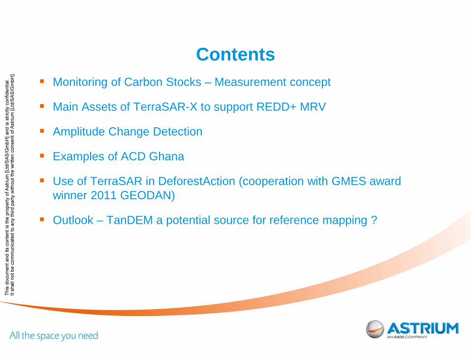
Contents Monitoring of Carbon Stocks – Measurement concept
Main Assets of TerraSAR-X to support REDD+ MRV
Amplitude Change Detection
Examples of ACD Ghana
Use of TerraSAR in DeforestAction (cooperation with GMES award winner 2011 GEODAN)
Outlook – TanDEM a potential source for reference mapping ?
ASTRIUM CONFIDENTIAL
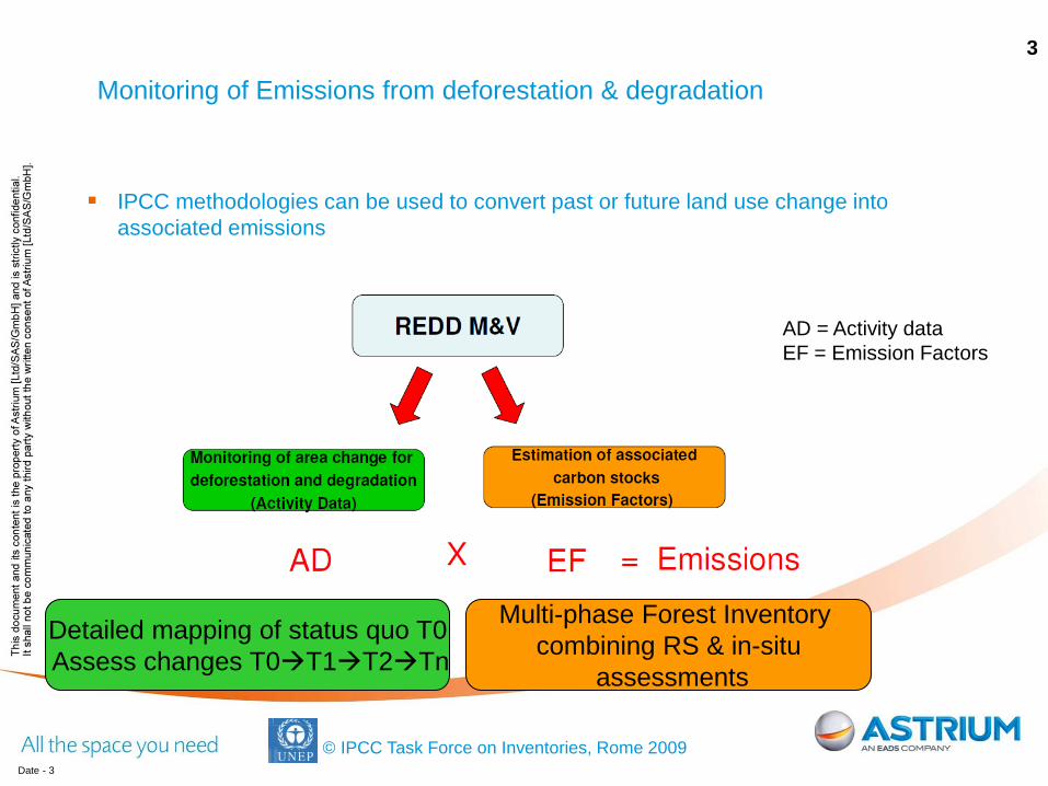
IPCC methodologies can be used to convert past or future land use change into associated emissions
Date - 3
© IPCC Task Force on Inventories, Rome 2009
AD = Activity data EF = Emission Factors
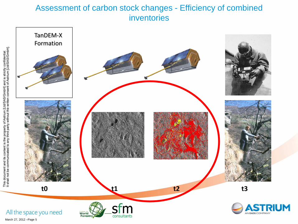
Monitoring of Emissions from deforestation & degradation 3
Detailed mapping of status quo T0 Assess changes T0T1T2Tn
Multi-phase Forest Inventory combining RS & in-situ
assessments
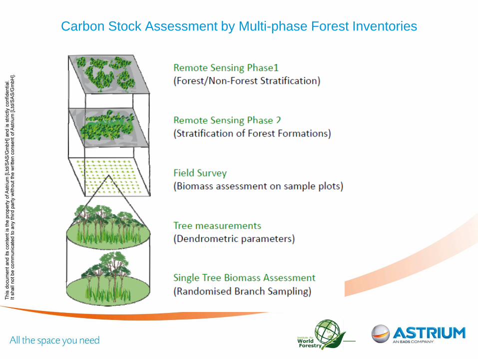
ASTRIUM CONFIDENTIAL Carbon Stock Assessment by Multi-phase Forest Inventories
ASTRIUM CONFIDENTIAL
March 27, 2012 –Page 5
t0 t2 t3
Assessment of carbon stock changes - Efficiency of combined inventories
TanDEM-X Formation
t1
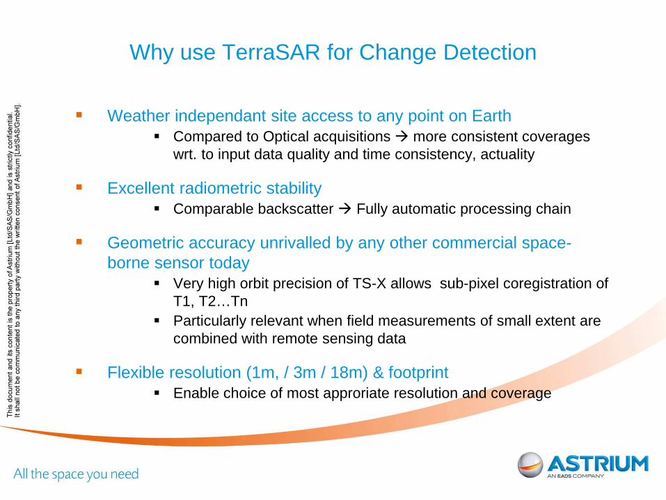
ASTRIUM CONFIDENTIAL Why use TerraSAR for Change Detection
Weather independant site access to any point on Earth
Compared to Optical acquisitions more consistent coverages wrt. to input data quality and time consistency, actuality
Excellent radiometric stability Comparable backscatter Fully automatic processing chain
Geometric accuracy unrivalled by any other commercial space-borne sensor today
Very high orbit precision of TS-X allows sub-pixel coregistration of T1, T2…Tn
Particularly relevant when field measurements of small extent are combined with remote sensing data
Flexible resolution (1m, / 3m / 18m) & footprint Enable choice of most approriate resolution and coverage
ASTRIUM CONFIDENTIAL
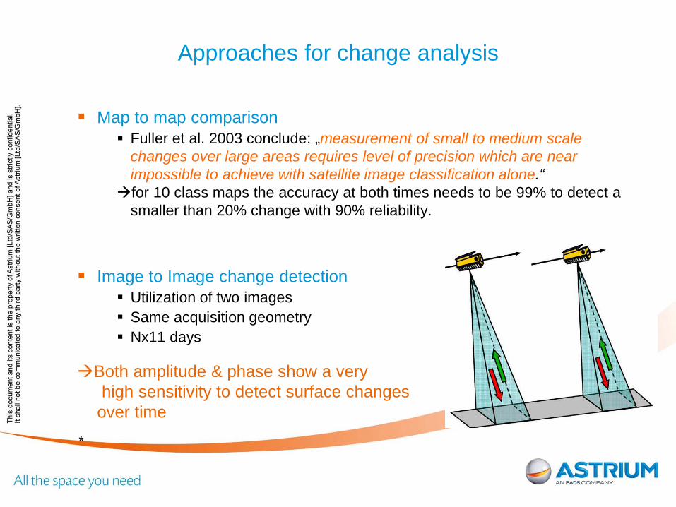
Approaches for change analysis
Map to map comparison Fuller et al. 2003 conclude: „measurement of small to medium scale
changes over large areas requires level of precision which are near impossible to achieve with satellite image classification alone.“
for 10 class maps the accuracy at both times needs to be 99% to detect a smaller than 20% change with 90% reliability.
Image to Image change detection Utilization of two images Same acquisition geometry Nx11 days
Both amplitude & phase show a very high sensitivity to detect surface changes over time
*
ASTRIUM CONFIDENTIAL
Amplitude Change Detection
Amplitude Change Detection Compared to optical imagery the change Indicator shows differences in the canopy
structure Cut trees in canopy layer lead to new shadow and layover regions ->Change of
backscatter shadow areas -> decrease in backscatter often in conjunction with increase (layover) depending on canopy structure/ density of top crown
layer change of texture
Comparably robust measure: backscatter changes are induced by differences in object geometry
Pre-requisite VHR SAR imagery (TerraSAR High resolution SpotLight -> StripMap Repeat pass acquisitions Comparable season at t1 and t2
The change indicator layer provide the result of the automated change detection.
provide information that a change has occurred do not give an indication about the type of the change.
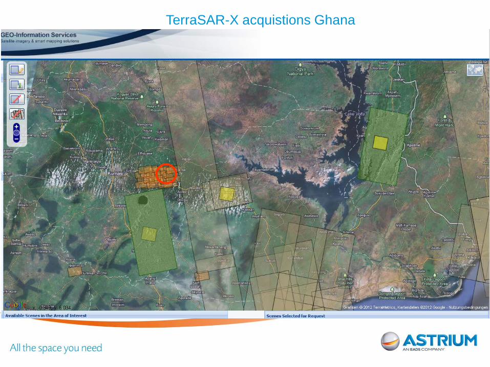
ASTRIUM CONFIDENTIAL TerraSAR-X acquistions Ghana
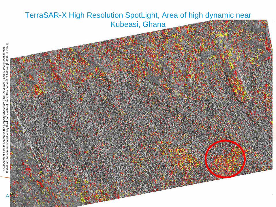
ASTRIUM CONFIDENTIAL TerraSAR-X High Resolution SpotLight, Area of high dynamic near
Kubeasi, Ghana
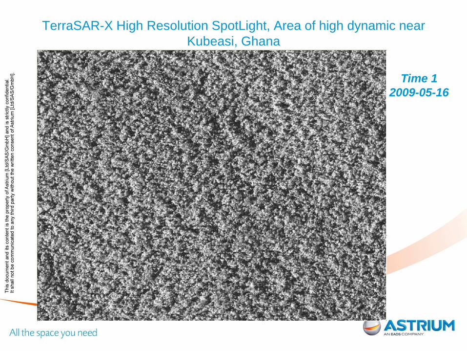
ASTRIUM CONFIDENTIAL TerraSAR-X High Resolution SpotLight, Area of high dynamic near
Kubeasi, Ghana
Time 1 2009-05-16

ASTRIUM CONFIDENTIAL
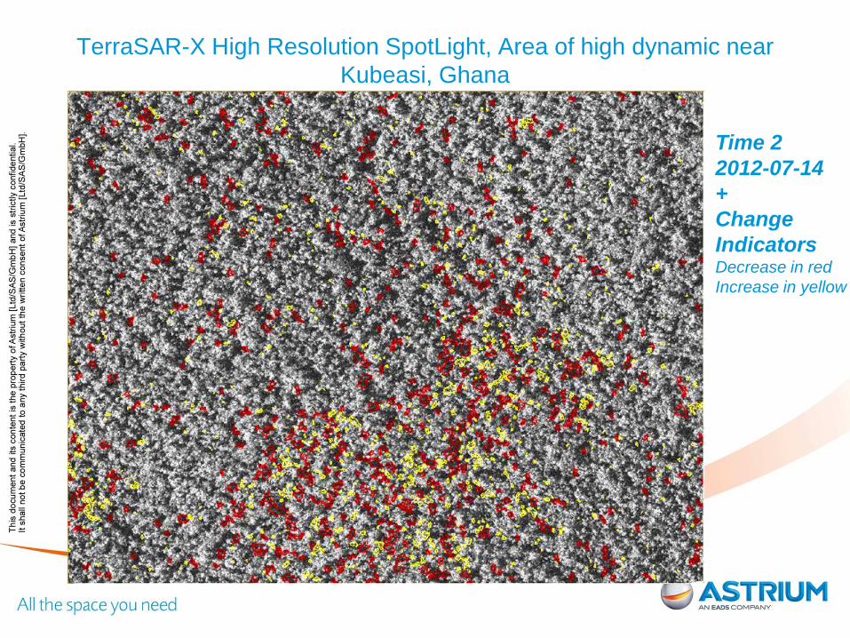
TerraSAR-X High Resolution SpotLight, Area of high dynamic near Kubeasi, Ghana
Time 2
2012-07-14
ASTRIUM CONFIDENTIAL
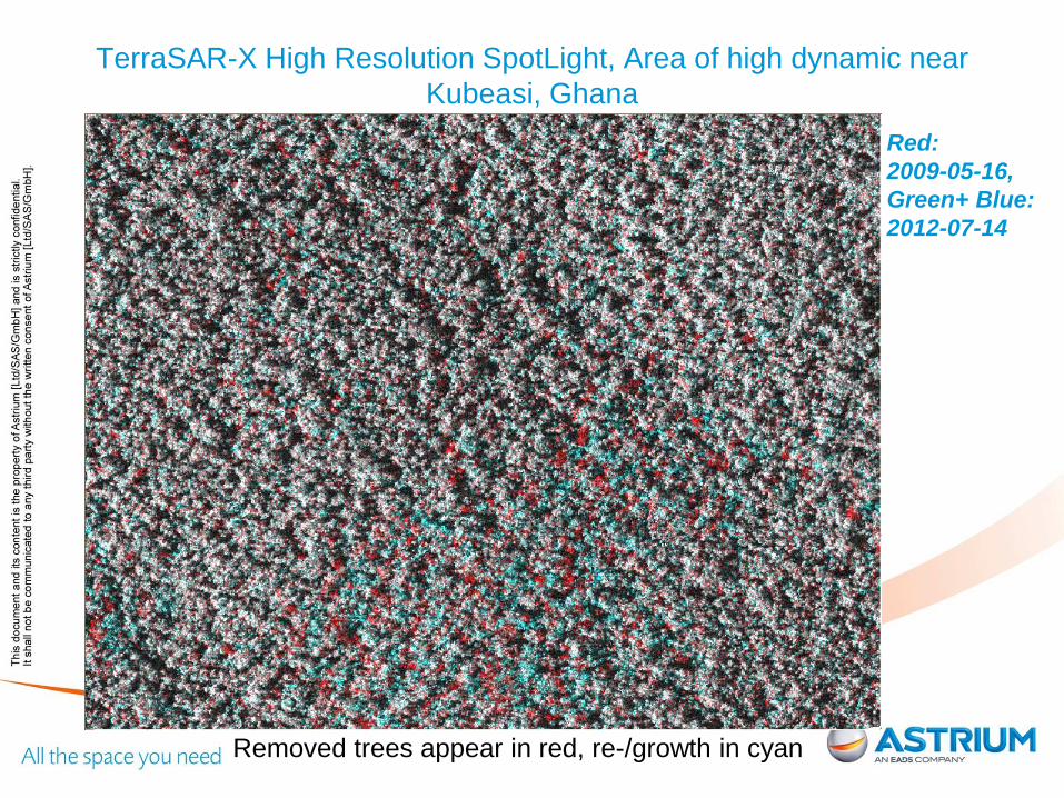
Red: 2009-05-16, Green+ Blue: 2012-07-14
Removed trees appear in red, re-/growth in cyan
TerraSAR-X High Resolution SpotLight, Area of high dynamic near Kubeasi, Ghana
ASTRIUM CONFIDENTIAL
TerraSAR-X High Resolution SpotLight, Area of high dynamic near Kubeasi, Ghana
Time 2 2012-07-14 + Change Indicators Decrease in red Increase in yellow

ASTRIUM CONFIDENTIAL TerraSAR-X acquistions Ghana
ASTRIUM CONFIDENTIAL
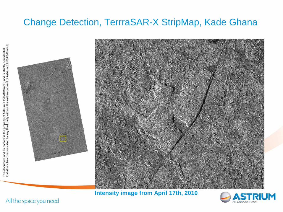
Change Detection, TerrraSAR-X StripMap, Kade Ghana
Intensity image from April 17th, 2010
ASTRIUM CONFIDENTIAL
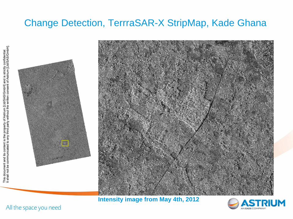
Intensity image from May 4th, 2012
Change Detection, TerrraSAR-X StripMap, Kade Ghana
ASTRIUM CONFIDENTIAL
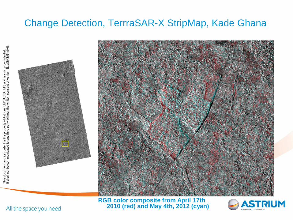
RGB color composite from April 17th 2010 (red) and May 4th, 2012 (cyan)
Change Detection, TerrraSAR-X StripMap, Kade Ghana
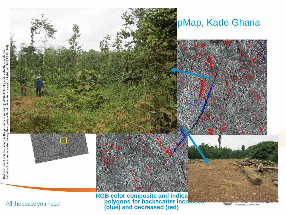
ASTRIUM CONFIDENTIAL
Change Detection, TerrraSAR-X StripMap, Kade Ghana
RGB color composite and indicator polygons for backscatter increased (blue) and decreased (red)
ASTRIUM CONFIDENTIAL
2011 – May 25 21 © Infoterra GmbH
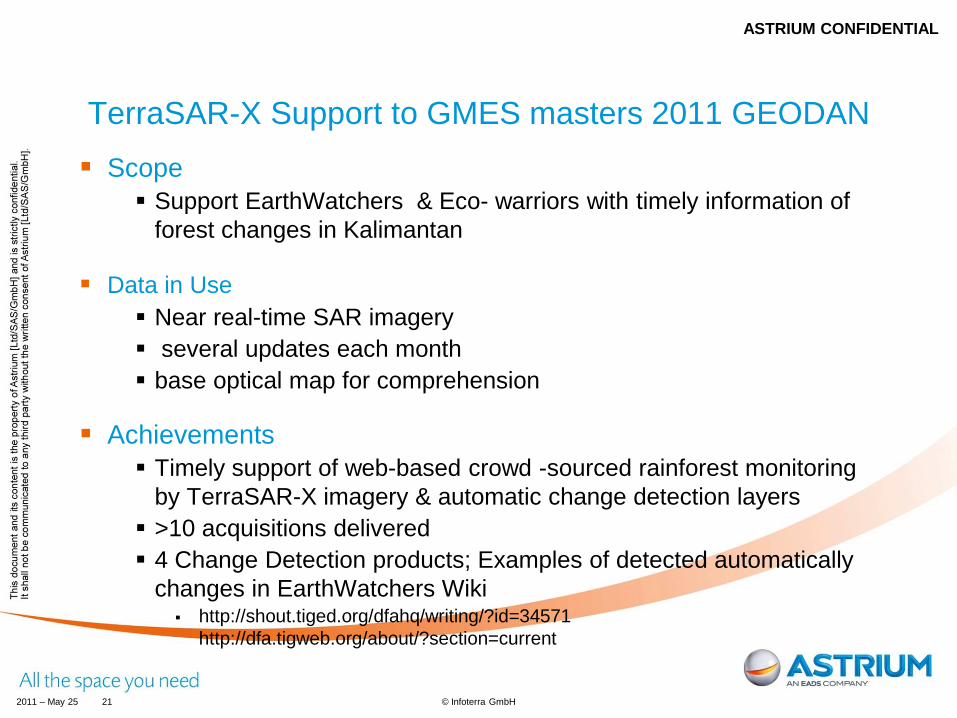
TerraSAR-X Support to GMES masters 2011 GEODAN Scope
Support EarthWatchers & Eco- warriors with timely information of forest changes in Kalimantan
Data in Use Near real-time SAR imagery several updates each month base optical map for comprehension
Achievements Timely support of web-based crowd -sourced rainforest monitoring
by TerraSAR-X imagery & automatic change detection layers >10 acquisitions delivered 4 Change Detection products; Examples of detected automatically
changes in EarthWatchers Wiki http://shout.tiged.org/dfahq/writing/?id=34571
http://dfa.tigweb.org/about/?section=current
ASTRIUM CONFIDENTIAL
ASTRIUM CONFIDENTIAL
2011 – May 25 22 © Infoterra GmbH
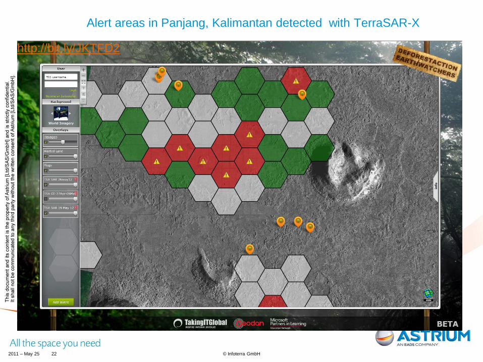
Alert areas in Panjang, Kalimantan detected with TerraSAR-X
http://bit.ly/JKTFD2
ASTRIUM CONFIDENTIAL
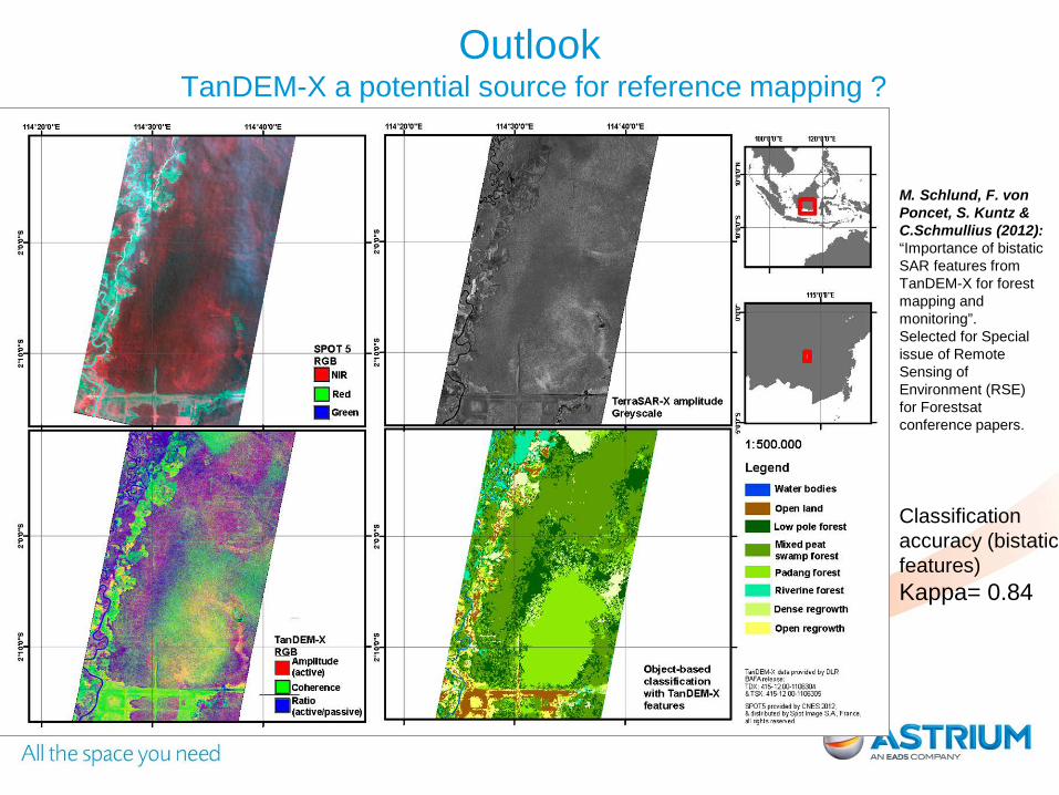
ASTRIUM CONFIDENTIAL Outlook TanDEM-X a potential source for reference mapping ?
Classification accuracy (bistatic features) Kappa= 0.84
M. Schlund, F. von Poncet, S. Kuntz & C.Schmullius (2012): “Importance of bistatic SAR features from TanDEM-X for forest mapping and monitoring”. Selected for Special issue of Remote Sensing of Environment (RSE) for Forestsat conference papers.
ASTRIUM CONFIDENTIAL
Thank you for your attention
Astrium Services GEO-Information Business Division
15, avenue de l’Europe 31522 Ramonville Saint-Agne, France
+33 (0)5 62 19 66 36
Contact Felicitas von Poncet SAR R&D Environmental Monitoring Astrium GEO-information Services / Infoterra GmbH Phone: +49 7545 8 3183 Mobile: +49 171 711 0340 Email: [email protected]


