
Hegg, D, Covert, D, Univ. of Washington, Atmospheric Sciences, WA

06
m*"" 1Q70?6 UNITED STATES DEPARTMENT OF THE INTERIOR CUct. IV/^J NATIONAL PARK SERVICE
NATIONAL REGISTER OF HISTORIC PLACES INVENTORY - NOMINATION FORM
FOR FEDERAL PROPERTIES(Type all entries - complete applicable sections)
STATE:
CaliforniaCOUNTY:
Los Angeles
FOR NPS USE ONLYENTRY DATE
flPT 1 fi 1Q74fl!li|!i!!llf;;!;lll!lll!l
COMMON:
Battery Os good-Far leyAND/OR HISTORIC:
lili;iiilll$lillfiiiiili;^^STREET AND NUMBER:
Fort MacArthur Upper ReservationCITY OR TOWN: CONGR
San PedroSTATE: CODE COUNT
California 90731 06|$8$iiiiijii^^
CATEGORY OWNERSHIP (Check One)
Q] District [^Building [jj] Public Public Acquisition:
CH S' te S Structure | | Private [ | In Process
| | Object | | Both | | Being Considerec
PRESENT USE (Check One or More as Appropriate)
[ | Agricultural Q Government JE~1 Park
| | Commercial | | Industrial | | Private Residence
Q] Educational [Xj Military [ | Religious
Q] Entertainment Q Museum [~~| Scientific
ESSIONAL DISTRICT:
Y: CODE
Los Angeles 037
c-rj.-r.tc ACCESSIBLE aiAiua T0 THE PUBUC
r%\ Occupied Yes:
[~1 Unoccupied [K~| Restricted
Q Preservation work Q Unrestricted
in progress [~~] No
| | Transportatjjon"""Vj> , r~~f^~l Comments.••''' \ \ , .. i \ / . > "^-^
Q Other C^V;VA>"" T "'' '- > -'' /N\
/" ~\-''^ r*. "^^ ' /
jc?s t\u;F!\/Fii -;\/ -' . . ': \
lilii^^U.S. Array
REGIONAL HEADQUARTERS: (II applicable) STF
Fort MacArthurCITY OR TOWN: ST/
San Pedro 90731 C
i f — ' ', ' :
W"'v RFP/CT/ ~JEET ANDXMOMBER: '^ ' til* . /
kTE: \^ O' / / i V> \ \_-"-' CODE
alifornia ~~"" 06
COURTHOUSE, REGISTRY OF DEEDS, ETC:
County Hall of Records, Los Angeles CountySTREET AND NUMBER:
320 West Temple StreetCITY OR TOWN: ST^
Los Angeles
iTE: CODE
California 06
x"<^,
TITLE OF SURVEY:
Deed to Fort MacArthur Upper ReservationDATE OF SURVEY: July 8, 1910 Q Federal Q State |y | County | | Local
DEPOSITORY FOR SURVEY RECORDS:
Book 4214, Page 147, Los Angeles County RecordsSTREET AND NUMBER:
320 West Temple StreetCITY OR TOWN: STf
Los Angeles
^ / '
iTE: CODE
California 06
STATE:
COUNTY:
c3C? .~I
-H*CT:
!
" ENTR
Y NUMBER
DATE
Tlo70Z TJ </>
C v> mOz r -<
CONDITION[XJ Excellent | | Good | | Fair
(Check One)
fyl Altered | | Unaltered
(Check One)
[~| Deteriorated
E
(~~| Ruins | | Unexposed
(Check One;
] Moved [£] Original Site
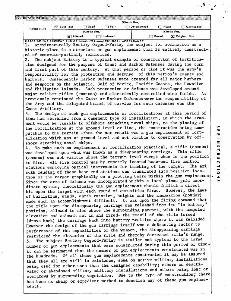
DESCRIBE THE PRESENT AND ORIGINAL (if known) PHYSICAL APPEARANCE
1. Architecturally Battery Os good-Far ley the subject for nomination as a historic place is a structure or gun emplacement that is entirely construct ed of concrete-partially reinforced.2. The subject Battery is a typical example of construction of fortifica tion designed for the purpose of Coast and Harbor Defenses during the turn and first part of this century. At that period of time it was the Army f s responsibility for the protection and defense, of this nation f s coasts and harbors. Consequently Harbor Defenses were created for all major harbors and seaports on the Atlantic, Gulf of Mexico, Pacific Coasts, the Hawaiian and Philippine Islands. Such protection or defense was developed around major caliber rifles (cannons) and electrically controlled mine fields. As previously mentioned the Coast or Harbor Defenses wezae the responsibility of the Army and the delegated branch of service for such defenses was the Coast Artillery.3. The design of such gun emplacements or fortifications at this period of time had retreated from a casement type of installation, in which the arma ment would be visible to offshore attacking naval ships, to the placing of the fortification at the ground level or line, the construction being com patible to the terrain -thus the net result was a gun emplacement or fort ification which was at ground level and not visible to observation by off shore attacking naval ships.4. To make such an emplacement or fortification practical, a rifle (cannon) was developed upon what was known as a disappearing carriage. This rifle (cannon) was not visible above the terrain level except when in the position to fire. All fire control was by remotely located base-end fire control stations employing optical instruments for tracking of the target. The azi muth reading of these base end stations was translated into position loca tion of the target graphically on a plotting board within the gun emplacement Since the area of defense was incorporated within a local plane grid coor dinate system, theoretically the gun emplacement should inflict a direct hit upon the target with each round of ammunition fired. However, the laws of ballistics, winds, earth rotation, heights and the ammunition (powder) made such an accomplishment difficult. It was upon the firing command that the rifle upon the disappearing carriage was released from its "in battery" position, allowed to rise above the surrounding parapet, with the computed elevation and azimuth set in and fired- the recoil of the rifle forced (drove back) the carriage back into battery position where it was reloaded. However the design of the gun carriage itself was a detracting factor to performance of the capabilities of the weapon, the disappearing carriage restricted the elevation of the rifle and thereby decreased rifle's range.5. The subject Battery Osgood-Farley is similar and typical to the large number of gun emplacements that were constructed during this period of time- it can be estimated that the number of gun emplacements constructed was in the hundreds. Of all these gun emplacements constructed it may be assumed that they all are still in existence, some on active military installations being used for other uses than the designed capability; others on deacti vated or abandoned military military installations and others being lost or overgrown by surrounding vegetation. Due to the type of construction," there has been no cheap or expedient method to demolish any of these gun emplace ments .

PERIOD (Check One or More as Appropriate)
I | Pre-Columbian
CH 15th Century
| | 16th Century
f~l 17th Century
HI 18th Century
[~| 19th Century
20th Century
SPECIFIC DATE(S) (If Applicable and Known)
AREAS OF SIGNIFICANCE (Check One or More as Appropriate)
Aboriginal
Q Prehistoric
0 Historic
[~~1 Agriculture
(X) Architecture
[H Art
I | Commerce
[~~1 Communications
I I Conservation
| | Education
[jjj Engineering
[~~| Industry
[ | Invention
[| Landscape
Architecture
[~~| Literature
fX| Military
usic
Q Political
Q Religion/Phi
losophy
| | Science
[~| Sculpture
[~~| Social/Human
itarian
[~1 Theater
| | Transportation
I | Urban Planning
Q Other (Specify;
(J3 Of
Ul IU
STATEMENT OF SIGNIFICANCE
(1) Battery Osgood-Farley was selected for nomination as a representative portion of the defense system that existed during the period 1917-1947.(2) Background;
(a) Troubles in the Far East and heightening tensions in Europe caused the War Department planners in 1908 to project plans for a strong harbor defensive installation at Fort MacArthur. As a result of these planners activities, action was taken in 1910 to acquire the land, now known as the Fort MacArthur Upper Eeservation, as gunsites for large coastal guns. In 1912, construction was started and in 1916, under the authority of the War Department, General Order Number 15, Battery Osgood-Farley was named in honor of Brigadier General Henry B. Osgood, U. S. Army, who died March 12, 1909 and Brigadier General Joseph P. Parley, U. S. Army, who died April 6, 1912. The construction of Battery Osgood-Farley of reinforced concrete to house the 14-inch disappearing carriage rifles was finally completed in the fall of 1917. Each of the 14-inch rifle tubes weighed about 100,000 pounds and the arrival of each was an important event in the lives of the local residents. Being much heavier than what the movers normally moved, the tubes were snaked up to the Upper Reservation sometimes at a rate of only three feet per day.
(b)." The first regular Army unit assigned to man the battery at Fort MacArthur was the 4th Company, 38th Artillery. They were transferred from Fort Scott, California, arriving March 23, 1917. Originally, the 38th Company of Artillery, part of the Army of the Potomac during the Civil War, the unit was later designated the 3rd Antiaircraft Company,, prior to its departure for France in November 1917.
(c) United States involvement in World War I accelerated the building program at the Fort, and during the winter and spring of 1917-18 many temporary buildings were constructed on the Upper Reservation. These build ings and tents housed the Training Center which furnished the major portion of the 5,000 men Fort MacArthur trained and started on their way to France prior to the Armistice.
(d) During an inspection trip in April 1924, BG Henry D. Todd, Com mander, Ninth Cbast Artillery, stated that the big guns at Fort MacArthur were too few and too short range to carry out their mission of harbor defense. Emphasis shifted from the heavy coastal defense weapons theory to that of anti-aircraft and anti-submarine warfare defense. And, although the

War Department - Annual Reports of the Secretary of War (Wash, D. C. Government Printing Office, 1823-1941).
Smithsonian Institute - Seacoast Fortifications of the United States: Intro ductory History by Mr. Emanuel Raymond Lewis. (Washington, D. C. : Smithson ian Press, 1970)
Army Ordnance Association, Washington, D. D. (undated brochure).
Fort MacArthur Harbor Defenses of Los Anaeles CWorld War II-undfHted booklet")
LATITUDE AND LONGITUDE COORDINATES . DEFINING A RECTANGLE LOCATING THE PROPERTY *
ICORNER
NE
SEsw
LATITUDE LONGITUDE
Degrees Minutes Seconds Degrees Minutes0 i ii O i
O i ii , O i
O 1 II '; O 1,
Seconds
LATITUDE AND LONGITUDE COORDINATES ) DEFINING THE CENTER POINT OF A PROPERTY s OF LESS THAN TEN ACRES
LATITUDE LONGITUDE
Degrees Minutes Seconds Degrees Minutes Seconds
33 ° 42 ' 0 " 118 ° 17 ' '^/. ;
APPROXIMATE ACREAGE OF NOMINATED PROPERTY: 9.53
LIST ALL STATES AND COUN Tl ES F,OR PROP ERTIES OVERLAPPING -STATE OR fCOUNTY BOUNDARIESSTATE:
STATE:
STATE:
STATE:
CODE
CODE
CODE
CODE
COUNTY: '^^~O \ I ^s>^ CODE/\y-" A "r v̂ ./7\COUNTY.: /^-/ ^^r^l\!Cf\ ^\ ' ' CODE,. /^y/ ... ^>'*~u :^\ : • .COUNTY: / __ / MAY 1 4 1374 -^ CODE-
•'.-•• .\^ ^j£T(n • ! ~~*COUNTY: \ "~\ '^^''UNAL. CODE
\^ REGISTER ^
NAME AND TITLE: ^^
GEORGE L. EALER; LTC, m^^c.^ \ C ? /K^^ Ma\ >^'TE:
^^^^^^^S^^CIJ 4 Dec 1973BUSINESS ADDRESS: ^S^ ./^
Directorate of Facilities Engineering——————————————————————————————————————— ̂ r-". ——————————— : —————— - ————————— •—— ——— '• ———— —— ! ——————————————————————————————————————————————————————— : —————————— i ———————— 1
STREET AND NUMBER:
Fort MacArthurPHONE:
831-7319CITY OR TOWN:
San Pedroj$^Wi?ii®$
State Liaison Officer recommendation:
fUrfes ' J^--''''*>xT :
CD None sjS^^s — 'State Liaison Officer Signature
In compliance with Executive Order 11593, I hereby nominate this property to the National Register, certify ing that the State Liaison Officer has been allowed 90 days in which to present the nomination to the State Re view Board and to evaluate its significance. The recom mended level of significance is {^ National | ] State
/) /
Federal Representative Signature Date
A. S-. Kerr/Dir, Base RqmtsTitle
STATE CODECalifornia — Q^ —
I hereby certify that this property is included in the National Register.
/V tiC^I J // ~ ; /A^ r\ lA^&^L/ cJ^CA-4j^^^
Director, Office of Archeology and Historic Preservation
/ f /// / *7 / 1
f ' I ATTEST: '
/ y
Keeper of Theyvational Register If
to ' i (• 7 ^Date
CO
m m
O-I
o•z.CO
GPO 938-449

.Form No. 1Cr-300a (Rev. 10-74) '
UNITED STATES DEPARTMENT OE THE INTERIOR NATIONAL PARK SERVICE
1976 NATIONAL REGISTER OF HISTORIC PLACES
INVENTORY -- NOMINATION FORM
CONTINUATION SHEET ITEM NUMBER 7____ PAGE 1
DESCRIPTION
6. Of the number of gun emplacements constructed of the period of years until the deactivation of the Coast Defenses in 1950, none engaged an attacking force in actual combat excepting those in the Philippine Islands (Fort Mills, Fort Hughes, Fort Drum and Fort Frank). It was during the World War II conflict, the siege of these Forts by the invading Japanese forces, that glaring deficiencies in the design of this type of fortifications became apparent. They were designed for a frontal or sea attack only - bombardment from the rear was their undoing or destruction.
7. There was (shortly prior to World War II) an accelerated program underway for the modernization of the Coast Defenses. The below ground firing platform was abandoned in favor of exposed casement type installation which would provide greater firing range and protection. The subject modernization program was confined mainly to the continental limits of the United States, Alaska and the Hawaiian Islands. These new gun emplacements were more massive in concrete construction than preceding structures and they themselves defy destruction or disposition.
8. There has been several books written and considerable research made by reputable authors and historians as to the extent and remains of the Coast Artillery (Harbor Defenses). The location of numerous gun emplacements had become lost and only through diligent research by these historians have they located and chronicled these installations.
9. The construction of Battery Osgood-Farley was adapted to the existing terrain of the Upper Reservation, Fort MacArthur overlooking the Pacific Ocean in a southerly direction. The emplacement was of a cut and cover type of con struction - the area of the emplacement being deeply excavated so that the required concrete emplacement could be constructed without a great deviation in the sur rounding terrain. The Battery (Osgood-Farley) was a two gun emplacement (14" bore diameter each). These gun emplacements were of exposed construction with fronting parapet walls 14' in height. The guns(carriages) were emplaced in gun wells directly behind the parapet walls. The gun wells were 20' in depth. The entire area (firing platform) behind the parapet was paved in a semi-circular

Form No 10-300a (Rev. 10-74)
UNITED STATES DEPARTMENT OE THE INTERIOR NATIONAL PARK SERVICE
NATIONAL REGISTER OF HISTORIC PLACES INVENTORY -- NOMINATION FORM
CONTINUATION SHEET_________________ITEM NUMBER 7_____PAGE 2__________________
DESCRIPTION
pattern with concrete to provide ease of operation for the access of shell and powder carts. The gun (firing) platforms were connected to the main under ground structures with galleries (tunnels) and open access roads. The main underground structure was the center or hub of the battery, containing shell and powder chambers, plotting rooms, generator room, power room and storage room. The entire structure was interconnected by main truck corridors, air galleries and doors. The main structure was of concrete construction, the ceiling height being 10' with interior walls of 3' thickness. The exterior walls towards the front and sides of the structure are 16' in thickness. The ceiling or roof of the main structure is 9' in thickness with approximately 10' of earth overburden. The parapet walls in front of the gun emplacements are 20' in thickness and full depth of the parapet height.
10. The rear wall of the main underground structure is exposed-rising to the height of 30'. Located in the face of this rear wall are all the main entrances to the truck corridors, power rooms, plotting rooms, etc. Adjacent to this rear wall or parapet is the latrine and storage building. This building is separated from the main underground structure by an exposed, paved service area. This service area is connected or joins the main access road to the battery. The latrine and storage building is of entire concrete construction, no earth over burden on the roof or ceiling.
11. The battery is equipped with electric Rights, having connection to commercial electrical power. The standby or emergency generator plants are inoperable at this time. The latrines are connected to sanitary sewer mains. There is also in existence voice speaking tube and mechanical indicator tunnels which were used to transmit azimuth and elevations to the guns when they were in existence. Also in the battery is a switchboard room which is still connected to and a part of the post signal system. The battery is well adapted to the surrounding terrain, and is covered with native vegetation, ice plant and landscaped with evergreen and deciduous trees.

.Form No.'10-300a (Rev. 10-74)
UNITED STATES DEPARTMENT OF THh INTERIOR NATIONAL PARK SERVICE
NATIONAL REGISTER OF HISTORIC PLACES INVENTORY -- NOMINATION FORM
CONTINUATION SHEET__________________ITEM NUMBER 8_____PAGE 1
SIGNIFICANCE:
California. The freighter Absoroka was torpedoed off Point Fermin. The SS Montebello was sunk by torpedo fire off San Simeon, Although none of Fort MacArthur* s "heavies" ever went into action, the day following the attack on the Absoroka, Battery "F", 105th Field Artillery Battalion, fired 10 rounds of smaller ammunition from the Upper Reservation at what was reported to be an enemy submarine approximately 4,000 yards off Redondo Beach, California. All traces of the submarine had disappeared next morning and it was assumed that it had sunk. The unit was cited for its action after the war.
(e) As the enemy was driven across the Pacific, the need for maintaining all batteries at full commission lessened. One-by-one, the weapons at Fort MacArthur were inactivated. In 1946, the permanent pieces in the Osgood-Farley Battery as well as the other Batteries were sold for junk.
Forrn No. 1{)-30Ga (Aev. 1-0-74)
UNlTtD STATES DEPARTMENT OF THE INTERIOR NATIONAL PARK SERVICE
NATIONAL REGISTER OF HISTORIC PLACES INVENTORY -- NOMINATION FORM
CONTI NUATION SHEET _________________ ITEM NUMBER 9 PAGE 1
MAJOR BIBLIOGRAPHICAL REFERENCES;
For£ MacArthur - published by Marquam and Co., (undated booklet).
Various other published articles:
Los Angeles Times - February 20,
Los Angeles Times - May 11, 1S98
Los Angeles Times - January 20, 1907
Los Angeles Times - February 4* 1907
San Pedro Pilot - October 23, 1909
San Pedro Pilot - March 1, 1911
San Pedro Chamber of Commerece, Brochure, February 22, 1926
Standard Oil Bulletin, September 1929
San Pedro News-Pilot - May 11, 1935
FMA HQ Harbor Defenses of Los Angeles - May 25, 1936 (letter)
Los Angeles Herald Express - June 3, 1936
Psy Ops Reservist, FMA, - August 16, 1963 San Diego Union - February 2, 1964
San Pedro News-Pilot - November 2, 1964
Los Angeles Times - October 16, 1966 Long Beach Press-Telegram - April 7, 1967 LOB Angeles Times - January 12, 1968
San Pedro News-Pilot - October 1, 1969
Various news items or references covering 1916-1920 's from two San Pedro papers.

• '
RECEIVEDf.UY 141974
NATIONAL
UNITED STATES DEPARTMENT OF THE INTERIOR NATIONAL PARK SERVICE
REGISTER OF HISTORIC PLACES
INVENTORY - NOMINATION FORM
(Continuation Sheet)
California
Los AngelesFOR NPS USE ONLY
ENTRY NUMBER
OCT 1 6 1974
ION (Cont'd)
the number of gun emplacements constructed over the period of years until the deactivation of the Coast Defenses in 1950, none engaged an attacking force in actual combat excepting those in the Philippine Islands (Fort Mills, Fort Hughes, Fort Drum and Fort Frank). It was during the World War II conflict, the siege of these Forts by the invading Japanese forces, that glaring deficiencies in the design of this type of fortifications became apparent. They were designed for a frontal or sea attack only - bombardment from the rear was their undoing or destruction.7. There was (shortly prior to World War II) an accelerated program underway for the modernization of the Coast Defenses. The below ground firing platform was abandoned in favor of exposed casement type installation which would provide greater firing range and protection. The subject modernization program was confined mainly to the continental limits of the United States, Alaska and the Hawaiian Islands. These new gun emplacements were more massive in concrete construction than preceding structures and they themselves defy destruction of disposition.
8. There has been several books written and considerable research made by reputable authors and historians as to the extent and remains of the Coast Artillery (Harbor Defenses). The location of numerous gun emplacements had become lost and only through diligent research by these historians have they located and chronicled these installations.
9. The construction of Battery Osgood-Farley was adapted to the existing terrain of the Upper Reservation, Fort MacArthur overlooking the Pacific Ocean in a southerly direction. The emplacement was of a cut and cover type of construction - the area of the emplacement being deeply excavated so that the required concrete emplacement could be constructed without a great devia tion in the surrounding terrain. The Battery (Osgood-Farley) was a two gun emplacement (iV bore diameter each). These gun emplacements were of exposed construction with fronting parapet walls IV in height. The guns (carriages) were emplaced in gun wells directly behind the parapet walls. The gun wells were 20' in depth. The entire area (firing platform) behind the parapet was paved in a semi-circular pattern with concrete to provide ease of operation for the access of shell and powder carts. The gun (firing) platforms were connected to the main underground structures with galleries (tunnels) and open access roads. The main underground structure was the center or hub of the battery, containing shell and powder chambers, plotting rooms, generator room, power room and storage room. The entire structure was interconnected by main truck corridors, air galleries and doors. The main structure was of concrete construction, the ceiling height being 10' with interior walls of 3' thickness. The rear exterior wall of the maim structure is 3 f in thickness. The ceiling or roof of the main structure is 9' in thickness with approximately 10' of earth overburden. The parapet walls in front of the gun emplacements are 20' in thickness and full depth of the parapet height.
CP 0 Q 21.7 24
Form 10-300 a (July 1969)
NATIONAL REGISTER OF HISTORIC PLACES
INVENTORY - NOMINATION FORM
(Continuation Sheet)
California
Los AngelesFOR NPS USE ONLY
ENTRY NUMBER
T 1 6 T9/4"(Number all en trie a)
9. MAJOR BIBLIOGRAPHICAL REFERENCES (Cont'd)
Fort MacArthur - published by Marquam and Co., (undated booklet).
Various other published articles:
Los Angeles Times - February 20, 1898
Los Angeles Times - May 11, 1898
Los Angeles Times - January 20, 1907
Los Angeles Times - February 4, 1907
San Pedro Pilot - October 23, 1909
San Pedro Pilot - March 1, 1911
San Pedro Chamber of Commerce, Brochure, February 22, 1926
Standard Oil Bulletin, September 1929
San Pedro News-Pilot - May 11, 1935
FMA HQ Harbor Defenses of Los Angeles, May 25, 1926 (Letter)
Los Angeles Herald-Express - June 3, 1936
Psy Ops Reservists, FMA, Aug 16, 1963
San Diego Union - February 2, 196^
San Pedro News-Pilot - November 2, 196^
Los Angeles Times - October 16, 1966
Long Beach Press-Telegram - April 7, 1967
Los Angeles Times - January 12, 1968
San Pedro News-Pilot - October 1, 1969
Various news items or references covering 1916-1920's from two San Pedro papers
GPO 921-724

Form 10-300 a (July 1969)
UNITED STATES DEPARTMENT OF THE INTERIOR NATIONAL PARK SERVICE
NATIONAL REGISTER OF HISTORIC PLACES
INVENTORY - NOMINATION FORM
(Continuation Sheet)
STATE
CaliforniaCOUNTY
___Los AngelesFOR NPS USE ONLY
ENTRY NUMBER
16 1974(Number alt entries)
10. The rear wall of the main underground structure is exposed-rising to the height of 30'. Located in the face of this rear wall are all the main entrances to the truck corridors, power rooms., plotting rooms, etc. Adjacent to this rear wall or parapet is the latrine and storage building. This "building is separated from the main undergound structure "by a exposed, paved service area. This service area is connected or joins the main access road to the "battery. The latrine and storage building is of entire concrete construction, no earth overburden on the roof or ceiling.
11. The Battery is equipped with electric lights, having connection to com mercial electrical power. The standby or emergency generator plants are inoperable at this time. The latrines are connected to sanitary sewer mains. There is also in existence voice speaking tube and mechanical indicator tunnels which were used to transmit azimuth and elevations to the guns when they were in existence. Also in the battery is a switchboard room which is still con nected to and a part of the post signal system. The battery is well adapted to the surrounding terrain, and is covered with native vegetation, ice plant and landscaped with evergreen and deciduous trees.
1974 NATIONAL
V::> REGISTER
CPO 921-724

Form 10-300o (July 1969)
UNITED STATES DEPARTMENT OF THE INTERIOR NATIONAL PARK SERVICE
NATIONAL REGISTER OF HISTORIC PLACES
INVENTORY - NOMINATION FORM
(Continuation Sheet)
California
Los Angeled*FOR NPS USE ONLY
ENTRY NUMBER
(Number alt entries)
STATEMENT OF SIGNIFICANCE (Cont'd)
heavy artillery pieces remained an important part of the defense system, three companies of the 63rd Coast Artillery (AA) were assigned to Fort MacArthur from Fort Scott, California, in March 1930. The Coastal Defense Artillery at Fort MacArthur saw limited "action" during WWII. During thearly months of 19^2, numerous sightings of submarines were reported off
Southern California. The freighter Absoroka was torpedoed off Point Fermin. The SS Montebello was sunk by torpedo fire off San Simeon. Although none of Fort MacArthur's "heavies" ever went into action, the day following the attack on the Absoroka, Battery "F", 105th Field Artillery Battalion, fired 10 rounds of smaller ammunition from the Upper Reservation at what was reported to be an enemy submarine approximately 4,000 yards off Redondo Beach, California. All traces of the submarine had disappeared next morning and it was assumed that it had sunk. The unit was sited for its action after the war.
(e) As the enemy was driven across the Pacific, the need for main taining all batteries at full commission lessened. One-by-one, the weapons at Fort MacArthur were inactivated. In 19^6, the permanent pieces in theOsgood-Farley Battery as well as the other batteries were sold for junk.


![Washington Herald. (Washington, DC) 1908-08-06 [p ]. · A PAPER OF QUALITY THE WASHINGTON NO 669 WASHINGTON D C THURSDAY AUGUST 6 LARGEST MORNING D CIRCULATION Q TWO CENTS HERALD](https://static.fdocuments.us/doc/165x107/5f0fe7b67e708231d4467823/washington-herald-washington-dc-1908-08-06-p-a-paper-of-quality-the-washington.jpg)
