03 November 2016 | Issue 23 - Seafish - Seafish · Information contained within the Kingfisher...
22
03 November 2016 | Issue 23 Shaded blocks indicate activity. What’s inside? New Hazards (p.3) Area 1 (p.4-8) 1. Notice to Fishermen 2. Seabed Activity Area 2 (p.9-11) 1. Notice to Fishermen 2. Seabed Activity Area 3 (p.12-31) 1. Notice to Fishermen 2. Seabed Activity Area 4 (N/A) 1. N/A Area 5 (p.14) 1. Seabed Activity Area 6 (p.15) 1. Deployment of Buoys Extra... (p.16-22) 1. Rig List 2. Anchor List 3. Survey List
Transcript of 03 November 2016 | Issue 23 - Seafish - Seafish · Information contained within the Kingfisher...

03 November 2016 | Issue 23
Shaded blocks indicate activity. What’s inside?
New Hazards (p.3)
Area 1 (p.4-8) 1. Notice to Fishermen 2. Seabed Activity
Area 2 (p.9-11) 1. Notice to Fishermen 2. Seabed Activity
Area 3 (p.12-31) 1. Notice to Fishermen 2. Seabed Activity
Area 4 (N/A) 1. N/A
Area 5 (p.14) 1. Seabed Activity
Area 6 (p.15) 1. Deployment of Buoys
Extra... (p.16-22) 1. Rig List 2. Anchor List 3. Survey List

2 of 22
Support
The Kingfisher Bulletin is provided by the Kingfisher Information Service of Seafish, to promote the awareness of offshore hazards to fishing, new structures and zones and conflicting offshore operations. Support for the production of oil & gas industry information is received from FLTC Services Ltd.
Information Information contained within the Kingfisher Bulletin comes from a variety of sources, although is in the majority, supplied directly to Kingfisher from the offshore operating industry, or government licensing authorities. Coordinates within the Kingfisher Bulletin are converted into World Geodetic System 1984 (WGS84) and displayed as degrees, minutes and decimal minutes, to three decimal places (ddd°mm.mmm’). Route or boundary coordinates may be simplified for ease of use.
Disclaimer and Limitation of Liability Whilst reasonable steps have been taken to ensure its accuracy, the data contained in this Bulletin (“Bulletin Data”) is not verified. Neither Seafish nor FLTC Services Limited (together the “Parties” and each a “Party”) makes any warranty, express or implied, as to accuracy, completeness or suitability for any particular purpose of the Bulletin Data. Except for any liability which cannot be excluded or limited by applicable law, none of the Parties shall have any liability to You, meaning any person, firm, partnership, corporate body or any other legal person receiving or otherwise using, or benefitting from the use of, Bulletin Data for any damage or losses (including indirect, incidental, special or consequential loss or damage) caused by any: (i) use of the Bulletin Data, or (ii) error or omission in the Bulletin Data. Notwithstanding the foregoing exclusion of liability, in the event that any of the Parties are found liable to You, then the Parties’ entire liability in such event, whether in contract, delict (including negligence) or otherwise, shall not exceed £1,000. The Admiralty Notices to Mariners should also be consulted.

3 of 22
Area 1 Hazard List Hazard Type Position Issue Date Contact Details Map
Concrete Mattress 13Te (6m x 3m x 300mm)
61°23.699'N 001°44.424'E 03 Nov 2016 [email protected] Concrete Mattress 13Te (6m x 3m x 300mm)(
61°22.779'N 001°43.834'E 03 Nov 2016 [email protected] Grout Bags 80 bags, each measuring 25kg (400mm x 250mm x150mm)(LxBxH)
61°23.836'N 001°44.434'E 03 Nov 2016 [email protected] Grout Bags 80 bags, each measuring 25kg (400mm x 250mm x150mm)(LxBxH)
61°23.831'N 001°44.437'E 03 Nov 2016 [email protected] Grout Bags 80 bags, each measuring 25kg (400mm x 250mm x150mm)(LxBxH)
61°22.764'N 001°43.836'E 03 Nov 2016 [email protected]
Large Anchor 59°03.027'N 000°18.516'W 03 Nov 2016 [email protected] New Suspended Wellhead – 205/21a-7Z 60°11.959'N 003°51.841'W 03 Nov 2016 [email protected] Mooring Chain 61°28.514’N 004°30.905’W 22 Sept 2016 [email protected] Enquest Water Injection Flowline - Crater 61°28.383’N 001°30.767’E 28 July 2016 [email protected] Exposed cut end of pipe 61°04.102’N 001°24.107’E 14 July 2016 [email protected]
Area 2 Hazard List Hazard Type Position Issue Date Contact Details Map
Kessog 30/01c-09–SSXT 2.75m protruding 56°50.662’N 002°10.008’E 22 Sept 2016 [email protected] Cement Block 57°49.735'N 001°02.347'W 25 Aug 2016 [email protected] New Suspended Wellhead – 21/19-13 57°22.931'N 000°43.018'E 28 July 2016 [email protected]
Area 3 Hazard List Hazard Type Position Issue Date Contact Details Map
6 tonne elastomer buoy 53°23.917’N 002°14.033’E 06 Oct 2016 David King [email protected] Lost Wire 53°24.177’N 002°13.896’E 06 Oct 2016 David King [email protected] Dropped objects in East Anglia Wind Farm 52°16.665’N 002°31.323’E 14 July 2016 [email protected]
The Hazard List is a collection of potential fishing hazards supplied to Kingfisher from across all offshore industries. Potential hazards will be listed for 6 months.
New Hazards

4 of 22
Notice to Fishermen First Published: 03 November 2016 | Latest Update: 03 November 2016
Suspended Wellhead – Structure On the Seabed
Please be advised that the suspended wellhead below, should be added to your Kingfisher Yellow Card Edition July 2016.
Structure Operator Position 205/21a-7Z Petrofac 60°11.959'N 003°51.841'W
For further information: Kirsty Mcwilliam, Petrofac, [email protected]
Notice to Fishermen First Published: 03 November 2016 | Latest Update: 03 November 2016
Abandoned Wellhead – Structure Removed form Seabed
Please be advised that the abandoned wellhead below, should be removed from your Kingfisher Yellow Card July 2016.
Structure Operator Position 16/28-11 BP Exploration 58°07.609'N 001°27.953'E
For further information: Marcelle Wynter,DECC, Tel:0300 0671616 [email protected]
Notice to Fishermen First Published: 03 November 2016 | Latest Update: 03 November 2016
Fishing Hazard – Protective Structures
In support of Murchison decommissioning activities specifically the Murchison PL165 Gas Pipeline and Umbilical Suspension
a series of protective structures have been put in place, namely 2 tapered concrete mattresses and a series of grout bag piles.
The following dimensions: 13Te (6m x 3m x 300mm)(LxBxH)
The following dimensions: Piles are approx. 80 bags, each measuring 25kg (400mm x 250mm x150mm)(LxBxH)
Hazard Position Concrete Mattress 61°23.699'N 001°44.424'E Concrete Mattress 61°22.779'N 001°43.834'E
Hazard Position Grout Bags 61°23.836'N 001°44.434'E Grout Bags 61°23.831'N 001°44.437'E Grout Bags 61°22.764'N 001°43.836'E
For further information: Nick Strachan, BP Exploration, Tel: +44 (0)1224 955089 email: [email protected]
Notice to Fishermen First Published: 03 November 2016 | Latest Update: 03 November 2016
Fishing Hazard – Large Anchor
A fishing vessel has come fast at the position below, sustaining damage to gear and winch due to the excessive weight. Presumed to be a large anchor. Hazard to fishing, 13nm N of MCP01 platform
Position 59°03.027'N 000°18.516'W
For further information: Bernie Bennett, Oil & Gas UK Tel: 01590 643986 email: [email protected]
Area 1
5 of 22
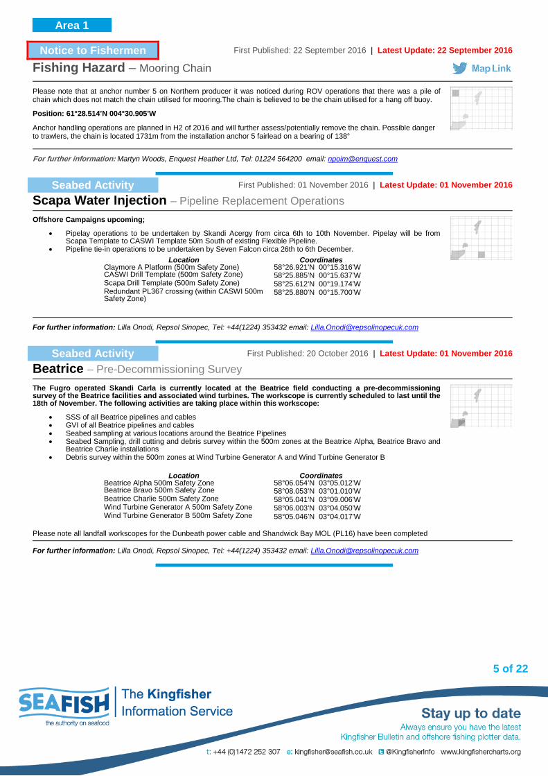
Notice to Fishermen First Published: 22 September 2016 | Latest Update: 22 September 2016
Fishing Hazard – Mooring Chain
Please note that at anchor number 5 on Northern producer it was noticed during ROV operations that there was a pile of chain which does not match the chain utilised for mooring.The chain is believed to be the chain utilised for a hang off buoy.
Position: 61°28.514’N 004°30.905’W
Anchor handling operations are planned in H2 of 2016 and will further assess/potentially remove the chain. Possible danger to trawlers, the chain is located 1731m from the installation anchor 5 fairlead on a bearing of 138°
For further information: Martyn Woods, Enquest Heather Ltd, Tel: 01224 564200 email: [email protected]
Seabed Activity First Published: 01 November 2016 | Latest Update: 01 November 2016
Scapa Water Injection – Pipeline Replacement Operations
Offshore Campaigns upcoming;
• Pipelay operations to be undertaken by Skandi Acergy from circa 6th to 10th November. Pipelay will be from Scapa Template to CASWI Template 50m South of existing Flexible Pipeline.
• Pipeline tie-in operations to be undertaken by Seven Falcon circa 26th to 6th December.
Location Coordinates Claymore A Platform (500m Safety Zone) 58°26.921’N 00°15.316’W CASWI Drill Template (500m Safety Zone) 58°25.885’N 00°15.637’W Scapa Drill Template (500m Safety Zone) 58°25.612’N 00°19.174’W Redundant PL367 crossing (within CASWI 500m Safety Zone)
58°25.880’N 00°15.700’W
For further information: Lilla Onodi, Repsol Sinopec, Tel: +44(1224) 353432 email: [email protected]
Seabed Activity First Published: 20 October 2016 | Latest Update: 01 November 2016
Beatrice – Pre-Decommissioning Survey
The Fugro operated Skandi Carla is currently located at the Beatrice field conducting a pre-decommissioning survey of the Beatrice facilities and associated wind turbines. The workscope is currently scheduled to last until the 18th of November. The following activities are taking place within this workscope:
• SSS of all Beatrice pipelines and cables • GVI of all Beatrice pipelines and cables • Seabed sampling at various locations around the Beatrice Pipelines • Seabed Sampling, drill cutting and debris survey within the 500m zones at the Beatrice Alpha, Beatrice Bravo and
Beatrice Charlie installations • Debris survey within the 500m zones at Wind Turbine Generator A and Wind Turbine Generator B
Please note all landfall workscopes for the Dunbeath power cable and Shandwick Bay MOL (PL16) have been completed
Location Coordinates Beatrice Alpha 500m Safety Zone 58°06.054’N 03°05.012’W Beatrice Bravo 500m Safety Zone 58°08.053’N 03°01.010’W Beatrice Charlie 500m Safety Zone 58°05.041’N 03°09.006’W Wind Turbine Generator A 500m Safety Zone 58°06.003’N 03°04.050’W Wind Turbine Generator B 500m Safety Zone 58°05.046’N 03°04.017’W
For further information: Lilla Onodi, Repsol Sinopec, Tel: +44(1224) 353432 email: [email protected]
Area 1

6 of 22
Seabed Activity First Published: 21 May 2014 | Latest Update: 01 November 2016
Edradour / Glenlilvet Field Development – Construction Activities
Please note that TEPUK have two new permanent subsea 500m safety zones which come into effect 14 July 2015 at Edradour & Glenlivet.
MV Genesis (BF505), Call Sign: MSDK3, is acting as guard vessel part way between Edradour & Edradour PLEM at the following location: 60° 55.39’ N 02° 23.73’W MV Karen Ann II (FR559), Call Sign: MADQ7, is acting as guard vessel part way between Edradour & Glenlivet at the following location: 61° 00.28’ N 02° 09.16’ W The metocean buoy in the last issue has been removed from the field.
Area Block Coordinates Glenlivet UKCS 214/30a 61°04.600’N 02°05.010’W Edradour UKCS 206/4a 60°56.040’N 02°14.010’W Edradour PLEM UKCS 206/4a 60°54.660’N 02°32.260’W Laggan UKCS 206/4a 60°56.670’N 02°53.620’W
For further information: Luis McArthur, Total, Tel:01224 297903 email: [email protected]
Seabed Activity First Published: 24 March 2016 | Latest Update: 27 October 2016
Mariner – Pipeline Works UKCS 9/11a
Please be advised that a number of works are taking place for the Mariner Field development.
The remaining activities in 2016 are as follows:
Activity Vessel & Call Sign Position Date /
Duration Comments
Location of jack-up drilling unit alongside the PDQ Platform Jacket.
Noble Lloyd Noble D5EM7
59°35.308'N 01°03.363'E From October 2016 to July 2017
Within existing safety zone of the PDQ jacket. The Noble Lloyd Noble will have an additional safety zone.
Shallow geotechnical borehole drilling
Fugro Bucentaur C6SU4
59°34.489'N 01°07.925'E 59°35.270'N 01°08.726'E
November for 7 – 10 days
Three boreholes at (or close to) each of the stated locations
For further information: Ray Wells, Statoil, Tel:07771 918018, email: [email protected] or Remi Arne Larsen, Statoil, tel: 07889 807954, email: [email protected]
Seabed Activity First Published: 24 March 2016 | Latest Update: 20 September 2016
Martin Linge Project – NOCS Blocks 30/4 & 30/7a
Total Norway have activities solely within the Norwegian Sector for the Martin Linge Project which are included here for information. October 2016
• Tie-in of infield pipelines between FSO riser(s) and ML platform riser(s). • Protection of exposed part on the seabed by use of protection structures and/or rock dumping.
These activities between the following locations: 60°30.34’ N 02°00.79’ E and 60°29.87’ N 02°04.42’ E. A guard vessel will be present in the area until the FSO arrives in late 2017. From 15th July 2016 Total Norway will have a new 500m radius safety zone at the STL buoy centred on the following location: 60° 29.87’N 02° 04.42’E
For further information: Luis McArthur, Total, Tel:01224 297903 email: [email protected]
Area 1

7 of 22
Seabed Activity First Published: 28 July 2016 | Latest Update: 22 September 2016
Telford Pigging Project – Phase 2
As part of the above project, Nexen Petroleum U.K. Limited (Nexen) is undertaking a subsea intervention campaign in the Telford Area (blocks 15/21a and 15/22 approximately 10km south of the Scott Field) commencing 2nd September 2016. This subsea intervention campaign will consist of the following activities: - The replacement of a section of 8”production pipeline; - Additional deposits (outwith a Safety Zone) at the locations listed below. The pipeline works will be carried out totally within a HSE recognised 500m safety zone at Marmion /West Telford Manifold (SI 1997/735). Primary Locations within the Safety Zone: Primary Deposit Locations out width a Safety Zone Concrete mattresses deposited at the shown locations, these may pose a snagging hazard to normal fishing operations: The above work will be undertaken by the Seven Falcon (DSV) over a 14 day period commencing on 2nd September 2016.
Location Coordinates North Tie In 58°14.303'N 000°12.469'E Barred Tee 58°14.295'N 000°12.471'E West Tie In 58°14.290'N 000°12.458'E South Tie In 58°14.286'N 000°12.494'E
Location Coordinates Area 1 58°16.357'N 000°12.456'E Area 2 58°15.189'N 000°12.454'E Area 3 58°15.134'N 000°12.459'E Area 4 58°13.964'N 000°12.602'E Area 5 58°16.422'N 000°12.409'E
For further information: : Ian Murphy, Tel: +44 (0)1224 371733 email: [email protected]
Seabed Activity First Published: 08 September 2016 | Latest Update: 08 September 2016
Athena Field – Decommissioning
Ithaca Energy UK Ltd is currently decommissioning the Athena Field in Block 14/18b of the UK Continental Shelf.
Ithaca Energy advises that the Athena STP Buoy, Risers and Mid-water arch will be removed in a campaign commencing on the 24th September, the duration of these works is likely to be around 18 days. The vessels conducting the works in the Athena field will be the Skandi Skansen, Skandi Iceman and two tow tugs (TBC).
Location Coordinates STP Buoy 58°24.374'N 000°34.382'W
Mid Water Arch 58°24.426'N 000°34.345'W Riser Base 58°24.472'N 000°34.272'W
For further information: Keith Stewart, Tel: 01224 652184 email: [email protected]
Seabed Activity First Published: 25 August 2016 | Latest Update: 25 August 2016
Western Isles Development – Permanent Infrastructure Installation
Dana has been undertaking drilling work in the northern North Sea (UKCS Block 210/24a) and there are two partly constructed wellheads (guide base and posts) that have been installed.
They are 15m apart from each other and we are currently awaiting the consent to locate approval for the permanent installation of these.
Structure Position 210/24a-BUI4 61°11.766'N 000°43.649'E 210/24a-B9A 61°11.772'N 000°43.638'E
For further information: Nicola Bannigan, Dana Petroleum, Tel: +44 1224 616170 email: [email protected]
Area 1

8 of 22
Seabed Activity First Published: 28 July 2016 | Latest Update: 19 August 2016
Brae Alpha to West Brae and Sedgewick – Replacement Umbilical
the replacement umbilicals for West Brae and Sedgwick have been installed and trenched. Tie-in activities will now commence 22nd October 2016.
Activity Vessel & Call Sign
Brae Alpha Platform
West Brae Manifold
Sedgwick Well V1
Date / Duration
Umbilical pull-in & lay
North Sea Giant 9HA1237
58°41.567'N 01°16.917'E
58°45.783'N 01°12.950'E
58°46.733'N 01°11.533'E
Umbilical Trench Deep Cygnus
58°41.567'N 01°16.917'E
58°45.783'N 01°12.950'E
58°46.733'N 01°11.533'E
Umbilical tie-ins Orelia V7GY7
58°41.567'N 01°16.917'E
58°45.783'N 01°12.950'E
58°46.733'N 01°11.533'E
22 Oct 2016 6 Days
For further information: John Colegrave, Marathon International Oil (GB) Ltd, Tel: +44 (0)1224 803416 email: [email protected]
Seabed Activity First Published: 15 June 2016 | Latest Update: 26 July 2016
Laggan / Tormore Yell Sound Shetland – Overtrawlability Sweeps
Overtrawlability sweeps are now complete in the following area. TEPUK in discussion with SFF / SFA regarding results, please continue to exhibit caution in this area: 60°45.280'N 001°15.010'W 60°29.050'N 001°15.310'W
For further information: Luis McArthur, Total, Tel:01224 297903 email: [email protected]
Area 1

9 of 22
Notice to Fishermen First Published: 22 September 2016 | Latest Update: 22 September 2016
Fishing Hazard – Kessog 30/01c-09 Well Abandonment plans
As part of the Kessog 30/01c-09 well abandonment plans, the disconnected SSXT and wellhead are to be left in place until approx. summer 2017. The SSXT was disconnected and left approx. 20 metres from the wellhead, it is has dimensions of 3m x 3m. The stick-up of the SSXT above the seabed is 2.75m.
Position: 56°50.662’N 002°10.008’E
For further information: Nick Strachan, BP, Tel: +44(0)1224 955089 email: [email protected]
Notice to Fishermen First Published: 25 August 2016 | Latest Update: 25 August 2016
Fishing Hazard near Buzzard – Cement Block
Please note that a Cement Block (1.5 metres long) Located 2NM of Buzzard Platform
Position: 57°49.735’N 001°02.347’W
For further information: Brian Bettie,Nexen Petroleum UK Ltd, Tel: +44(0)1224 371347 email: [email protected]
Seabed Activity First Published: 03 March 2014 | Latest Update: 03 October 2016
Montrose BLP Project – Development Operations
Offshore campaigns currently in progress or upcoming;
• Prosafe Operated Safe Boreas arrived at Montrose A 14th March. Flotel will operate in Combined Operations with the Montrose installation for 9-12 months.
• Nobel Regina Allen jack-up - On location 27th September, providing accommodation at Montrose A for 6 months.
Please note: HSE recognised 500m Safety Zone are now in force at the following:
Cayley drill centre 57°25.167’N 001°13.804’E Cayley/Montrose intermediate towhead 57°26.160’N 001°18.420’E Shaw Production drill centre 57°17.813’N 001°21.755’E Shaw WI drill centre 57°17.369’N 001°22.299’E
Key Coordinates 57°27.068’N 01°23.214’E Montrose BLP (500m Safety Zone) 57°25.167’N 01°13.804’E Cayley Drill Centre (500m Safety Zone) 57°25.924’N 01°17.332’E 44” Langeled Crossing – located between Montrose BLP and Cayley Drill Centre– Fishing
Hazard stay clear (concrete mattresses) 57°26.671’N 01°20.804’E 24” GAEL Crossing - located between Montrose BLP and Cayley Drill Centre– Fishing
Hazard stay clear (concrete mattresses) 57°17.813’N 01°21.755’E Shaw production Drill Centre 57°17.369’N 01°22.299’E Shaw Water Injection Drill Centre 57°25.757’N 01°22.760’E 24” GAEL crossings- located between Montrose BLP and Shaw Production Drill Centre –
Fishing Hazard stay clear (concrete mattresses) 57°27.054’N 01°22.987’E 14” Forties Crossings- located between Montrose BLP and Shaw Production Drill Centre
(inside Montrose 500m zone) 57°22.000’N 01°20.25’E CATS T2
For further information: Lilla Onodi, Talisman, Tel+44 (0)1224 358867 email: [email protected]
Area 2

10 of 22
Seabed Activity First Published: 24 March 2016 | Latest Update: 24 October 2016
Catcher Area – Development Project
Subsea construction activities on behalf of Premier Oil UK Limited on the Catcher Area Development (including the Catcher, Burgman and Varadero fields) located in block 28/9a of the UKCS 56°46.200'N 000°42.783'E
Seabed Activity Offshore installation works in the Catcher Area Development re-commenced in April 2016. To date, the following have been successfully installed:
• six (6) drilling template structures (elevation 9.2m above seabed) at the drill centres and coordinates listed below;
Please note; Each drill centre has an approved HSE 500m safety exclusion zone in force.
• three (3) 3.5km pipeline bundles have now been installed on the seabed between each Drill Centre and the future FPSO location.
• twelve (12) piled anchors with chain and wire mooring legs (in 3 groups of 4 mooring legs) extending out approximately 1000m from the future Catcher FPSO location (56°46’ 12.44” N and 00°42’ 46.93” E), where the mooring lines are connected to a Submerged Turret Production buoy (STP) – top of buoy at 17m water depth. Please note, the STP buoy has its own approved HSE 500m safety exclusion zone.
• Mid Water Arches and Gravity Base Structures Three (3) x piled gravity base structures attached to 3 x mid-water arches (buoyancy units used to support risers positioned mid-water approximately 30m below sea surface and 80m from the future FPSO location).
• Dynamic Risers & Umbillicals 13 x dynamic risers and umbilicals connected to the STP Buoy and running in catenary over the mid-water arch buoys and down to the seabed. The risers and umbilicals then run along the seabed, to Riser Base Towheads that are also within the STP Buoy/Future FPSO location 500m zone.
• Ongoing works Installation works are continuing with Tideway vessel “Seahorse” providing rock dump protection over risers and umbilicals within the STP 500m zone. Diving operations from Subsea 7 DSV “Seven Osprey”, are also continuing spool and jumper installations at the Catcher drill centre. Work for the 2016 construction campaign is expected to be complete early in November.
• Guard Vessel A Scottish Fishermen’s Federation guard vessel is monitoring the STP Buoy location.
Drilling The ENSCO 100 Drilling Rig is currently on location at the Varadero Drilling Template #1 position (coordinates of Drill Centres above) and will remain at this location until April 2017. Standby vessel Grampian Deliverance is monitoring the rig’s 500m zone throughout drilling operations. In April 2017, the ENSCO 100 Drilling Rig will move to Burgman Drilling Template #2 for approximately 140 days. Wave-Rider Buoy The wave rider buoy previously deployed within the Catcher Area Development has been removed.
Structure Coordinates 2 x drilling template structures at Varadero drill centre Varadero Drilling Template 1: Varadero Drilling Template 2:
56°48.366'N 00°42.258'E 56°48.369'N 00°42.337'E
2 x drilling template structure at Catcher drill centre Catcher Drillign Template 1: Catcher Drillign Template 2:
56°46.277'N 00°46.299'E 56°46.321'N 00°46.296'E
2 x drilling template structure at Burgman drill centre Burgman Drilling Template 1: Burgman Drilling Template 2:
56°44.542'N 00°40.640'E 56°44.566'N 00°40.581'E
For further information: Mike Jordan Premier Oil, Tel: 01224 615940 email: [email protected]
Area 2

11 of 22
Seabed Activity First Published: 19 May 2016 | Latest Update: 20 September 2016
Janice, James and Affleck Fields – Decommissioning
Maersk Oil UK Ltd have commenced decommissioning activities associated with the removal of the Janice ‘A’ FPU in Block 30/17a of the UK Continental Shelf.
The FPU has now been towed from location and the associated moorings and anchors have been recovered. The Janice Drill Centre location is being cleared of all flowlines and umbilicals, mid water arches and several small structures. In addition the flexible flowline and umbilical between Janice and James will also be recovered. Subsea facilities recovery operations are being performed from a construction support vessel the ‘MSS Achiever’, with the ‘Resilient’ providing long term guard vessel services.
The subsea wells at Janice and James will be plugged and abandoned commencing Q4 2016. The remaining subsea structures will be recovered in the future in accordance with the Decommissioning Programme.
A summary of the current/upcoming activities is as follows:
Facility / Installation Block Coordinates Activity Schedule
Janice ‘A’ FPU 30/17a 56° 23.876’ N 02° 15.004’ E Disconnection of risers and moorings - Within existing safety zone
Work Complete
Janice ‘A’ FPU 30/17a Anchor 1 Anchor 2 Anchor 3 Anchor 4 Anchor 5 Anchor 6 Anchor 7 Anchor 8 Anchor 9 Anchor 10 Anchor 11 Anchor 12
56° 23.876’N 02°15.004’ E 56°24.505’N 02°14.799’E 56°24.520’N 02°15.007’E 56°24.511’N 02°15.106’E 56°23.984’N 0216.138’E 56°23.876’N 02°16.140’E 56°23.807’N 02°16.159’E 56°23.258’N 02°15.117’E 56°23.242’N 02°15.003’E 56°23.259’N 02°14.801’E 56°23.762’N 02°13.805’E 56°23.872’N 02°13.840’E 56°23.993’N 02°13.860’E
Recovery of FPU moorings and anchors and FPU tow away
Work Complete
Janice Drill Centre 30/17a 56° 23.706’ N 02° 15.316’ E Recovery of risers, flowlines and spools; recovery of subsea structures; sinking / recovery of mid-water arches - Within existing safety zones.
Aug – Nov 2016
James Drill Centre (Well P8) 30/17a 56° 21.485’ N 02° 18.835’ E Recovery of spools and jumpers -
Within existing safety zone Aug – Nov 2016
Janice Drill Centre to James Drill
Centre 30/17a
56°23.706’N 02°15.316’E 56°21.485’N 02°18.835’E
Recovery of Flexible flowline and umbilical approx. 5.5km length Oct – Dec 2016
For further information: Steph Kiltie, PDi Ltd, Tel +44(0)1224 562193 email [email protected]
Seabed Activity First Published: 25 August 2016 | Latest Update: 26 September 2016
Culzean Field – Maersk Drilling
The Maersk Oil North Sea Ltd. Culzean Project in conjunction with Maersk Drilling plan to move the “Maersk Highlander” HDJU rig to the Culzean Field Development Area (Block 22/25A) The Maersk Drilling “Maersk Highlander” HDJU rig was installed alongside the existing Culzean WHP Jacket on 4th September 2016. This HDJU rig will be located in the Culzean field for a period of approximately 5 years. The HDJU rig has now a 500m safety zone established for the duration of the works around the rig centre coordinates as detailed below:
Location Coordinates Maersk Drilling Highlander HDJU Rig Centre 57˚ 11.565' N 01˚ 54.645’ E Culzean Wellhead Jacket Structure 57˚ 11.547' N 01˚ 54.679’ E
The UK Hydrographic Office has been informed and the Admiralty Charts for this development area location shall be updated to include the HDJU Rig location and established safety zone.
For further information: Max Ferran, Tel: +44 (0) 1224 242858, Email: [email protected] www.maerskoil.com
Area 2

12 of 22
Notice to Fishermen First Published: 06 October 2016 | Latest Update: 06 October 2016
Fishing Hazard – 6 tonne elastomer buoy
Please note that a 6 tonne buoyancy surface support elastomer buoy with 5 metres pigtail pennant wire. Buoy is coloured bright yellow and has and approximate freeboard of 1.5 metres
Buoy has no light fitted.
Position: 53°23.917’N 002°14.033’E
For further information: David King, Ensco, Tel: 01224 366053 email: [email protected]
Notice to Fishermen First Published: 06 October 2016 | Latest Update: 06 October 2016
Fishing Hazard – Lost Wire
Please note that a Ensco 92 on contract to ConocoPhillips was being towed from Victor JD platform to Vixen VM location with three towing vessels. As the rig was being positioned at Vixen’s standoff location the tow wire from Bugsier 9 (tow vessel) parted close to the vessels stern. Ensco 92 was able to retrieve two sections (approx 60m) of the tow wire but the last section was lost to sea. The lost wire is 52mm diameter and 200 meters in length. Buoy has no light fitted.
Position: 53°24.177’N 002°13.896’E
For further information: David King, Ensco, Tel: 01224 366053 email: [email protected]
Notice to Fishermen First Published: 25 August 2016 | Latest Update: 25 August 2016
Bacton to Hewitt – Pipeline Spans
New pipeline spans discovered on ENI’s Bacton to Hewett pipeline (Approx. 8.5nm offshore). Please exercise caution.
Span Position Length / Height Span 1 52°59.466'N 001°34.373'E to 52°59.445'N 001°34.327'E 65 m x 1.7 m Span 2 52°59.618'N 001°34.695'E to 52°59.606'N 001°34.664'E 23 m x 0.7 m
For further information: Kingfisher – See details in footer
Area 3

13 of 22
Seabed Activity First Published: 10 October 2016 | Latest Update: 10 October 2016
Cygnus Field – Development Project – Subsea Installation update
ENGIE E&P Ltd is developing the Cygnus Field in Block 44/11a & 44/12a of the Southern North Sea. The development is centred on 3 fixed bridge-linked platforms which comprise the Cygnus Alpha Complex (Well-Head AWHP, Production and Utilities APU and the Utilities and Quarters AUQ). There is also an additional satellite platform, Bravo Well-Head BWHP. An infield pipeline links the Bravo satellite to the Alpha Complex and product is ultimately exported via the ETS Pipeline system. The upcoming subsea installation phase is due to commence mid October 2016, this form lists upcoming activities, key co-ordinates, details of the vessels involved and ENGIE E&P Ltd contacts. Over the next 6 weeks the following works are planned: Subsea Operations
• Olympic Ares Construction Support Vessel shall wet store 12” pipeline spools at Cygnus Bravo • Bibby Polaris Dive Support Vessel shall install infield umbilical and tie-in 12” pipeline spools between Cyngus Alpha
and Bravo • Fugro Saltire Trenching Support Vessel shall trench infield umbilical between Cygnus Alpha and Bravo • Boskalis Rockpiper Dynamically Positioned Fallpipe Vessel shall conduct infield subsea
rock installation between Cygnus Alpha and Bravo Key Locations:
Structures Coordinates Structures Coordinates Cygnus AWH Platform 54°34.146'N 002°17.465'E Cygnus BWH Platform 54°35.878'N 002°11.696'E Cygnus APU Platform 54°34.118'N 002°17.385'E Cygnus SSIV Manifold 54°34.159'N 002°17.320'E Cygnus AUQ Platform 54°34.090'N 002°17.305'E Cygnus WYE Manifold 54°18.030'N 001°40.578'E
Subsea Operations:
• Olympic Ares mobilising 12th October 2016 • Bibby Polaris mobilising 12th October 2016 • Fugro Saltire mobilising 18th October 2016 • Boskalis Rockpiper mobilising mid November 2016
For further information, David Hawkins, GDF Suez E&P UK Ltd, Tel: +44 1224 281 082 email: [email protected]
Deployment of Buoys First Published: 03 November 2016 | Latest Update: 03 November 2016
Ramsgate Kent – Metocean Seabed Frame Deployments
Partrac Ltd., on behalf of DeepOcean, proposes to deploy three seabed mounted AWAC frames for a period of 30 days within 20 m of the target locations below near Ramsgate, Kent. Deployments are estimated to be carried out over two days from 1st November 2016, weather permitting. Surface marker buoys will be deployed in the immediate proximity of the seabed frames with an amber navigation light set to flash 5 times at 1 Hz every 20 seconds (FI Y [5] 20 s). All equipment (including ground weights) will be removed at the end of the study.
Site Coordinates Site A 51°18.894'N 001°24.480'E Site H 51°18.384'N 001°27.456'E Gull Stream 51°18.870'N 001°31.278'E
For further information, Kevin Ransom, Partrac Ltd, Tel: 07810 055 685 email: [email protected]
Deployment of Buoys First Published: 03 November 2016 | Latest Update: 03 November 2016
Ramsgate Kent – Metocean Seabed Frame Deployments
Partrac Ltd., on behalf of DeepOcean, proposes to deploy a shallow water seabed mounted Aquadopp frame for a period of 3-4 days within 20 m of the target location below in Pegwell Bay, Kent. Deployment is estimated to be carried out from 1st November 2016, weather permitting, and a pellet buoy marker will be attached to the frame. All equipment will be removed from site 3-4 days after deployment.
Name Coordinates Aquadopp 51°19.170'N 001°23.579'E
For further information, Kevin Ransom, Partrac Ltd, Tel: 07810 055 685 email: [email protected]
Area 3

14 of 22
Seabed Activity First Published: 01 November 2016 | Latest Update: 01 November 2016
Liverpool Bay – Drilling Operations
Petrofac drilling operations
Drilling Rig/Ship Installation / Well No Position Start / Finish Duration Irish Sea Pioneer Douglas Field 110/13D 53°32.234'N 003°34.781'W 11/11/16 33 Days
For further information: Alec Townley, Petrofac, Tel: +44 1352 842353 [email protected]
Area 5

15 of 22
Deployment of Buoys First Published: 25 August 2016 | Latest Update: 02 September 2016
Isle of Mull near Bloody Bay – Moorings
Marine research activities intended in / near Bloody Bay, Isle of Mull, and adjacent areas in the Sound of Mull from 5th/7th September to 20th October 2016. The work will be undertaken by the Scottish Association for Marine Science and involves deploying and recovering an array of moorings, including three 800-m long mooring lines and six solitary moorings. All equipment will be removed by the end of the research period.
Point Position Name
1 56°39.363'N 006°07.718'W Ardmre Point 2 56°40.958'N 006°08.514'W Sron Beag 3 56°40.763'N 006°01.821'W Maclean’s Nose 4 56°38.984'N 006°00.258'W Auliston Point 5 56°38.326'N 006°03.988'W Rubhn nan Gall Lighthouse
For further information: Dr Steven Benjamins, SAMS, Tel: +44(0)1631 559449 E-mail address: [email protected] http://www.sams.ac.uk
Area 6

16 of 22
Area 1 Rig List Latest Update: 31 October 2016
MOVEMENT RIG POSITION MOVEMENT RIG POSITION New Sedco 712 58°02.00’N 00°43.70’E Safe Scandinavia 60°41.90’N 02°55.90’E
Blackford Dolphin 58°18.10’N 01°42.40’E Flotel Victory 60°44.30’N 02°29.40’W Maersk Integrator 58°34.30’N 01°41.80’E COSL Promoter 60°46.20’N 03°36.10’E Deepsea Atlantic 58°50.00’N 02°32.90’E Songa Equinox 60°49.80’N 03°34.20’E Rowan Viking 58°50.60’N 02°14.90’E Stena Don 60°50.70’N 03°37.60’E
New Ocean Valiant 59°20.30’N 01°36.40’E West Epsilon 60°51.20’N 02°38.50’E New Wilphoenix 59°36.00’N 01°19.20’E New Scarabeo 5 60°52.10’N 02°38.50’E
Transocean Leader 59°53.90’N 01°16.90’E West Elara 61°02.30’N 02°20.30’E Transocean Spitsbergen 60°12.00’N 03°51.70’W New Ocean Guardian 61°11.70’N 00°43.70’E Deepsea Aberdeen 60°20.00’N 04°06.00’W Borgland Dolphin 61°13.30’N 03°26.40’E
New Songa Delta 60°28.10’N 02°39.20’E Transocean Arctic 61°25.00’N 04°04.00’E Maersk Intrepid 60°30.30’N 02°00.80’E Paul B Loyd Jr 61°35.20’N 01°18.60’E
Area 2 Rig List Latest Update: 31 October 2016
MOVEMENT RIG POSITION MOVEMENT RIG POSITION Ensco 71 55°28.80’N 05°06.60’E Rowan Gorilla 6 56°31.20’N 03°13.30’E Maersk Resilient 55°34.70’N 04°45.60’E COSL Rival 56°41.80’N 02°20.30’E Noble Sam Turner 55°38.40’N 04°53.10’E Ensco 100 56°48.40’N 00°42.30’E Seafox 5 55°46.10’N 04°38.90’E Rowan Gorilla 5 56°57.55’N 01°48.33’E Ensco 121 55°52.90’N 04°14.00’E GSF Galaxy 1 57°00.79’N 01°50.37’E Stena Spey 56°11.90’N 02°45.80’E Prospector 5 57°00.80’N 01°50.50’E Maersk Resolve 56°14.80’N 03°57.60’E Noble Hans Deul 57°01.90’N 01°57.30’E Maersk Innovator 56°22.60’N 03°15.50’E Noble Regina Allen 57°27.00’N 01°23.20’E Maersk Giant 56°29.00’N 04°54.70’E New Ocean Patriot 57°46.60’N 01°46.20’E
Area 3 Rig List Latest Update: 31 October 2016
MOVEMENT RIG POSITION MOVEMENT RIG POSITION Seafox 4 53°03.20’N 02°11.30’E Ensco 122 53°58.00’N 04°27.60’E
590021 53°14.00’N 03°14.50’E Seafox 2 54°34.10’N 02°18.10’E Atlantic Amsterdam 53°15.30’N 00°52.00’E Ensco 102 54°34.20’N 02°17.60’E Ensco 92 53°23.90’N 02°14.00’E Ensco 80 54°36.00’N 02°11.80’E GMS Endurance 6101 53°32.00’N 02°15.30’E Seafox 7 54°36.00’N 02°11.80’E
New Paragon B391 53°43.00’N 02°51.30’E
Area 5 Rig List Latest Update: 31 October 2016
MOVEMENT RIG POSITION MOVEMENT RIG POSITION Irish Sea Pioneer 53°37.80’N 03°10.60’W
Extra…

17 of 22
Rig anchors may extend over one mile from rig positions; anchor buoys are not always deployed. There may be additional structures called anchor pennants, deployed up to 200 metres from each anchor. In the interests of safety and to avoid fishing gear damage, fishing close to, or within anchor patterns, should be avoided. Fishermen may contact the installation or the ERRV (standby vessel) for positions of the anchors.
Area 1 Anchor List Latest Update: 03 October 2016
Ocean Guardian – Anchors as Laid at Western Isles South Dril l Centre
Anchor No. Position Anchor No. Position Anchor No. Position
Rig 61°11.770'N 00°43.640'E 3 61°12.410'N 00°43.130'E 6 61°11.450'N 00°44.180'E 1 61°11.570'N 00°42.240'E 4 61°12.430'N 00°44.050'E 7 61°10.770'N 00°43.180'E 2 61°12.000'N 00°42.320'E 5 61°12.020'N 00°45.050'E 8 61°10.880'N 00°43.210'E
PBLJ – At the Magnus D5 Well – Decommissioning Operations
Anchor No. Position Anchor No. Position Anchor No. Position Rig 61°35.190'N 001°18.492'E 3 61°35.580'N 001°20.106'E 6 61°34.260'N 001°17.910'E 1 61°36.054'N 001°17.574'E 4 61°34.938'N 001°20.250'E 7 61°34.656'N 001°16.296'E 2 61°36.258'N 001°19.176'E 5 61°34.182'N 001°19.560'E 8 61°35.532'N 001°16.170'E
Blackford Dolphin – As Laid Pattern Captain B
Anchor No. Position Anchor No. Position Anchor No. Position Rig 58°18.001'N 01°42.492'W 3 58°18.869'N 01°42.727'W 6 58°17.298'N 01°41.225'W 1 58°18.239'N 01°44.023'W 4 58°18.698'N 01°41.400'W 7 58°17.054'N 01°42.489'W 2 58°18.646'N 01°43.554'W 5 58°17.877'N 01°40.638'W 8 58°17.437'N 01°44.025'W
Captain FPSO
Anchor No. Position Anchor No. Position Anchor No. Position Rig 58°18.296'N 01°44.658'W 3 58°18.529'N 01°42.623'W 6 58°17.542'N 01°41.653'W 1 58°18.148'N 01°43.413'W 4 58°18.430'N 01°41.829'W 7 58°17.389'N 01°42.497'W 2 58°18.391'N 01°43.139'W 5 58°17.919'N 01°41.275'W 8 58°17.630'N 01°43.494'W
Anchors st i l l on seabed At Schiehal l ion North WestDril l Centre Anchor No. Anchor Position Surface Buoys Anchor Position Surface Buoys
1 60°22.434'N 004°09.270'W 60°22.656'N 004°07.734'W 5 60°23.358'N 04°02.580'E 60°23.244'N 004°03.186'W 2 60°23.670'N 004°08.976'W 60°23.286'N 004°07.548'W 6 60°21.906'N 04°02.946'E 60°22.068'N 004°03.450'W 3 60°24.462'N 004°06.960'W 60°23.700'N 004°06.498'W 7 60°21.288'N 04°05.664'E 60°22.032'N 004°05.742'W 4 60°24.324'N 004°04.464'W 60°23.634'N 004°05.220'W 8 60°21.456'N 04°07.614'E
Deepsea Aberdeen – As-Laid At Schiehall ion North Dri l l Centre
Anchor No. Position Anchor No. Position Anchor No.
Position
Rig 60°22.116'N 04°01.578'W 3 60°23.568'N 04°02.880'W 6 60°21.630'N 03°58.530'W 1 60°21.792'N 04°03.738'W 4 60°23.634'N 04°00.588'W 7 60°21.090'N 04°00.402'W 2 60°23.136'N 04°05.646'W 5 60°22.698'N 03°58.590'W 8 60°20.580'N 04°02.406'W
Anchors st i l l on seabed At Schiehal l ion North WestDril l Centre
Anchor No. Position Anchor No. Position 5 60°23.358'N 04°02.580'E 7 60°21.288'N 04°05.664'E 6 60°21.906'N 04°02.946'E 8 60°21.456'N 04°07.614'E
Glen Lyon – FPSO
Anchor No. Position Anchor No. Position Anchor No.
Position
Rig 60°21.383'N 04°04.071'W 7 60°20.531'N 04°03.269'W 14 60°21.054'N 04°05.849'W 1 60°21.811'N 04°02.375'W 8 60°20.516'N 04°03.331'W 15 60°21.084'N 04°05.872'W 2 60°21.779'N 04°02.349'W 9 60°20.506'N 04°03.393'W 16 60°22.223'N 04°04.934'W 3 60°21.755'N 04°02.298'W 10 60°20.493'N 04°03.449'W 17 60°22.236'N 04°04.873'W 4 60°21.720'N 04°02.297'W 11 60°20.955'N 04°05.765'W 18 60°22.253'N 04°04.808'W 5 60°21.691'N 04°02.274'W 12 60°20.987'N 04°05.792'W 19 60°22.264'N 04°04.737'W 6 60°20.534'N 04°03.198'W 13 60°21.019'N 04°05.824'W 20 60°22.278'N 04°04.675'W
Extra…

18 of 22
Transocean Spitsbergen – At well 205-21a-7
Anchor No. Anchor Position Laydown Pennant s Anchor Position Laydown Pennant s
Rig 60°11.959'N 03°51.841'W 1 60°11.995'N 003°53.618'W 60°11.998'N 003°53.953'W 5 60°11.918'N 003°50.052'W 60°11.909'N 003°49.707'W 2 60°12.593'N 003°53.075'W 60°12.727'N 003°53.315'W 6 60°11.324'N 003°50.619'W 60°11.200'N 003°50.362'W 3 60°12.844'N 003°51.755'W 60°13.016'N 003°51.743'W 7 60°11.074'N 003°51.924'W 60°10.902'N 003°51.923'W 4 60°12.572'N 003°50.567'W 60°12.704'N 003°50.319'W 8 60°11.346'N 003°53.111'W 60°11.230'N 003°53.351'W
Ocean Valiant – Pre-Laid At Bagpuss Well
Anchor No. Chain Pennant Chain End Anchor 1 58°12.450'N 01°10.240'W 58°12.420'N 01°10.380'W 58°12.180'N 01°11.590'W 2 58°12.510'N 01°10.220'W 58°12.540'N 01°10.360'W 58°12.800'N 01°11.540'W 3 58°12.600'N 01°10.110'W 58°12.670'N 01°10.170'W 58°13.280'N 01°10.650'W 4 58°12.580'N 01°09.980'W 58°12.660'N 01°09.920'W 58°13.280'N 01°09.420'W 5 58°12.510'N 01°09.880'W 58°12.540'N 01°09.730'W 58°12.800'N 01°08.530'W 6 58°12.320'N 01°09.270'W 58°12.370'N 01°09.400'W 58°12.030'N 01°08.650'W 7 58°12.410'N 01°10.000'W 58°12.330'N 01°09.940'W 58°11.680'N 01°09.440'W 8 58°12.430'N 01°10.070'W 58°12.360'N 01°10.110'W 58°11.710'N 01°10.520'W
Deepsea Atlantic – Prelayed Anchors at Johan Sverdrup
Anchor No. Position Anchor No. Position Anchor No. Position Rig 58°50.088'N 002°33.021'E 3 58°51.440'N 002°33.992'E 6 58°48.948'N 002°33.878'E 1 58°50.510'N 002°30.809'E 4 58°50.602'N 002°35.620'E 7 58°49.001'N 002°31.942'E 2 58°51.557'N 002°31.514'E 5 58°49.666'N 002°35.239'E 8 58°49.496'N 002°30.036'E
Transocean Leader – At Kraken DC1 9/02b-A1
Anchor No. Anchor Position Laydown Pennant s Anchor Position Laydown Pennant s
Rig 59°53.510'N 01°12.230'E 1 59°54.290'N 01°11.580'E 59°54.380'N 01°11.500'E 5 59°52.760'N 01°12.810'E 59°52.680'N 01°12.870'E 2 59°54.310'N 01°12.690'E 59°54.400'N 01°12.740'E 6 59°52.740'N 01°11.590'E 59°52.660'N 01°11.540'E 3 59°54.760'N 01°13.790'E 59°53.790'N 01°13.980'E 7 59°53.200'N 01°10.670'E 59°53.170'N 01°10.520'E 4 59°53.210'N 01°13.700'E 59°53.170'N 01°13.880'E 8 59°53.820'N 01°10.660'E 59°53.850'N 01°10.510'E
Paragon MSS1 – Telford H2 Well
Anchor No. Anchor Position Laydown Pennant s Anchor Position Laydown Pennant s
Well 58°12.320'N 00°16.720'E 7 58°11.760'N 00°17.300'E 58°11.700'N 00°17.380'E 1 58°12.850'N 00°16.160'E 58°12.930'N 00°16.050'E 8 58°11.690'N 00°16.720'E 58°11.610'N 00°16.720'E 2 58°12.940'N 00°16.720'E 58°12.950'N 00°16.580'E 9 58°11.770'N 00°16.150'E 58°11.700'N 00°16.090'E 3 58°12.840'N 00°17.270'E 58°12.900'N 00°17.130'E 10 58°12.020'N 00°15.690'E 58°11.980'N 00°15.570'E 4 58°12.610'N 00°17.720'E 58°12.680'N 00°17.660'E 11 58°12.320'N 00°15.500'E 58°12.320'N 00°15.370'E 5 58°12.320'N 00°17.860'E 58°12.320'N 00°18.000'E 12 58°12.620'N 00°15.670'E 58°12.660'N 00°15.550'E 6 58°12.020'N 00°17.760'E 58°11.990'N 00°17.880'E
Borgsten Dolphin – Dunbar Plat form 3/14a Borgsten Dolphin is currently in transit to offhire position in Cromarty Firth Port anchorage #4
Anchor No. Position Anchor No. Position Anchor No. Position Rig 60°37.660‘N 01°39.290‘E 5 60°37.820‘N 01°37.750‘E 10 60°37.390‘N 01°40.390‘E 1 60°36.930‘N 01°38.730‘E 6 60°37.930‘N 01°37.820‘E 11 60°37.290‘N 01°40.320‘E 2 60°37.000‘N 01°38.510‘E 7 60°38.350‘N 01°39.510‘E 12 60°37.190‘N 01°40.180‘E 3 60°37.060‘N 01°38.300‘E 8 60°38.300‘N 01°39.750‘E 4 60°37.700‘N 01°37.700‘E 9 60°38.250‘N 01°39.980‘E

19 of 22
Area 2 Anchor List Latest Update: 01 November 2016
Borgsten Dolphin – At Invergordon anchorage #4 Offhire from TEPUK but final position published.
Anchor No. Position Anchor No. Position Anchor No.
Position
Rig 57°41.060'N 004°10.330'E 2 57°40.880'N 004°09.910'E 5 57°40.850'N 004°10.680'E 1 57°41.000'N 004°09.830'E 4 57°40.810'N 004°10.560'E 6 57°40.890'N 004°10.750'E
West Phoenix – At Invergordon Anchorage West Phoenix at Offshore Invergordon Anchorage, Moray Firth with anchors deployed. Offhire from TEPUK, but TEPUK want to publish final position. The DP3 semi-submersible Rig West Phoenix is currently at an offshore Invergordon anchorage, Moray Firth
Anchor No. Position Anchor No. Position Anchor No.
Position
Rig 57°42.560'N 03°52.550'W 2 57°43.150'N 03°54.140'W 4 57°43.720'N 03°51.690'W 1 57°42.140'N 03°54.500'W 3 57°43.710'N 03°53.420'W
Stena Spey – As-Laid At Alma
Anchor No. Position Anchor No. Position Anchor No.
Position
Rig 56°11.890'N 002°45.750'E 3 56°12.260'N 002°46.930'E 6 56°11.060'N 002°44.930'E 1 56°11.530'N 002°45.330'E 4 56°11.680'N 002°46.990'E 7 56°11.640'N 002°43.820'E 2 56°12.660'N 002°46.250'E 5 56°11.170'N 002°46.270'E 8 56°12.260'N 002°43.840'E
Catcher FPSO – Construction vessels Skandi Skansen and Skandi Neptune working around and extending out approximately 1000m from the future Catcher FPSO
Anchor No. Position Anchor No. Position Anchor No. Position STP Buoy @ Future FPSO
56°46.207'N 000°42.782'E
1 56°46.573'N 000°42.093'E 5 56°46.457'N 000°43.780'E 9 56°45.713'N 000°42.755'E 2 56°46.602'N 000°42.136'E 6 56°46.423'N 000°43.804'E 10 56°45.719'N 000°42.687'E 3 56°46.630'N 000°42.182'E 7 56°46.387'N 000°43.824'E 11 56°45.728'N 000°42.620'E 4 56°46.655'N 000°42.233'E 8 56°46.350'N 000°43.840'E 12 56°45.739'N 000°42.555'E
COSL Rival – Proposed Mooring at Judy30/7a COSL Rival located adjacent to the East face of the Judy Platform from 19th April for approx 6 months. Moorings are fitted with polyester inserts and subsea buoyancy and represent a significant snagging hazard to fishing vessel activity in the vicinity. Moorings have a circa 2km radius about the location
Anchor No. Position Anchor No. Position Anchor No. Position Alongside 56°41.791'N 002°20.319'E 4 56°42.870'N 002°19.365'E 9 56°42.406'N 002°21.890'E Standoff 56°41.807'N 002°20.355'E 5 56°42.897'N 002°19.526'E 10 56°41.361'N 002°21.830'E
1 56°40.927'N 002°19.690'E 6 56°42.945'N 002°20.077'E 11 56°41.193'N 002°21.599'E 2 56°41.102'N 002°19.457'E 7 56°42.757'N 002°21.099'E 12 56°41.061'N 002°21.267'E 3 56°41.250'N 002°19.161'E 8 56°42.583'N 002°21.519'E
Ocean Patriot – As Laid at Pierce A12 Well
Anchor No. Position Anchor No. Position Anchor No. Position Rig 57°10.081’N 002°15.560’E 5 57°09.323'N 002°16.412'E # 7 Pennant End 57°09.638'N 002°14.153'E 1 57°10.622'N 002°14.944'E # 5 Pennant End 57°09.263'N 002°16.466'E 8 57°10.298'N 002°14.428'E 2 57°10.691'N 002°15.793'E 6 57°09.382'N 002°15.260'E # 8 ROV Survey 57°10.362'N 002°14.457'E 3 57°10.369'N 002°16.396'E # 6 Pennant End 57°09.316'N 002°15.228'E 4 57°09.971'N 002°16.677'E 7 57°09.671'N 002°14.261'E
Safe Caledonia Flotel – At ETAP
Anchor No. Position Anchor No. Position Anchor No. Position Rig 57°17.576’N 001°39.588’E 4 57°17.170'N 001°37.220'E 8 57°17.884'N 001°41.775'E 1 57°16.250'N 001°39.942'E 5 57°18.740'N 001°38.764'E 9 57°16.292'N 001°40.303'E 2 57°16.236'N 001°39.646'E 6 57°18.806'N 001°39.416'E 10 57°17.412'N 001°37.130'E 3 57°17.012'N 001°37.388'E 7 57°18.179'N 001°41.507'E

20 of 22
Area 1 Survey List Latest Update: 03 November 2016
Company & Vessels Towed Cable
Length & Depth
Area Covered 1 (inc Quod Blocks) Area Covered 2 (inc Quod Blocks) Duration
Fugro Subsea Services Ltd Scandi Carla
C6RX4
58°09.125'N 003°01.006'W 58°07.493'N 003°08.071'W 58°05.560'N 003°09.191'W 58°05.600'N 003°04.401'W 58°06.284'N 003°02.406'W
11 20/10/2016 - 12/11/2016
For 19 Days
Baker Hughes Wireline Ocean Valiant
V7EB7 59°20.232'N 001°36.301'E 9
20/10/2016 - 28/02/2017
For 1 Day Fugro Survey Ltd Fugro Searcher
3EUY6 Fugro Galaxy
C6YY4
58°17.482'N 000°49.120'E 58°22.458'N 000°52.901'E 15
19/10/2016 - 20/12/2016
For 5 Days
Fugro Searcher Fugro Searcher
3 EUY6
58°19.195'N 000°51.700'E 58°16.503'N 000°51.862'E 58°16.416'N 000°46.753'E 58°19.108'N 000°46.584'E
15 14/10/2016 - 14/12/2016
For 7 Days
Gardline Geosurvey Limited Ocean Reliance
J8B2707
59°35.849'N 001°39.467'E 59°35.932'N 001°47.967'E 59°31.623'N 001°48.121'E 59°31.540'N 001°39.638'E
9 23/09/2016 - 30/04/2017
For 4 Days
PGS Geophysical ASA Ramforn Titan
C6AL9 1300m
3m
59°05.934'N 000°47.106'E 59°23.403'N 000°45.914'E 59°24.209'N 001°46.717'E 59°17.366'N 001°42.602'E 59°06.629'N 001°39.751'E
8 9 15/09/2016 - 30/11/2016
For 90 Days
PGS Geophysical ASA Nordic Explorer
C6TU3 Thor Assister
OZ2061
59°10.986'N 001°37.080'W 58°29.444'N 002°28.293'W 58°36.058'N 002°54.933'W 58°44.849'N 002°47.665'W 58°57.351'N 002°31.868'W 59°22.240'N 002°12.186'W 59°28.108'N 002°13.267'W 59°27.275'N 002°29.060'W 59°53.790'N 002°30.822'W 59°51.742'N 001°33.902'W 59°49.494'N 001°17.396'W 59°54.397'N 001°08.573'W 60°02.022'N 000°55.813'W 60°12.213'N 000°50.007'W 60°18.211'N 000°45.880'W 60°24.164'N 000°39.235'W
60°28.377'N 000°44.972'W 60°30.955'N 000°45.419'W 60°36.041'N 000°42.139'W 60°53.483'N 000°39.830'W 60°54.331'N 000°59.477'W 61°28.940'N 000°54.016'W 61°28.334'N 000°05.690'W 59°37.709'N 000°06.373'W 59°37.325'N 000°45.254'W 59°11.109'N 001°15.133'W 59°10.986'N 001°37.080'W
209; 1; 5; 6; 7; 12; 13
12/08/2015 - 30/11/2016
For 90 Days
Fugro Survey Ltd Fugro Searcher
3EUY6
60°03.714'N 001°58.026'E 60°04.259'N 001°59.083'E 60°03.696'N 002°00.244'E 60°03.151'N 001°59.186'E
3; 4 01/06/2016 - 30/11/2016
For 1 Day
Fugro Survey Ltd Fugro Searcher
3EUY6
60°03.714'N 001°58.026'E 60°04.259'N 001°59.083'E 60°03.696'N 002°00.244'E 60°03.151'N 001°59.186'E
3; 4 01/06/2016 - 30/11/2016
For 1 Day
Subsea 7 Subsea Viking
LJJL
60°18.834'N 000°01.121'E 60°25.606'N 000°02.114'E 60°32.377'N 000°03.113'E 60°39.015'N 000°05.757'E 60°44.935'N 000°12.423'E 60°44.512'N 000°12.870'E 60°38.554'N 000°06.356'E 60°31.896'N 000°03.918'E 60°25.124'N 000°02.916'E 60°18.353'N 000°01.921'E 60°12.063'N 000°00.135'E 60°12.010'N 000°00.992'E 60°49.780'N 000°21.151'E 60°49.552'N 000°21.885'E 61°13.053'N 000°44.978'E 61°13.035'N 000°41.108'E 61°12.999'N 000°44.979'E
61°12.981'N 000°41.109'E 61°11.261'N 000°43.144'E 61°12.978'N 000°44.808'E 61°11.238'N 000°43.245'E 61°12.955'N 000°44.909'E 61°15.461'N 000°49.508'E 61°15.065'N 000°49.867'E 61°14.667'N 000°48.204'E 61°14.151'N 000°46.810'E 61°13.498'N 000°45.803'E 61°13.236'N 000°45.537'E 61°13.192'N 000°49.455'E 61°12.761'N 000°49.434'E 61°12.818'N 000°44.316'E 61°13.702'N 000°45.016'E 61°14.461'N 000°46.190'E 61°15.038'N 000°47.748'E
17/05/2016 - 31/12/2016
For 7 Days
Fugro GeoConsulting Ltd MV Bucentaur - C6SU4 MV Gargano - VSMW5
Greatship Manisha - 9V7823
59°26.229'N 001°32.632'E 59°26.264'N 001°35.804'E 59°24.648'N 001°35.871'E 59°24.613'N 001°32.701'E
9 01/05/2016 - 31/12/2016
For 3 Days
Fugro GeoConsulting Ltd MV Bucentaur - C6SU4 MV Gargano - VSMW5
Greatship Manisha - 9V7823
59°36.916'N 001°18.301'E 59°36.956'N 001°21.490'E 59°35.341'N 001°21.569'E 59°35.300'N 001°18.382'E
9 01/05/2016 - 31/12/2016
For 3 Days
Fugro GeoConsulting Ltd MV Bucentaur - C6SU4 MV Gargano - VSMW5
Greatship Manisha - 9V7823
59°27.678'N 001°35.536'E 59°27.711'N 001°38.711'E 59°26.095'N 001°38.776'E 59°26.062'N 001°35.603'E
9 01/05/2016 - 31/12/2016
For 3 Days
Fugro GeoConsulting Ltd MV Bucentaur - C6SU4 MV Gargano - VSMW5
Greatship Manisha - 9V7823
59°23.121'N 001°38.404'E 59°23.153'N 001°41.572'E 59°21.537'N 001°41.634'E 59°21.505'N 001°38.469'E
9 01/05/2016 - 31/12/2016
For 3 Days
CCG Services S.A Oceanic Champion
LAJQ6 Bourbon Fulmar
5BXP3
1000m / 50m
61°31.423'N 001°11.406'E 61°31.762'N 001°41.006'E 61°21.370'N 001°47.295'E 60°59.970'N 001°51.498'E 60°29.969'N 001°57.391'E
211; 3; 9 25/02/2016 - 30/11/2016
For 90 Days
Extra…

21 of 22
59°53.767'N 002°04.500'E 59°53.551'N 002°04.370'E 59°53.073'N 001°16.799'E 61°31.423'N 001°11.406'E
Area 2 Survey List Latest Update: 03 November 2016
Company & Vessels Towed Cable
Length & Depth
Area Covered 1 (inc Quod Blocks) Area Covered 2 (inc Quod Blocks) Duration
Fugro Survey AS Fugro Galaxy
C6YY4 1300m
3m
57°55.791'N 000°15.364'E 58°02.165'N 000°04.441'E 57°56.344'N 000°07.333'E 57°49.988'N 000°03.401'E
20; 14; 21 November
For 7-10 Days
Gardline Geosurvey Ltd Kommandor - PBQW 56°26.072'N 002°42.548'E
56°32.809'N 002°33.954'E 30 05/09/2016 - 04/12/2016
For 7 Days
PGS Exploration (UK) Limited
Ramform Vanguard C6TU8
8100m 25m
56°57.651'N 002°25.826'E 56°56.431'N 002°21.764'E 56°55.478'N 002°16.359'E 56°55.690'N 002°10.799'E 56°57.300'N 002°05.095'E 56°59.400'N 002°01.823'E 57°09.978'N 001°50.294'E 57°13.540'N 001°48.234'E 57°16.841'N 001°49.068'E 57°19.417'N 001°51.855'E 57°21.156'N 001°55.804'E 57°25.988'N 002°11.800'E
22; 23; 30 01/08/2016 - 30/11/2016
For 50 Days
Dana MV Kommandor
57°14.326'N 000°44.876'E 57°10.890'N 000°49.512'E 57°08.534'N 000°43.589'E 57°11.966'N 000°38.949'E
10/07/2016 - 30/11/2016
For 7 Days
Gardline GeoSurvey Ltd M/V Kommandor
PBQW
57°12.819'N 000°44.448'E 57°11.124'N 000°46.737'E 57°10.040'N 000°44.016'E 57°11.735'N 000°41.725'E
21 03/07/2016 - 30/11/2016
For 7 Days
Western Geco Ltd M/V WG Magellan
5BPK2 M/V Geco Topaz
3FYH3 M/V WG Vespucci
5BXF2
3600m 23m
57°47.049'N 000°26.075'E 57°38.408'N 000°22.455'E 57°37.438'N 000°30.614'E 57°31.793'N 000°28.185'E 57°31.693'N 001°00.010'E 57°31.935'N 001°00.121'E
57°41.759'N 001°16.435'E 57°52.590'N 001°21.269'E 57°58.097'N 001°08.217'E 57°58.010'N 000°59.489'E 57°57.568'N 000°56.542'E 58°00.786'N 000°32.046'E
01/06/2016 - 30/11/2016
For 55 Days
CGG Services S.A Oceanic Champion
LAJQ6 Bourbon Fulmar
5BXP3 Storm West
LCHX3
7950m 50m
56°49.570'N 002°29.826'E 56°35.660'N 002°36.710'E 56°26.533'N 002°48.141'E 56°27.122'N 000°48.228'E 56°43.794'N 000°48.144'E 56°43.830'N 001°18.159'E 56°47.132'N 001°18.168'E 56°47.061'N 001°44.411'E 56°49.903'N 001°44.452'E
29; 30 01/05/2016 - 30/11/2016
For 37 Days
Area 3 Survey List Latest Update: 03 November 2016
Company & Vessels Towed Cable
Length & Depth
Area Covered 1 (inc Quod Blocks) Area Covered 2 (inc Quod Blocks) Duration
Fugro Survey B.V Fugro Pioneer
C6BH3 54°15.437'N 000°25.045'E
54°17.299'N 002°28.202'E 44 01/12/2016 - 31/01/2017 For 3 Days
Gardline Ocean Researcher
52°20.00'N 001°41.21'E 52°35.00'N 001°51.61'E 52°35.35'N 002°01.89'E 52°20.00'N 002°02.20'E
05/11/2016 - 16/11/2016
Gardline MV Confidante
ZQZ15
53°19.055N 001°07.364E 53°29.291N 001°41.672E 53°24.500N 001°35.140E 53°16.095N 001°02.094E
01/11/2016 For 2 - 3 Weeks
Horizon Geosciences Ltd Horizon Geobay
3ETG2 Kommandor Stuart
MPQ3H
54°02.443'N 000°30.120'E 54°00.361'N 000°26.382'E 54°02.603'N 000°22.815'E 54°04.704'N 000°26.536'E
01/11/2016 For 2 Weeks
Horizon Geosciences Ltd Horizon Geobay
3ETG2
54°02.404'N 000°26.379'E 54°04.037'N 000°29.045'E 54°04.037'N 000°29.029'E
42 17/10/2016 - 07/12/2016 For 1 Day
Horizon Geosciences Ltd Horizon Geobay
3ETG2
54°02.404'N 000°26.379'E 54°04.037'N 000°29.045'E 54°04.037'N 000°29.029'E
42 17/10/2016 - 07/12/2016
For 4 Days
Fugro Geoconsulting Fugro Galaxy
C6YY4 54°01.437'N 000°25.045'E
53°44.269'N 000°10.346'E 42; 47 08/10/2016 - 30/11/2016 For 9 Days
Poarcus DMCC Polarcus Asima
C6XK6 6000m / 15m
54°04.904'N 001°03.830'E 54°04.838'N 001°47.764'E 53°44.071'N 001°47.648'E 53°43.703'N 000°53.830'E 53°53.904'N 000°53.680'E 53°53.753'N 000°15.779'E 53°59.903'N 000°11.829'E
42; 43; 47; 48 01/10/2016 - 31/07/2017 For 2 Days

22 of 22
54°02.803'N 000°14.929'E 54°06.937'N 000°15.528'E 54°14.754'N 000°15.378'E 54°14.921'N 001°03.746'E
Gardline MV Titan Discovery
ZQZ15
50°55.231'N 000°59.672'E 51°00.370'N 001°04.900'E 51°03.741'N 001°11.851'E
01/10/2016 - 01/12/2016
Gardline MV Vigilant
52°07.530'N 002°02.471'E 52°03.050'N 001°40.000'E 52°05.213'N 001°34.796'E 52°19.983'N 001°41.082'E 52°19.946'N 002°02.212'E
Area 4 Survey List Latest Update: 03 November 2016
Company & Vessels Towed Cable
Length & Depth
Area Covered 1 (inc Quod Blocks) Area Covered 2 (inc Quod Blocks) Duration
WesternGeco Limited MV WG Magellan
5BPK2
50°46.521'N 005°09.613'W 50°54.734'N 005°21.377'W 51°23.465'N 005°32.878'W 51°23.964'N 005°52.113'W 51°44.429'N 006°19.058'W 52°25.496'N 005°45.560'W 53°22.694'N 005°30.252'W 54°15.687'N 003°58.268'W 54°11.478'N 003°27.524'W 54°02.513'N 003°18.029'W 53°43.822'N 003°11.240'W 53°48.175'N 003°43.918'W 53°27.473'N 004°37.826'W 53°17.694'N 004°52.738'W 53°05.874'N 004°35.066'W
53°00.567'N 004°34.771'W 52°50.729'N 004°53.595'W 52°42.207'N 004°53.279'W 52°42.663'N 004°41.443'W 52°30.980'N 004°09.668'W 52°11.988'N 004°43.412'W 52°01.541'N 005°17.783'W 51°49.709'N 005°30.255'W 51°24.218'N 005°09.268'W 51°28.065'N 004°40.844'W 51°29.228'N 004°28.022'W 51°06.450'N 004°27.483'W 50°49.849'N 004°49.619'W 50°46.521'N 005°09.613'W
94; 95; 102; 103; 104; 107; 108; 110; 112; 113
01/09/2016 - 30/11/2016
For 35 Days
WesternGeco Limited MV WG Magellan
5BPK2 8500m
30m
47°57.866'N 009°30.380'W 48°24.314'N 009°51.115'W 48°55.542'N 009°23.870'W 49°20.235'N 008°30.930'W 49°22.076'N 008°04.960'W 50°05.040'N 008°26.728'W 50°33.619'N 008°03.452'W 51°03.311'N 007°06.777'W 51°53.850'N 006°15.171'W 51°42.988'N 005°59.932'W 51°38.791'N 006°00.167'W 51°35.361'N 005°55.610'W 51°33.799'N 005°53.578'W 51°32.619'N 005°50.400'W 51°31.784'N 005°47.778'W 51°30.853'N 005°43.248'W 51°30.823'N 005°36.463'W 51°30.698'N 005°33.626'W
51°29.328'N 005°18.827'W 51°27.180'N 005°15.995'W 51°25.788'N 005°11.914'W 51°19.261'N 005°12.078'W 51°15.371'N 005°18.802'W 51°13.136'N 005°17.915'W 51°06.857'N 005°16.721'W 50°59.059'N 005°15.216'W 50°55.064'N 005°10.256'W 50°51.228'N 005°13.876'W 50°41.830'N 005°19.934'W 50°25.554'N 005°40.999'W 50°04.074'N 006°54.515'W 49°28.435'N 006°38.680'W 49°45.122'N 005°03.265'W 49°50.366'N 004°33.620'W 49°22.970'N 004°09.977'W 72; 73; 82; 83; 85; 86; 87;
93; 94
15/07/2016 - 30/11/2016
For 90 Days