A common global framework for marine data management Helen Glaves.
Upload
owen-jenkinsCategory
view
217download
1
© NERC All rights reserved
British Geological Survey
Helen Glaves

© NERC All rights reserved
Talk outline
• BGS: a data archive centre
• Data holdings
• Database
• Marine Data Management Handbook
• Requesting marine data form BGS
• Archiving marine data with BGS
• GeoSeas

© NERC All rights reserved
Marine Data Holdings
• Marine geological and geophysical data
• Gravity, magnetic, seismic, sonar and bathymetry
© NERC All rights reserved
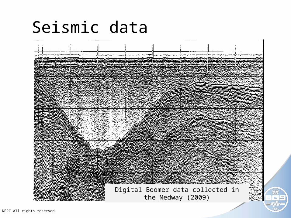
Seismic data
Digital Boomer data collected in the Medway (2009)

© NERC All rights reserved
Marine Data Holdings - Samples
• Geological samples
• Grab samples (sea bed sample)
• Gravity cores
• Vibrocores
• Rock-drill cores (max 6m)
• Borehole cores (max 240m)

© NERC All rights reserved
Core samples

© NERC All rights reserved
Marine Data Holdings – other sources
• Datasets from other organisations
• industry
• other government departments
• universities

© NERC All rights reserved
Coastal and Marine database
• ORACLE 10g relational database
• 30 tables
• 20 dictionary tables
• 12 query layer objects

© NERC All rights reserved
Coastal and Marine database
Cruise tables
Geophysical lines
Survey station table

© NERC All rights reserved
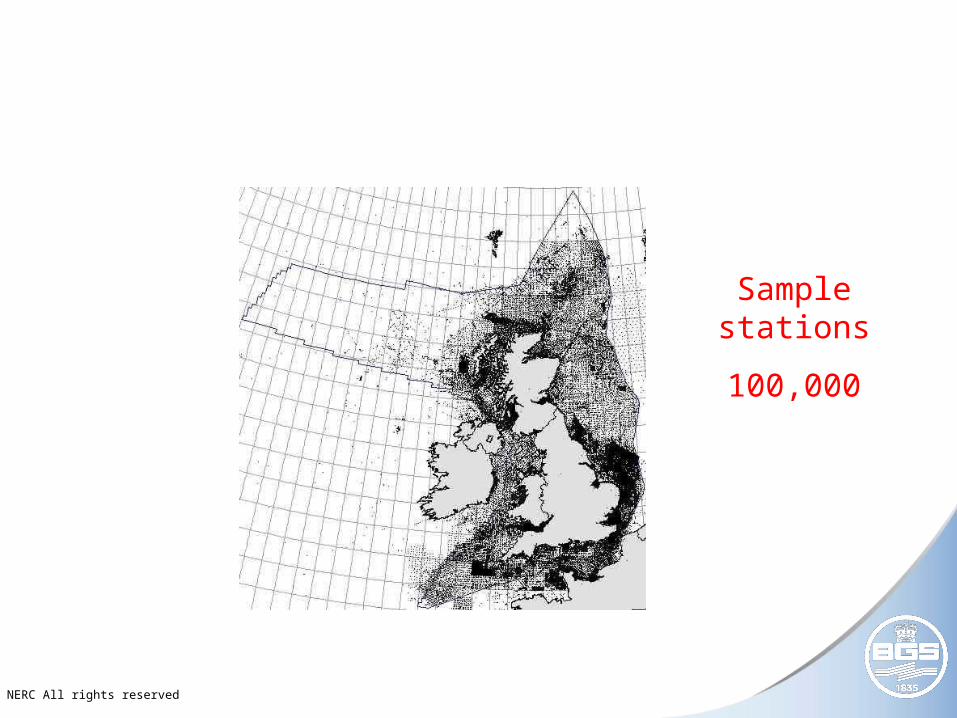
Marine Data Holdings
• Coastal and Marine database holds metadata for
100, 000 sample stations
300 000 line kms of geophysics
5000 site survey reports
• Results from analyses, processing, interpretation
© NERC All rights reserved
Sample stations
100,000

© NERC All rights reserved
Marine Data Holdings
• Coastal and Marine database holds metadata for
100, 000 sample stations
300 000 line kms of geophysics
5000 site survey reports
• Results from analyses, processing, interpretation

© NERC All rights reserved
Geophysical tracks
300,000 line km

© NERC All rights reserved
Marine Data Holdings
• Coastal and Marine database holds metadata for
100, 000 sample stations
300 000 line kms of geophysics
5000 site survey reports
• Results from analyses, processing, interpretation

© NERC All rights reserved
Site survey reports
5,000

© NERC All rights reserved
Marine Data Holdings
• Coastal and Marine database holds metadata for
100, 000 sample stations
300 000 line kms of geophysics
5000 site survey reports
• Results from analyses, processing, interpretation

© NERC All rights reserved
Marine Survey Data Handbook
• Management of marine geological and geophysical data
• 4 sections
• Guidelines - general guidelines for data management of survey data
• Specification – specifications for the management of each type of data
• Templates – standardised log sheets and report layouts
• Enclosures – procedure and quick reference sheets for specific aspects of survey data collection &
management

© NERC All rights reserved
Available to download at:
http://www.bgs.ac.uk/downloads/browse.cfm?sec=1&cat=112

© NERC All rights reserved
http://www.bgs.ac.uk/discoverymetadata/list.html
Marine data requests

© NERC All rights reserved
Marine Data Requests

© NERC All rights reserved
DEAL data

© NERC All rights reserved
Archiving marine data with BGS
• Data must be supplied in a recognised exchange format
• Be in a format appropriate for the data type
• Supplied on a modern type of media e.g. Exabyte tape)
• Older media is not acceptable e.g 9 track media

© NERC All rights reserved
GeoSeas
• Pan-European infrastructure for the management of marine and ocean geological and geophysical data
• EU Framework 7 project
• 29 organisations
• 16 Countries

© NERC All rights reserved
• United Kingdom
• France
• Netherlands
• Germany
• Spain
• Bulgaria
• Latvia
• Estonia
• Portugal
• Greece
• Ireland
• Italy
• Denmark
• Norway
• Poland
• Lithuania
• Belgium

© NERC All rights reserved
Objective of Geoseas
“ build and deploy a unified marine geoscientific data infrastructure within Europe”

© NERC All rights reserved
Geo-Seas
• Build and deploy a unified marine geoscientific data infrastructure within Europe
• Improve locating, accessing and delivering marine geological and geophysical data
• Interoperable with other data e.g. oceanographic data
• Provide middleware to locate, retrieve and use primary data in multidisciplinary combinations.

© NERC All rights reserved
Objectives of GeoSeas• Expand SeaDataNet infrastructure by including the
network of national geological surveys and selected geological research institutes
• Publish and maintain a common catalogue and index of available data, data products and services managed by European geological surveys and research institutes
• Harmonise quality standards and exchange formats to facilitate access and delivery of this data to user communities.
• Provide federated marine geological and geophysical data sets to the user community using middleware to access and deliver data via the internet