Fathom: Six feet down in depth. 1 fathom = 6 feet Nautical mile: 6,076 feet across the ocean...
39
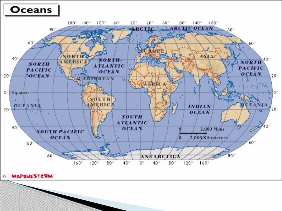
A. Ocean Exploration
-
Upload
hope-hunter -
Category
Documents
-
view
218 -
download
0
Transcript of Fathom: Six feet down in depth. 1 fathom = 6 feet Nautical mile: 6,076 feet across the ocean...

A. Ocean Exploration
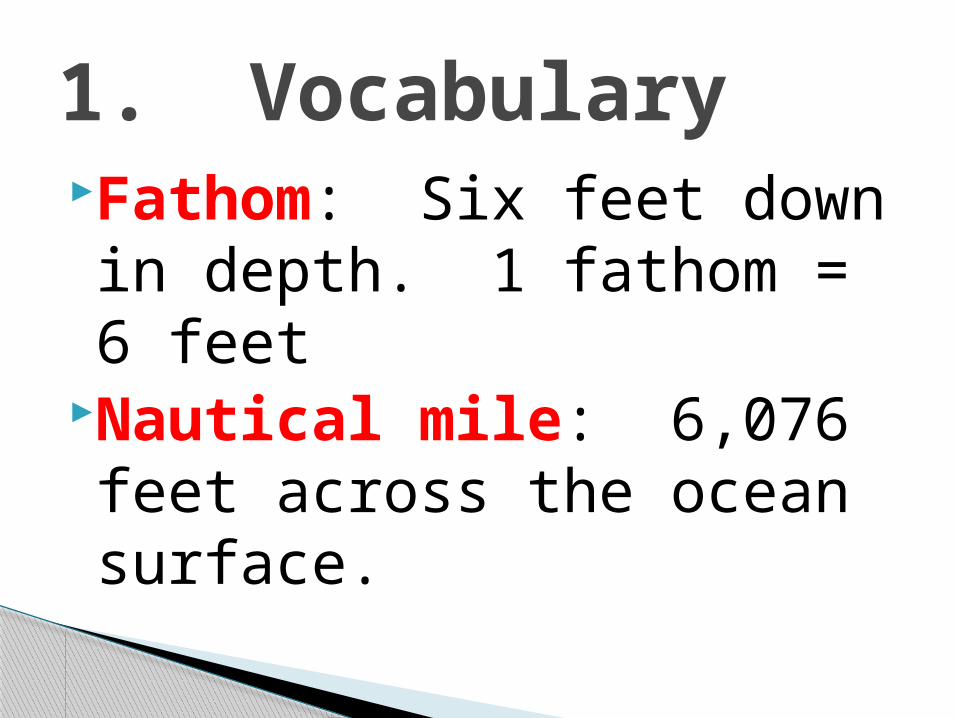
Fathom: Six feet down in depth. 1 fathom = 6 feet
Nautical mile: 6,076 feet across the ocean surface.
1. Vocabulary
Oceanography: The scientific study of the ocean using chemistry, biology, physics, geology and other sciences
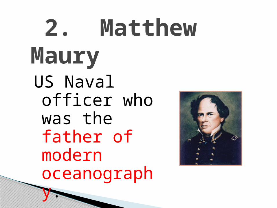
2. Matthew MauryUS Naval officer who was the father of modern oceanography.
1872- The first large-scale ocean research project
Onboard lab to measure ocean depths, take water samples record temperatures and study currents.
3. H.M.S. Challenger

•Note the name of the chief Scientist in your notes


Big advances in oceanographySubmarinesSurface ships- More accurate
ocean chartsSonarMagnetic recorders
4. World War II
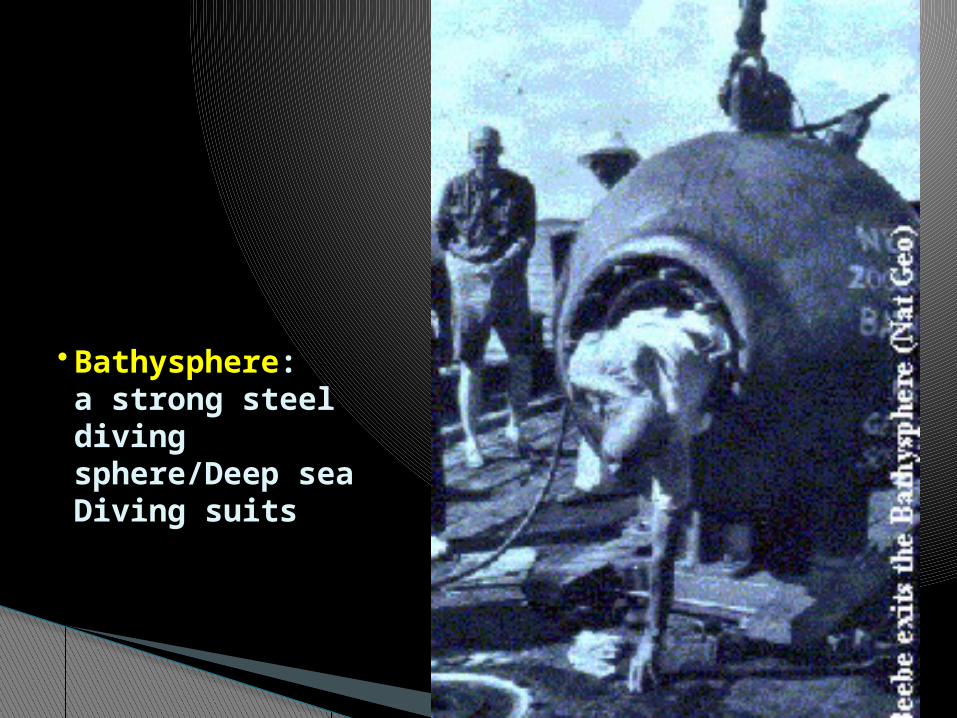
• Bathysphere:a strong steeldiving sphere/Deep sea Diving suits

sonar

Research vessels◦ Deep-sea corers- JOIDES Resolution
Alvin: Mini-sub that has explored deep-sea trenches, vents and the Titanic
Argo: Robotic sled that has lights and cameras
Buoys: collect data
5. Modern Ocean Research


Alvin

◦Core sampling is used to look at seafloor sediments
◦Cores can remain intact and easy to study layers
◦Dredging- scooping up sediment to study
•Sediment Sampling
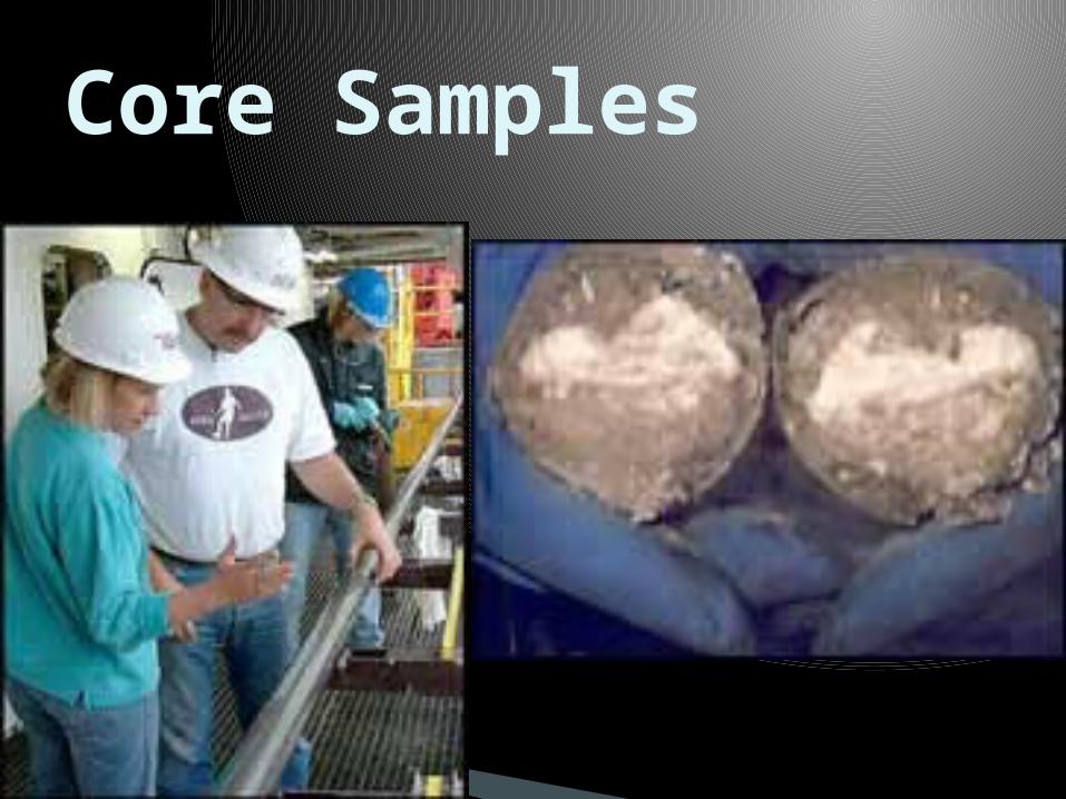
Core Samples

Depth recorder sends out sound waves that travel to the ocean floor and return The time is recorded and used to find distance
Intensity of reflected beam can determine sea floor composition and shape of objects.
D= S x t
SONAR-Echo sounding


Echo sounding is a very slow method of mapping ocean floor
Satellites provide a better range and speed to mapping.
Satellites look for variations in surface elevations to make maps
Satellite Observations
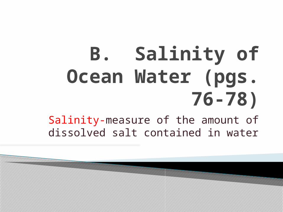
B. Salinity of Ocean Water (pgs. 76-78)
Salinity-measure of the amount of dissolved salt contained in water

1. Average 35 parts salt dissolved per thousand parts water(35/1000)
NaCl, MgCl and MgS most common salts
2. Salt sources could be from wave action, volcanic action or erosion of glaciers and rivers
3. About 85 elements found in the ocean4. The amount of salt present determines
density (high salinity-more dense)
B. Salinity of Ocean water

5. Variations in Salinity◦Location◦How much fresh water is present (low where there is a lot)
◦Rate of evaporation/ freezing-faster is higher salinity

The same gases found in air are dissolved in ocean water Nitrogen, oxygen, carbon dioxide
Ocean animals take in oxygen and give off carbon dioxide
Plants use carbon dioxide and release oxygen
C. Gases in Ocean Water
THIS YOU SHOULD ALREADY KNOW
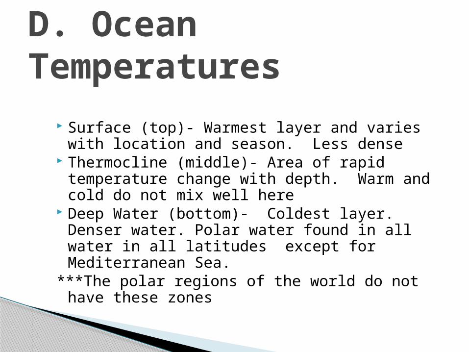
Surface (top)- Warmest layer and varies with location and season. Less dense
Thermocline (middle)- Area of rapid temperature change with depth. Warm and cold do not mix well here
Deep Water (bottom)- Coldest layer. Denser water. Polar water found in all water in all latitudes except for Mediterranean Sea.
***The polar regions of the world do not have these zones
D. Ocean Temperatures

If we look at the ocean, we see miles and miles of water. However, if we were to look under the water, we would see many features that are similar to those found on land. There are two major areas of the ocean.
E. Ocean Features (text 80-82)

a. Shoreline-where land and ocean meetb. Continental Shelf- Shallow depth. Flat .
Many resources found here (oil & gas)c. Continental slope- Water depth
increases. Land drops. Boundary between oceanic and continental crust
d. Continental rise- Accumulation of sediment at the bottom of Continental slope.
1. Continental Margin-where the underwater edge of the continent meets the ocean floor


Large underwater valleys that have resulted from mudslides from the continent.
Some line up with rivers and some do not
Turbidity currents are also responsible for making the canyons.
d. Submarine Canyons
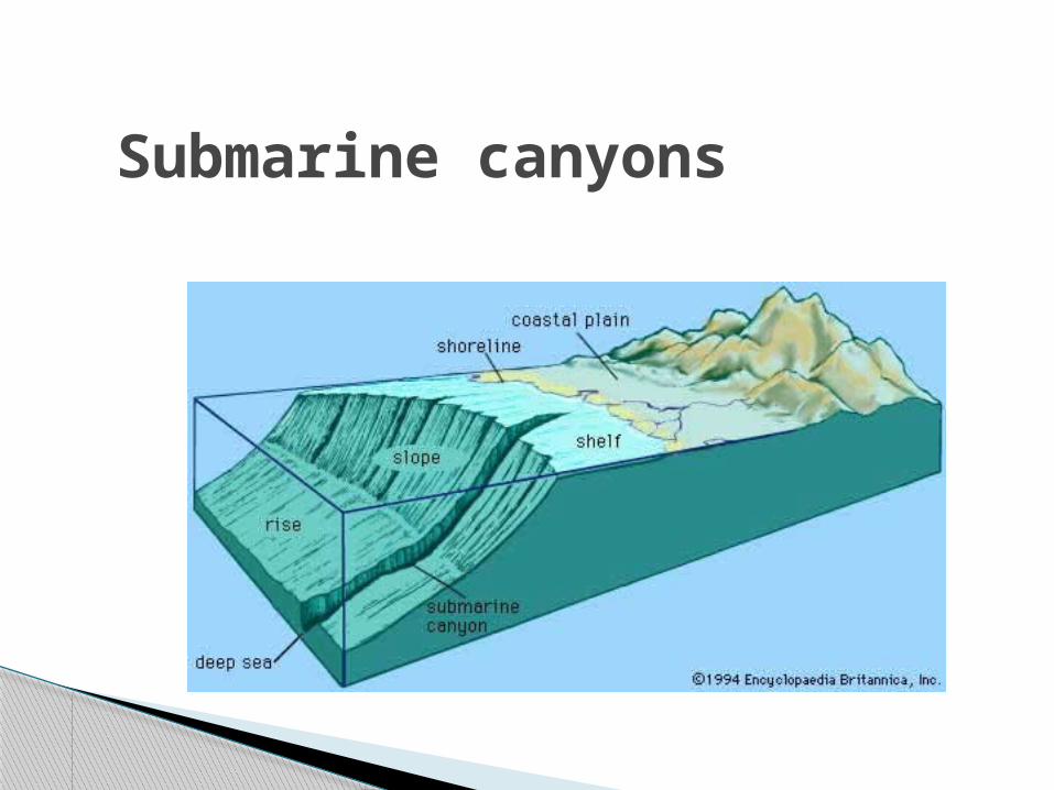
Submarine canyons

Active (earthquakes, volcanoes): West coast of U.S.
Passive: East Coast of the U.S.
Continental Margins


a. Abyssal Plains: Flat areas of ocean floor; Larger in the Atlantic and Indian Ocean. The Pacific ocean has many deep cracks that trap sediments like mud, sand and ooze (remains of organisms)
b. Ocean trench-long, narrow, steep-sided clefts or troughs (volcanic and earthquake activity)
◦ Mariana trench is deepest in world
2. Deep Ocean Basin
d. Seamount- cone shaped mountain peaks. Lot in Pacific where volcanoes hot spots are**Guyots- Seamounts with tops sliced off by wave action and sinking of ocean crust.
e. Volcanic Mountains-underwater volcanoes tall enough to reach the surface of the water
c. Mid-Ocean Ridges-great undersea mountain ranges. Vents or underwater geysers found near these
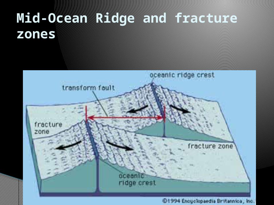
Mid-Ocean Ridge and fracture zones
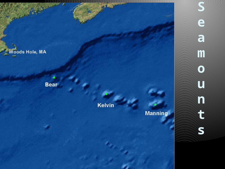
Seamounts


Occur in tropical waters near the continental shelf
Coral reefs ◦ Masses/ridges of limestone rocks◦ Contain the shells of animals
3 types Fringe reefs (Y)-touch the shore of
volcanic islands (letter C-already sinking) Barrier reefs(Z)-separated from shore by
a lagoon. Island (F) is eroding and sinking Atoll (X)-surrounds a sunken island (X
above)and forms a A lagoon (A, E) is water surrounded or
trapped by reefs
Reefs