© Crown copyright Using ensemble rainfall predictions in a countrywide flood forecasting model in...
22
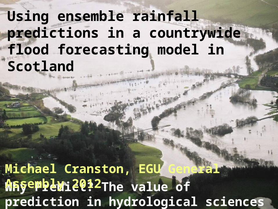
© Crown copyright Using ensemble rainfall predictions in a countrywide flood forecasting model in Scotland Why Predict? The value of prediction in hydrological sciences and policy Michael Cranston, EGU General Assembly 2012
-
Upload
ella-warren -
Category
Documents
-
view
218 -
download
1
Transcript of © Crown copyright Using ensemble rainfall predictions in a countrywide flood forecasting model in...
© Crown copyright
Using ensemble rainfall predictions in a countrywide flood forecasting model in Scotland
Why Predict? The value of prediction in hydrological sciences and policy
Michael Cranston, EGU General Assembly 2012
© Crown copyright
Acknowledgements• Bob Moore, Steve Cole, Alice Robson, Vicky Bell
and Phil Howard of CEH Wallingford
• Alex Minett and Marcel Ververs of Deltares
• Peter Buchanan and Alan Motion of Met Office
• Richard Maxey, Amy Tavendale, Lauren McLean and Rachel Geldart of the Flood Forecasting and Warning Section of SEPA

© Crown copyright
Aims• What policy is driving our flood forecasting
developments
• What are the key challenges in flood forecasting uncertainty and how are we tackling this through science developments and applications
• What have we learned from recent operational experience of use of probabilistic flood forecasts
© Crown copyright
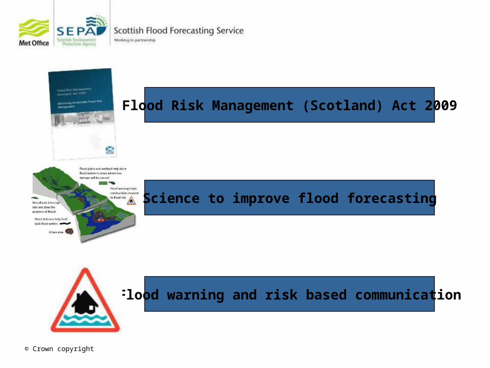
Flood Risk Management (Scotland) Act 2009
Science to improve flood forecasting
Flood warning and risk based communication

© Crown copyright
Flood Warning Policy
“…SEPA will aim to reduce the impact of flooding through the provision of actively disseminated, reliable and timely flood warnings to registered users of a national flood warning service.
…and SEPA will aim to provide an effective flood warning service and to reduce the impact of flooding from all sources.”
SEPA (2010) Statement of Intent for Implementing Flood Warning Duties under the Flood Risk Management Scotland Act

© Crown copyright
Service Expectations
“…public expectations around flood warning systems can never be fully met.”
Association of Chief Police Officers (2008) Scottish Parliament Flooding and Flood Management Review, RAE Committee 2nd Report.
© Crown copyright
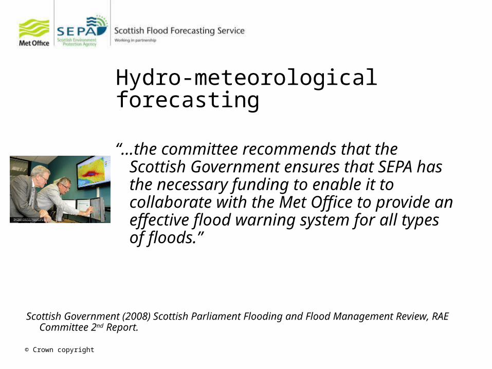
Hydro-meteorological forecasting
“…the committee recommends that the Scottish Government ensures that SEPA has the necessary funding to enable it to collaborate with the Met Office to provide an effective flood warning system for all types of floods.”
Scottish Government (2008) Scottish Parliament Flooding and Flood Management Review, RAE Committee 2nd Report.

© Crown copyright
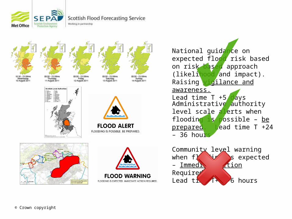
National guidance on expected flood risk based on risk based approach (likelihood and impact). Raising vigilance and awareness. Lead time T +5 days
Community level warning when flooding is expected – Immediate Action Required. Lead time T+ 3-6 hours
Administrative authority level scale alerts when flooding is possible – be prepared. Lead time T +24 – 36 hours
© Crown copyright
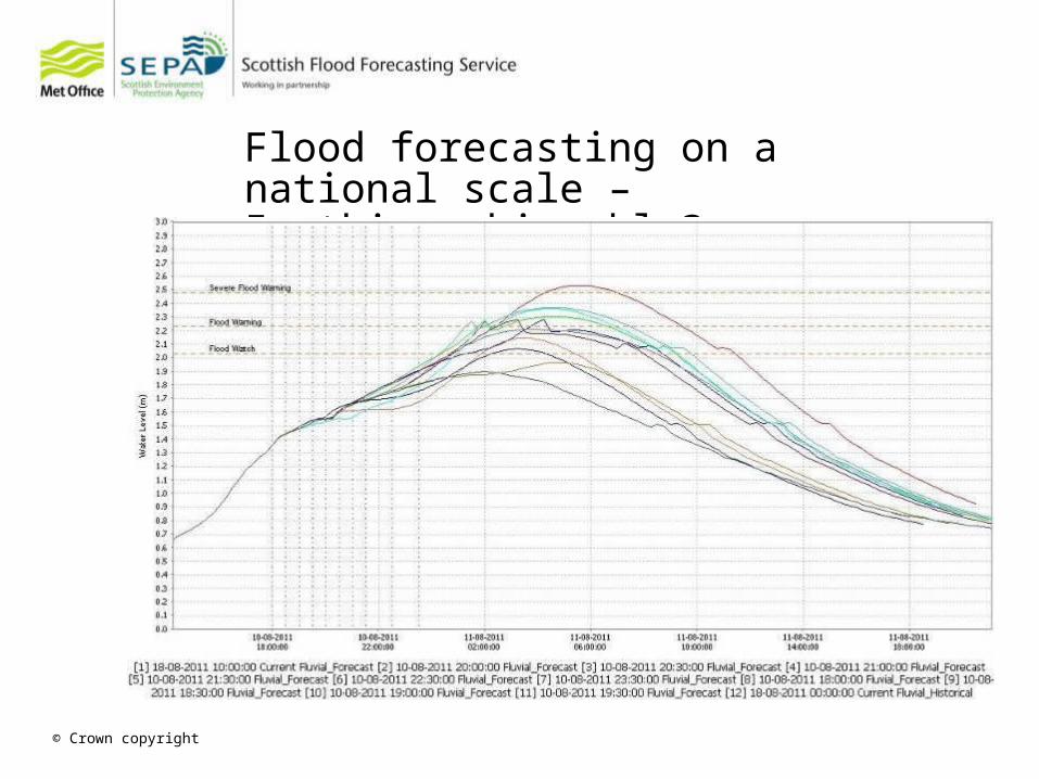
Flood forecasting on a national scale – Is this achievable?

Grid-to-Grid (G2G) Distributed Model
• Uses spatial datasets on terrain, soil/geology, land-cover • Responds to spatial variation of rainfall input
Distributed Model Structure
Subsurface flow-routing
Saturation-excess surface runoff
Drainage
River
Surface flow-routing
Precipitation Evaporation
Return flow
River flow
Runoff- producing soil column
Acknowledgement: Moore et. al, CEH Wallingford, 2011

G2G Model Performance: R2 Efficiency
2008 Water Year(all configured sites)
Acknowledgement: Moore et. al, CEH Wallingford, 2011
© Crown copyright
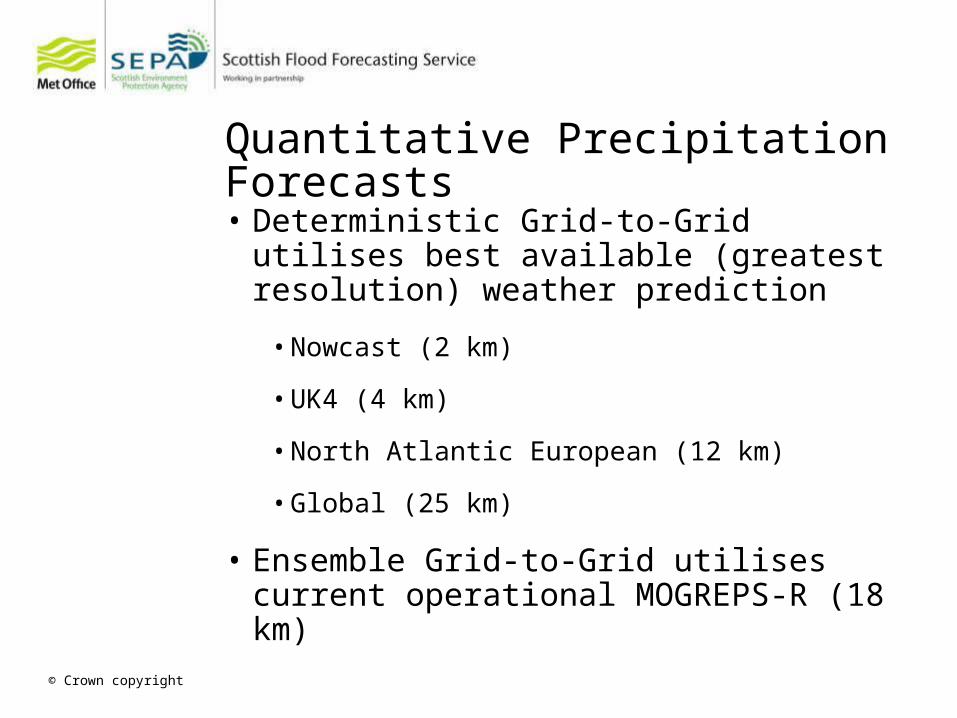
Quantitative Precipitation Forecasts
• Deterministic Grid-to-Grid utilises best available (greatest resolution) weather prediction
• Nowcast (2 km)
• UK4 (4 km)
• North Atlantic European (12 km)
• Global (25 km)
• Ensemble Grid-to-Grid utilises current operational MOGREPS-R (18 km)

Flood Forecasting and Warning
MOGREPS members T +54
UKPP, UK4, NAE, GM deterministic T +144
P > 75%
P > 25%

© Crown copyright
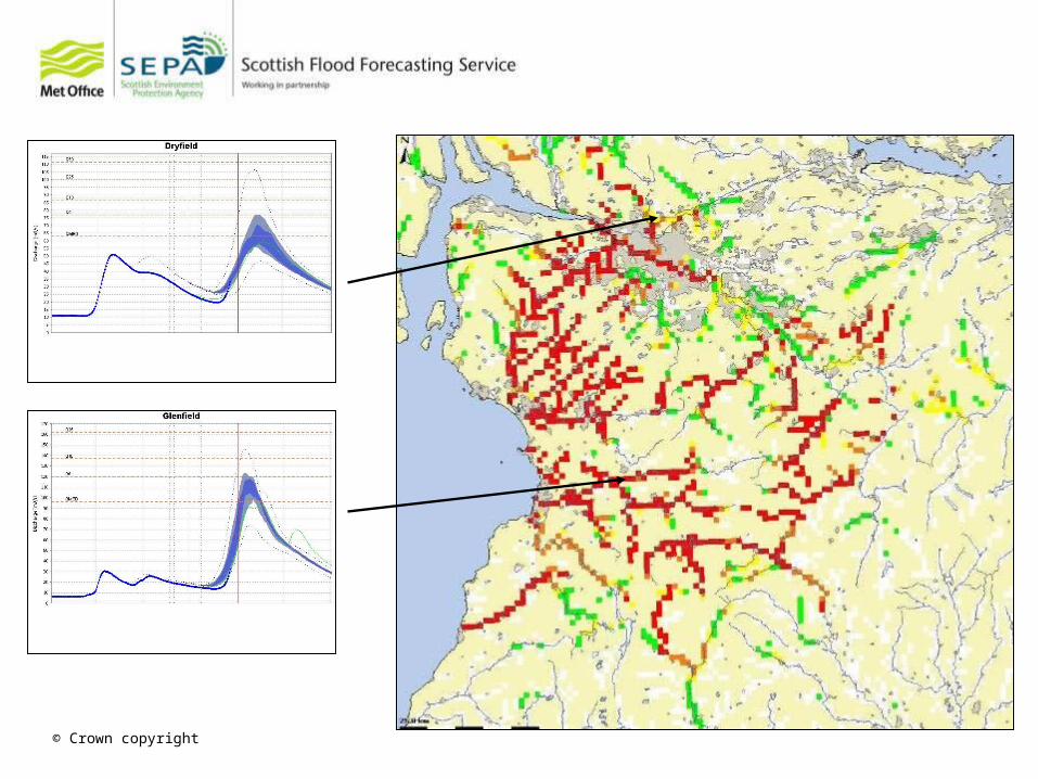
• Countrywide assessment of flood risk
• Probability of exceeding flow threshold Q(T)
• Good indication of flooding hotspots
Operational Utility4th January 2012
© Crown copyright

© Crown copyright
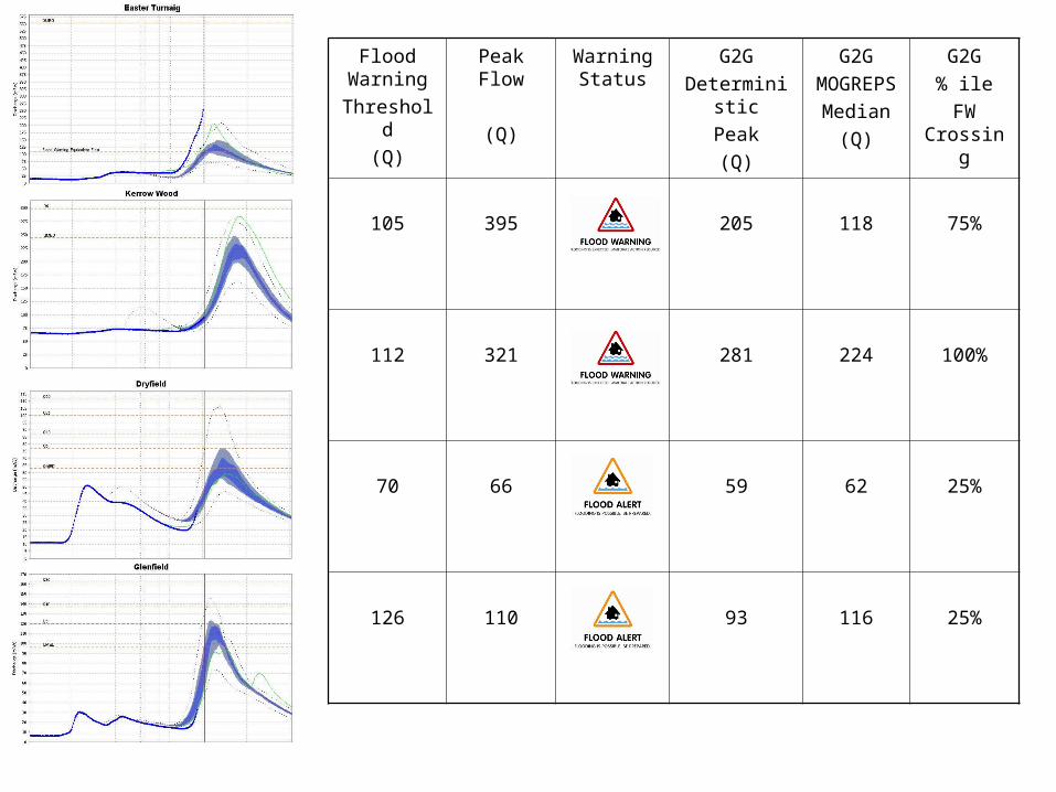
Flood Warning
Threshold(Q)
Peak Flow
(Q)
Warning Status
G2GDeterministic
Peak(Q)
G2GMOGREPS
Median(Q)
G2G% ileFW
Crossing
105 395 205 118 75%
112 321 281 224 100%
70 66 59 62 25%
126 110 93 116 25%

© Crown copyright

© Crown copyright
Value of countrywide forecasting• Distributed model provides spatial representation
of forecast risk with lead time of 1-2 days, especially when using probabilities
• Greater accuracy of river flow forecast when using higher resolution deterministic QPF models
• Ensemble-based MOGREPS-R forecasts provide objective assessment of risk on a national scale
© Crown copyright
National guidance on expected flood risk based on risk based approach (likelihood and impact). Raising vigilance and awareness. Lead time T +5 days
Community level warning when flooding is expected – Immediate Action Required. Lead time T+ 3-6 hours
Administrative authority level scale alerts when flooding is possible – be prepared. Lead time T +24 – 36 hours

© Crown copyright
Application for flood warning
“…(the forecast) provided a useful heads up, not only for the potential for high levels especially within the Irvine but also the confidence that could be attributed to these forecasts by seeing the spread of the predicted hydrographs.
…it did mean that … I was more prepared.”
David Fadipe (2012) Flood Warning Duty Officer response to consultation on use of probabilistic forecasts, pers. comms.

© Crown copyright
Conclusions• Greater than ever expectations on flood warning
delivery based on policy drivers
• Significant advances in hydrometeorology with specialists working together
• Use of ensemble prediction good at countrywide scale but higher resolution (storm scale) models needed for flood warning application
• Understanding uncertainties helps risk based flooding guidance and communication